|
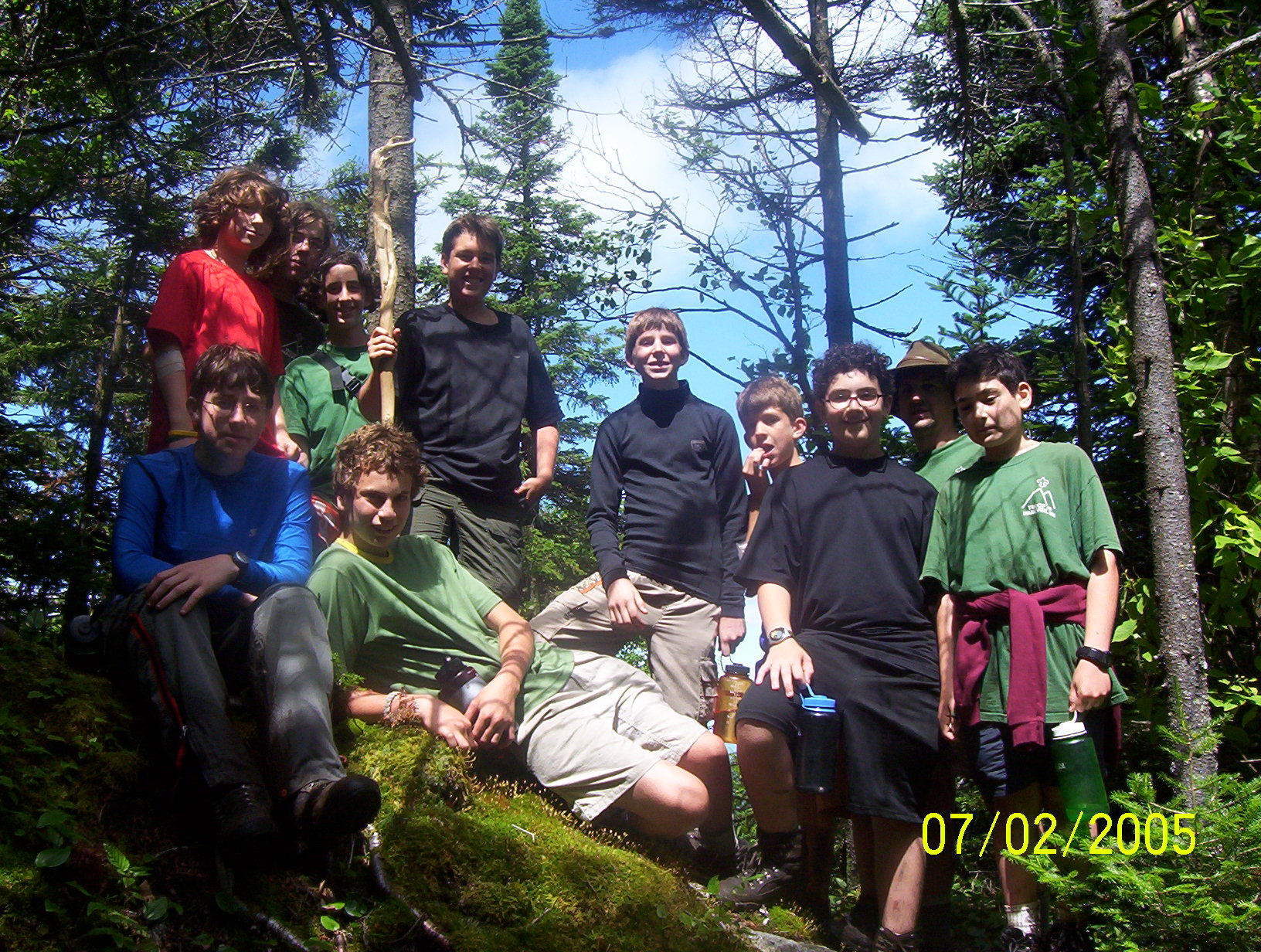
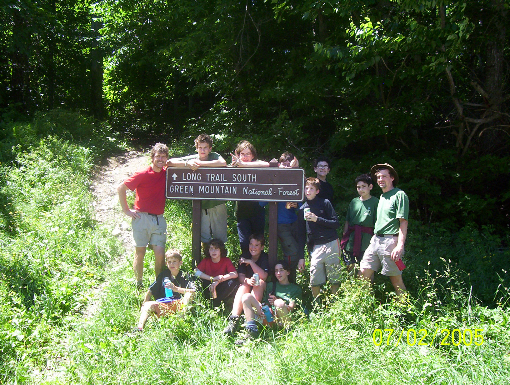
Scouts: Will, Oli, Ari, Nick, Connor, David Danna, Paul T.,
Robin, Jason, Paul F. Adults: Ted Simpson, Tim Smith |
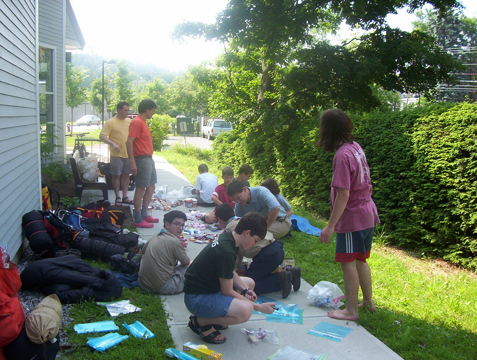
Getting Food Ready |
The day Before |
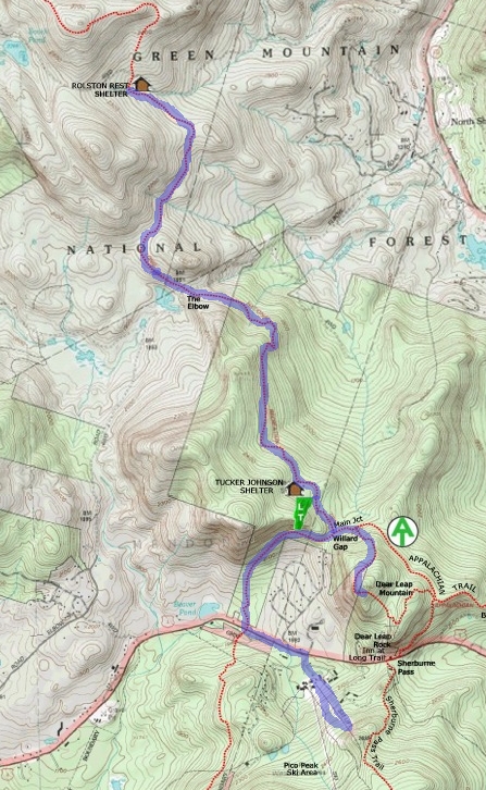
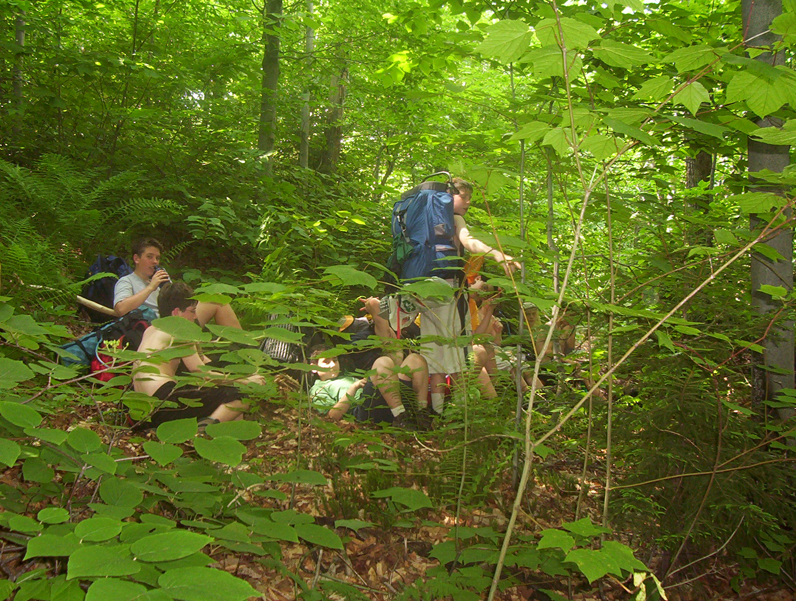
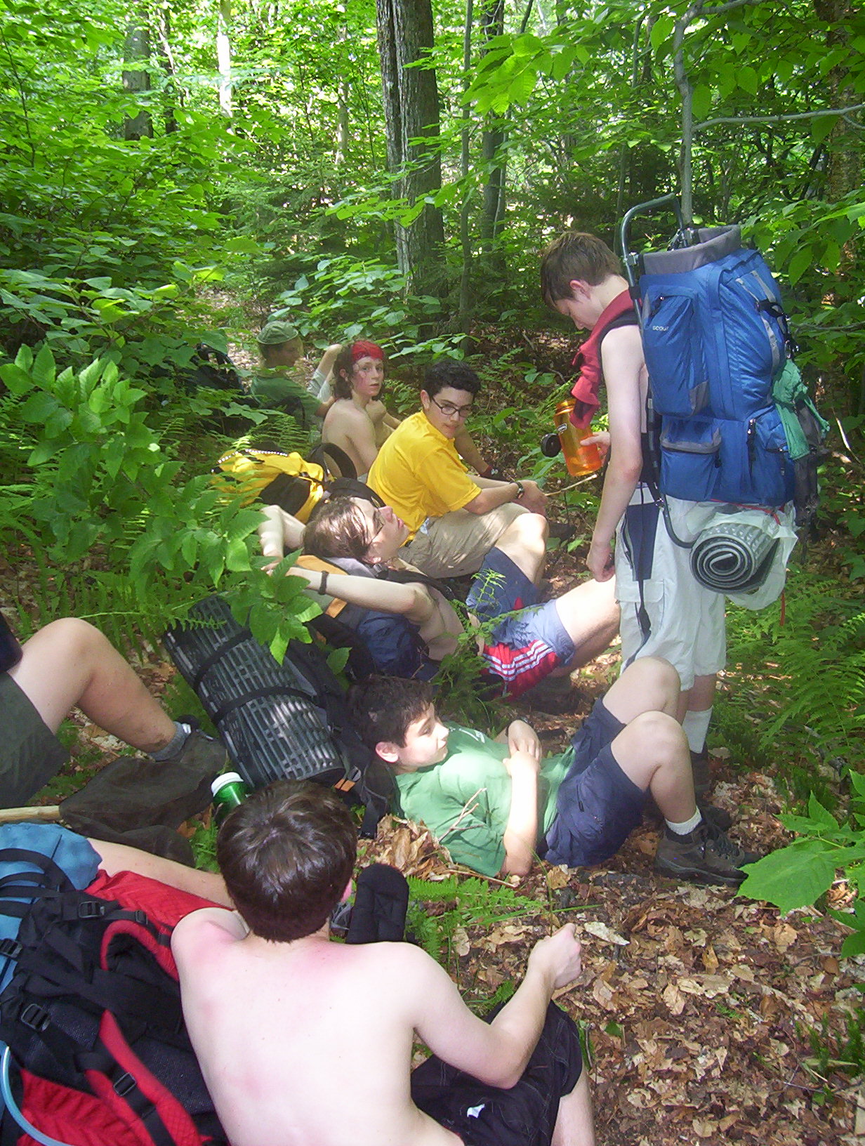
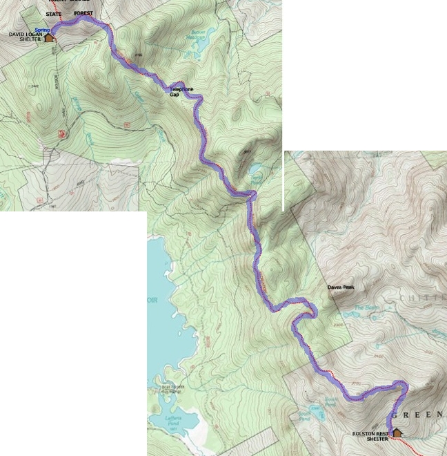
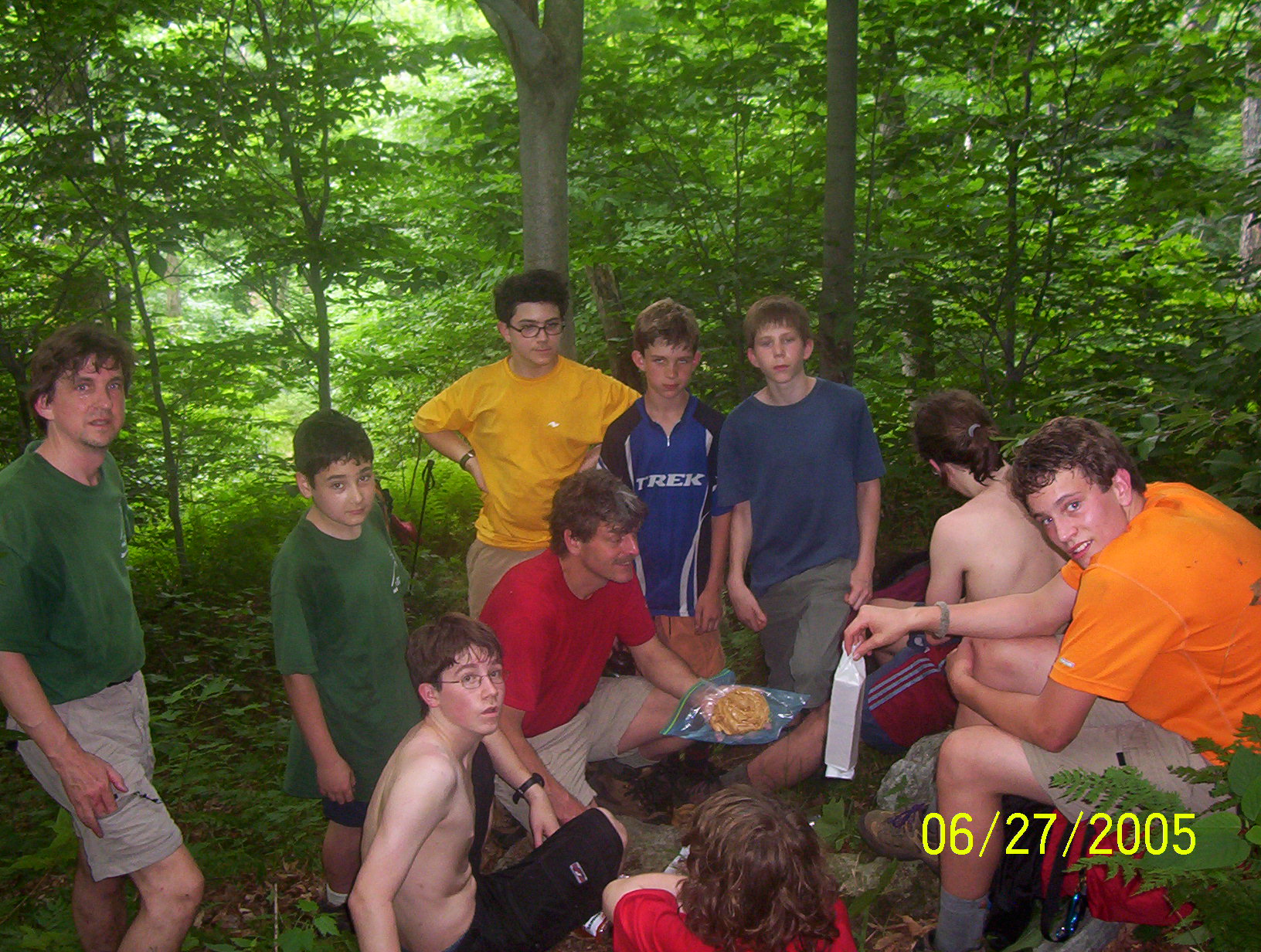
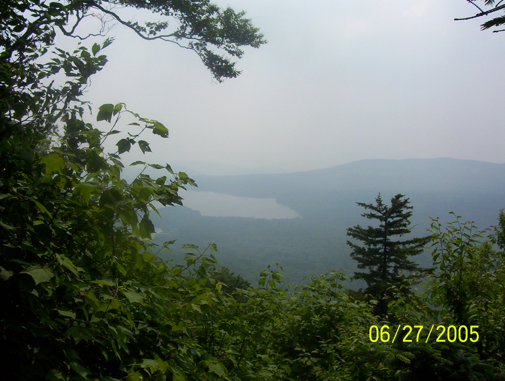
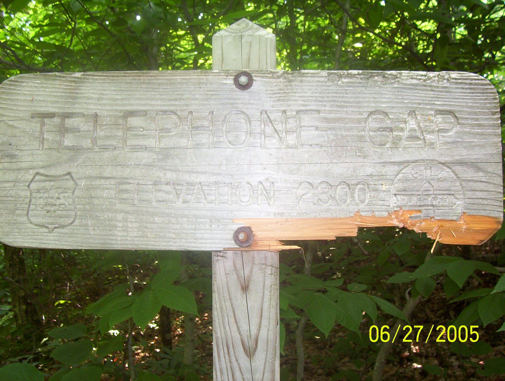
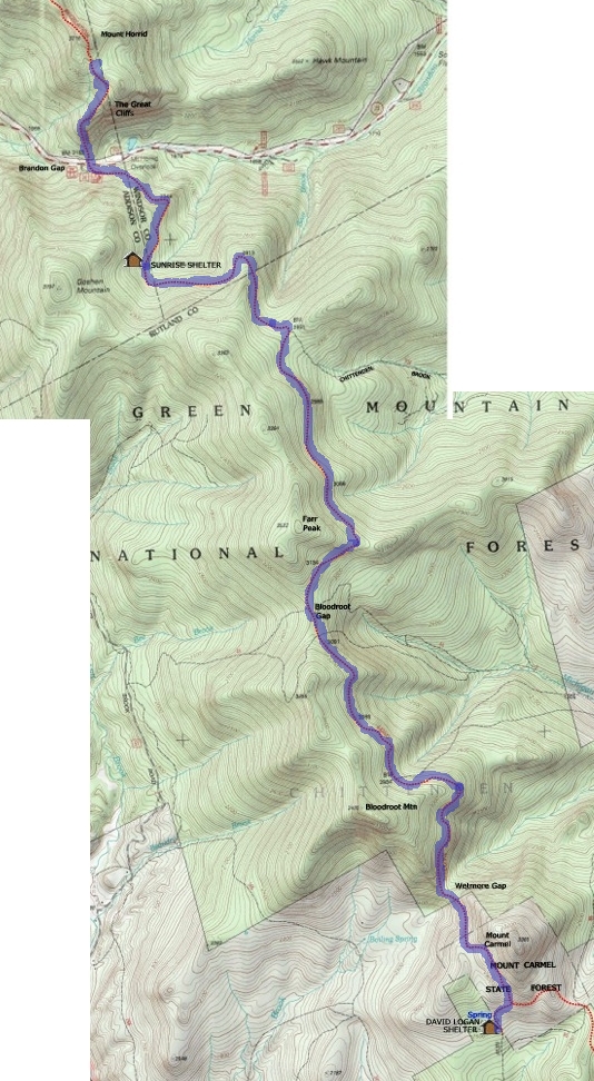
Robin and Connor are the first up at 5:30. By the time I am up they have started the fire again from the coals of last night. I tried to keep them quiet, but the fire is right in front of the lean-to and the whole crew is up by 6:00. We are not the most organized crew and it takes us until 8:40 to put together breakfast (oatmeal and hot chocolate), pack up and hit the trail. We cook, clean dishes, take down the flag, pack, police the area and finally (long after the other three have left, shoulder our packs and get on trail. It is clear from the start that this is not going to be an easy day for Connor. His pack is loose and unbalanced and Ted Simpson spends some time shifting things around. On the map there are some "views" marked with stars. Yet it was never clear to us where these views were. Every time we seemed to be in the right place, at a dramatic height there were always trees. I expect that the Long Trail has become greener over the years as pastures and farmlands have reverted back to forest. But that was but the start of our trouble. The real problem was "Telephone Gap". On the map we had with us it was about a third of today's hike to the gap. The guide book differed on this point. (The book proved to be right). So every time we came to a gap we assumed we had arrived. We stopped at a large boulder which was split. The boulder was the size of a house and we climbed on it for awhile. Lunch was peanut butter, jelly and crackers. We seemed to have picked a poor place to eat - perched on the side of a hill. People on the uphill side of the peanut butter and jelly (which were in a plastic bag), kept sliding down and threatening our lunch. Paul and Connor are definitely feeling the miles. Just below the trail there is a spring with very cold and very refreshing water. We stopped and use Ted Simpson's filter pump to top up everybody's bottles. The temperature is in the mid- to high-eighties and humid and everyone is sweating buckets. Occasionally we can see the Chittenden Reservoir below us. We saw a trail sign ahead of us which Oli reported as, "Very Depressing". The sign marked the long sought "Telephone Gap". This meant that we had two miles to go, which was more then we had thought. It also meant that we were hiking at about 1 mile/hr. Connor is getting slower and the lead hikers (Ari, Robin, Jason) are getting faster. Finally the boys decide to split up Connor's load. This speeds us up a great deal and at about 4:30, eight hours after starting, we reach the branch trail to David Logan Shelter. The boys practically run the rest of the way. Dinner was Ramen Noodles, which left us still hungry. Late in the evening another hiker joined us. And then to bed.
|
|
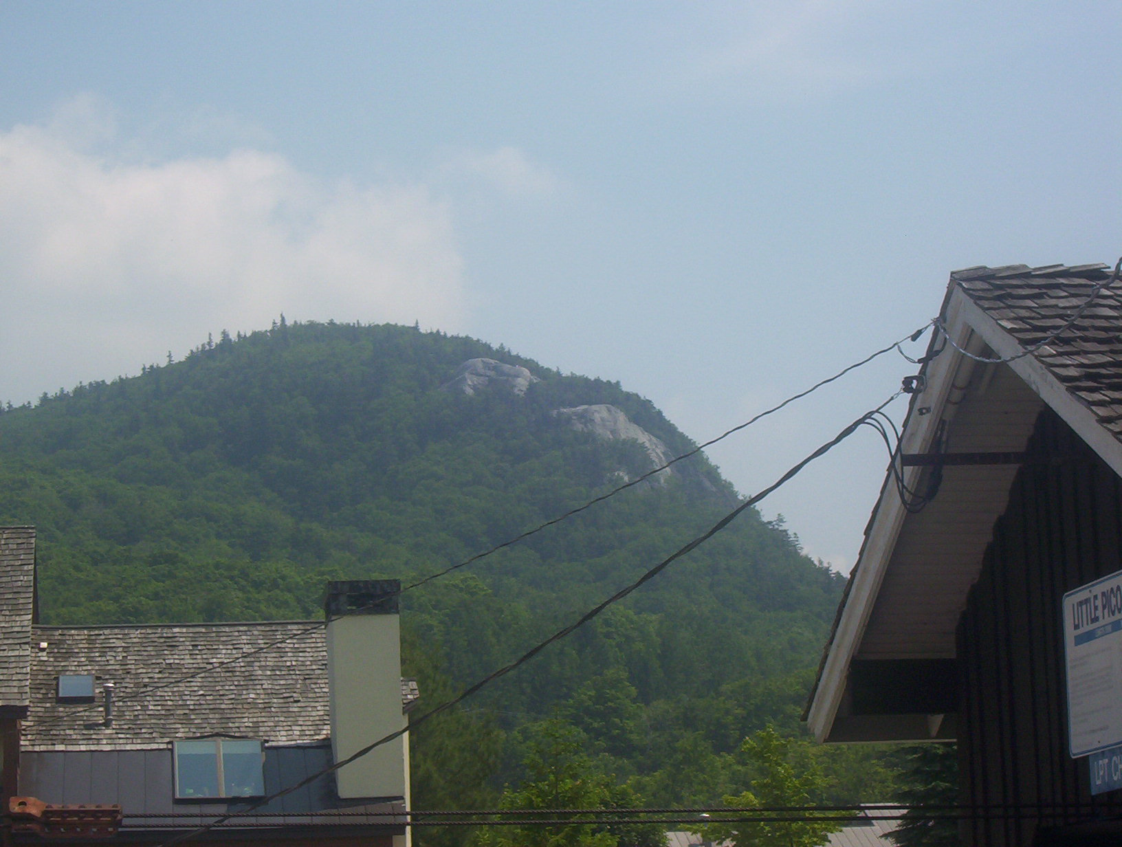
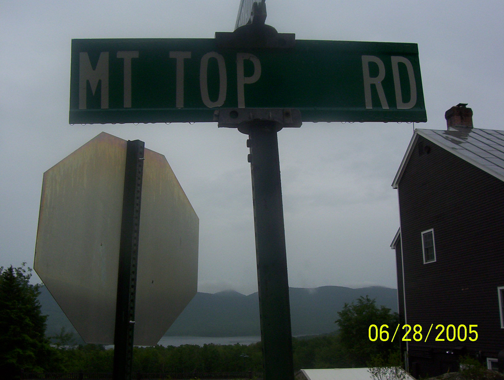
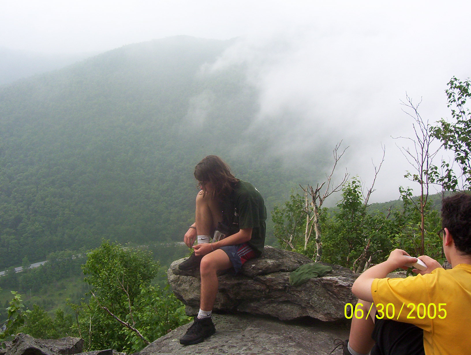
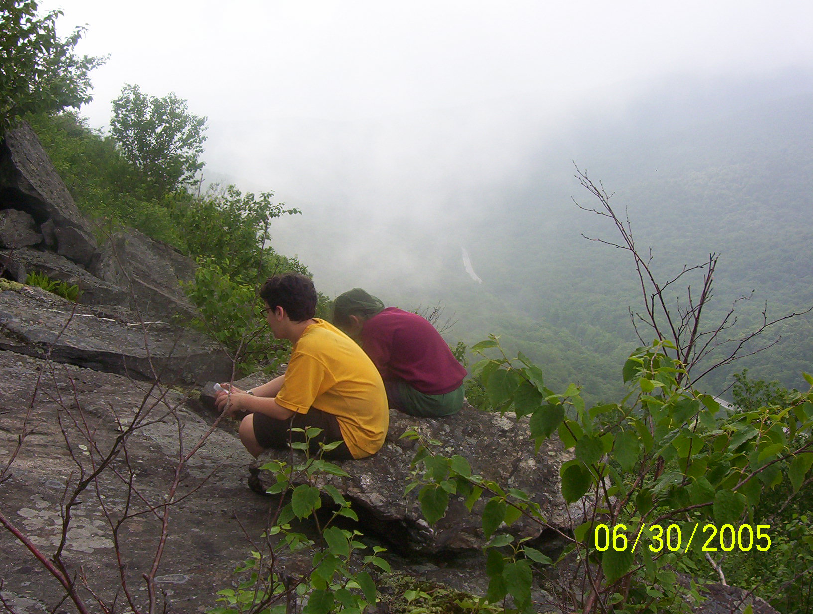
| Mt. Carmel |
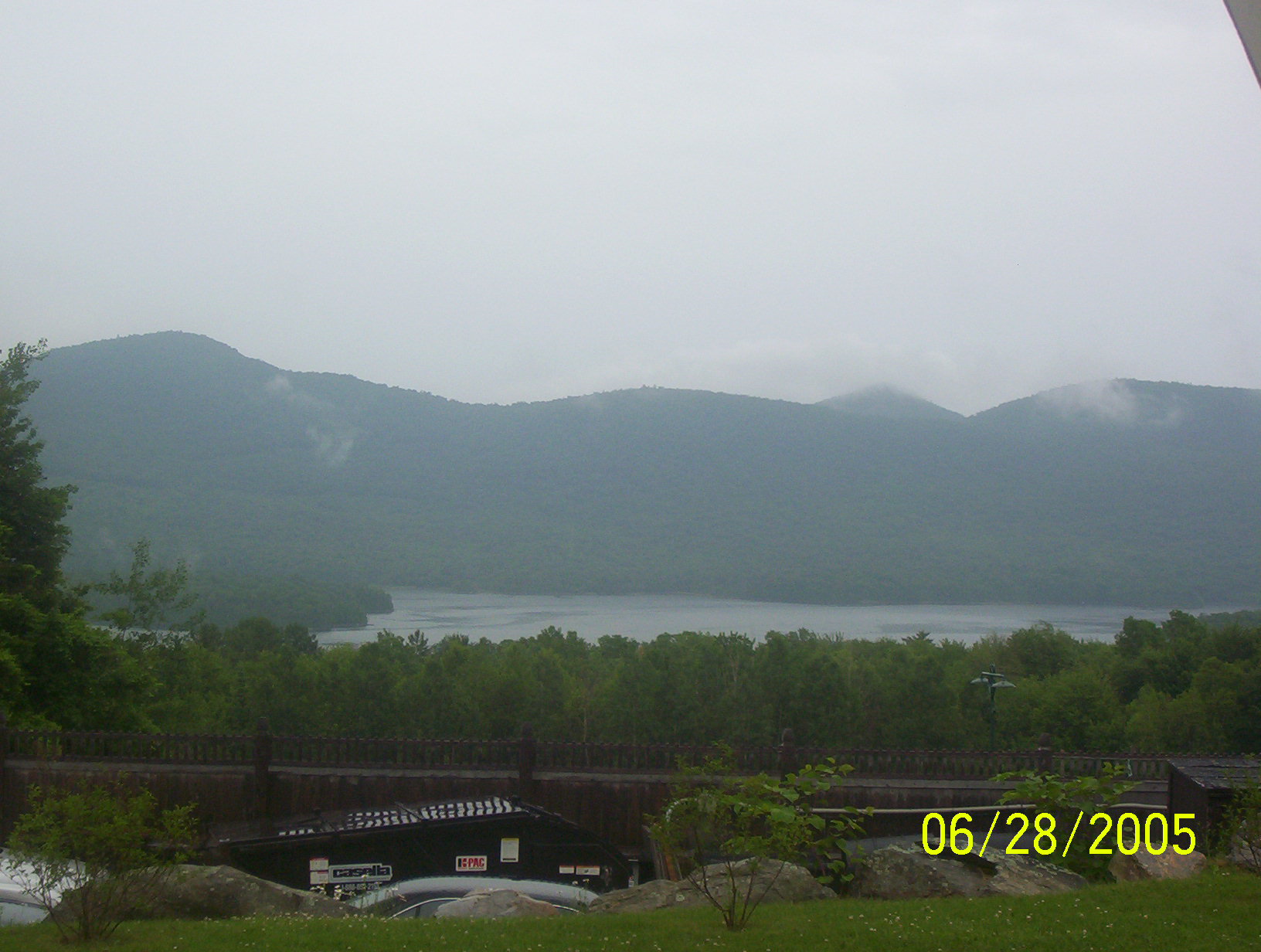
Chittenden Res. |
"Very Depressing" |
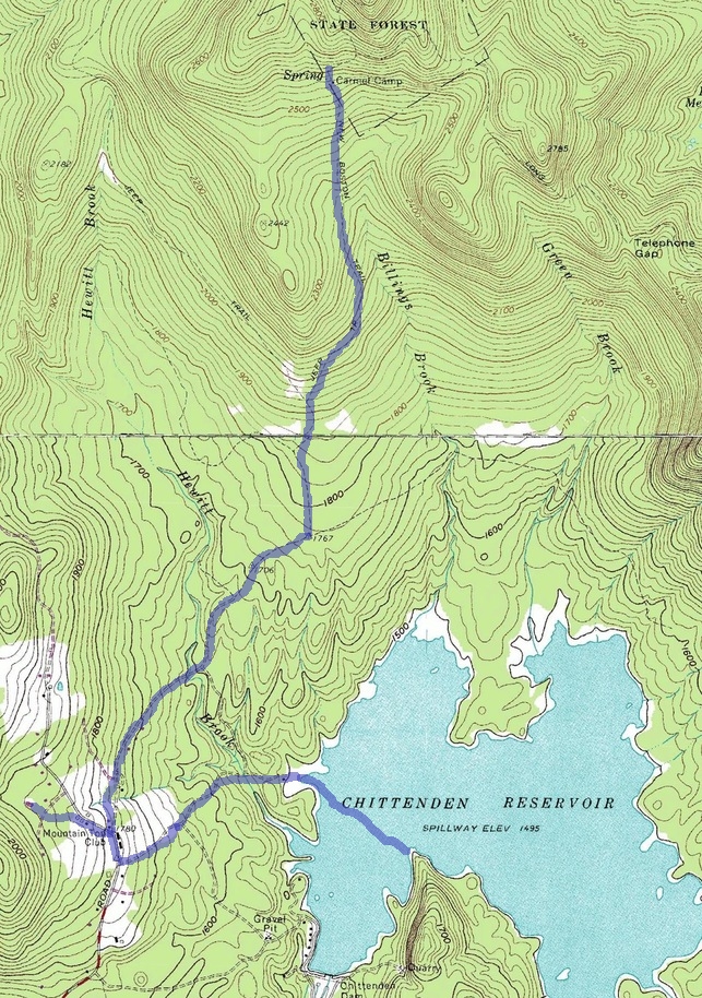
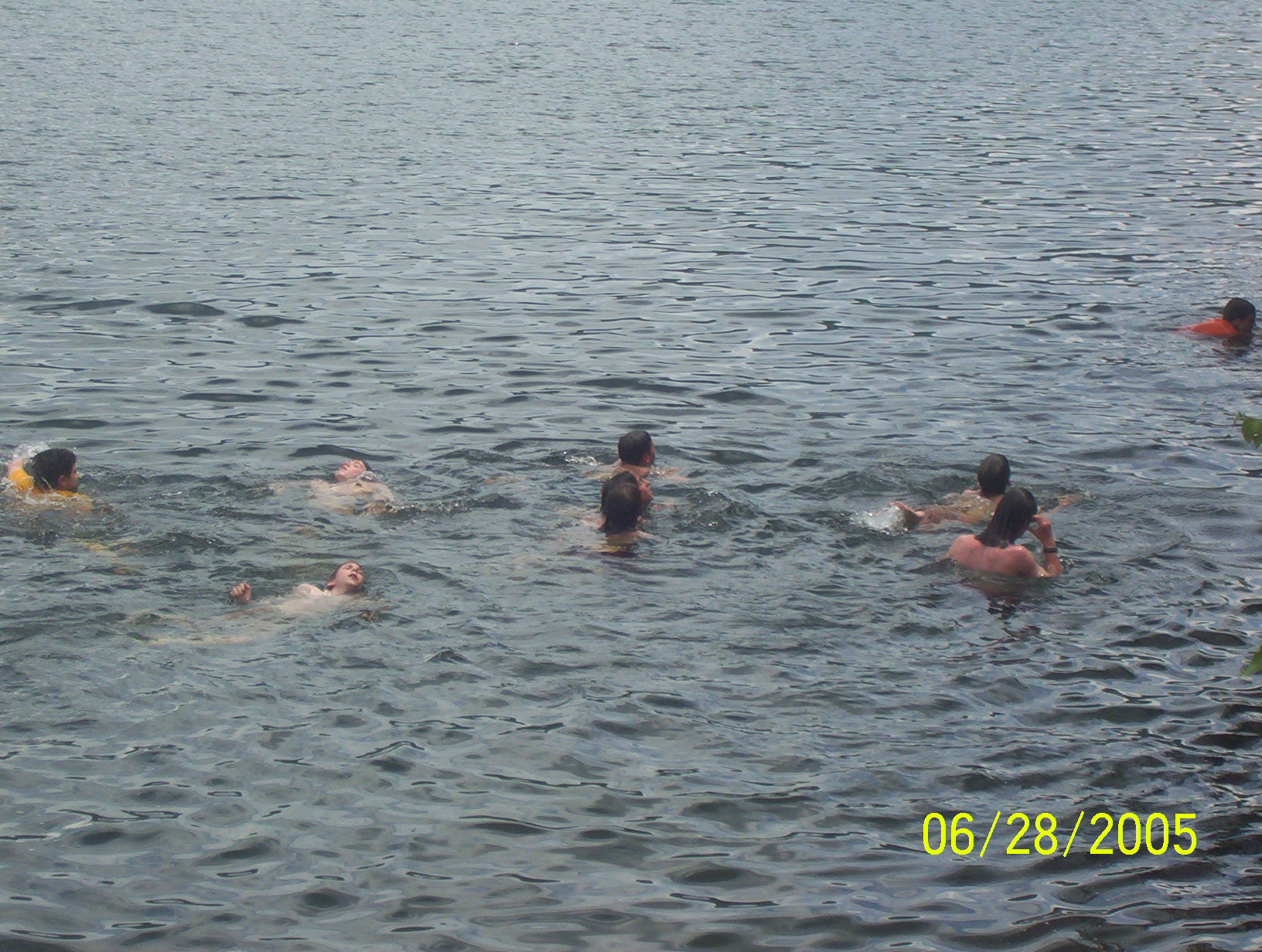
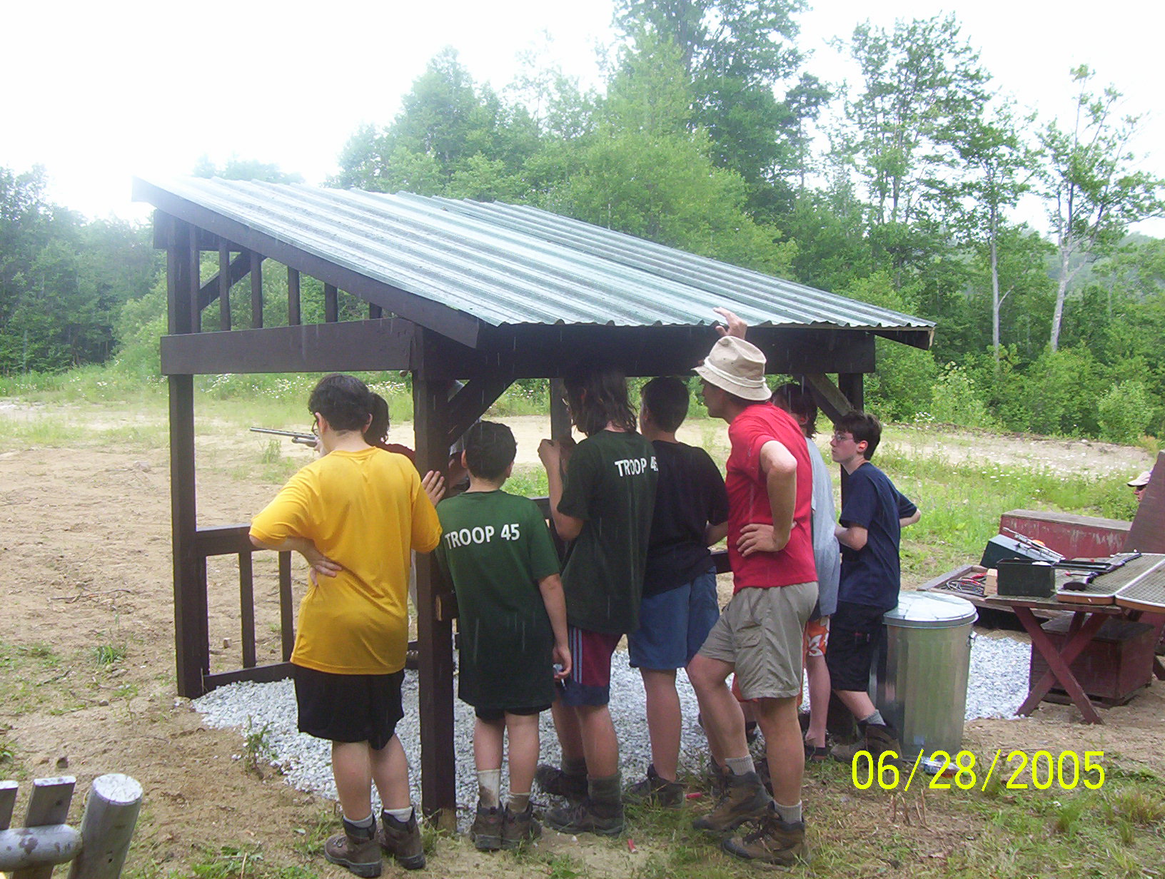
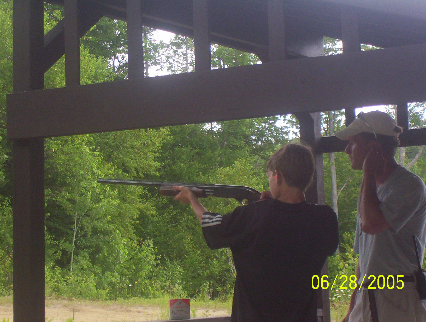
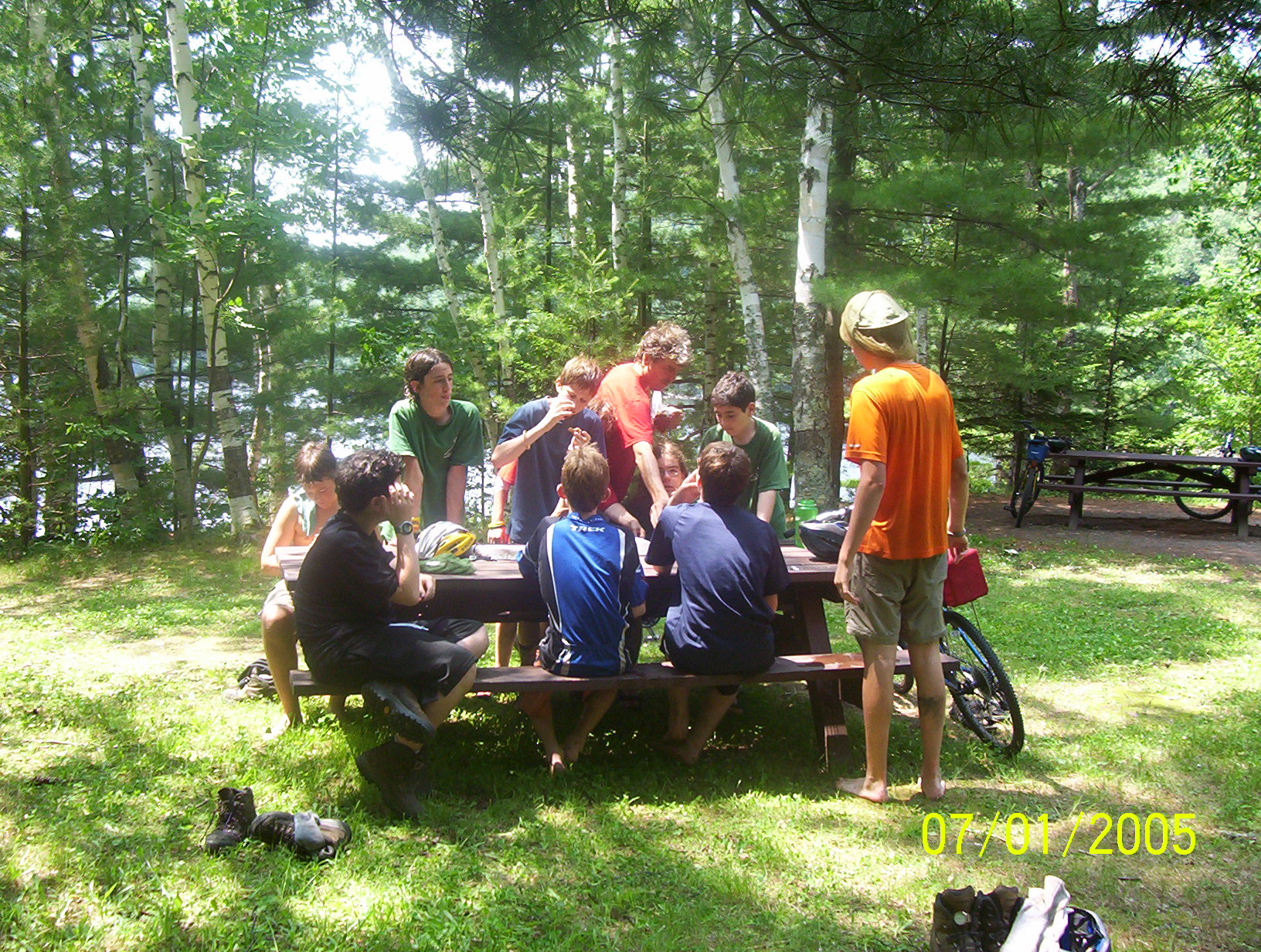
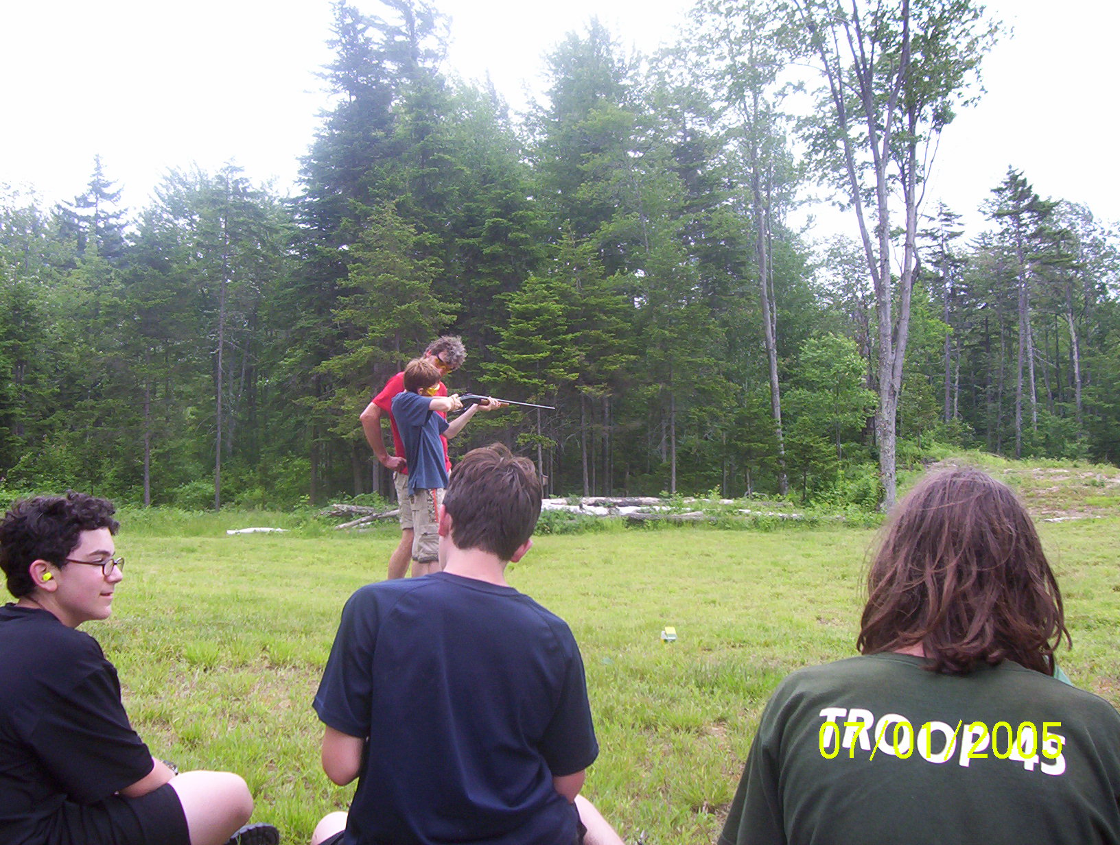
We got up at about 6:00 and had a long and leisurely breakfast. Today we are away from the Long Trail, walking down to Chittenden Reservoir to meet the Fitzmaurices, where Paul will join us and we have a food drop. So when we leave the site we carry only three almost empty backpacks. The first three-quarters of a mile is like the trails we have been on, with part of it in a stream bed. The scouts make good time down this. We then hit an old logging road which is thick with ferns. This connects to Forest Service Road 99 (FSR-99). This dirt road eventually becomes bigger and bigger, passing by some ancient apple trees. The downward slope eventually bottoms out on a bridge which crosses a clear cool stream. We were all tempted to dive in, but we also knew that we were not far from the reservoir. So we press on up a rise. Our road is now auto-accessible and we walk by a few cottages, one of which Ari assumed was our destination and almost opened the front door and walked into. Finally we got to the "Mountain Top Inn". A few weeks ago Ted and I had driven around the region looking for trailheads, etc. We had stopped at the Mountain Top Inn to inquire about the use of their canoes and beach. If we had paid the posted fees it would have cost over $200, but when the director of outdoor activities meet us he said, "Boy Scouts? On a Tuesday?", he offered us everything for $100. I think is was a sweet deal. Ted went into the office while the rest of us ate power-bars and dried fruit outside. Then we hiked another half a mile down to the beach. The water was so inviting that soon we were all swimming. Out in the reservoir was a massing inner tube which served as a diving platform. We had been swimming for only about twenty minutes when Paul Fitzmaurice arrived with our food drop. They also had the sleeping bag which was missing on the first night. We packed up the new food and then took today's lunch (the end of the old food) in the canoes and paddled across the lake/reservoir. After about half a mile we landed on a great granite slab and had our lunch of cheese and pepperoni. Later the boys went swimming again (using the buddy system). They devised a new method of diving. They would find a flat rock, about a foot square and thirty pounds and set it on the sloping granite. They would then sit on this and slide down the slab and into the water. They would hold onto the rock until it pulled them down about ten or twelve feet. They would then let go and swim back up to the surface. After about an hour we paddled back to the beach and stowed the canoes and were met by two of the staff from the inn who led us up to the shooting range. Here the boys were instructed in the use of a shot gun. I took my turn too and got my second clay pigeon! Ted showed us the reason for a double-barreled gun by hitting his with the second shot. Back at the beach we had one more swim. Paul T. and David fished and caught a few pan fish which they threw back. We also played with a pair of kayaks for a bit. Finally we shouldered our packs -- full of new supplies -- and headed up hill past the inn to a trout pond. One of the inn's staff was going to meet us there to show us how to fly fish. But it never happened because of a cloud burst. We set out back towards our camp and in fifteen minutes the sun was back out. We hiked back up the forest service road, the old logging road and then the streambed/trail to David Logan Shelter. Paul F. complained that he had a full pack and the rest of us just shared the food pack. But the other boys just whispered "Telephone Gap" to each other and thought of the dozen miles they had already hiked, and ignored Paul's complaints. We snacked on wild strawberries as we walked along. Once back in camp we divided up the food into people's backpacks. Dinner tonight was Oli's suggestion, Rice-a-Roni and canned chicken! This went over very well. We also had a long session with the video camera and Monty Python, especially the "She's a Witch" skit from `The Holy Grail'. One hiker joined us that night. My tent is only slightly water proof (Will and Robin have our new tents), and so I acquired a few puddles over night when it rained. Most of the boys were dry in the tent, or in Oli's hammock.
|
|
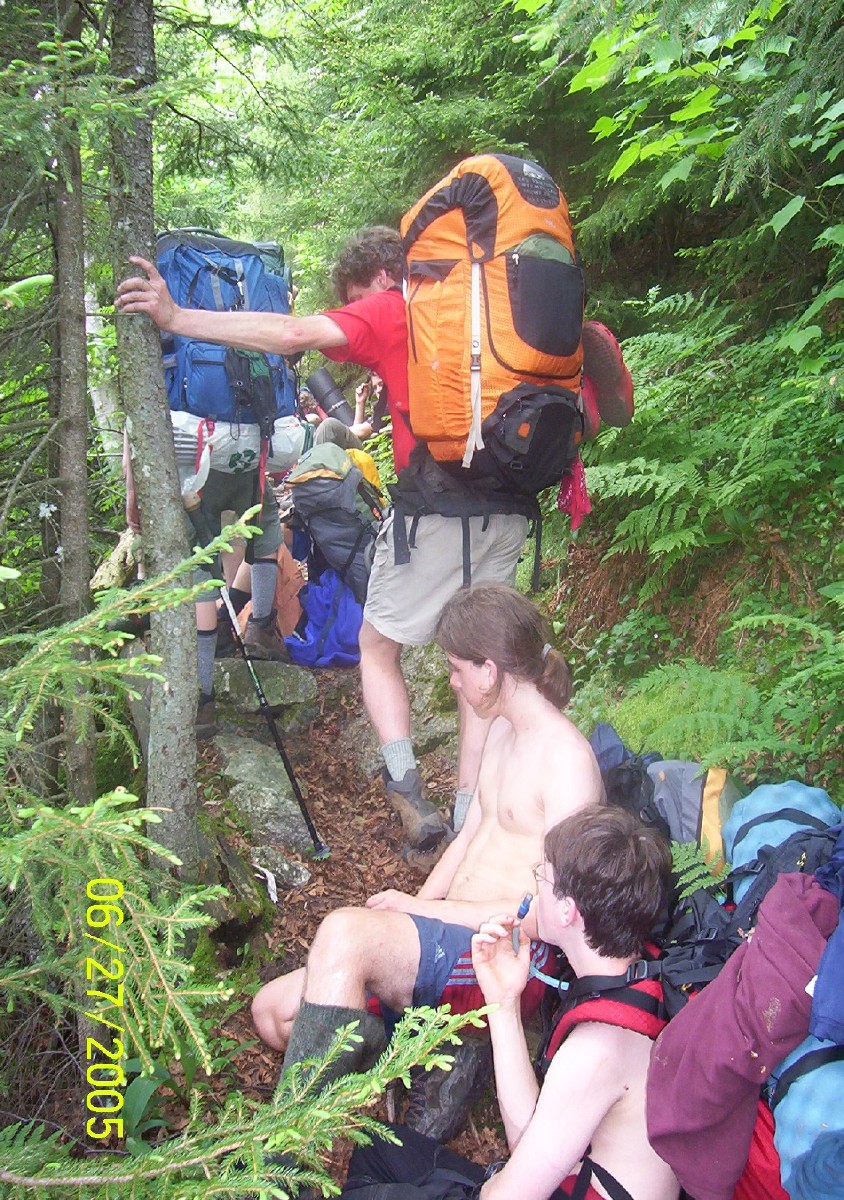
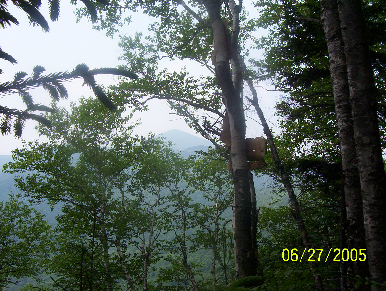
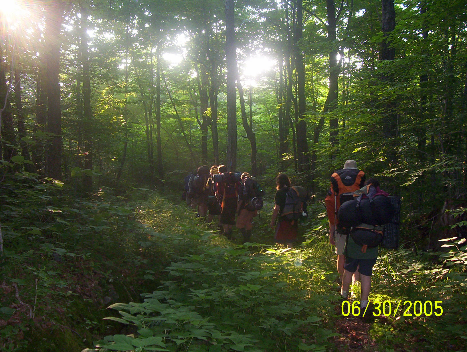
The sun was out in the morning and we did our best to dry a few things while cooking breakfast and packing. Our crew does a lot of horsing around and getting on trail is not very high on their list of priorities. Last night Paul T. and David made contact with Yorke Brown via their ham radios and they are going to try to do it again tonight during the troop meeting. The rest of the troop will be at Storrs Pond for the regular Wednesday night meeting. Breakfast (oatmeal), packed up, took down the flag and hit the trail. First it is 0.2 miles back up hill to the Long Trail itself. Here we turned north again. Yesterday's side trip to Chittenden Reservoir was welcome, but now back to our primary target -- ever northward. It is a push uphill through a forest of maples and around the shoulders of Mt. Carmel. This is the same peak we were circling two days ago after Telephone Gap. After Mt. Carmel we dropped into Wetmore Gap. Wetmore Gap is a gap in the canopy as much as a gap between Mount Carmel and Bloodroot Mountain. It is an open glade and a marshy stretch of trail. It always seems curious to me that we can be on a narrow ridge with steep sides dropping a thousand feet to the east and the west, yet water still accumulates here to form these mountain top bogs. Out of the gap, the trail rises to the north and back into the woods, now spruce, hemlock and pine. We skirt the east side of Bloodroot Mountain on a nearly level trail. The trail is easy going, but it is very wet due to last nights rain. It is 2 1/2 miles around Bloodroot but it takes us quite awhile with numerous stops along the trail sides. Bloodroot Gap itself is not very big. We cross a snowmobile trail and are right back into the woods on the east flank of Mt. Farr, or Farr Peak. I think that we must be on an old logging road, it is wide and flat and there is a good deal of grass and ferns along the trail -- all dripping with water. My wool socks are so wet that they droop on top of my boots. My feet and boots are as wet as if I had fallen into a stream. We all know that this is our last hike-only day. Tomorrow morning we will be rock climbing. We had originally planned to spend the night at Sunrise Shelter. But Ted points out that if we push on across Brandon Gap to Mt. Horrid today we will have more time to rock climb tomorrow. The crew is tired and dismisses the idea of going beyond Sunrise. So Ted and I don't discuss it any more but the seed is planted, and the day is still young. A mile beyond Bloodroot Gap there is a side trail down to Chitten Brook campsite. The Long Trail is certainly on an old "wood road" at this point, slowly dropping towards Brandon Gap. At one point there is a break in the trees and we can see across the gap to the Great Cliffs and Mt. Horrid. We take a long break at Sunrise Shelter. The crew is divided about pressing on. It is only about 3:00 in the afternoon. So we agree to rest for an hour and then reconsider continuing. I hang out my tent to dry and we gather up all the water bottles and refill them with the filter-pump. All told our crew carries about 30 liters of water.
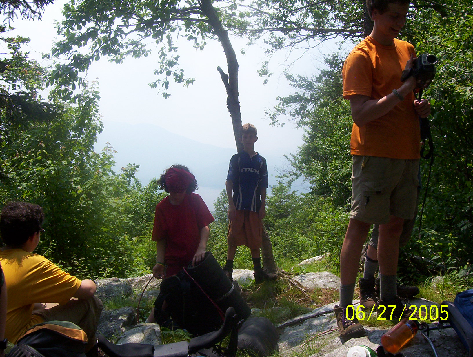
At the shelter the boys are well entertained by reading the guest book
out loud. The favorite entrance was An hour later we are all feeling better and the crew chooses to press on. It doesn't take long to drop into Brandon Gap. There is a wide grassy strip here, and even though it is thick with flies we sit here for awhile eating wild strawberries. And then it is time to climb Horrid. I think the ascent of Horrid was the single hardest hour of the hike so far. It is a very steep ascent and at one point somebody has build a stone staircase. Some of the scouts are bounding, running up these steps, while others are dragging. I tell them they can take a break every 50 steps. The whole staircase was 111 steps, and we do it in two pitches. At the end of the staircase there is a side trail to the top of the Great Cliffs. This is where we will climb tomorrow, so now we just made a quick side trip to inspect them. Back on the main trail we continued another 200 meters and then turned off the trail to look for a spot to camp. We forged around awhile through some wet and tangled areas, past some bogs, swamps, ferns and blow-downs until we at last found a place where we could pitch our tents. We have seven tents and it took awhile to find seven patches in this tangled and wet forest. It was raining by the time we were cooking. We had "Pasta Side Dishes" for supper -- pasta shells with a white garlic sauce. Ari had been waiting for this meal in particular since we had brought powdered milk with us for it. Any left over milk would need to be drunk and Ari was willing to help dispose of it. The evening settled down to a long drizzle and rain. Because this is a bivouac site we felt that we should not build a fire (leave no trace), and with the rain everyone crawled into their tents early. Nick was visiting Will in Ari's tent and said he would spend the night there because it was too dark to find Jason's tent. Also Ari had been in Robin and Connor's tent -- and spent the night there. A wet and mixed up night. It was a wet night, but it was also a warm night so sleeping in a damp sleeping bag was not too bad.
|
|
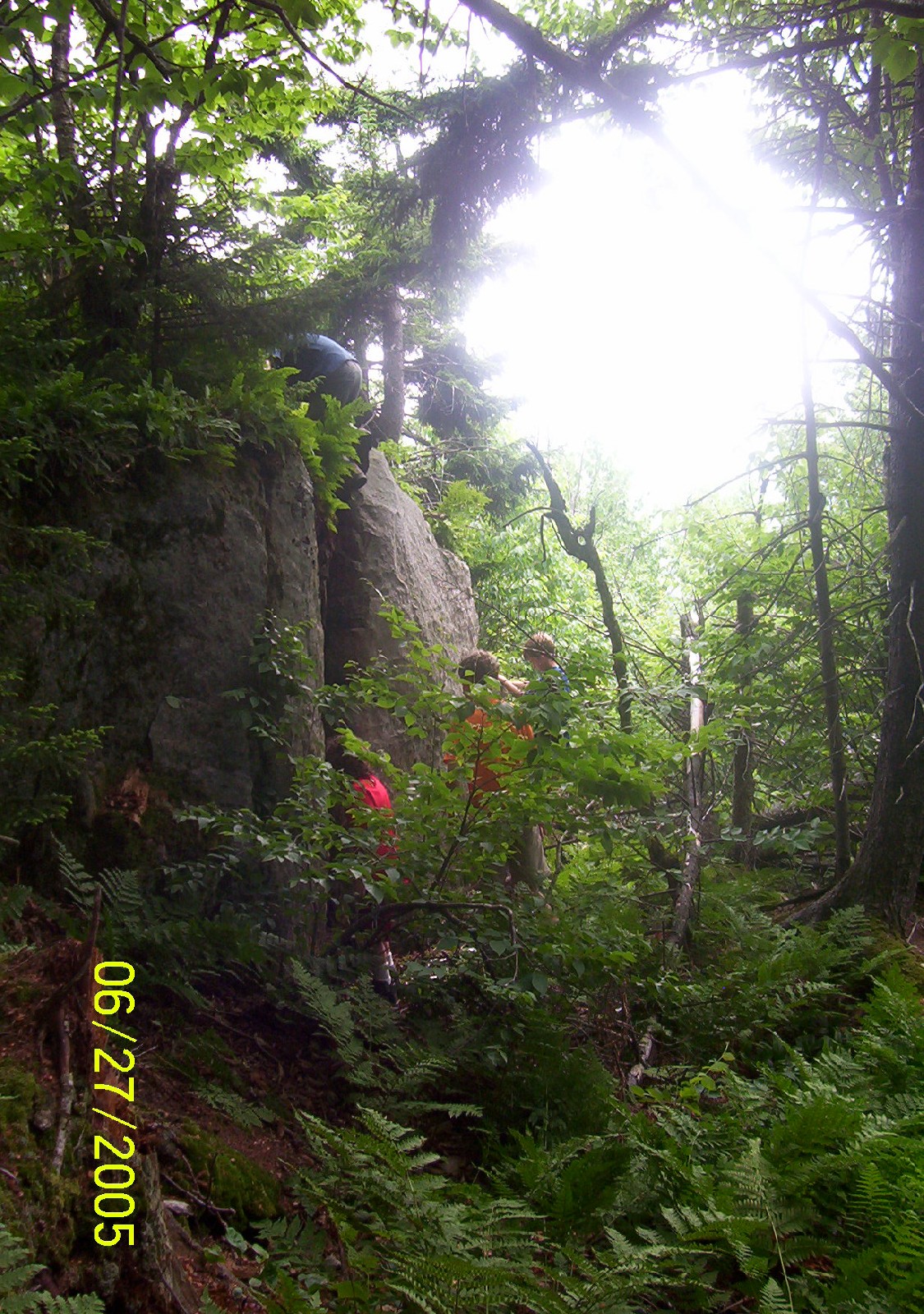
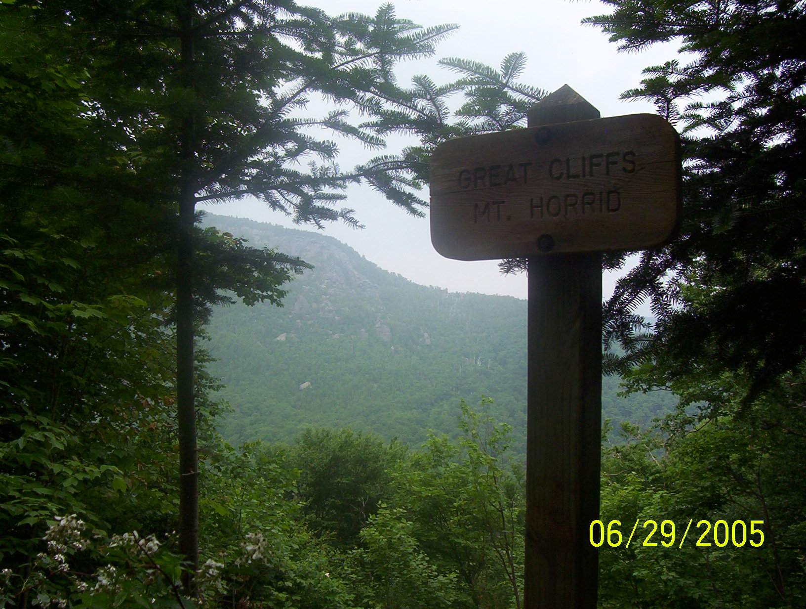
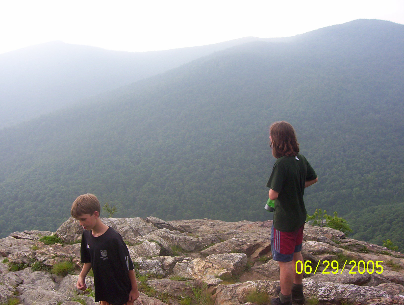
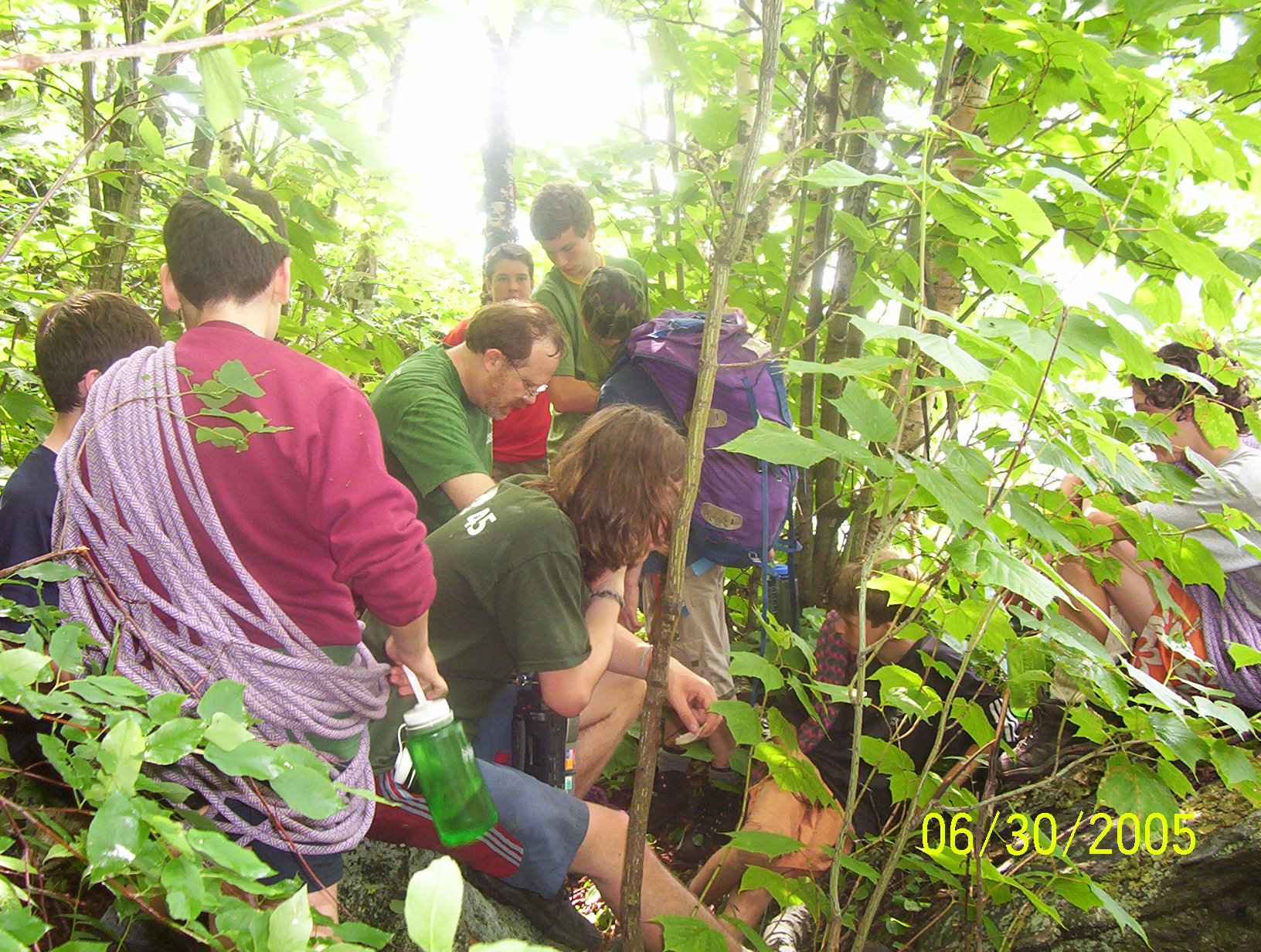
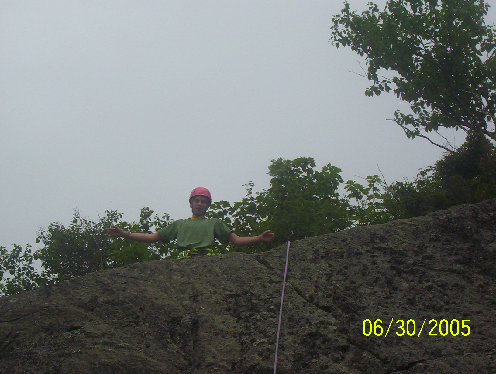
After thunder, lightning and an all night rain the sun came out in the morning. We made and ate our breakfast, and then broke camp. It is curious how little trace we could leave. At one moment we are a small hamlet of seven shelters and a dozen backpacks. An hour later there are only a few broken sticks and ferns, and some trampled grass to mark where we have passed the night. Back on trail we pull out our water bottles and cache most of our gear, heading south with a few empty backpacks to meet Yorke Brown. After descending the Horrid staircase we split into two groups. Ted and a few boys with the empty packs continue to descend into Brandon Gap to meet Yorke and retrieve our next food drop. The rest of us explore some trails towards the cliff faces. The upper section of the Great Cliffs is closed to climbing because of nesting falcons, but the lower cliffs were open. We poked around and found a good spot and then returned to the trail.
The group which had descended into the gap soon returned with new food,
rope, climbing equipment and Yorke Brown. We lead the way, bushwhacking,
towards the cliff face. Half way there Yorke stopped us and sat the
boys down to talk about rope and safety. One of the things he told us
was that `judgment' was not fully developed until age 45. But if
you acted like you had judgment that that was a good substitution.
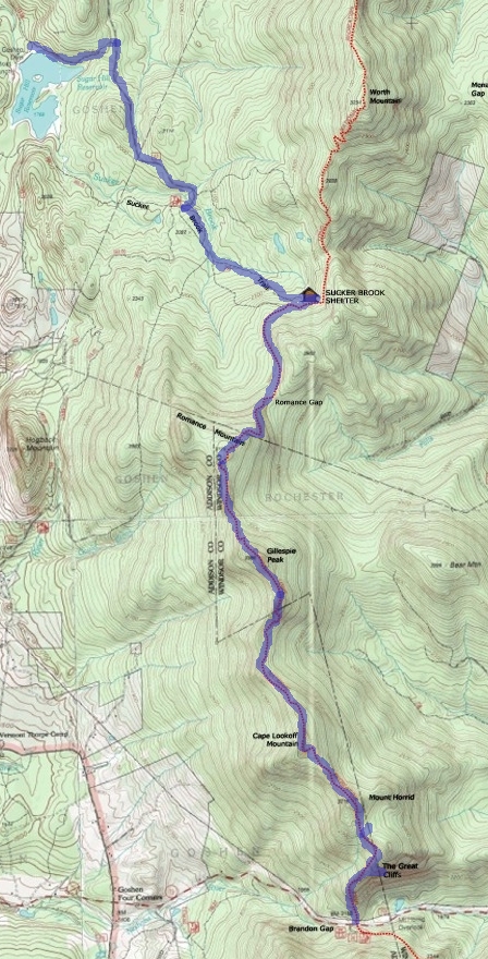
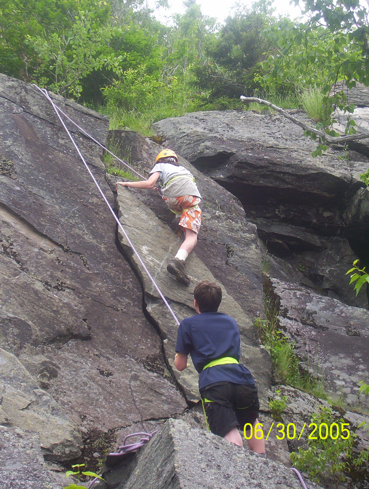
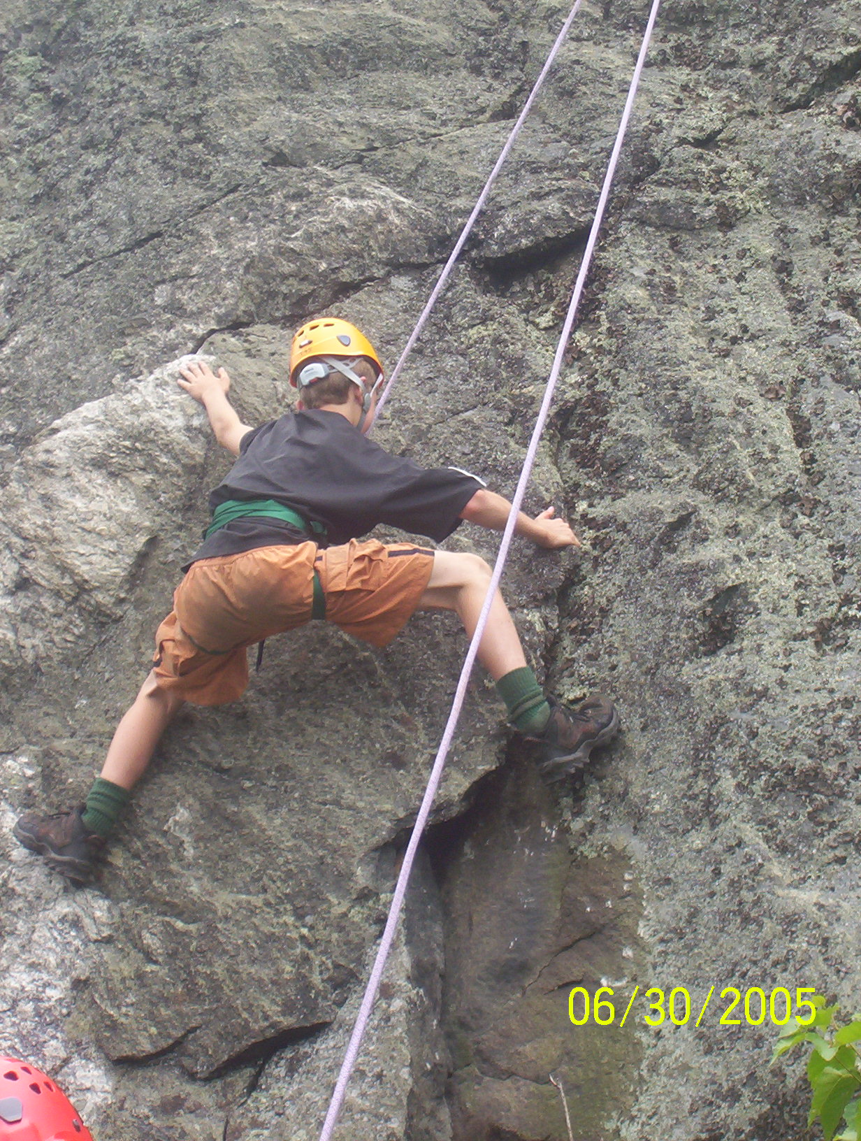
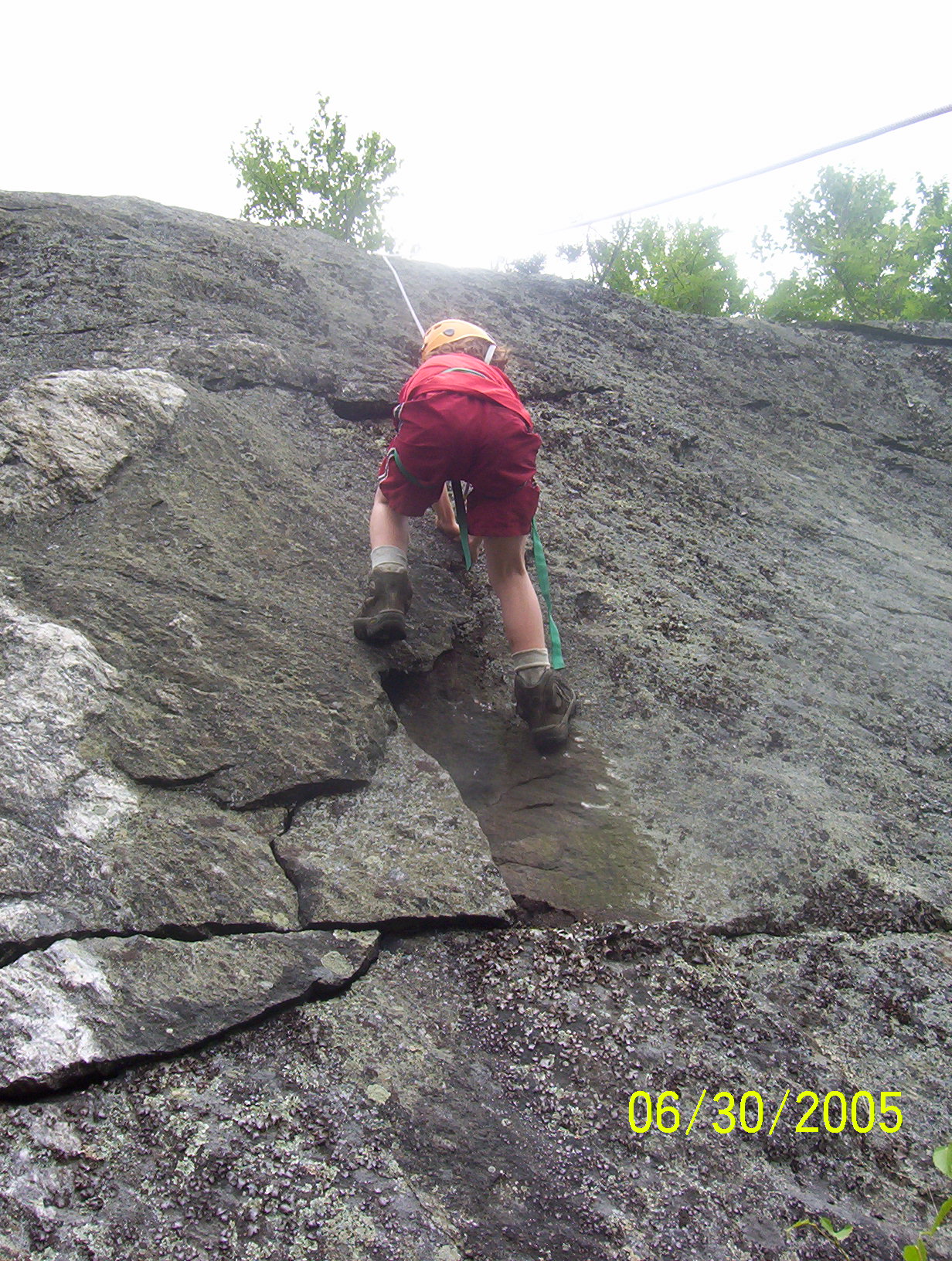
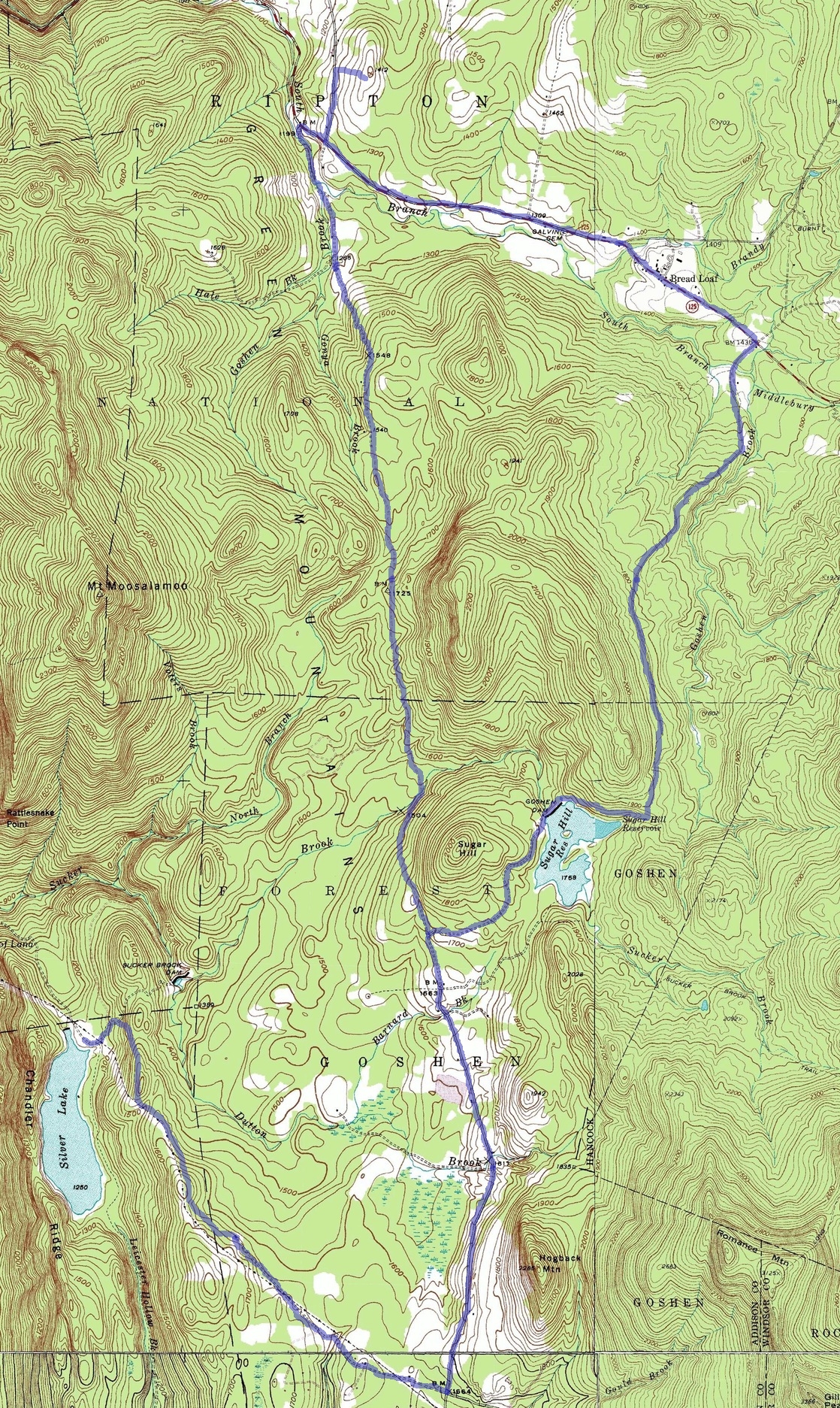
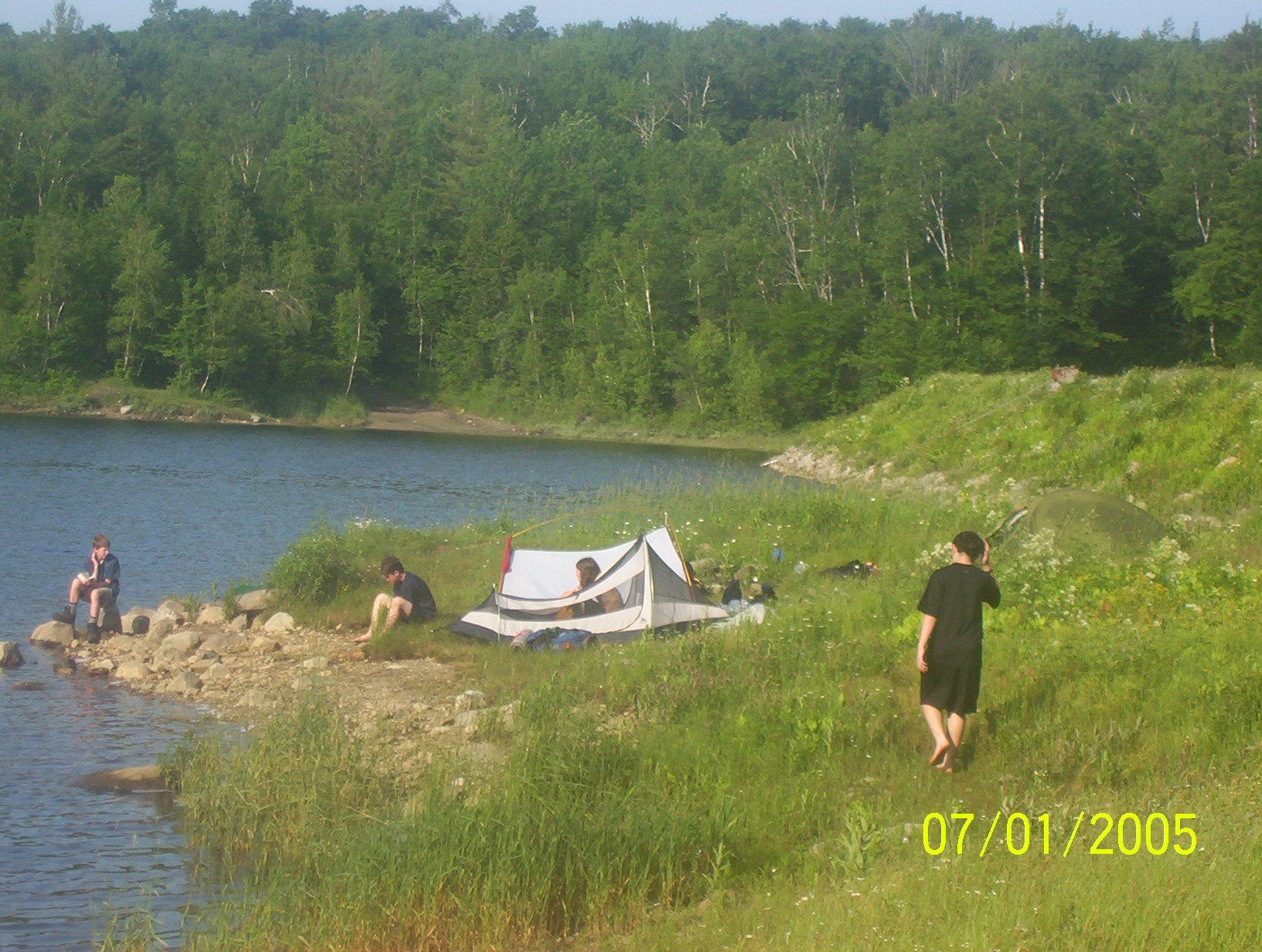
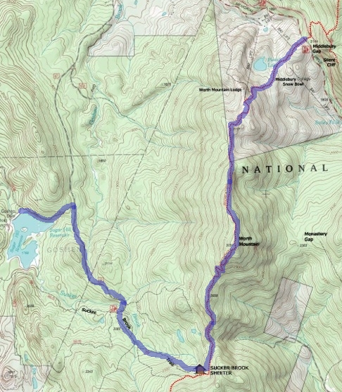
The first -- and only -- rule of climbing is: At the cliff face Yorke gave each of us a length of nylon webbing and taught us how to weave and tie it into a harness. We also reviewed how to belay. Oli was the first to attempt the cliff. He pulled off a large flake which tumbled down into a crevice below. The route started up a crack, a lay-back, and onto a ledge. Beyond this was a smooth slab. So Oli did a traverse to the left and the topped the face. Later Robin attempted the same route and managed (somehow) to get up the smooth section. Connor then followed. Will took the lead on exploring a second route which he thought most of the other scouts would be able to do. At the base of the cliff the rock was riddled with crevices which the scouts spent a long time exploring. We have a lot of video footage in these caves and crevices. People not climbing also had lunch. At the beginning of our time on the cliffs I enjoyed watching puffs of clouds seeping through Brandon Gap, far below us. By 1:00 we finished climbing. We are short on water and debated about descending back into the gap to refill our bottles. But in the end we felt that the five liters we had would be enough, and it seemed as if in the past few days we never went more then a mile or two without crossing at least a trickle. Yorke stacked ropes on ropes and said farewell and headed back down into the gap. We re-climbed the Horrid Staircase, reclaimed our packs and headed north in search of water. From where we camped to Sucker Brook Shelter was about four and a half miles -- and the day was turning warm. Actually we had not topped Horrid yet, but we have climbed by far the steepest sections. Water was on everyone's mind. I was surprised to see one of the scouts who had a bottle take a few secret sips after we had agreed to ration it. Horrid itself is tree covered, but after the summit it was at least downhill. We stopped at Cape Lookoff Mountain for only a few minutes even though we could actually see out of the trees from here. Ted had some lemon drops which helped some dry mouths. I think water is all some of the boys are thinking about. Finally, after a steep section, we top Gillespie Peak. At 3366 ft (1026 m) this is the highest point of our week long hike. But we don't stop for long. Jason had been famous since two days ago (Telephone Gap) for saying "It's all downhill from here". (David Danna said "It was all downhill two hills ago".) Now it is (nearly) true. But I think it is not just that it is downhill, it is easier because this crew is much stronger then when we started. We are now averaging 1.5 miles/hr, whereas on day two we averaged about 0.9. We may be thirsty, but we are storming along in good form. A mile from Sucker Brook Shelter we spy a trickle of water, the first since Brandon Gap. But we agree that it is too muddy and too little and so we push on. Ten minutes later we find water, cold and clear! We pump and fill the water bottles and enjoy it. The rest of the way to Sucker Brook is leisurely. At Sucker Brook Shelter we take a break and eat power bars. Now it is a simple walk down off the ridge to Sugar Hill Reservoir. The first mile is an old logging road which seems green and soft after following the rocky spine of the ridge. We stroll along peacefully at two miles per hour! Soon we come out on USFS-67 -- a gravel forest service road -- and follow it for a mile. Finally we cut across on a trail to the reservoir. I think this trail may primarily be used by snowmobilers. A dozen minutes later we emerge into a field next to the cool waters of Sugar Hill Reservoir. We are all excited to be here! we set up tents and then go swimming. Ted's brother has left a canoe and some fishing gear at the far end of the dam, which Ted retrieved. But then, late in the afternoon, the mosquitoes arrived and we think we will be sucked dry. In the evening the breeze comes up and drives the bugs away. Supper is spaghetti. We then spend some time around the campfire and finally trickle off to bed.
|
|
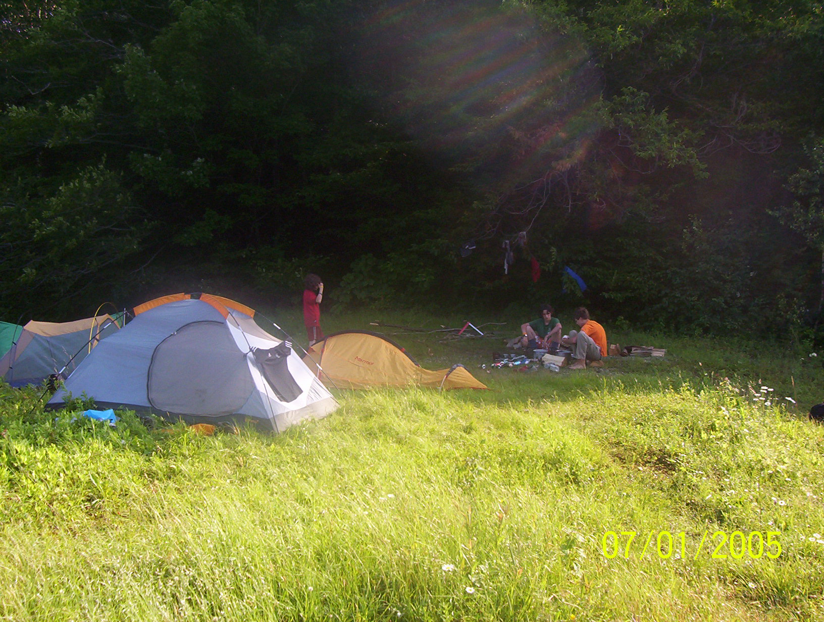
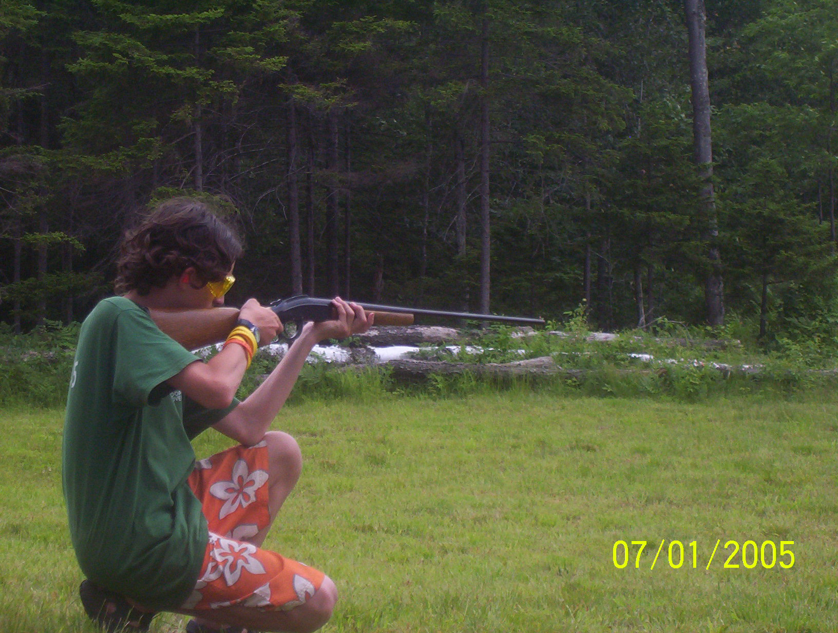
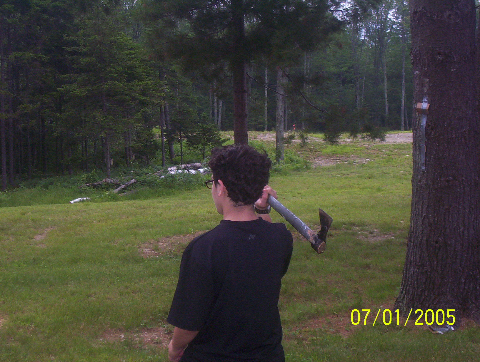
Ted has found wild strawberries to add to his oatmeal, and so the whole crew started grazing through a patch about 30 meters behind our site. We have finished breakfast and are almost ready when the Bike-man arrives. There is a bike shop in Rochester, Vermont, which we have rented mountain bikes from. The owner has agreed to drop them off this morning at the boat ramp next to the dam, and pick them up tomorrow. They each include a bag on a back rack. So we pack up enough stuff for the day and head out. It is a pretty rough dirt road out to the main forest service road -- but so much smoother and faster then anything we have seen since the Alpine Slide on Sunday. We turn south on Forest Service Road 32. This is a smooth road and we sail past the Blueberry Hill Inn. Off to our left, to the east is Gillespie Peak, which we easily glide past -- so different from yesterdays labor. We then turned onto FSR-27 and headed towards Silver Lake. Near the lake cars and trucks are barred by a gate. We consult the map and push our bikes around the gate and continue. We are on mountain bikes, so this should be no problem. There is a steep downhill with loose gravel and Connor wipes out. He was pretty cut up, but before I could dig out my first aid kit three scouts had their's out. So I let the scouts patch him up. We continued down to the lake where there was a picnic table and a swimming area. We had our lunch and hung out by the water for awhile. Finally we retraced our path, back up FSR-27 & -32. However when we got to the turn off for Sugar Hill Reservoir we continued north for a few miles. I think Oli was in on the surprise, but the rest of the scouts didn't really know where we were heading. FSR-32 ends on Hwy-125. Here we headed east for a quarter mile and then north on Maiden Lane. Up this road, less then a mile is where Oli's uncle and Ted's brother Tim Simpson lives. He was expecting us. We spent the rest of the afternoon around his house. He had set up a shooting range for a rifle and a shot gun. He also had a throwing hatchet. The scouts had a great time. And then it was time for the "End of Trek Feast". Tim had lots of hot dogs, hamburgers and sodas waiting for us. Cold Sodas! After eating our fill, and now it was getting into the evening, we headed back to our campsite. We headed east on Hwy-125, then south on FSR-67. This is the same road we hiked on near the end of yesterday. It is straight and flat, and I think mainly used for logging, and we flew down it headed home. When we got to the snowmobile trail we pushed our bikes through the woods and back to the camp site. That evening I noticed that fireflies filled the field where we had picked strawberries in the morning. One last campfire. One last session of `Thorns and Roses', mainly roses tonight. This is our last night and last campfire, so the boys talked late into the night.
|
|
| Ted, Ari & Rifle |
Paul F. Shooting |
David & Hatchet |
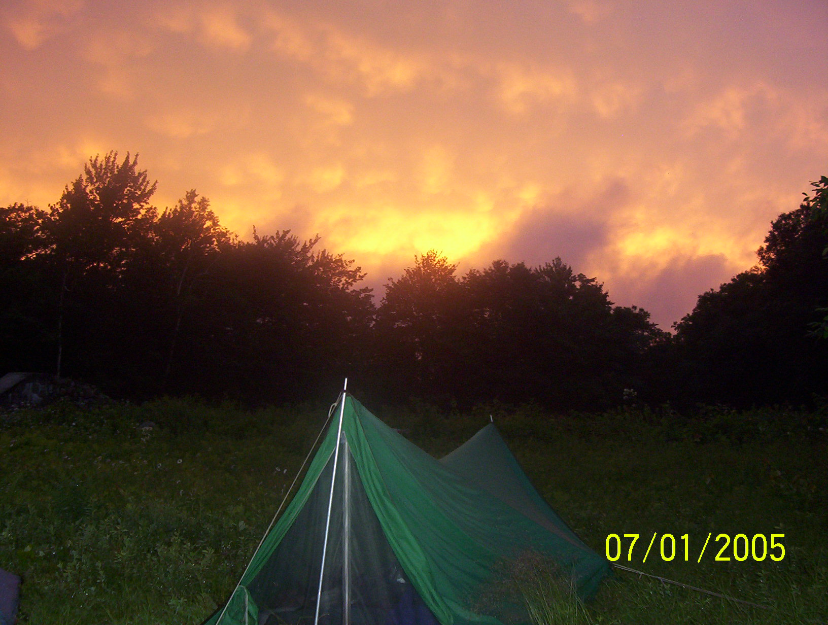
Colorful Sunset |
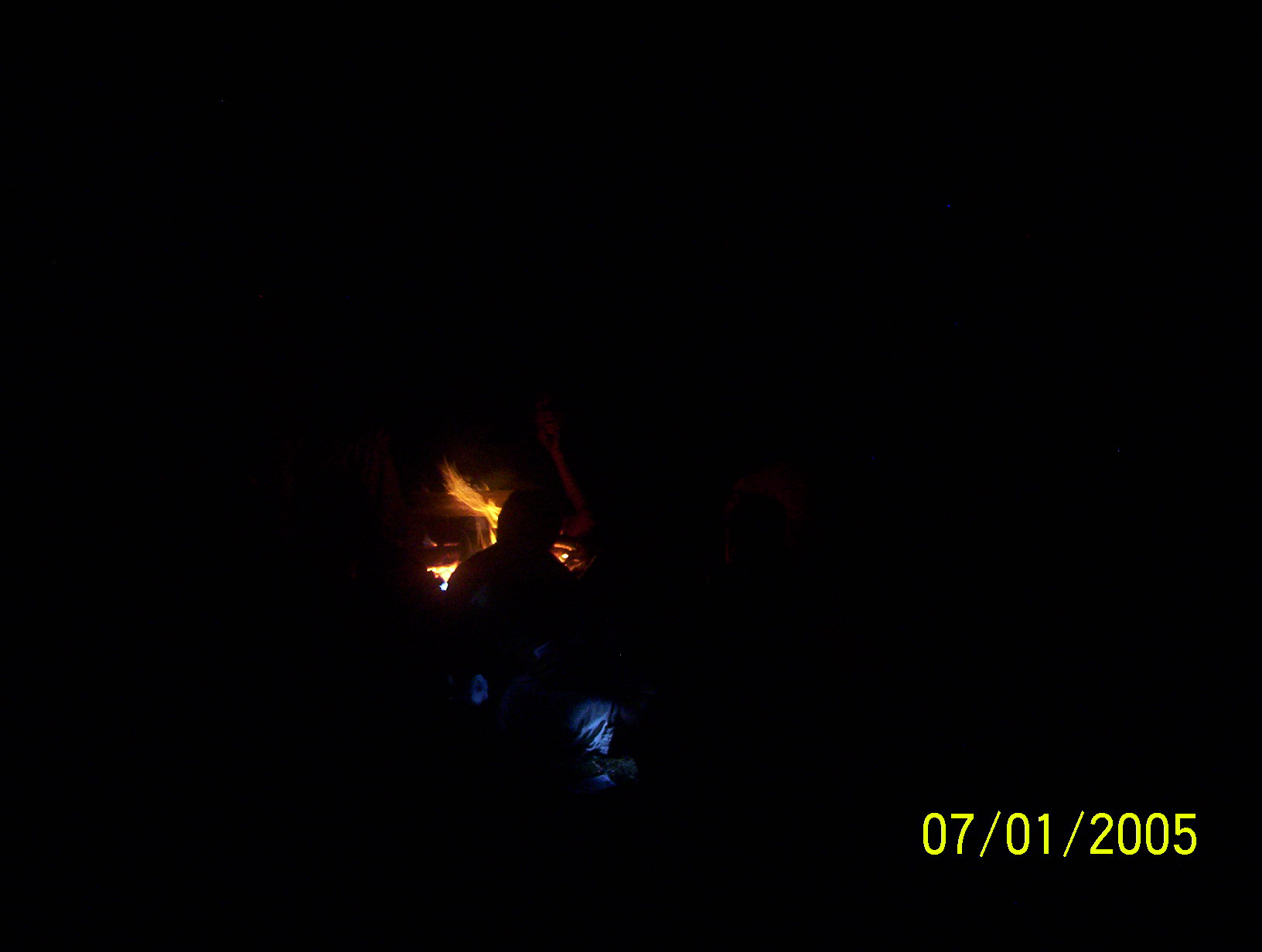
Last Campfire |
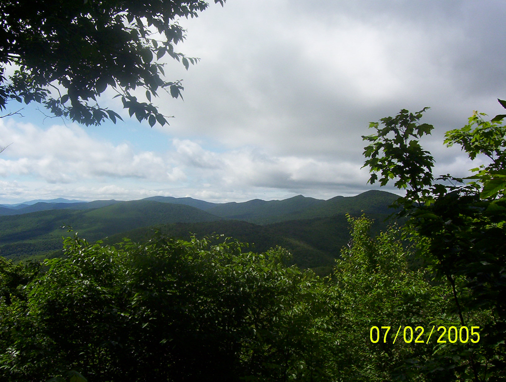
This is our last day on trail and I think we have developed a real `Esprit de Corps' -- which to me is one of the major reasons for going on an outing like this. Packing up is easy, we are so use to the routine by now. Ted's brother, Tim, has dropped by to pick up the canoe and the fishing gear. He has also volunteered to carry our packs to the trail's end so we will have a light hike today. We put granola bars in our pockets, grab our water bottles, and drop the rest of our gear into the back of his pickup truck. Back on trail after yesterday's bicycle hiatus. We retrace our steps up to the the ridgeline where the Long Trail awaits us. We left the campsite a bit before 9:00 and in about an hour we are back to Sucker Brook Shelter. From here it is a steady climb up nearly a 1,000 feet to the top of Worth Mountain, but the crew is flying along, rested, light-footed and high spirited. We are averaging about two miles per hour! In part it is the seventh day on trail and we are a much stronger crew, in part we are without backpacks, and in part it is horses who can smell the stable. From the top of Worth Mountain we can look back all the way to Killington. We can see the whole ridgeline where we have hiked and toiled this last week. And then, as Jason said on day two, "It's all down hill from here." We break out of the trees at the Middlebury Snow Bowel, near the top of one of the chairlifts. The trail weaves through the woods which separate the different ski trails. Eventually we emerge on Hwy-125, where our packs are waiting for us and our rides back to Hanover have just arrived. We were to be picked up at noon and we arrived here at 11:45. Not bad timing after a week on trail. One of the parents has brought a cooler full of ice, GatorAde and cold soda -- which is greatly appreciated! Life back in Hanover, sleeping in a bed under a roof will just seem way too normal.
|
|
| Ted gazes on his beloved Vermont |
The crew |
Trail's End |