|
Tuesday, April 24, 2007
Stockholm
Hello People,
Reminder, past letters, and better photos are on
on the website. On the website is also a calender
which tells you who is visiting us when.
http://he3.dartmouth.edu/Sweden
username: Sweden
password: Stockholm
(capital letter required)
There is an essay of bikes below the report.
|
Map of Recent Trips
|
|
This last Saturday I took a long bicycle ride
north of here. Göran (from Kristina's office) has
lent us a bike. I knew of some bike paths that went
around Brunnviken, the lake I run around, and beyond
that up to Ulrikdale and Ulrikslott ("slott"=palace).
and I wanted to know how far I could ride on paths.
Ulrikdale is 10km north of home. Beyond that
I lost the trail for awhile, but reconnected along
Edsviken ("viken"=lake). I was riding on somethings
marked as "Edsvikenleden", and later on "Sverigeleden",
I was just starting to get the idea that these bike
routes are part of something much big then just getting
across the park.
At the north end of Edsviken, in the town of
Edsberg I was stopped while a foot race went by. But
then on. In Sollentuna and Norrviken I went through
some basic suburbs and strip development, but
occasionally the wasteland would be broken by an old
church. It is curious how the towns have migrated
away from the churches. The old churches and town
centers are at the top of hills. The new town-centers
are around the railroad stations build in the lowlands.
actually this part of Sweden is pretty flat, at least
compared to New Hampshire.
In the town of Bollstanäs I saw a scout house.
Actually the second of the day; there was also one
near Ulrikdale. Past Upplands-Väsby and Fresta and
all of a sudden I am in farmland. I started
circling to the east, and when I pass a "Moose
Crossing" sign I feel like I really have left Stockholm.
I've cycled about 30 kms at this point. The Valletuna
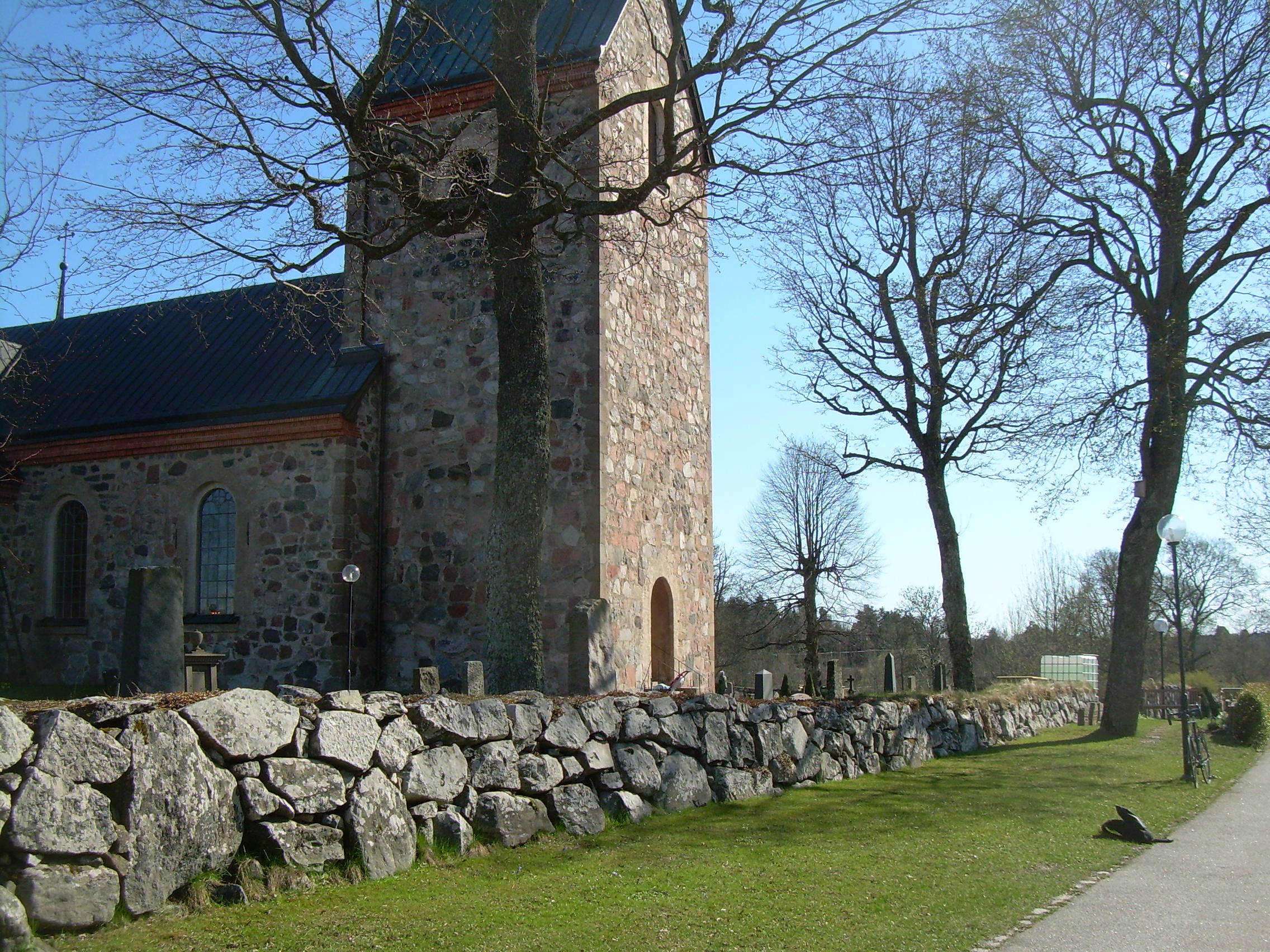
Kyrk ("Kyrk"=Kirk=Church) is very pretty (Vallentuna.jpg),
located at the north tip of Vallentunasjön ("sjön"=
lake or sea). I took a break here and sat in the
church yard, basking in the sun. I've been fitting
a head wind all day, but now that I am turning south, I
think it is stopping.
In Vallentuna I stop for lunch and then found a
bicycle highway towards Stockholm. In Täby I lost the
path in an area under construction, but Viggbyholm
is nice and bring me to a finger of the sea called
Stora Värtan. From Täby on I am back in the city.
Djurholm is full of very nice homes along the water.
My bike path also cut through a number of boat yards,
which are in the process of unwrapping big boats from
winter storage. I think the ratio of boats to people
for greater Stockholm must almost be as high as it is for
my house.
I am getting sore and tired as I spot Stockholm
University. It is funny how small Brunnviken seems as
I pedal the last 3 kilometers along its shores.
All told I cycled 63 km (39 miles).
On Sunday Robin and Kristina went downtown to see
the Royal Apartments. They then went shopping and
later to Nickolay's house. Nickolay and Natalia have
had a new baby, and Kristina and Robin brought them gifts.
They took the train to Täby, near where I biked.
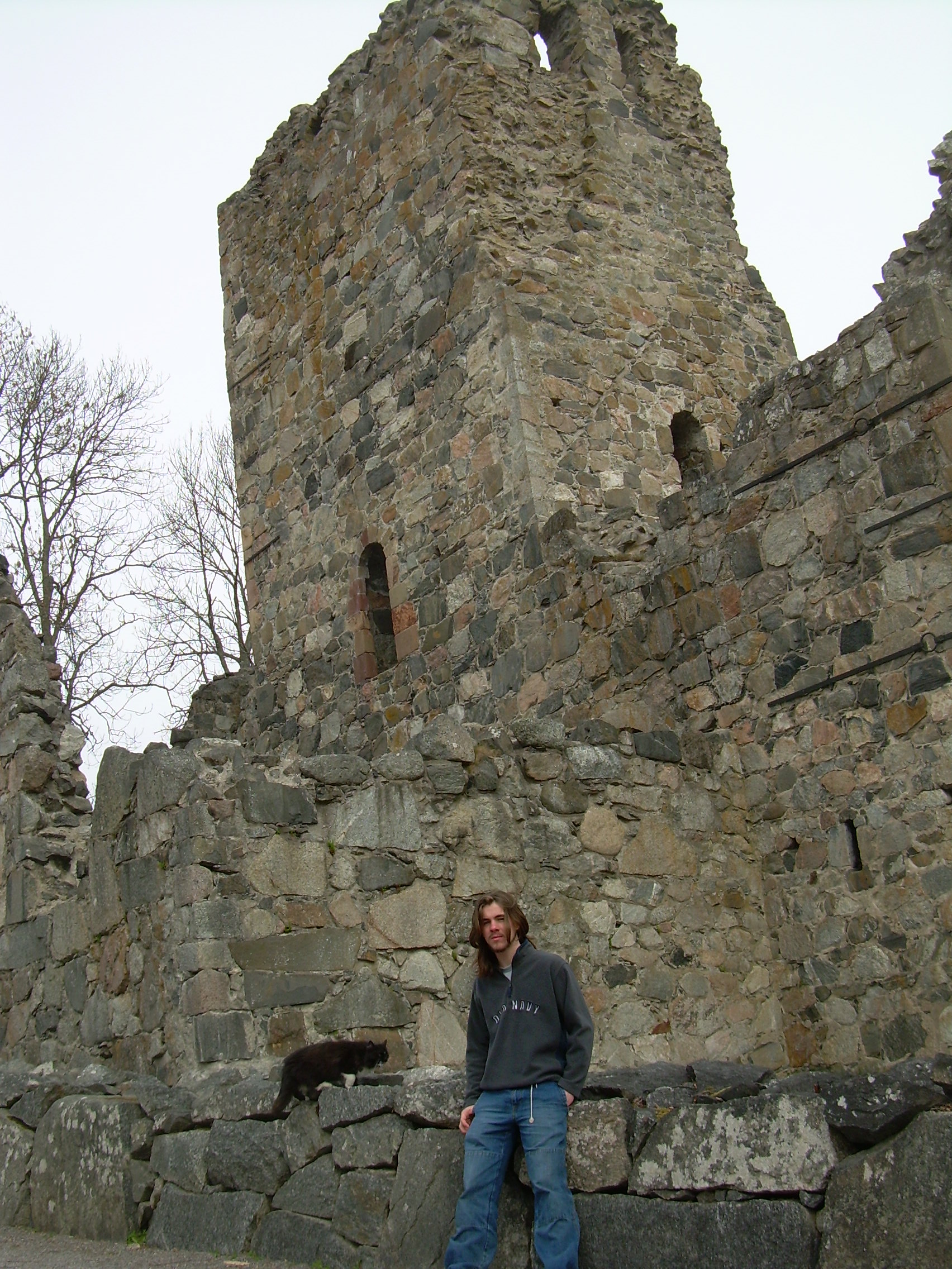
Will and I went o Sigtuna. This is the oldest town
in Sweden, dating back to the year 980 or so, but they
is not much that is old in it any more. Most of the
adventure was riding the bus to Solna, taking the train
to Märsta and then a bus through the countryside to
Sigtuna. I pointed out to Will how every major road has
a bike and walking path build near it, usually 10 meters
away from the road, winding through the fields.
We walked around the town and stopped at the ruins
of two old churches (WillSigtunaChurch.jpg), had lunch.
Will had a "kyckling" grill. ("kyckling"=chicken -
Kristina says that kycking makes her think of chickens on
bicycles). I think in the summer this would be a busy
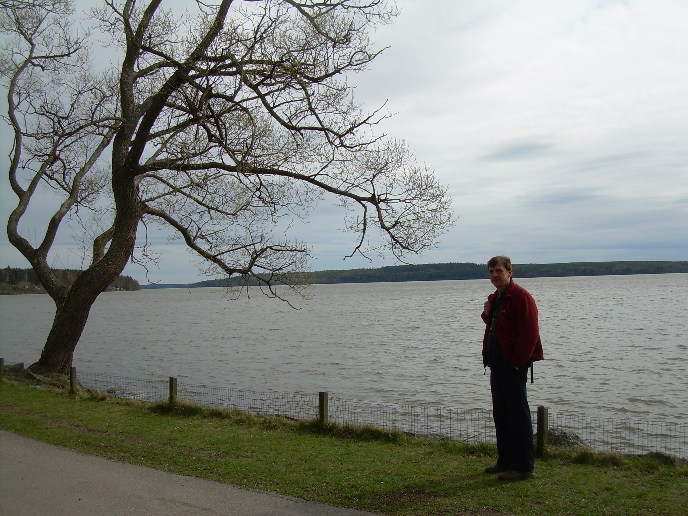
place, but it is quite now. Then we walked down to the
water front to see Lake Mälaren. (TimSigtuna.jpg,
WillSigtunaTree.jpg)
Apparently this town was the center of trade on
Lake Mälaren for many years, but was sacked by Estonian
pirates in the 13th century. At that point it was decided
to build a fortress to protect Mälaren from the open
Baltic Sea. That fortress was a stockade on an island
(ie. "Stockholm" - "stock"=timber, "holm"=island).
Later we retraced our steps via the bus, train and
bus home.
What else is new? Will has started Jujitsu. Robin
still plays fotboll when he can (we have had some rain
days). Kristina works and I write.
Tim
|
Vallentuna
Will at the ruin of
a church in Sigtuna
Tim by the shores of
Lake Mälaren, Sigtuna
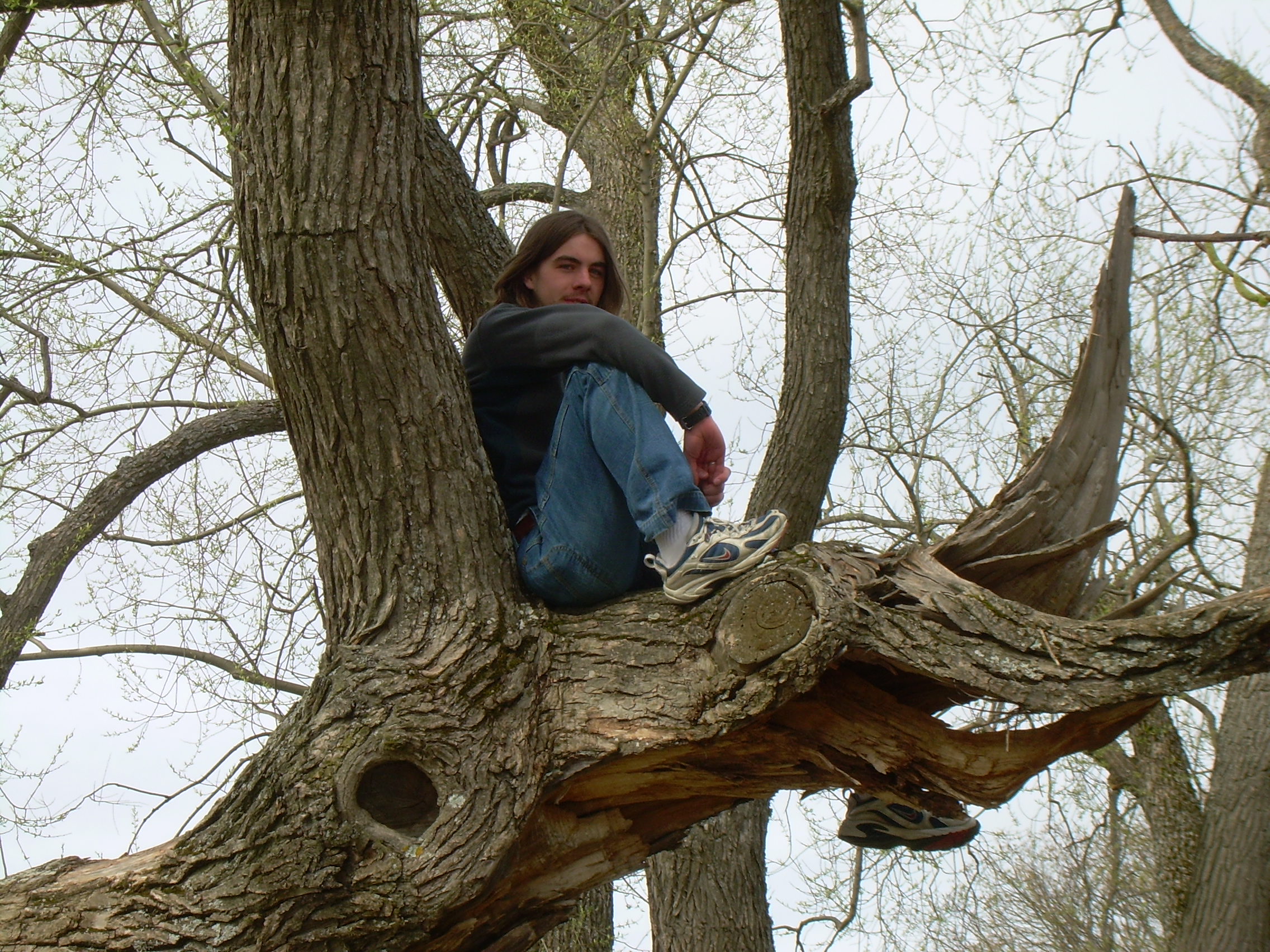
Will in a tree in Sigtuna
|
|
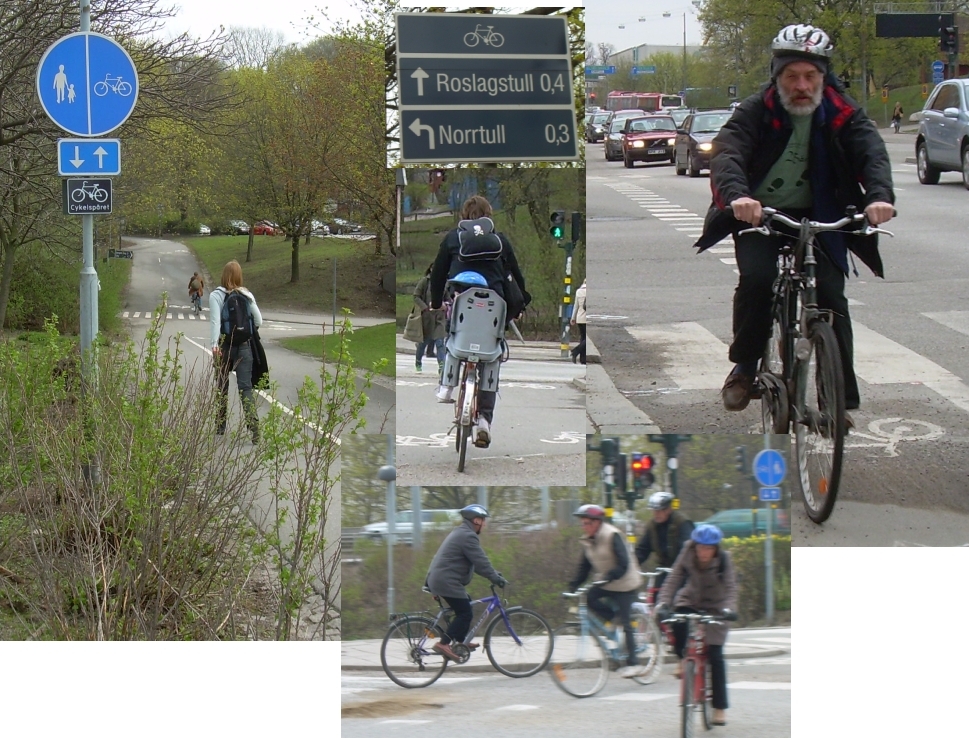
Bicycles in Stockholm
On my my bike ride I became aware of how seriously
the Swedes treat bikes as real transportation. At the
bottom of this essay is a table of travel modes statistics,
which are curious to see. An average Swed bicycles a
kilometer a day.
The first thing which strikes me about the bikes
is that they are often old clunkers. I see bike shops
full of bikes as fancy as we ride in New Hampshire, but
I think the average bike-on-the-street is a quarter of
a century old. Where do they hide the new ones? Or
maybe the first thing you do with a spiffy new set of
wheels is take it home, strap on an old hand-me-down
grocery basket or child-seat, and cover it with
a bit of grim so it wouldn't call attention to itself.
Or maybe shops put fancy neon colored bikes in the
windows, but actually only sell black five-speeds
out the back door. This is something like fashion
or auto design shows which show you things people will
never actually buy to get your attention.
(Someday maybe I'll write about why everyone is
Stockholm wears black. Right now I am waiting to
see if the spring brings more color in clothing.)
So how do you bike in the city? Most major streets
have bike lanes. But usually this are lanes build into
the side walk, not on the auto part of the street.
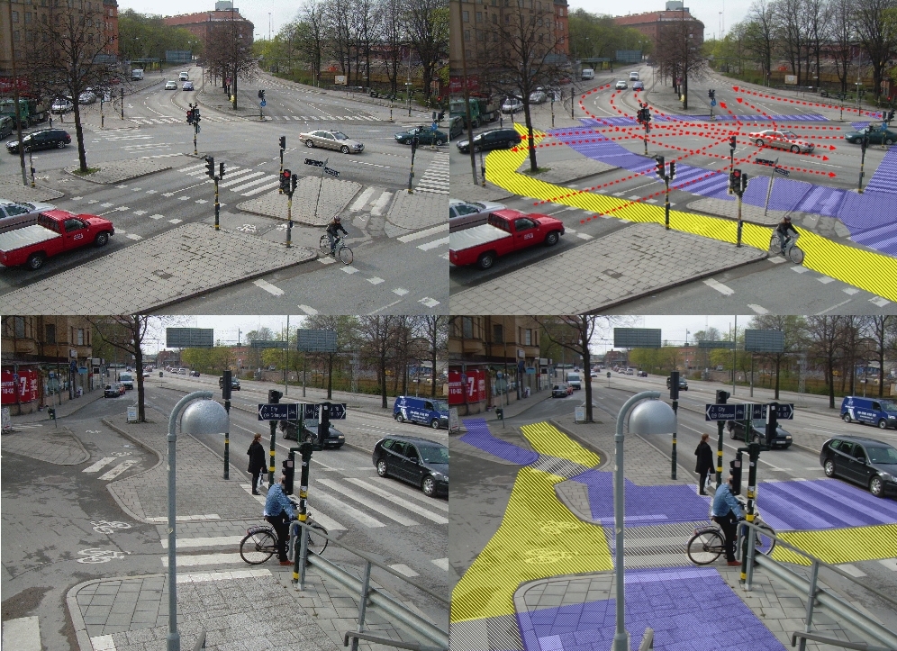
What becomes interesting is the intersections where
you have three separate traffic patterns crossing each
other. (Bike1.jpg, Bike2.jpg) I am use to the idea that
when a pedestrian has a crosswalk and right-away through
car traffic, there is a "zebra" crossing. But I
had not thought about zebra crossing so pedestrian
could get across bike lanes.
At major intersections bikes will also have there
own traffic lights, as do pedestrians. But cyclers
and walkers often cross even when it is red, if there
are no cars. Cars do recognize the rights of the bikes.
I think starting and stopping takes more of a toll on
a biker then a driver. It takes real energy out of
my legs to get this bike rolling again.
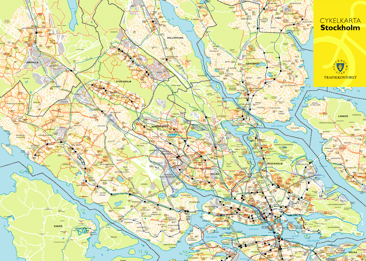
Out side of the city most major roads have bike
and walk ways. These are usually separated from the
highway by a strip of grass. Sometimes these are
compact gravel, sometimes paved. I rode on the
"Sverigelden", which is part of a nation wide network
of paths. (BikeMap.gif)
Biking and bad weather? I've still seen a lot
of bikers in the rain. The snow was gone before we
arrived. Another curious thing I've seen is a bike
path in the countryside which is cutting through the
woods and has street lights! Is this because if
you commute by bike in November it will be dark
out when you are riding?
Even though there are dozens of path which will
get me out of Stockholm, I think I want to learn how
to put the bike on a train so I can start my next
ride "far from the madding crowd" of other bikers.
Percent of Trips by Travel Mode
| Country | bicycle | walking | public | car | other |
| Netherlands | 30 | 18 | 5 | 45 | 2 |
| Denmark | 20 | 21 | 14 | 42 | 3 |
| Germany | 12 | 22 | 16 | 49 | 1 |
| Switzerland | 10 | 29 | 20 | 38 | 1 |
| Sweden | 10 | 39 | 11 | 36 | 4 |
| Austria | 9 | 31 | 13 | 39 | 8 |
| England/Wales | 8 | 12 | 14 | 62 | 4 |
| France | 5 | 30 | 12 | 47 | 6 |
| Italy | 5 | 28 | 16 | 42 | 9 |
| Canada | 1 | 10 | 14 | 74 | 1 |
| United States | 1 | 9 | 3 | 84 | 3 |
Tim
|
Bike Intersections
Bicycles around town
Stockholm Bike Map
- Image -
Stockholm Bike Map
- Detailed (BikeMap.pdf) -
|