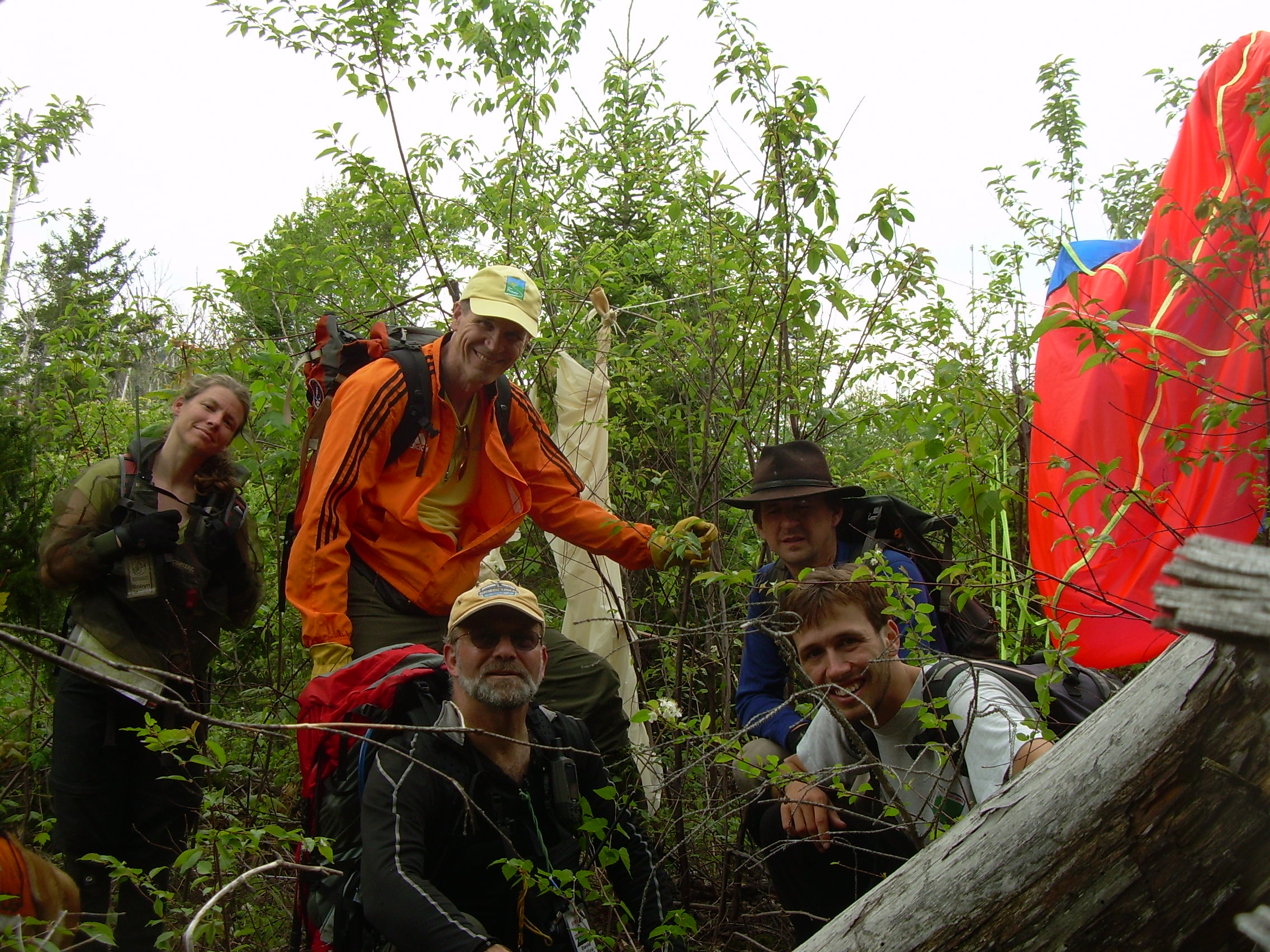
Alex, Bill, Dave, Robyn, Tim
"Green Cube" is a project in the Lynch Rocket lab in which students
are developing a package of instruments for a launch. The June 3rd
flight was the first launch of a a simple package. It was launched
on a balloon flight from Newport, Vermont, rose to about 93,600 feet as it
drifted over New Hampshire, and landed
between Wilson's Mills and Rangeley in Maine. What follows below is my
account of the day from my viewpoint on the recovery crew.
5:00 am We met at Wilder and loaded the remaining equipment
in the cars and vans. Most of the balloon and payload equipment
had been already loaded the night before, and this morning we
were adding personal equipment: backpacks, boots, ropes and lunch.
The new projected trajectory shows the balloon landing near Dixville
Notch, a little shorter flight then yesterday's forecast. We called Robyn
and told her to still rendezvous with us in Berlin.
Phil is missing. This will remain a mystery to the recovery crew
most of the day. While we waited for Phil, Bill and I took his car home.
After a number of phone calls and even an unsuccessful visit to
Phil's apartment, it was finally decided that we needed to go.
In the original plan Phil was the communications and data person
with the recovery crew, and Bill served a similar role with the
launch crew. It was decided that Bill would travel with the recovery
crew and Parker would cover for data and communications out of
Newport. So we swap radios and computers between the crews and cars,
such that Bill took his own computer and the less automated radio.
5:50 am The recovery crew (Alex, Bill, Dave and myself)
headed out. We traveled north on I-91 to just before St. Johnsbury.
We took I-93 one exit, around St. Johnsbury and then got on US-2.
The road wound east through Concord, VT and Lunenburg and crossed over
the Connecticut River in Lancaster, NH. US-2 then continues past
Jefferson and just to the north of the Presidential Range, past Randolph
and down in the Androscoggin River Valley and Gorham. From here
we followed NH-16 north to Berlin.
7:50 am Just before reach Berlin Robyn called us.
She was about five minutes
ahead of us. We met up in Berlin and then had Breakfast at the
"Tea Bird Dinner". This is a dinner to put on the map - perhaps the
brightest point of all of Berlin.
The reason we had picked Berlin is because we felt certain it would
have cell-phone coverage, which would become spotty further north
near Errol and Dixville Notch.
Over breakfast we were in cell-phone
contact with Newport. Parker is having problems setting up the
radio and so Bill, reading the manual off his laptop, talked
her through the setup. We also learned that a transistor
on the board of the payload has been blown, and so we think
that it would not be surprising if the launch is scrubbed.
There is a lot of discussion about how high the balloon would have
to be before we would get a line-of-sight radio connection
from where we are. If the mountains near us are five miles away and
a thousand feet up, a balloon fifty miles away will need to be ten
times higher up to be visible. We also estimated the effect of
the Earth curvature.
~ 9:20 am We receive a call that the balloon is being
filled and will be released in about ten minutes. We had expected
a longer warning, but were in the middle of paying for breakfast at
that moment, so we head north to the airport at Milan. We reasoned
that Milan is in the direction of the landing site and it also had a good low
horizon, so hopefully we could pick up the balloon's radio signal.
~ 9:50 am We arrived at the Milan Airport and discovered that in
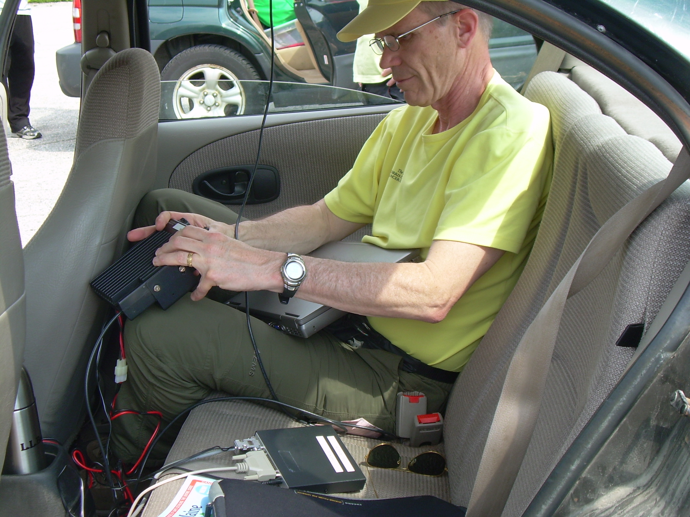
the process of swapping the computer and radio two critical cable were
left behind. We can not connect the radio up and the power cord for
the laptop is missing.
Milan airport has a number of single engine planes and one building
with an airport manager. The manager is friendly and curious as to what
we are doing, and when Bill ask to use a computer which is connected
to the web, the manager promptly gives us the password to get on
their wireless network. We can then see the track of the balloon
on the web. By this time the balloon is over North Stratford, Vermont,
near the Vermont-New Hampshire border.
Bill has a second radio which he has never used. He manages to download
the manual for this radio from the web and figures out how to configure
it and plug it into his computer - and all of a sudden we are seeing
data directly from the balloon!
When we first realized that we had no data we anticipated calling Parker
for her last GPS read-out to direct our search.
Once we had the web we thought we might
stay in Milan until the balloon landed and we had the last know position.
We assumed that would be about a mile up when other trackers lost.
But once we were talking directly to the balloon we were again mobile.
So we headed north along the Androscoggin to Errol.
Bill's computer was on batteries only, and it was down to %60, so when
not needed Bill would send it to sleep.
~ 11:30 am, Errol By the time we arrived at Errol and set up the
computer and radio the balloon was at about 40,000 feet and dropping
rapidly towards Colebrook. If it was to continue in that manner we
should head up rout 26, northwest to Colebrook. That looked like an
easier place for a recovery, Colebrook is a lot of farm
fields. On the other hand, the
winds could take it furthers to the east towards the "Second College
Grant". So we waited about 15 minutes and watched it drift east, and
then when it crossed the grant we got back into the cars and headed
up Rt-16 to the northeast, past Wentworth location.
~ Noon The last in-flight GPS location we received was when the
balloon was at about 5,000 feet and posed over the southern tip of
Azicohos Lake. At that time we had just crossed into the town of
Wilson's Mill, Maine. Just before the balloon disappeared
Bill tells us that he is picking it up on a lot of repeaters,
even some Canadian repeaters.
Azicohos Mountain was blocking our
line of sight, but we hoped that at we rounded that peak we would
catch the signal again, but we don't. So we pulled off on the side
of the road and Bill tried out the ELT. There was a very faint
signal, and we concluded that it might be behind a mountain, or sinking
in the lake. There was a dirt road which accessed a boat ramp, from which
we hoped to be able to have a view of the lake. Instead we could only
see a small finger of water. We also drove up a cottage access road,
but still could neither see the lake, or get an ELT signal. At that
point Dave and Robyn went off to a general store to call in a report
to Parker while Bill, Alex and I drove on east to West Richardson Pond, to
start looking at the other side of the Observatory Mtn. / Deer Mtn. ridge.
The balloon had been coming down fast - but it may have cleared this
ridge.
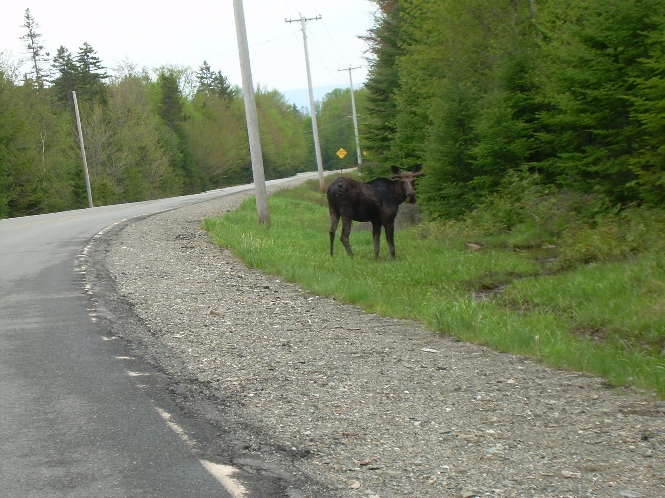
We drove east on Rt-16 and as we passed Observatory Mtn we encountered
a moose! Also as we approached the pond Bill started picking up the
GPS signal from the payload. The highway continued up a hill a mile
or two beyond the pond, so we drove up to high grounds and sat there
for awhile until we had acquired a few good readings.
Since leaving Errol the good GPS readings have been jotted down on paper
as well as logged in Bill's computer since we do not feeling overly
confident about the computer's batteries.
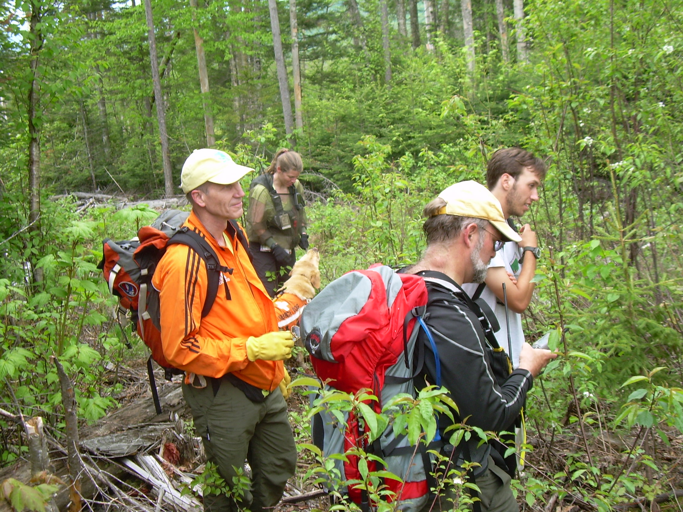
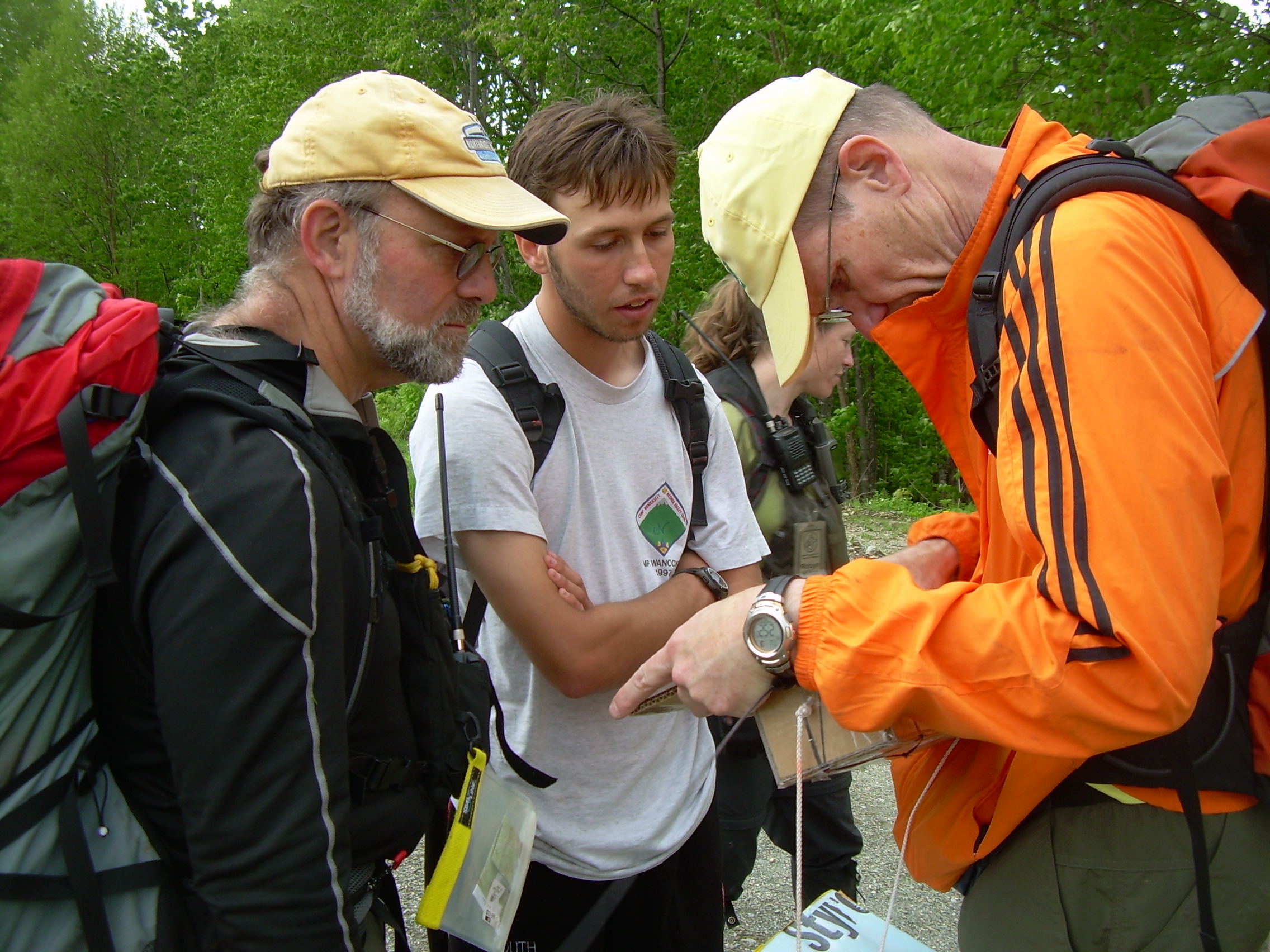
We met Robyn and Dave near West Richardson Pond boat launch. Dave typed
the coordinate of the balloon into his GPS and Robyn lead us onto some
dirt roads. We expected to find roads which she could drive on, but
my car could not. However the dirt road was very good and we were
able to drive to within half a mile of the payload. Up there, on the
side of the ridge, Alex found that he had cell-phone coverage, and
so called in.
1:15 The ridge has been logged and is
covered with logging roads, or "skid rows",
where heavy machines have dragged trees out of the woods. Many of these
roads are choked with slash; the twigs, branches and brush which will not
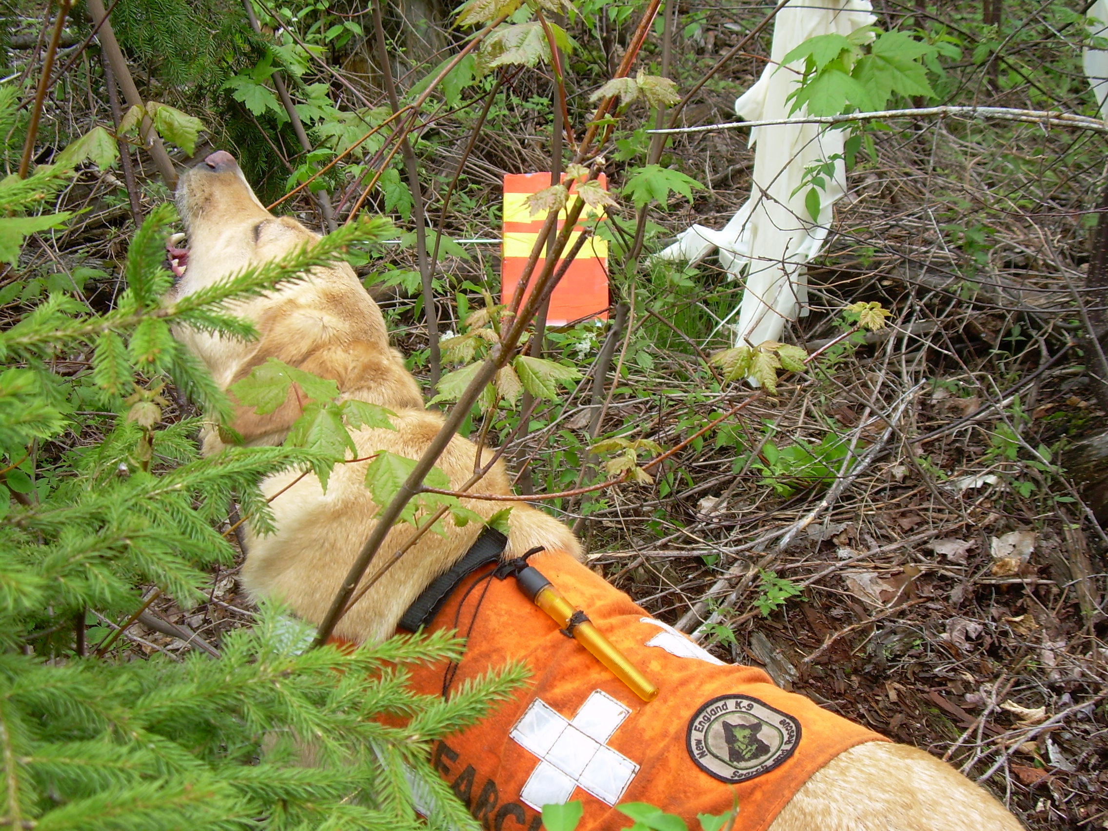
be hauled to the mills. Siggy, Robyn's Labrador Retriever, and trained
search and rescue dog is excited to get into the woods. Robyn straps
Siggy's orange vest on, to help us see Siggy as he zips through the
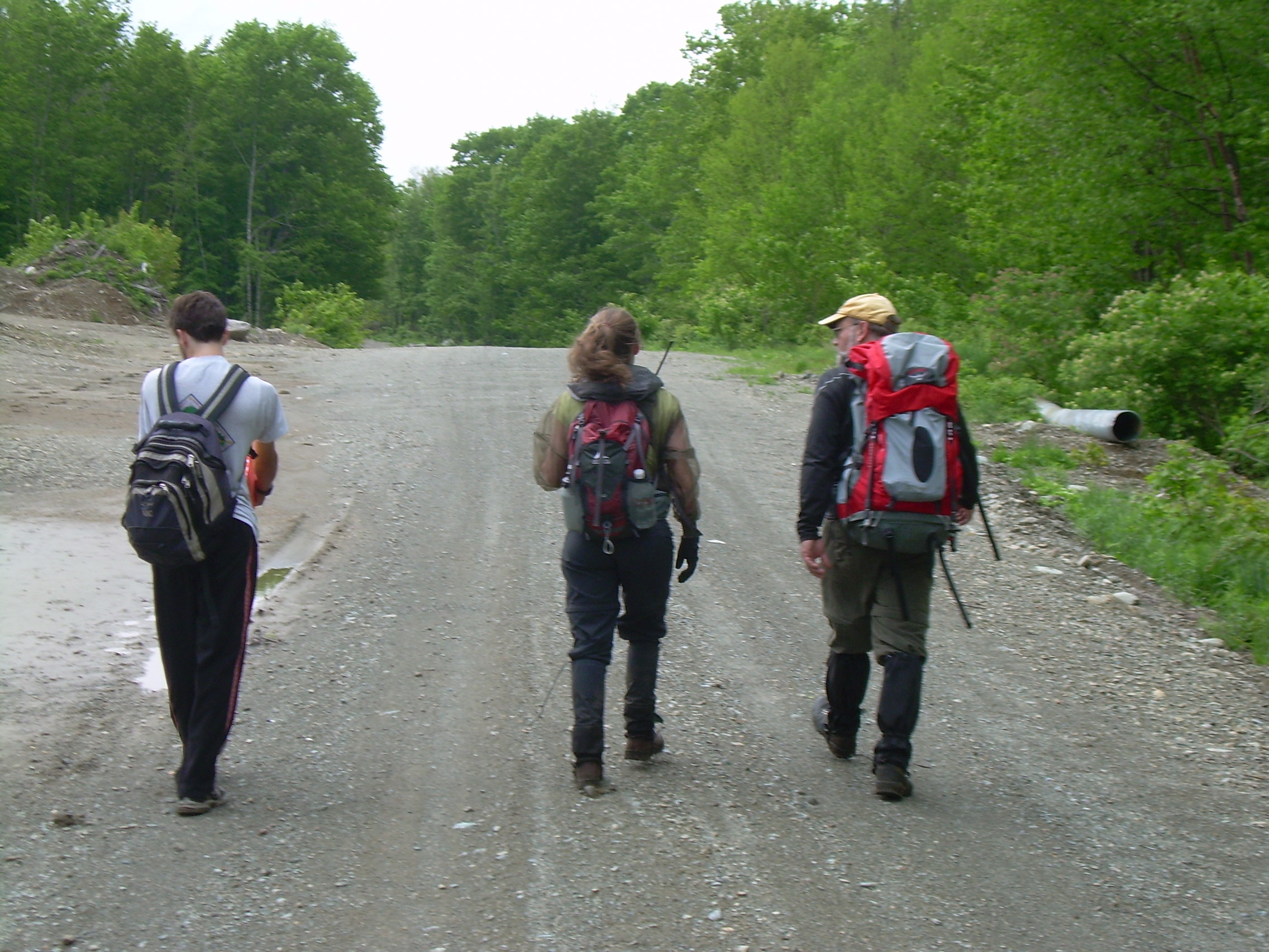
underbrush. We shouldered our packs and headed up one of
these skids. Where it is not full of slash, it is rutted and muddy,
with a stream flowing down it, but it is much faster then bushwhacking.
The logging road headed almost straight west, whereas our goal was a bit
to more south, so after 200 meters we bear to the left and into a hardwood
forest. Here we are also crossing logging roads, but I think this
area may have been logged years earlier, and now is not so chocked. We
cross a stream and climb through briers and brambles. The going has been
simple until we approach a ridge. We are only 300-400 feet from the
transmitter when we encounter a thick tangle, almost a wall, of young pines.
These trees are ten to twelve feet tall and spaced every foot or so. Dave
starts to push a path through the lower, dead branches. Siggy has little
problem running under the lowest branches.
We emerge after fighting our way for 30 meters into an area that was
logged maybe a decade ago. Most of the trees in this 100 acre
swath are about four feet tall and between them is a tangle of slash,
raspberries, briers and brambles.
Finally we reach the GPS coordinate and pause to look around. Straight
in front of us are some bigger trees and thicker bush. I think they
didn't log there because of a ravine.
We did not bring the ELT antenna into the woods because it is mounted
on a long mast and carrying it through the tangle would have been hard.
But now we wished we had something to help us in the last 50 meters
of our search. Bill has his hand held radio and he tuned it to the
frequency of the ELT beacon. It is loud and clear. He tries to pick
out a direction by changing orientation. The best guess is straight
into the thick tangle. So Dave, Alex, Bill and I plunged into the
tangle. Robyn is going to follow Siggy around it. She thinks he
could smell the balloon. It may interest Siggy, but he wouldn't
search it out.
We all meet on the far side of the thicket, about 20 meters later,
and start discussing setting up a circle search pattern. Siggy and Robyn have
wandered off a bit down hill. I climbed three or four feet up a
stump to get a view of the logged over region, in hopes of seeing
the red parachute, when Robyn calls out that they have found it!
As hoped, it caught Siggy's attention and when Robyn looked into
a that tangle of brush and saplings, there is was!
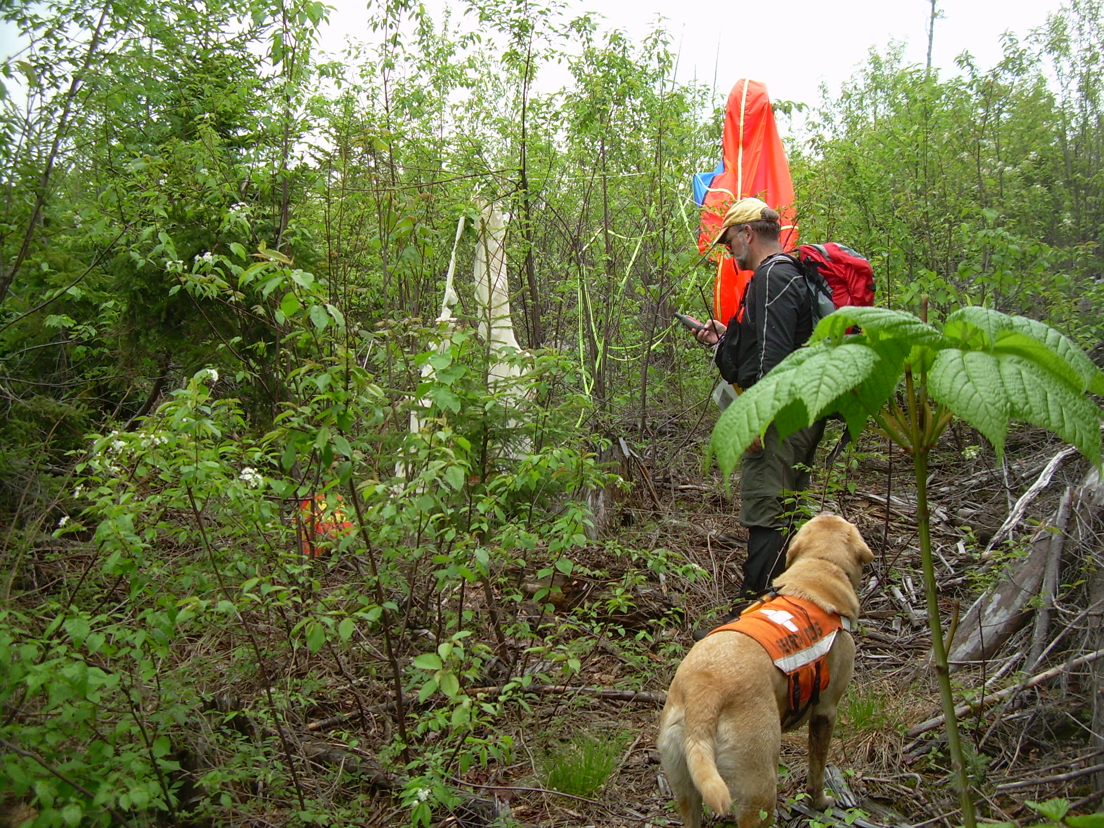
2:15 pm The parachute is hanging from a sapling, as is the
shattered balloon. The two orange boxes which carried the payloads
are laying on the ground looking completely unscathed. I take a few
photos and then we untie the balloon, payloads and parachutes.
Dave recorded the position on his GPS, and I took a number of
photographs. I have some
plastic bags for packing up the bits of balloon,
and I also put one of the
payloads into my backpack.
At the downhill end of this logged off area is a logging road which
looks like it will go straight down to the dirt road where we are
parked, just not next to our cars. But that will be simpler
then going back over the ridge with the tangled pines. As we
walk down we think we should call Parker. However Alex has lost
his cell phone.
Just before getting back to the dirt road we see a moose scurrying
through the woods (can moose scurry?), trying to avoid us. Siggy
takes off and Robyn has to use her whistle to call him back.
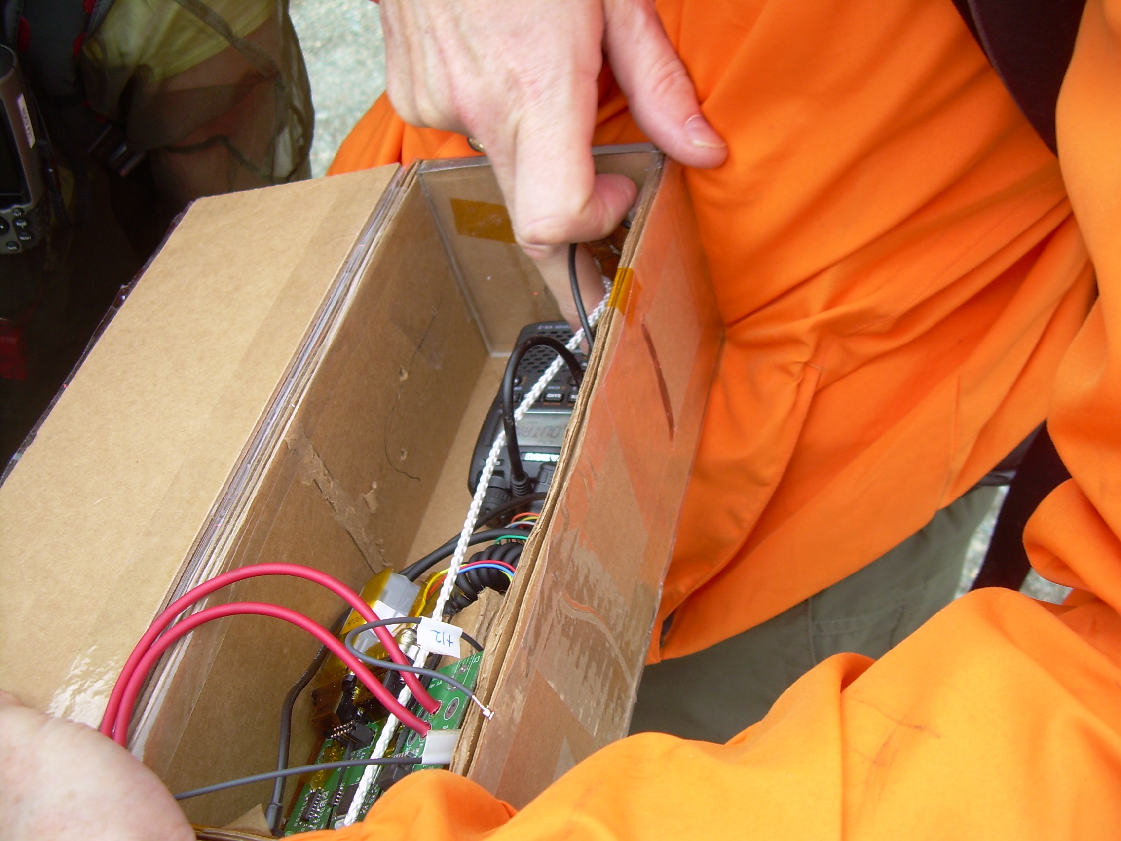
Once on the road we realize that the radios are still transmitting.
It is easy to throw the switch on the ELT, but the data radio
is harder to get at. We end up clipping the wires to the battier
pack to stop the GPS. The transmitter itself is glued into the
cardboard box and we can not see the switch. So we cut the cardboard,
and finally switch it off.
~ 3:00 pm After getting back to the cars we spend about
15 minutes looking for Alex's cell phone. We retrace our steps up the
first logging/skid road, occasionally calling his phone and listening
for it to ring. But we do not find it and eventually give up.
It is raining as we climbing back into the cars. We drive back to
Errol and use a public phone there to call Parker. We haven't had lunch
and are getting hungry and so head south to Berlin. The Tea-Bird Cafe is
closed and we don't find anything we like, so continue south to Gorham.
I remember Gorham as catering to White Mountain tourist. There are more
restaurants here, but many are still closed for the season. Finally,
at about 5:30, we find Crabby-Jack's, a Mexican restaurant.
~7:00 pm We head home to Hanover. We follow US-2 across the
mountains to Lancaster and St. Johnsbury, and then I-91 south. We
drop Alex off at 9:05, and then Bill and I unload the car at Wilder.
Robyn and Dave are already there. I dropped off Bill and got home
at 9:50, just as Kristina called to ask about the whole day.
|
9:59 - Bill, Working on the Radios and computers |
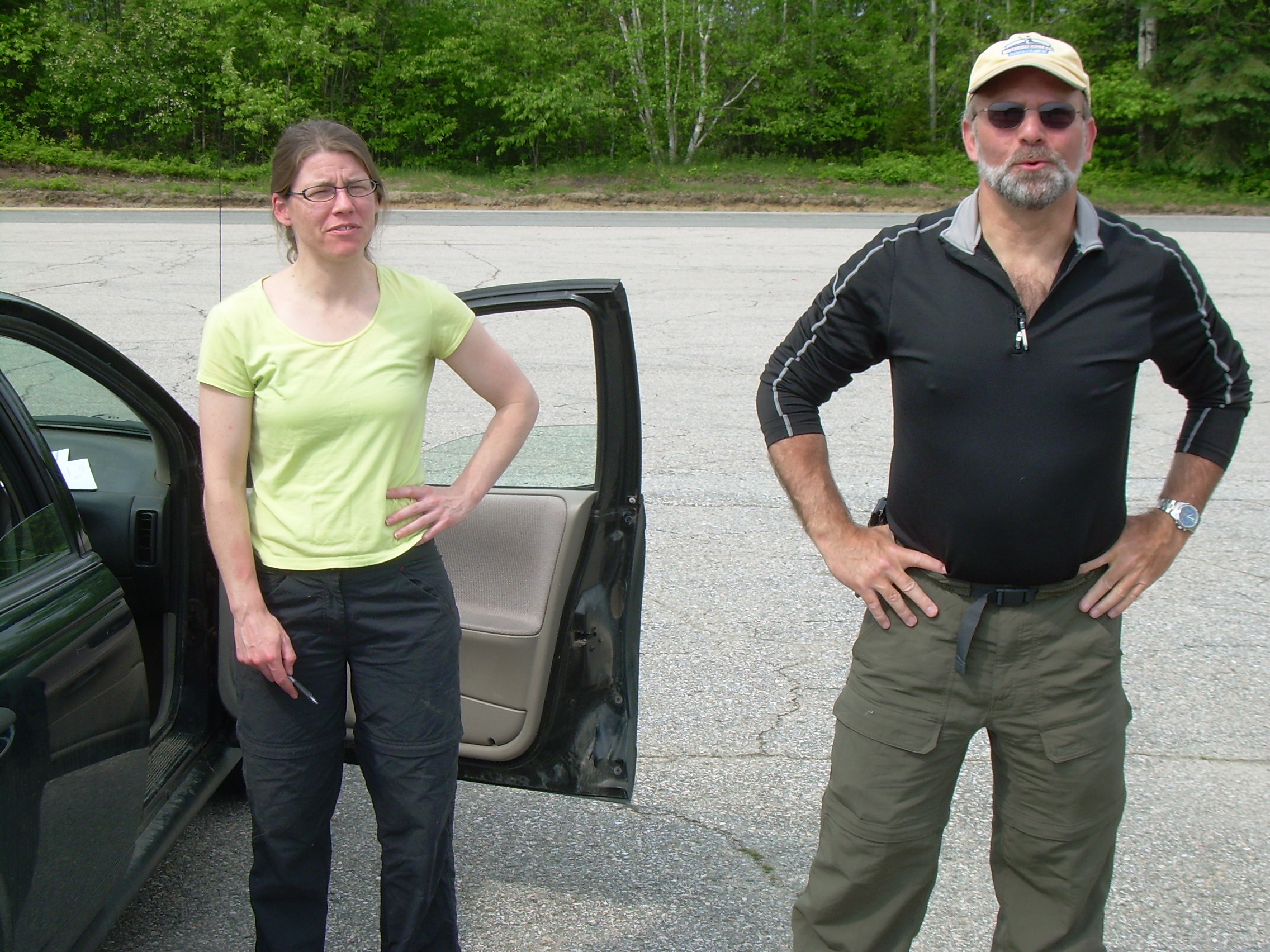
9:58 - Robyn and Dave in Milan |
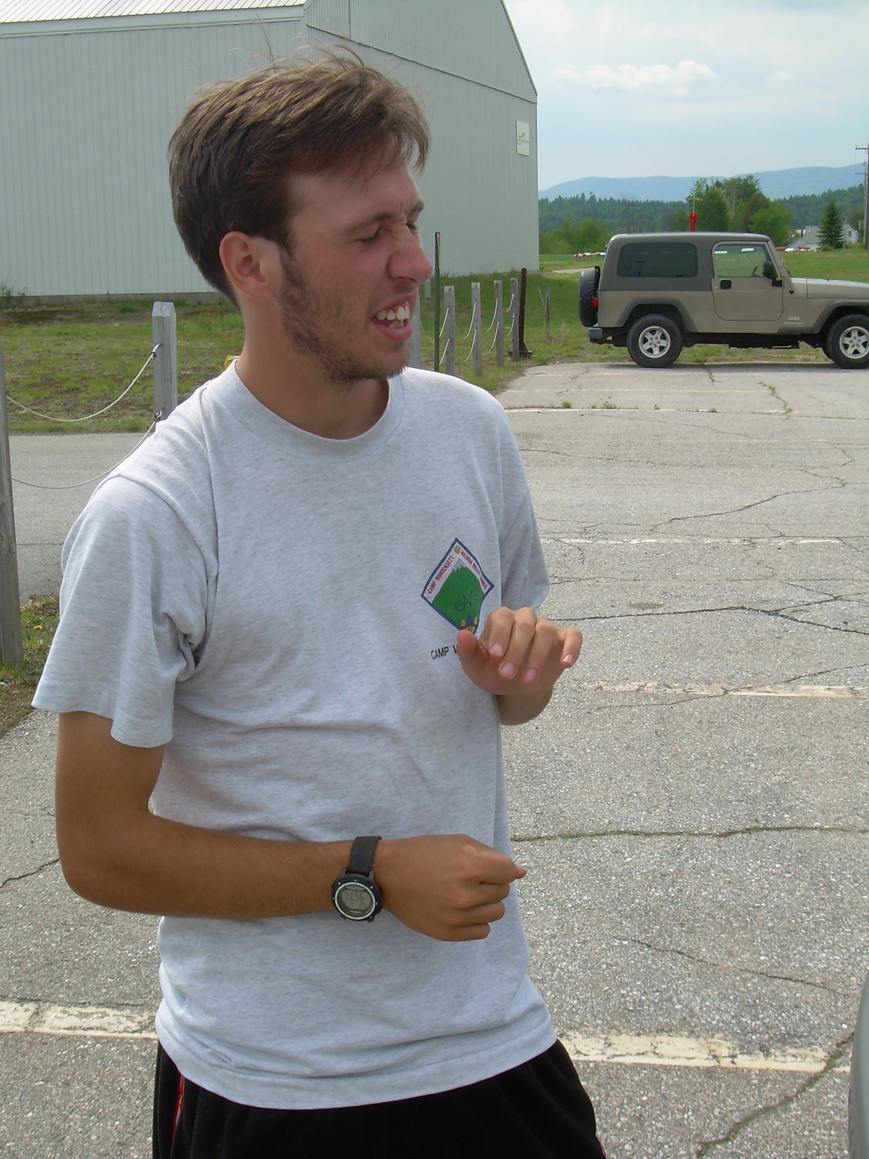
9:58 - Alex at Milan Airport |
12:26 - Moose near Azicohos |
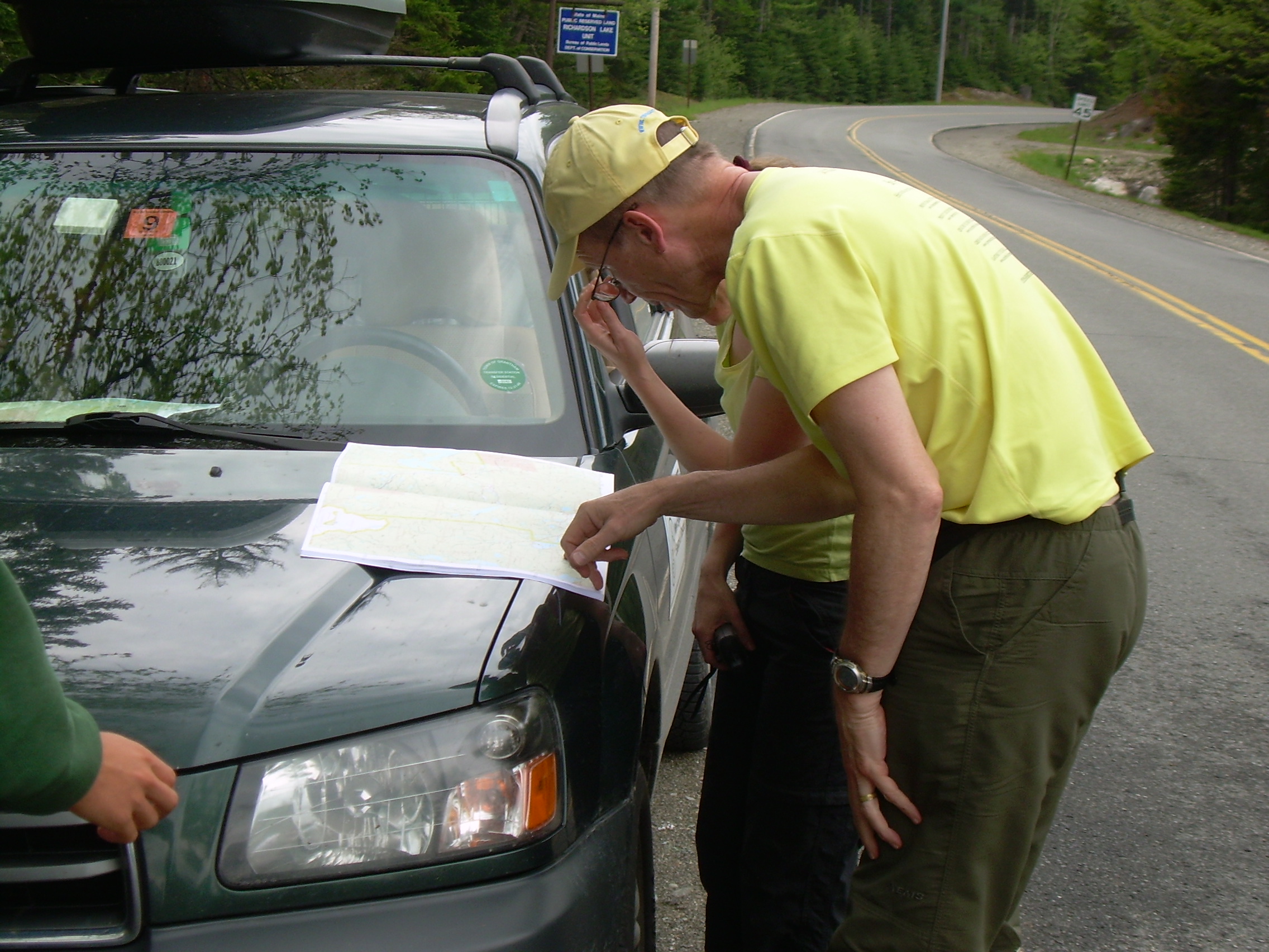
12:41 - Checking maps after getting the post-landing GPS signal |
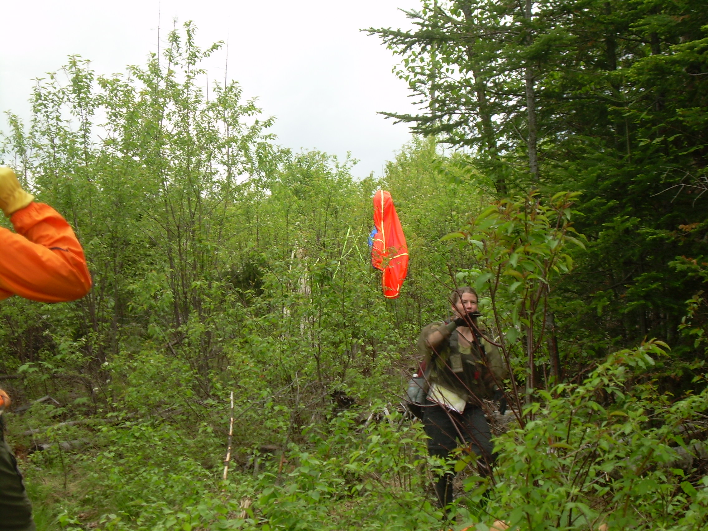
13:03 - Trillium mixed with the bramble and slash |
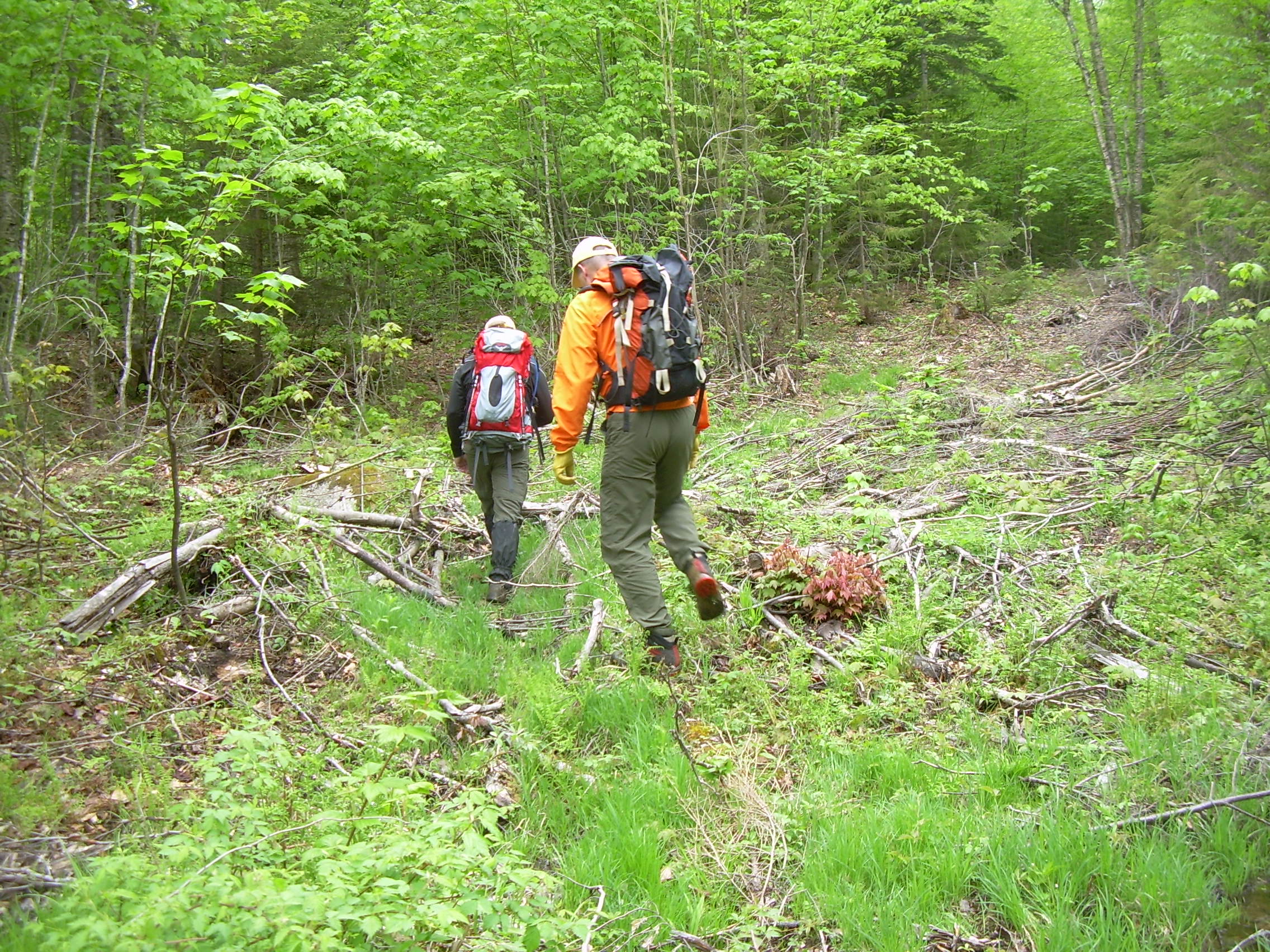
13:30 - Headed up the logging/skid road |
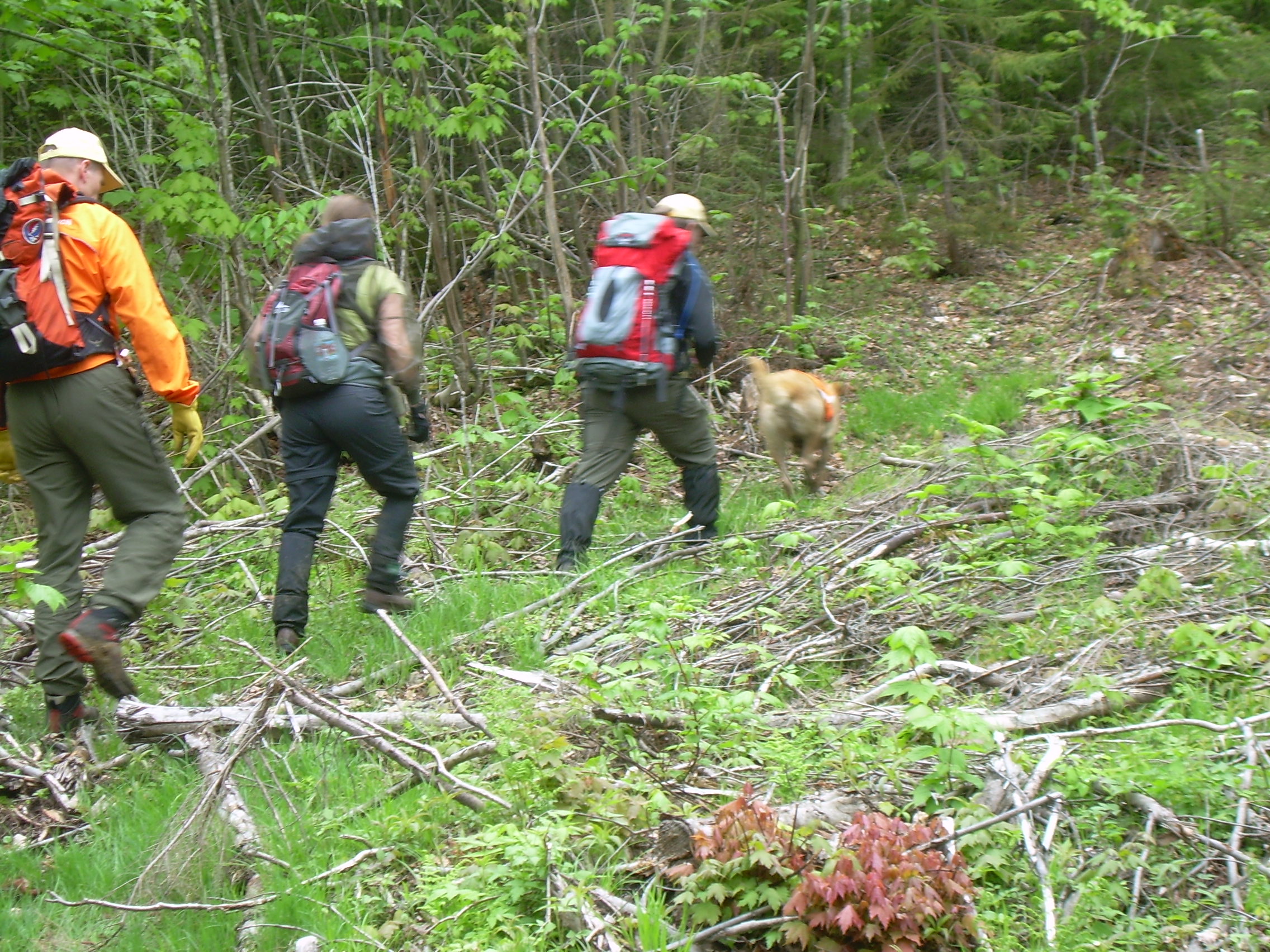
13:30 - Bill, Robyn, Dave and Siggy in the lead |
14:17 - Robyn and the parachute |
14:17 - Dave recording the position on his GPS |
14:18 - Siggy is more interested in the tree then the payload |
14:18 - Looking around the landing site |
14:21 - The recovery crew, the ballon and the parachute |
14:48 - Back on the dirt road |
14:53 - Trying to turn of the transmiter |
14:53 - Bill looking for the transmiter switch |
|