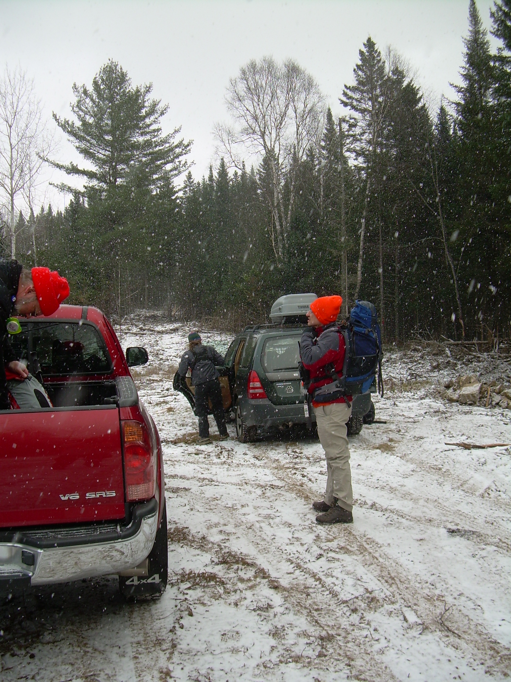
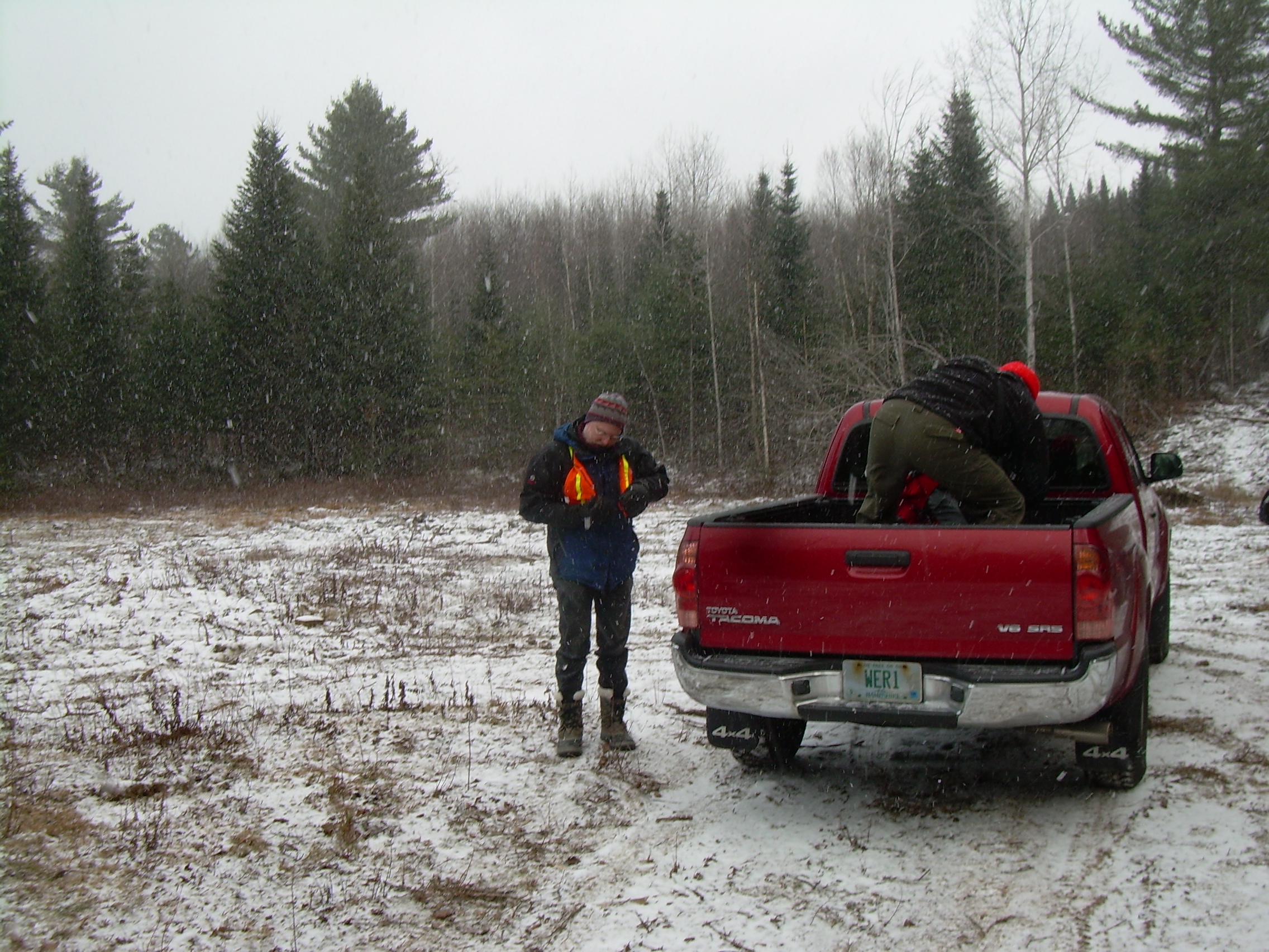
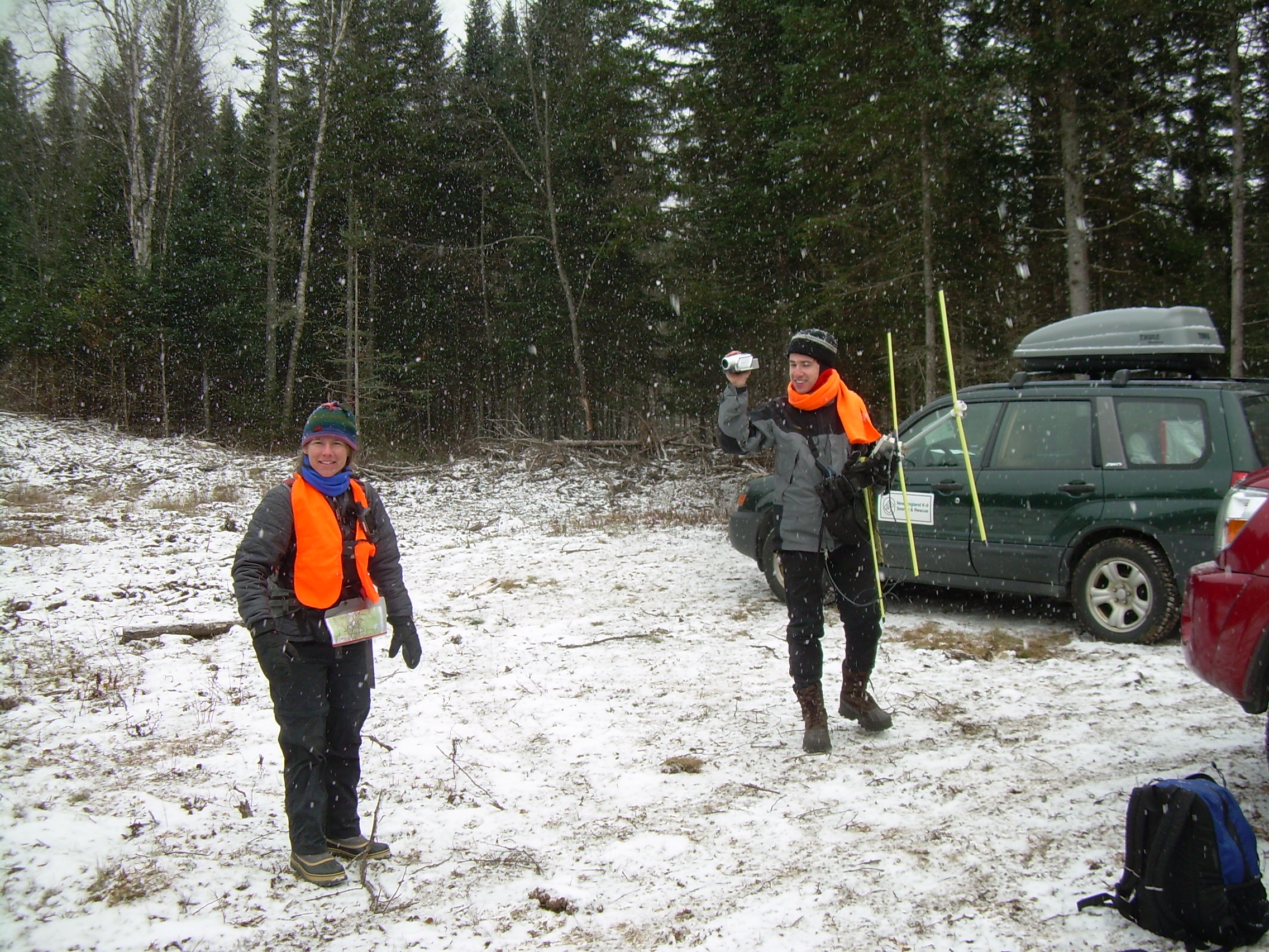
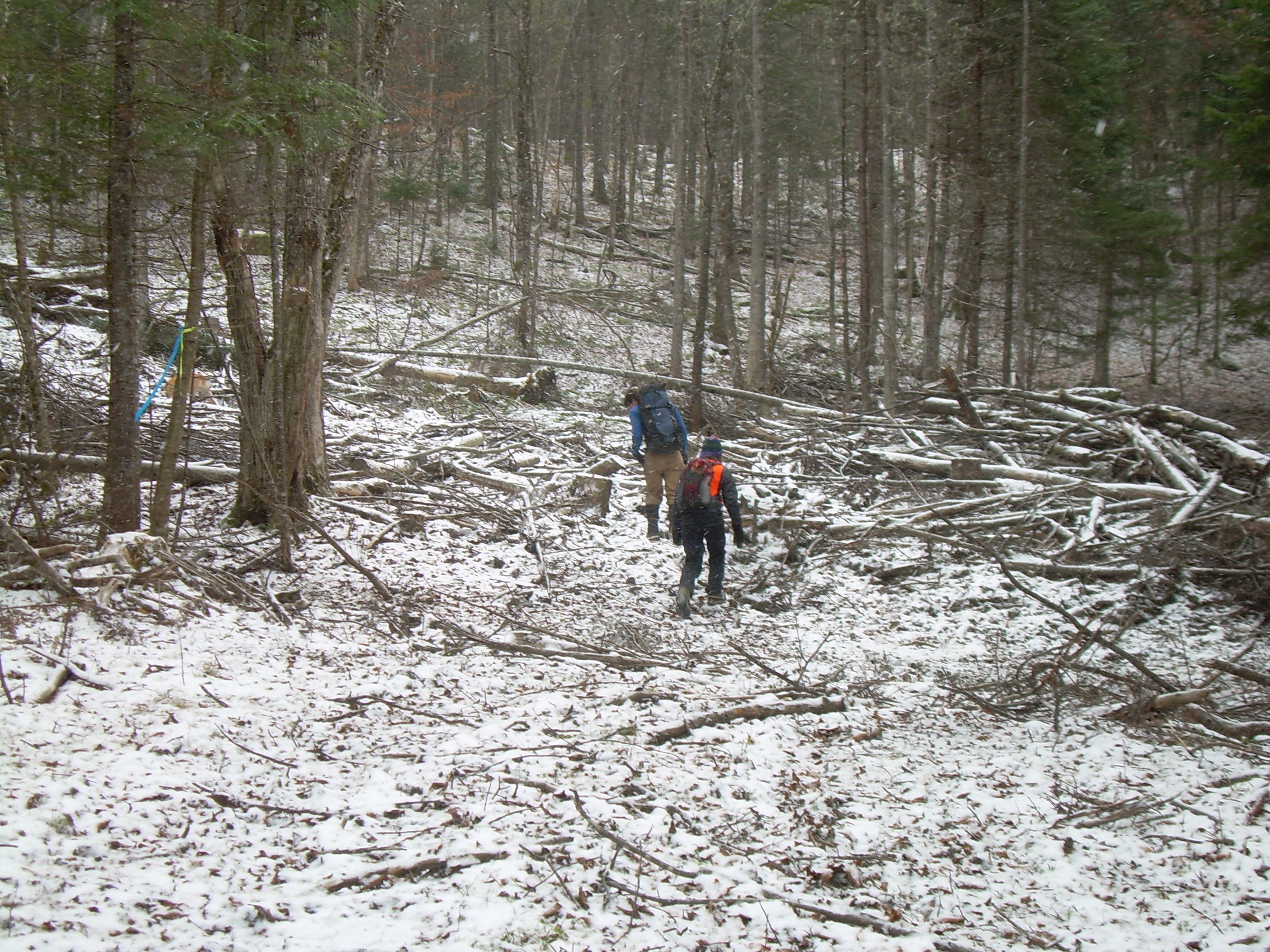
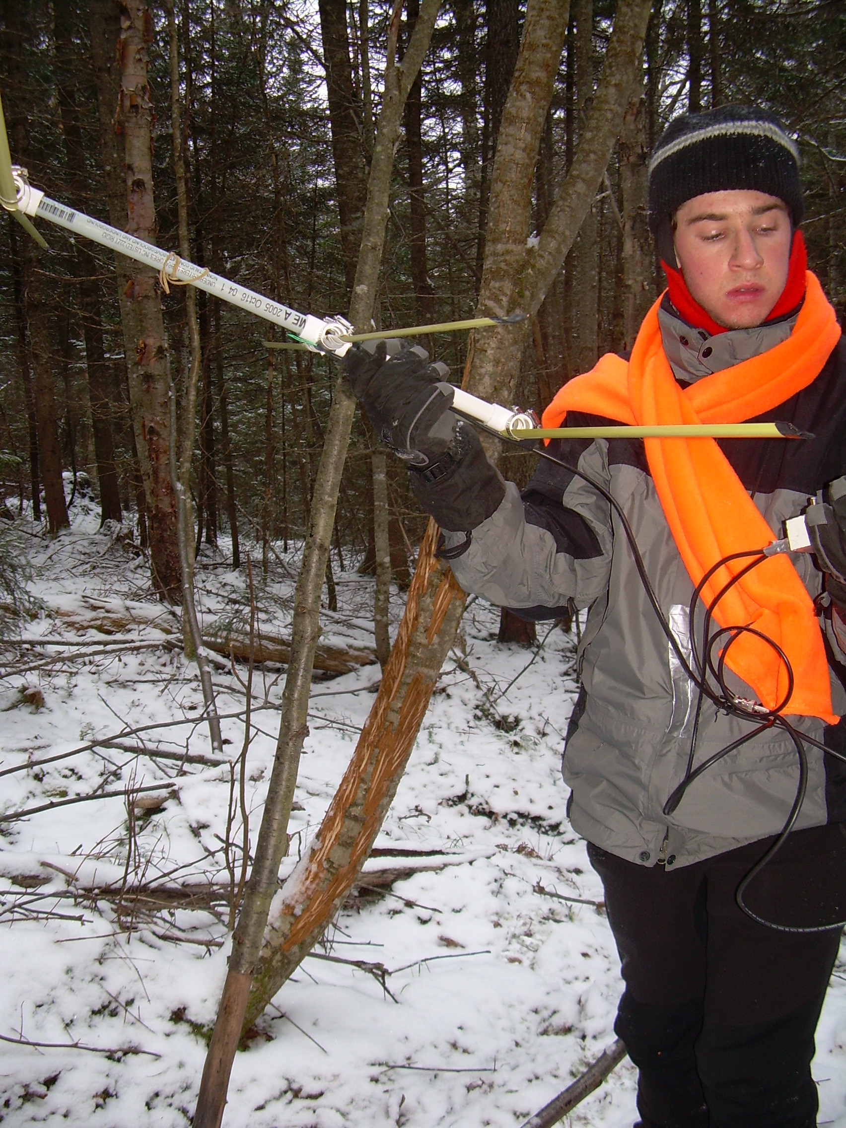
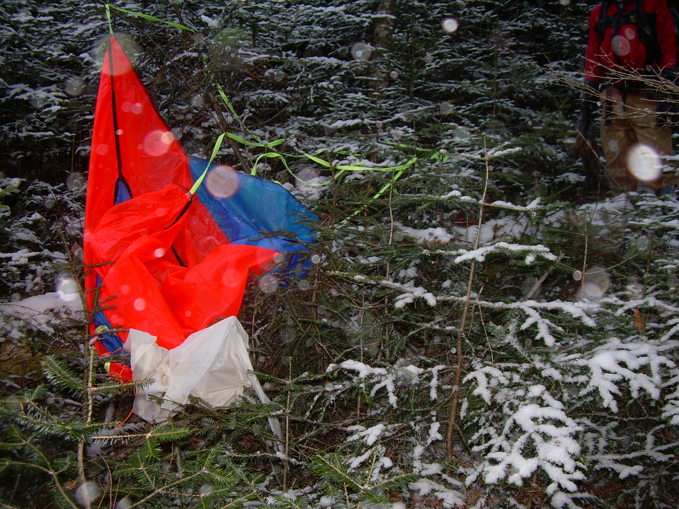
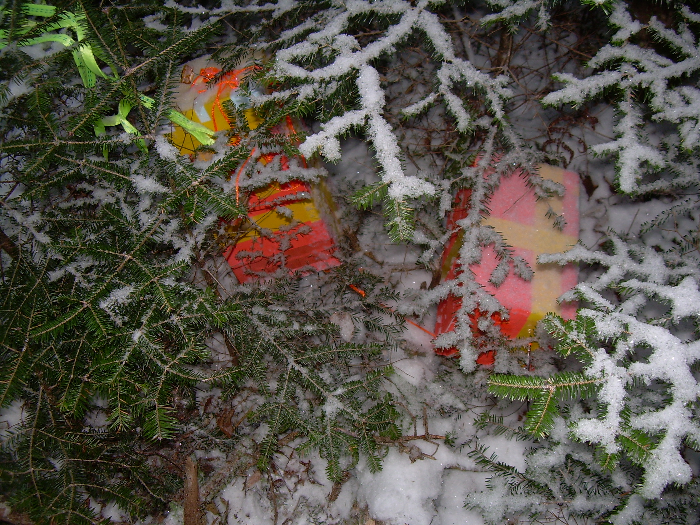
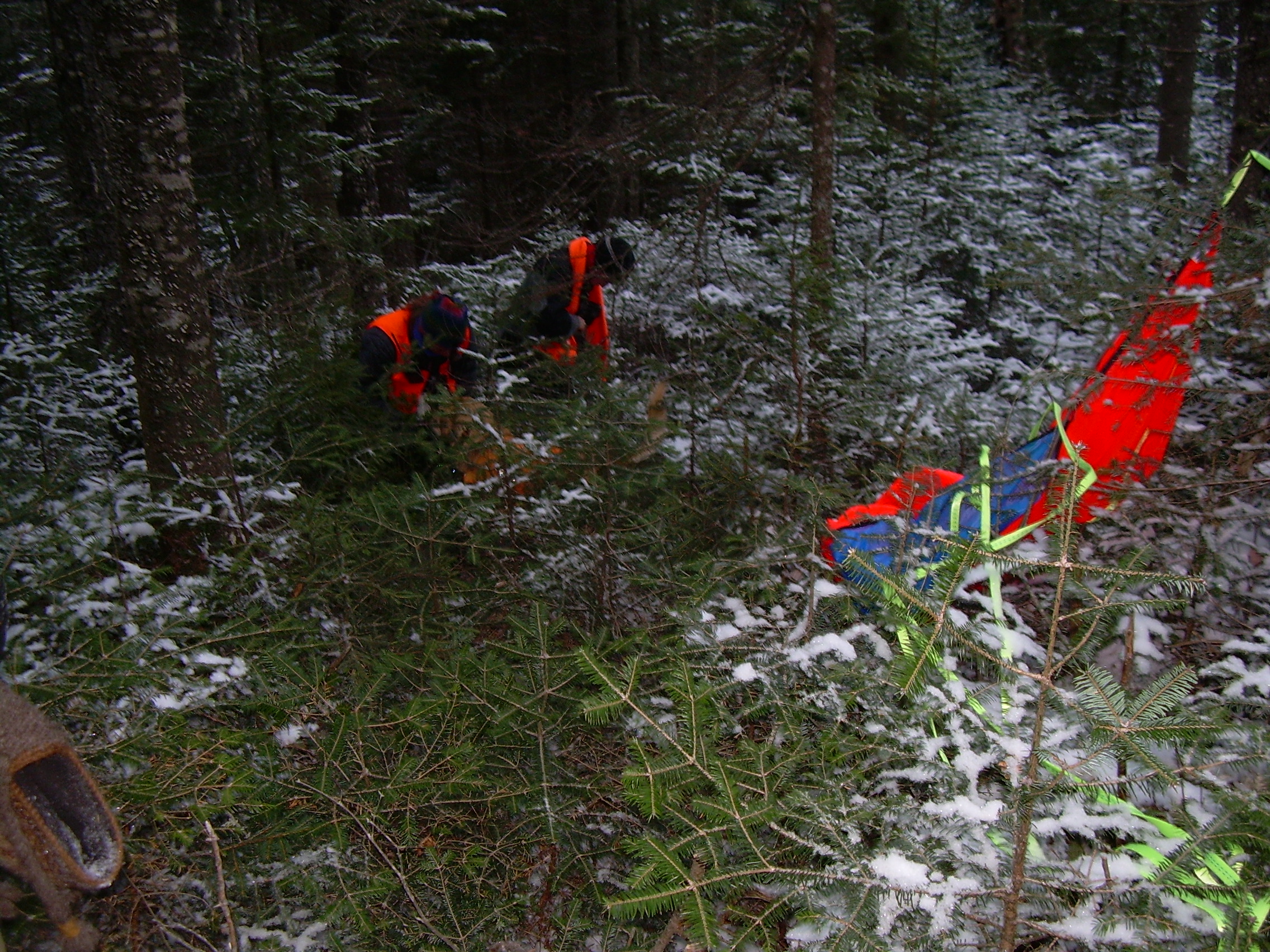
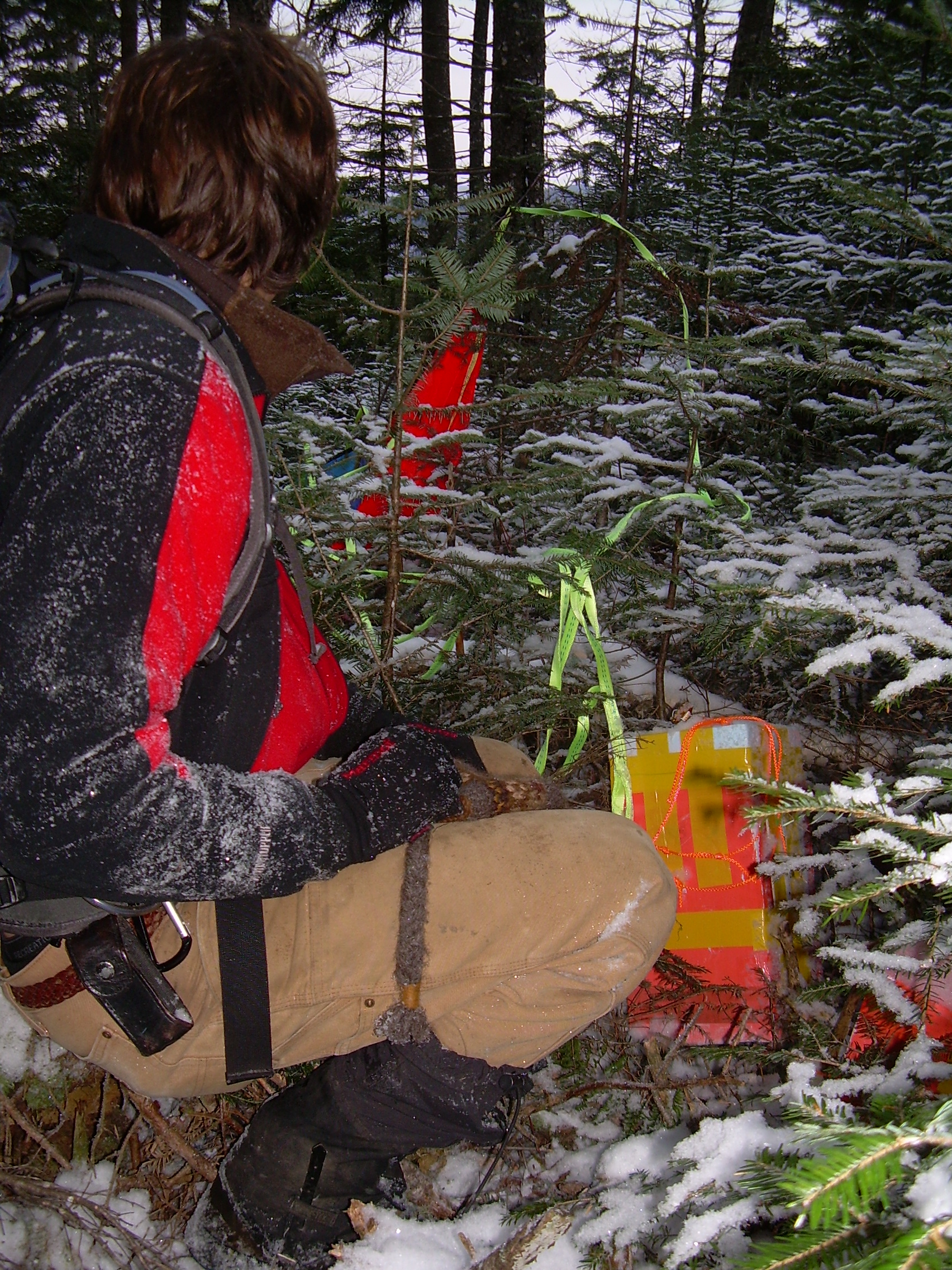
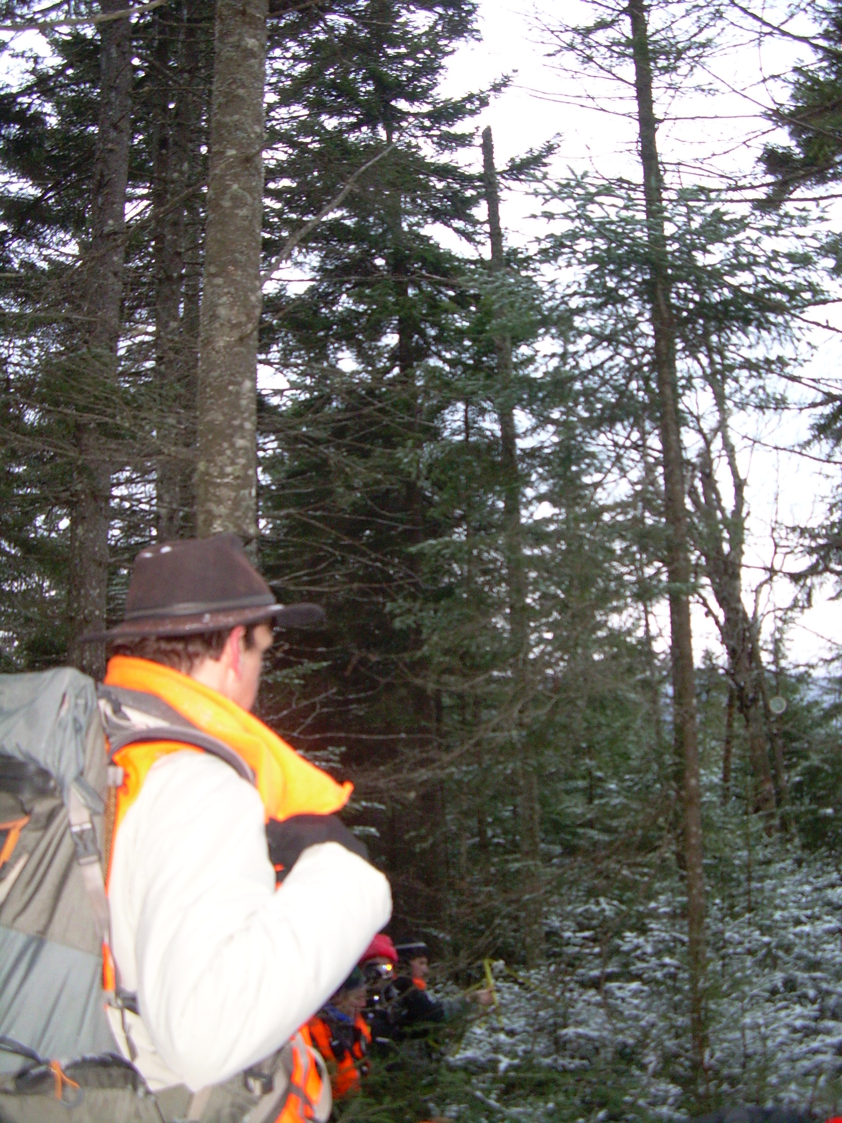
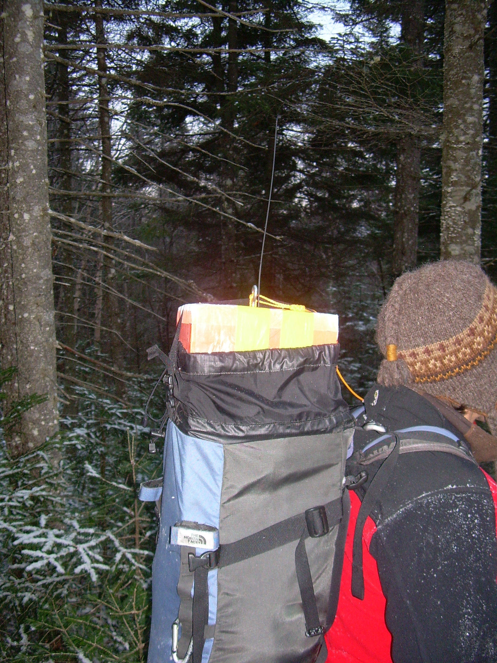
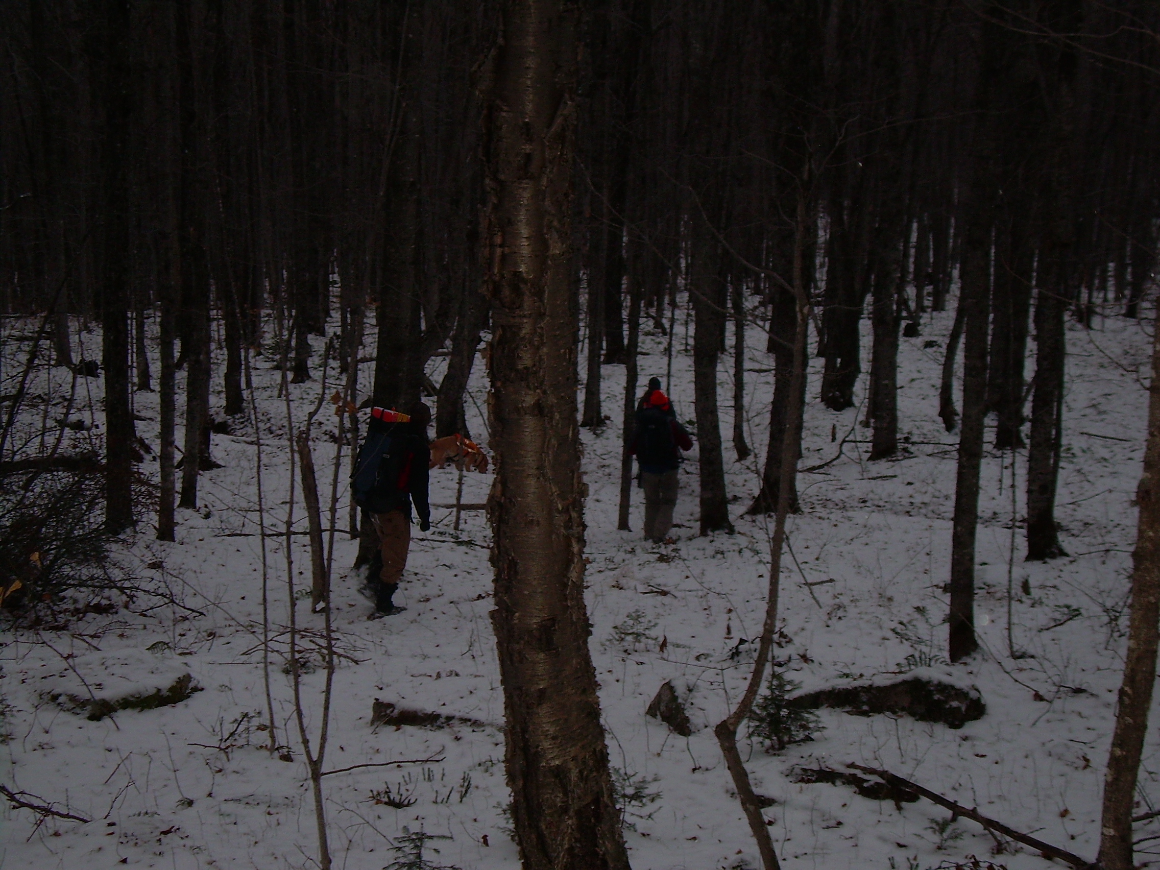
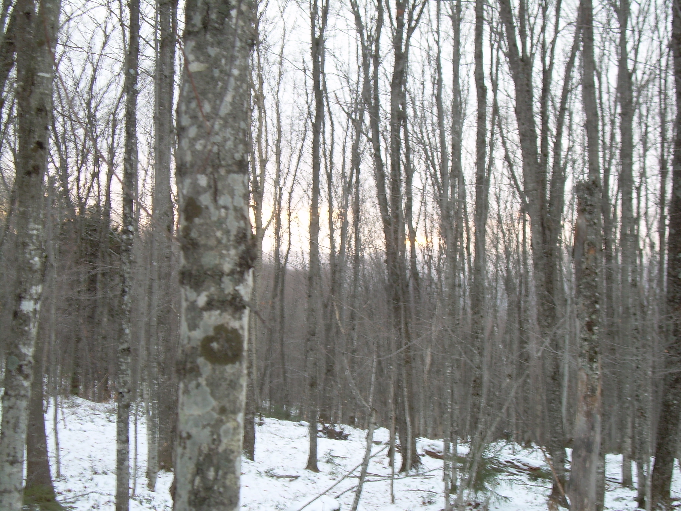
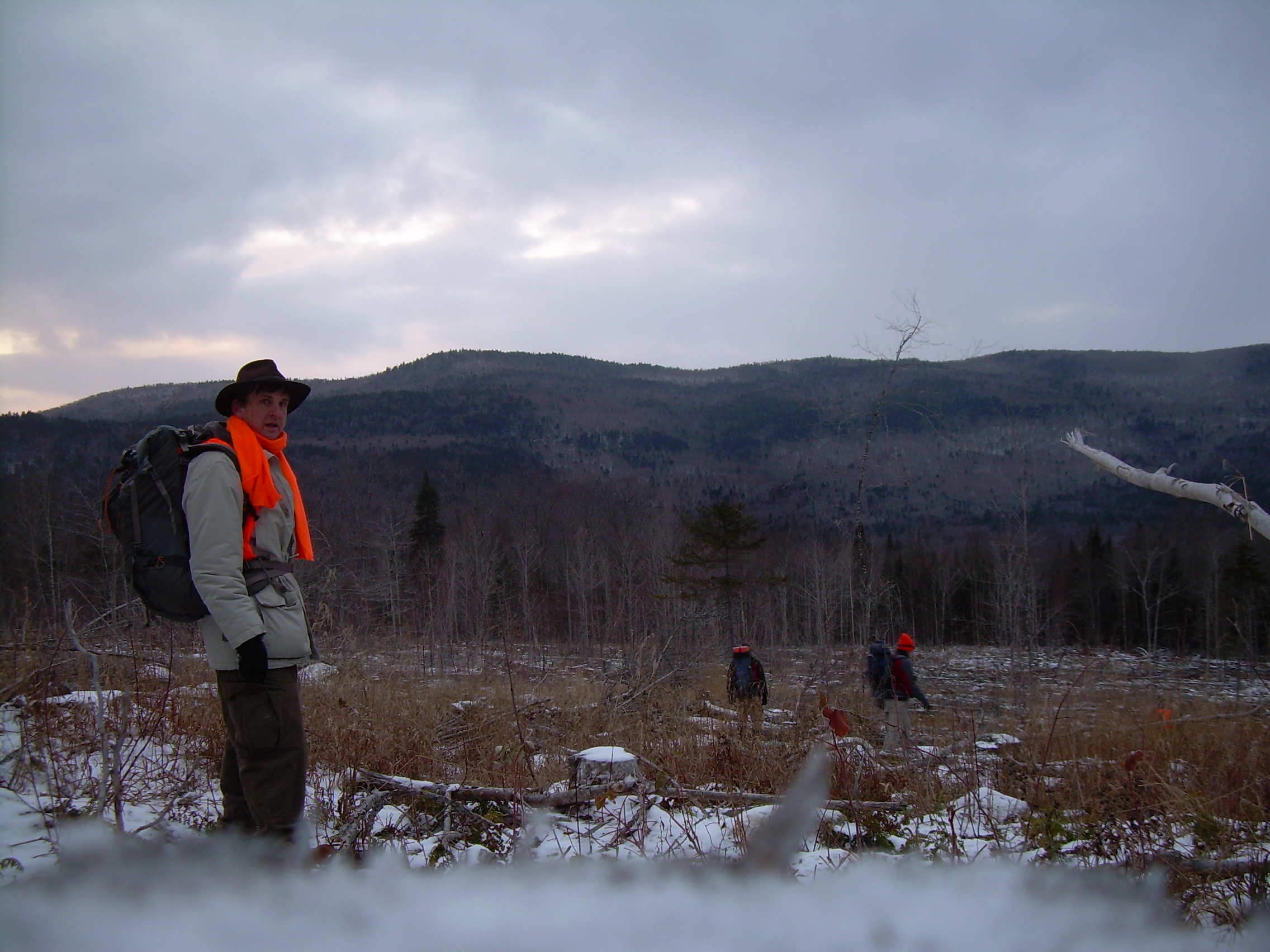
It was black out at 5:00 am, indistinguishable from the dead of night, but the game is afoot, and I am to be at Wilder at 6:00. So after a quick shower and breakfast I am off. Kristina also joined us at Wilder, to see the balloon launch and recovery teams head north. The night was still black when we arrived but Wilder was ablaze with lights and activities as the GreenCube team assembled itself. The sky is now starting to bloom into a deep deep blue. What is Green Cube? It is one of Kristina's "Brain Children". It is a payload full of radios and a home build data acquisition system, designed for some future rocket or satellite. It was build at Dartmouth by undergraduates, as part of a long term development plan. But it also a short term need, and today fulfills part of that need. Today we not only test this payload, but we do it in a way which is challenging, stressful, complex, and also a bit of fun. The payload will be hung below a giant helium balloon which will float up 93,000 feet. The balloon will then burst and the payload will parachute back to the ground. In Wilder we have two teams. The launch team is gathering up the payload, balloon, parachute, radios, computers and people and packing them up. They will drive north about 80 miles to Newport, Vermont, to launch the balloon from the Newport Airport. The recovery team will drive to the expected landing location, 60 miles downwind of Newport. Today that means due east on the Maine-New Hampshire line. Umair has been busy all week tracking the weather, and forecasting the probable landing spot. Curiously enough, the prediction which he produced last night had the balloon landing on the same hill as last June's flight! What make this forecast so astonishing is that potential flight and landing zones have varied all over the northern woods in the past few days, with projections ranging from Bethel to Rangley to Wilson's Mills in Maine, and circle of mountains, forest, swamps and lakes one hundreds kilometers across (60 miles). This morning Phillip runs the forecasting code again with the most recent weather forecast, and the projected landing site has shifted a few kilometers west, closer to the ME-NH line. So we plan on breakfast in Berlin and then using Errol as our staging location. By the time the full recovery team has assembled it is nearly seven and the launch team has already left. We pack up out radios, computers, people and Kristina's kayak. Phillip and I feel the cold air and look at the kayak and hope we don't need to use it, but there are a lot of lakes in that region, and if the payload landed out there one hundred yards it would be hard to just walk away from it. Phillip, Robyn and Siggy, Robyn's search dog, climb into Robyn's vehicle, a green four wheel with a "Upper Valley K-9 Rescue" placard on the side, and head north. They are followed by David C. and Jan in Jan's red pickup truck. Finally David M., Max and I climb into the green Saturn and also hit the road. The day has dawned and the world of the upper valley is becoming brighter as we head up I-91 towards St. Johnsbury. David spreads out his electronic in the back seat. With an array of antenna on the roof I feel like a mobile ham radio shack. Max has his hand held ham radio in the front passenger seat. All I have the steering wheel and a kayak I hope we do not need. Some place along I-91 my muffler develops a hole, and we sound like a truck as we stop to regroup with the other cars just east of St. Johnsbury. Actually comparing our sound to a truck is an insult to a number good trucks. Think of a semi with air-brakes coming downhill into town. Think of a tank. But there is not much I can do about this right now. We wind along US-2 heading east across the "Northeast Kingdom" and soon cross the Connecticut river into Lancaster, New Hampshire. The highway then passes through Jefferson and skirts the northern flank of the White Mountains. This morning the peaks of the Presidential Range are lost in clouds. We briefly touch the north edge of the town of Gorham and get on NH-16, headed north into Berlin. Here I spotted an auto supply store and stopped to buy some muffler tape. It is years since I have used muffler tape, but we have a great many miles to go and anything which could deaden the roar of our exhaust would be welcomed. In Berlin the recovery team converged on the Tea-Bird Cafe, which was one of the more important discoveries of of our June Green Cube expedition. We remembered being caught a bit unprepared by the launch five months ago, so we set things in order in a most business like manner. We ordered our breakfast (Egg Benedict for all those on the east side of the table), and then went out to the cars and trucks to set up radios. I crawled under my car hoping to find a simple hole in the muffler. It is 19o F out as I lay on the frozen pavement. But it is a quick job, for I quickly find the hole by feeling around with my finders. It is on the top of the muffler and feels like it is about 4-6 centimeters of rusted and rotted metal. I wrapped the tape on and tie it down with a piece of p-cord. But the tape in stiff in the cold and never lays flat, and in the end never really adheres to the muffler. But inside the Tea-Bird breakfast is ready and we have almost finished wrapping ourselves around our eggs when Newport calls us. They will launch in a few minutes! We pay our bills and head north. We paused in the parking lot of the Milan elementary school to confirm that we were tracking the balloon. The signal is clear. I wonder what kids and teachers were thinking if they happened to look up from their lesson and saw us outside waving around our directional antennas? So on up the winding rout 16, following the Androscoggin River to Errol. We probably should have originally stationed ourselves in Errol, but we knew we had cell phone coverage in Berlin - or at least that was our official reason to station ourselves over coffee and Eggs Benedict at the Tea-Bird. In Errol we watched our data coming in, latitude, longitude and elevation every half minute. The balloon was approaching the Connecticut River and still on the rise. It was cold in that parking lot in front of the general store and outfitters. We debated about pushing on to Wilson's Mills - the projected landing zone, but decided to wait where we knew we were receiving data at least until it started to come down. 80,000 feet and still on the rise. 85,000 feet, 90,000 feet and then at 93,000 feet, the elevation changed and the balloon was dropping. Or rather the payload, parachute and shreds of the burst balloon were on the descent. At this time we packed up and head up Rt 16 to Maine and Wilson's Mill. Enroute David M. discovered that he had cell phone coverage, so called back to Newport and reported our progress. As we drove Dave would read off the payload's GPS data every few minutes and Max would enter it into his GPS as a way station, and then report its relative position to all of us. It dropped quickly to 70,000 feet, then 50,000 feet, but near 20,000 feet it started to slow up as the air around it thickened and the parachute had something to grab onto. "It is two miles to the northwest and eight thousand feet up", max reported as we entered Wilson's Mills and our path and GreenCube's converged. We stopped the car when the payload was within a mile of us. There was a low cloud covering, yet I think if we had looked in the right direction at the right moment we might have seen it break cloud cover moments before touching down on Aziscohos Mountain, but we missed sighting it. The recovery team, or "squad" as I starting thinking of us, had stopped in front of a house which was being build. The construction crew was three big burly Maine woodmen, wrapped in red and green plaid wool hunting coats and stocking caps. Their were working on a home build of massive logs, with a large gape in the front where someday a floor to cathedrals peak window will frame a view of Halfmoon Mountain and the Second College Grant to the west. The workers slowed their hammering as we consulted with each other, and then came to a halt was Max and David M. walked around with their antennas. It was something out of a 1950's science fiction movie. The antenna whaled, screeched and beeped if you pointed them south by southeast towards Mt. Aziscohos. I went over to the workers and told them that we were from Dartmouth College and were chasing a balloon which had been launched from Newport, Vermont, had risen to nearly 20 miles and traveled across New Hampshire to land on their mountain. It was great to watch these face transform, thaw, from mystified to delighted. One of them keep muttering, "20 miles up!" We were having trouble printing maps. So Max, David M. and I headed back south about two miles to try and triangulate the landing site based on the ELT (Emergency Locator Transmitter). We pulled off on the side of the road where we thought our closest point was and got a very strong signal, 100o from north. An "old timer", complete with coveralls and massive, Santa Claus beard pulled his pickup off the road about forty meters behind us and watched us. I walked back and described our search which also delighted him. I think we may have supplied some supper time entrainment to a few kitchens in Wilson's Mills, "Honey, you will never guess what I saw today. College folks hunting for a balloon which went twenty miles up!" The other two vehicles had scouted out a road which started into the woods at the base of Aziscohos, and we soon all converged there. We strapped on packs and wrapped ourselves in orange, because it is hunting season, and headed into the woods. GreenCube had touched down at about noon, and it as 1:05 when we finally plunged into the woods. The logging road proved to be a tangle. Apparently when a logging crew finishes with an area and is moving on, the last one out closes the door, or at least fills the logging road with vast quantities of slash. Sometimes the tangle was so thick that we left the road and pushed through the woods. Every 100-200 meters we stopped to play with the ELT and it kept telling us we were headed in the right direction and that we should just continue. Our shortest path may have been off the logging road. But the road, more or less, went in the direction we wanted. We came out in an opening where the trees had been clear cut. It was a block or former forest a quarter of a mile on a side. Here our last GPS numbers and the ELT pointed us up the hill, across this expanse of logged over acreage. Do I look at this and see pillaged forest, or the necessary side effect of feeding civilization's appetite for wood and paper? Actually what I feel is not the lost of the forest, but the repugnance of the messy which was left behind. It is a bit like a house or dorm room which has been trashed in a wild party. Beyond the clear cut expanse we are back into the wood and climbing. Our party in getting spread out and so we stop at the top of the hill to let us regroup - and deal with a new crisis. The BNC connector which comes out of the ELT antenna has broken off. In addition we discovered another problem. Two groups had been recording the GPS data broadcast from the balloon and we were proceeding towards the "last GPS coordinate". We now discovered that we had two different "last coordinates". One coordinate was 400 meters southwest of us, the other was 500 meters east by south east! And we don't have the ELT to play Solomon. There was far to much discussion as to what we can do, or might have done. So while the debate rages David C. and I pull out our jack knifes and duct tape and do the necessary and expedient repair. The cable is coaxial, so I strip back a dozen millimeters of the black outer cladding to reveal the ground shield of woven wires. I bend this over until the inter wire can be pushed through a nick in the weave. Then I twist up the grounding mesh into its own wire and proceed to strip the inner white insulation. Finally I have five millimeters of the inner signal wire bare. It is about 15oF and I am happy to turn the operation over to David C. and jam my hands back in my gloves. I suddenly realized how to account for the disparity of all of our data. Clearly one group had got the last GPS, and the other the almost-last GPS. The balloon had (of course) gone east with the prevailing winds. This even agreed with our ELT triangulation when we recognized a reasonable uncertainty in our angles. All data really did agreed and we should proceed east-southeast. Meanwhile David C. had directly mounted the two bare wires to the plate mounted BNC coming out of the attenuator box, then wrapped everything in duct tape and the ELT was back in operation, pointing east-southeast! We dropped from BNC hill to what must have been an upland pasture seventy or eighty years ago. It was now filled ash and beech trees a foot thick and very little underbrush. But our heading lay across it and up into the pine tangle beyond it. We had agreed at this point to set aside the ELT until we got to the last GPS coordinate and to try and make our best speed to that location. Jan has pointed out to us that we needed to turn back at about 3:15 if we were to be out by sunset, and time was slipping away. Our direction was through thickets of pine - not a bad as last June - but still slow. However there was a stream which cut through the pines in almost exactly the desired direction. The stream was frozen over and in many places I could walk up it. It was a bit less then a meter wide and rawly more then ten centimeters deep. However walking up a mountain side, on ice, is not always the easiest route. I was with Robyn and Phillip when we got to the point where the last GPS was away from the stream, so while those two push on the last 30 meters I waited to help us regroup. Soon Jan, then Max, then the two Davids joined me. By following whistle blast and the barking of Siggy we regrouped. It was 3:15 and should have been our turn-around minute. Still one last try. Max pulled out the ELT and laid a direction for us - and almost immediately Phillip spotted the parachute! We were relived to see that the balloon, parachute and payload had come all the way down through the trees to the ground. The GPS receiving antenna had rolled over into the ground - so no wonder it had continued to broadcast but without a fix. The balloon itself must have broken into shreds and pieces, for only a little bit of it was still attached to the payload and parachute. Philip pulled off the side panel and switched off the radio. A sticky note was loosely taped to the outside, but had survived the whole flight ("twenty miles up!"). We photographed the site, with the two payloads looking like packages under a Christmas tree. We untied the parachute, balloon and payloads and packed up as quickly as we could. Phillip and I put the payloads in our backpack, shouldered up and headed down the mountainside. The descent was much faster then going in. Not only was it downhill, but we didn't consult any of our electronics. Down to the old pasture, over the knoll where we repaired the BNC and out into the clear cut opening. The sun shown a red-orange as it hung just about the New Hampshire mountains. Instead of just setting over the mountains, it seen to just fade into the hazy winter sky. Down past the logging roads filled with slash, as the twilight gathered upon us, and finally out of the woods to where our cars and trucks awaited us. It was dark by the time the last of our team emerged from the woods. We packed-up in the blue glow our head lamps and got on the road at about 5:00. As we drove south back into New Hampshire and Errol we discussed dinner over the hand-held radios. We planned on stopping at Lancaster, but then one of us remembered promised duties in Hanover, so we all continued. We snaked across the northern woods of New Hampshire, then the Northeast Kingdom of Vermont and down I-91 to Hanover and home. It was a long day - but we found what we were looking for and it was a nice day to be tramping in the woods.
|
|
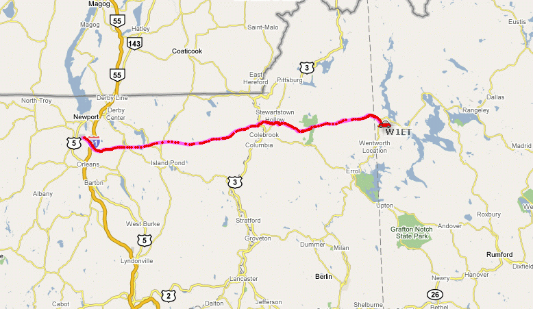
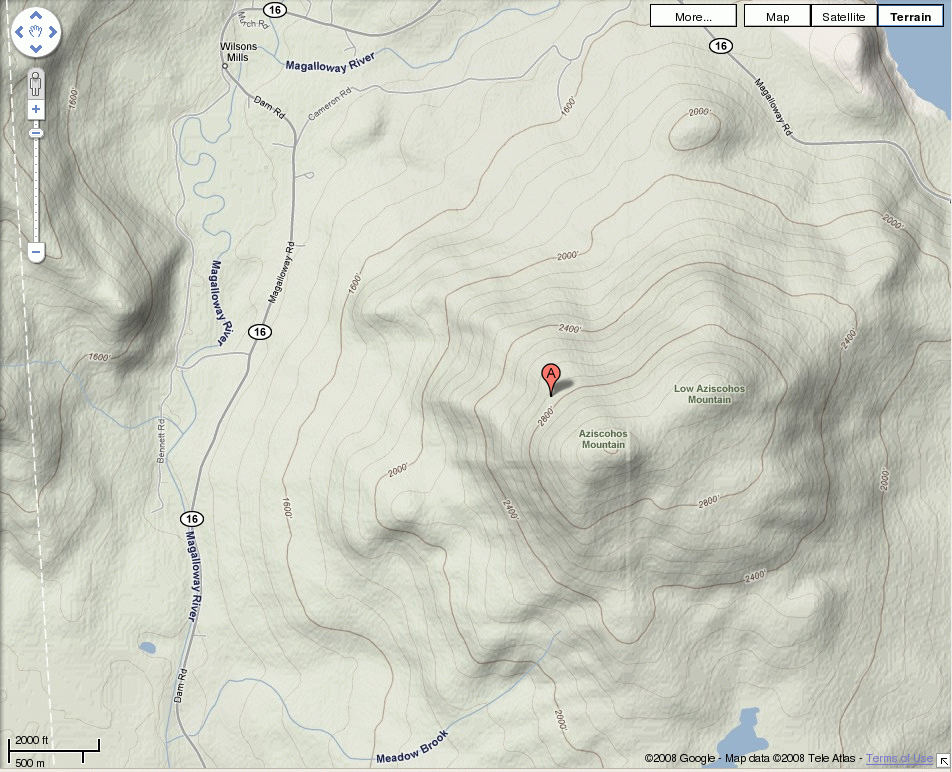
Wilson's Mills & landing position |
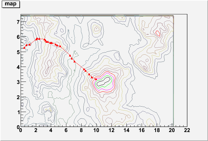
Payload's GPS on Contour Map |
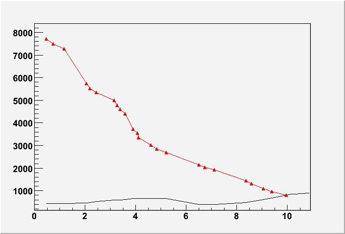
Payload's Elevation and mountain profile |