|
It seems like a long time since I have just gone off on my own to
do something I wanted to do. Most of the time when I climb a mountain
it is with a troop of boys. Where as I enjoy that, it always involves
a lot of logistics. Who is coming? how do we do the transportation?
Is the smallest scout up to the task.
But not today. Today I am climbing on my own. I wanted to climb
Mt. Cube without explaining it to anyone, expect the readers of these
notes. So why Cube?
When I moved to Hanover I had this idea that I would hike the Appalachian
Trail - but not as a "Through Hiker", who hikes from Georgia to Maine
at one fell swoop. Not even as "Section Hikers", who will hike for a week
or two every summer, finishing the who trail in a decade or two. Rather,
my goal was to hike as a "Micro-Section Hiker". My span would old be
New Hampshire and Vermont, and I would hike primarily as a day hiker.
I plan to drive to where the trail crosses a road, and then hike up the next
mountain and back down. Later I would climb that same mountain from
the other side. It means I hike each micro-section of trail at least twice,
but I will be looking in the other direction on the return. And I am in no
rush. I plan on being here for years.
However - I have only hiked from the White River in Vermont to Smarts
Mountain for a total of only thirty-four miles. So this winter I am planning
a series of snow shoe hikes over Smarts and Cube, two peaks twenty
miles north of Hanover.
I'm starting the day by having breakfast at the Fairlee Diner. I enjoy breakfast
at a diner, but since I live with people who think sleeping in on Saturday
morning is a sacred right, I rarely go out. But here I am getting the number
two "farmer's Special", eggs, ham and home-fries. Walking into the diner
is a curious transition from home. There I tiptoed out while everyone else
slept on. Here the world is full of very awake people, many of whom have
been up for hours. They start to serve breakfast at 5:30, but I expect that part of
the staff has been there since 5:00. At this time of year 5:00 is the dead of the
night.
Confession - I am really not very early, and the side trip to the diner didn't
help me start my hike early. I have been seduced by not only breakfast, but
also a newspaper and coffee, so it is nearly 11:00 when I reach the trail-head.
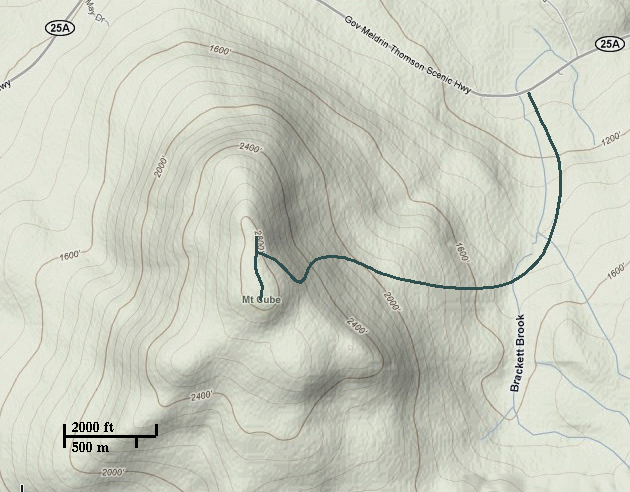
I am starting on the north side of Cube, on route 25A, between Upper and Lower
Baker Pond, near a cross roads marked as Gilmans Corner. These two ponds
are primarily surrounded by summer camps. Camp Pemigewasset is particularly
exclusive and pricey. But a few steps off the road and the life of the valley vanishes
behind me and I am engulfed by a hardwood forest. The leaves are all down, and
most of there are buried under a layer of early winter snow. I didn't bring my
shoe-shoes, but the trail has been hiked a few times since the last snow fall
and is well packed.
The beginning of the hike is a gentle rise through an open wood, but the trail
steepen as I climb out of the bottom lands. Occasional the trail hits straight a
level sections - old farm roads in the lower lands and logging roads as I get
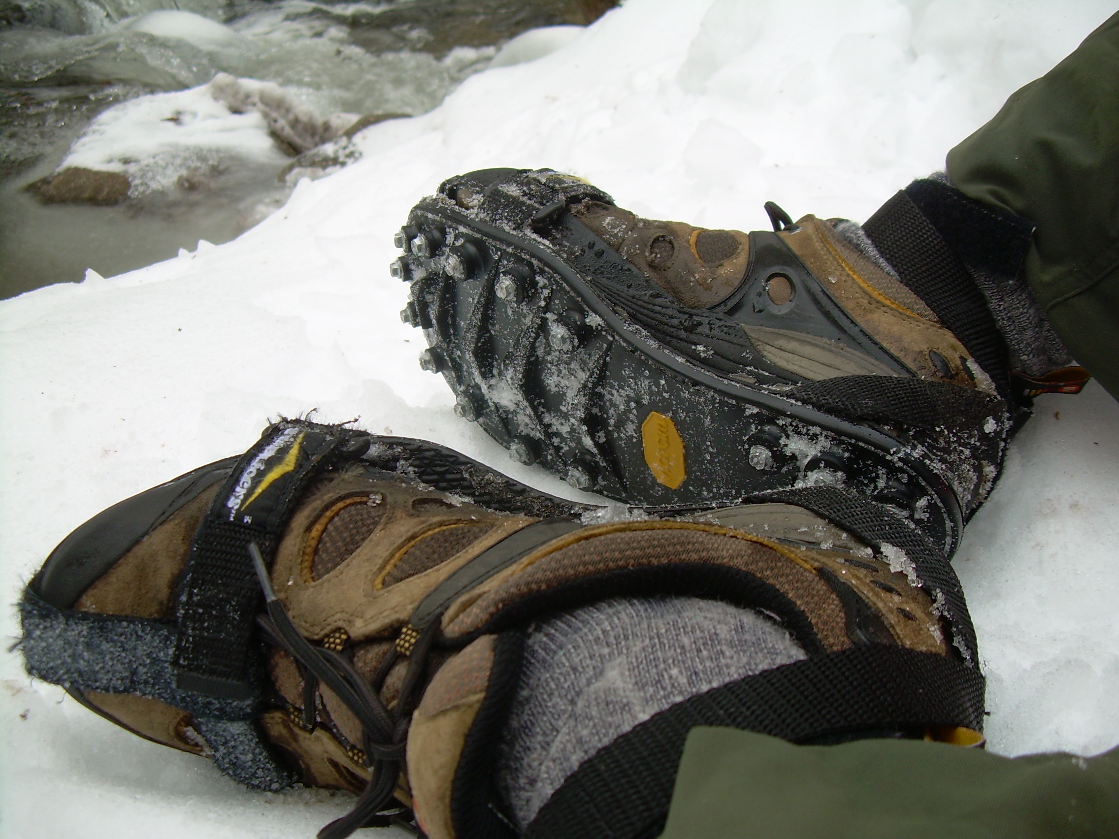
higher. A quick plunge down a ravine and I come to Brackett Brook. The normal
stepping stones are frozen under ice. At this point I strap on my "trekkers". These
are mini crampons for hiking. They look like over size sandals which you wear
over your boots. On the bottoms they have spikes. They remind me of the
"pin spikes" we would wear for running races on all-weather tracks.
I pick my way across Brackett Brook, and then start the real ascent. Soon I
leave the hard wood behind and the trail become hemmed by hemlocks. As an
experiment I step of the trail, and plunge knee deep into snow.
Up and up. I am making good time. After a bit over an hour and a half I reach
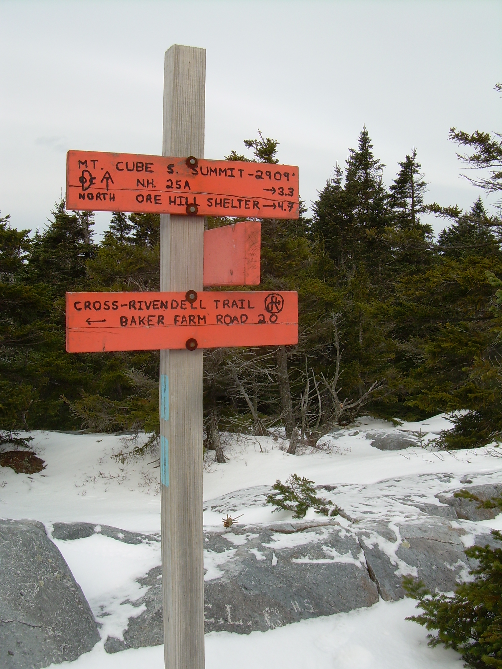
the saddle between the true peak to the south, and an overlook to the north.
I take the north spur trail out to the ledge. I use the term ledge in the New England
way. A ledge means exposed rock and not necessarily a cliff face. This ledge
only tumbles down to some wind stunted hemlocks.
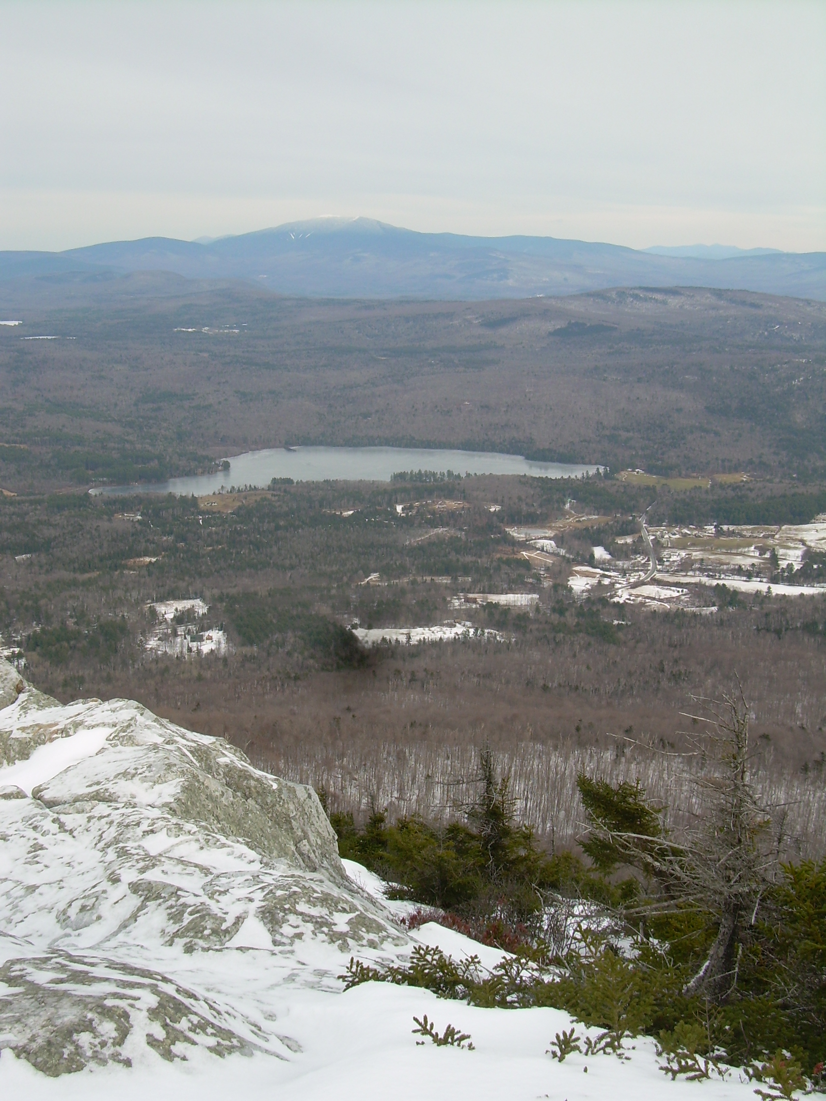
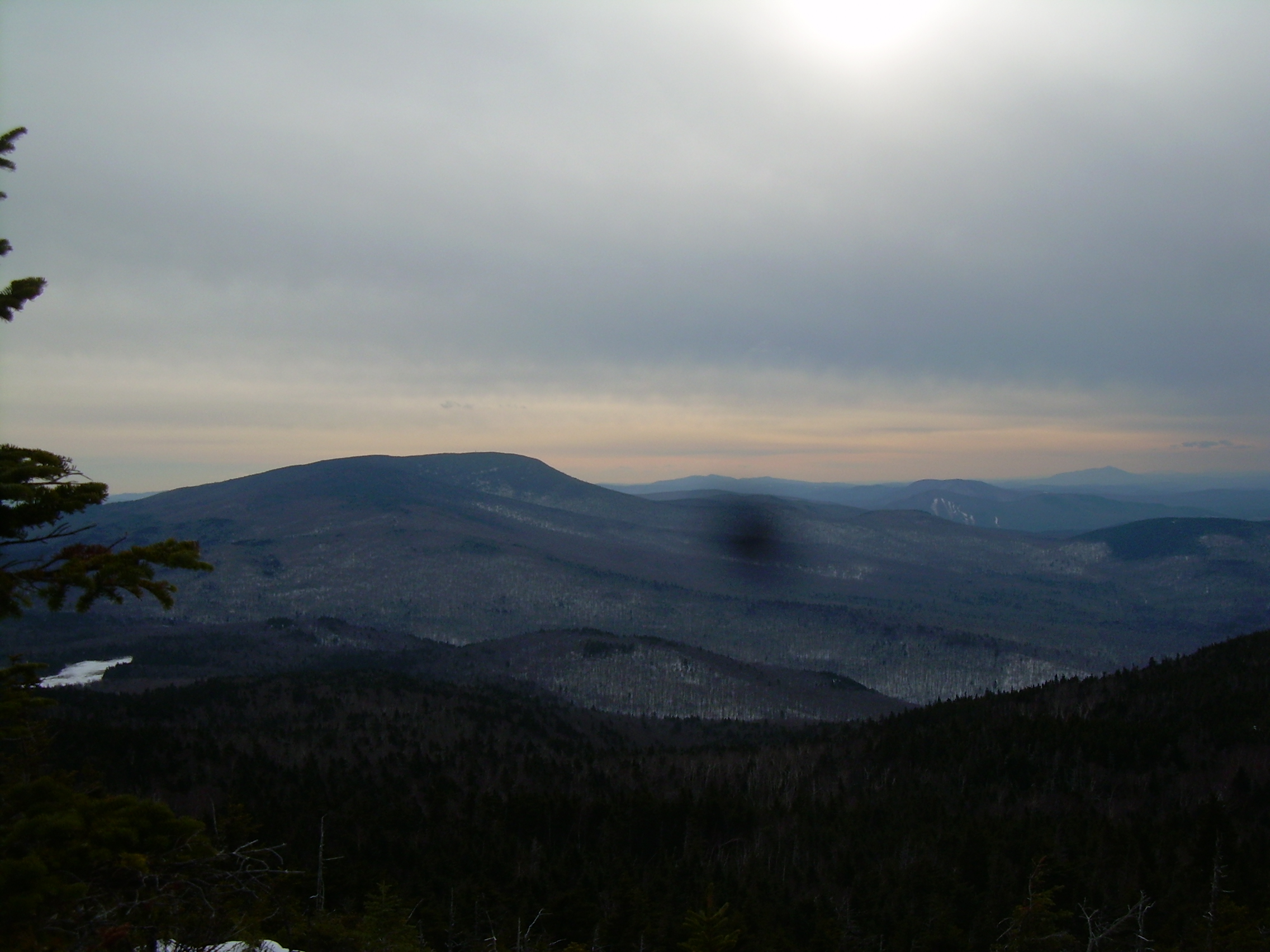
To the north the view is grand. Mt. Moosilauke is a slumbering giant. As you come
up from the Connecticut River Valley it is the first 4,000 footer of the White
Mountains which you meet. Its bare summit is well encased in ice and snow.
I take off my trekkers and sit on them, and eat a granola bar and sip coffee.
I could spend the rest of the day gazing north - or at least until I am chilled.
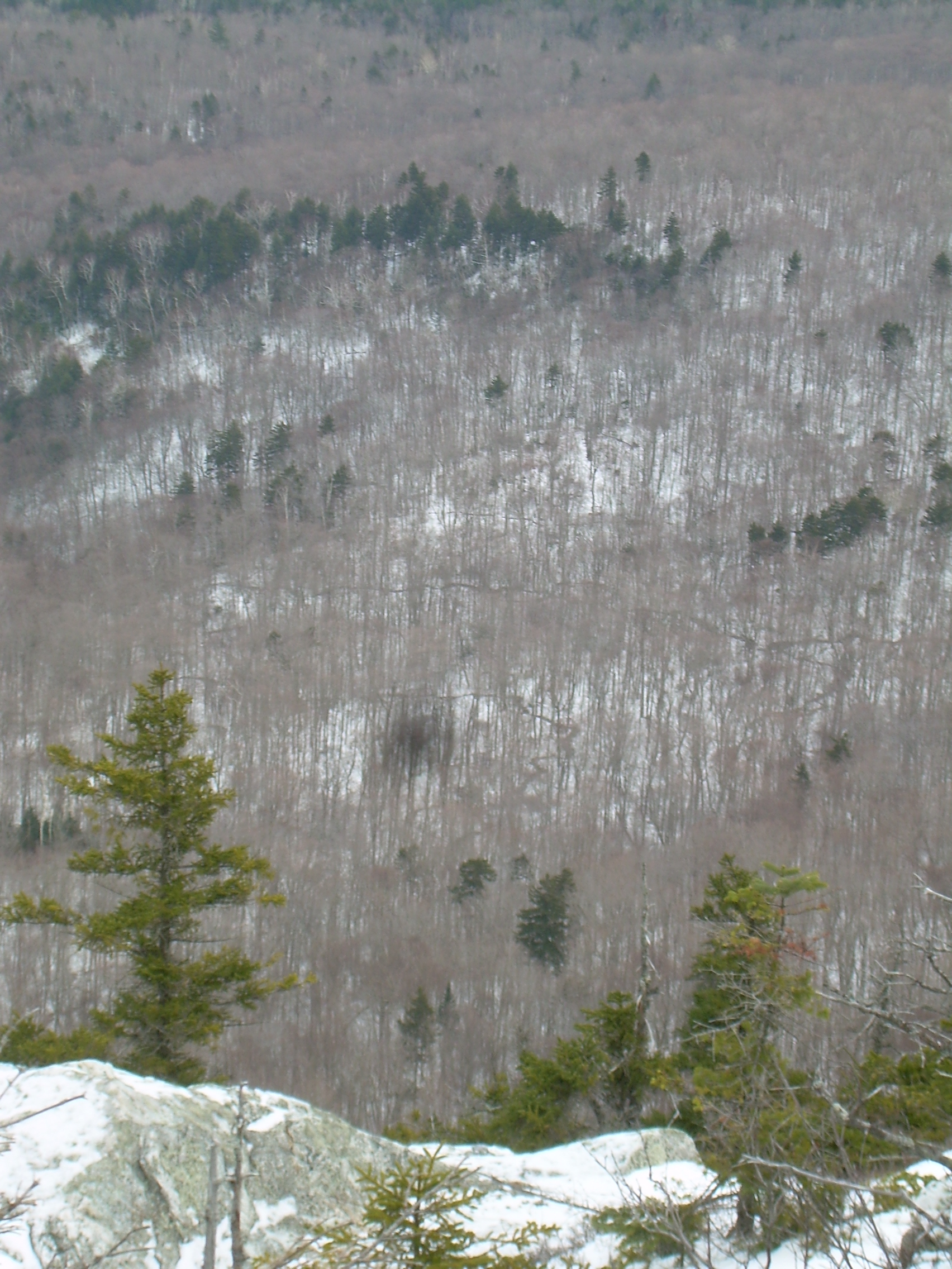
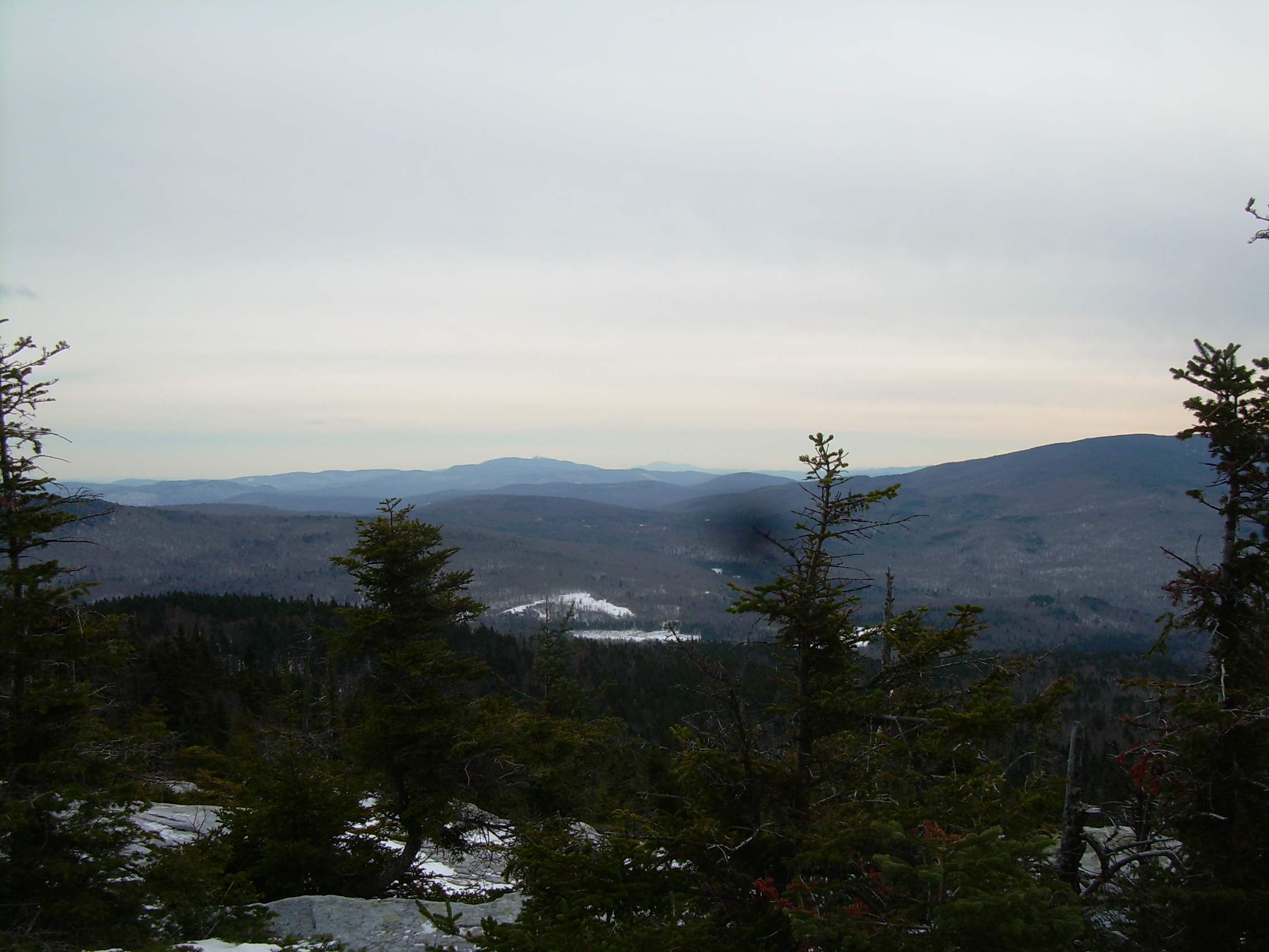
Down below my feet, down in the forest below me I notice what looks like
lines running through the forest. I look at them with my binoculars and realize
that they are tiny stream and trickles which appear dark against the snow.
Curious how many of them there are!
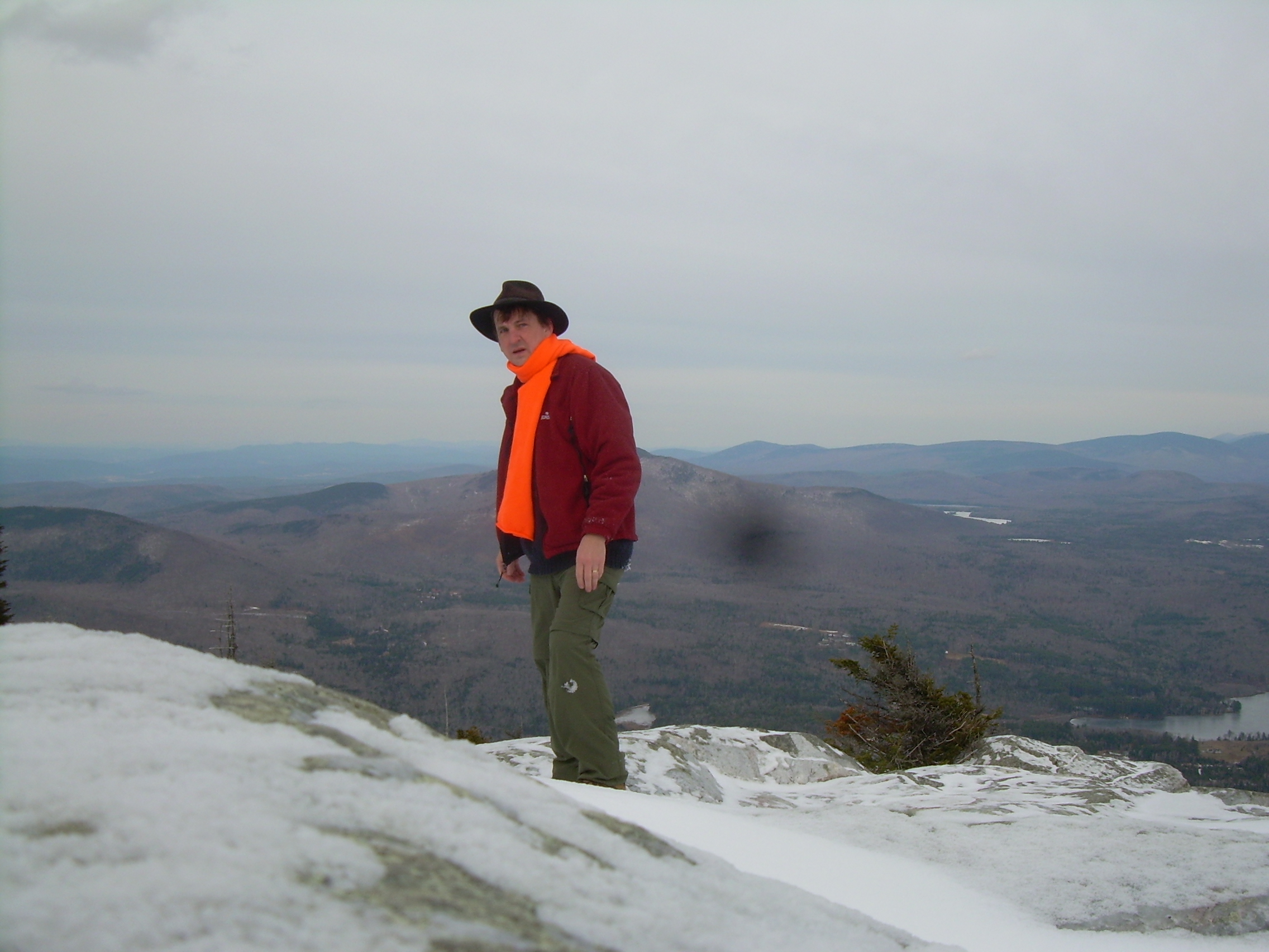
I walked over to the true peak where the view of the mountains of Vermont is
stunning. The day is so clear! But now it is time to head down.
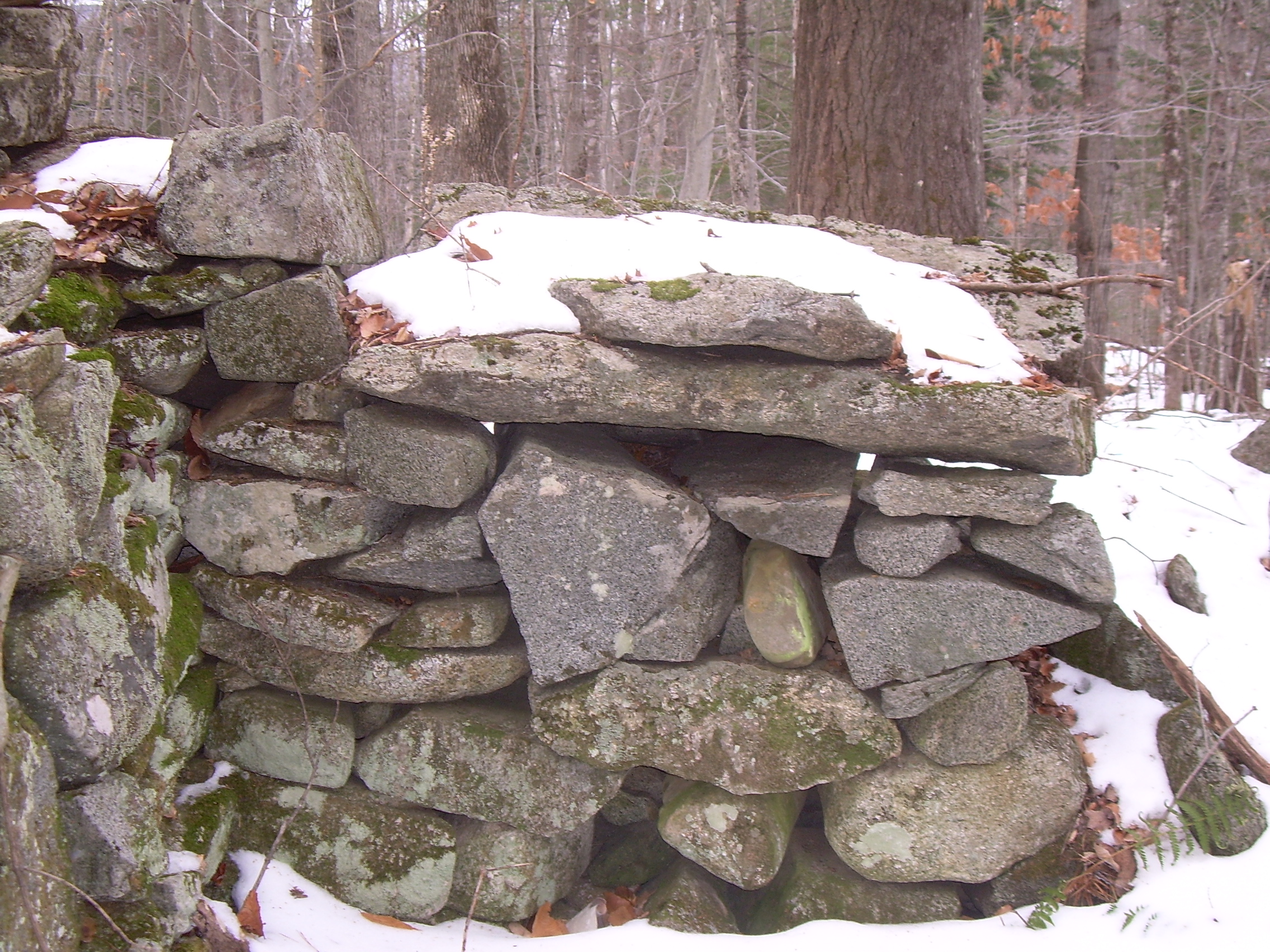
The descent is easy, and after crossing Brackett I stop and explore an old
foundation in the woods. The stones have a patina of lichen and seem to
be the survivors of a different age when all this was farm land. Undoubtedly
a hard life on a rocky hill side farm. I would get romantic about a simpler
age - but sometimes it does seem like why is it so hard to escape to the
woods for a little while? We are rich in everything except time.
How can we make time?
|
|
|
Brackett Brook |
Mt. Moosilauke |
Looking down into the forest |
Self portrait |
Looking South - Smarts Mtn. |
West to Vermont |
Tail Signs on top |
Trekkers |
Foundation |
Lost Farm |
Foundation & lichen |
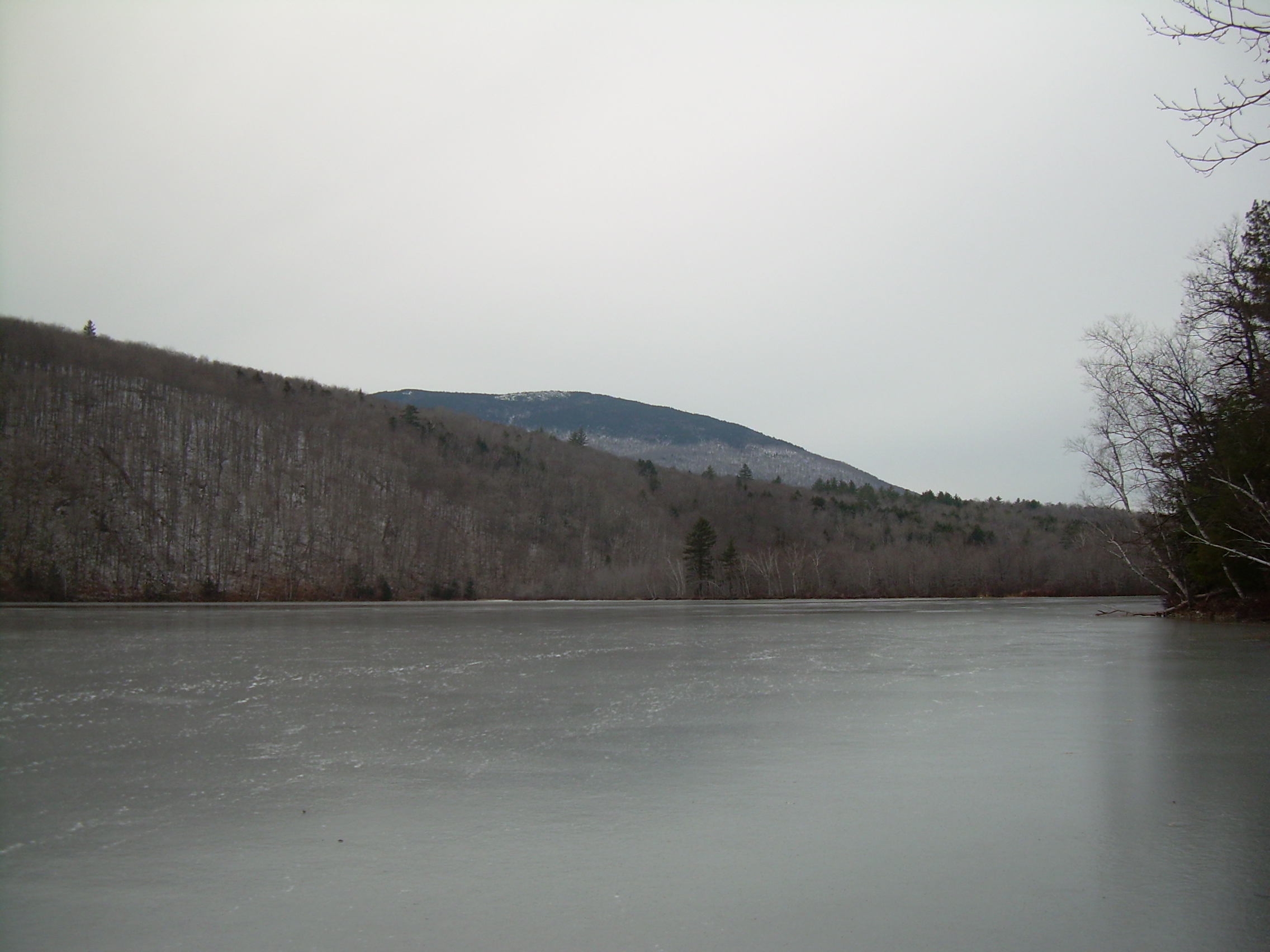
Mt. Cube over the ice
of Lower Baker Pond |
|