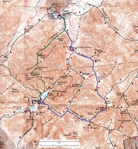
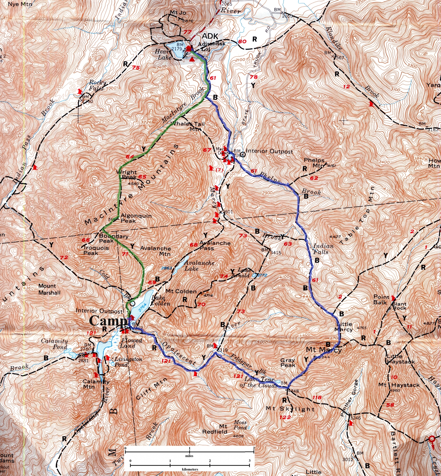
Map of Hike
|

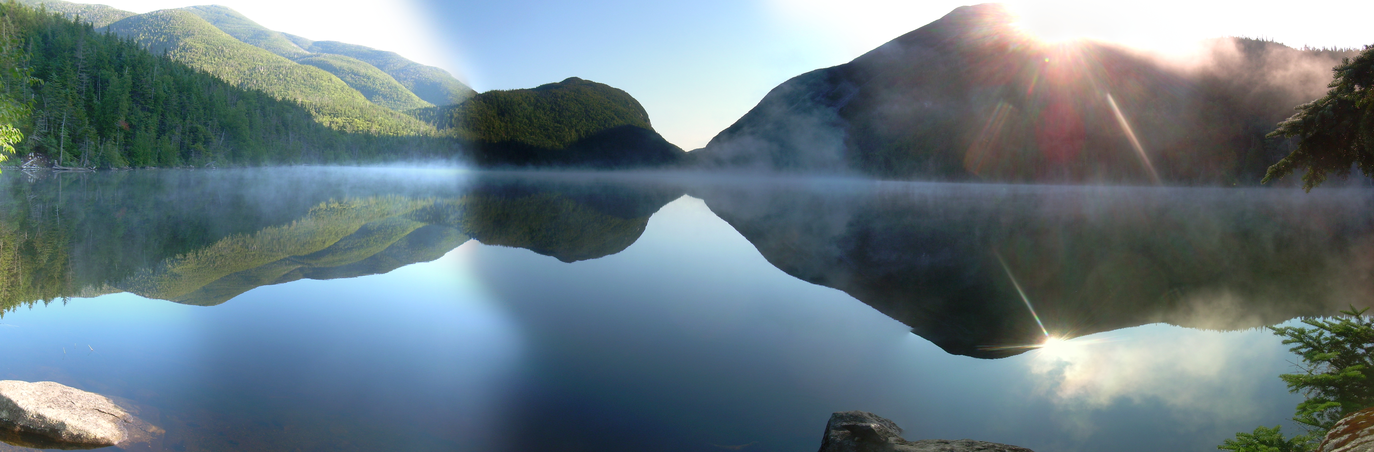
Double Sunrise
Lake & Mount Colden | |
Sunrise is at 5:45 but it is dark down here in the valley and yesterday's
was a long hike, so I slept in until 6:30. When I finally crawled out
of the tent the peaks of the McIntyre range; Marshall, Iroquois and
Algonquin were lit, but our camp site was still in the shadows of
Mt. Colden. I retrieved the bear canister and brewed some hot chocolate.
I handed Robin a mug just as I could first see sunlight peeking through
the trees, and then took my own mug to the shore of Lake Colden.
The lake is still in the shadow-lands with patches of mist tripping over
the waters. The surface is a mirror reflecting the peaks which crowded
in upon the lake; Algonquin to the left and northwest, Avalanche Mountain
straight ahead and Mount Colden to the right. And then, unannounced, the
sun rose over the shoulder of Colden. Light had been on the peaks for
over an hour and a half, but finally a single ray could angle down to the
shoreline where I awaited it.
As I watched the reflection of Mount Colden in the lake, the sun rose
again, a double sunrise! As real and poignant as the first, an unveiling,
a revelation. This is not the rosy fingers of dawn. It is not a sunrise
on the horizon through clouds and atmosphere and full of color. The early
clouds have burnt off and this is the clear and crisp sunrise of winter or
deep space. The postponed but promised start of a new day.
Thursday, July 29th, 2010
to
ADK Loj / Heart Lake
This trek is part of the celebration of my semi-centennial, I am going
to hike something old and something new. So Robin and I headed to the
Adirondacks, a place where I tramped a great deal as a teenager, but
also a place where I have not hiked in almost thirty years. We arrived in
the Adirondacks on a ferry boat, crossing Lake Champlain and headed
into the evening sun. This lake is ringed by peaks with the Adirondacks
to the west and Green Mountains behind us in the east.
It is a lovely sight and I wonder why I don't come here more often.
Night falls upon us as we drive into the High Peaks and find our way
in the dark to the Adirondack Lodge (ADK Loj). I have stayed here
twice as a teenager, as the guest of the Wolf family. Once we had
a "family" four bunk room, and once Doug and I were sent to the
big bunk room in the loft to sleep with the men. Yes this trip is
going to be filled with remembrance.
Robin and I are sharing a four bunk room with two women and since
it has just gone 10:00, the time of lights out, we tip-toe in, leave
our stuff and retreat to the Great Room of the lodge. This lodge
was build in the late 1920's and it wears its age proudly. A massive
fireplace dominates the room and almost makes you wish that a blizzard
was raging outside. Over the mantlepiece is a giant moose-head - there
to remind us of that other age when the Adirondack Mountain Club was formed.
Somehow I think that most of the present members of the ADK would
shun a trophy head in a new lodge, but also fervently defend this
old moose-head.
Next to the fireplace are shelves stacked with books and board games.
Games from before the age of pocket electronic entertainment. But
coming to the Adirondacks is all about escaping from the modern world.
There are also maps of peaks and faded black & white photographs of
smiling hikers from before even my youth.
Robin and I make ourselves a cup of tea and hot chocolate and sit
back to read for awhile. But tomorrow will start early and stretch
across a good many miles. So we soon tip-toe back to our bunks and
pull the thick wool blankets up under our chins - for the night has
a chill - and we drift off to sleep.
Friday, July 30st, 2010
ADK Loj / Heart Lake -
Mount Marcy -
Lake Colden
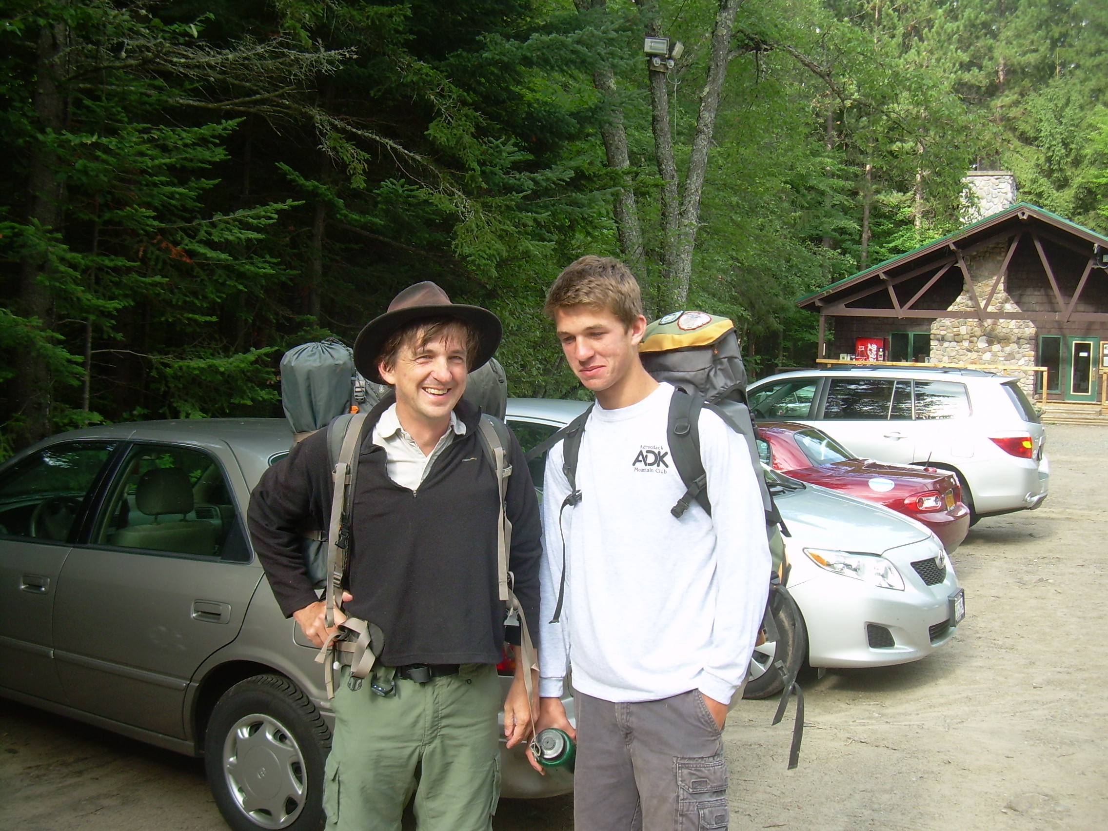
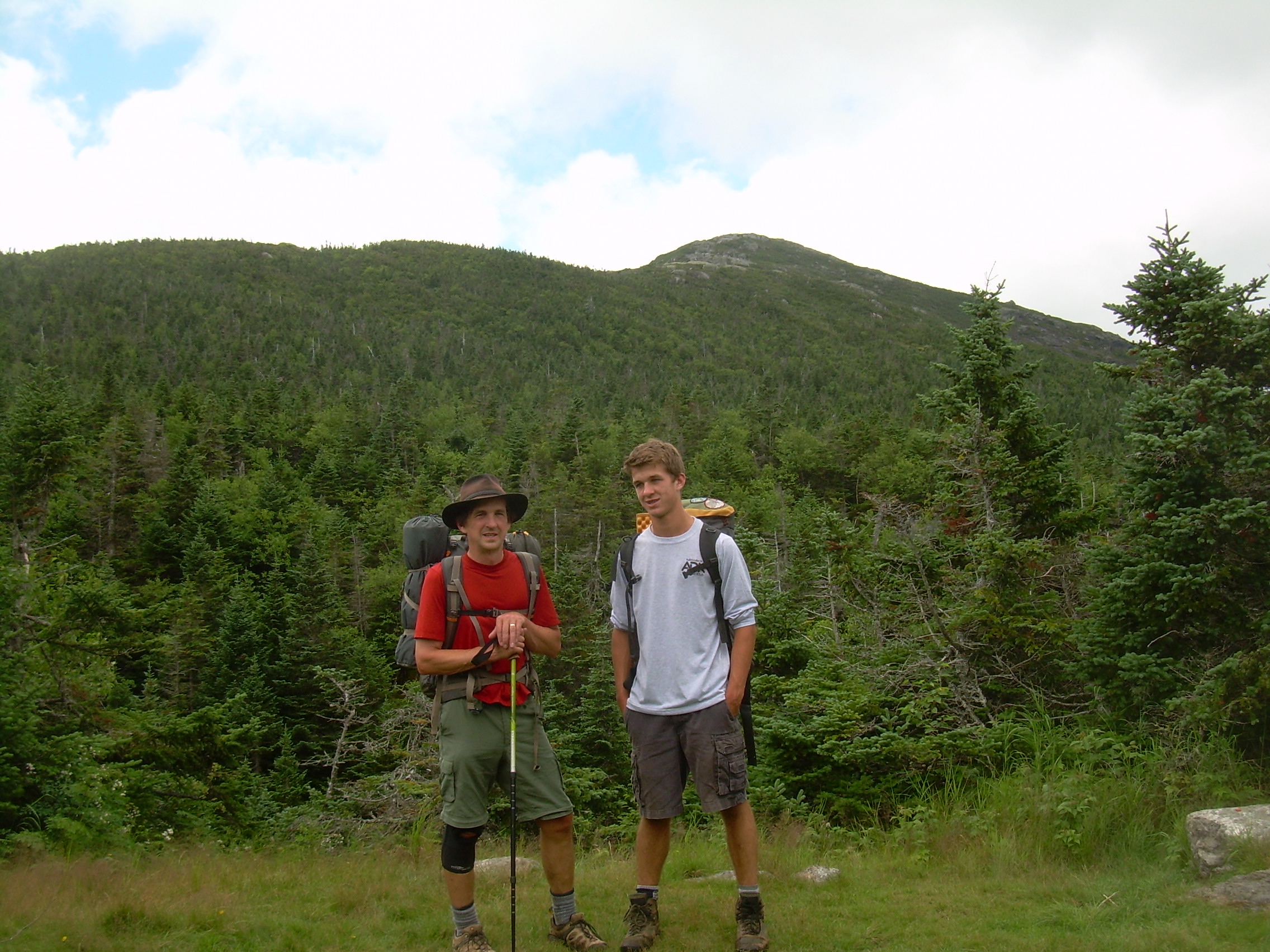
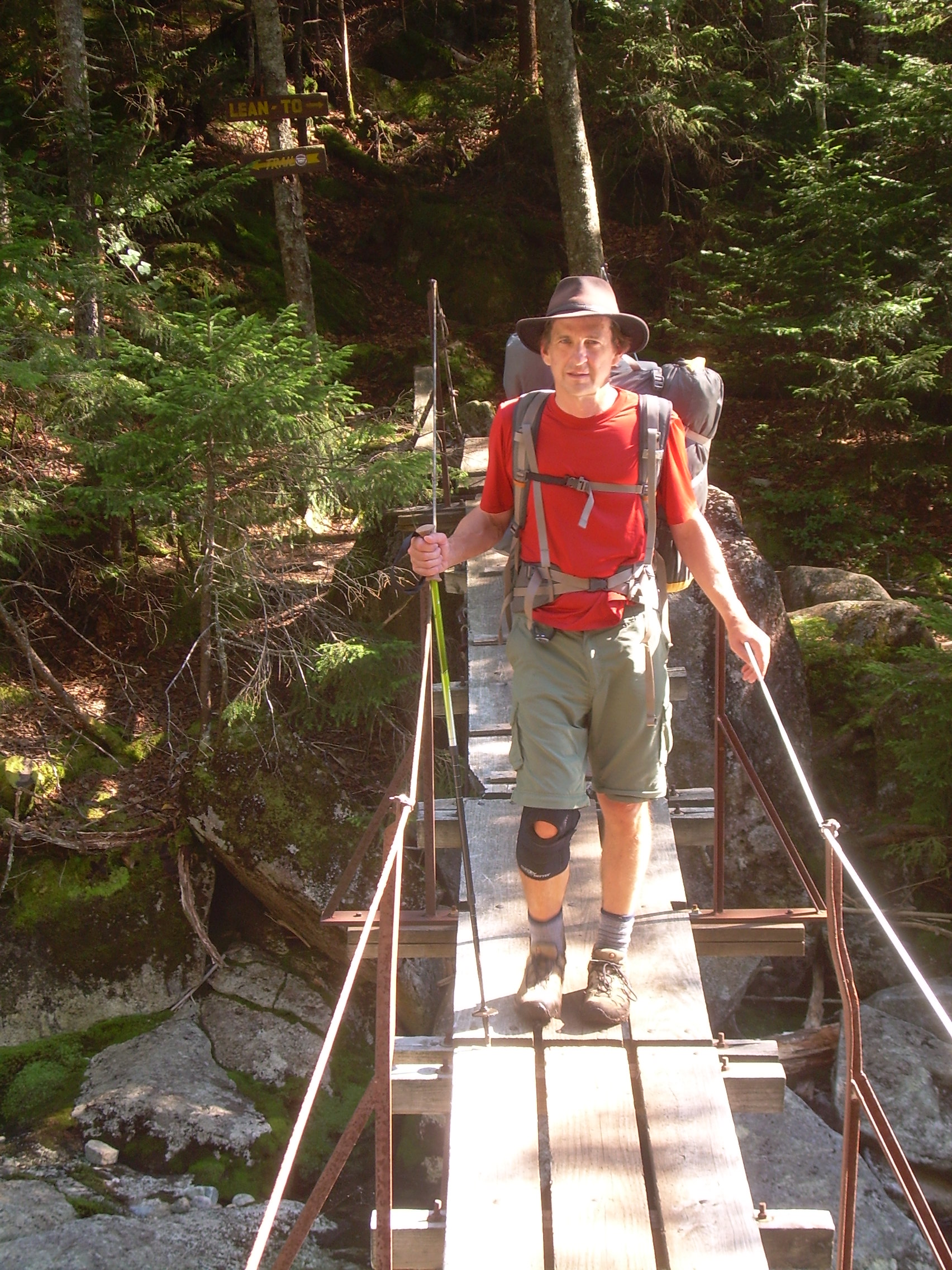
Tim & Robin at the Trailhead |
Tim & Robin near Marcy |
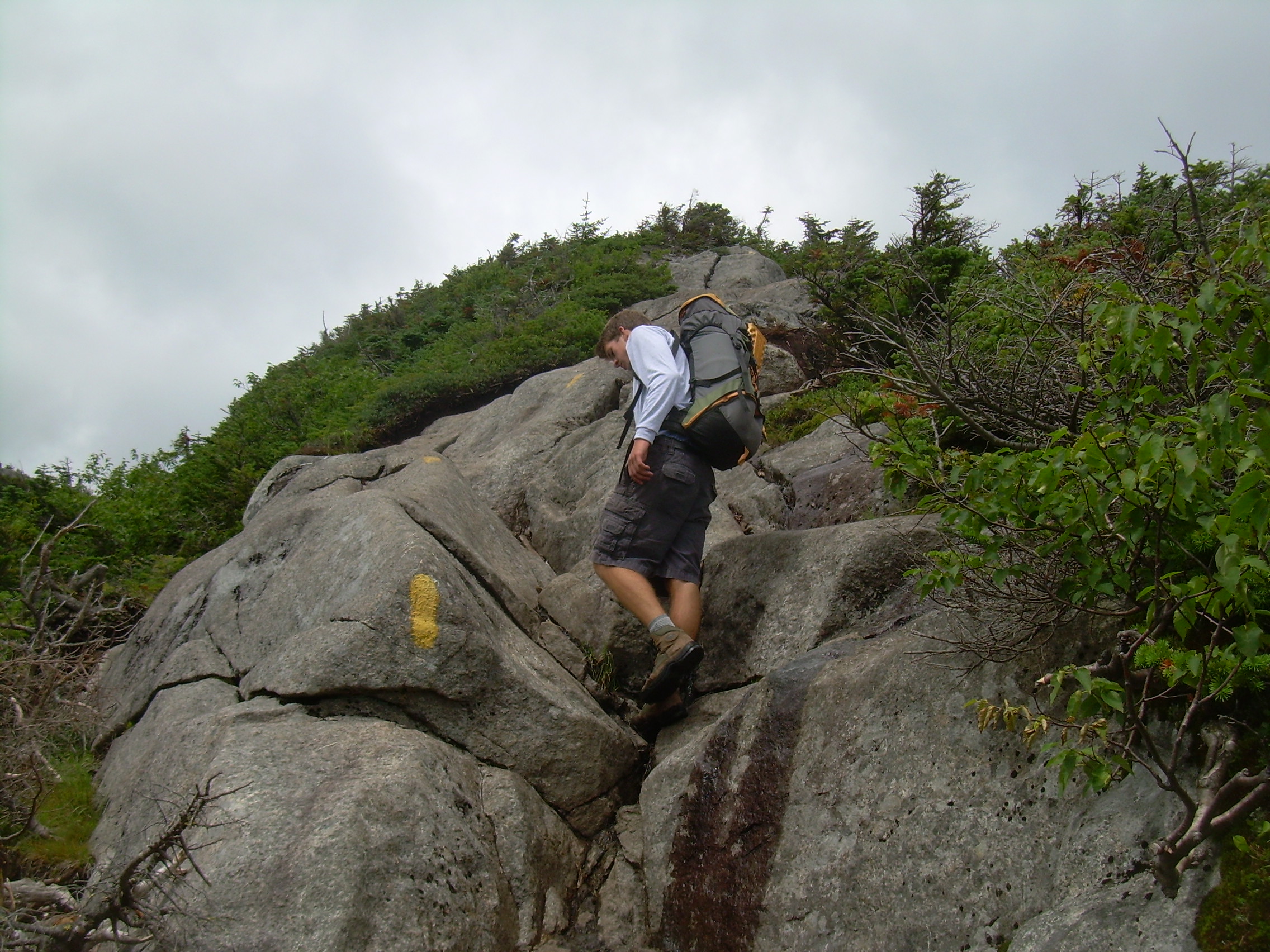
Trail up Marcy |
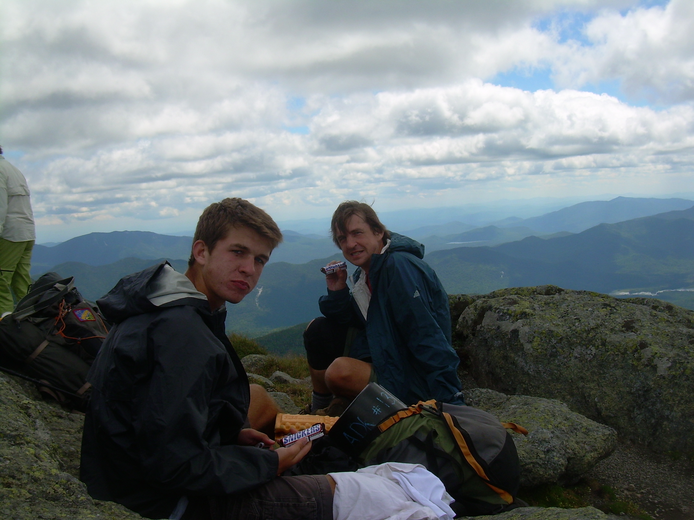
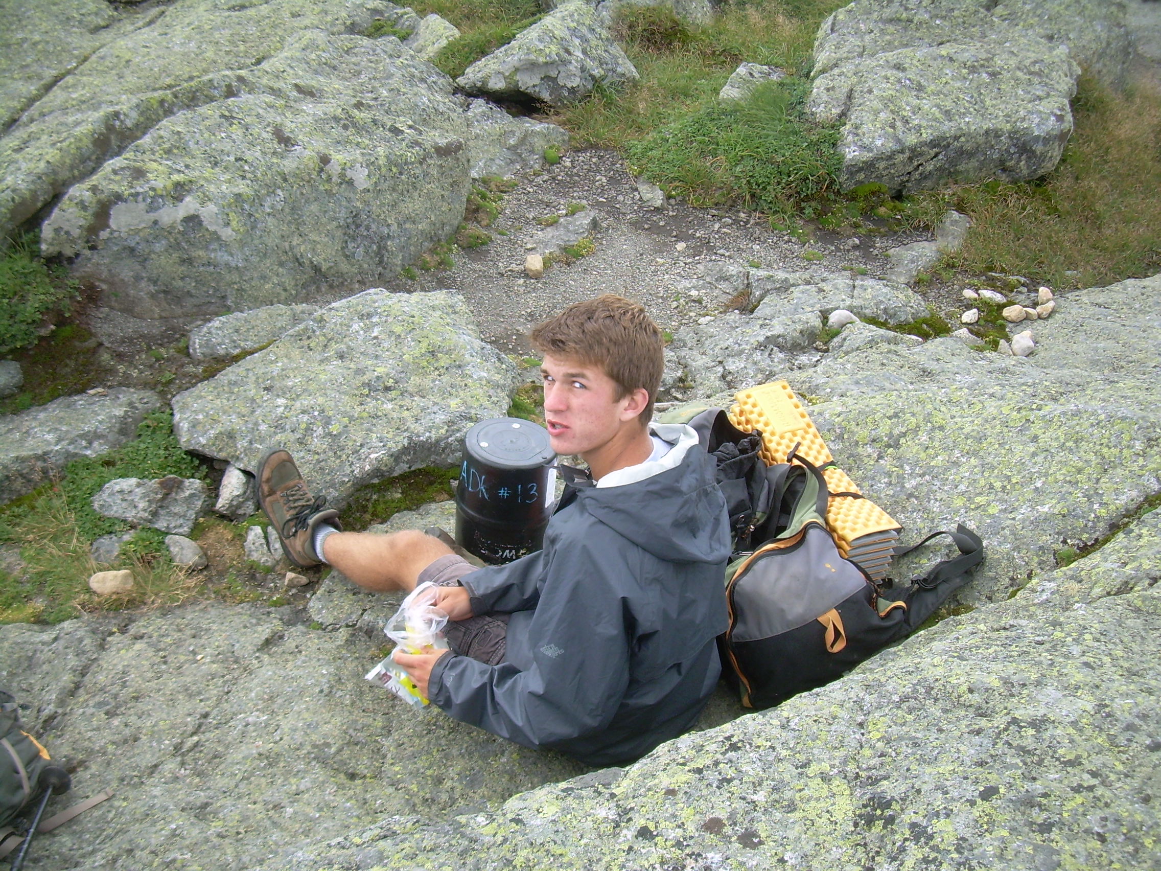
Chocalate Bars
on top of Marcy |
Mount Haystack |
Robin & Lunch
(with Bear Canister) |
Trail headed to
Lake Tear of the Clouds |
Muddy Trail |
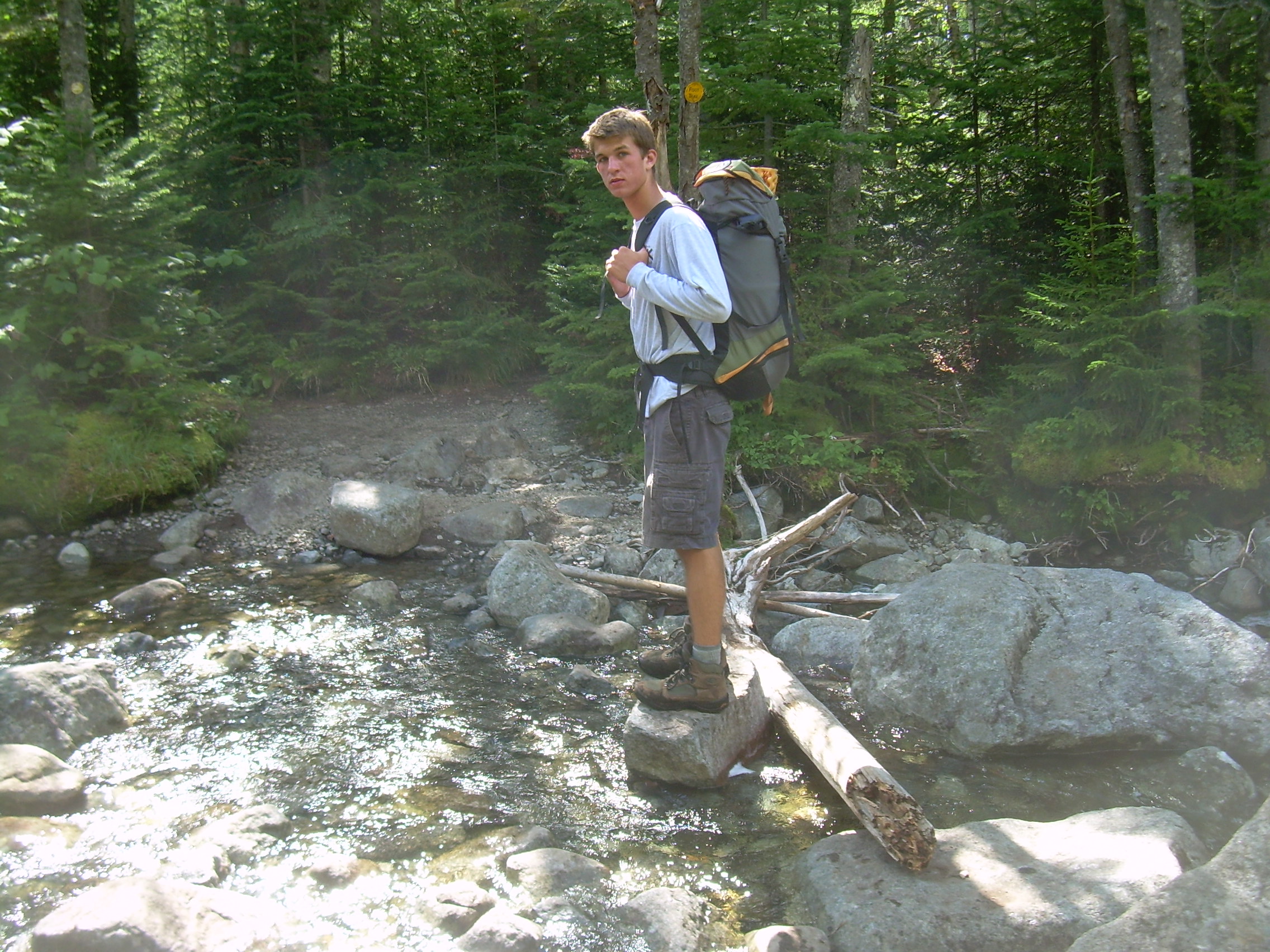
A Stream Crossing |
Tim on the bridge over the
Opalescent River |
I awoke at 6:40 and remembered that breakfast was at 7:15 and that there
are only two shower stalls in the men's room. The Lodge's attraction
is community and location -- not excessive luxuries like private baths.
Robin joined me in the great room at 7:00 where we could watch the
staff actively preparing breakfast. I acquired a mug of coffee while
we waited. At 7:15 one of the staff emerged from the breakfast room
with a loud triangular bell and marched through the lodge making sure that
everyone was aware of the time. As he disappeared down the hallway the
clanging seemed to transform into a screech! Two boys (ages 4 & 6) came
tumbling out into the great room shrieking and laughing at the bell.
I think they were both alarmed at the clang, but also delighted and
overjoyed by it too.
At breakfast we talked with our fellow lodgers, the meals are very
very communal, but we came here to hike. So by 8:00 we have packed up,
checked out and are headed to the trailhead.
At the trailhead Robin spotted Kristen and Ryan from Hanover High. Kristen
has been in Robin's classes for years and Ryan was in his boat in crew.
The coincidence was too much for Robin who keep on saying, "Aren't we
a hundred miles from home?" I had met their mother before at a crew race and
now we talked a bit. Apparently Kristen and Ryan are working on climbing
the highest peak in all fifty states and Mt. Marcy is number forty-three
for them. They are doing it as a day hike (seven miles each way). They
left Norwich at 4:00 AM and are racing to get on trail.
Robin and I stopped at the visitor's center next to the trailhead to
rent a bear canister. These are hard plastic cylinders, about eight
inches in diameter and a foot long. You put your food in them at night
and leave them out in the woods. A bear may bat them around, but they
can not open them. We repacked our food and finally stepped out on the
trail at 8:40.
It is an easy two miles up to Marcy Dam and we stride over this in less
then an hour. Here, because of the open waters, we break out of the trees
and have a bit of a view. We really are entering into the High Peaks,
they rise up abruptly in front of us. Across the lake and down a
valley is Mt. Colden. Marcy is to the southeast and still hidden from view.
The trail is busy and we keep passing and being passed by groups of
day hikers, one of which I think of as "people-being-pulled-by-a-dog".
Why is it that this trail is labeled the "Phelps Brook Trail", instead
of the Van Hoevenberg Trail?
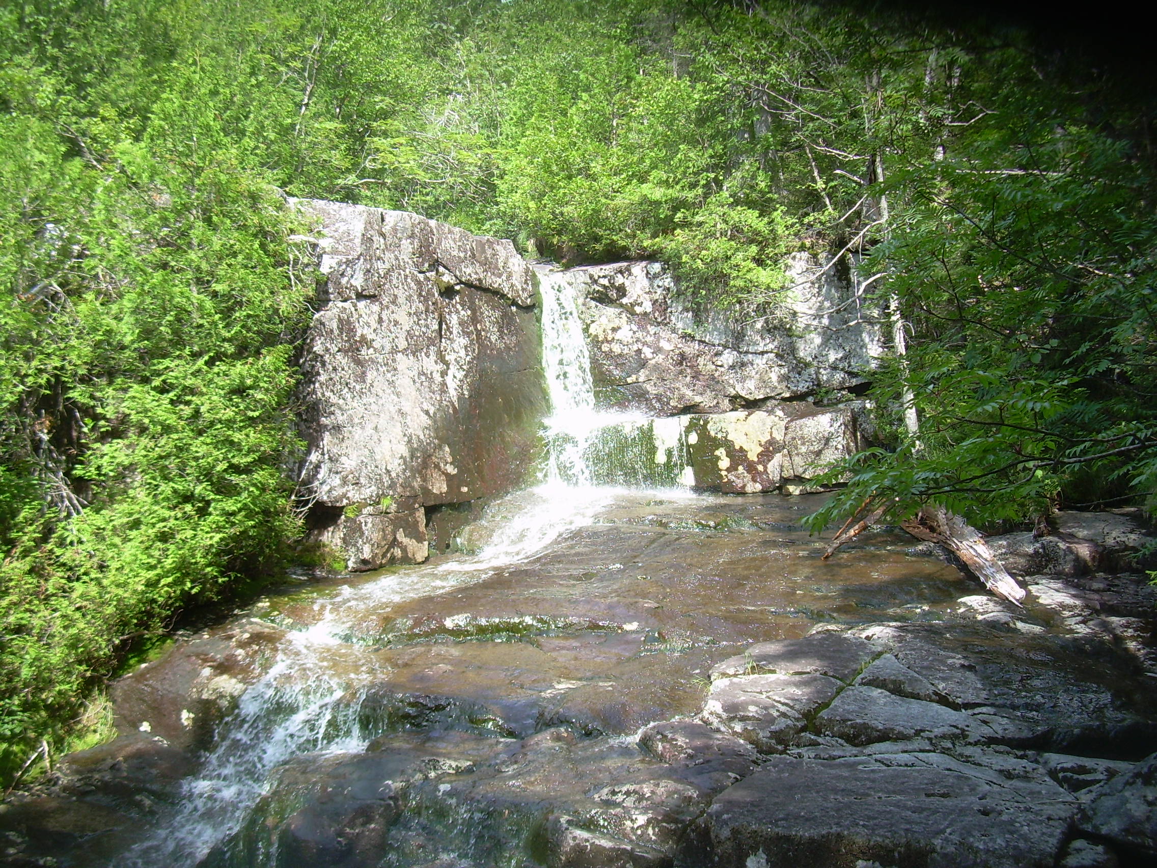
At the five mile mark Indian Falls is a nice ten minute diversion. Most
of the water of Marcy Brook is funneled into a trough about three feet
wide before it rushes the edge of the cliff face and plunges into the
void -- thundering down below.
It is about three more miles to the summit of Marcy and the trail is getting
steeper and wetter. Up to this point we have just had two "views", only
at Marcy Dam and Indian Falls could you see more then the nearest trees.
But now, with growing frequency, we can see out across the mountains.
The Adirondacks are a lot more rugged then I remembered. They feel very
different from the White mountains. What I see are not a few big
ranges with a dominate peak (like the Presidentials or Franconia),
but many peaks each raising up from the valley floor. The Brothers to
the northeast, Gothic to the southeast, Haystack due south and to
the west -- filling our whole field of view -- Marcy.
We met Kristen and Ryan about half a mile from the summit. Just a brief
"Hello" and they continue down and we continue up. The path is becoming
windy, colder and more exposed as we push through the Krummholz. We
scramble over bare slabs of granite, sometimes putting down a hand to
aid our balance -- and then, quite suddenly -- there is the top.
It is a nice day and so the top is a busy place with twenty to thirty
people already there and more following us. "Nice" maybe is not
quite right. Down in the flat-lands, in Lake Placid and Keene Valley
where people made their decision to hike today, it is a nice summer day
and the occasional cloud offered shade and a bit of relief from the sun.
But up here the clouds are thick over the summit, caught on this spire
as they blow by. I remember that the indian name for this peak, "Tawahus",
means "Cloud Splitter". Marcy is cloud making and splitting today. The
dark clouds rush close overhead, but at least it is dry.
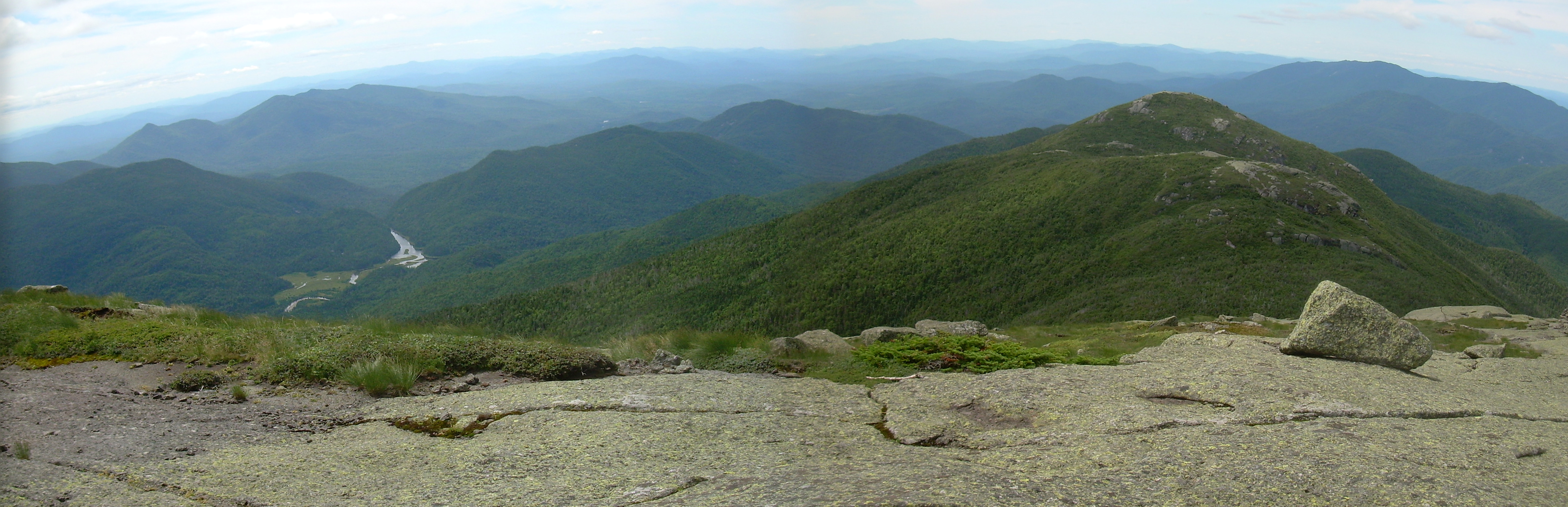
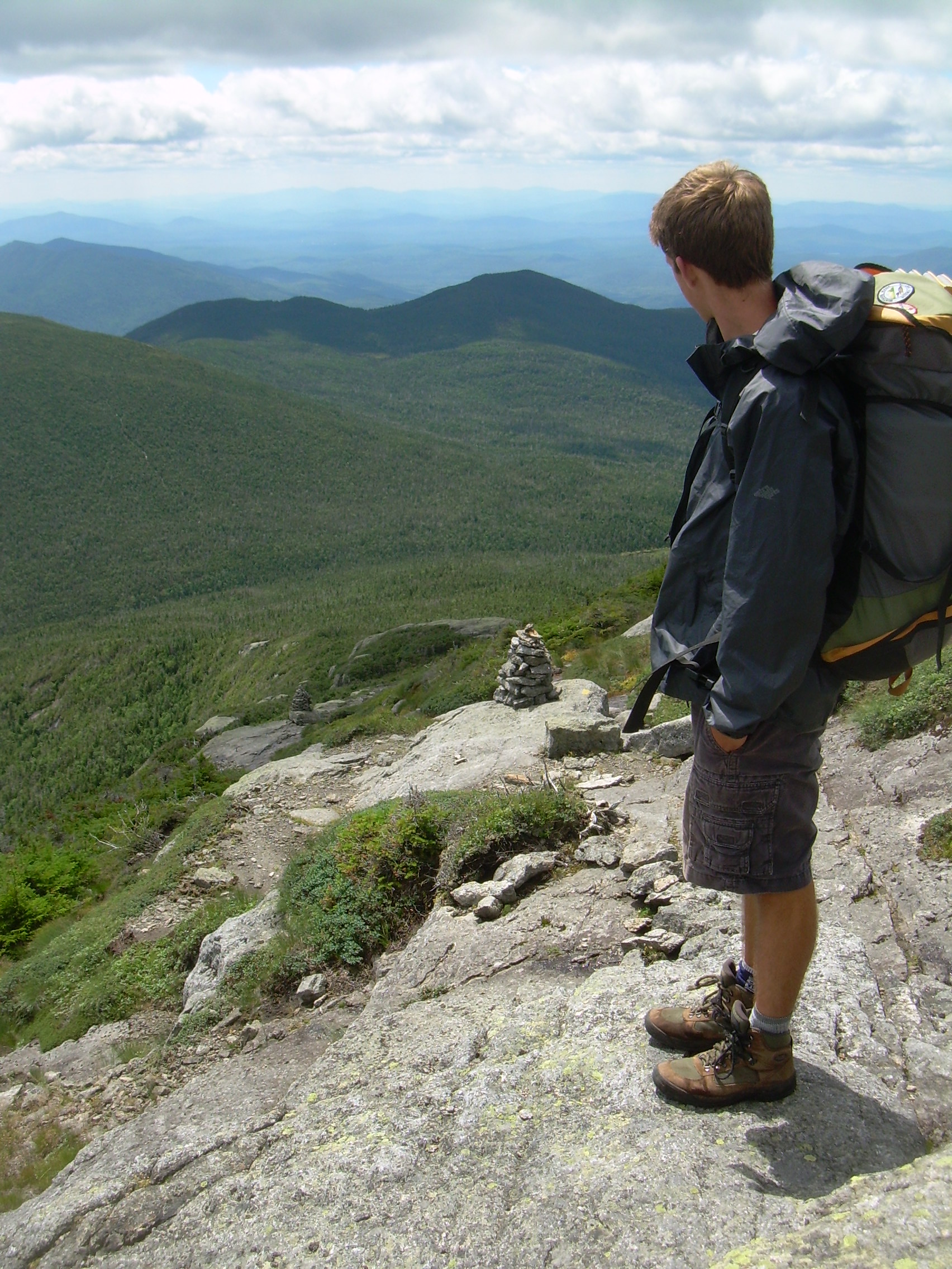
The horizon is spectacular! Range upon range off to the horizon.
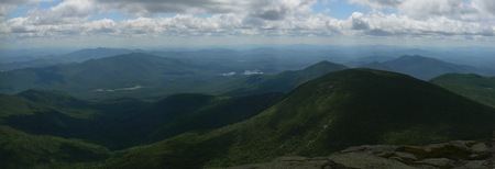
From Marcy, looking south
I have been telling Robin stories about when I hiked here as a teenager,
first with Doug Wolf, and then with Steve Rogers. I also told him about
my first ascent of Marcy (1970?, 1971?) when Jonathan and I urged Stephen
up to the top of the mountain by promising him a "3-Musketeers" chocolate
bar. There is a picture in the family archive of Steve sitting on top
of Mt. Marcy with a huge chocolate bar and a similarly large smile.
I seem to remember my mother exhausted, she had set out that morning
expecting to turn around at Marcy Dam.
Robin and I celebrated with chocolate and tried to recreate that
historic photograph. Our real lunch was bagels, cheese and apples.
And then it was time to leave behind the crowd and head down the backside
of the mountain. Our trail led off southwest to "Lake Tear of the Clouds".
The moment we stepped off the summit the whole nature of the trail
changed. There are no day-tripers here, the trail is narrow and
lightly worn. When we left the open face
behind and stepped into the krummholz I was overwhelmed by the thick
sweet smells of the balsam spruce and hemlock which crowed this less used
path.
We were not completely alone here. We encountered two Boy Scout Troops
in the afternoon, one from Pittsburgh, Pennsylvania and the other from
New Jersey. They had hiked into Lake Colden and camped there and now
they were taking short hikes up from the lake to the summit of Marcy.
There is no longer a shelter at Lake Tear of the Clouds. In fact I don't
think there are any shelters above 3,500 feet and no camping above
4,000 feet now a days. We follow Feldspar Brook and drop very fast.
Marcy is at 5,344 ft but by the time we reach the Opalescent River,
an hour and a half later, we have dropped to 3,300 feet.
The grade is a bit more gradual here -- and a lot more muddy. Rocks,
roots and mud make our trail. The stream cascaded musically next to
us and we stopped for a break to fill our water bottles. It is a sunny
a bright day at 3,000 feet.
Lake Colden is a popular camping place and it takes us a little while to
find a site. The shelters are all full, but that is okay with me. I
really didn't want to sit around with a lot of strangers tonight. After
we pitched our tent a ranger stopped by to talk and make sure that we
had a bear canister.
"Oli Chicken and Rice" tonight. This recipe (Rice-a-Roni and a can of
chicken meat) was introduced to us by a scout years ago. But after
eating everything we are still hungry and so we steal a bagel from
tomorrow's lunch. Our plans have evolved and we expect to be getting
off trail tomorrow about mid-day.
We have heard a lot about bears and so are very careful about our
cleaning up, broadcasting our wash water far from our tent. We then
pack up all our food in the bear canister and leave it on the ground
about fifty meters from where we will sleep. Backpackers in the
High Peaks are required to use bear canisters and apparently it is
have the desired effect. Bears are learning they wouldn't get food
from campers, and there are less bear raids then a decade ago.
It is too early for bed. So we sit for an hour and talk. I tell
Robin about some of the more adventurous parts of my bike trips,
and we talk and talk. Finally, a bit after 9:00 we head to bed.
It has been a long day and the temperature is really starting to drop!
Saturday, July 31st, 2010
Lake Colden -
Algonquin -
ADK Loj / Heart Lake & Home
Second Sunrise Video |
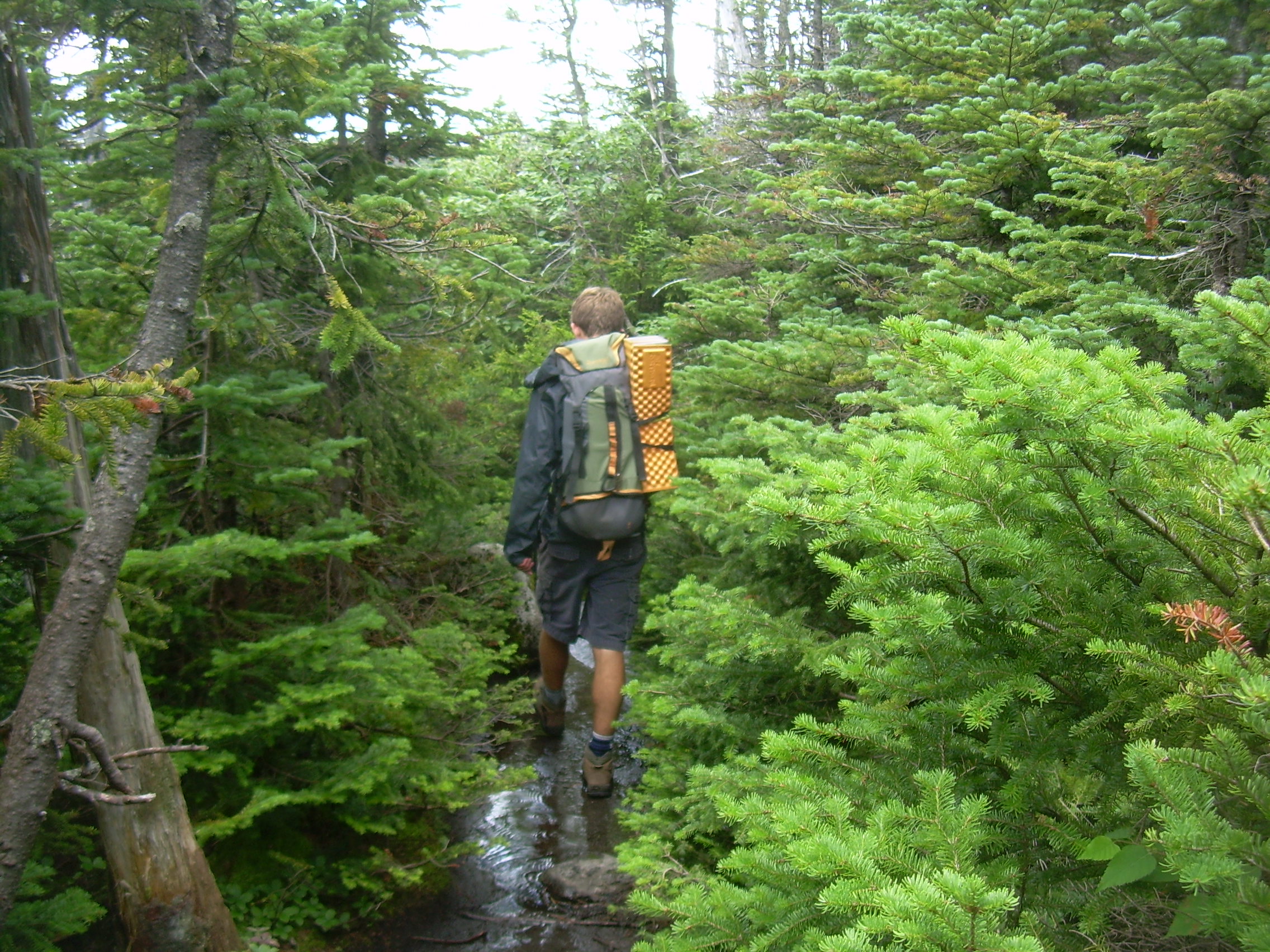
Trail up the Streambed |
It was a cold night for the end of July. Back at the trailhead we were told
it could be in the thirties tonight. I think it may have just slipped below
forty, but that was cold enough. I slept with my fleece on which meant
that I was warm, but it also makes it hard to move around in my sleeping
bag, I'm a bit too tightly packed.
This is the morning of that double sunrise over Lake Colden. Here I will
only repeat that it really was that beautiful.
After sunrise I walked back to camp. Robin was getting up and so I started
cooking breakfast; oatmeal and hot chocolate. We are not in a rush, but
it doesn't take long for two experienced backpackers to have breakfast and
strike camp. While eating and looking at the maps Robin says that he thinks
we should go over Algonquin on our way out of the High Peaks. I am delighted
at the suggestion. Later I read that this route was slightly shorter
then Avalanche Pass, but was not recommended for backpackers because
of the climb.
The trails climbs 2350 ft. from Lake Colden to the summit, which
makes this one of the most continuously steep climbs in the mountains.
Although actually a slightly shorter route between Lake Colden and
Heart Lake, this trail up and over Algonquin is not recommended for
backpackers in either direction. - Guide to Adirondack Trails I
It is a good thing we did not have the trail guide with us this morning.
However, even without the guidebook we realized that choosing to go
over Algonquin would probably add at least two hours to today's hike.
We shouldered our packs at about 9:00 and are at the turn off for Algonquin
by 9:20. It is only 2.1 miles to the peak, but what a climb. The
trail follows a stream during the first mile or more. It is forever
criss-crossing the waters and sometimes even traveling up the stream
bed itself with blaze painted on rocks which on rainy days must be
flooded. Today it is beautiful and flooding is not an issue.
The climb is.
After an hour we caught up with a pair of college-aged hikers. They
had left most of their gear at Lake Colden so they could make a light
and quick hike up here. Still, Robin and I, fully loaded, had caught
up with them. It became apparent that we were going to play leap-frog
with them because of the way we alternated resting. So Robin and I
chose to have one long break at this time. We have been climbing
steadily for over and hour and I think have gained about 1,000 feet.
Robin referred to this section as "The Staircase to Mordor".
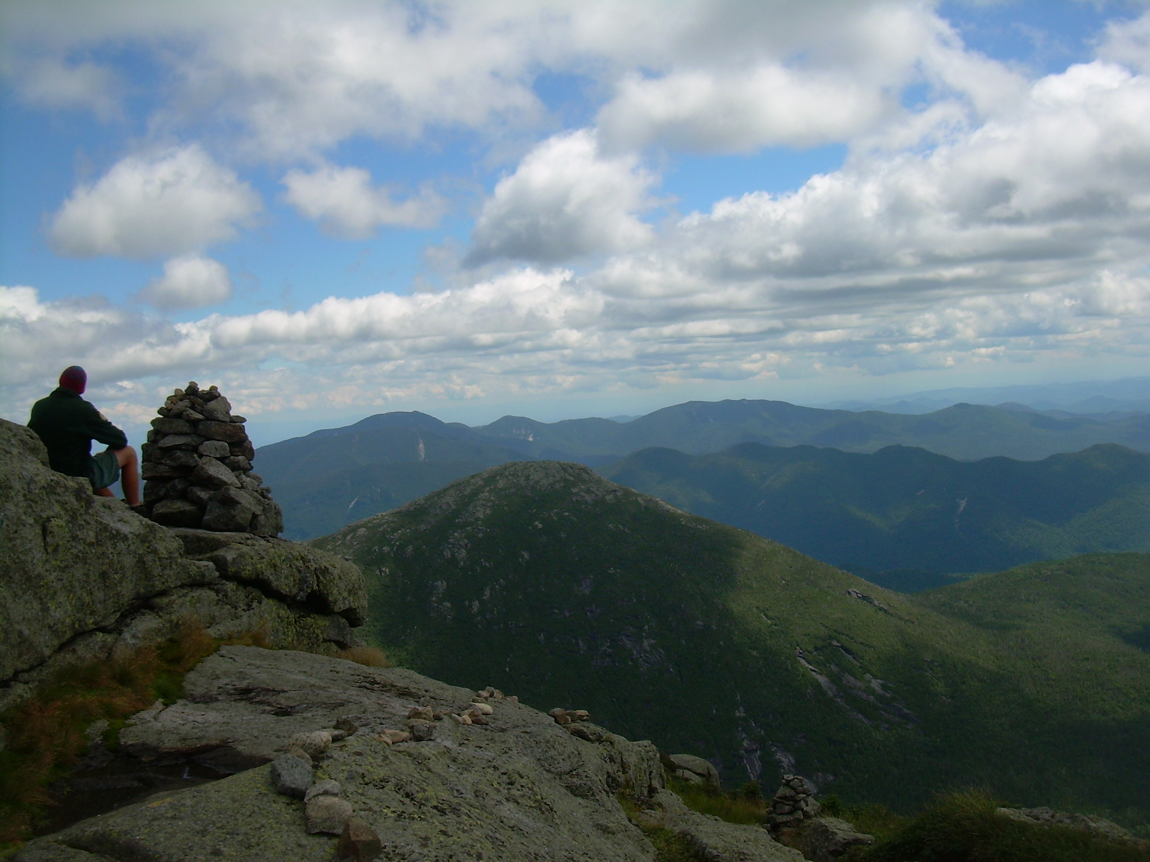
Eventually we leave the brook and at this point we can look behind us
and see Mt. Marcy just peaking over the top of Mt. Colden. Mt. Colden
is 4,714 ft and just over a mile away, whereas Marcy is 5,344 ft
and three times further. I used this to estimate our height at 4,400 ft.,
which proves to be about right.
The transition from the brook and tall trees to the krummholz was very
abrupt, perhaps no more then five minutes. Yesterday I remembered
how strong the smell of the spruce was when we descended from Marcy.
Today it is not nearly as strong, perhaps because the sun has not
been baking this area so long.
We then reached the trail intersection, with Iroquois and Boundary to
the left and Algonquin to the right. Our heads are already above the
trees and within 100 meters we are walking on bare rocks.
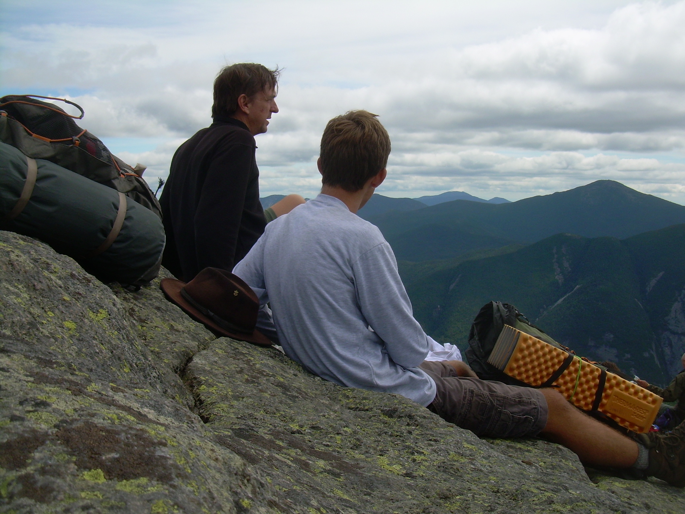
The last quarter mile to the peak was a delightful walk, with the world
at out feet. Algonquin is the second highest peak in the Adirondacks.
Except for Marcy, off to the east, everything else is below us. Someone
on the summit asked us about our hike and we were able to point it out,
to trace it along the horizon; through the valleys, along the lakes and
over the peaks. Robin said that it was better then having a map -- just point.
Robin on Algonquin |
Tim & Robin with
Marcy in the back |
"Each long scratch tells
us that somebody was
out of control" |
Trail's End |

From Algonquin, looking south
The top is a bit of a shock to me. It is only four miles from the trailhead
and so it is covered with day-hikers. I told Robin that I had been there
twice before and the only other person I had ever seen on this peak
was my hiking partner, Doug Wolf.
We found a quiet rock on the east side of the summit. We were about
60 meters from the top and so away from the madding crowd.
We had lunch and tried to eat everything such that we wouldn't have
to carry it out. The panoramic view is breathtaking. With Lake
Colden and Avalanche Pass beneath us -- viewed between our feet -- I
think it may be an even more dramatic view then from Marcy.
After forty-five minutes it is time to shoulder our packs and head
down. We are the only people up here with overnight gear, which
impresses a few people. Still, Robin and I hike faster and with
surer footings then most other hikers up here.
There is a steady stream of people coming up to the summit from the
north side -- the side towards Heart Lake. I tell Robin that these are
the people who have made reservations for the 1:00 lunch seating and view.
Soon the number of up-climbers thins and we make better time. It is hard
going down, but it is not nearly as steep as the ascent. Still,
we are skidding our way down some slick slabs. I pointed out to Robin
the number of scratches on the rocks from trekking poles and crampons
(I expect that there are very few hob-nob boots nowadays) and said that
each long scratch tells us that somebody was out of control.
We are rock hopping our way down the mountain. I think after the summit
we feel like we have accomplished what we set out to do and are ready
to finish our hike. It is four miles back to the trailhead and we are
racing on with the grade becoming more gradual with each mile.
When we reached the trail junction for Marcy Dam, which we passed
on our way in yesterday, it is only 0.9 miles to the trailhead.
We practically jog out this last section with full packs in 18 minutes.
And then it is over.
Things are very anticlimactic after returning to a trail head. There
is the mundane tasks, signing out of the hiker's log book (and see when
Kristen and Ryan finished), return the bear canister and change into
clean clothes. We then drove into Lake Placid for a second lunch.
I think this town celebrates the hosting of the 1932 Winter Olympics
with a greater passion then the 1980 Olympics.
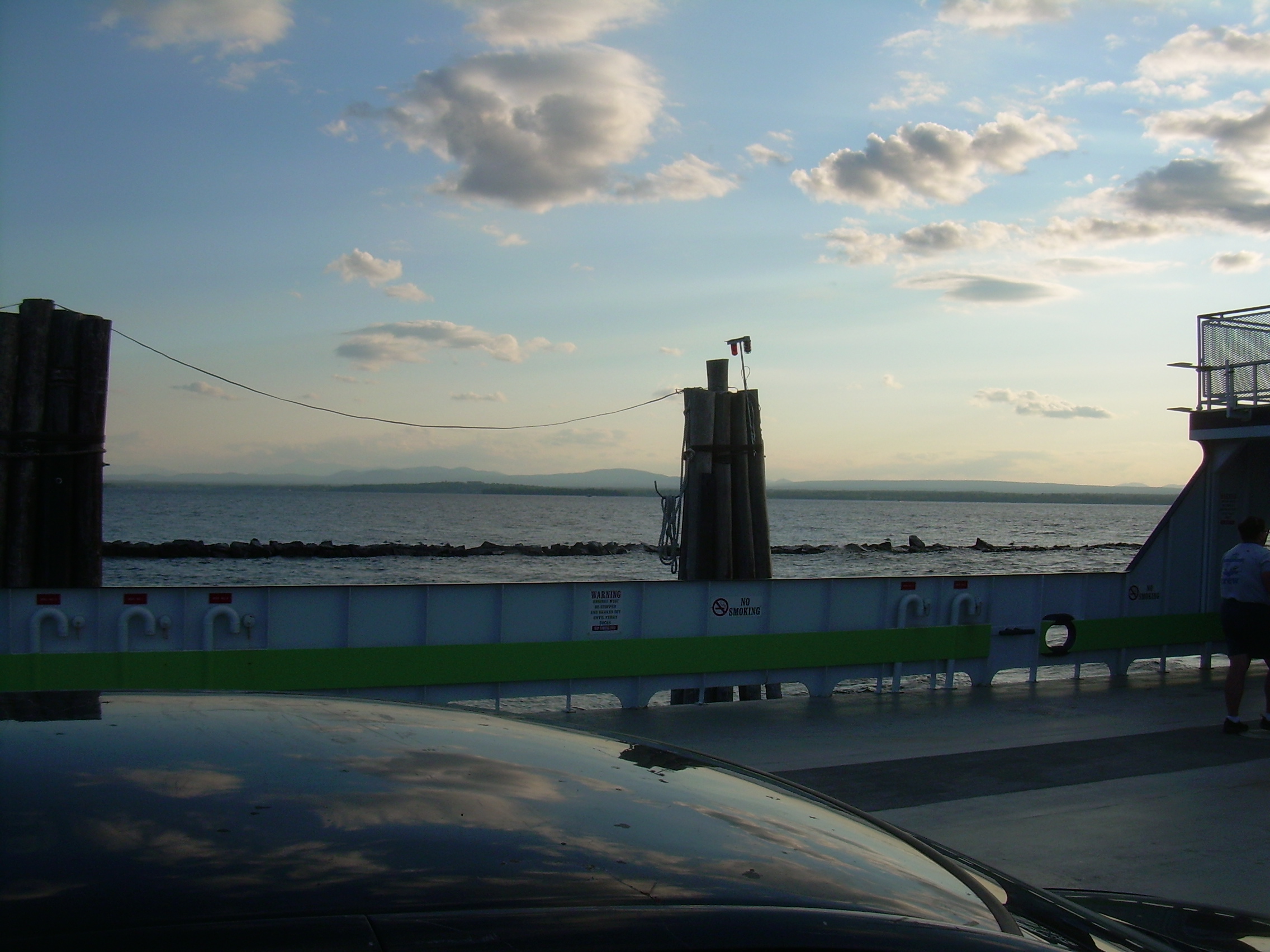
Then it is time to head east; Avalanche Pass, Keene Valley to Port Henry.
Here we crossed a narrows of Lake Champlain on a ferry boat into Vermont.
Past Middlebury and its college, Rutland, Killington, Woodstock and
home to Hanover.
TPS - Aug, 2010
| 
