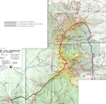
Map of Hike
|
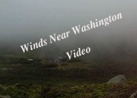
Wind Near Washington
Video (1 min)
|
Monday, August 23, 2010
Hanover, NH -
Pinkham Notch
Madison Springs Hut
We got out of the house at 8:30 in the morning and after a quick stop
at Lou's for muffins, coffee and hot chocolate, we headed north.
North through Lyme, Orford and Wentworth. We then continued
east past Moosilauke, through Woodstock and Lincoln and over the
Kancamagus Highway - the "Kanc" as it is often called. The
traffic in Conway was, as always, backed up. Finally we arrived
Pinkham notch, where we can see Mt. Washington's radio mast 4,266 ft
above us.
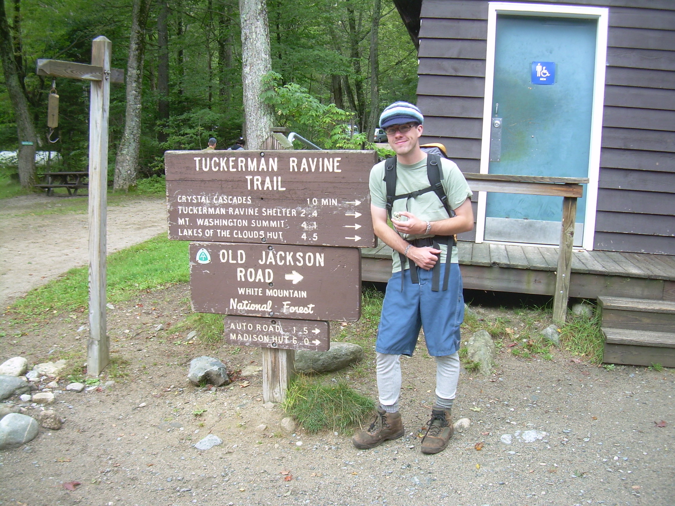
We went into the visitor's center and bought an updated map
and then shouldered our packs and got on the trail at noon. It was a
much later start then I had hoped for. It just seemed to take longer
to get here then it had aught to.
We set a good pace up the "Old Jackson Road" and reached the Auto
Road in under an hour (1.6 miles). It is misty and moist, but for
the first few hours we could occasionally see the peaks which
hem in the Great Gulf. It started drizzling at this
point, but the day is still warm. At the two hour mark we were well
into the "Great Gulf Wilderness" and so we stopped at a stream
crossing for a snack which turned into lunch. Pita Bread, cheese,
peanut butter, nuts and gorp. We got out our rain coats at this
point. The weather has settled down into a constant drizzle.
Will at the Trailhead |
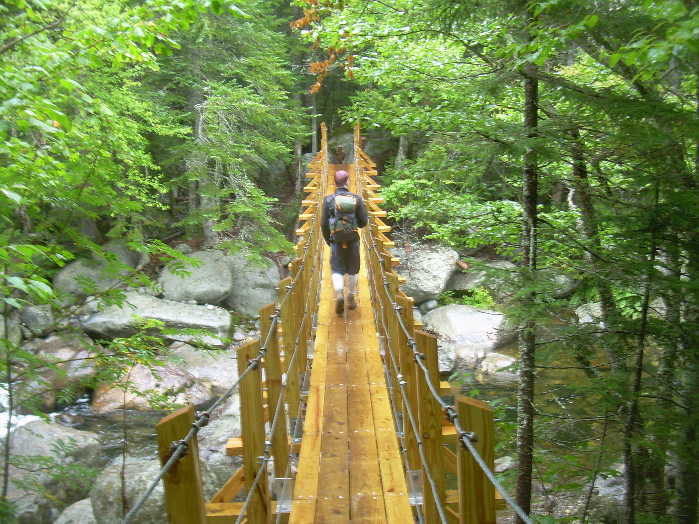
Crossing the Peabody River |
Climbing the Osgood Trail |
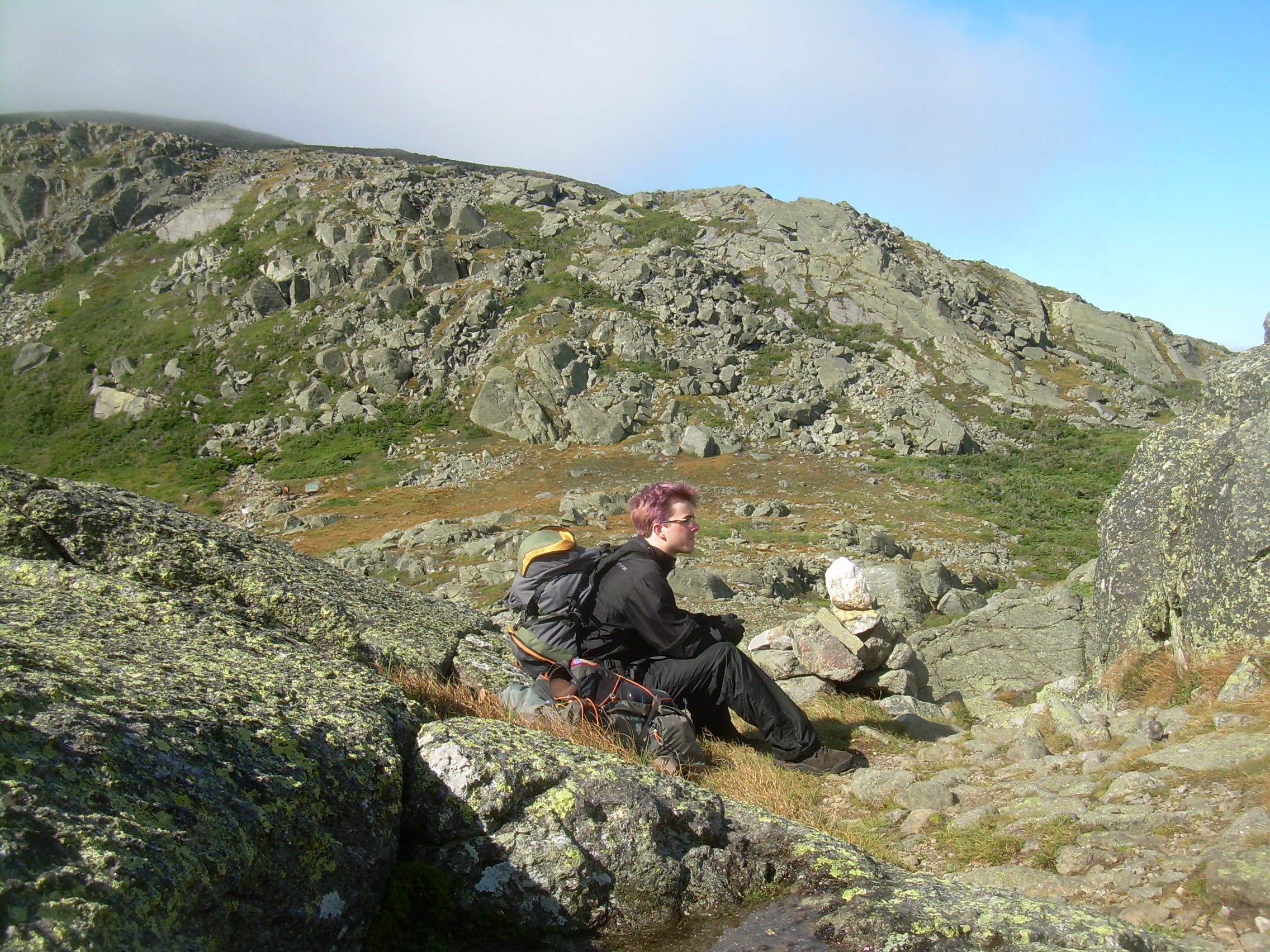
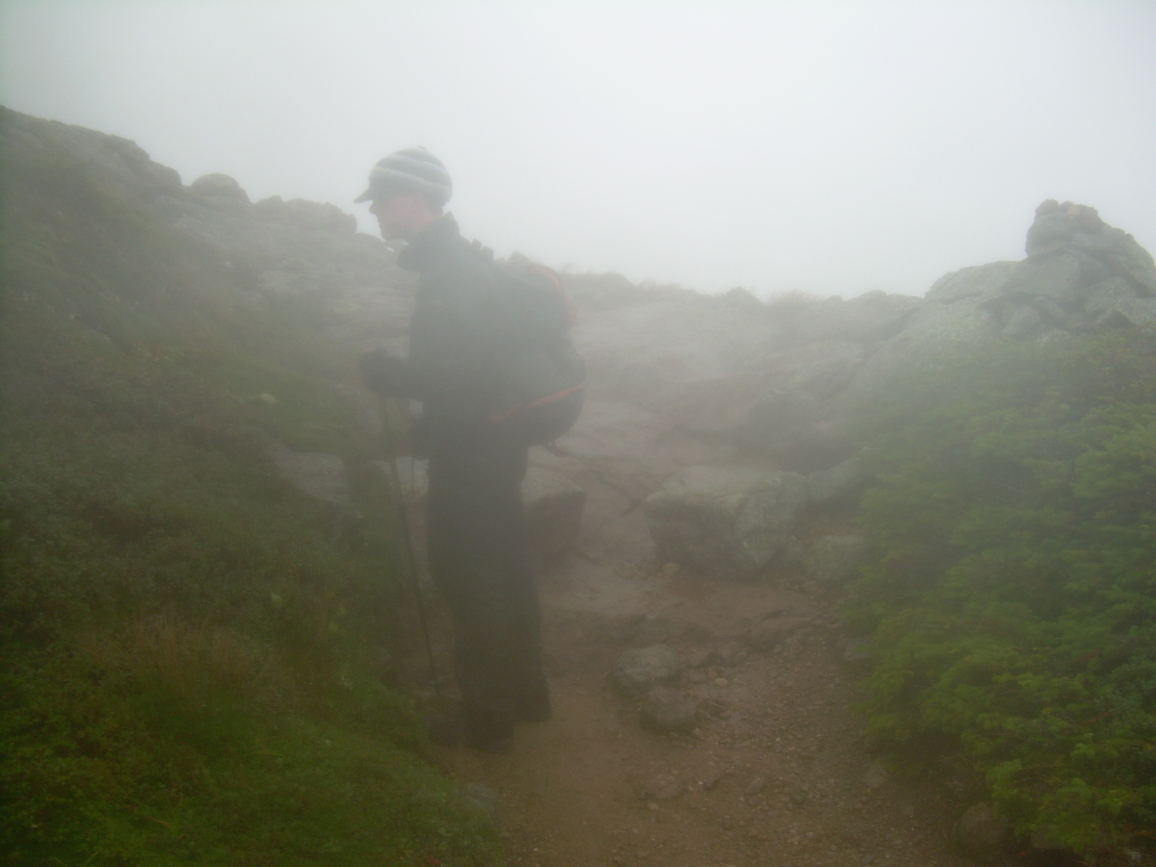
Will at Treeline |
On the shoulder of Madison |
Osgood Junction |
Tim on Madison |
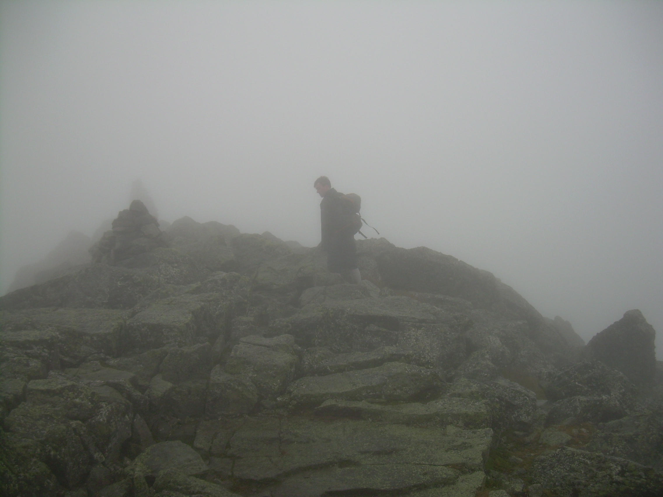
Will on the Summit of Madison |
As we walk we talk. Will explains to me many of the finer nuances
of Facebook, both the technology and the culture. We also talked
a lot about our writing projects. I think one thing I particularly
enjoy about hiking with both Will and Robin is that they share a
sense of pace with me. We tend to take few and short breaks and
move through the wilderness at an steady, respectable pace.
Eventually we reach the bottom of the Great Gulf and cross the
Peabody River On a suspension bridge. At this point we had a choice
to make. Our original plan was to follow the Osgood Trail up and
over Mt. Madison to the Madison Springs Hut, where we are spending
the night. But we are running late and we could take the more
direct Madison Gulf Trail. It would save us a bit over a mile of
hiking, and 700 ft of climbing, which means probably an hour.
It is now 2:30 and dinner is at 6:00. We choose the longer, Osgood
Trail, four miles and almost 3,000 ft of climbing. This will be
the major climb of the whole hike.
Even though it continues to drizzle the rain gear comes off, it
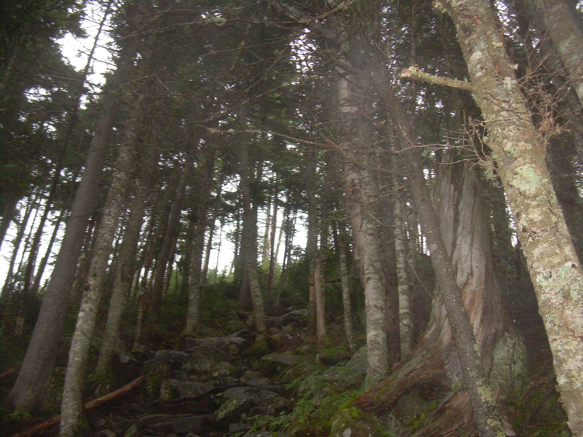
is a lot of work to climb and we are toasty. The Osgood trails
starts off deceptively easy, and then abruptly transforms into
a staircase up and up. An hour later we stopped for a three minute
break, chocolate bar and water. The trees are dripping with moss
here - something we rarely see in New Hampshire, and I expect an
indicator of the normal weather in the Great Gulf Wilderness.
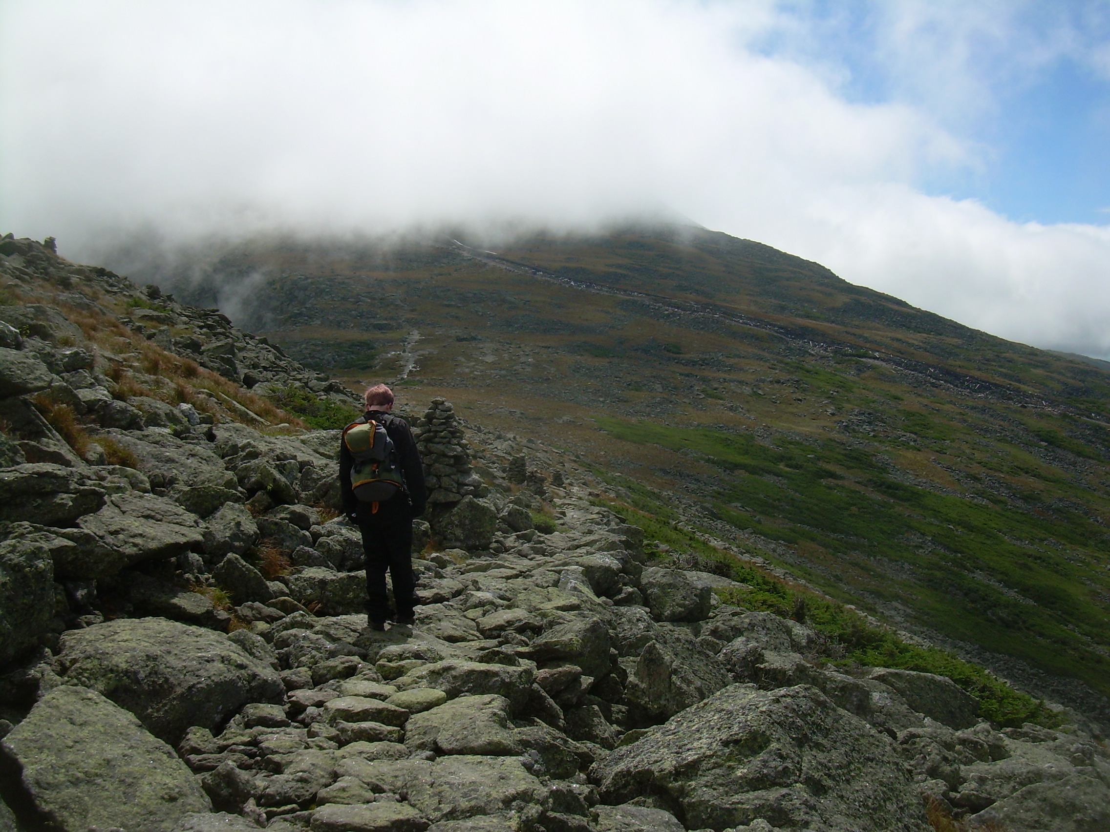
The trees start to thin and we think that we must be nearing the
treeline, but then the spruce and hemlock get tall again and we
have another half an hour of climbing.
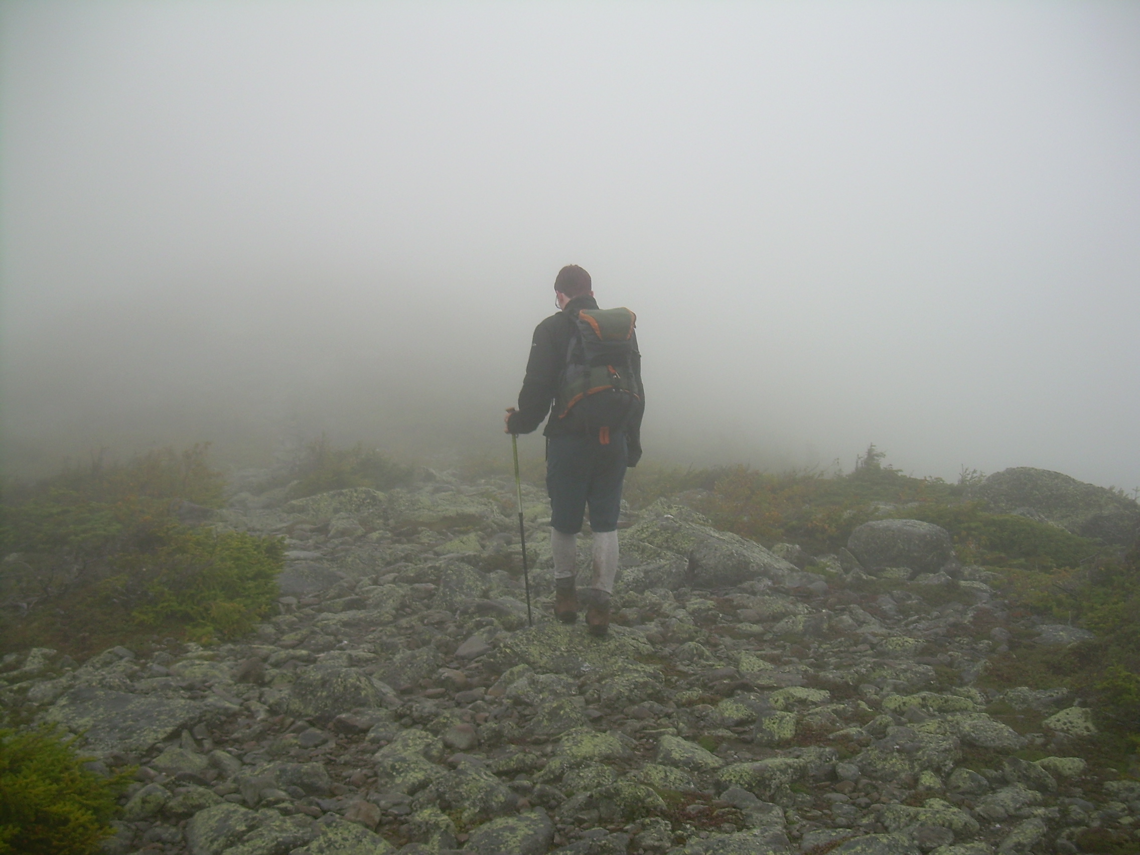
Just before finally breaking out above the tree line I hear some voices
off the side of the trail. There is a rabbits warren of side trails
here and some patches in the krummholz where people have camped in
desperation for years. This time they were occupied by a group
of Scouts from the Ukraine! Will and I stopped and talked with
some of the boys who were sitting by the trail. I could see and
hear some of the girls in there group - Scouts in most of the
world is coed. They told me that they had originally planned to
cross Madison today and camp on the other side, but had turned
back to the treeline due to the wind. We took this as a warning
of weather to come, donned our raincoats again and secured
hats. At times I wear my hood over my hat so I don't lose it.
Madison was lost in the fog.
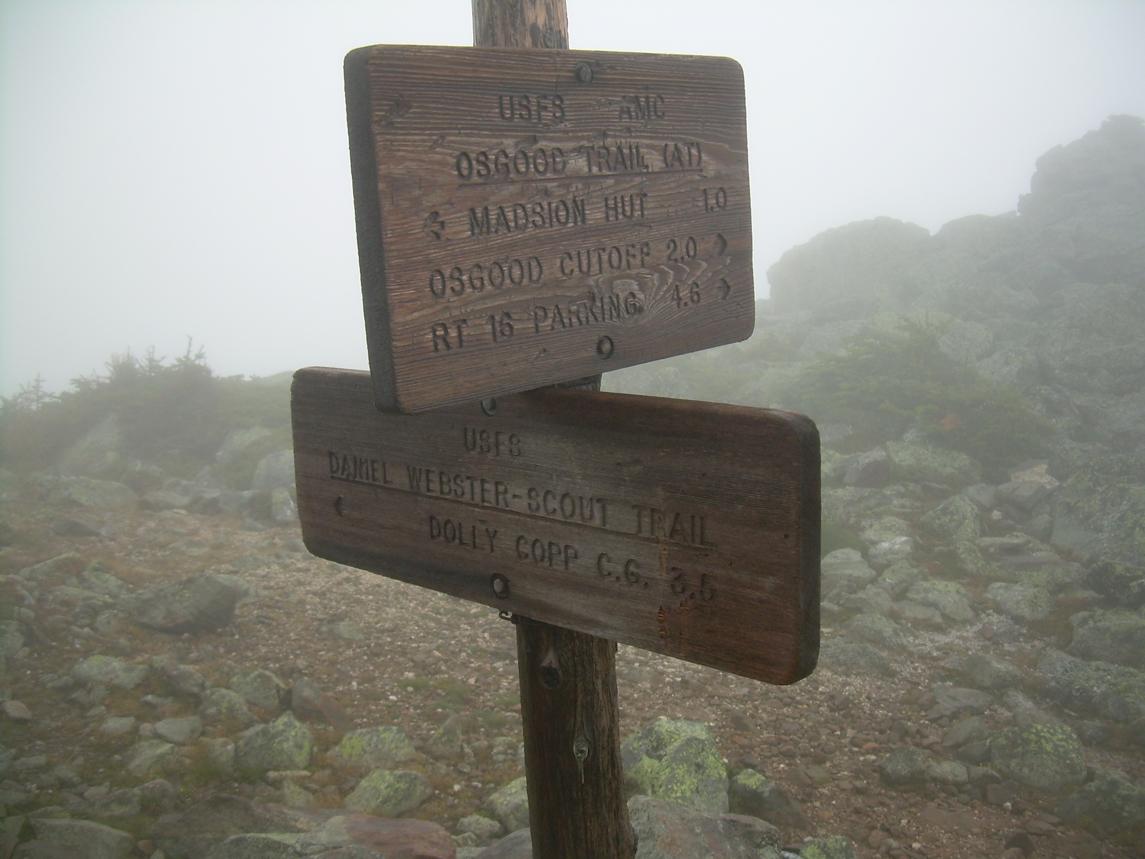
Just below the peak is "Osgood junction", where you can choose to
go over the peak, or pass below it on the Parapet trail, or you can
drop back to the valley via the Daniel Webster Scout Trail. I had
never heard of this trail before. Daniel Webster is the name of the
local council which covers New Hampshire. I have since learned that
this trail was build by eight scouts "of high rank" in 1933. The local
newspaper reported, "The U.S.F.S. has furnished the scouts with tents,
blankets, cots and food in return for the volunteer labor." What
an adventure for a summer!
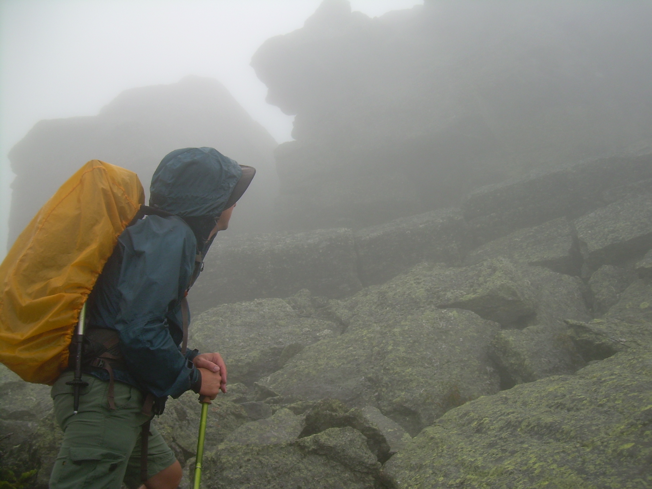
We pressed on to the summit of Madison at about 5:00. I love this
sort of place, thick with fog and a howling wind. I tell Will,
"It may not be scenic (we can only see about 30m), but it is
invigorating!" We only spend a few minutes on the peak itself, and
then pressed on to the hut.
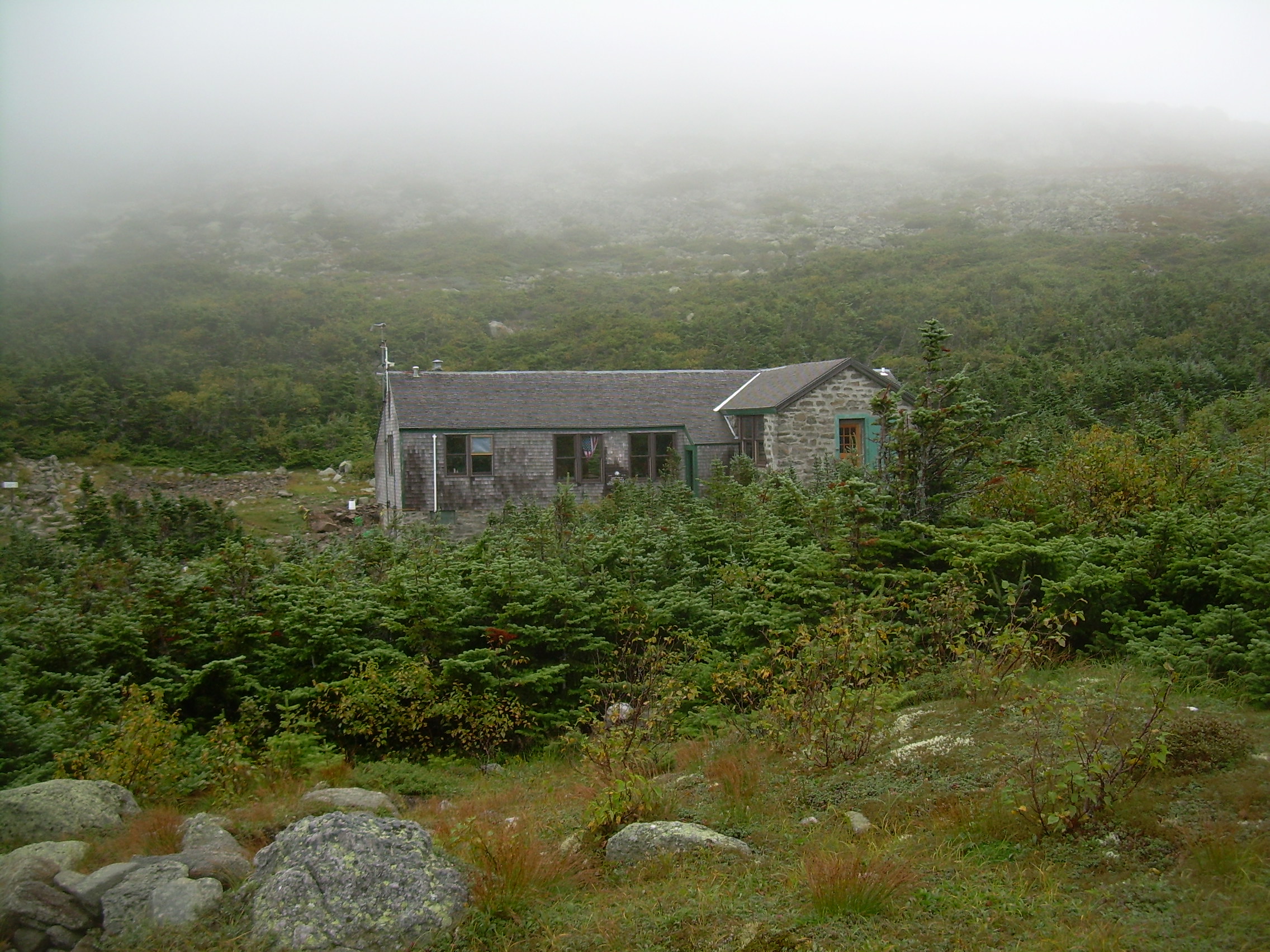
About twenty minutes later the hut appeared out of the mist. We
checked in and claimed bunks and wrapped ourselves around a mug of
hot tea while we waited for supper. The Madison Springs Hut is
half stone and half wood. The stone half is split into two bunk
rooms with a total of 52 bunks. The bunks go up three tiers,
nearly to the ceiling. I pick an upper one, and Will the one below
me. Each bunk is equipped with a pillow and three thick wool blankets.
Since there is no light in the bunk rooms we unpack and set out the
fleece bags we are carrying before it gets dark. We also remember
to grab our head lamps before heading to supper.
One of the reasons to stay in a hut is the community. The hut's crew
(or "croo" as they insist on spelling it) are usually young dynamic
people, often just out of college and not quite certain where they
are going -- but in love with hiking and lots of people. The guest
tend to be older hikers, like myself, with "more money then muscles",
as my father said a few years ago. Although there are a very few
families with young kids. One family has hiked up with an infant
and a toddler in their backpacks.
We eat dinner in a communal mode and the hut is full tonight so
every table is full. There are six to eight people at a table.
Dinner always includes soup, fresh baked bread, vegetable and tonight
a baked lasagna. We shared the table with two other pairs of hikers.
Across from us sat Kathleen and Kenneth, a brother an sister in their
mid-forties. She is from Philadelphia and he is from Washington DC.
Kathleen has often hiked in the Whites but only now convinced her
brother to join her. A bit of a sibling reunion.
The other pair we talked with were father and son from Ispwich,
England. The father is a solicitor in his mid fifties and the
son is a teacher, about thirty years old. Apparently they do a
week long hike every year. Last year's was in the Pyrenees in Spain.
This year's hike was suggested by the solicitor's secretary. They
had seen a sign proclaiming the "World's Worst Weather", and joked
that they would show the secretary a photo of that sign, "and then
sack her -- for a minute or two".
One of the crew members came over to our table and introduced herself.
She told us that she had done a senior thesis in archaeology on the
plague. The solicitor turned in astonishment and announced, "I have too!"
Apparently he had just finished an advance degree (masters or PhD)
on the economic effects of the plague. The croo member had spent a
semester in London and the solicitor knew some of her professors,
although his degree was from Cambridge.
We talked and talked for a long time into the evening. That seems to
be about the only thing to do. People slowly drifted off to the
bunk rooms. At 9:30 the croo turned off the lights, electricity is
scarce since it comes from solar cells and a wind turbine. I turned
on my head lamp and wrote in my journal. But I am ready for bed. The
night is getting cold and those three wool blankets look inviting.
The wind is rattling the windows, but I don't think it will keep
me awake. I headed to bed at 10:00.
Tuesday, August 24, 2010
Madison Springs Hut
- Mt. Washington
- Lakes of the Clouds Hut
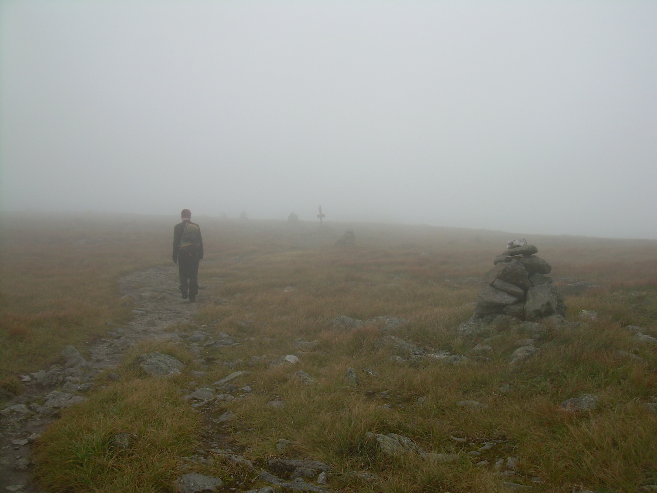
Madison Spring Hut |
Clouds in the Great Gulf |
From Thunderstorm Junction |
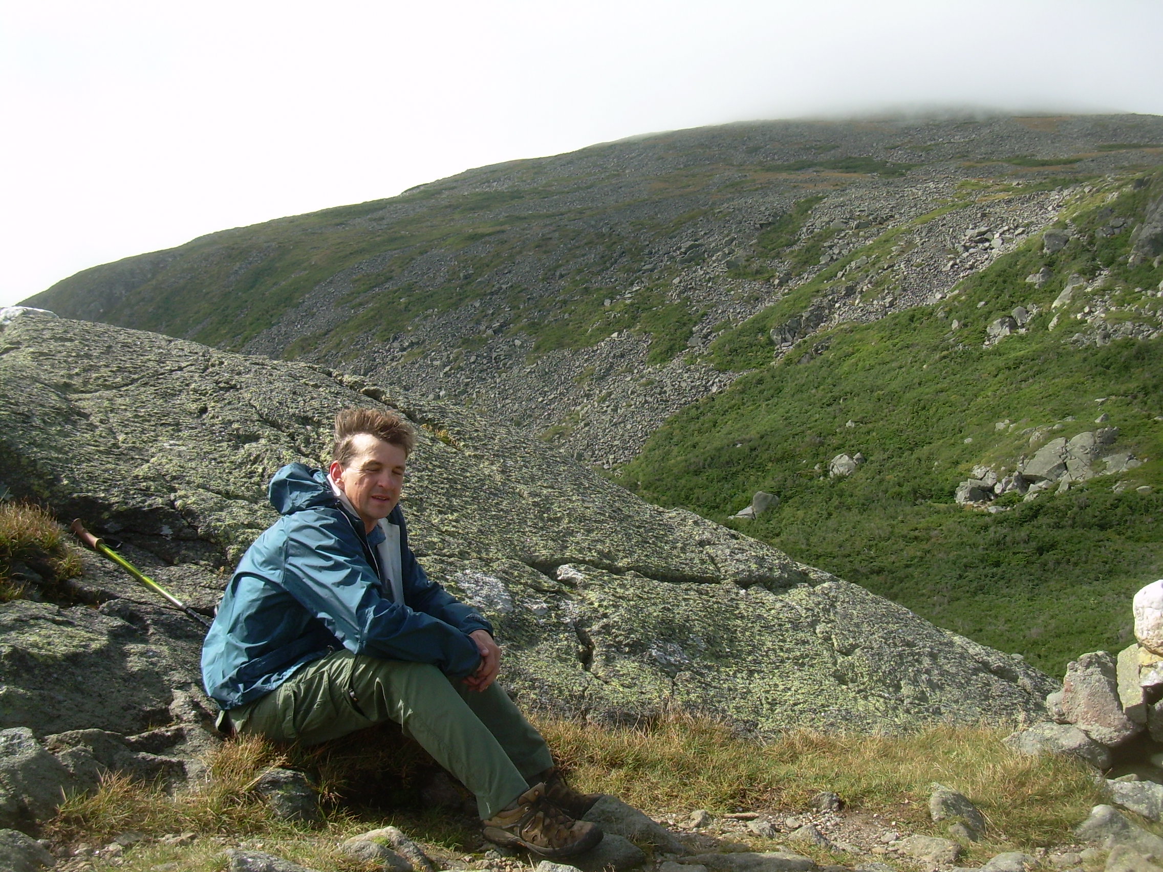
Will at Edmand's Col |
Tim at Edmand's Col |
Monticello's Lawn |
Down to Sphinx Col |
It took me a little while to drop off to sleep last night. When you
sleep in a room with over twenty other people it is a bit different
then your own bedroom. Someone was up for half and hour reading with
a very bright LED lamp. But eventually I dropped off.
I woke at first light, at about 5:30. My bunk is next to a big window
so I can see out. The mist is still there, swirling as it goes through
the pass, but it is not as thick as yesterday. I dozed off and on for
a little while, but then at 6:30 one of the hut croo came into the
bunk room and sang "Edelweiss". It was a sweet alarm clock.
Will and I folded our blankets (we knew the hut routines from our hike
on the Franconian Ridge last year) and packed ourselves up before 7:00
which is when breakfast is served.
Breakfast was canned pears, oatmeal, bacon, eggs, coffee cake (freshly
baked), coffee and hot chocolate. I know that we will easily burn all
of these calories today, but at the moment I feel about three pounds
too heavy. While getting ready to step out on trail the mist around
the hut breaks for a few moments and we can see the clouds trapped down
below us in the Great Gulf. The thermometer at the hut reads 43 F as
we shoulder our packs at 8:00 and step out.
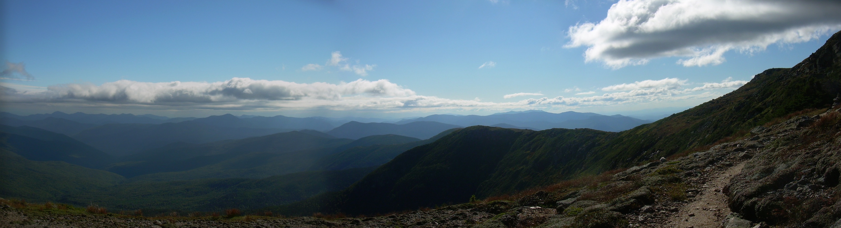
The presidential range extends as two long arm sticking out from
Mt. Washington. There is the southwest arm we will hike tomorrow, and
the the northern arm which curves to the east to embrace the Great Gulf.
The ridge from Mt. Madison to Mt. Clay stands about 5,000 ft in
elevation, that is about 3,000 ft above Pinkham notch. Along that
ridge stands three major peaks; Madison, Adams and Jefferson, as
well as a number of minor peaks; John Quincy Adams, Samual Adams and Clay.
But once you have reached the ridge line, all of these peaks are
only a few hundred feet more in elevation.
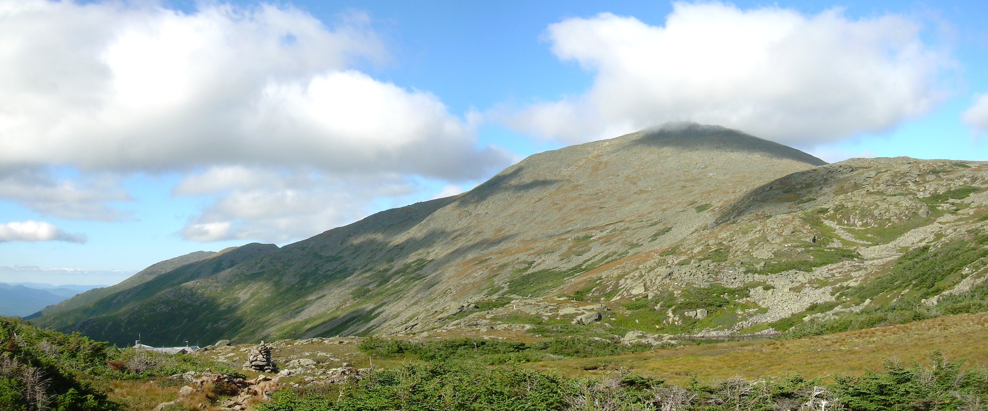
We left the Hut and circled to the north of Adams. The major trail
here is the "Gulfside Trail", which in fact doesn't cross any
peaks except Madison. The peaks are accessed with short side trails.
When we came to the first intersection, the summit of Adam was
some place south of us lost in the fog. We decided that it was
pointless to climb Adams just to say that we did it - but really
wouldn't be able to enjoy it. So we stuck to the Gulfside Trail.
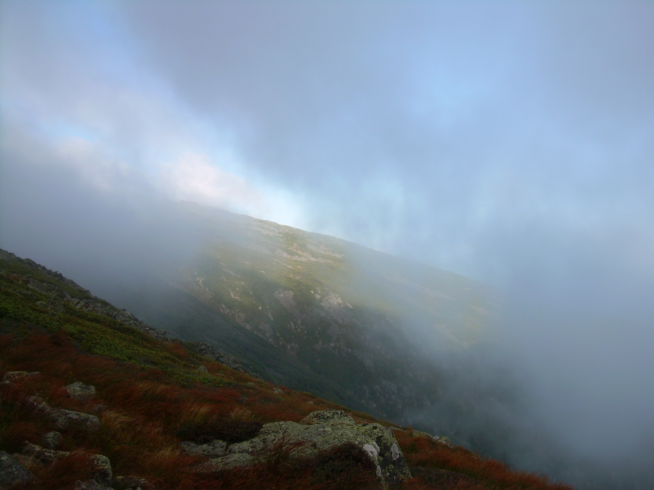
As we passed through Thunderstorm Junction the sun occasionally broke
through. From here we dropped about 500 feet, traverse the south
face of Sam Adams to Edmand's Col. The day is clearing and we can
look down into the Gulf below our feet. One of the delights of this
trek is that all day today we will be above treeline. This means that
we are constantly being buffeted by the wind, but exposure brings with
it a type of exhilaration as well.
We stop for a break in Edmand's Col. It is sunny, and if you hunker
down behind a rock to get out of the direct blast of wind you might
remember that it is a pleasant day in August. However if you stepped
out from shelter the wind could be frightening here. I tied my hat to
my pack. We watched clouds being sucked through the gap, racing on
over 100 m is 5-6 seconds, which means the winds are 30-40 mph.
Are coats are cracking in the wind, and a loose strap on a backpack
can snap like a whip.
While we stopped here we met a group of four guys who are determined
to hike the whole Presidential Range, including all major and minor
peaks, in one day. They started down in the valley at 2:00 this
morning, coming up the Osgood trail before dawn, undoubtedly by
headlamp. They passed us at the col and disappeared into the clouds
which engulfed the peak of Jefferson.
We also left the col and started climbing Jefferson, but when
the peak trail branched off we stayed with the Gulfside Trail
and skirted the peak to the east. Still we had come up several hundred
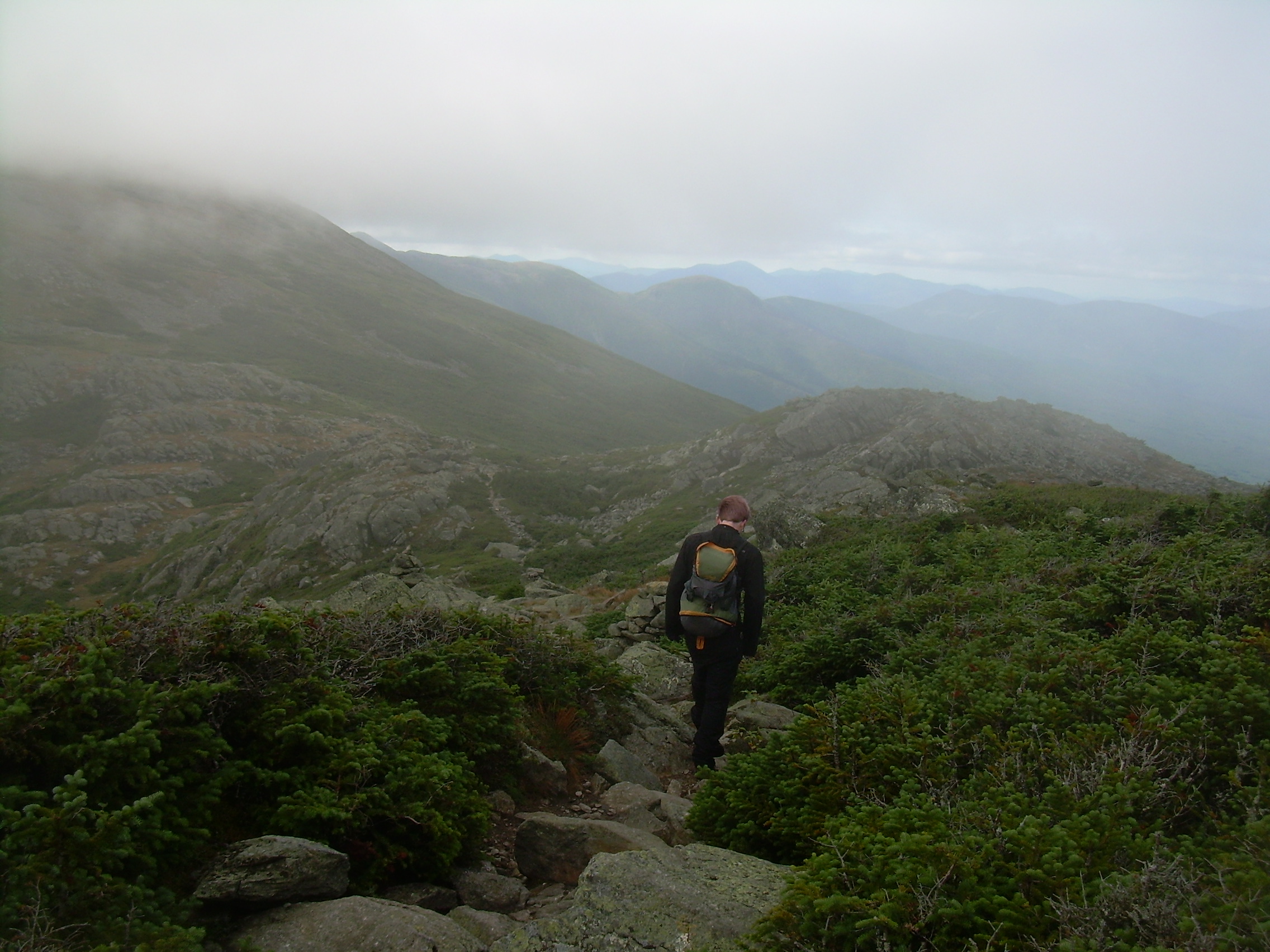
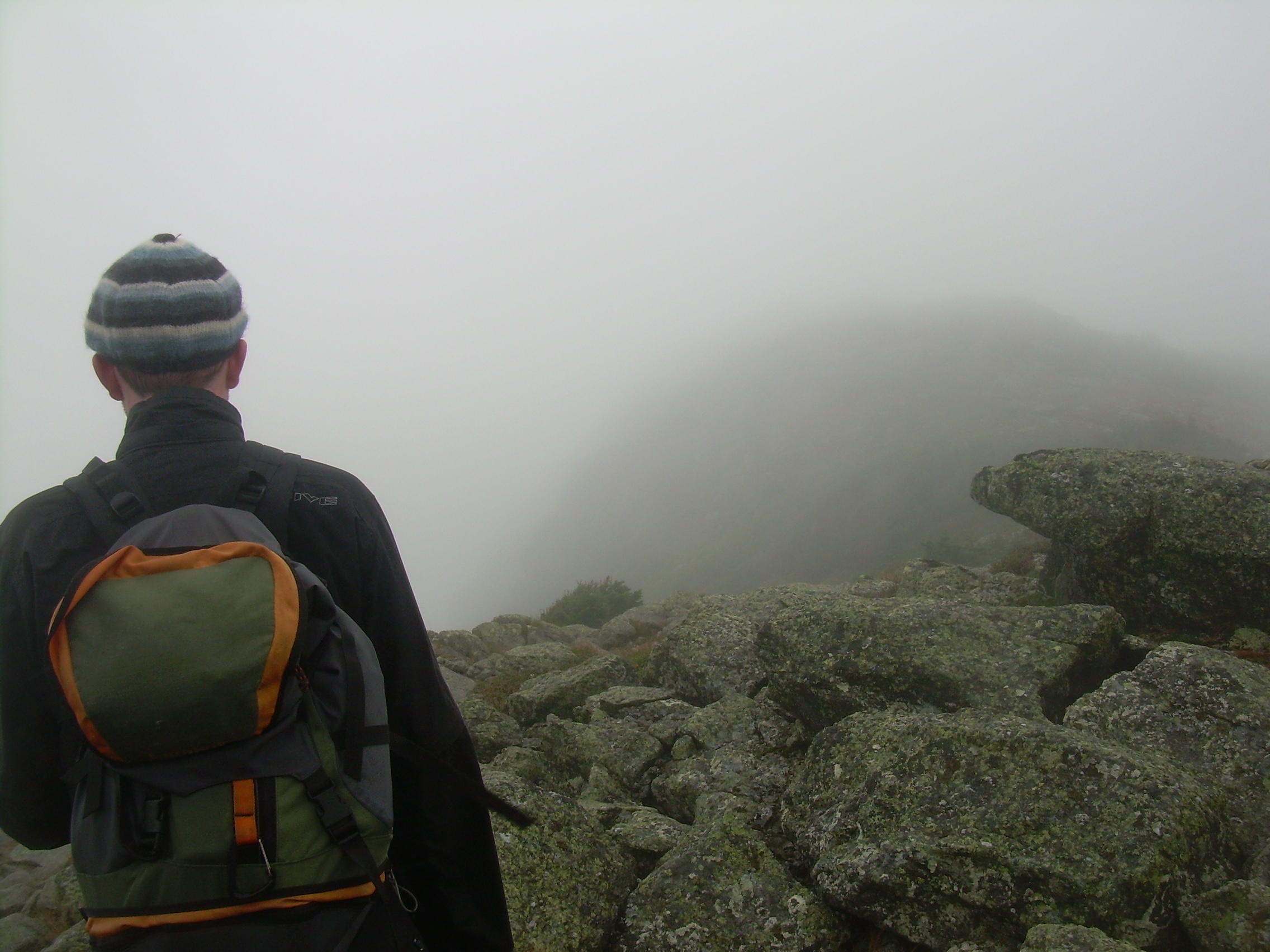
feet from our break and found Sphinx col thick with an eerie fog.
We could see no more then 50 meters here and this col is shallow, a
few hundred yards which were almost flat. This alpine tundra,
sometimes referred to as "Monticello's Lawn", almost has the
feeling of a moor. We followed the cairns across the land,
only able to see the next one or two. Occasional a rocky obelisk
would loom out of the mist -- and then disappear as we passed it. At
the Sphinx Col junction we meet a couple who were staying at Lake of the
Clouds and now just making a day trip to Jefferson. The four ridge
hikers also passed us here.
West from Sphinx Col. Mt. Clay on the left. Mt. Washington Hotel in the valley. |
Circling Mt. Clay |
Cog Railroad |
Cog Railroad |
On Top |
Again, when we reached the turn off for Mt. Clay we were embedded
in a cloud. So we decided to bypass this peak too. Clay is a
peak of some curiosity. First off, even though it is tall, standing
at 5,533 feet it is not listed in the 4,000 footers since is lacks
"prominence". You only need to drop about 150 ft before you can
start ascending a higher peak -- namely Mt. Washington itself.
Clay is also curious because although it is in the "Presidential"
range, Clay was not a president. He has an early nineteenth century
senator from Kentucky and later secretary of state, who earned the
nickname the "Great Compromiser". In 2003 the New Hampshire legislature
voted to change the name of the peak to Mt. Reagan. The US Board of
Geographic Names at that time said they would not consider the change
since Reagan was still alive. The issue came up again this spring.
When the board asked for public comments over 90% of the response was
against the change. In the end the board voted to not re-name the peak,
citing a reluctance to change names and no clear public support for
the new name.
So we hiked past Mt. Clay.
The day promised to clear a bit. Just before the intersection with the Jewell
Trail we could see and hear a group headed down that trail. They were
discussing Mt. Jefferson and so we called down to them to tell them they
had missed the Gulfside Trail.
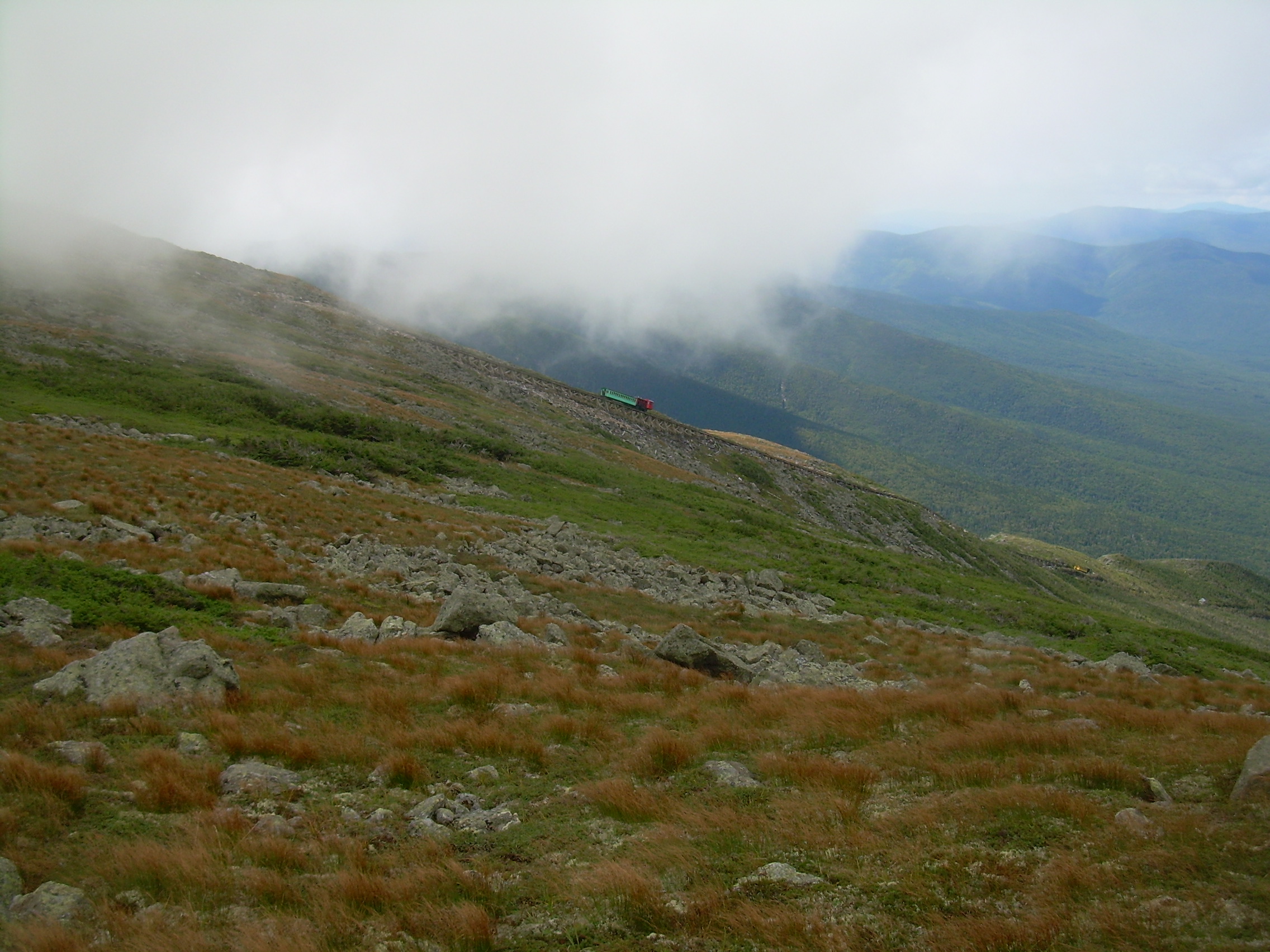
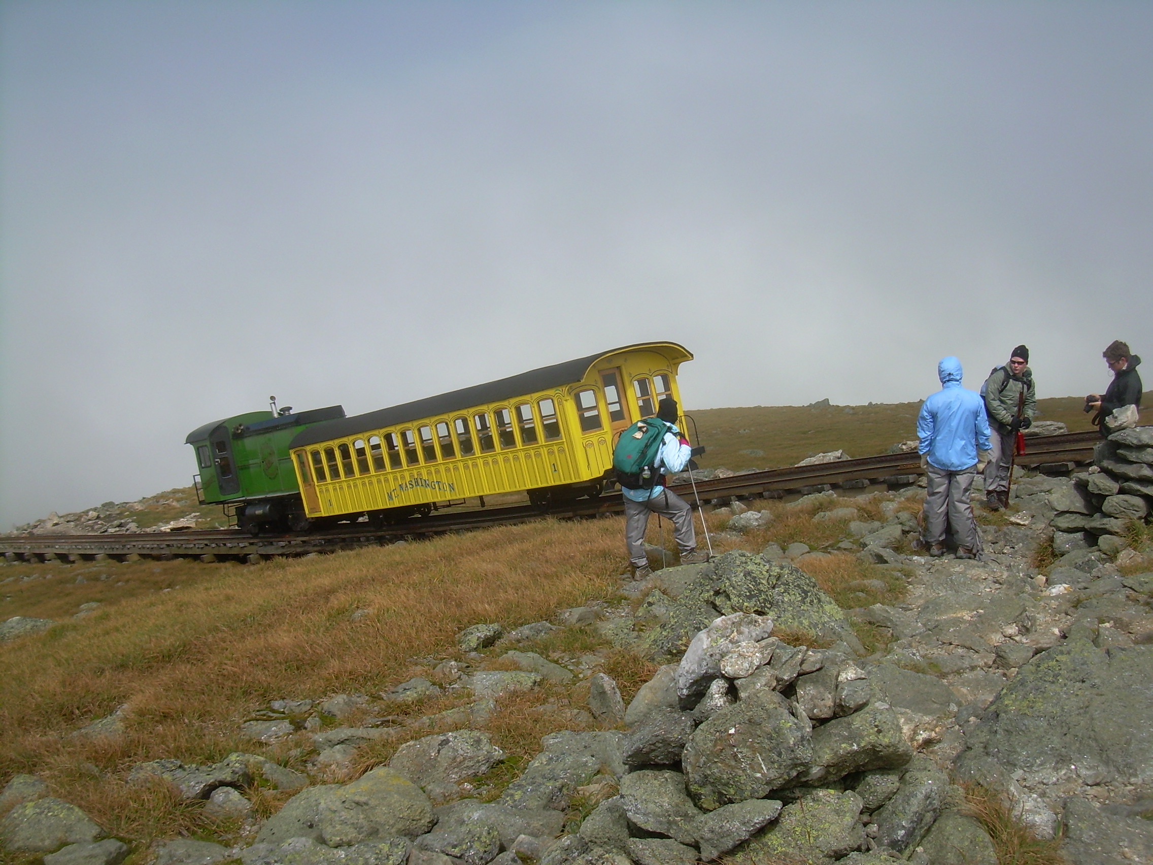
Beyond Clay we could occasionally catch a glimpse of the cog railroad,
and even when clouds blew in an obstructed over view we could hear it.
From here at the saddle south of Clay, to the peak of Mt. Washington, is
a climb up the last pyramid, the final spire. 1,000 feet over broken
stone to the top. The train ran by us every 20 minutes. I found pieces
of coal 100m from the rail-line -- pieces which must have blown off the
tender in high winds.
After laboring up for so long it is a shock to see a car driving across
the tundra. The famous Mt. Washington Auto Road snakes up a ridge from the
east, from Pinkham Notch. There has been an road up the mountain since
1861, from The Glen House, a grand hotel in Pinkham Notch, to the
Tip Top House on the summit. The cog railroad was build in 1869.
We followed the white blazes of the Appalachian Trail (AT), which is also
the Gulfside Trail here, up the the summit. It is a bit strange to
be the two guys with backpacks striding towards the final peak, in the
midst of a crowd of tourist most of whom came up in cars or on the railroad.
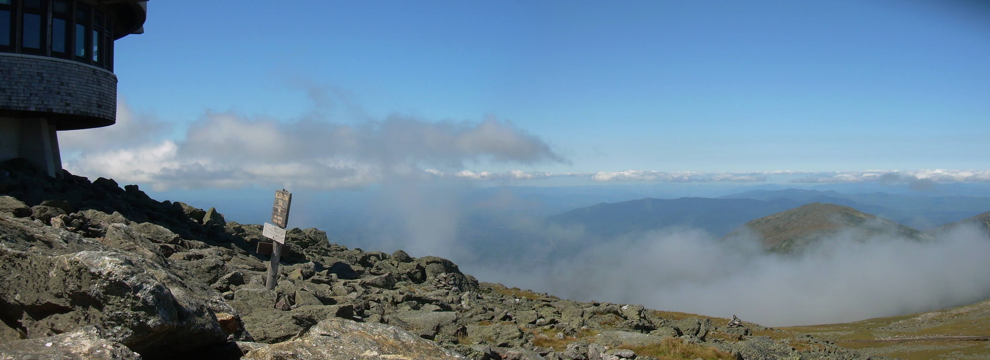
The summit itself has a visitors center run by the state park system
with a cafeteria and gift shop. The Tip Top House is still there, as
is the weather observatory and a number of building related to the
radio mast.
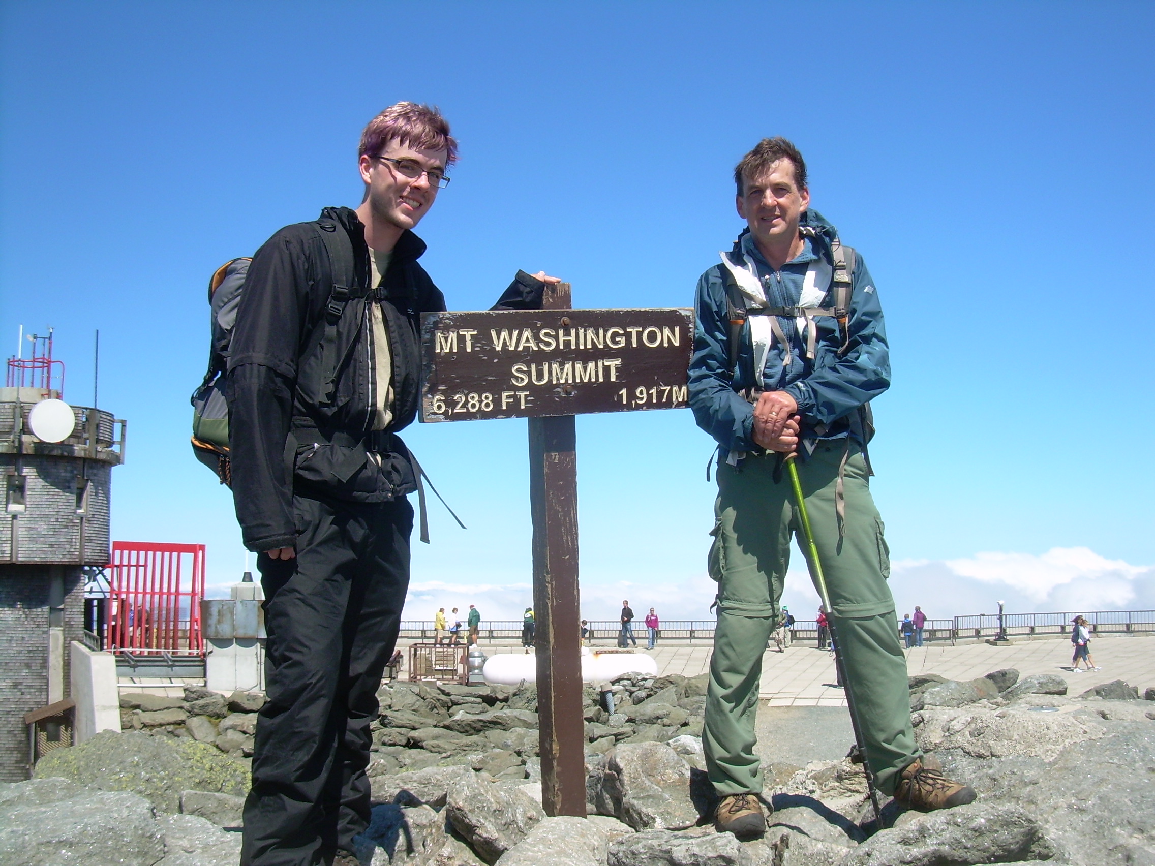
After stepping on top - 6,288 feet - 1,917 meters, Will and I availed
ourselves of the cafeteria, one can work up an appetite mountain climbing.
Stew, hot dogs, pizza and chili, and then the lunch we packed up with us.
When I signed the hiker's logbook there was a woman who saw that we
were headed onto the Lakes of the Clouds hut and asked if she could
hike with us. She was going to hike with a friend who had canceled
out at the last moment, so she had come up the van on the auto road
by herself. I told her that Will and I would first spend an hour
at the top before hiking on, but then we would look for her.
Tim looking east towards
Pinkham Notch |
Lakes of the Clouds
from Washington Summit |
Sitting by the Lakes |
Lakes of the Clouds Hut |
Sunset from the
Common/Dinning Room |
North from the summit of Mt. Washington - Mt. Clay |
The sun was out and there was a sea of clouds below us - especially
in the Great Gulf. We again met the four guys who are trying to
do the whole range today. I asked them about the "view" from Clay.
They told me that they could see each other very well -- and that we
had not missed anything scenic.
We found two Adirondack chairs outside the visitors center in the sun
and out of the wind. It was a delight to sit there for awhile with
my boots off - letting my feet and socks dry out.
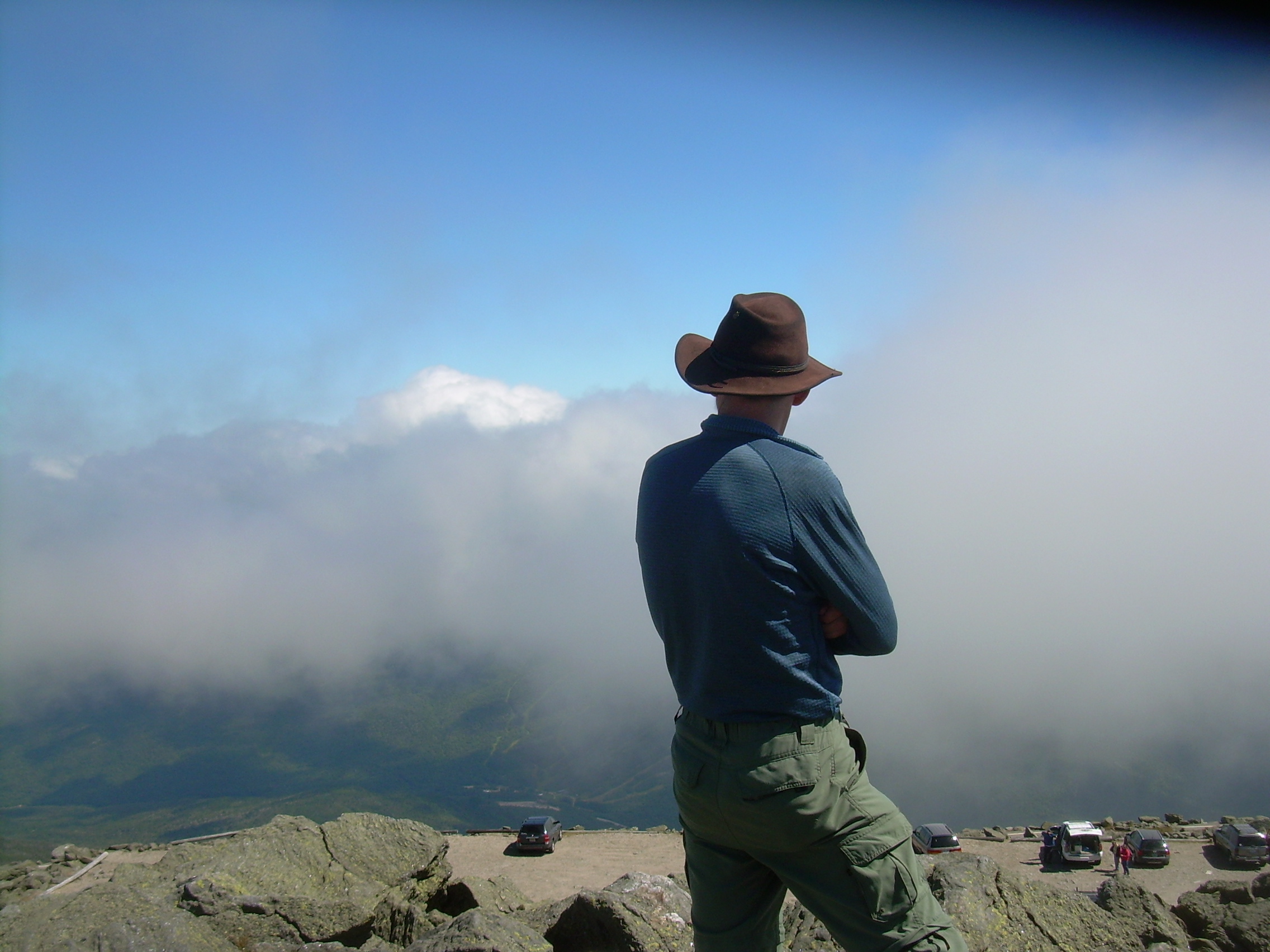
At about 2:00 we left the summit. As soon as you past the radio mast
on the south edge of the peak you can see the trail clear all the way
to the Lakes in the Clouds and the Hut. We didn't find the woman who
had asked to hike with us. But the trail was so clear I was not
worried about her. (We met her later at the hut).
The hike was downhill and easy. The day was clear and beautiful.
Here we continued on the Appalachian Trail, but it locally is called
the Crawford Path. Crawford Notch is where we will end tomorrow.
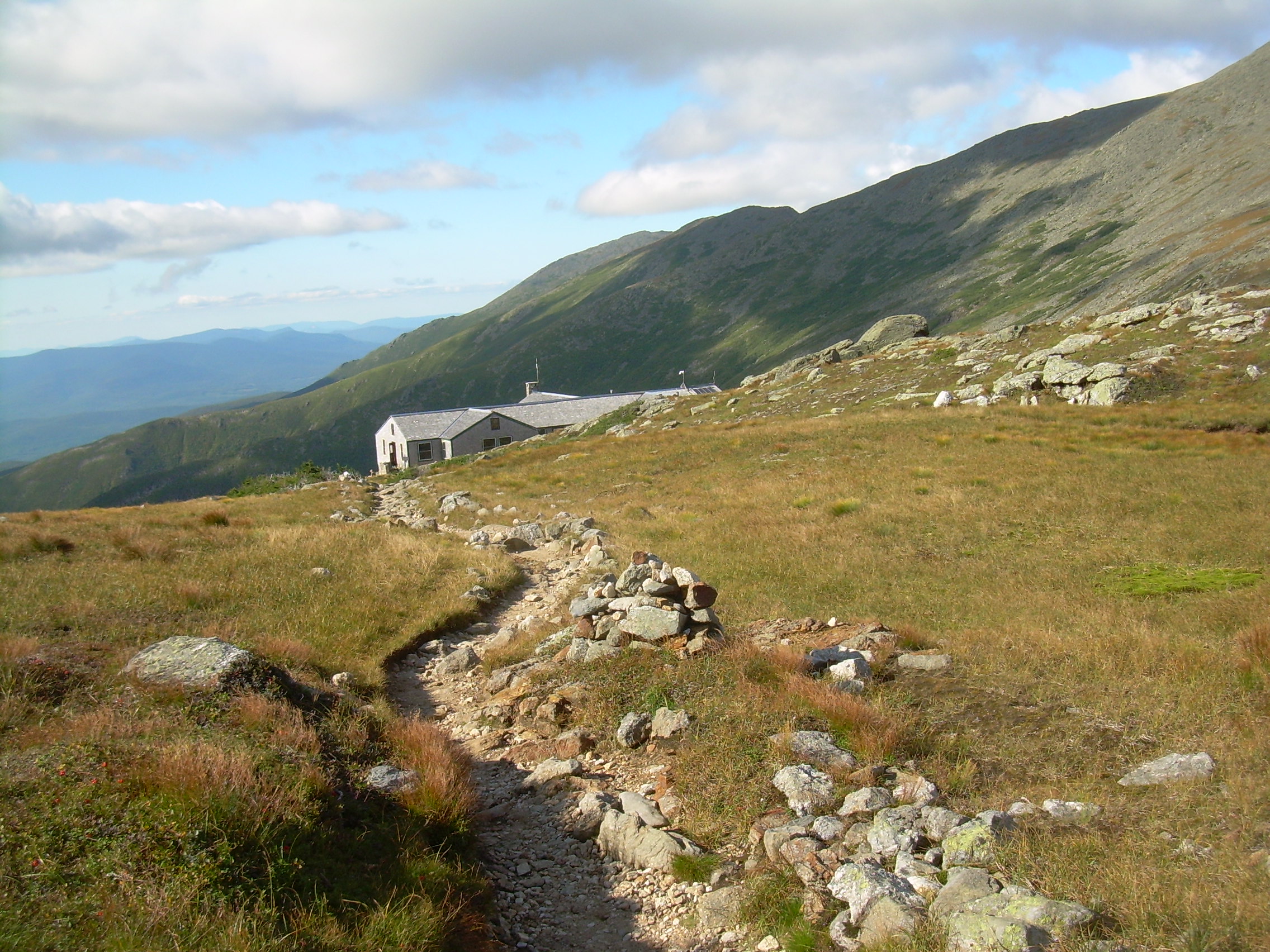
In less then an hour we have arrived at the hut.
This is by far the largest hut the the AMC system. Since it is only
one and a half miles from the summit of Washington a number of people go up
the railroad then hike to here, and then the next day hike 3-4 miles
to the railhead. Another popular day trip is to drive up Washington
and then hike to this hut for lunch and then back to the summit.
In any case the hut was busy, and so after we checked in and dropped
our bags I was happy to escape for a bit. We walked back to the
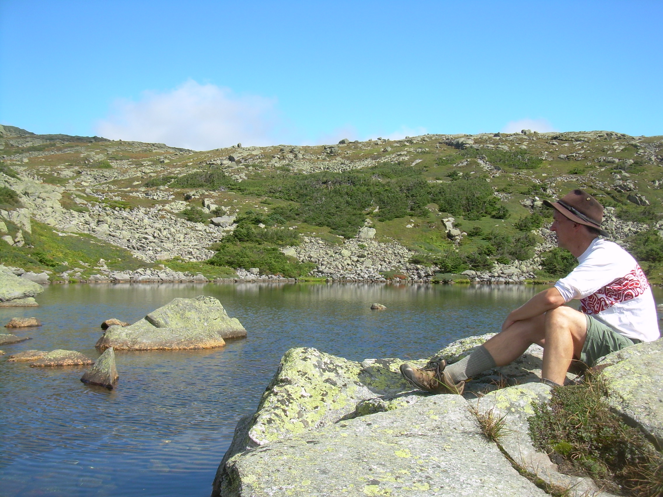
"Lakes", which are really no more then ponds maybe 30 m across,
and soaked our feet, knees and ankles for awhile. It was only three
o'clock, so while Will sat in the sunshine and read I walked south
on our trail for half a mile. It is a delight to lay down in the
on the tundra next to the trail, listen to wind in the grass and
gaze out across the mountains. Hawks were circling overhead.
When I returned to the hut I found Will trying to understand
multi-variable calculus. One thing about Will is that it is hard to
know what will grab his interest next. We sat in the dining room
writing equations and drawing sketches of functions and surfaces in
Will's notebook until supper.
Mt. Washington from near Lakes of the Clouds |
Near Lakes of the Clouds - looking south. |
At supper time the size of the hut became apparent as nearly 90 of us
sat at eight tables. The croo brought out tons of food, which had
been hauled in on the backs of croo members. For the staff, the
disadvantage of being close to the summit is the number of people,
the advantage is that food comes downhill only 1.5 miles.
Pea soup, anadama bread, salad, corn and baked pasta. Coffee and
chocolate cake for dessert.
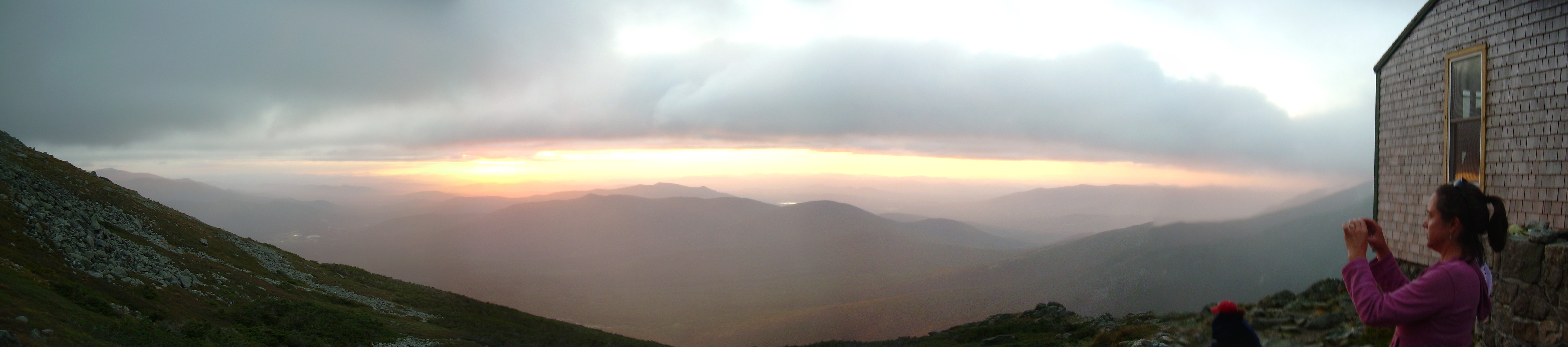
We sat across the table from a couple from Sunapee. He was a banker.
When he found out I was a physicist he had a thousand questions to
ask. So I never learned very much about him. We talked until sunset
which was spectacular! The windows of the dining room face west-northwest
and we could see the sun going down over the peaks of Vermont.
Stow? Mansfield?
Will and I continued to talk about calculus for a while. The croo
warned us that lights would go off a bit early since their wind turbine
was not working properly. By the time I had caught my journal
up to date I was ready for bed.
Sunset from Lakes of the Clouds |
Wednesday, Aug 25, 2010
Lakes of the Clouds Hut -
Crawford Notch -
AMC Highland Center
Will on Crawford Path
near Mt. Monreo |
Near Mt. Eisenhower |
AMC Highland Center |
When Will came into the bunk room last night he announced "I got it",
referring to a multi-variable calculus problem we had been discussing.
I asked him to explain it to me in the morning.
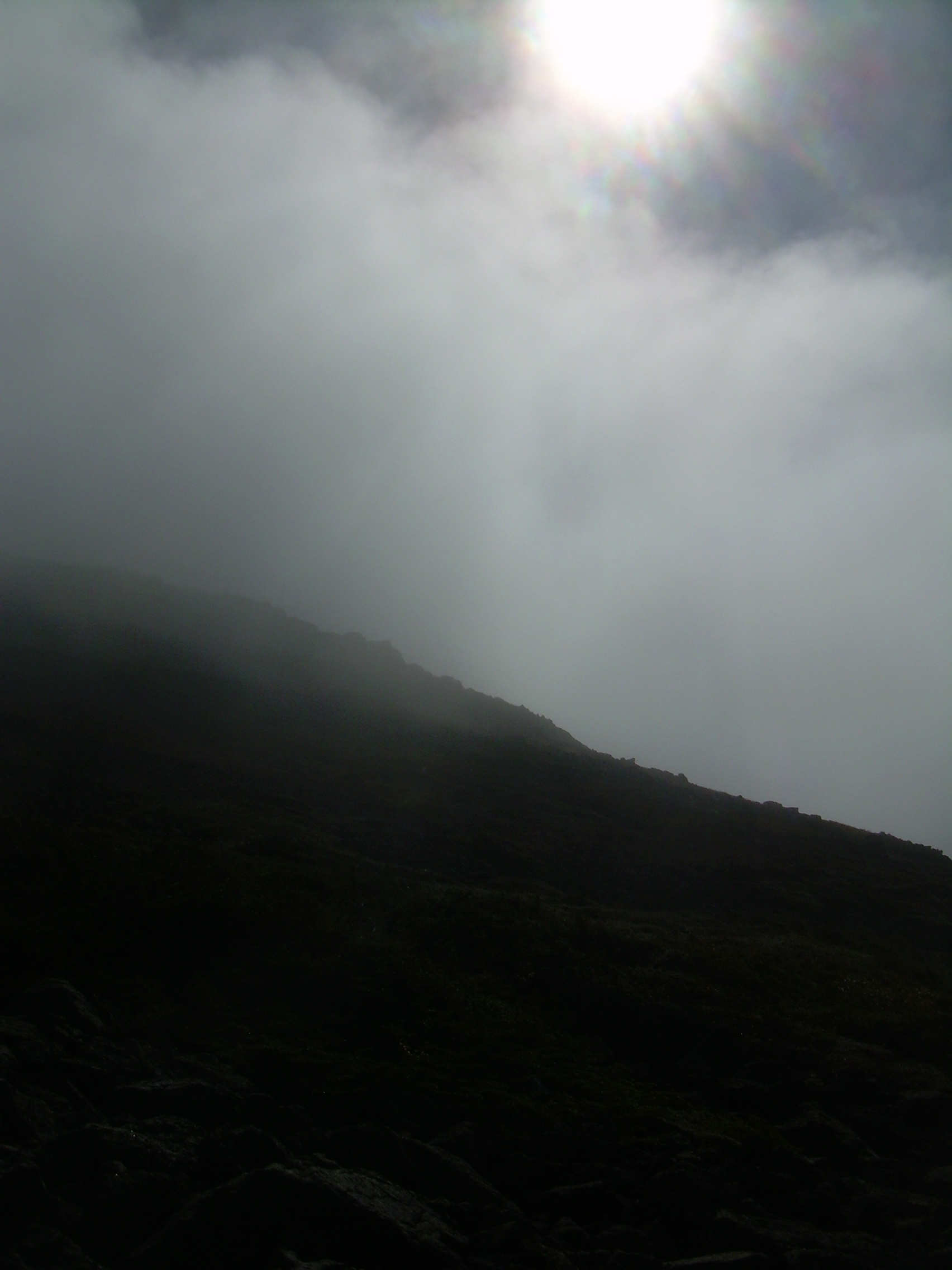
Through the night I could hear that the wind was on the rise and the
hut was creaking and groaning. I awoke occasionally, when people went
off to the toilet, or the snoring changed. But it was warmer then at
Madison, and there were only fifteen of us in this room. I slept until
a bit after six. When I opened my eyes it was a deep gray outside the
window. I lay there until the promised musical wake-up call. At
6:30 the Hut Master came down the hall playing her harp. It was
very pleasant.
I rolled out of bed, dressed, folded my blankets and went out xto the
great room. The hut is in the midst of a cloud. Whereas last night
we could look out the windows of the dining area and see Vermont,
this morning we could see about 50 meters. The room started filling
up with people, there are about 90 of us, and the staff needed
to shoo us to the sides so that they could get to the tables and set
them up for breakfast.
Over on the wall there is a "weather station". Outside the temperature
is about 48-deg F, and the winds are about 48 mph. That makes it a
9 of the Beaufort scale, a "Strong Gale". I could also hear the sound
of the wind turbine mounted on the roof. If the winds gusted up to
fifty the turbine would hit a resonance and change from a whirr to
a high pitched buzz.
Finally the croo called us to breakfast. Oatmeal, canned peaches,
raisins, hot chocolate, coffee, bacon and pancakes. We devour it all
in anticipation of many miles, but I will confess that the pancakes
are a bit dense. There is a great deal of hubbub and concern over the
weather. A number of people are afraid that they will be told they
can not climb to the peak of Washington where they had planned to
meet a van or the train. I find it curious that people are more
concerned about being told they can not climb then they are about the
weather itself.
I personally was happy to be away from the crowd. Will and I
shouldered our packs at about 7:50 and stepped out into the gale.
45 degrees, 45 mph and visibility -- 45 meters, maybe not even.
The hut is located in a col between Washington and Mt. Monroe.
The wind is coming out of the south east and it is funneled through
here with a great deal of ferocity. I think that most people
found it frightening. We met a number of people at the Highland
Center in the evening who had come down for the same hut as us, but
we were the only ones to take the Crawford Path. Everyone else
went down the Ammonoosuc Ravine Trail, which drops straight north
from the ridge line. On that trail the treeline is about a third of
a mile from the hut.
We circled Mt. Monroe. There would be no view from the top -- and I am
not certain that I want to be climbing a knife edge peak in this
wind. There is a long open alpine tundra from Monroe to Eisenhower.
This gale is so exhilarating! We need to constantly lean into the
wind, and I find that my trekking pole is a handy stabilizer. I am
wearing my black hat and would have lost it long ago if I didn't
also have the hood of my rain pulled over my hat and the draw
strings cinched.
Sometimes we drop into notches in the ridgeline and the wind can
be particularly furious here. It is blowing from the southeast
(left) to the northwest (right). I have my trekking pole in
my right hand and occasionally a gust will bump me up against
my pole. Will is using the other trekking pole and we actually make
good time pushing into the wind across the ridgeline.
We also circle around the base of Eisenhower. It is here that we
meet our first hiker of the day and so we reason that we must be
about half way between Lake of the Clouds and Mizpah Spring Hut.
Mt. Eisenhower is a mountain which was renamed. Until 1972 is
was called Mt. Pleasant. I would love to see it, and climb it in
clear weather. As we pass below the peak we are back in trees
briefly. These are the first trees, or krummholz, since we climbed
up the Osgood trail on Madison.
The wind has been abating over the last hour and it is being replaced
with rain. I had originally hoped to spend a leisurely morning and
early afternoon on this ridge. But it is just not the sort of day
which invites you to skip through an alpine meadow, examining
distant peaks and alpine flowers. It is a day to enjoy the ruggedness
of the peaks, stimulating weather, and to keep warm by pressing on.
There is a short opening beyond Eisenhower and then we are in the
krummholz again. We are meeting more and more hikers, the wind
continues but is waning and the rain is growing harder. Just
before Mt. Pierce the trail splits. The Appalachian Trail
continues on the ridge over Pierce and on to the Mizpah Springs Hut.
The Crawford Path bears off to the west and starts to descent into
Crawford Notch. We are headed to the notch.
Down below the treeline we stop for a break. We have hiked five
miles in two and a half hours, essentially without a pause. I
enjoy hiking with Will, he reads the day, the terrain and the pace
just the same way I do. The trail gets steeper, but never
as steep as the Osgood Trail. Soon we find ourselves rock hopping and
then paralleling Gibb's Brook. The water splashes and dances next
to us, even as the rain continues to splashes and dances on our hats
and hoods. And then -- with little warning -- we break out of the
trees and onto the road.
Across the highway is the Appalachian Mountain Club Highland Center
and to us trails end.
I think we were both happy to be hiking and happy too to be finished.
Epilogue
Wednesday, Aug 25, 2010 -Thursday, Aug 26, 2010
AMC Highland Center
Will & Kristina at
AMC Highland Center |
AMC Highland Center |
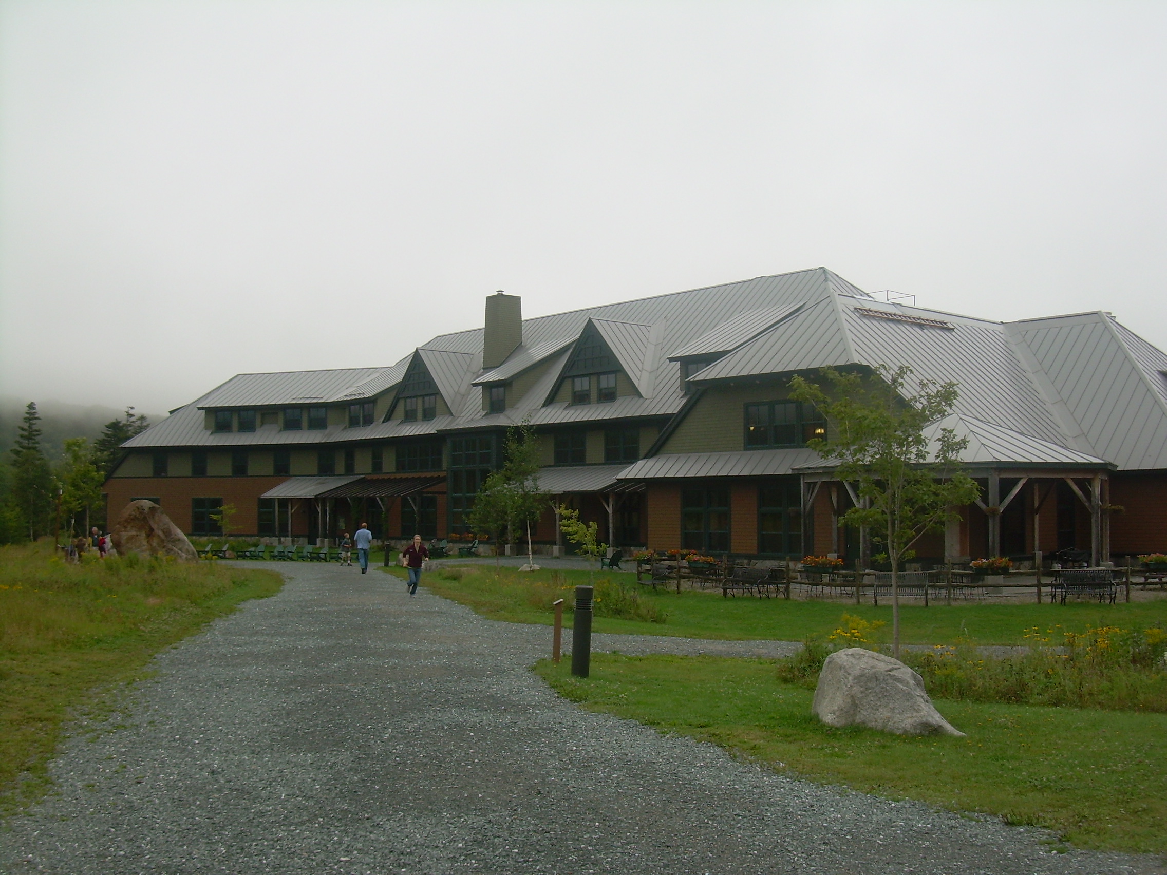
We were very wet when we arrived at the Highland Center, and although
this would appear to be a very nice lodge, they are use to wet, dripping,
muddy and smelly hikers. It was almost noon, so we had chili for
lunch and hung out in the lobby because our room was not yet ready.
At 2:00 we checked into our room (four bunk beds for the three of us) and then
at 3:30 I caught the shuttle to Pinkham Notch to retrieve our car.
The woman who had asked to hike from Washington to Lakes of the Clouds
with us was on the bus. I was happy to see that this retired substitute
teacher from Gorham was accounted for.
Kristina arrived at 5:30 and we dined at 6:00. Supper is similar
to the huts in that you eat at communal tables. A family from
New Jersey sat across the table from us, the two brothers hiking
together while the parents stayed close to the Highland Center.
At the end of the table two retired men discussed the hikes they had
made in the last few days. One of them had been an airline pilot, the
other an elementary school teacher who had also been a smoke jumper.
Kristina and I strolled around the grounds in the twilight and early
evening. The rain had stopped.
In the morning, breakfast and then back to Hanover.
Of course the point of this trip was to spend time with Will. Much
as I enjoy his friends, I was privileged to have him to myself for
three days. And then there was the hike. When it was clear it was
spectacular, but I didn't resent the wind or the rain, the cloud or
fog for one moment. They made this alpine world the special environment
which it is. And they are invigorating and stimulating.
The surprise were the people on the trail. The scouts from Ukraine, the
brother and sister in Madison Springs, the father and son from Ipswich
England, the four guys hiking the whole ridge. The non-hikers at the
summit, the woman who had lost her party. The banker from Sunapee, the
family from New Jersey, the airplane pilot and the smoke jumper.
And then (of course) Kristina.
A most enjoyable Alpine Amble.
TPS - Aug, 2010
| 