|
Clark Pond Project
| ||||||||||||||||||||||||||||||||||||||||||||||||
You can also read part of the 1968 DOC trail guide by clicking on it. I traversed the trail on four separate outings between October and February.
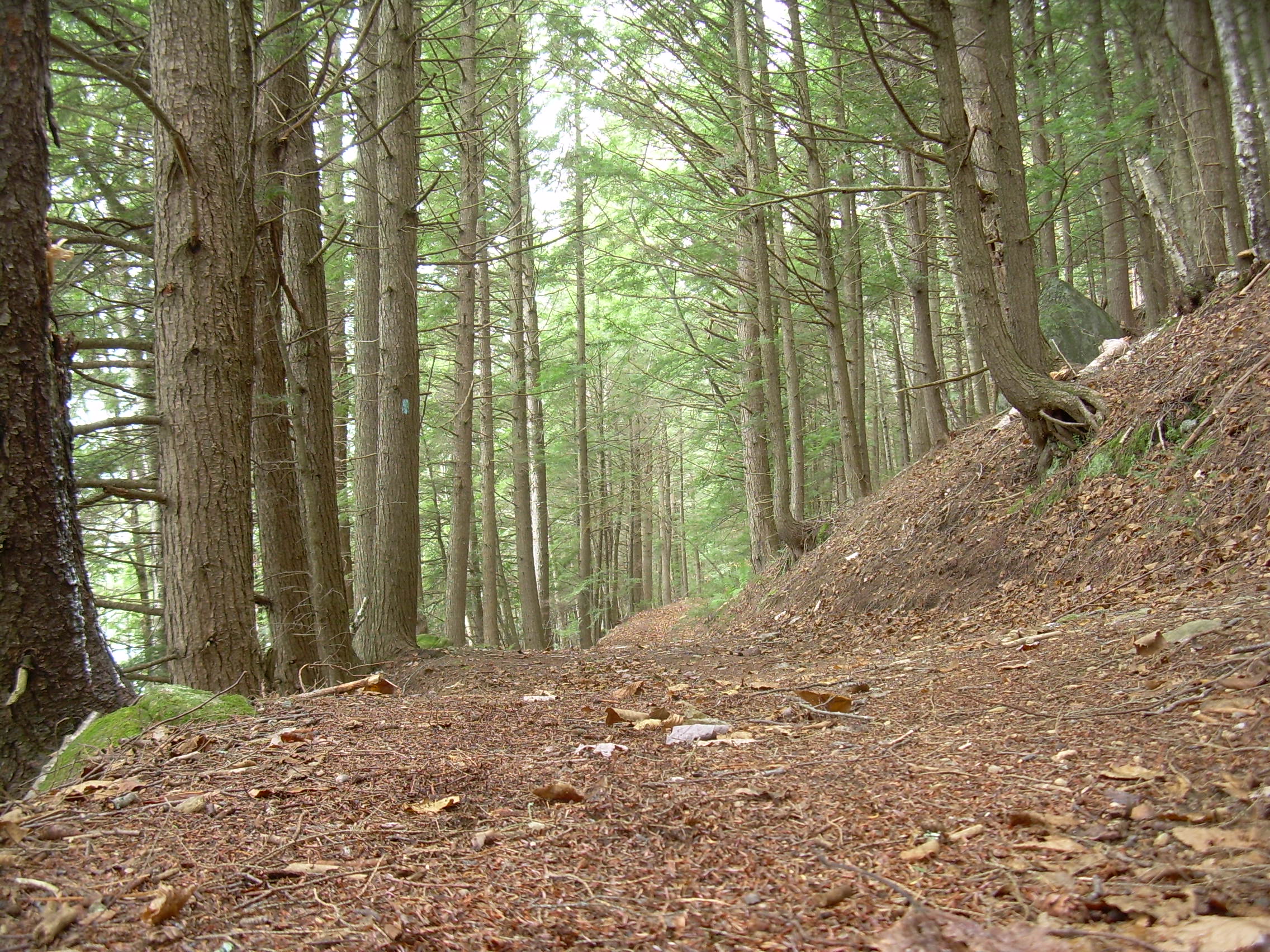
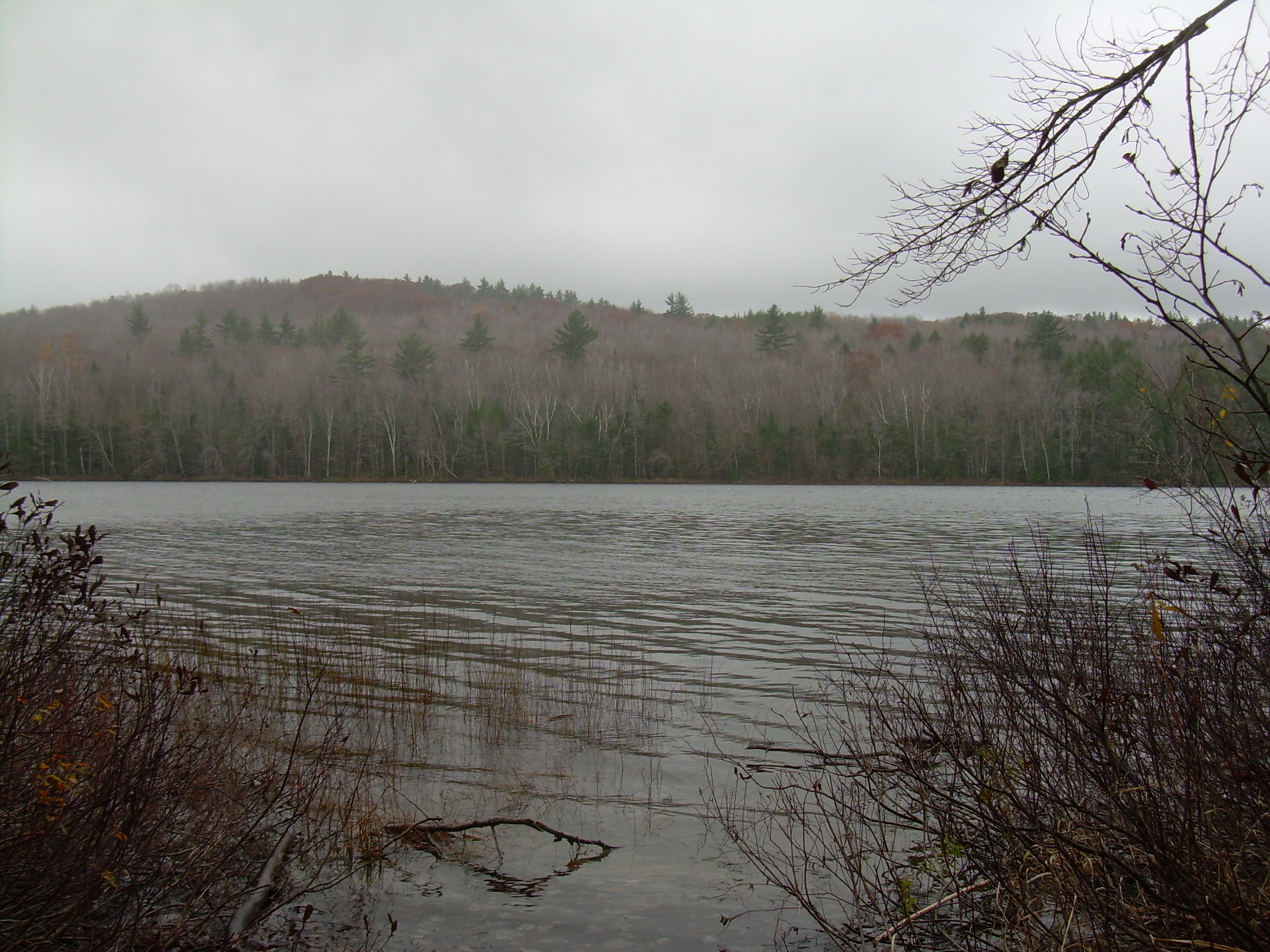
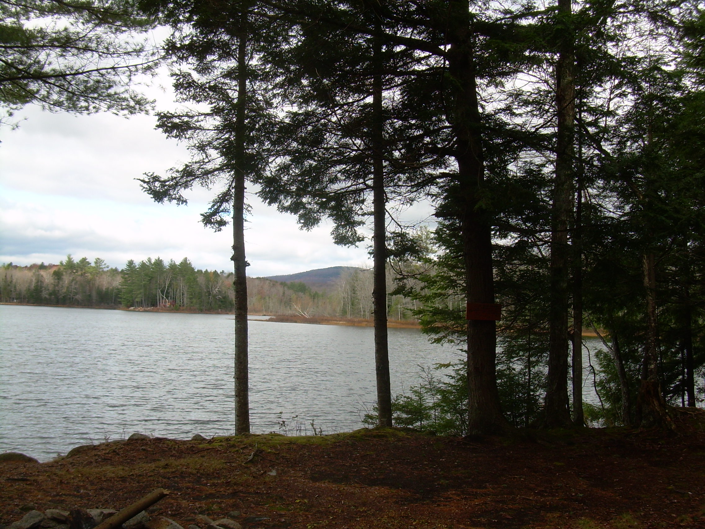
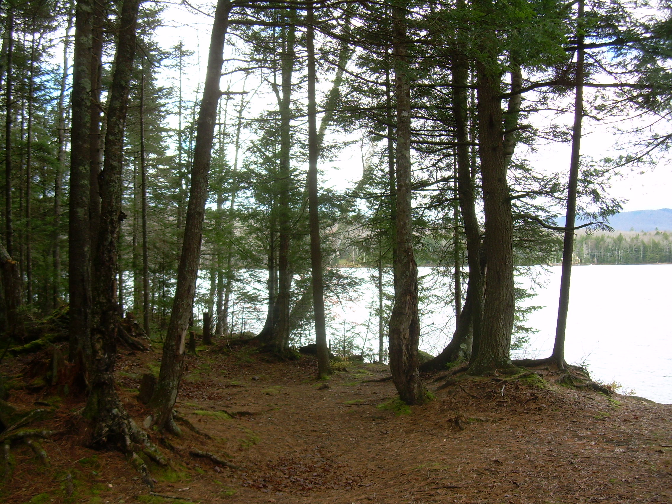
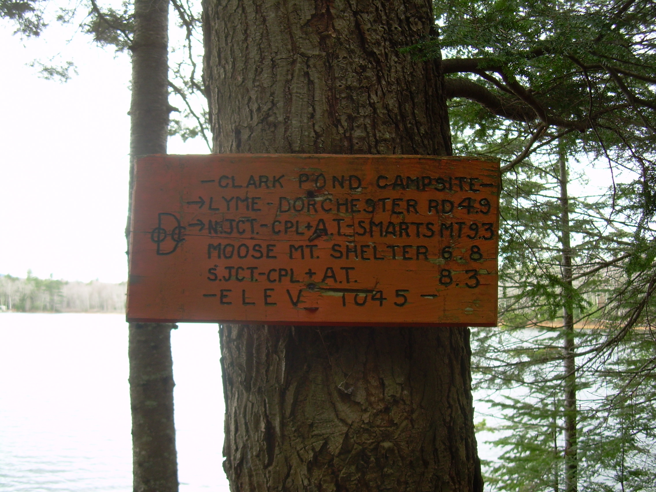
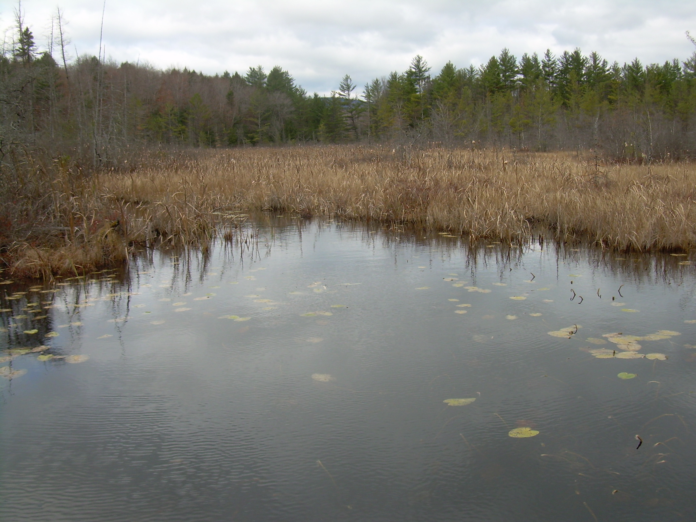
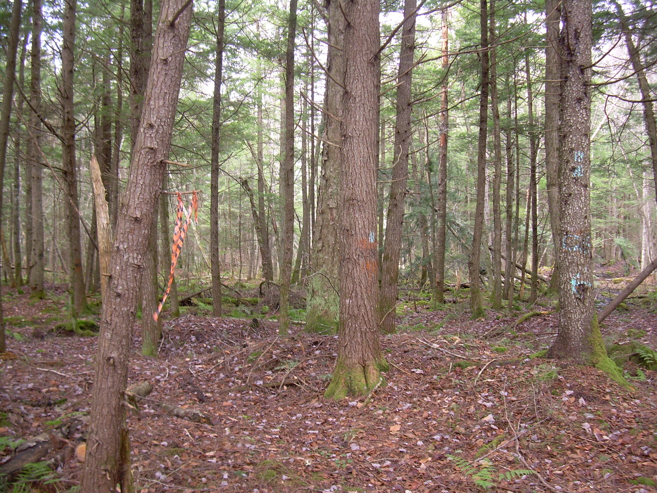
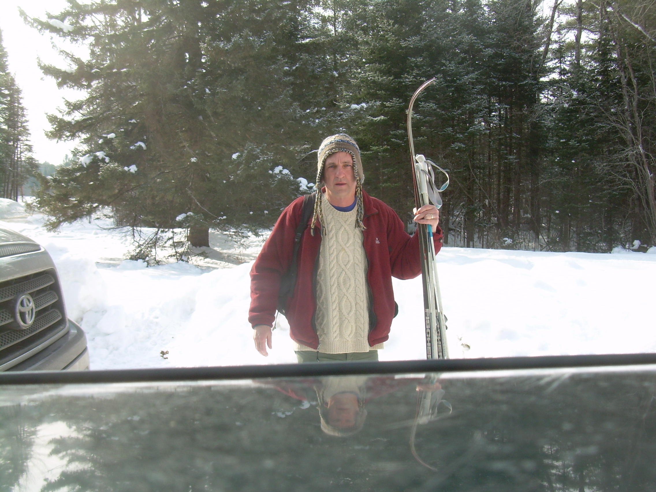
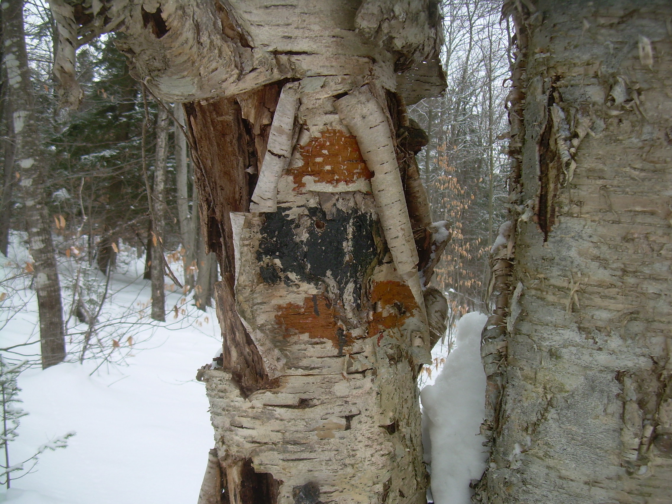
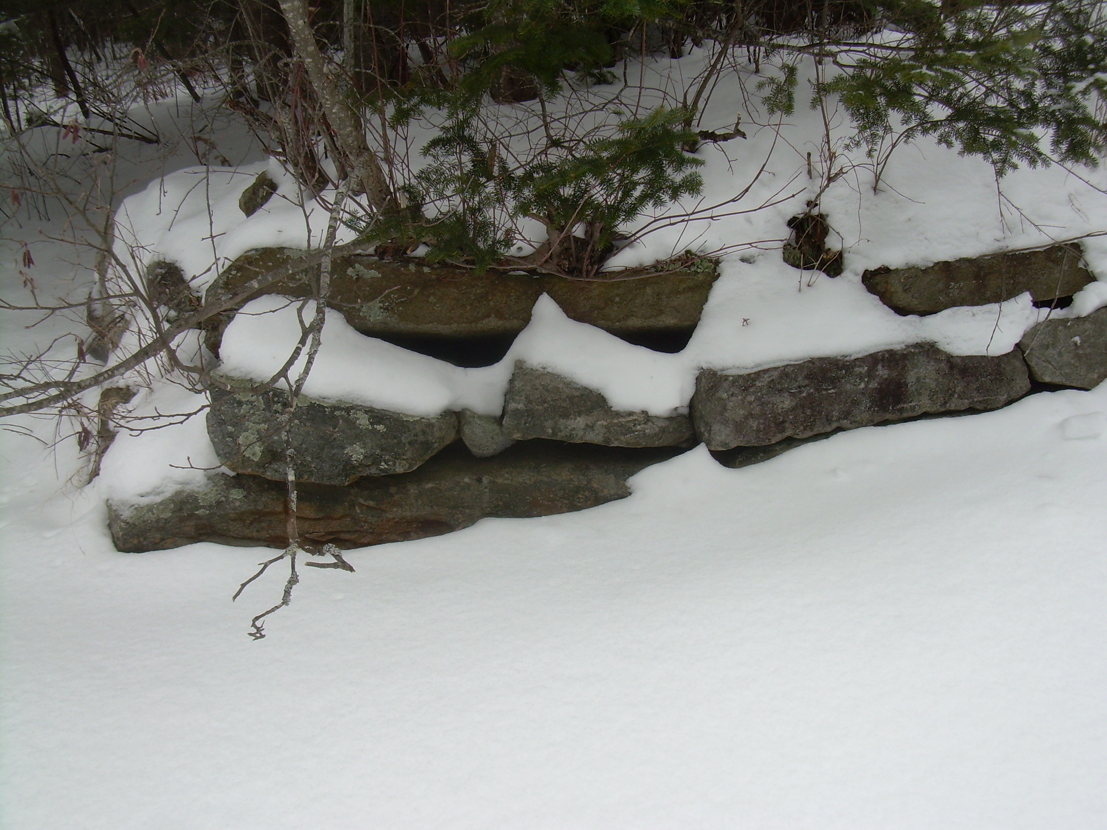
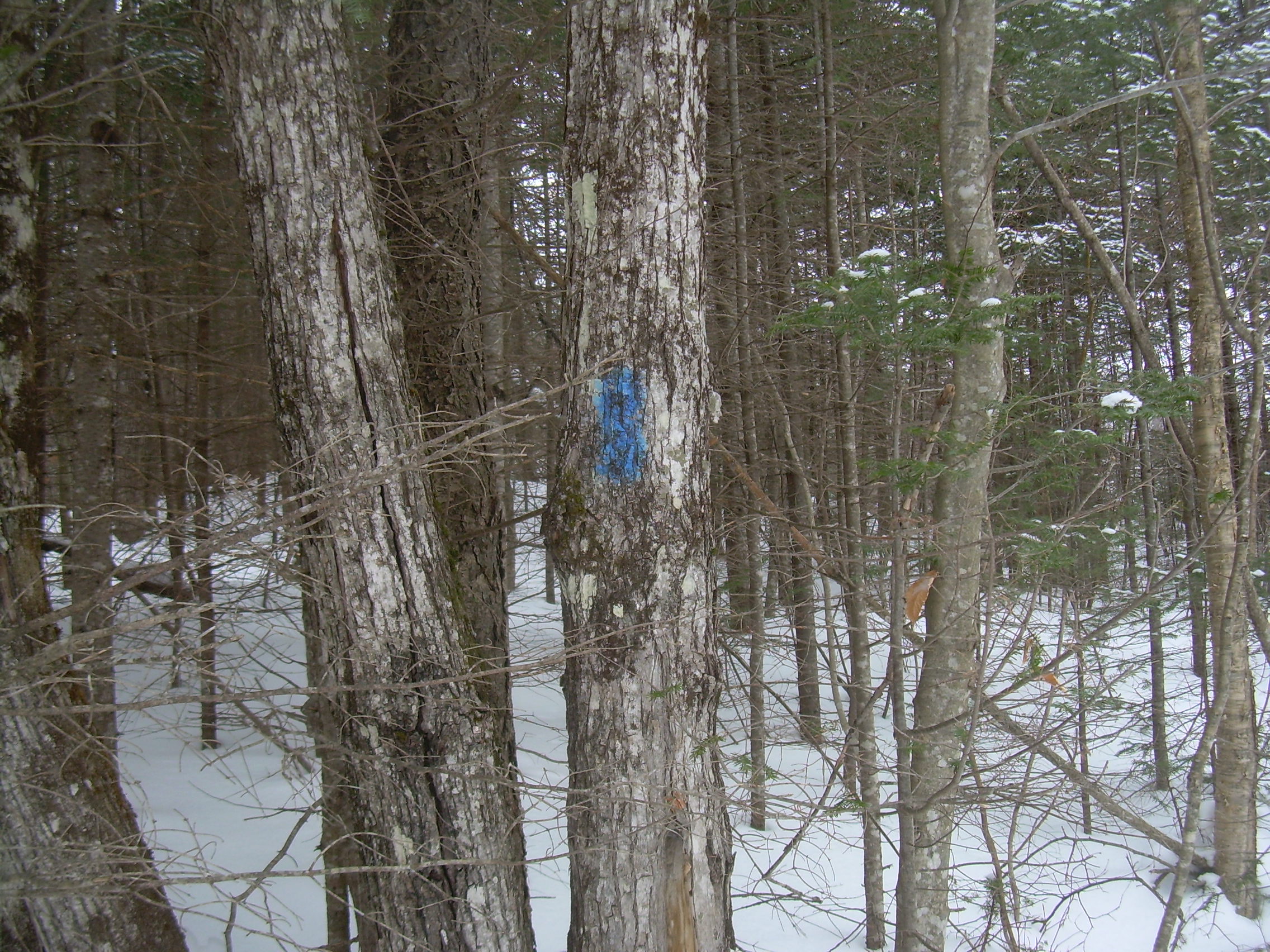
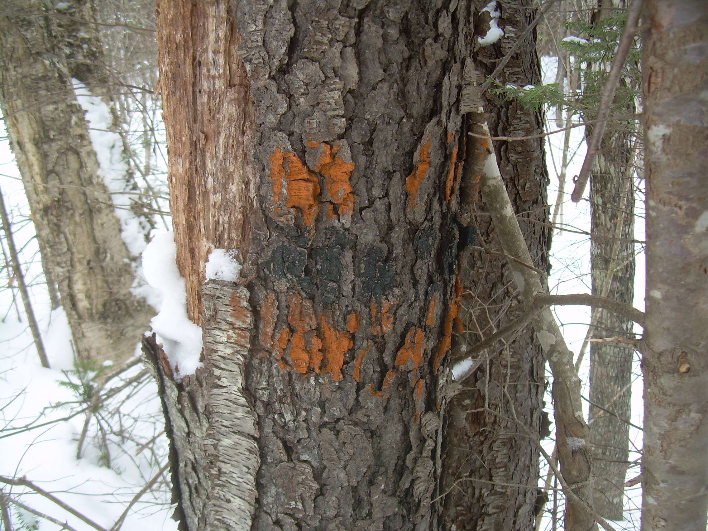
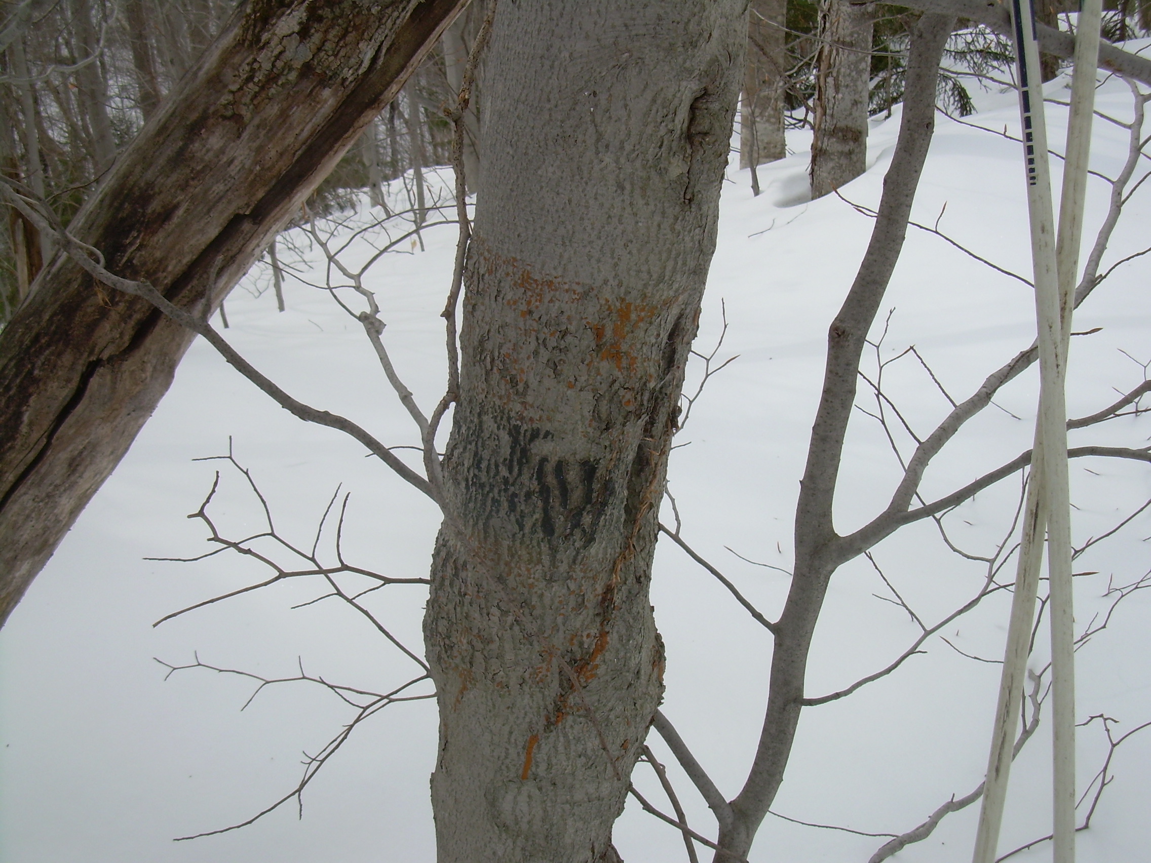
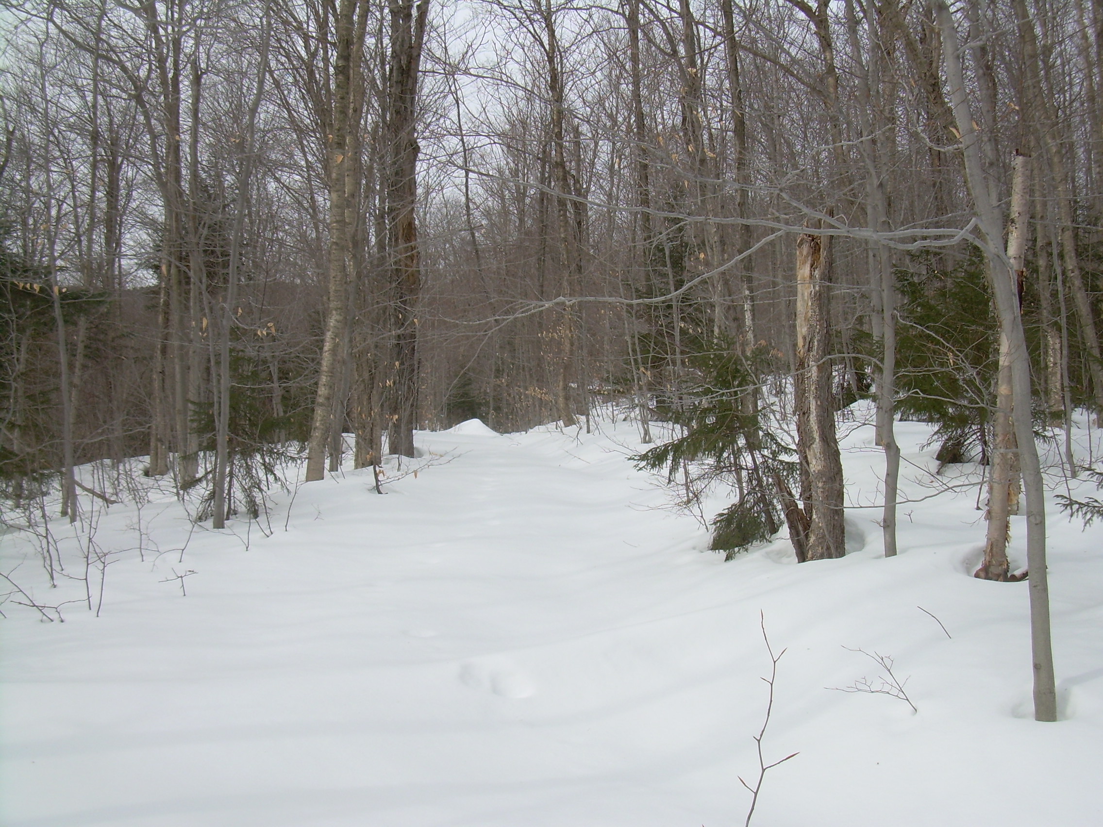
Goose Pond to Clark Pond | October 31, 2010 I parked the car at the corner of Wolfeboro Rd. and Goose Pond Rd. I am not certain where the trailhead is, but I saw a sign for the Marshall Brook Nature Reserve 100m behind me. So I walked back there and started to hunt around. After a few false starts I found the old Kimball Hill Road. Much of this hike will be finding old Class IV roads which were used as part of the Clark pond trail. Sometimes there are stretches where I am not certain about my direction, and in other places the way is obvious. 200 meters beyond the last house I find confirmation. There is a faded blue blaze painted on a beach tree next to the old road. Kimball hill road is rutted and washed out and would be a challenge to a jeep in a number of places. A stream runs down the middle of a lot of it. But it is flanked by a pair of old stone walls and once I knew I was on the right lane the way was clear. At the top of the hill I passed a number of camping trailers. These look like they are here permanently -- like a cluster of cabins. Beyond them the road is maintained and marked "private", but I don't think I'm trespassing. It is just that the town doesn't maintain the road. I also passed a classic orange and black DOC blaze -- which warmed the heart. It is a pleasant day to be kicking down a dirt road, past a few houses and meadows. The trail, according to my topo sheet, turns off after Beech Cobble Rd, and so I step onto the most likely of several tracks. There is a powerline over head, and on the line's pole is a blue blaze! I lost the trail here for a bit. It is suppose proceed east north-east across an opening in the woods. A new house is situated in the middle of that opening and I am reluctant to walk through their backyard. So I circle the opening and where I can no long find a marker I end up just following the power-line to Grafton Turnpike. This is about the only section where I didn't see a blaze today. Later, at home, I read the 1968 DOC guide which told me that those were phone-line, and also marked the trail. 200 meters down the turnpike I see another blaze. The Grafton Turnpike is a well maintained and used dirt road. I passed a house with a windmill which looked more like a propeller blade off of a WWI biplane. I turned north on Bragg (?) for a short distance, and the east on another class IV road flanked with stone walls. At one point along here I had to duck under a tube for maple sap which was strung across the lane. It had been flagged with orange surveyor's tape, I expect so snowmobilers would see it. Once again I emerged from the woods near a lone house and again the road was privately maintained. I have heard gun shots in the distance, but I am wearing my day-glow orange scarf. When I am on a road with uncertain ownership I don't want to call attention to myself, but I don't want to look like a deer either. I hit Clark Pond Road at the outlet of Clark Pond and follow it up the the boat ramp. It is a pretty pond, a mile long and a quarter of a mile wide at its widest. From the boat ramp I can see one cottage straight across for me, and a few at the far end of the pond. I follow a few logging roads and a number of blazes. The trail skirts the northeast shore of the pond and for most of this it is clearly following and old road, a dozen feet wide and cut into the side of the hill - terraced. At mid pond I pause for a while. Across from me most of the beechs and maples have lost their leaves. The evergreens are still dark, but the deciduous are misty gray. The trail crosses a swamped marked by a sign which I think must have been posted by a snowmobile club. The trail then rose out of the swamp and curved away from the pond. I am looking for the trail to make a shape right turn towards the Mascoma River, as well as any signs of the old Clark Pond Shelter. At one point I realize that I haven't seen a blaze in a while, so I retraced my steps, closely consulted the map, and found that eastern turn! This is as far as I am planning to go today, but I trek east for 50 meters to confirm that it is indeed the trail. I then returned to the pond's shore. Some one has constructed a make-shift shelter with logs and a sheet of plastic. But it is not the shelter that I was hoping to find. I sat watching the pond and eating my breakfast, a Danish, muffin and thermos of coffee, when I noticed a thinning of the trees about 50 meters south east of me. Here I found a DOC sign marking this as the DOC campsite. 9.3 miles to Smarts Mountain and 6.8 miles to the old Moose Mountain Shelter. 8.3 miles to the start of the Clark Pond Loop near the Harris Cabin. But no sign of a shelter here any more. My return today would be very different. I forged my way across a swamp at the north-west end of the lake. Hummock to hummock, and somehow keeping my feet dry. At one point this meant tip-toeing across a beaver dam. Then, compass in hand, I bushwhacked to a private road and back to the Grafton Turnpike. From here it was a pleasant stride down to Beach Cobble Road to close the loop. Then finally back to the car via Kimball Hill Road.
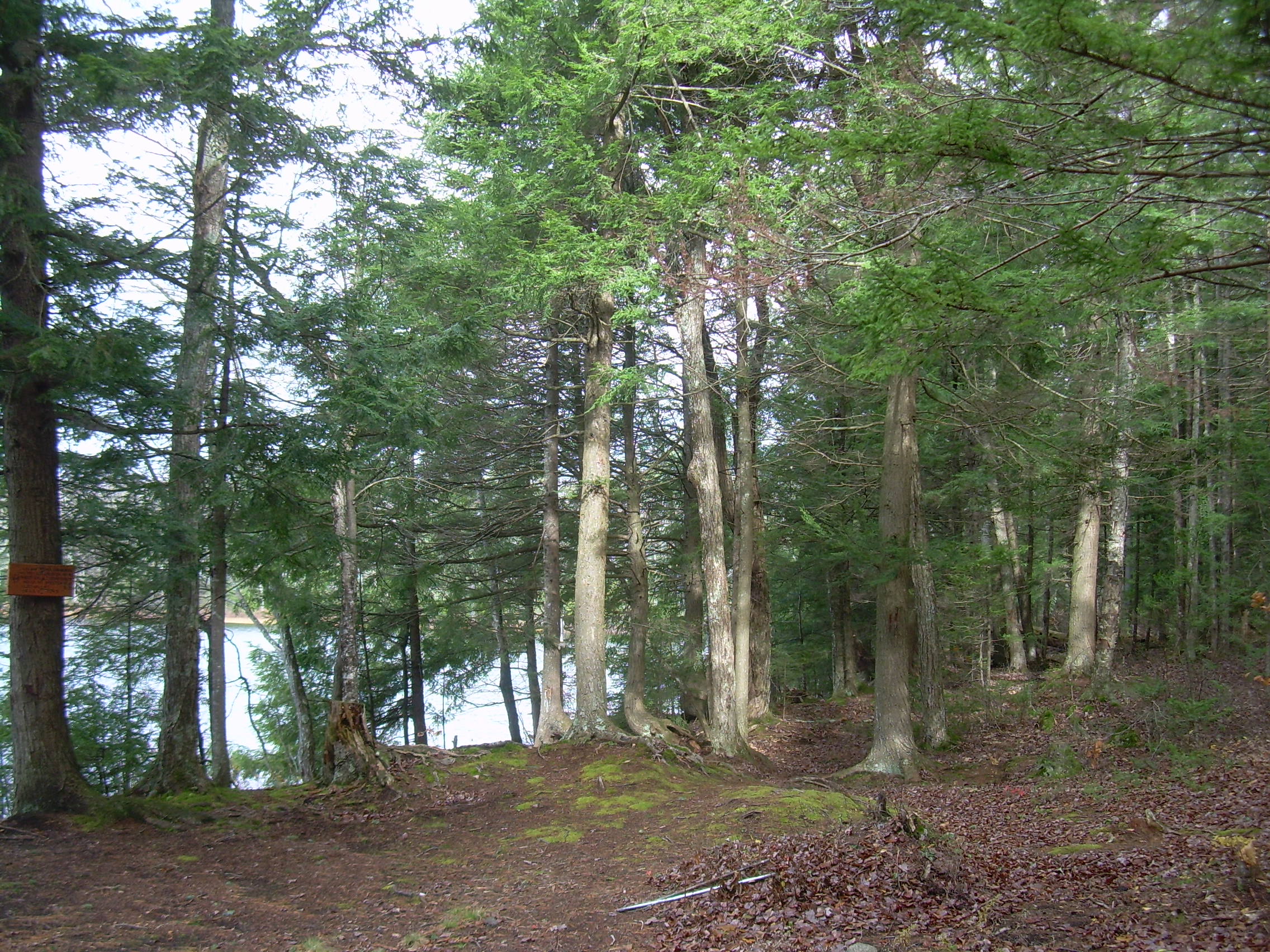
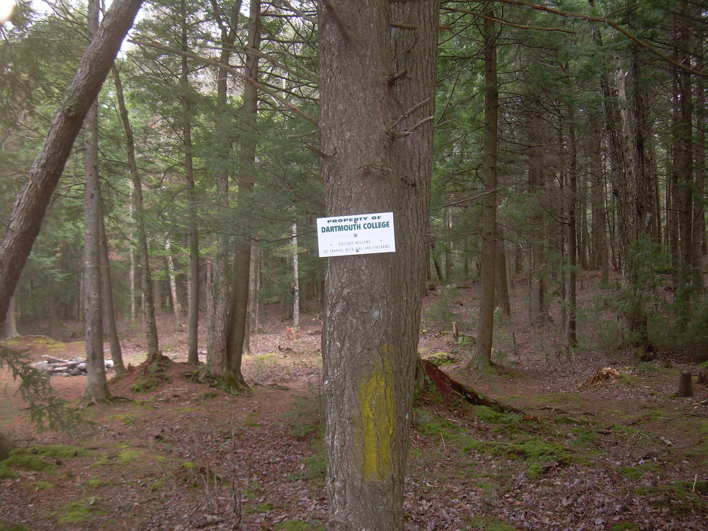
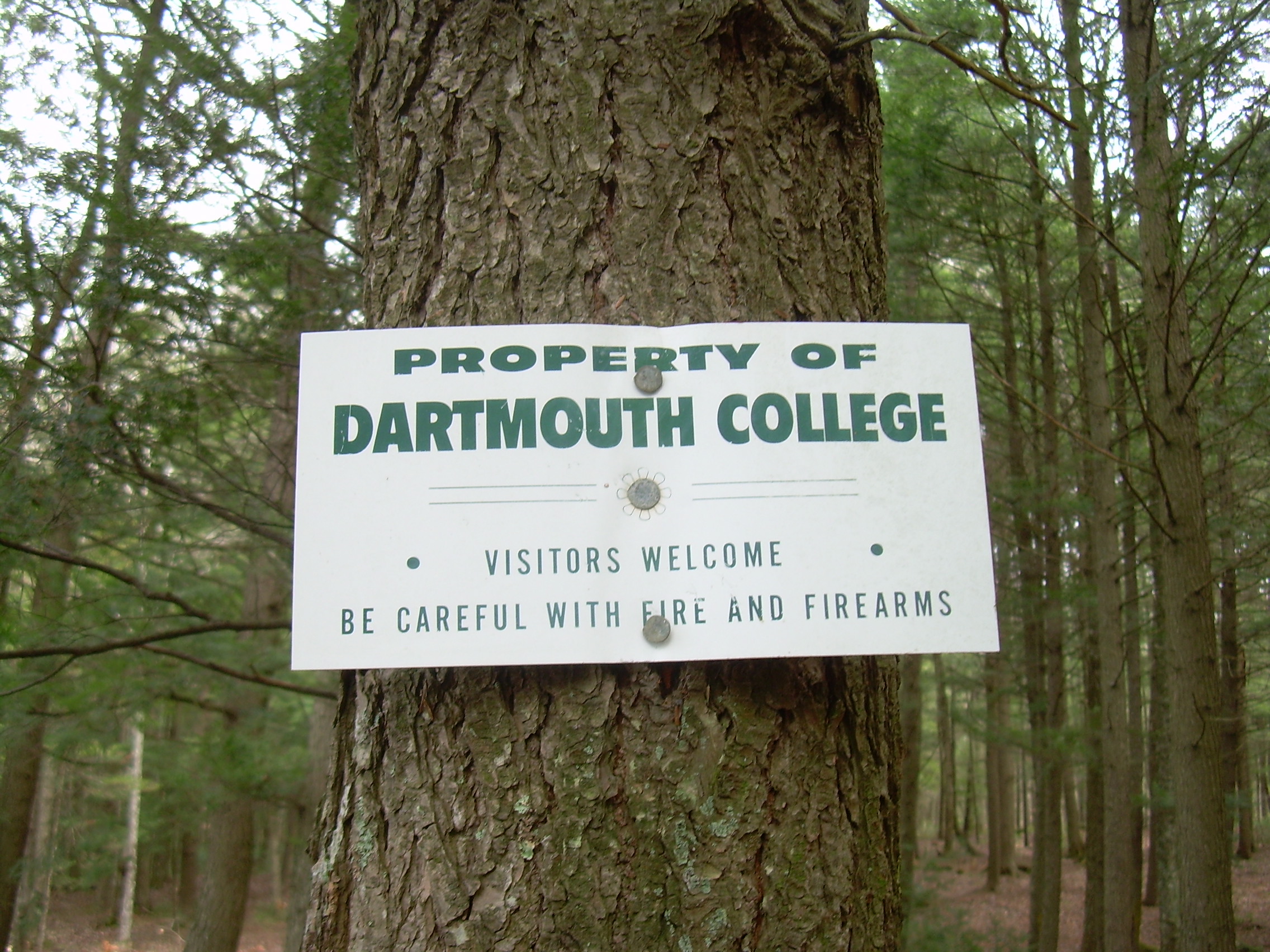
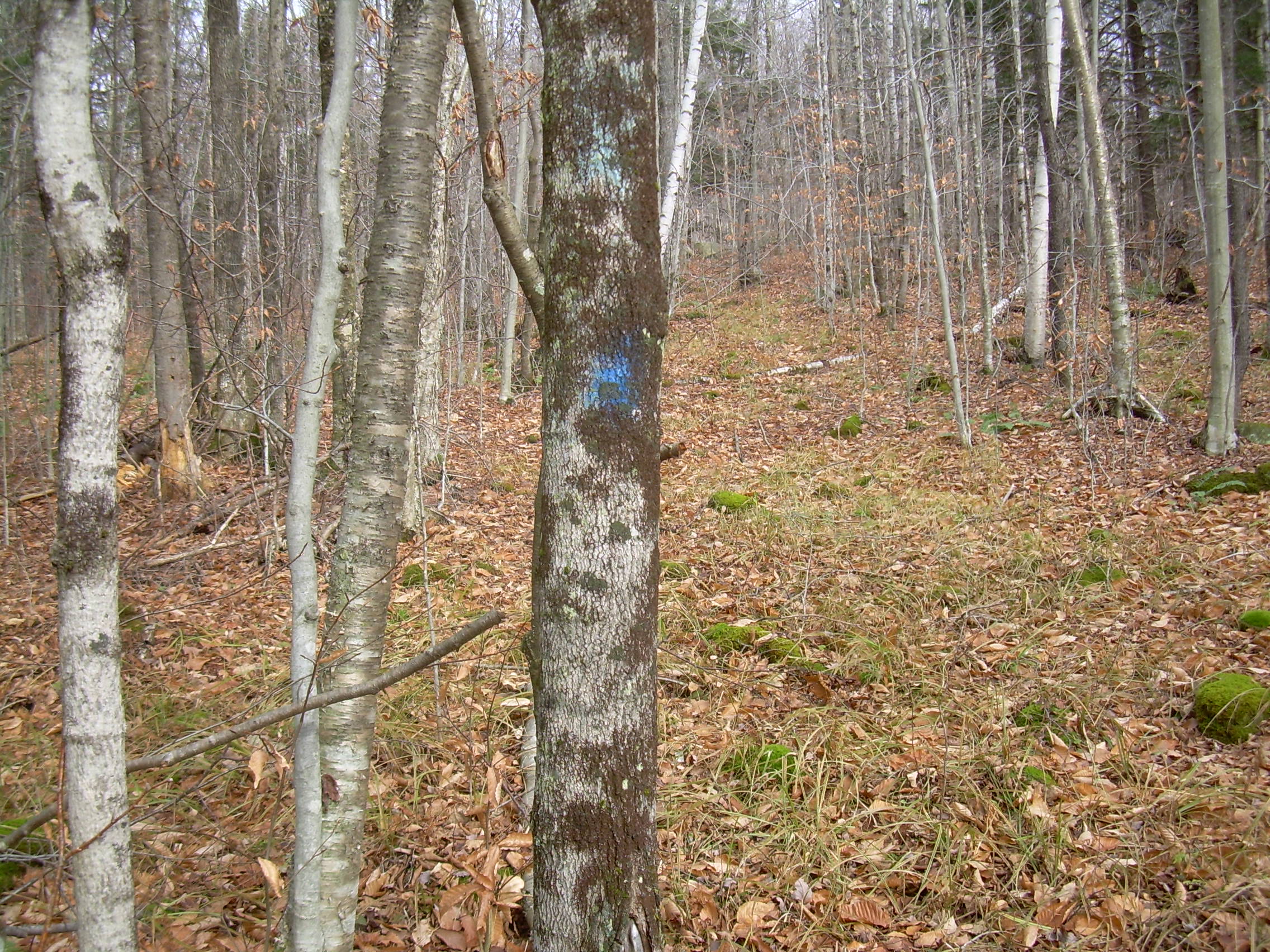
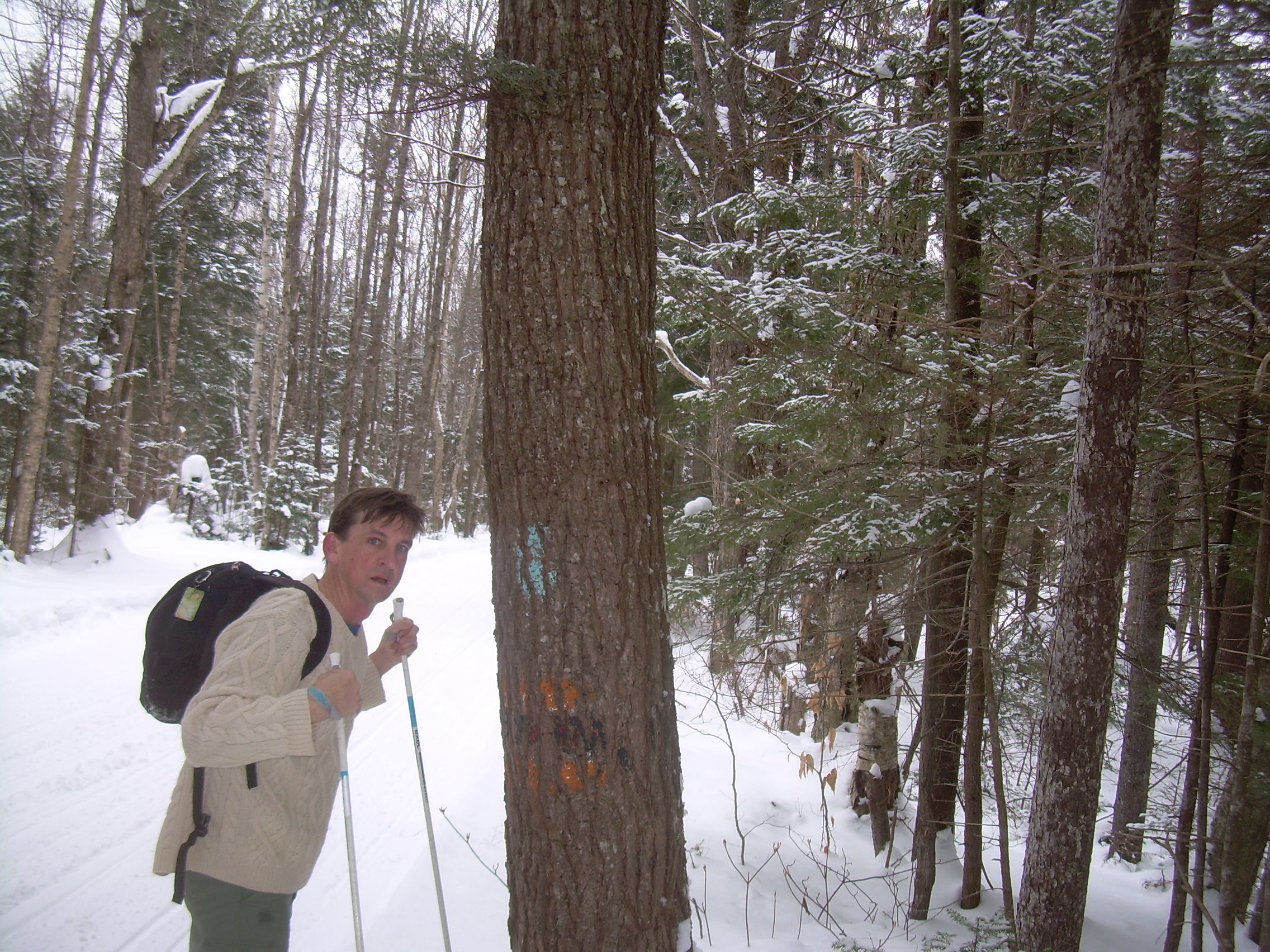
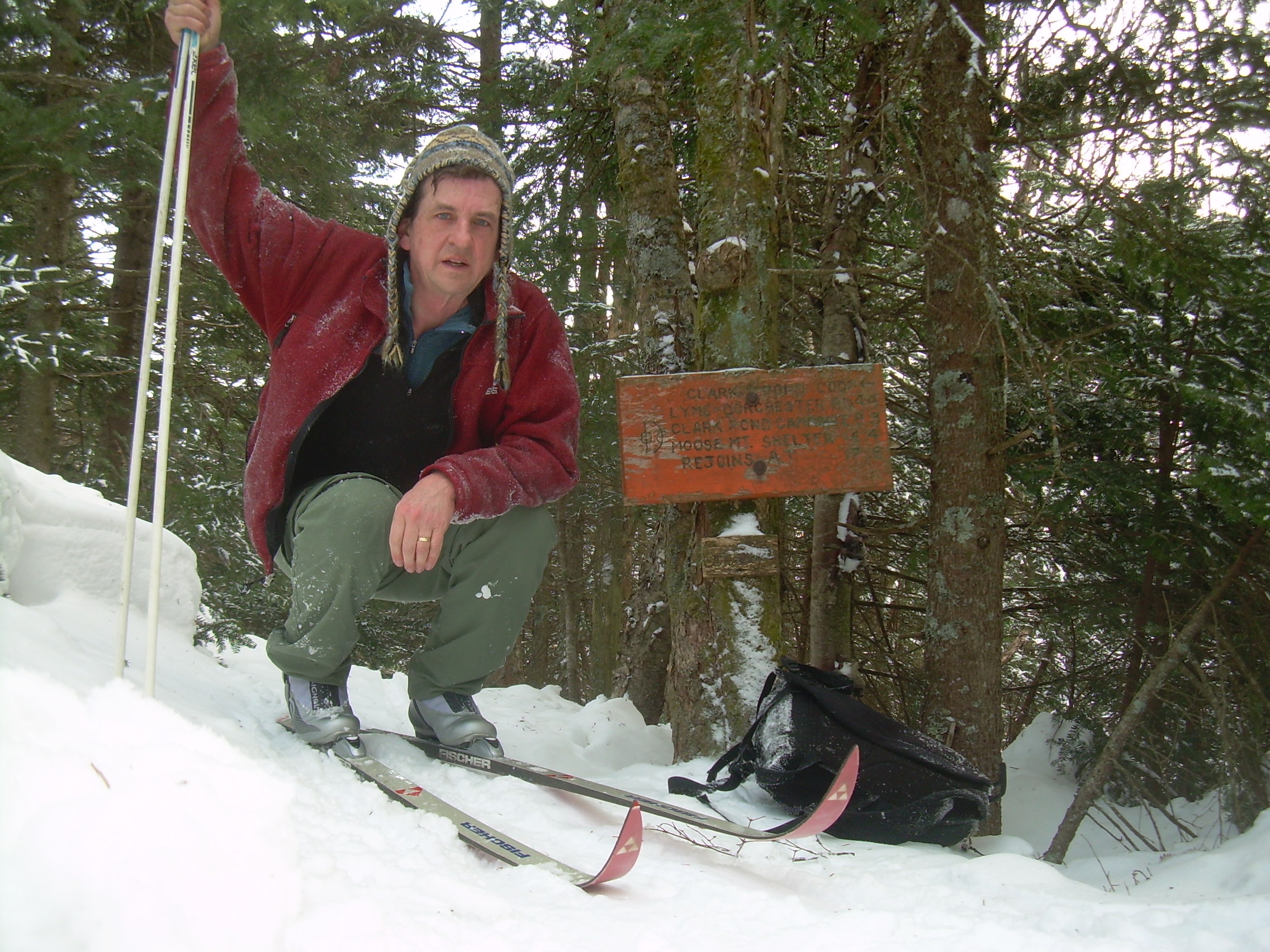
Clark Pond and East | November 9, 2010 When I finished my previous section I was left with a bit of an uncertainty as to where the trail was going. By consulting old maps Canaan and Dorchester I concluded that the trail from near Clark Pond to Cumming's Pond would be on old class IV roads, and with the experience of the October walk I thought this might not be too hard. But the section between the Clark Pond campsite (old shelter) and the top of the ridge between Clark Pond and the Mascoma River seem to be an original DOC effort. This short section is my goal today. I drove to the boat landing on Clark Pond and left my car here. Again, the walk next to the pond is very nice. The road is cut into the side of the hill. It is clearly a road and not a trail, it is wide and someone put a lot of work into it. Through the pines and hemlocks and then across a swampy area. Here, a few hundred yards from where I turned last time I spotted a blaze, and a plastic ribbon which I missed before. A neglected trail ran from the woods road down to the ponds shore. I followed it and found self emerging into the DOC campsite. A sign, nailed to a tree proclaimed; "Property of Dartmouth College -- Visitors Welcome / Be Careful with fire and firearms". Even if I know I am on the right tracks, a notice like that is heartening. A discovery, an affirmation, a treasure. Back on the main trail I again find the right-hand turn where the trail leave the pond and heads east towards the Mascoma River. The first hundred yards is not too bad. There seems to be a suggestion in the forest canopy, a lessening of trees and branches as the trail climbs a path which I think once once logged. And again, every 40-50 meters there is a blue blaze. But at the top of a minor ridge, only a 200 m from where I start the trail disappeared. There is a maze of logging trails -- but I've lost the trail. I start a circle search, but to no avail. I'm suspicious that maybe loggers have removed the blazed trees. I then try to think like a trail designer. Where would I cross this stream. There is a cut in the bank which may have been a path -- but no conferring blaze. Eventually I work my way higher up the ridge, crossing a modern logging road. I think I've worked my way too far north, and so point my nose south, and in 30 yards again find a blaze. I cut back down the ridge a bit, but there is a 200 m gape where I doubt I was on the trail. Someday perhaps I'll return to fill this short void. On up the ridge. I come out on a trail which shows up on my 1860's town map. It is class IV roads along stonewalls now. 200 m north and then at a cross roads I head east again. I pass an old cemetery which also shows up on that 1860 map. At this point I have crossed into Dame's Gore, I continue up the hill for another quarter of a mile and found two blazes on my way. I also feel certain that this old road is occasionally used for logging, but every winter maintained for snowmobiles. I think finding my way to Mascoma will be easy. When retracing my steps I passed through an old iron gate and poked about the old graveyard for a bit. But then stuck to the old roads and stonewalls back to Clark Pond and my trail head.
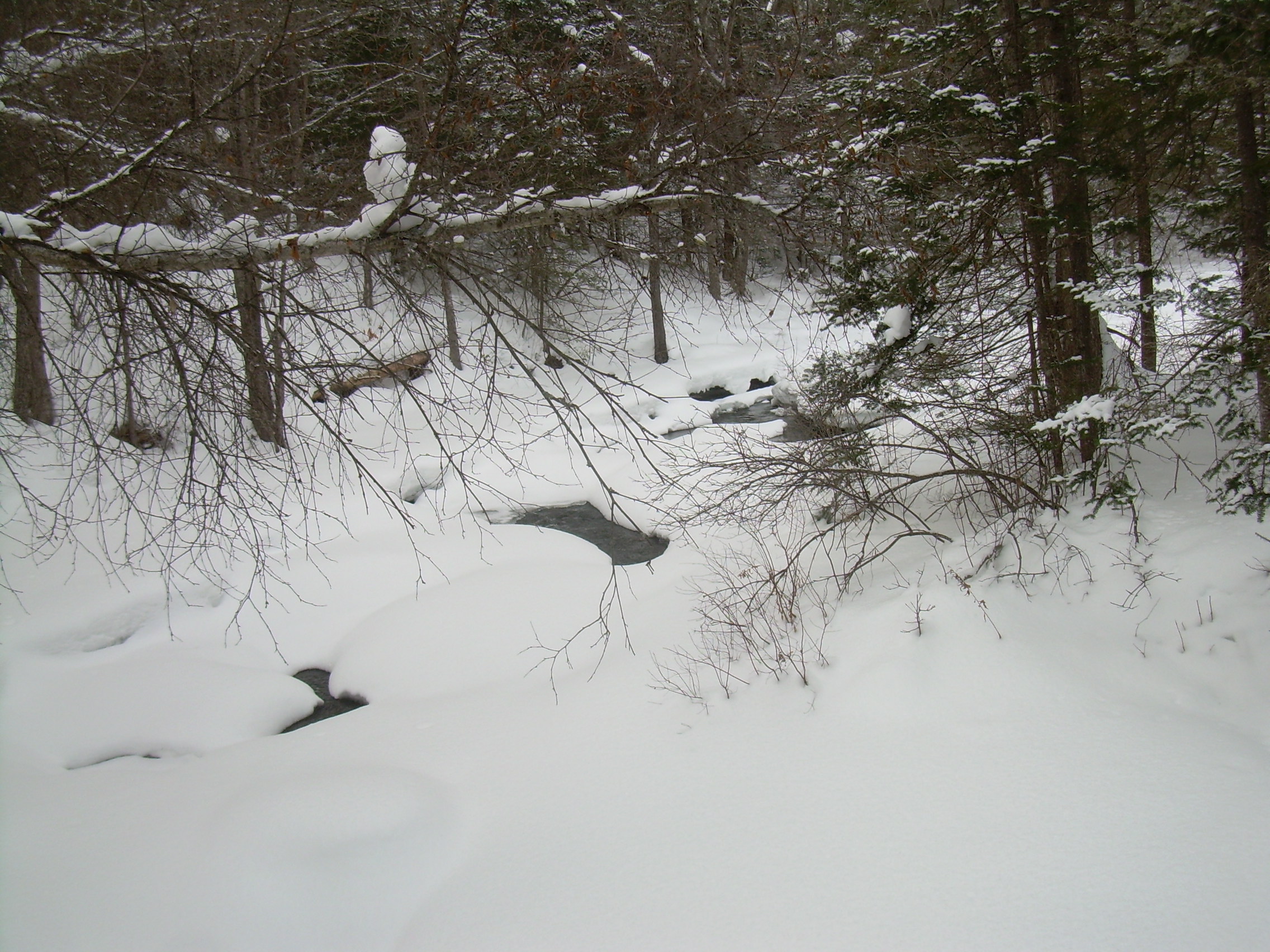
Clark Pond, Mascoma River, Cummings Pond | January 30, 2011 I am headed back to Clark Pond this morning, and I am not quit certain what I'll find. We have had a lot of snow recently and the woods could be three feet deep in the white stuff. If it is light a fluffy, that would mean wading through it. I am not certain if I'll be snow-shoeing or skiing. The last two times I was here, in the autumn, I saw signs of the activities of snowmobile clubs. But I don't know how extensive their tails are. So the plan is to drive to the boat launch on Clark Pond, to have with me both snowshoes and skis, and see what I can do. The first surprise was that the Clark Pond Rd is not maintained during the winter. However there is a place plowed to park where Clark Pond Road branches off of River Rd. I could also see that there are snowmobile tracks headed up the road. It seems that a lot of my traveling today may be on their tracks -- and so I choose to use my skies. I am classic skiing with blue wax today It is about a mile and a half to Clark Pond, and takes me about 20 minutes. I met one group of, 2 humans on snowshoes and 4 dogs barefoot, but most of the time I have the world to myself. I skied out onto the pond. Snowmobile tracks run down the center of the snow, but I have the whole world to myself. To the Northwest, above the far end of the pond raises up Winslow Ledge and to the east of that Sugar Hill. The sky hangs low and grey. Back on shore I make my way towards where I turned around in November. It is tempting to follow the edge of the pond again, but I think that will be long and slow. Instead, by cutting inland at this point I will stay on snowmobile trails and make better time. In fact I'll end up on snowmobile trails most of the day except in the swamp, and near Cumming's Pond. In about half an hour, at about noon, I passed the old cemetery and topped the hill. This was now new territory as IO dropped into the Mascoma river valley. The trail seems to be in the right place and I have seen no viable alternate gap in the woods, but it still fells good to find the DOC orange-and-black blaze. It is painted on an old dead birch, the bark is peel in and a few more season it will disappear. There is a long steep drop to the river here, dropping 100 m in elevation in 500 m horizontal. Just as I started this decent I heard the roar of snowmobile engines, and so pulled off to the said and let two pass. If I was in the midst of my descent, in a narrow part of the trail, it is not clear what I would have done. It is not easy to stop when it is steep and icy. I now turn north and ski next to the Mascoma river. The forest is beautiful, trimmed with a mantle of new snow, clear and white -- even if the day remains grey. What I am on here is an old road. It shows up on maps dating back to the middle of the 19th century. In fact what I am skiing into is an area once called "Dame's Gore". A Gore is a sliver of land which just didn't get surveyed right. When this part of the upper valley was originally charted by Governor (?) Wentworth, their measurements were a bit incomplete, so a few years later it was realized that there are parcels of land which don't fit into any particular township. There was a gore between Hanover and Lyme, and Dame's Gore between Canaan and Dorchester. Theonus (?) Dame was a veteran of the French and Indian War, and in (?) 1770 Gov Bennington Wentworth give him this strip of land, a half mile north and south, and six miles east and west. The trail left the river, or rather the river left the straight road while I crossed the gore. I skied through a sapling grove which had had all off the bark shredded off of the. I could distinctly see the claw marks from a bear. Soon the river and the road rejoined each other. On both my old DOC map and my USGS topo sheet it shows the Clark Pond loop heading straight across what is now a swamp. The snowmobile trail takes a more prudent route to the west. I however, forge on ahead. I find the place where the old road at one time bridged the river, there is a build up embankment here. But on the other side of the river -- in the swamp -- I lose the trail. I can easily ski up the river itself because it is frozen solid -- a winter road. But I lose the trail for a half mile. The skiing is tough, as I venture off the river to try and find some remnants of the road, and in two places I get into some iffy ice and water. A warm day can cause the stream to seep over the swamp ice and the combination of water and snow clings to my ski like an anchor such that I have to stop and scrape is clean. Eventually I make my way back to the snowmobile trail, and then 200 m later I think I see a ridge running off through the trees, back south towards the swamp. I follow the ridge, and when it reaches the river I find a stone embankment and know that I have once again regained the old road. I would like to find that old trail in the swamp. (Note: later when looking at imagines from Google Earth it seems apparent that the old road curved more to the east then I had realized. Next time.) North on this old woods road. This section has often been used for logging and the road is in good repair, straight and level. I am flying along the icy tracks of the snowmobiles. Once again I start to see the DOC orange and block blaze, as well as a blue blaze. I wonder if the blue is covering an old white blaze from when this was the AT. I eventually come to a cross-roads. This is the same place where we camped during Long Trek III. The Clark Pond route crossed the Mascoma River and now makes a bee-line to Cumming's Pond. Just before starting this last leg I hear snowmobiles and so pull off on the side to let four pass me. Again the tail is straight and simple through a pine wood. Eventually I come to an opening with signs directing snowmobiles to the right and cross-country skiers straight ahead. This is the edge of the Green Woodland. In another ten minutes I am skimming along next to Cumming's Pond. At about 3:00 I stop in the warming hut by the pond to have hot chocolate and eat my sandwich. This will be my turn around spot today. A number of skiers stop in and most are confused when I tell them that I have just skied about seven miles up from Canaan. They didn't realize that there was any connection between the two. By road it would be about 20 miles. I spoke along time with one of the foresters for Bob Green. He knew of the snowmobile trails, but had not imagined that there was any connection with the AT. He told me that he had come across AT hikers who had gotten off the trail. One of them said he was purposely avoiding the crowds on the trail. Other ... maybe just lost. The return trip was much faster. I did not stop to explore the swamp, or try to find additional blazes. I didn't take a side trip out onto the ice of Clark Pond either. Just a fast seven miles back to the car. The only point of note was that climbing out of the Mascoma valley was very hard, and my knee started hurting right afterwards.
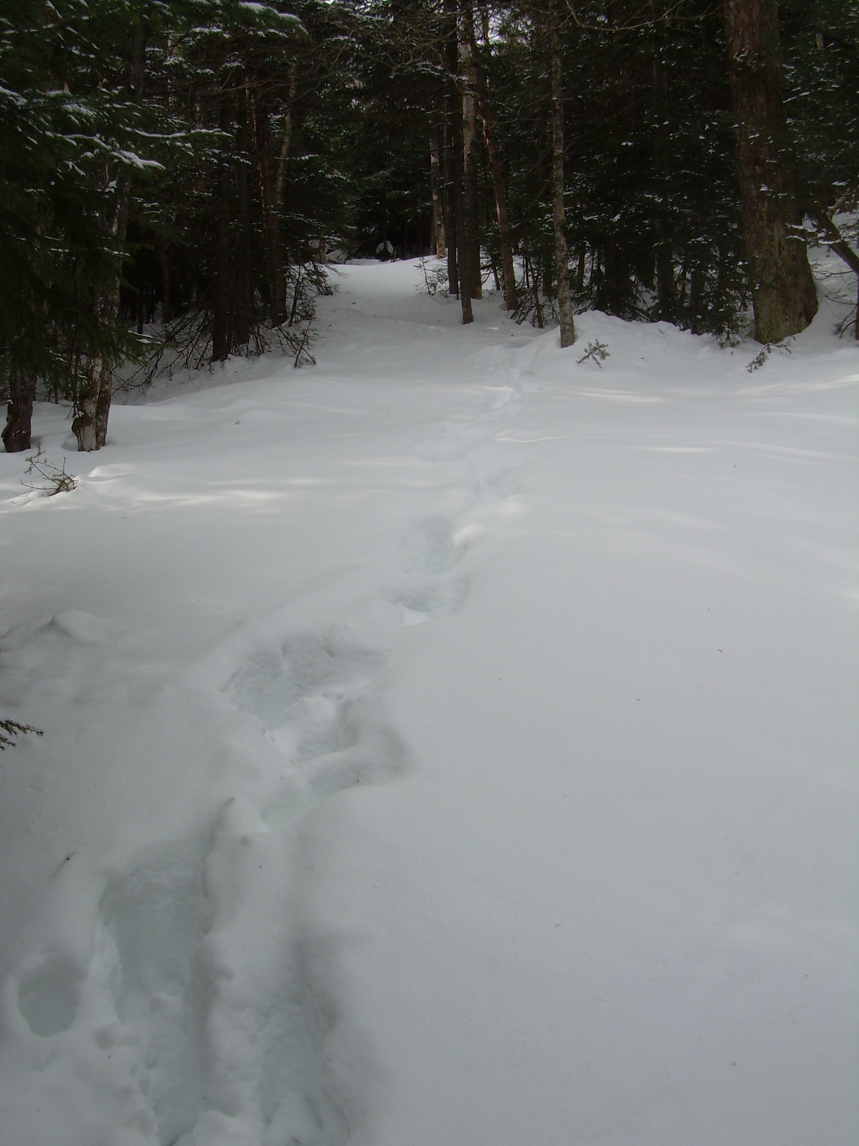
Cummings Pond to Smarts Mtn. | February 19, 2011 (the day started out in the low 20's, but had dropped to 10 by the time I finished. I expect that it was maybe even a bit below 10 on the peak of Smarts) I was cross country skiing today. I left the car on the Lyme-Dorchester road and skied into the Green Woodland, returning to the Clark Pond trail as it skirts the southwest corner of Cummings Pond. North from here is a well used ski trail which I have skied on numerous times, and so I traversed the first 3 kilometer quickly. There has been some logging north of where the ski trail is maintained and I assumed that the trail went that way too. I had tried this last winter -- only briefly -- and never found the Clark Pond trail. However, this time I had the advice of Ted Simpson who told me that when I came to a fork - "always bear left". I have also poured over the map a lot more and am aware of the fact that the trail follows the Clough Brook. So I continued another half-mile into the area which has been logged, always looking for a break to the left. But I became more and more convinced that I was too far away from Clough Brook. So eventually I struck off due west to find the brook. In the wood, especially just as I was leaving the logged area and starting down the steep banks of the Clough Brook Vale I found my self alternating between skidding with little control on the icy snow, or tangled in the undergrowth. So I took off my skies, only to discover that the snow was near three feet deep here, and because of the thick icy crust I couldn't wade through the snow. Each step meant climbing up onto the surface and breaking through again. However, down below me my attention was caught by a lines of tracks dotted through the woods on what appeared to be an old logging road or trail. Thirty more exhausting yards of "post holing" and I arrived on the foot steps. They were the size and shape of a big man's boot, but with a good stride length. I had a hard time understanding a woodsmen without showshoes and a 3+ foot stride in 30 inch deep snow ... until later. The trail seemed in about the right place I and strapped on the skies, got up on the snow and headed off. I had traveled the first two miles on the groomed ski trails in 30-40 minutes, but I would not be able to do that now. I was only sinking into the half inch of powder which was on top of the crust (we had a thaw on Wednesday), but it was all up hill. About ten minutes later, after a deep ravine where a trickle crossed my path, I spotted my first Orange-and-Black, classic DOC blaze. It was a heartening experience. It has been nearly three miles since I say the last one. I also now understood the tracks. They were moose tracks. They had looked like boot prints because the moose was placing its rear hoofs nearly on the same place as it's front hoof. Now, as it changed stride to climb a steeper grade the stride changed and I could see all four prints distinct. Even with legs which are four feet long, it still must be a lot of work for a moose in this heavy snow. The trail was getting steeper and I was spending more time "herring-boning" up the slope. This also made me think about how am I going to get down again off this mountain later. (I think I know!) The maples, oak and beech are changing over to birch and hemlock as I climb. And then hemlock and spruce. Occasionally the moose wanders off the trail, but usually soon returns. I had spoke to a forest caretaker a few weeks ago who told me that he didn't realize that this was the old AT and it was referred to as the "Emergency Road". I could imagine a 4-wheel jeep negotiating a mile of this, and somebody has been through with a chain saw to clean fallen trees. But eventually it was even too steep for a jeep -- and the trail narrowed. But the moose prints kept on going. I am reduced to either herring-boning or side-stepping up most of the time, and the transition to fir, hemlock and spruce is complete. The branch also seem to hang very low as a past the sign marking the edge of the AT corridor. This sign is only a foot above the snow, and reminds me that I have at least three feet of ice and snow below me, so no wonder I have my head in the branches. The ground levels out a bit as I approach the summit. I pass a pair of signs which say "YO!", "This is NOT the Appalachian Trail". A few meters later and I am at the AT-Clark Pond Loop junction.
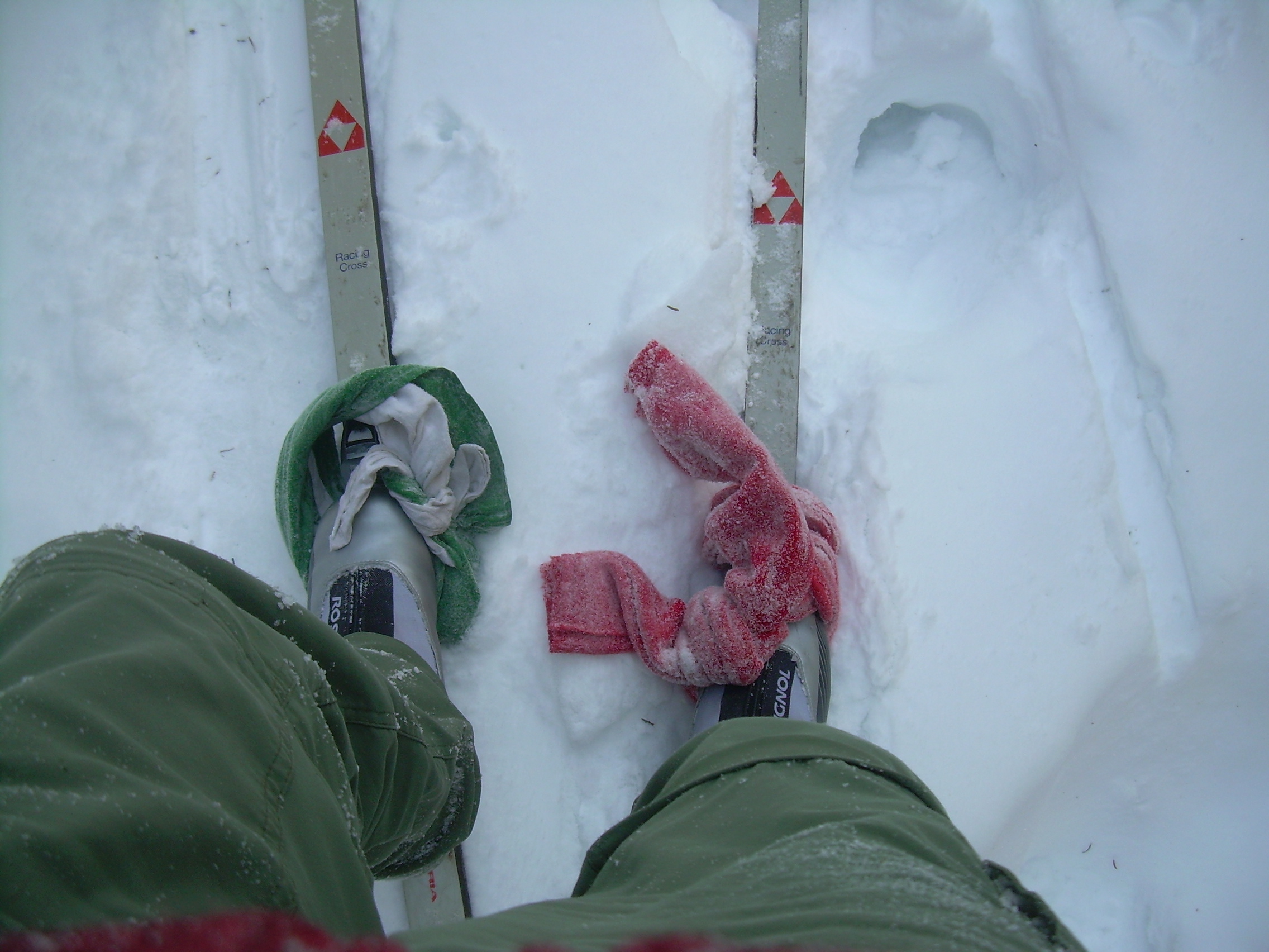
Clark Pond LoopIt is a thrill to be on top. It is just after 3:00, which is just about my turn-around time. Still I find the old ranger's cabin to have my lunch. I planned on sitting on its porch. I wanted to take off my skies and not sink in. But the wind is coming up and so I stepped inside. Nobody has added to the log book since Will and I were up here over his Christmas break. I had taken off my gloves on the last stretch because I was working hard and was hot. Now I find that they have frozen in my coat pockets. I think the temperature must be dropping below 10-deg. So I enjoy my sandwich and a few cups of tea, but I do not tarry too long. Within fifteen minutes of arriving I head back down. Going down is very hard! With that crust I ski across the surface and it is far to easy to get up some speed. But they really is no space to turn and break, and there are lots of trees and branches threatening me. So I remind myself that a controlled seat plant is always an option. In fact with the snow so high and branches so low I am often crouched down anyhow. But this is a hard way to travel, sitting down every 2 or three yards to stay under control. I try sitting on the tails of my skies. This works a bit better. I can still get going pretty fast, but can let my bottom drag in the snow if need be. Still I find myself skating down the icy slopes tens yards at a time. I cover a quarter of a mile with this method and am exhausted. Every ten yards I need to stand up, take a few steps over a level section, or point my skis, and plunged down the next decline. They is one last method. The traditional Backcountry skier/mountaineer at this stage would put his "skins" on his skies. Originally seal-skin, this strip of material would give him some friction on the snow. My makeshift, improvised solution was to tie my scarf around one ski, and my "class-B" field neckerchief around the other ski. Now, with a big wade of cloth under my foot I can walk. My skies become effectively long narrow snowshoes. In fact on steeper sections of trail I can still ski some. But most of the time I can stride along with 3-4 foot strides. On the return, as on the way up, one of the trickiest things is where stream cross the trail. I expect that in the summer these dry up, and in the spring and fall they are barely wet spots to step over. But now they cut deep ravines across the trail. Every hundred yards the cut a ravine 10 feet wide and three feet deep -- down to the ground -- which I have to side step down and back up. As the trail levels a bit I remove the neckerchief from one ski. Also the trail is straighter and simpler here. If I stand on my left foot, I glide, whereas my right foot still is wrapped in a scarf and works as a brake. I pass the point where I joined the trail, but continued the follow the trail -- and moose prints -- downhill. Eventually I found the point where the old Clark Pond Trail had branched from the maintained ski trails. A downed tree had obscured the junction. But the days are still short. I glide down the Black Bog trail and watch the sunset colors over Winslow to the west of me. It is going to be a cold night. I reach my car and start home, stopping next to Reservoir Pond for one last look at Smarts. Twilight is upon us.
|


