|
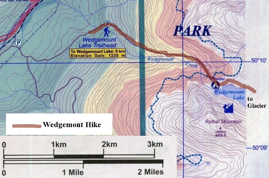
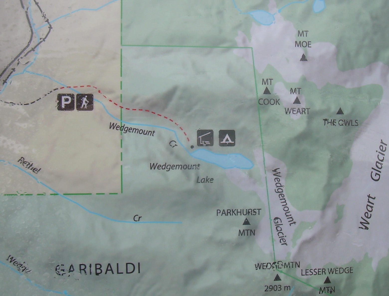
Maps of the trail to
Wedgemount
Lake & Glacier |
Wedgemont Lake and Glacier
Whistler, British Columbia
July 14, 2011
By lunch I had found myself inside of a hut which should be on the
shore of Wedgemont Lake. Not that I could see the lake. I was in
a cloud, as I have been ever since breeching the treeline. So when
I saw the grey outline of the hut through the mist and rain, I took
shelter. My lunch is a piece of cheese, a roll and an apple. Outside
the rain is drumming on the metal roof. Inside I read the hut's
log book. One of my favorite entry was from yesterday;
"We actually saw a fresh-water Sasquatch On the glacier!!
Very rare and timid creatures!"
Part of what I liked about this is that there is a glacier close at hand.
If only I could see.
Today is my last full day to go dancing on mountain tops here in
the Pacific Coastal Range. I have been debating between the Rainbow Lake
Trail [9 km, 825 m elevation gain], or the Wedgemont Lake Trail [6 km,
1220 m elevation gain]. I am not certain what tipped the balance towards
Wedgemont. Perhaps it was the idea of just a shorter hike today. Or
perhaps it was the fact that on my map this climb reached the white
zone - that is it crossed the 6000 foot / 1830 meter contour line. Who
knows when the next time I have a chance to climb that high will be.
To get to the trailhead you have to drive up a rough gravel and dirt road.
There is a warning sign at the bottom about logging trucks. The sign list
a channel on 2-way radio where you can announce your presents, and listen
for other vehicles. If you don't have such a radio, you are urged to
drive with lights on.
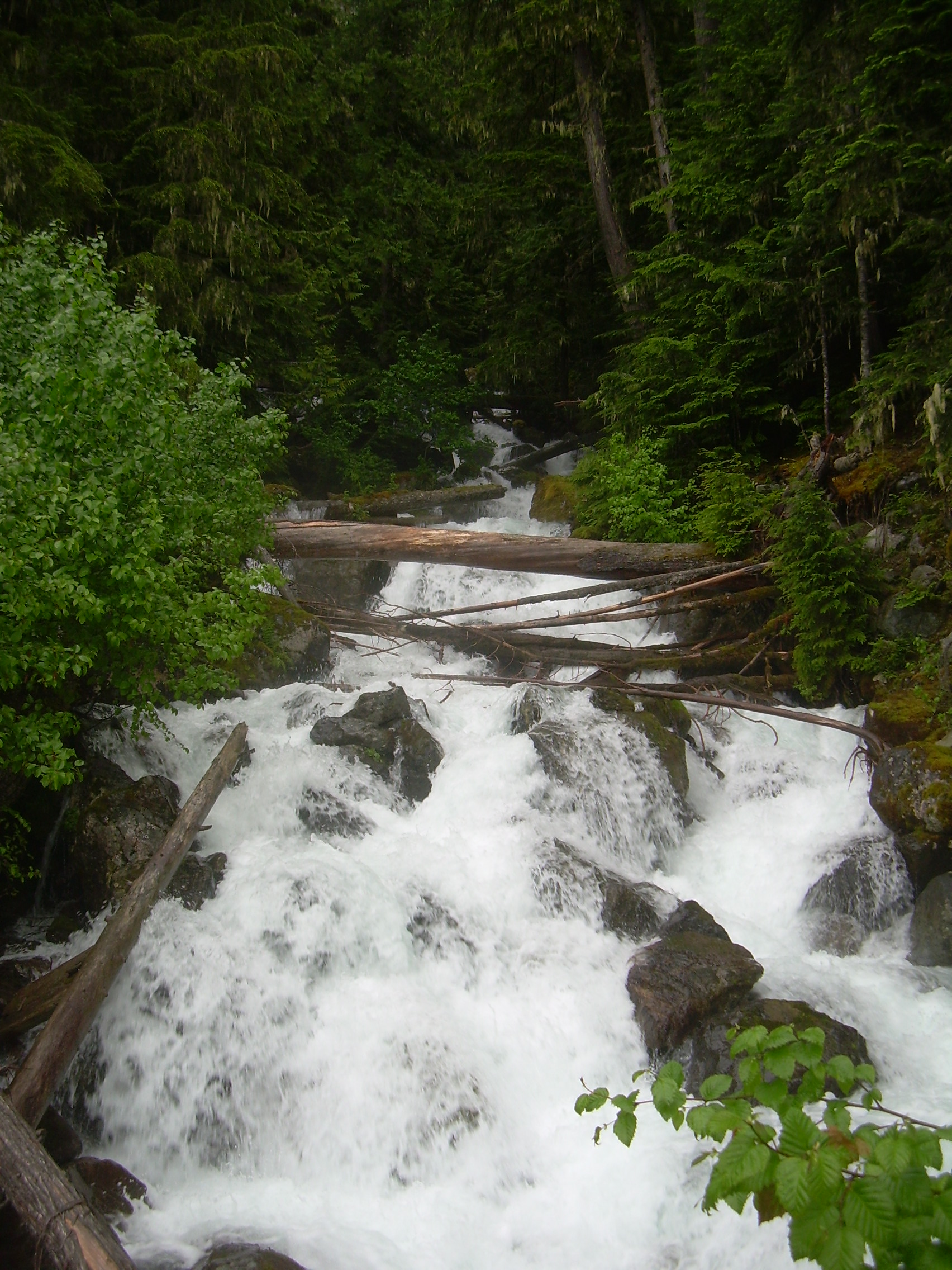
Wedgemont Creek |
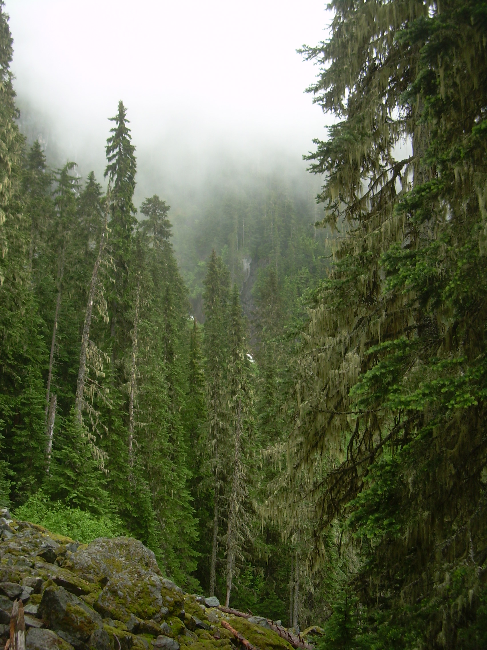
Tree into the Mist |
At the trail head I quickly shoulder my bag and step out. A
kilometer later I cross Wedgemont Creek, which is as much a waterfalls
as a creek here. It falls 1000 meters in just over 2000 meters horizontally.
The trail is not as direct as the stream, but from this point on it is
an aggressive climb. On the map it looks like it is 2.5 kilometers from
trailhead to the shelter by the lake, but the trail is listed as 6.0 km.
The discrepancy is because switchbacks don't show up very well on maps like
this.
1220 meters in 6.0 kilometers. I have to pause and try and find a
comparison. This trail is a 20% grade. The trail up Kebnekaise from
our campsite was a bit steeper at 24%, but only half as long. The
trail up Quandary was longer, about 10 kilometers, but half as steep
at just under a 10% grade. The trail up Algonquin ("Staircase To Mordor",
according to Robin) was 22% grade, but only 3.5 km, with full backpacks.
To me the trail which comes closes is the
Osgood trail, up the shoulder of the Presidential Range in the White
Mountains of New Hampshire. It is also a 20% grade, but it only goes
on for a bit over 4 kilometers. However, I think the reason I am
reminded of the Osgood trail is because it is also cold and wet.
The trees are dripping moss and mist.
The first half of the climb is through Western Redcedars and Douglas Firs.
These are not quite as impressive as those next to Cheakamus Lake, but
they still tower over me, sometimes with their tops lost in the low
laying clouds. At about the hour mark I start to encounter patches of
snow which grow as I climb higher into the Hemlock and then the
Sitka Spruce forest. Even with my boots in snow, I am sweating hard.
I've stripped down to just a nylon shirt which will dry quickly,
but I don't want to be soaked in sweat when I get up to the shelter.
I expect it to be cold and windy up there, and wet clothing would
lead to an uncomfortable chill.
There is one section without snow. I think it faces south and may have
been too steep to have accumulated a lot. But then as the trees start
to shrink in statue, the snow is back, thick and continuous.
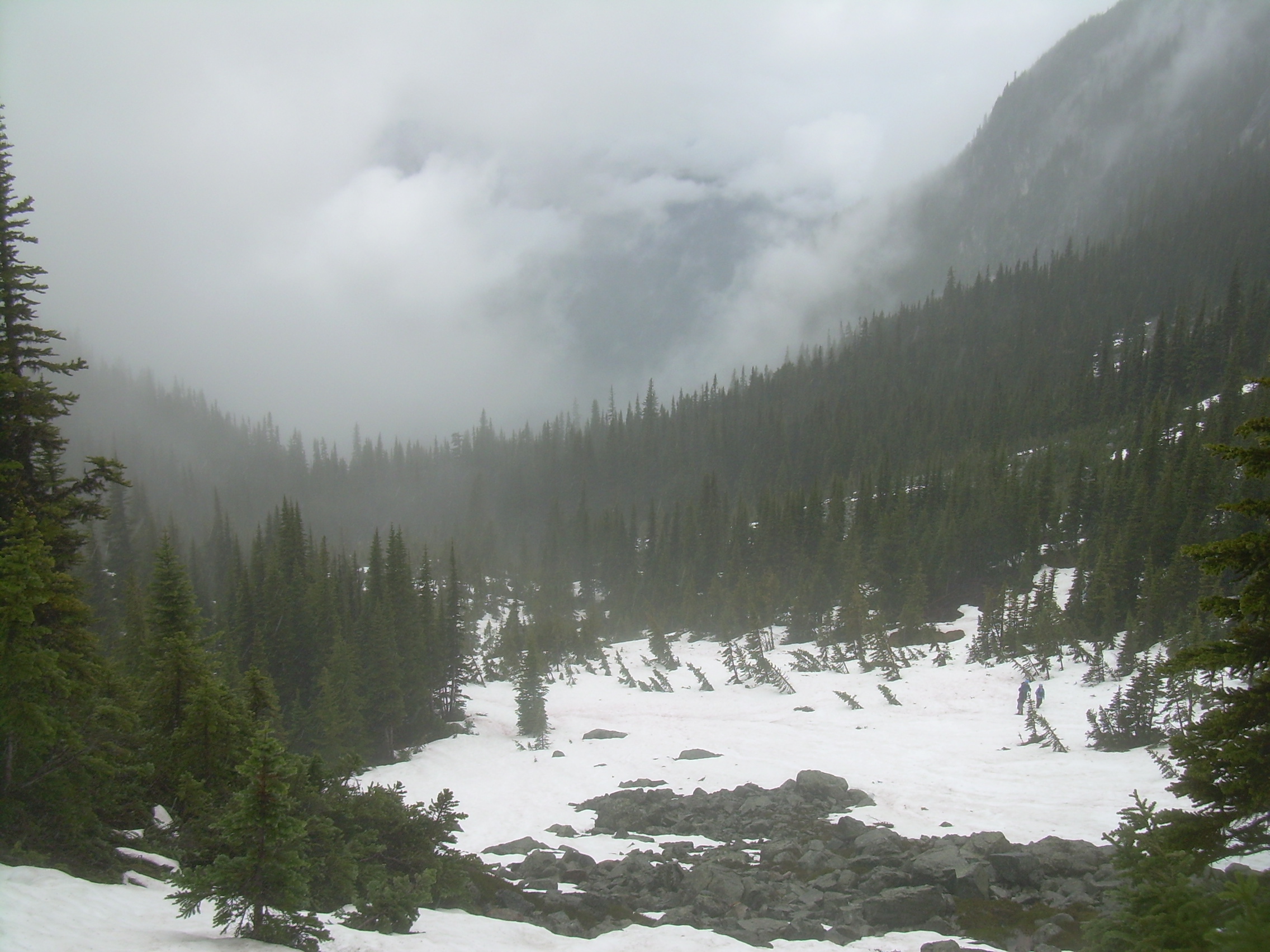
I am following small orange diamond blazes on the trees as well as
flagging tied to the branches. Abruptly I leave the trees onto
what I think must have been a landslide, a swath of open snow forty
meters wide, and extending up the slope into the clouds, at least two
hundred meters. I hunt around for awhile, but don't pick up the trail.
I can not see a place where it might take to the woods again. I
can not find any more flagging or blazes.
Trail to the hut? |
Log book in the hut
"...a fresh-water Sasquatch ..." |
Wedgemont Hut |
The tall out house |
But there are faint footprints in the snow.
I have been climbing for about two hours at this point, I think
at a good pace. So I think I am within a kilometer of the shelter.
But there have not been any definitive landmarks today to calibrate
my pace with. Still, I reason, the shelter should only be up this
snowfield -- or I could be completely wrong about my progress.
So I have two choices. Turn back or follow these faint foot prints.
It is only noon, and I have a lot of time before my turn-around time.
So I decide to explore up the field.
The footprints are very hard to see. With the rain of the last few
days there has been a lot of melting and what I really see are dints
in the dirty snowfield. I think they are humans, but they could just
as easily be animal. So I tell myself I have half and hour to find something,
and I start to climb.
It is steep. I am kick stepping up the snow, and often using my hands.
Every few minutes I stop to catch my breath and also to look behind me. If
I am going to have to descend this same slope in this thick mist I want
to make sure I recognize it and do not miss the trail.
As I near the top of the slope there is a place where the snow has
melted down to the ground, and I see what sure looks like a trail.
If it is, then I need only bare a bit more to the south -- and there
is a bit of flagging tied into the branch of a stunted spruce, almost the
last krummholz before the true alpine world.
The cloud is thicker then ever, but I am again certain of my way as I
climbed up another hundred meters and crested a ridge which marked the
start of the hanging valley which holds Wedgemont Lake. Across
another fifty meters of snow is something standing up straight, silhouetted
in the mist. I can not tell how far away it is, except it quickly
gets bigger as I walked towards it. I think it must be man-made because
it is so straight and its sides are perfectly parallel.
It is a building, but taller and thinner then anything I would have
expected. This is the hut's outhouse, two stories tall. I think it is build
this way so it wouldn't be buried for much of the winter.
Beyond that is the shelter. It is almost an A-frame, with bowed out
sides and a metal roof which reaches from peak to the ground. I think
it is build to withstand being buried in the winter.
I pull back the massive bolt which holds the door shut in even the strongest
of winds and step in out of the rain and fog. Inside there is a loft where
four could sleep, although a bit tight and hopefully friendly. Below there
is another bench to sleep on, a table and a bench for sitting and a trunk,
presumably with emergency equipment. One small high up window lets in some
light, but no view.
I sat, ate my lunch and read the hut's log book. It was mainly full of
entries from happy people tell me about what a beautiful view they were
enjoying, in marked contrast to the mist and grey I was enveloped in.
After lunch I had some time and didn't need to head down, but I can't see
anything and it seemed a bit foolish to march across the snowfields towards
unknown and unseen goals. So I resolved to head down. I packed up and
shouldered my bag, opened the hut's doors, and was knocked over by a glorious
sight!
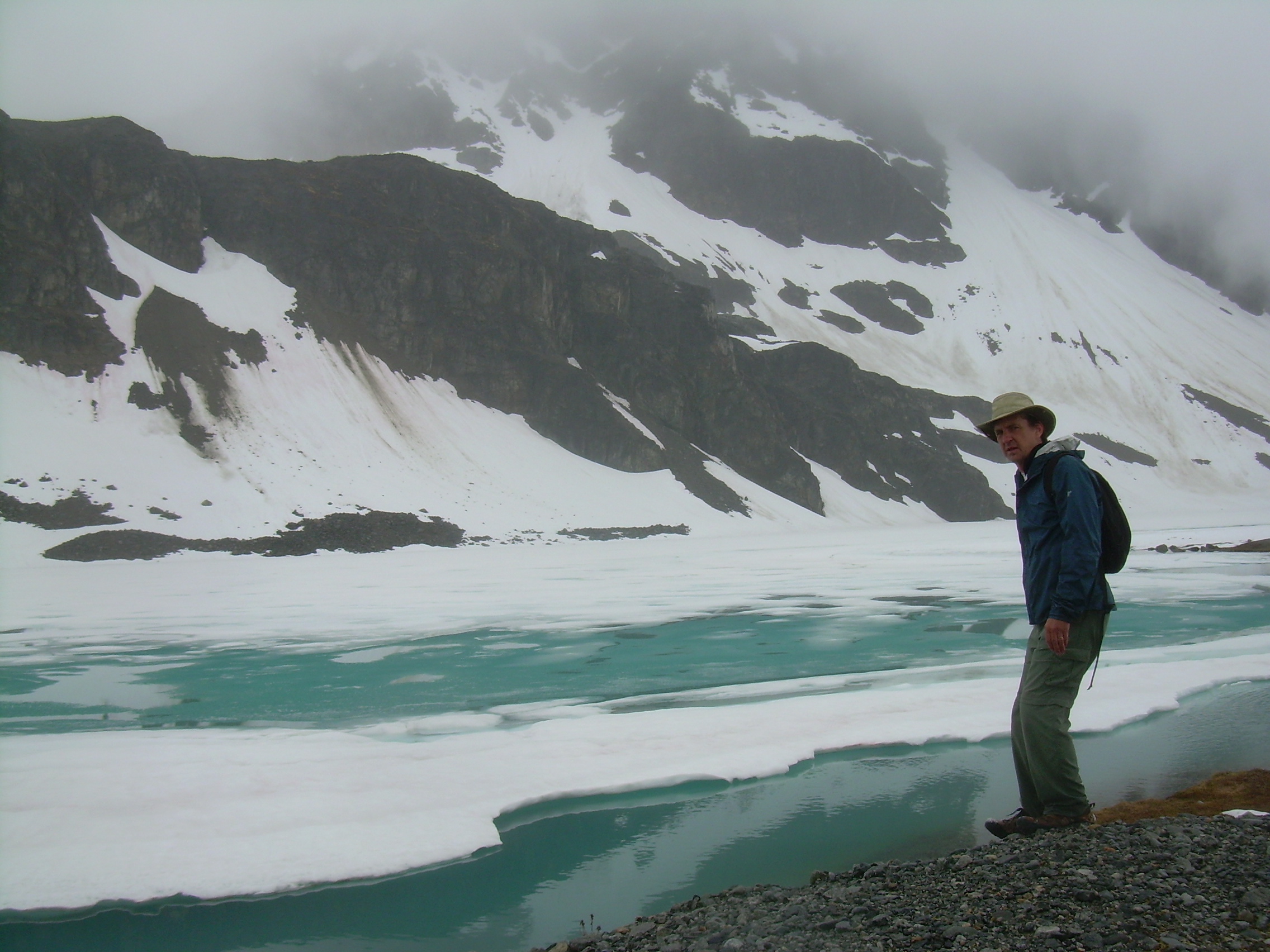
View from the hut. Wedgemont Lake & Glacier.
The cloud ceiling had risen 200 to 300 meters up over head, and the whole
Wedgemont hanging valley lay clear in front of me. A bit below the hut, and
200 meters away is Wedgemont Lake. Most of it is still covered with ice,
although along the north edge, presumablely the side with more sunshine,
there are patches of open blue water. The blue is an unnatural blue,
as are most glacial fed lakes. Stones are ground to a powder by the glacier.
This "rockflour" washes into the lake and changes the reflectivity of
the water. This is also why some streams are said to flow with
"Glacial Milk" (see "Kungsleden & Kebnekaise / Arctic Hike").
By Wedgemont Lake |
Wedgemont Lake |
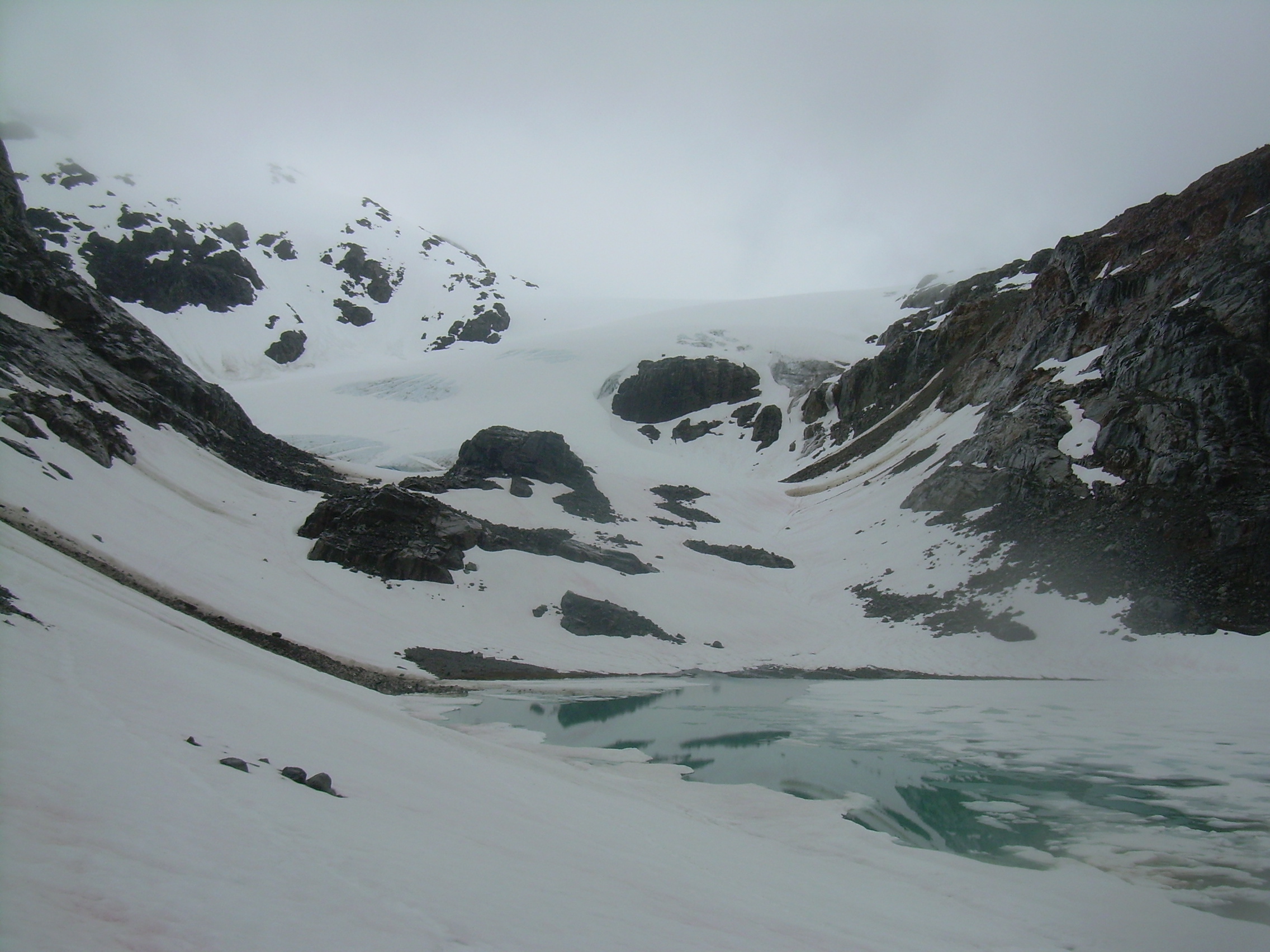
Wedgemont Glacier |
The lake stretched a kilometer back into the valley, between Mt. Cook, Weart
and The Owl to the north, and Parkhurst and Wedgemont Mountain to the
south. Four hundred meters beyond the end of the lake, on the
northern slope of Wedgemont was a glacier! I could have danced!
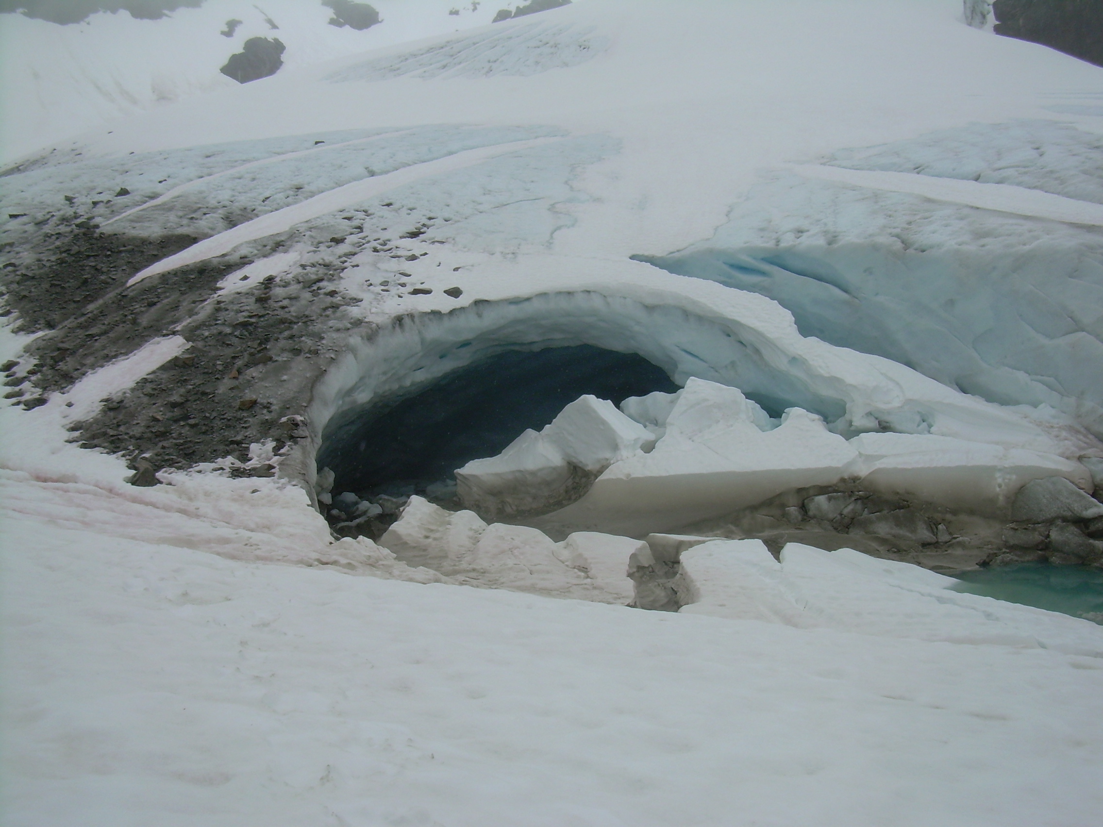
Wedgemont Glacier &
ice cave |
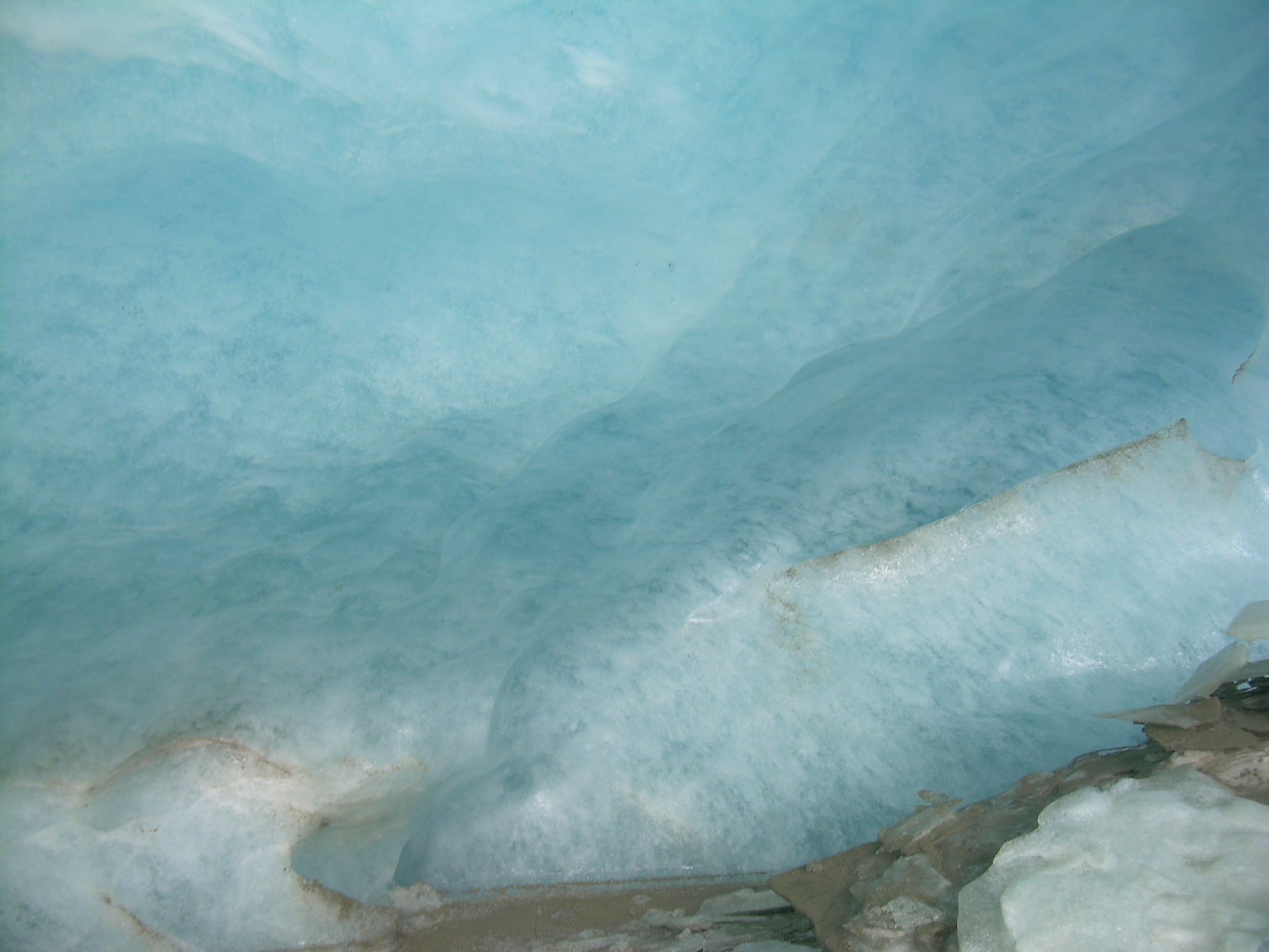
In the Glacier |
Glacier Blue |
I can also see a bit of trail between the huts and a camping area next to
the lake. So I raced down to the lake. There are a few tent platforms,
as well as some raised mounds of fine gravel to camp on. Where the snow
has melted the ground is covered with shattered rock, hundreds of hectares
of talus.
From here on I was on the snowfield. It started to rain again, but no
matter! I don't think I have ever been on an untamed glacier. Our
tramp across the Dachstein Glacier in Austria was on a well marked path
to an alpine hut with coffee waiting.
Most of the glacier is covered with the remains of this year's snow.
But in places you can see the blue ice. The ice is encrusted with rocks,
more talus which has tumbled onto it over the years. If the glacier's
bottom is as encrusted as the top then no wonder it can carve a valley.
Those rocks working as the teeth of a rasp-file.
The leading edge of the glacier is pinched in a narrow part of the
valley, and so bowed up. This folded leading edge has calved, broken and
fallen off, leaving a cavern as seductive as an Italian ice on
a hot day. I climbed into the cave.
It is about 8-10 meters tall, 15 meters deep and 30-40 meters wide with
a domed ceiling of pale blue ice, a shade sometimes called "glacier blue".
Sunlight comes through the ice, but the reds and long wavelengths tends
to be filtered out.
It is hard walking in the cave. The floor is scattered with flakes of
ice which have fallen from the ceiling. I think about the possibility of
being beaned on the head. But today is cold and overcast. Still I
make my exploration brief.
On top of the glacier I watch streams disappearing into crevices. I know that
glaciers can be dangerous, so only explore the edge, and only briefly.
It is time to head back down. The clouds have descended some as I skirt
around the shore of the lake and past the hut. Soon I am on the snowfield
where I lost the trail and almost turned back. I am so glad I continued.
At the base of the field, right where I had stood in doubt, I saw three
hikers, standing there, consulting their map and pointing in different
directions. I waved my hat at them, and slid down the snow to join them.
They too were on the verge of turning around. So I talked them into
continuing, telling them that they could easily trace my footprints to
the hut, and be there in twenty minutes.
They thanked me and started climbing.
Descending & meeing
hikers coming up |
How come I meet people ready to turn around always twenty minutes from
their destination?
The rest of the hike was eventless. Down into the trees and soon out of the
snow. Down the steep slopes and switch-backs. Down across the raging
Wedgemont Creek and back to the trailhead.
It is still a summer day at the trailhead, a world of difference from dancing
around on top of a glacier.
| 