|
Walking The Ridge Line - Loveland/Grizzly/Torrey's June 18th, 2017 |
|||||||||
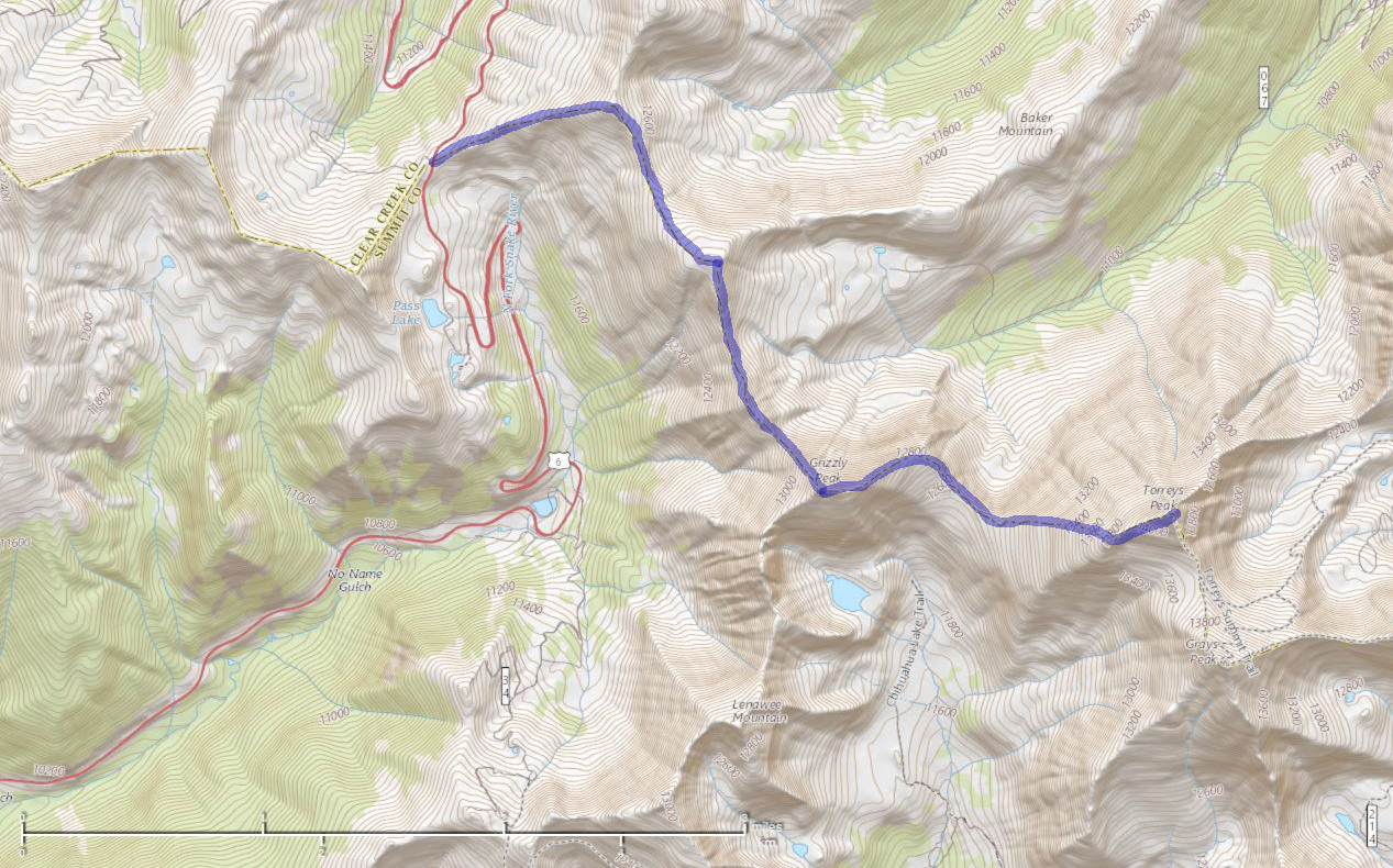
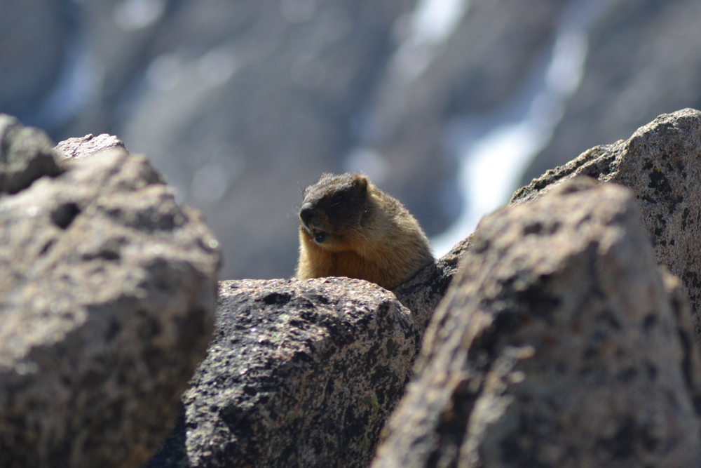
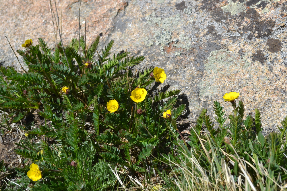
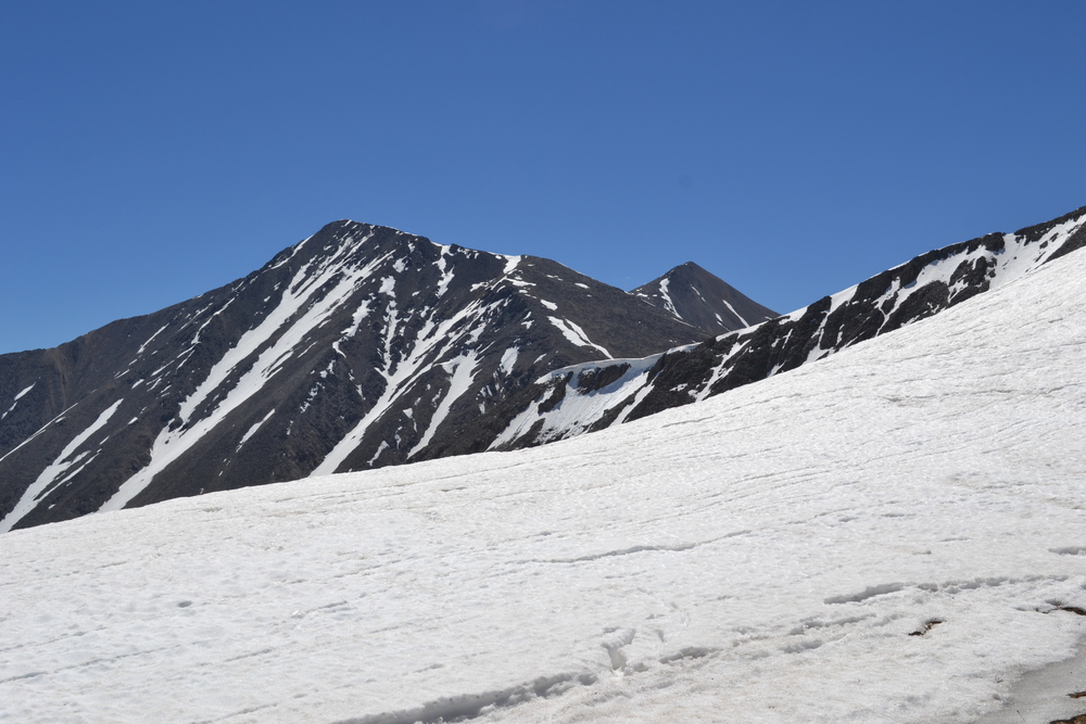
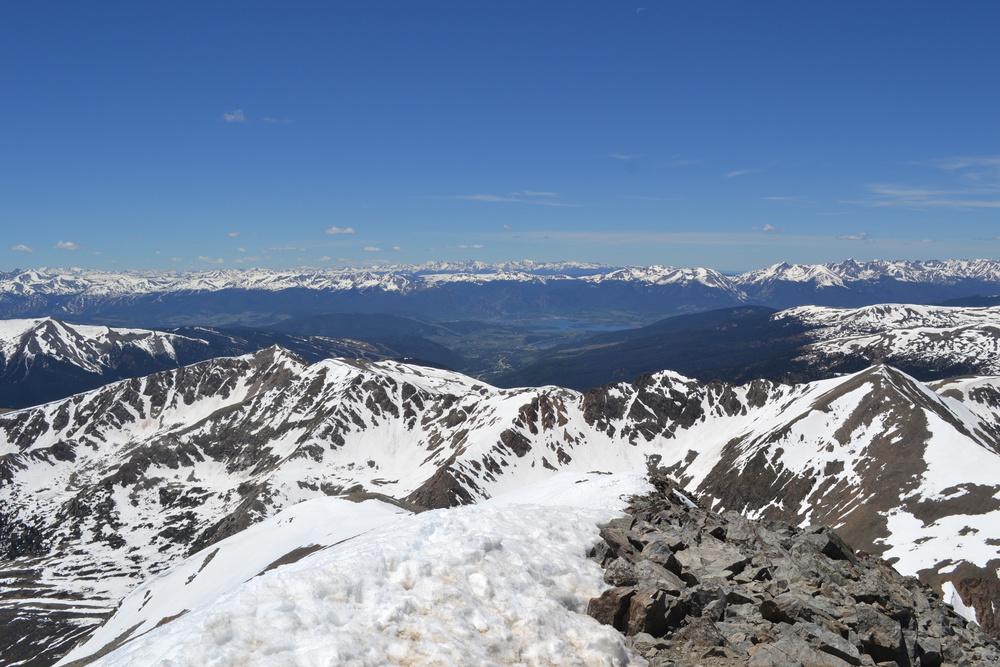
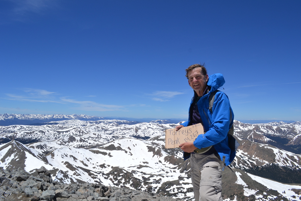
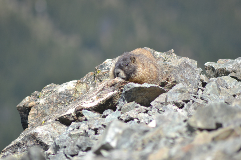
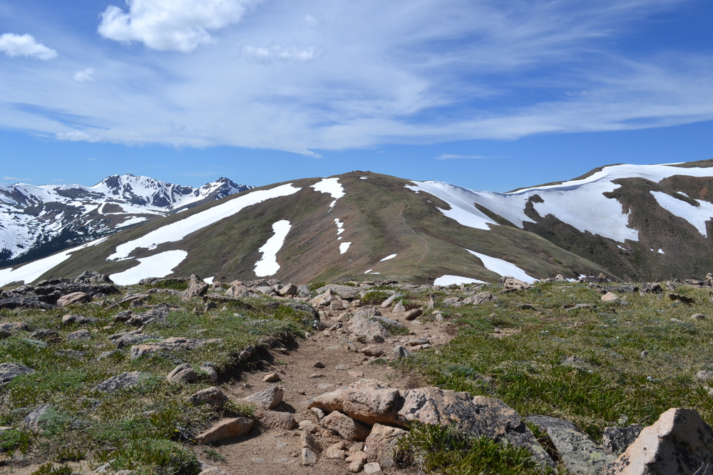
It is my first day walking in the mountains and I expect that I'll be a bit short winded, up on the continental divide the atmospheric pressure is about 60% of what it is at sea level. So I am stepping into the hyper-Troposphere with trepidation - I generally need all the oxygen I can get my lungs around. So the plan is to start as high up as I can, and do just a little bit of horizontal walking. Or at least that is the plan. I started at Loveland pass, 1,190 feet up. There is a peak about three-quarters of a mile from the pass - according to the map. But this is open country and it looks a lot closer and very tempting. So a grand mass of us hikers head out from the pass. I think about half of those who started make it to that first promontory, but only 20% continued. I think that is part of today's theme. As I walked the ridge line, at every peak the number of hikers drops by 80%. At that first peak the trail splits. To the northeast is Mount Sniktau, a hike highly rated in the trail guides, but round trip is only three miles and even though I may be huffing like a steam engine, I was looking for a longer walk. So I headed south towards Grizzly Peak. First, however, there is a smaller peak called Cupid. Cupid by itself is a gentle mountain and I am tempted to describe it more as a "Fell" then a mountain. It has the open, high, hill top feeling I experienced last year in Wales and the year before in Scotland. There are open sweeps of meadow intermixed with swells of broken rock which seem to boil up from within the mountain. There are, of course, a few noticeable difference from the fells of the British Isles too. It's not raining. There is not even a suggestion of rain clouds. In fact, ". . . the sun is up, the sky is blue, its beautiful, and so are you - - - dear Cupid, I've come out to play!" It was here where I encountered a number of Yellow-bellied Marmots! Like mountaintop beavers, minus the paddle-like tails, these big rodents watch me from their rocky lodges. Their live among the patches of broken stone, but venture into the meadows to sup. Between Cupid and Grizzly Peak there is an un-named knoll and beyond that I encounter my first snowfield, a reminder that these really aren't fells. The west slopes are nearly clear alpine meadows, but the east slopes are still piled thick with the remains of winter. In fact you can see the wind's sculpting hand as it push snow across the ridge-line and in the lee left "cornices". In mountaineering cornices are rank with quicksand as something to be avoided. It is seductive to walk out to the lip of the these fields, only to have the ice and snow collapse underfoot. The final push up Grizzly Peak, to my destination, is only a bit over a quarter of a mile, but it is about a 600 foot vertical climb up a path of scree. And even though the air is thin as I pass the 13,000 foot elevation mark, I find I can maintain a steady pace. Step after step, I am glad that I ran all those miles this spring and am in pretty reasonable shape. There is a knot of hikers huddled at the peak behind a wind shelter build of hand piled rocks, and so I head down the ridge line fifty meters and plant myself between some boulders to enjoy my lunch. The world is at my feet! A thousand feet below me is a cwm (or cirque) which contain Chihuahau Lake, still frozen as we approach the first day of summer. Twenty miles to the southwest is Breckenridge and the Tenmile-Mosquito Range. But what holds my gaze is closer at hand. The Continental Divide heads east from here, and the next peak, a mere mile and a half away, is Torrey Peak. At 14,267 feet it qualifies for Colorado's list of "fourteeners". But I have a problem. I have actually made my way to Grizzly faster then expected and I am here an hour and a half before my turn-around time. A person with too much time can get themselves into trouble - or at least I decided to try. I could think of no good reason to not press on to Torrey. So I stuffed the remains of my cheese and bread into my pocket and headed east. It is a 600 foot drop to a saddle and then a 1,700 foot climb to Torrey. There really is no trail here, just picking you way over rocks down to a snow field. Then I lay back on my raincoat and slid down 300 feet in a few minutes. A stroll across the saddle and then a long slog up the shoulder of Torrey. This is an ascent to try ones sole. With lose scree the whole way it is one foot up and half a foot sliding back with every step. Whereas I found it hard, I passed a young couple from Denver who found it almost impossible, making me once again glad that I have been running. Once on the shoulder proper, it is a pleasant 500 meters to the summit where I again find a crowd, there is a popular trail up the other side of the peak. And once again there are marmots to entertain us! My turn-around time was ten minutes ago, but by glissading (sliding) down 800 feet of Torrey the return was simple. I tried a standing glissade, but in the brilliant June sun the snow was too soft. So laying my pack on my stomach, tucking my raincoat (and wind shield) in my pants, I lay on my back and with feet forward slid down. I was soaked by the time I reached the bottom of the snow field, but the air is so parched, so I was dry in half an hour. Back over Grizzly, Cupid and down to Loveland Pass! A delightful ramble. |