|
Argentine Pass June 22nd, 2017 |
|||||||||||||||
[Click on any photo to get a higher resolution.
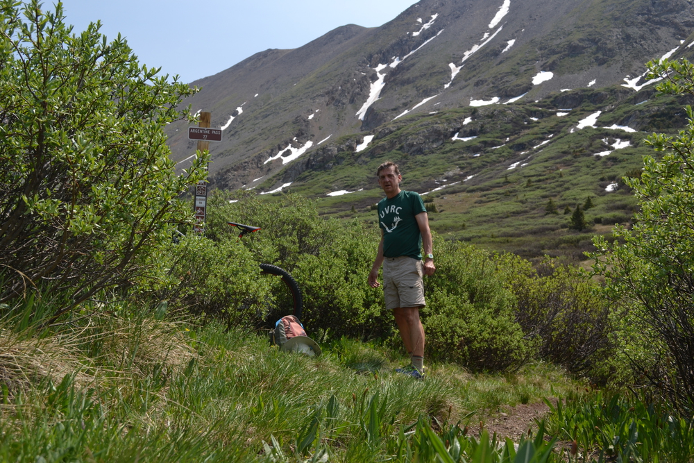
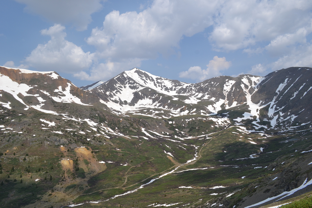
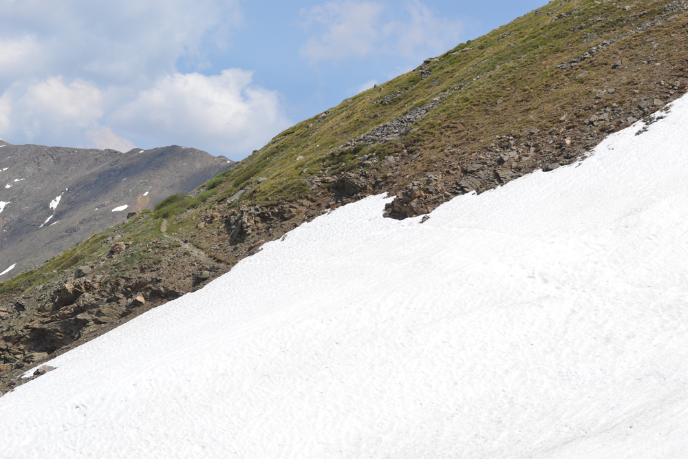
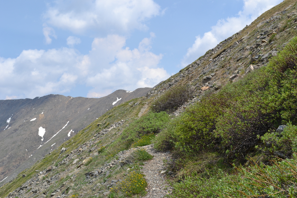
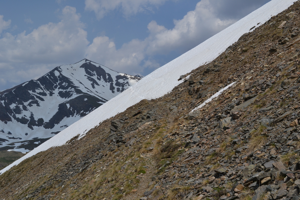
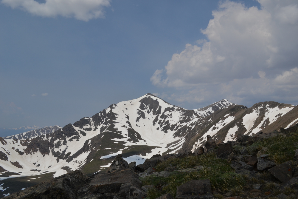
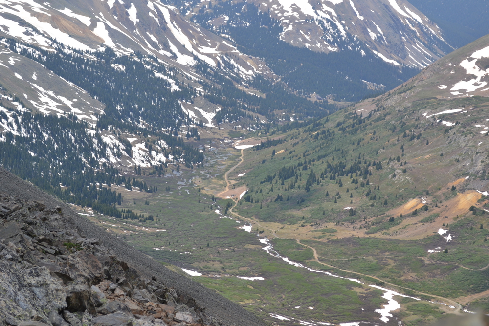
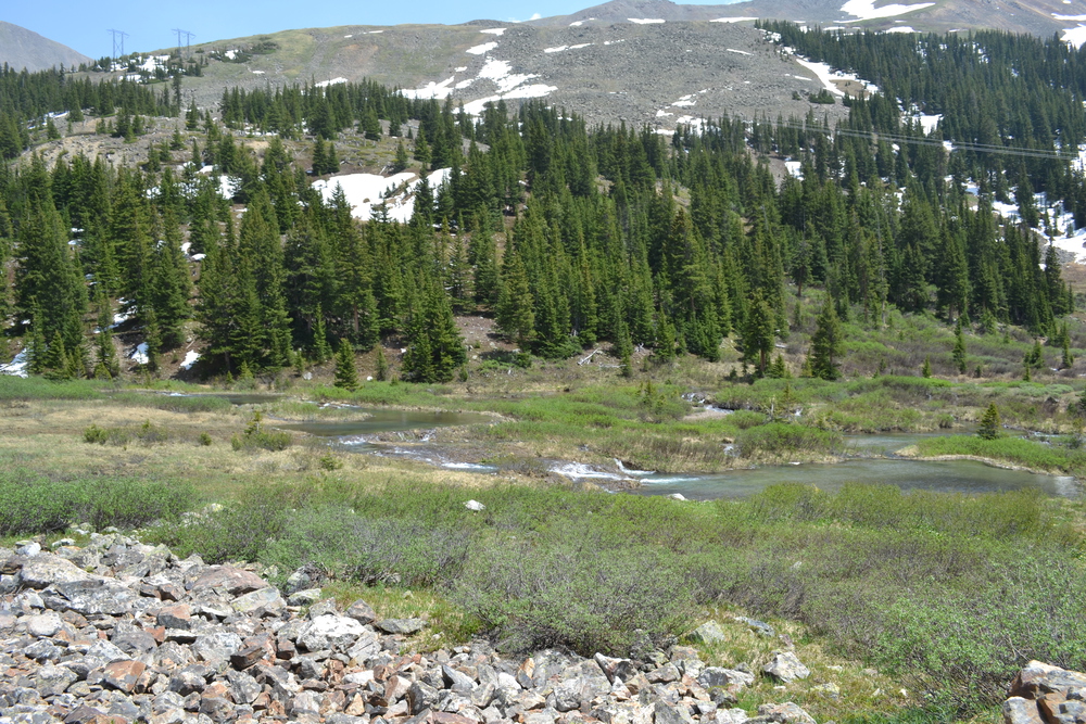
I had been eyeing a place on the map marked "Argentine Pass" since the beginning of the week, and as the week progressed it seemed more and more like it should be the natural destination of my last hike. It is still on the continental divide, south of Gray's and Torrey's. In fact it turns my five rambles into a coherent whole. Instead of walks in a scattering of peaks, trying to bag the 14,000 footers, it means I have explored a small region in more detail. Argentine Pass also seems to garner high marks from of hikers-bloggers, but it is also very remote, off of most people's beaten path, which made it particularly attractive to me. So since Monday, when I hiked up to Chihuahua Lake, I have been trying to figure out how to get to the trailhead. The trail starts off of Forest Service Road 260, next to Peru Creek. That is the same dirt road that I walked up at the start of my ramble to Chihuahua Lake. But on Monday the road was barred by a locked gate. I checked last night, but the gate was still locked, despite the sign promising that it would be open a few weeks ago. So what to do? It is about five miles from the gate to the trailhead and with a brisk pace I might walk in in an hour and a half. But somehow changing a four mile hike into a fourteen mile walk seemed a bit much. So I decided to rent a mountain bike. Although I would have to wait for the bike shop to open in the morning, it would simplify my day. With a bike loaded into the car I headed to the parking area just outside the locked gate, only to find that today the gate was open! Still, I've got the bike and so decided to use it. Actually, when I returned here at the end of the day, a forest ranger was looking over the gate. She told me that it was a "renegade opening", somebody had just cut the chain. If the forest service had really opened the road, they would have locked the gate back out of the way, instead of letting it swing as it did. So this morning I left the car outside the gate and cycled up the Peru Creek valley. With a pair of wheels under me, the miles are easy, the day is clear and all is right with the world. I could tell, based on tire tracks in the dust and occasional mud, that three vehicles have driven in this morning. But I don't think any have gone out yet . Finally I met a jeep as I am passing a beaver meadow. And then a second jeep as I climb up through an aspen grove. But the most surprising was on a narrow twisted section of road cut into the steep mountain side, when I met a large pickup truck who was driving backwards. I hopped off my bike and climbed up the embankment to let it pass, and wondered what this foretold. Around two more bends I came to a snowdrift, nearly three feet tall, and all was explained. I pushed the bike through the snow for a hundred meters, and then I remounted and rode the last mile and a half to the trailhead. Peru creek is breaking tree-line here in the Horseshoe Basin. I locked my bike up the the sign at the trailhead, more out of habit then any real concern. I think there is a good chance I am the only one in this whole basin today, the only person beyond the snow drift. At one time this was a busy place, I can see the tailing slopes from a number of mine shaft on the slopes surrounding me. Peruvian Mine, Paymaster Mine, Shoe Basin Mine and National Treasure Mine. Even the names of the peaks call out this history; Ruby Mountain, Silver and Brittle Silver to the west and the southwest. Even my destination today, Argentine Pass, takes its name not from the country, but from Argentum, the Latin word for silver. Silver was discovered in this area in 1864, and I expect that this was a bit of a boomtown. But today, the whole of the basin, maybe two miles across, is mine alone. The trail crosses Peru creek on a foot bridge which has cracked in the middle and is propped up on boulders, just above the whitewaters. It then pushs into some scrub for a hundred meters, past a few spruce and then onto the open slopes. This trail is what remains of a road which was blasted into the rock face in the 1870's. The idea of driving a team of horses and a wagon full of ore up and down this incline . . . I guess those were hardy (fool-hardy?) souls. Every few hundred meters the trail dips back into the mountain to cross a ravine, and most of the ravines are packed with snow. I kick and step my way across these fields. I find myself looking down the slope and trying to imagine what would happen if I lost my footing and went off on an unscheduled glissade. I think that at worst I would end up as much as 200 meters downhill, but no real chance of injury, and so I forged on. On one of these crossings a ridge had formed in the middle and so I carried a stone the size and shape of a trowel to help me cut toe holes in the hard snow. I had to cut, push and crawl up over the cornice. The trail climbs 1,840 feet in two miles, and by the time I have reached the last mile I have left almost all vegetation behind. In the basin the day was sunny and cheerful, but now the winds are on the rise and I can see clouds forming up over Breckenridge, twenty miles to the southwest. At last I reach the pass and the wind roars past me. I find a wind shelter and hunker down for a break. I had planned to lunch here, but I don't like the look of the clouds which have broken lose from Quandary and are drifting in my direction. So I breathe deep of this mountain air, and take in all I can; memories to comfort me when I am huddled in the low lands. I imagine clambering up Edward's Peak to the north and then back to Gray's. Or dancing across the alpine meadows south to Argentine Peak. But for now, I leave the Marmots guardians of these islands in the sky.
|