|
Connecticut River Kayak Trip - 2017 | |||||||||||||||||||||||||||||||||
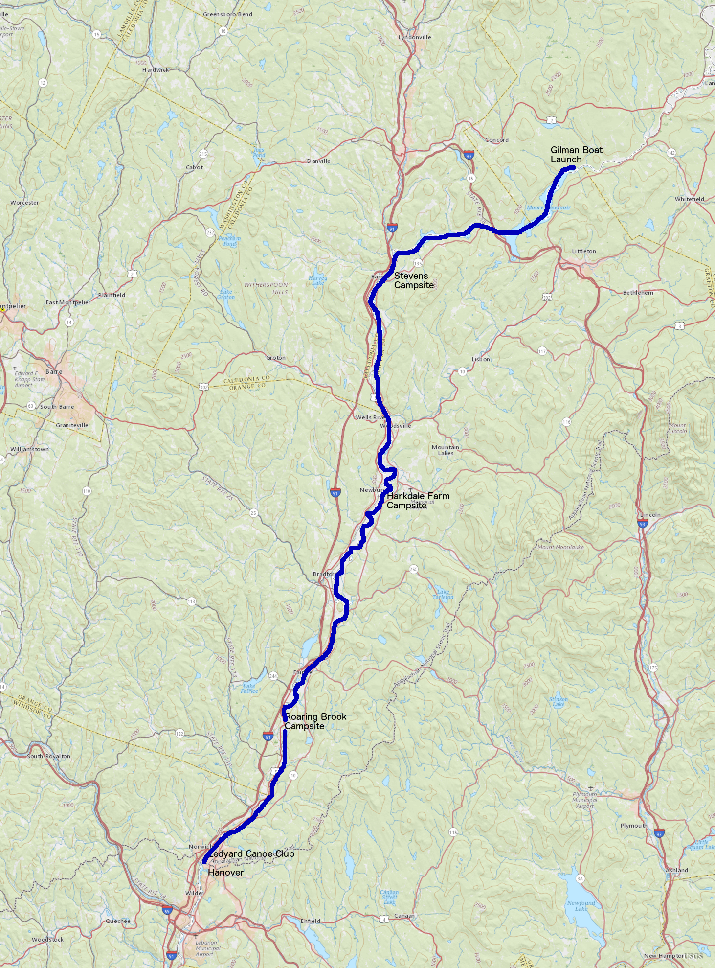
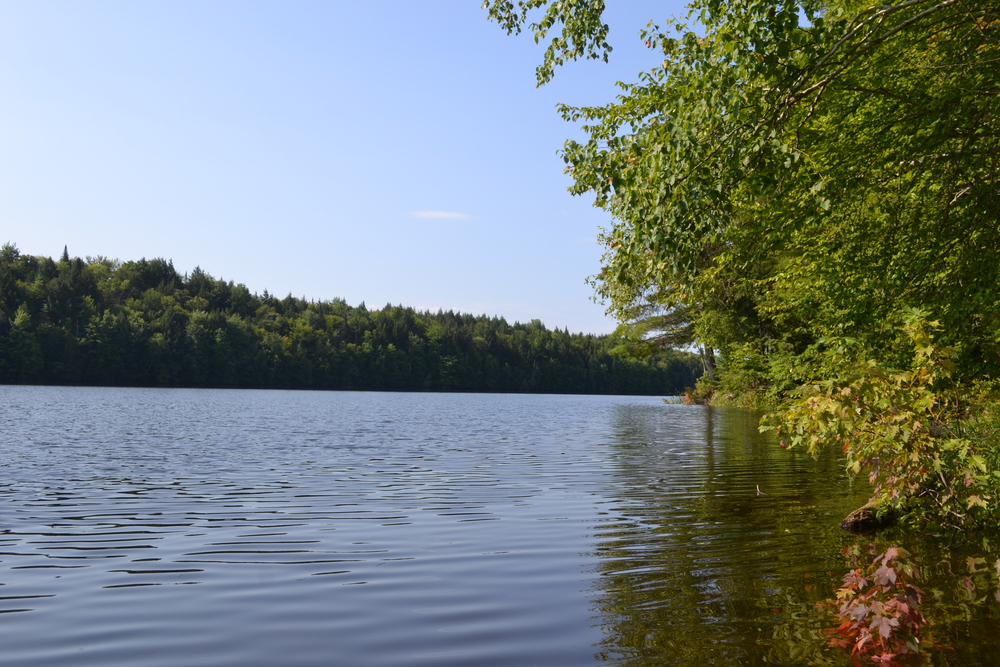
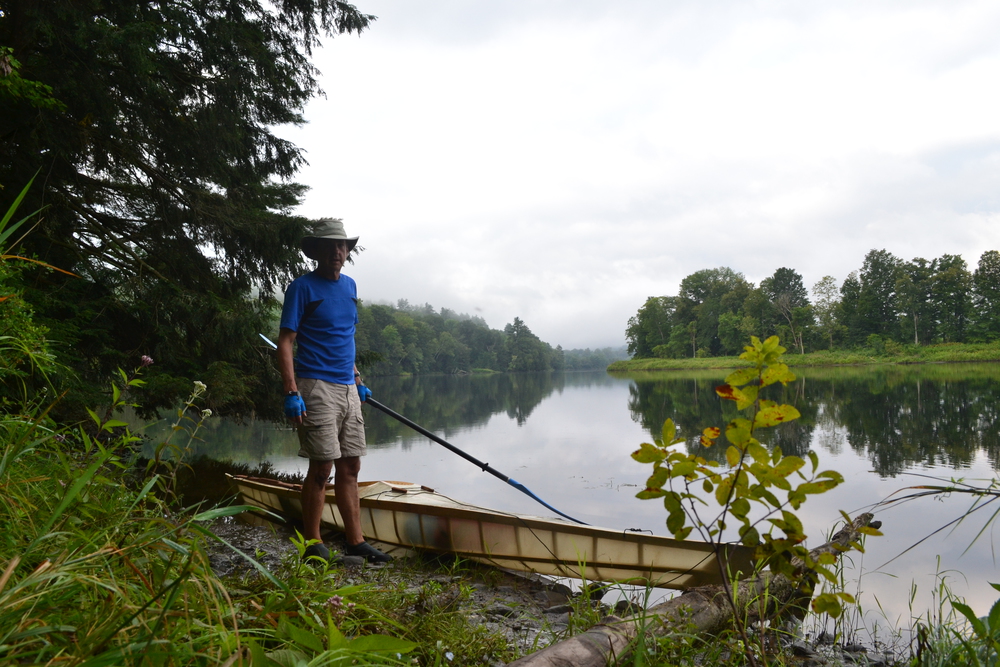
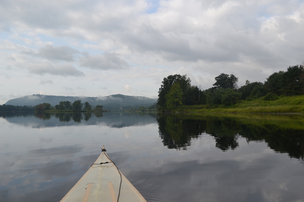
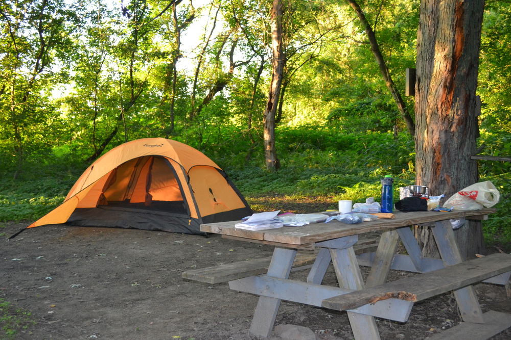
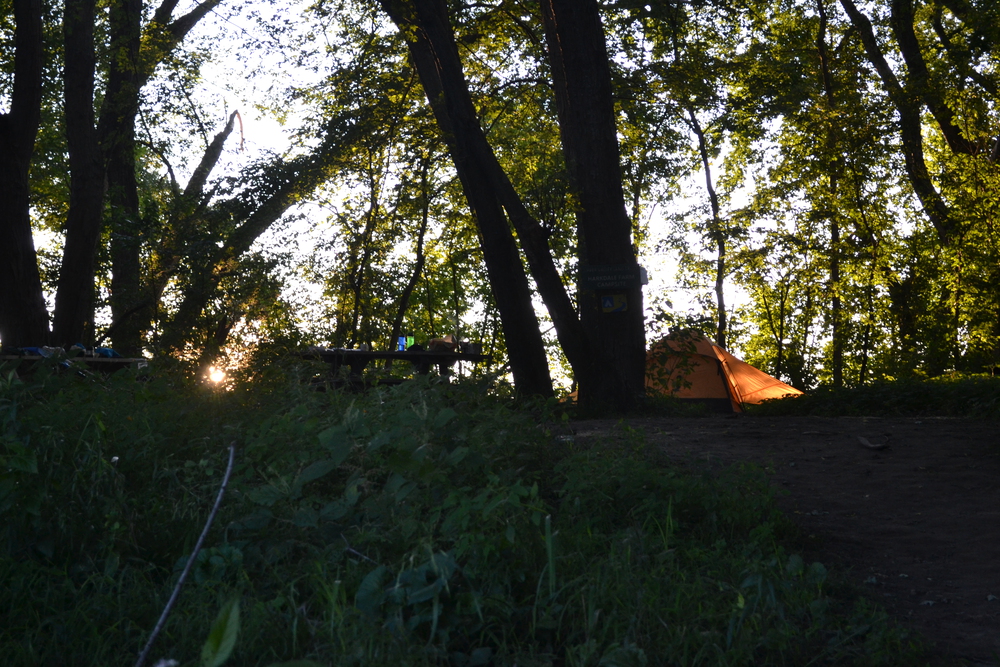
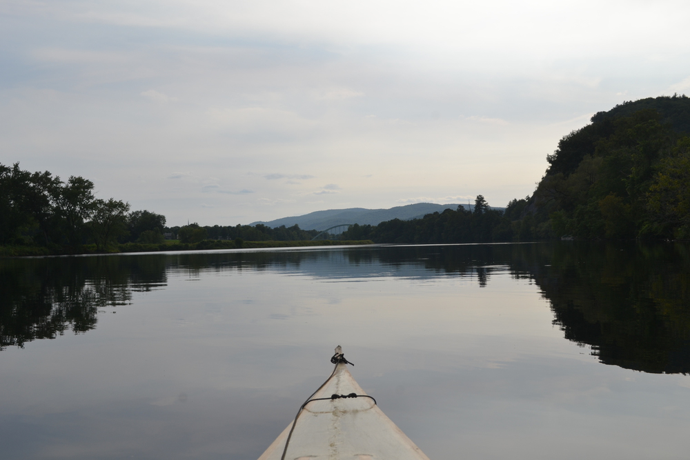
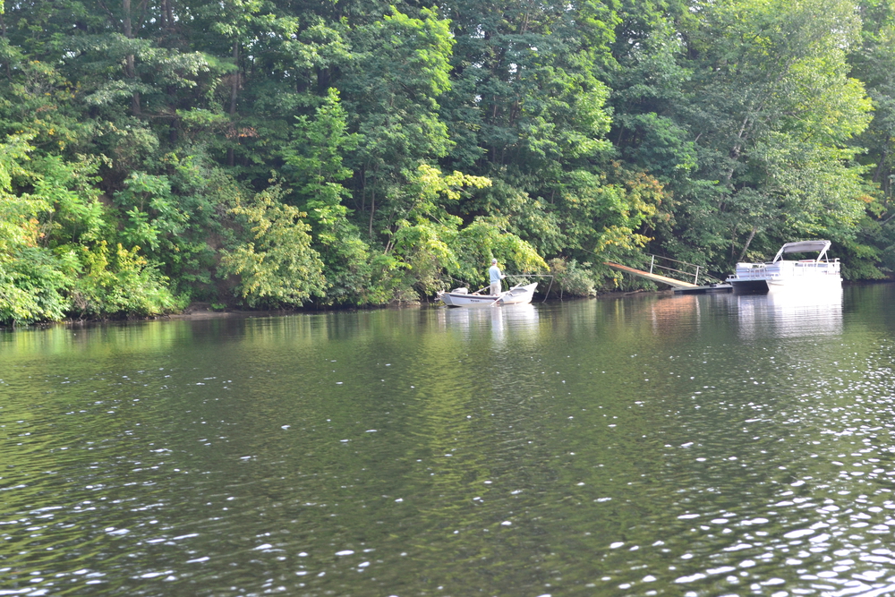
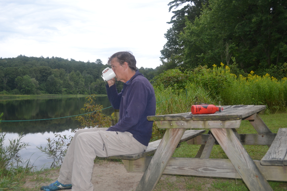
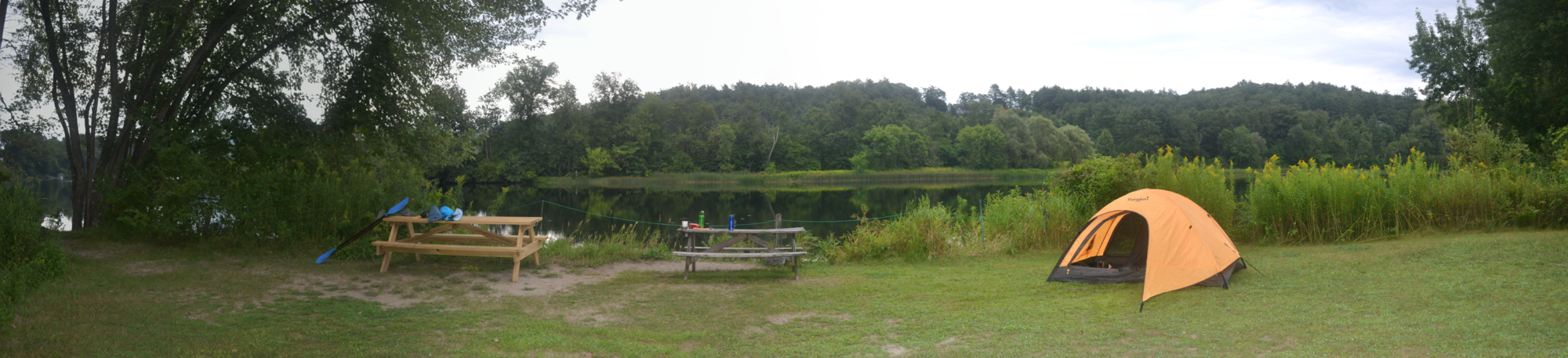
Tuesday, August 15th, 2017 Why is it that I am nerves to start on any adventure? I have been doing trek like this since 1980, for 37 years, yet still I lay awake for hours the night before stepping out. Am I still such an amateur adventurer? Or maybe if I wasn't filled with butterflies it wouldn't really be an adventure? That is part of my definition or adventure, stepping into a situation where you don't know exactly how things are going to turn out. I woke a few minutes before my alarm went off, and an hour later Kristina and I were on the road heading north. In an hour and a half we drove the same distance it will take me four days to paddle. Weaving among obscure Vermont byways we eventually found ourselves at the Gilman boat launch. The day is going to be beautiful and golden. An eagle flies over head as I carry the kayak and my gear down to the water. And in twenty minutes I bid Kristina adieu, shove off and start paddling. The boat launch is at the very start of the Moore Reservoir, so immediately the Connecticut Rivers starts to broaden. This reservoir is about ten miles long, but never more then half a mile across, it winds between the hills of Vermont on the starboard, and New Hampshire on the port. I expected this reservoir to be alive with speedboats on a beautiful August day, but I had most of it to myself, only spotting one fishing boat and one pontoon boat all morning. The wind was in my teeth and I thought to myself, "this would be a great day for sailing." Still, this first few hours of simple paddling gave me time to adjust to my cockpit where I will be in residence for many hours in the next few days. During a few hours of kayaking last week I realized that my back, resting against the cockpit conning, and me knees, which are often wedged up against a deck beam, can get mighty sore. So I have brought some new padding, but it all need fine adjustments. By the time I reach the Moore Dam I am ready to stretch my legs and have lunch. But this is also a long portage and I find myself making three trips to carry the kayak plus all my gear to a dock below the dam. I thought I could do it in two trips. But my gear is divided into six bags. I doesn't weigh more then a backpack, but it all has to be stowed under the kayak's deck so I had to subdivided into small packages, and thus carrying was never simple. I have read numerous times that canoers and kayakers should recognize that dams may release water at any time and to try and avoid these surges. So just moments after I launched below the dam, while paddling in a canyon of roaring waters, a siren sounded and a mechanical voice on a loud speaker announced that their would be a release "soon". I looked at the rocky walls which flanked this section and could see no way of pulling myself out of the river, so instead I paddled hard to get out of that gap. I never noticed a raise in water, so wondered if I provided a bit of entertainment to bored operators in the dam's control room. So I am back into a reservoir, this one behind the Comerford Dam and the afternoon is starting to wind down. This is going to be a long day - about 21 miles - and I didn't get into the water until 9:40, so I am pressing on as quick as I can to get over the Comerford portage and on to my campsite. The portage at Comerford is amazing steep down behind the dam. I don't think I could managed carrying my kayak down anything steeper. I have put together a strip of foam padding with clips onto the conning (the wooden hoop around the kayak's cockpit), and then I can hoist the kayak onto my shoulder and and carry it. But the kayak is 17 feet long and so on the steep decent I need to actively pull the kayak's nose down, to keep the tail for skid down the hill. And I need to tip-toe through some poison ivy! Below Comerford I was soon at the confluence with the Passumpsic River. Every time a tributary joins the Connecticut there is a bar of cobbles pushed into the main channel. After see the destructive power of Hurricane Irene and other flooding in the last few years, it is not hard to imagine these side streams in flood pushing gravel, stones and boulders down from the hills and mountains, bouncing against rocks for miles until, by the time they reach the Connecticut, they are rounded cobbles. The confluence is referred to as "The Nine Islands", a maze of little sluice ways, back waters and the main channel. As I came around a point of an island, with a marsh tucked behind it, I head a thundering, galloping sound. By the time I could see into the marsh all that remained were the jets of water in the air, but the great creature which had created them was out of sight. I hunted around in that marsh, expecting to find a massive moose, but it had vanished into the forest. Back where the major channel of the Passumpsic joined us the cobbles have backed up the Connecticut and formed a half mile of rapids. There were a number of boulders sufficiently jagged to have ended my trip right then. But they were also big enough to be spotted and avoided. The possibility of destruction, or at least dampening, always give me a thrill and an adrenaline rush, which was a delightful and unexpected way of ending the day's travel. When the waters calmed I started looking for the campsite. I have a book which is a guide to the "Connecticut River Paddle Trail" and list campsite generally every five or six miles. But in that book this is a barren stretch of river. However, my book is a decade old and so I had looked online before leaving home and a new campsite near here was listed. I had scratched onto my map the word "Stevens" and an arrow to about here. But where? On the Vermont side the "Stevens River" flows in here, and there is also an island, which for some reason I thought was also called Stevens, but I couldn't see anything which looked like a campsite on it. I was about ready to land on a sandbar at the tip of the island, and create my own site when I meet a women in a kayak coming up river. She called out to me, "I do love to see people enjoying the river!" After agreeing with her, I asked her if she knew where the site was. "I believe I do!", she replied, sounding very pleased with herself. "There, just between those big birch trees", she pointed with her paddle. If I had looked at my map more carefully I would have noticed a tiny arrow pointing to the New Hampshire side of the river, just opposite of where I was then. Within three minutes I was landed and setting up my campsite. Set up the tent or start cooking? I'm hungry, its late, and storm clouds are gathering to the west. So while the pasta is cooking I am setting up my tent and stowing gear. I crawl into my tent with my pot of pasta just as the skies open up. A beautiful storm to watch, with a great light show, but not too much rain or wind and I finish my dinner about the time the rain let up. I am sweaty from a long day of paddling in the sun, and so in the evening I wade into the river for a splash-bath. The storm clouds have drifted away and the stars are out!
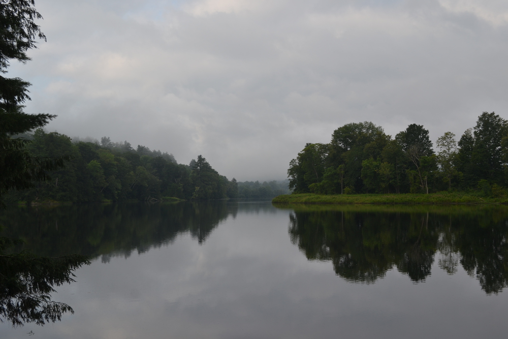
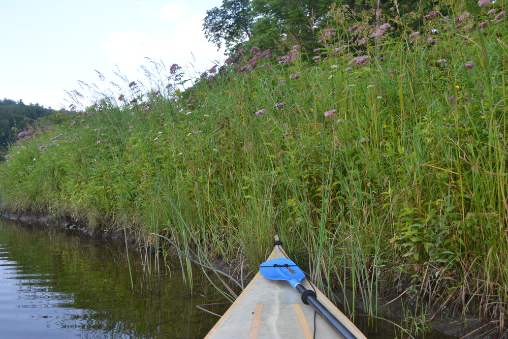
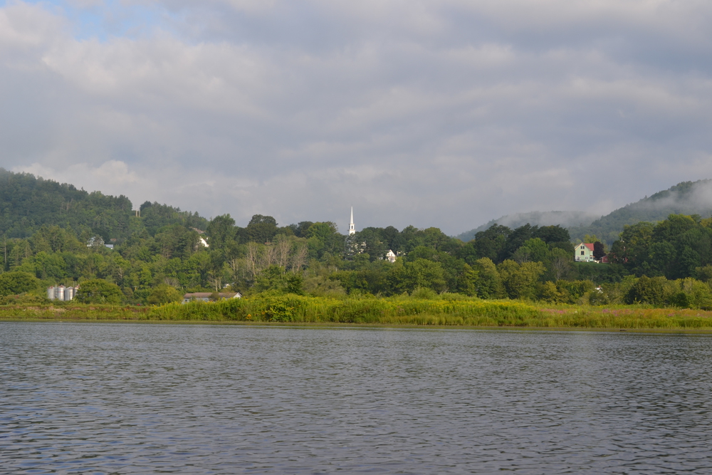
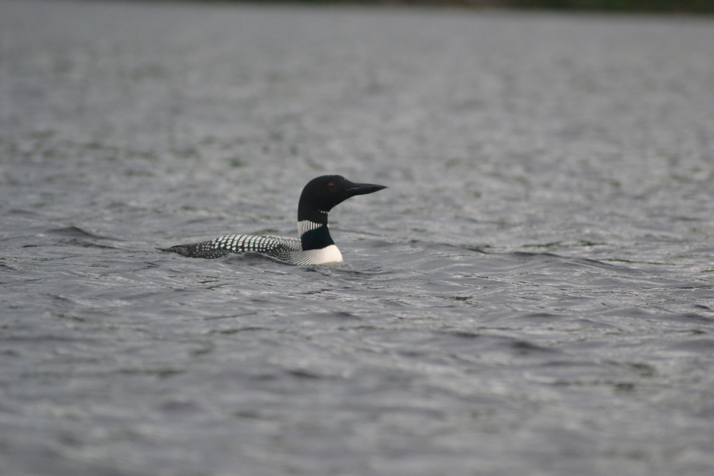
Wednesday, August 16th, 2017 The mist is rising by the time I pushed off this morning and the hour is pretty magically. I am a bit stiff, but that soon works itself out as I glide past Barnet. All I can see of the town is a steeple rising beyond the the wild flowers, which smother the river banks. Beyond the Monroe-Barnet Bridge the river widens out into a basin. I expect that it is backed up from the the McIndoe Dam, but since the dam is a few twist in the river away, it feels like a lake. I remembered that in Quebec the St. Lawrence is sometimes a 'rivière', or 'fleuve' or a 'lac' depending upon its width. Right now I am in a 'Lac'. Lac Barnet? Lac Monroe? Lac McIndoe? I guess that last one should be Loch. I am watching some creature swim towards me. I can only see its nose and am guessing a muskrat until it dives and slaps it's massive beaver tail. Eagles, cormorants, gulls and great blue herons. I heard the loons before I spotted them. They were not shy and came up to within a few meters before diving. Last night's storm still lingers this morning with great black thunders heads parading to the northeast, threatening but never quite developing. The portage around the McIndoe dam is simple and I am back on the water in twenty-five minutes. A few miles below the dam I pass a series of islands which includes the Fiddlehead Campsite where our troop camped a number of years ago. I am glad to see that the rope-swing is still there. The Dodge Falls portage is the site of my only major mishap of the trip. When I am wiggling my way out of the kayak's cockpit at the landing I lose my footing and while slipping grab the kayak, tipping, and filling it a quarter full of water. This would not have been too much of a problem, expect that I had my "day-bag", a dry bag with maps and stuff like that, open as the kayak flooded. Just up from the landing is an old tent platform where I laid out a few things to dry while I worked on portaging the rest of my gear. It also seems like a good time to wash my shirt. Forty-five minutes later I am back on the river and through my last portage of the trip. Most things, except my guide book and maps, are dry, and my shirt is stretched on the kayak's aft deck in the sun. A beautiful snowy egret brightens the day. The next landmark is the confluence of the Ammonoosuc and Wells River, which is a complication in the Connecticut. First we have two towns, Wells River in Vermont and Woodsville in New Hampshire. In addition the Connecticut breaks through a strata of schist in a small gap called "The Narrows". What this means is a series of rapids, twist, turns and whirlpools - which I think will be fun. In my kayak rapids always add an element of uncertainty. My kayak is a "skin on frame" boat. The frame is made of ash, pegged and lashed together. The skin is dacron, a type of polyester, painted with polyurethane. So all that is between me and the bottom of the river is a hundred of an inch of cloth. A few years ago I hit a snag and ripped a six inch gash. If I do that again, I will flood, but wouldn't sink because all of my dry bags are full of air. And repairs are simple, duct tape is amazing stuff. But still, it is pretty inconvenient. I shot the first set of rapids, the whirlpool and the narrows, then landed on a sand bar where the Ammonoosuc joins us. Its mid-day, so I put on my one clean shirt and walked into Woodsville for lunch at the "Salty Bistro". Back on the river, a quarter mile beyond where the Ammonoosuc comes in from the east is where the Wells River joins us from the west. The Wells has push a great bar of cobbles into the Connecticut and is a wild few hundred meters of rapids here. A curious thing about paddling in the rapids is that I have to hold my paddle more vertical and dig deeper, because otherwise, sometimes, I am paddling just air. Also, when the kayak bridges two wave crest momentarily it feels less stable, so I need to pay more attention to my balance. I think I must have scraped something hard. I know that my kayak suffers from some seepage, and every hour I have to sponge out the bilge, the area next to the keel. It take my sponge six time to make things dry. But now I find I have to do that twice as often. That is not really a problem - but it is a sign of a bad scrape. Past Howard Island and around two long, looping oxbows. The light is changing into something golden and warm as the day winds down. The Harkdale Farm Campsite was not hard to find, and is very pleasant. I gathered firewood and found the nick in my kayak before it got dark. I enjoyed a tuna-noodle casserole by the fire for dinner.
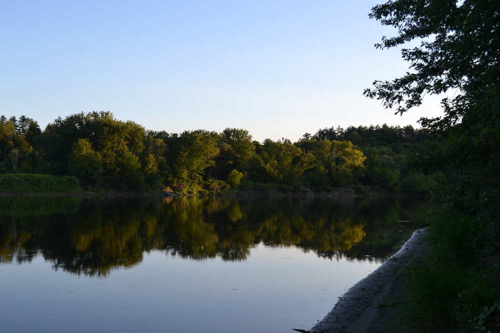
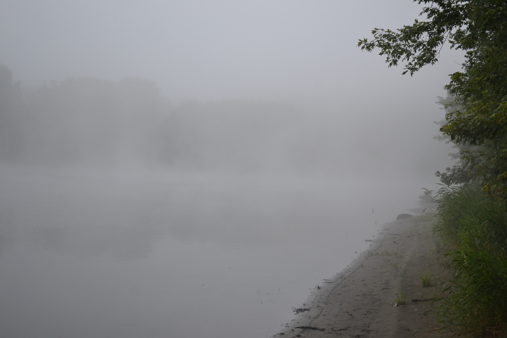
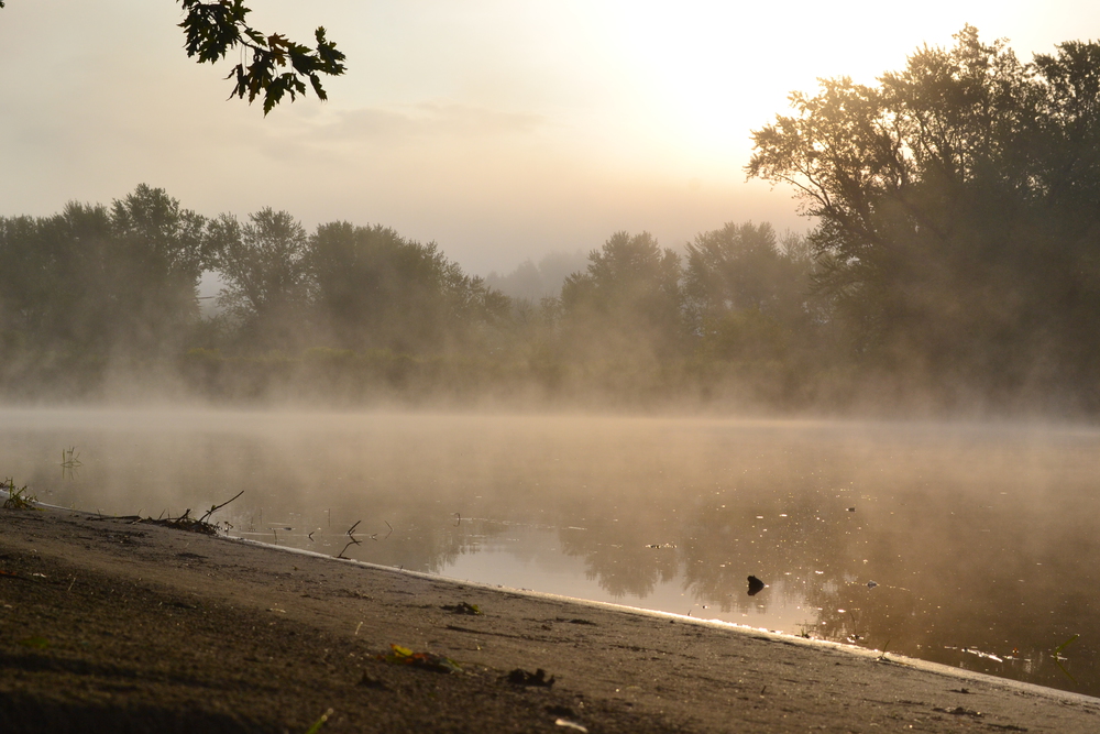
Thursday, August 17, 2017 The river was misty and the morning cold, so I lingered over my coffee and oatmeal for awhile and didn't get out on the water until 8:00. The first few miles were mystic. It was a thrill to have the bow of my kayak slice through the fog and occasionally I would come up suddenly upon a fleet of ducks and set them on the wing into the mist. It was cool enough that I left my fleece on for an hour and a half, until my first stop at Bedell Bridge. Bedell Bridge was a covered bridge dating back over two hundred years, but now all that remains is the shore abutments and a towering stone central pier. It is also a small state park and boat launch. Here I met a Grandfather, son and two granddaughters (ages 4 and 5) heading out on a fishing expedition. The granddaughters were very excited and their fathers had his hands full keeping them out of the way while granddad backed the boat trailer down the ramp. The son was very interested in my kayak and trip. He told me that if I continued on to Fort #4 in Charlston, I would be following in the wake of Roger's Rangers. I told him that if I didn't stop in Hanover my wife would be pretty disappointed. Two hours and a half dozen miles later, as I was approaching Bradford, I spotted a heron on the edge of the river. As the heron hunted fish, I stalked the heron. It tittered on its ever so long and thin legs, stilt like. It would dart its beak into the river and sometimes come up with a minnow. Only then would it stretch out it neck, raise up and tilt back its head, and swallow the little fish. You can't really see Bradford from the river. In fact this is something which continues to amaze me on this trip. I've pasted a number of villages which have effectively turned their backs on the river. Where was Haverhill, North Haverhill and Newbury? East Ryegate, Monroe and Barnet? Yes I could see Barnet's steeple, but why do these towns hide from the river? The St. Frances tribe stopped raiding along here 260 years ago! Back to Bradford. From the Connecticut, take a right up the Waits River (the biggest gap in the marsh) and look for the Bugbee Landing. But before I got to the landing I passed a sandbar with half a dozen canoes and a AMC (Appalachian Mountain Club) crew, two collage age leaders and eight or ten high schoolers. They were stretched in the sun and having lunch. Their food was in a large picnic cooler in one of the canoes. Canoes allow a lot of cargo which a kayak could not handle. They said they were heading to the Underhill Campsite. I told them it was a nice site, and maybe I would see them in the afternoon as I passed there. When I landed at Bugbee, there was a women there exercising her dogs, three Border Collies. They were a marvel to watch. She would call out a name and then throw a stick into the river, and then only the named dog would leap into the water and retrieve it. As we talked she made a point of impressing on me that these were not pets, they were working dogs and she was a shepherd. I told her that I had recognized that it was a working relationship by the way the dogs responded to her commands. But while I was stowing the kayak she had a call on her cell and she responded by tell the person at the other end that she would deal with it when she got back to her office. I was then left with trying to envision what type of office a shepherd would have. I walked into town. For such a small village Bradford is actually very alive. Most of the stores on main street are active and doing well, which is so nice to see when so many other small places are dying. I had a rueben at "Colatina". It was good, but slow, and I found myself anxious to get back on the water. I guess sitting in that cockpit, watching the world drift by is a very comfortable place to be. Back on the river I passed a few motor boats, the first I have seen since the Moore Reservoir. The rapids yesterday were the last I would see and the river now is backed up from the Wilder dam, 20-30 miles south of here. In fact this stretch of the river is sometimes called "Lake Wilder". I caught up with the AMC crew at Underhill. They told me that there was some stuff set up and they expected another group was already there, although absent at the moment. There didn't want to crash someone's party, so were going to push onto the next campsite, the Birch Meadow. It is a half dozen miles downstream, but it is only mid-afternoon, so they have plenty of time. As I left Underhill I could hear one of the leaders start in on the "frayed knot" joke. So I called over my shoulder that it was most certainly time for me to push on. Somehow passing under the Orford-Fairlee bridge marks a certain mile stone. This was the end point of a long scout trip, and the starting point of a short one. I'm now only twenty miles out from Hanover, almost in the backyard. I had thought about camping at Birches, but decided I would push to Roaring Brook, two miles beyond Birches. The river continues to get wider, the breeze drops as the day winds down and the river is a glassy mirror. Finally I land at Roaring Brook. The scouts camped here in 2009 and it is interesting to see how the place has changed since then. I expect most of the change was due to Hurricane Irene. Eight years ago the brook would emerge from a stone arch and tunnel under the railroad, and flow straight and true to the river. Here it had dumped stones into the river which had given us a shallow place for canoes and splashing about. Now however, post Irene, that stream is chocked with rocks and part of the stream found an alternative route to the river via and ravine to the north of the campsite. The old rocky shallows are starting to slit up, where as the new one has not build its stone bed yet. Which means that there is a lot more mud around this site. Still, the site itself is nice. A terrace of mowed grass three or four feet above the river. I make my dinner, wash up, filter water, write my journal and do odd jobs until I am ready to collapse in my sleeping bag with a book for half an hour.
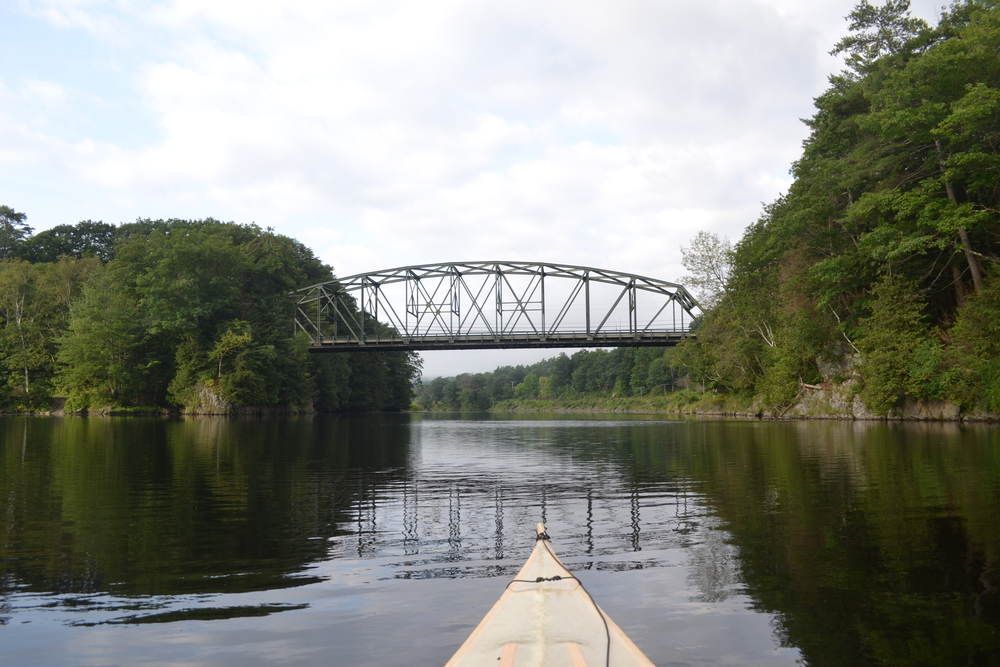
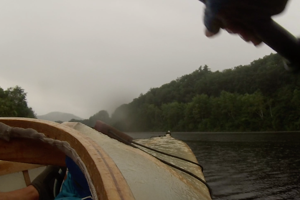
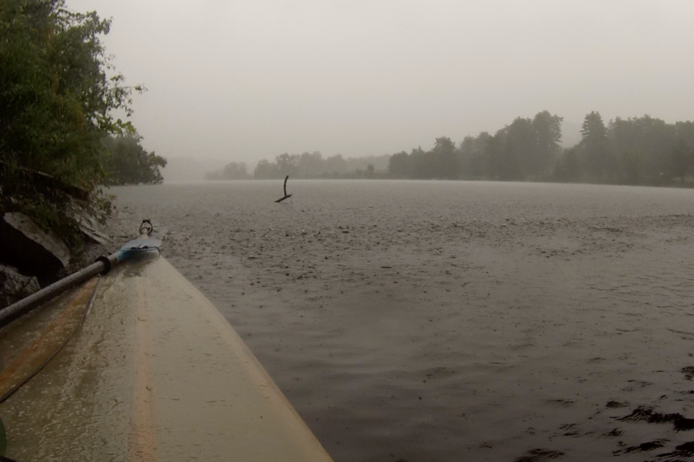
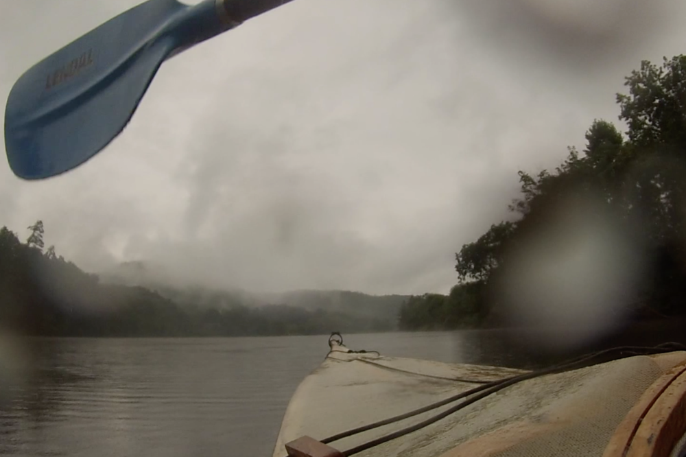
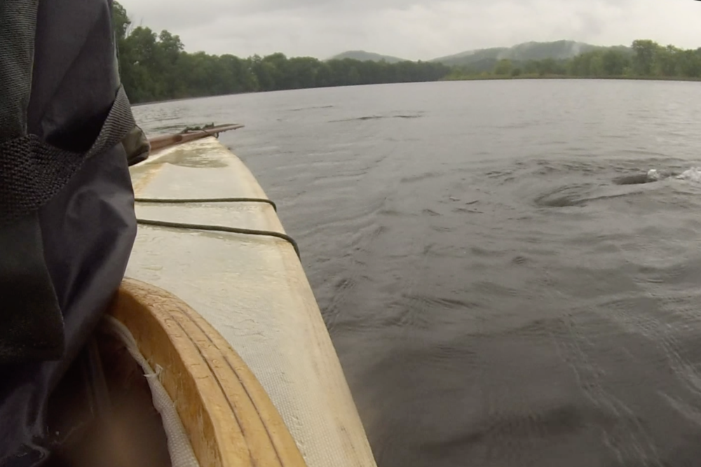
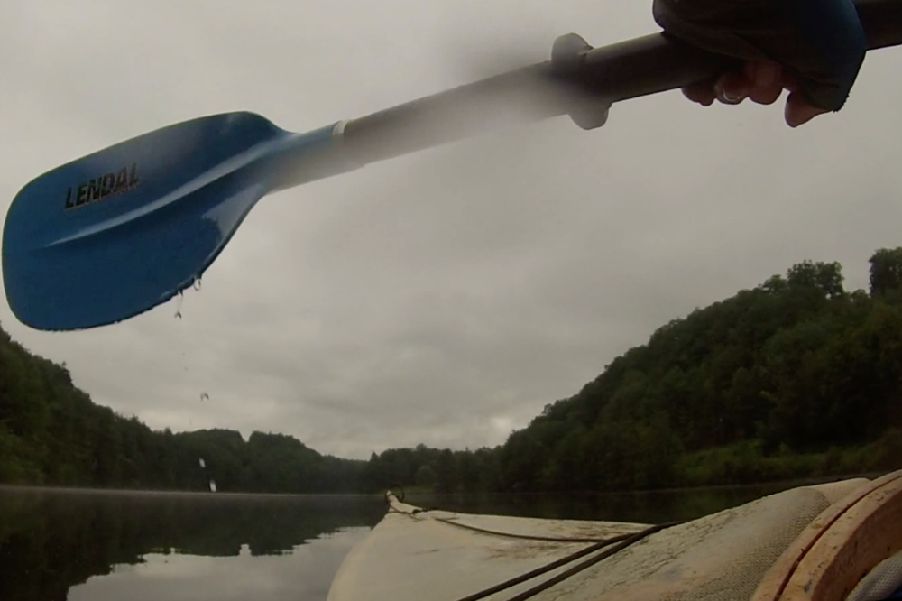
Friday, August 18, 2017 I woke at 6:00 and lay there a few minutes toying with the idea of going back to sleep. With only 14 miles left in this trip, why rush. And it is so gray that it would be easy to fall back asleep. But then I stick my nose out of the tent, and immediately I know that rain is coming. I don't think I need to rush, but I also don't think it would be a good idea to linger. As soon as the stove is started for the coffee and oatmeal I start to pack, which turns out to be a good thing. Moments after I pack the last bit of gear into a dry bag I feel the first rain drops. And by the time I have stowed the bags into the kayak and have launched it is starting to rain. By the time I pass North Thetford, a mile from my launch, it is pouring! My torso is wrapped in raincoat and lifejacket and so warm, and below my knees my legs are under the front deck. But between . . . North Thetford has also turned its back on the river. A few backyard connect to it, and there is a boat launch. But most houses maintain a ten foot wilderness zone between their lawn and the Connecticut. Occasionally along the river, out in a cornfield, I have seen a spot where a farmer has carved out a little piece of paradise; a picnic table, a few lawn chairs and maybe a grill. It is easy to imagine spending an evening by these cool waters after a hot day in the fields and on a tractor. But these are the exceptions and not the rule. The rain comes and goes in strength, but never really stops. When I am passing under the Lyme-Thetford Bridge it is a torrential downpour, so I act the troll and hold up under the bridge for awhile. Eventually the ferocity of the rain abates a bit and I decide to press on. Its clear that this is an all day rain and I don't really want to take up residency under this bridge. The river is beautiful, even in the rain. Wisps of mist periodically pull back and reveal a fleet of water fowl or a river bank dense with flowers; purple, yellow, blue and white. In the river itself I occasionally glide through a carpet of lily pads, now opening up white. The river banks have changed in nature since the last bridge; the lawns come down to the river and almost every house seems to have its own dock, with at least one boat moored there. And even though this use of the river makes sense to me, I think wishfully back to the neglected banks of Barnet and Haverhill. I am starting to fell a bit wet, and I have often paddled these last few miles through Lyme and Thetford, so I am not longer in exploration mode. I am just grinding out the miles. Past Hew Brook, Slade Brook and the Ompompanoosuc with its mouth guarded by "The Iron Bridge". Past Wilson's Landing and the crew's racing course. Past Patchen's Point and through "The Narrows" and finally to the dock at the Ledyard Canoe Club. Nobody is around the waterfront on this rainy day. Still, I extract myself carefully from the kayak, spilling like I did at Dodge Falls would be an ignoble way of ending this trip. Within twenty minutes Kristina is at the dock, fifteen minutes after that we are home. Half an hour later gear is hanging in the basement to dry and I am in the shower. It was a good trip. The next time I'll put more padding in my seat. But all the other lessons will take longer to discover.
|