|
A Walk In The Alps August 7th-10th, 2018 |
|||||
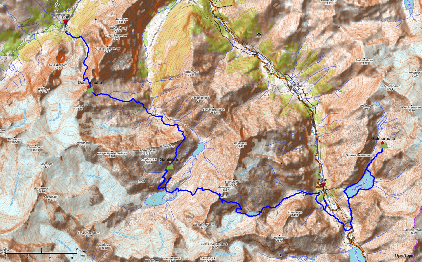
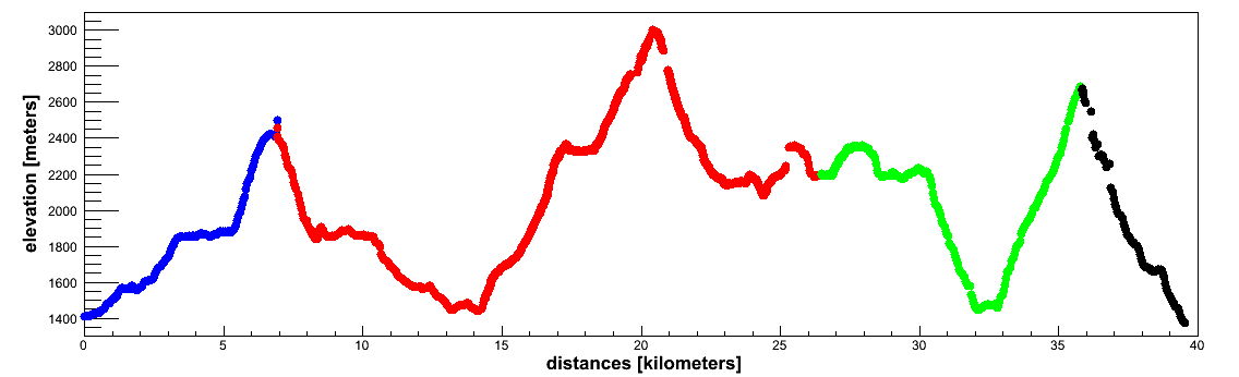
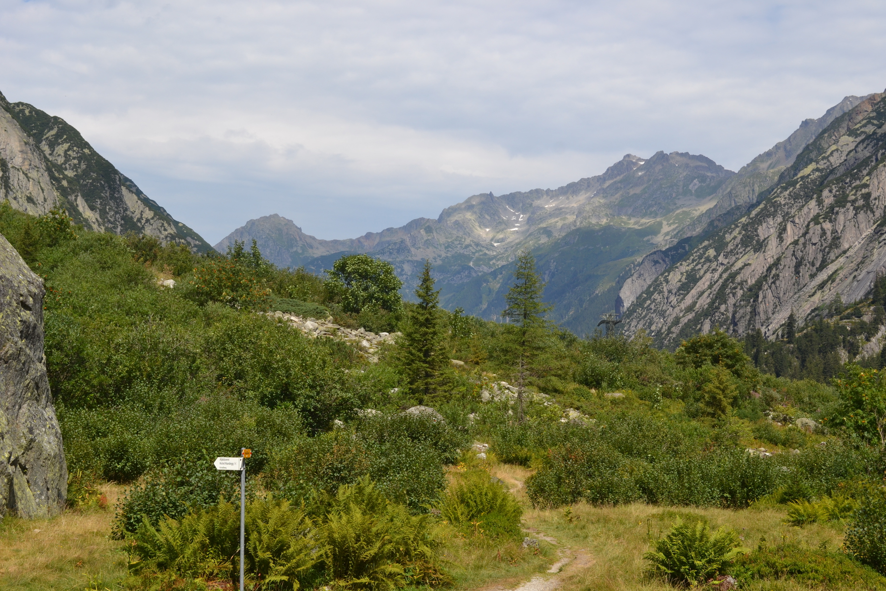
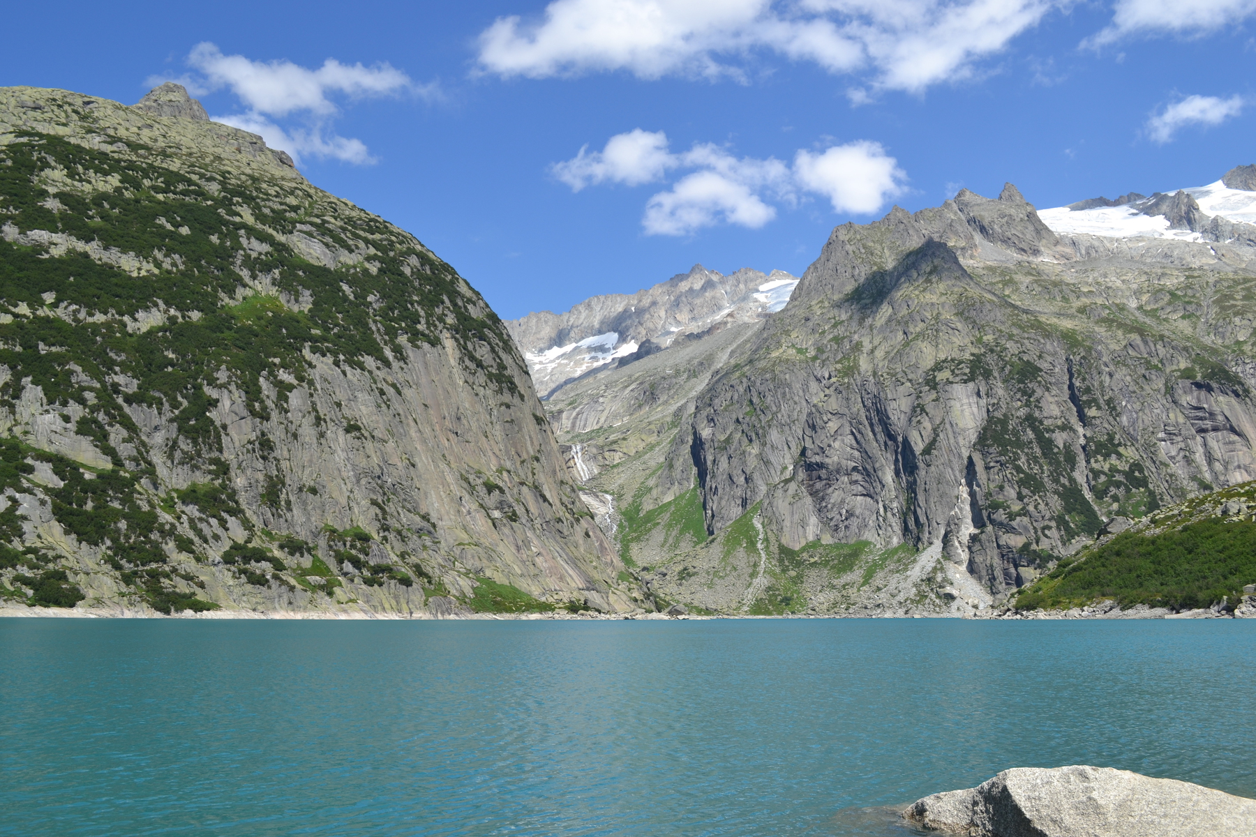
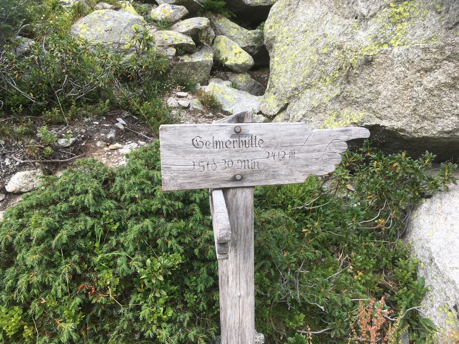
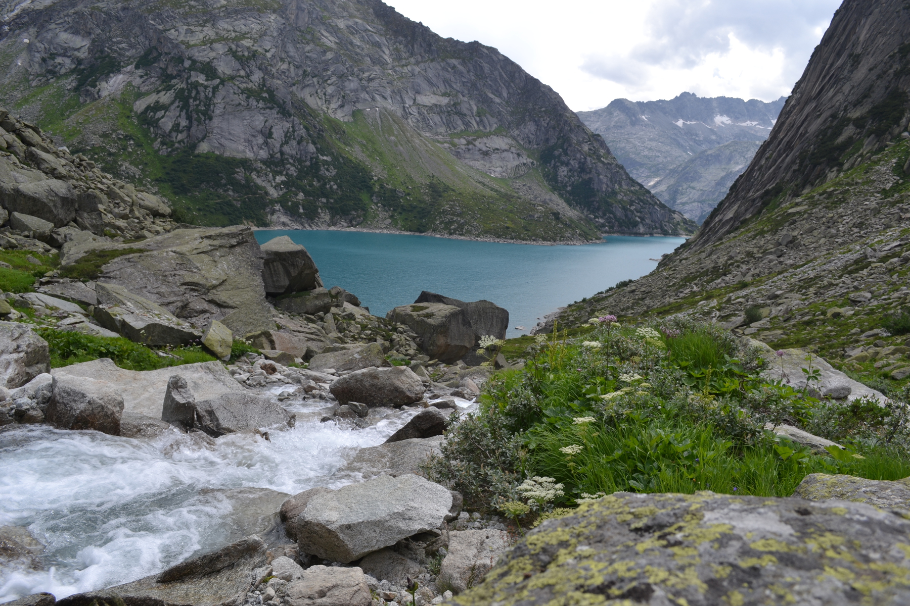
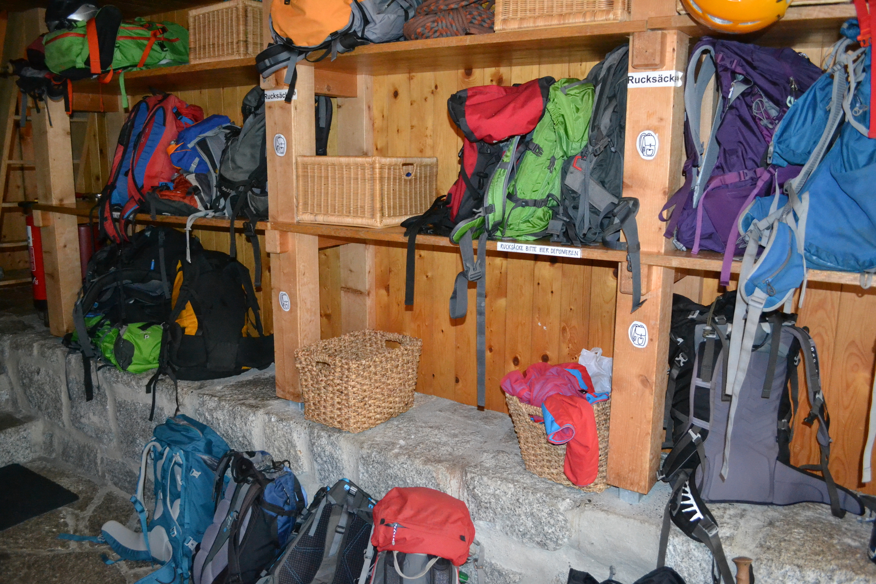
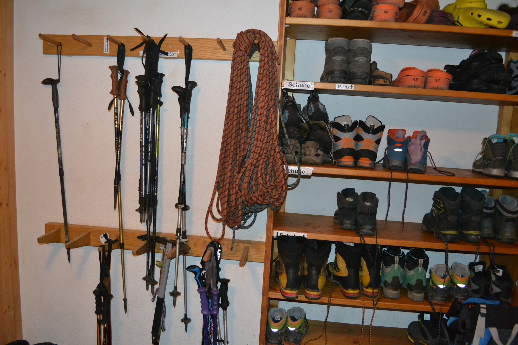
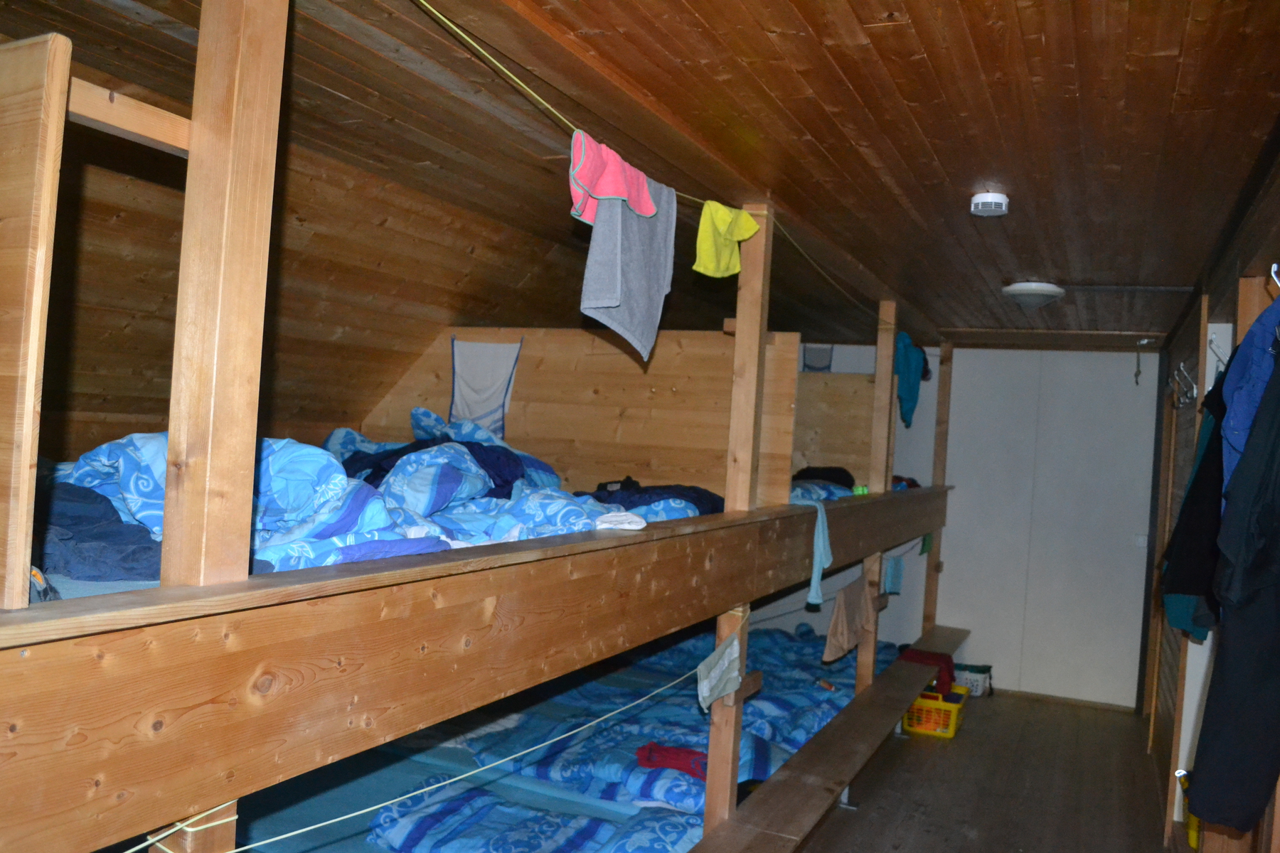
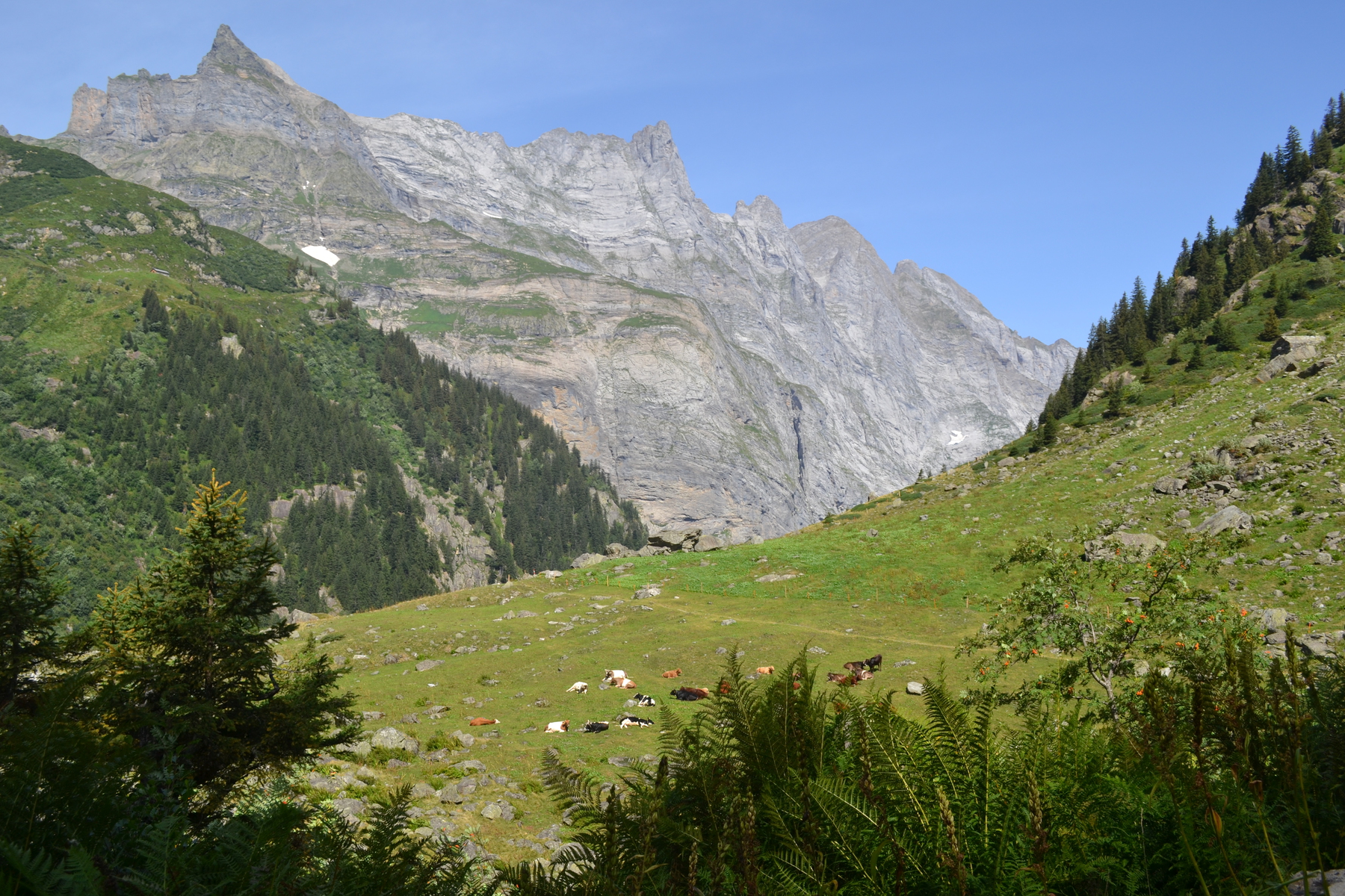
[Click on any photo to get a higher resolution. My walk ended with a 1500 meter descent from Dossenhütte. It was foggy, cool and drizzling and undoubtedly the most hair raising exposure of the whole trek. But at this stage, it wasn't a mystery. When I encountered a steel cable bolted into the face of the mountain I knew how to balance my weight, shift my trekking pole and step out - even if the other end of the cable, and the mountain below me, was shrouded in mist. When there was a film of water on the granite, I knew how much friction I could expect from the soles of my shoes. When a rock shifted and a pebble left the trail and vanished below, I would listen for the cascade, but know that my footing was still stable. These were all lessons I had learned in the last four days of rambling in the Alps. Tuesday, August 7th, 2018 Starting in Bern, the trains become smaller and the bus slower as we wound our way up the Aare Valley. In Bern the Aare is a broad and robust river, but by the time I had followed it up through the twin lakes of Interlaken, through Innerkirchen to Handeck (Handegg) it had been reduced to a wild mountain stream a few feet wide. I find that with every train and bus exchange, my confidence in this venture rises. I think it is because with every passing leg of transportation, I am less dependent upon others. When I stepped off that last bus, the success of the venture was totally in my hands - or rather - in my feet. But why do I have such trepidations? In this case it is partly traveling where I don't speak the language. It is true that most people in Switzerland do well with English, but I still always feel that is a handicap; other people have an advantage. But also these are the Alps! This is where in the Golden Age of Mountaineering Alpinist went to conquer peaks, or perish trying. I am hiking within ten miles of the famed Eiger. And I am planning on just casually romping over these mountains as if they were the hills of New Hampshire? If I had waited an hour in Innerkirchen I could have taken the PostBus 161 right to the trail head. But I was impatient; bus 171 took me to within 3km, and I was happy to walk the bit extra. Finally, I stepped off the bus at Handeck and shouldered my pack. That first 3km (2 miles) to the true trail head was a pleasant walk up the valley of the Aare, past pasture lands, by the roaring infant river. Yet even here I know it is not Kansas; the path may be as broad and level as a sidewalk, but there are points where a cliff drops 30 meters to the river on my left. Families with youngsters walk these paths with hardly a glance over the edge, as calmly as if walking their children to kindergarten in Bern. At the trailhead (Handegg, Kunzentannlein) a sign tells me "Gelmersee 1hr, Gelmerhütte 3hr". The signage of the trails is curious. First off they always report times instead of distances. Secondly, the newer signs report times in hours and minutes ("hr min") - in English. Whereas the older (wooden) signs are marked in "std min", "stunde" is German for an hour. The trail is beautifully maintained, and despite the recent rains, there is no mud! There are even occasionally paving stones! I later realized that a popular outing was to ride the incline railroad from near my bus stop at Handeck (Handegg Gelmerbahn) up to Gelmersee, a reservoir, walk around its blue-green waters, then go down the route I have been climbing back to Handeck. Gelmersee is my first mountain lake. In truth it is a product of the Swiss hunger for electricity. Hydro accounts for about 60% of Switzerland's electricity, which is impressive when you realize how intensely it is used. Much of there transportation (trains) depends upon it. Gelmersee is blue-green, as are most of the waters of Switzerland. This is "glacial milk", as we saw near Kebnekaise, Sweden. There are rocks frozen into the bottom of a glacier, and as that ice sheet grinds its way down the valley, where rock meets rocks, "rock flour" is formed. This tints all the waters. I soaked my feet for awhile in the lake and eyed my destination across the waters, and 500 meters (a third of a mile) overhead. And then it is time to climb. From the lake to the hutt is "1 Std 30 min", horizontally 1.3km (0.8 miles), but vertically 500m. It is not too difficult a climb, and there is a very lively stream on the left to keep me entertained. It splashed and played and leapt over cliff faces, cascading without bruising itself. Near the hütte I felt a few raindrops which spurred me on, but it never really amounted to anything. And here was the moment where I wished I had paid better attention in Herr Piepkie's classroom. Institutions, like huts, have traditions which I didn't want to get wrong. I had figured out that no boots are allowed beyond the mud room (shelves of crocs were provided). But what are those baskets that some people carried around? And what time is dinner? I found the hütte warden and she pointed out my place on the sleeping platform and my table in the dining area. I also asked for water and was surprised that they would sell me bottled water, but discouraged the use of tap water (although the staff told me they drink from the taps all the time). The Swiss hüttes fall someplace between the AMC huts of the White Mountains and an English pub. During most of the day the serving hatch between the main room and the kitchen dispenses with beer, wine, fanta, mineral water and all sorts of drinks and snacks (trinken und essen). At this moment the main room was also filled with day visitors who would soon be starting their descent. There are lots of children here and the hütte has a shelf of board games and old comic books for them. I went outside and lay down in the Alpine meadow for a while, then found a table on the hütte's patio and wrote in my journal and meet Reinhardt, a Canadian music professor who was here to rock climb. In fact I soon realized that most of the people at these high altitude Swiss hüttes are here to rock or ice climb. I, as a hiker was unique. Most people would come to one hütte for a few days and radiate out from there to the nearby cliff faces. (Things you wanted to leave at the hütte during the day could be left in those baskets in the mud room.) At dinner I sat at a table with two mothers and their three young boys (under 10). The boys eyed me with curiosity as I spoke a mysterious language, but they were about the only non-english speakers I met on my walk. They, however, were mainly engrossed in their comic books, which looked well thumbed and enjoyed by a generation of young hikers. Backerbsen (spherical croutons) in a broth soup, salad, mash potatoes with a pork stew, and for dessert a hard meringue with cream and fruit. At the table in the corner of the room was a party of Englishmen and a boy who were having a great time. At the center of the table sat Alex, a boy of ten or eleven years old surrounded by his father and many uncles. At the end of the table sat his grandfather, a burly gentlemen, who smiled over his brood. "What are you going to climb tomorrow?" asked an uncle. "I was thinking about going back and doing the same one as today", replied Alex. "Well, that was a really good one, a great choice!", chimed in another uncle. What a great adventure! To go off to the Alps with the "men" of the family and climb. I expect Alex was having the time of his life! After dinner Reinhardt and I talked for a long time. Although he spoke fluent German, I think he was starved for English conversation. So when I headed to bed it was already lights out in the bunk room, which made crawling into bed a bit complicated, especially since I had never used a sleep sack before. Gelmerhütte sleeps 55 guest in two dorms in the loft. My room had two sleeping platforms , one above the other, with room for 15 on each level. Each platform is covered with a foam mattress and each guest has a duvet and a pillow. Each guest carries a sleep sack. Mine was silk, weighed 6 oz and packed down to the size of a softball. Essentially it is a top and bottom sheet sewn together, with an insert for your pillow. We had been told at dinner that a frost was possible that night. but with thirty hot bodies in one room, even with the window open, it was a warm night and I discarded my duvet before going to sleep. Wednesday, August 8th, 2018 Did someone just shake my toe? Or is it that my foot was hanging out over the edge of the sleeping platform? I had asked for breakfast at 6:30 because I have a long day in front of me and it was now 6:00, with a grey, misty light coming in the single window of the dorm. So I slipped off the upper platform as quietly as I could, three-quarters of the others were still asleep, gathered my stuff and went downstairs. By 6:30 I was packed and ready for breakfast. Coffee, muesli, black bread, butter, cheese and more. In fact a continental breakfast indistinguishable from what was being served in hotels and guesthouses across Europe. Except, like last night, everything (except coffee) is served in one shallow bowl. I shouldered my pack by 7:00. It takes almost as much effort to go down off a mountain as climb up. In fact when crossing fields of broken rock it is a bit more challenging. When going up the "risers" of steps are distinct and easily seen, whereas steps viewed from the top are just rocks. By 8:00 I have dropped to Gelmersee where I skirt the lake on a trail which sometimes is chiseled into the cliff face. On one stretch across a slab a 15cm (6 inch) ledge had been created with concrete for the conveyance of the rambler. Finally down into the Aare valley and back almost to where I got off the bus yesterday. In some sense the last 24 hours and 14 kilometers have been a shake down, and now my Alpine venture really begins. In truth I stepped out on the next segment of my walk with a bit of trepidation. In about 5km (3 miles) my trail disappears and I need to somehow navigate the next 3km without a trail. I had read reports of people crossing between these valleys but was unclear as to how difficult the crossing is. So I had written to the Gaulihütte warden about crossing from either Bächlitahütte or Grubenhut. She wrote back;
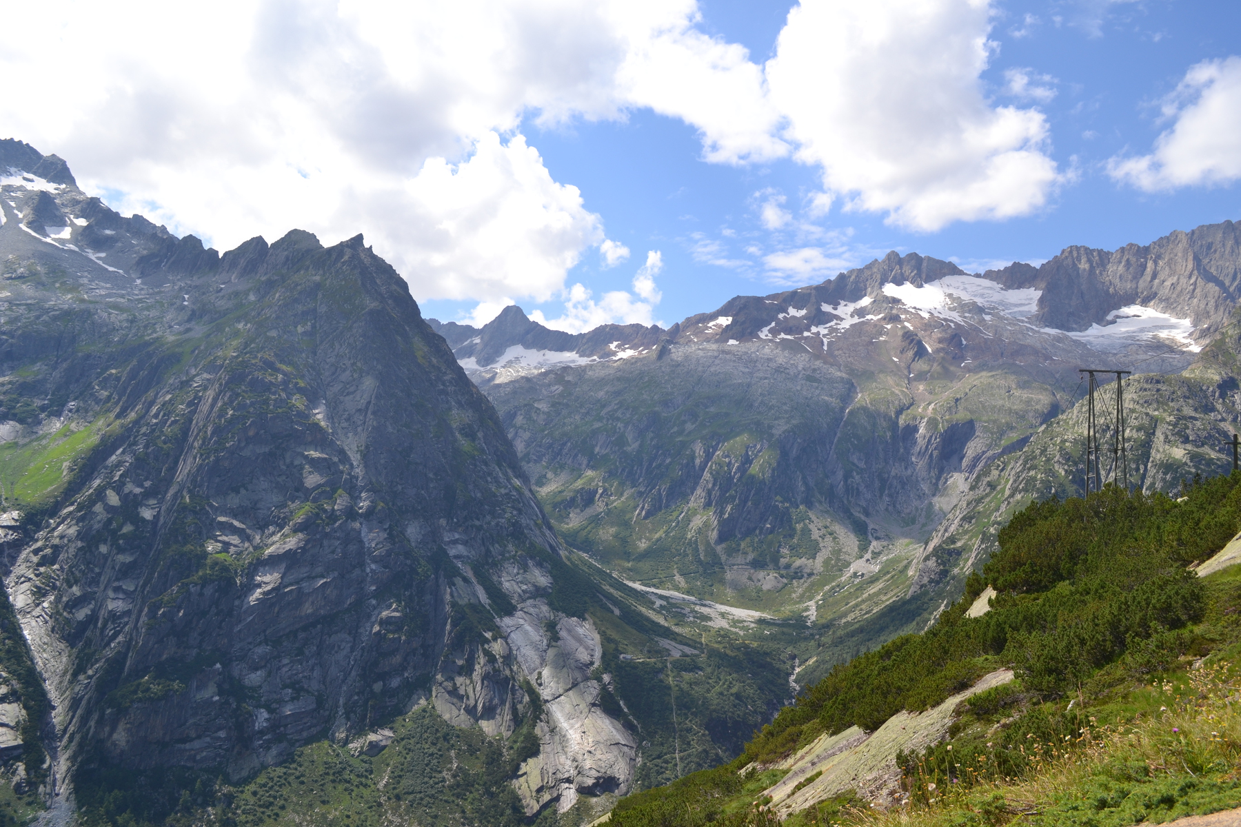
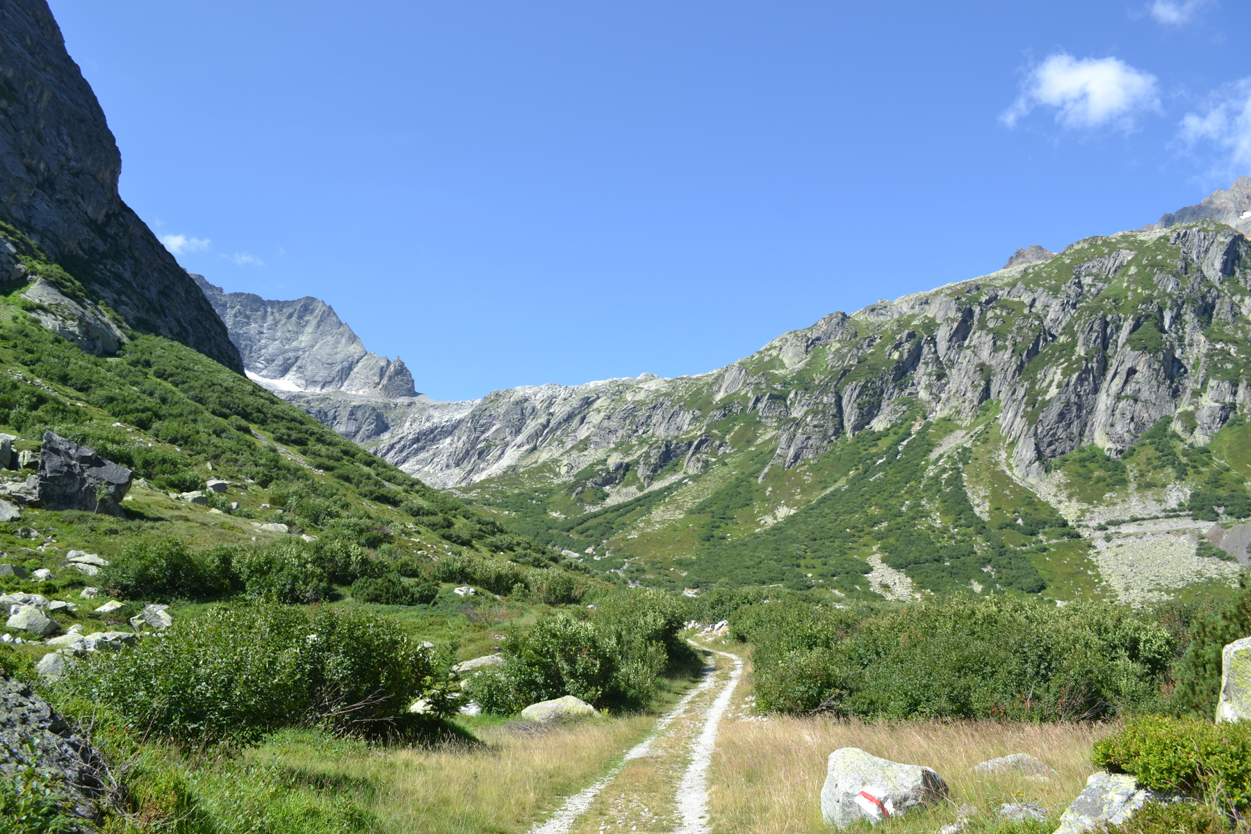
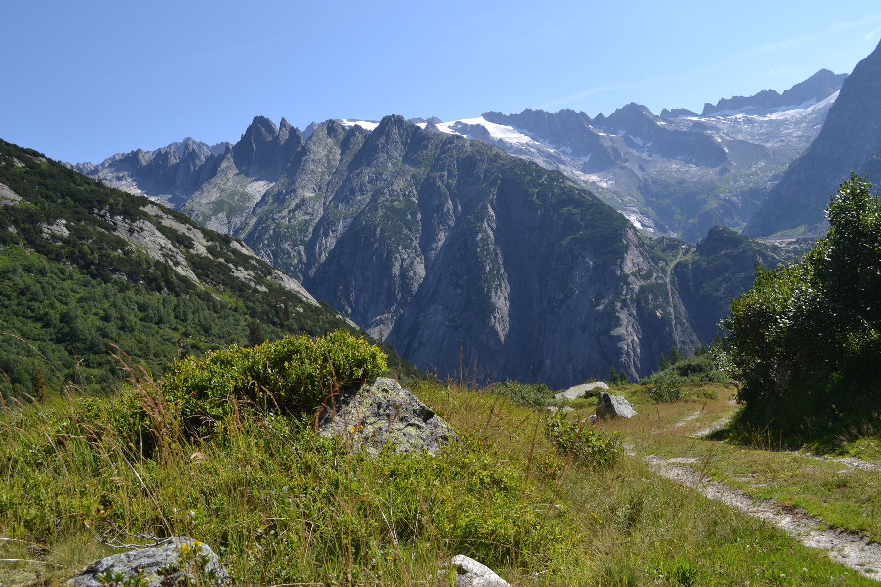
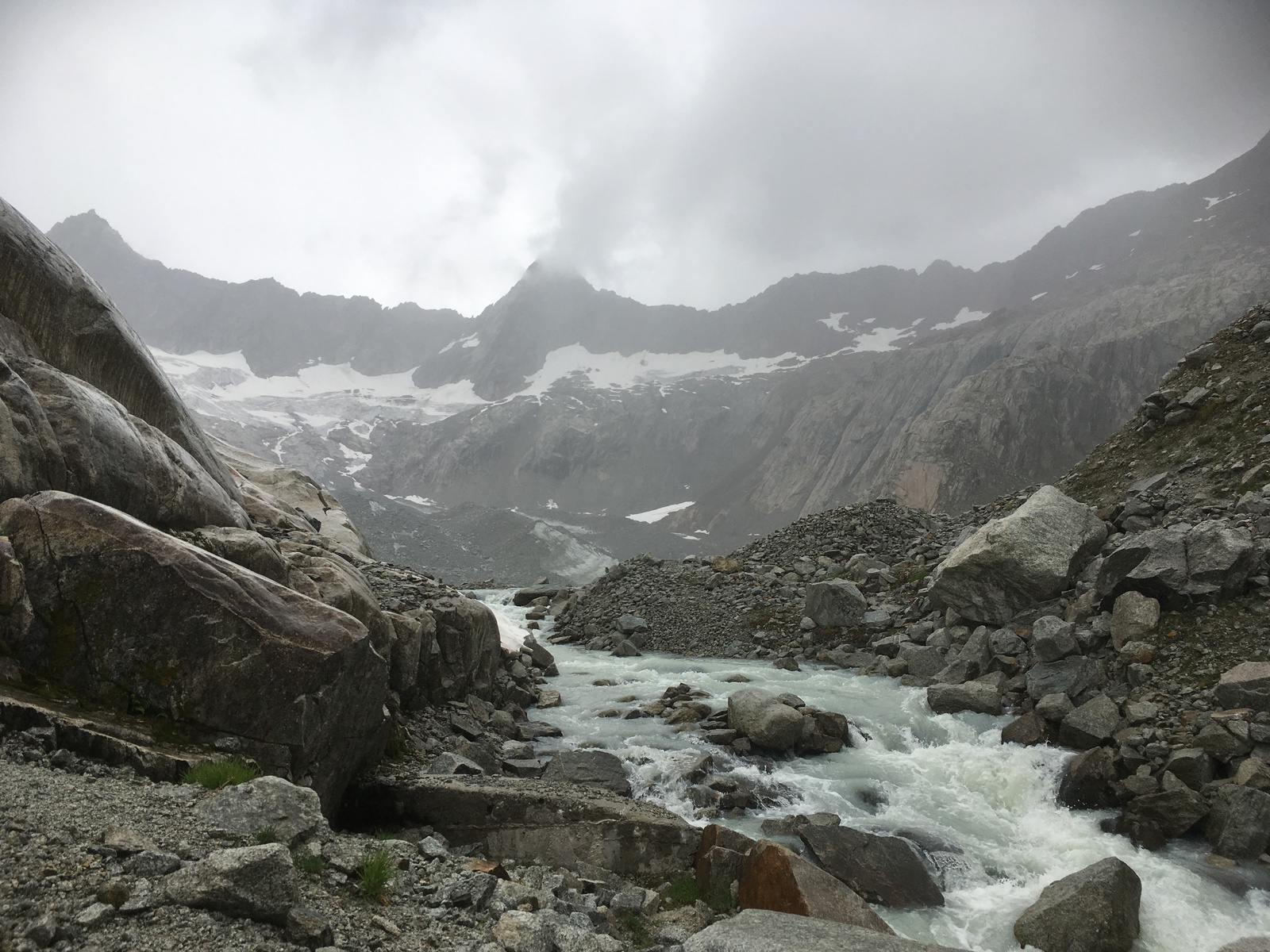
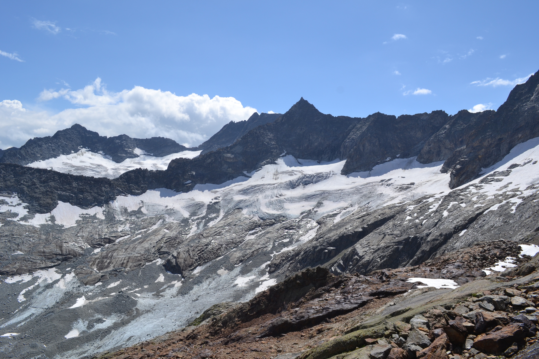
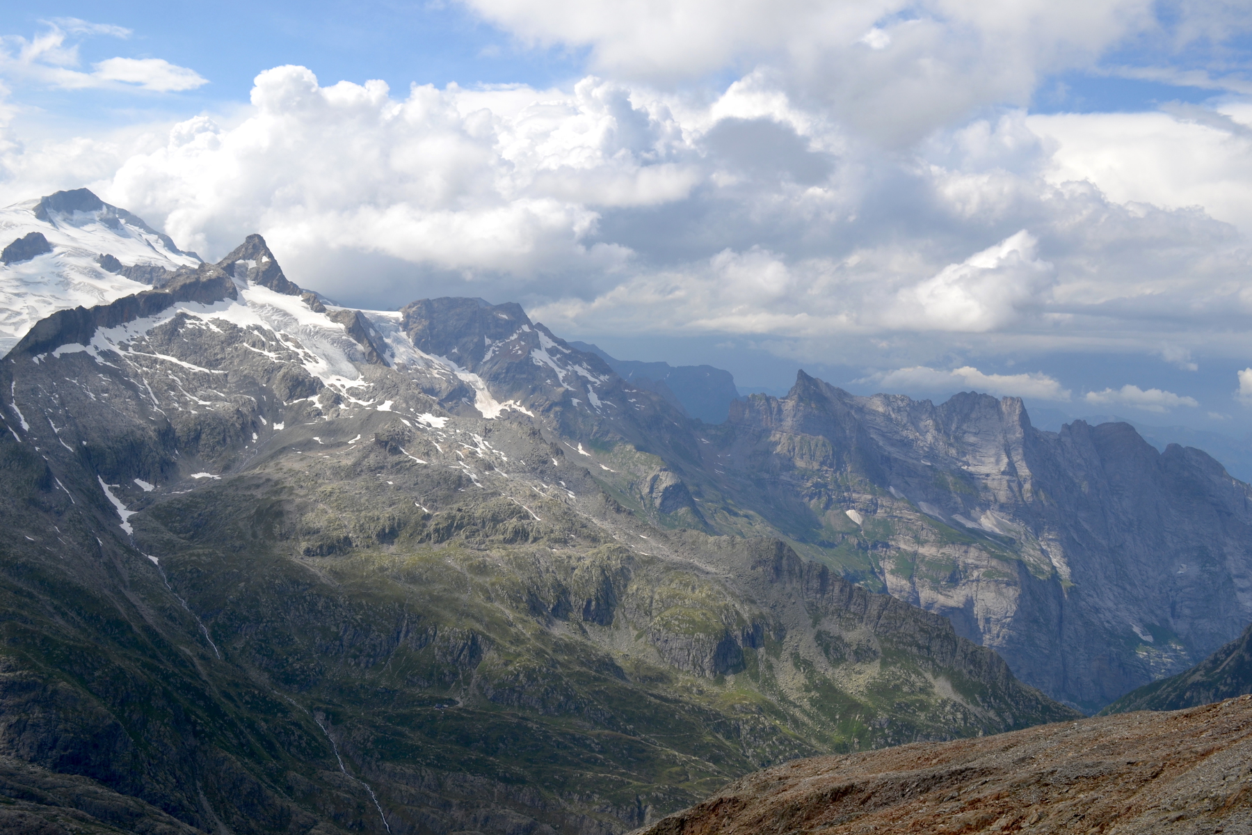
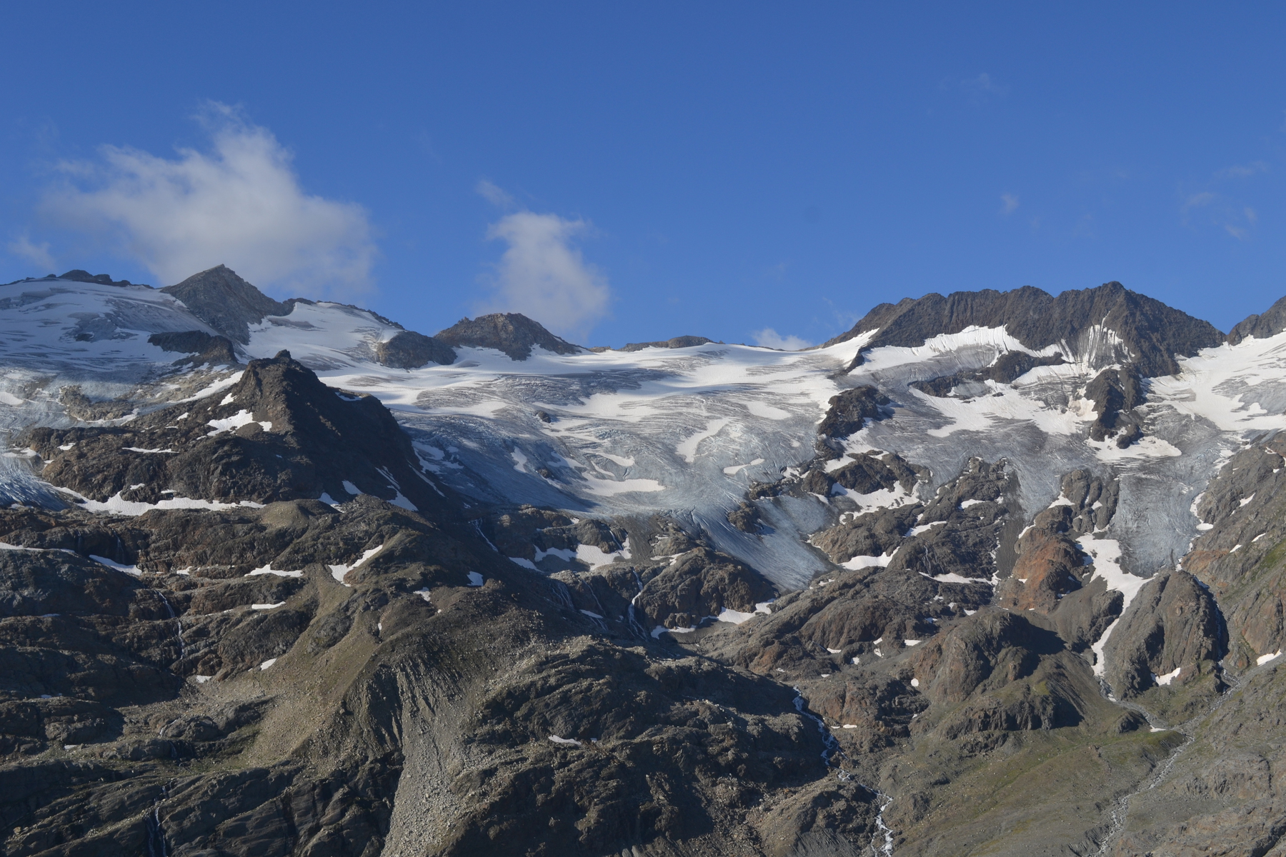
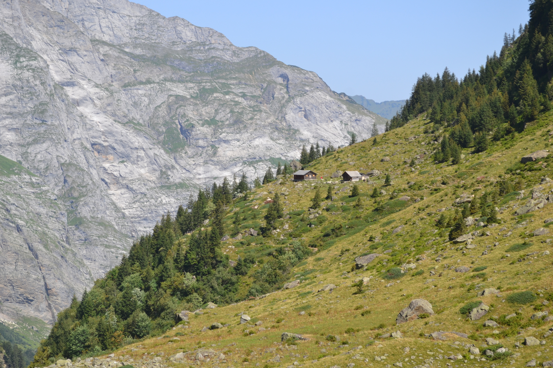
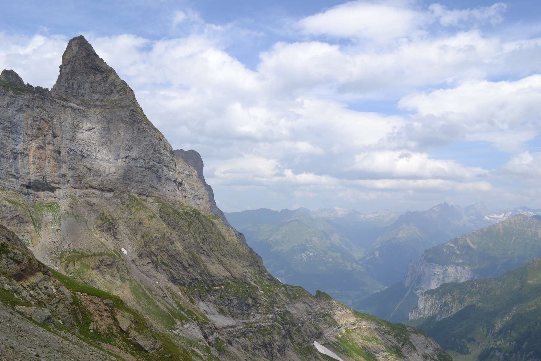
So up I go! I am hiking into a cluster of "hanging valleys", filled with glaciers, cirques and tarns. In the 1930's & 40's tunnels had been build to divert the waters from Gruebeseeroli though a mountain to Bächlisee and Räterichsbodensee for a hydro electric project. To get the heavy equipment up the mountain for this project an incline/cog and pinion railroad had been build and now my trail zig-zagged across those tracks. At the top it was curious to see the start of a jeep trail which didn't connect to anything except via the incline rails. For the next eight hours I had this whole complex of cirques, glaciers, tarns, moraines and mountains to myself! As I climbed I left behind the sunny pastures and woods of the Aare, then the grass lands and scrub of the Arienbach. A "hanging valley" is created when a smaller glacier meets a major glacier. The valley of the Aare was cut 1600m deep by a major glacier, whereas the valley of the Arienbach was cut by a smaller glacier which gouged down only about 1200m, meaning that its valley is hanging 400m above the Aare, and there is a steep drop between the two. The valley of the Guben glacier is about 700m deep when measured from the mountain tops, so it is a steep climb of 500m up to it. When climbing up towards Guben the talus slope seem to be topped by a cliff face, but by following the cairns and the occasional white/red/white trail blazes the path threaded its way up an obscure ravine and then on top of the cliff. And now I stood at the base of the Guben Valley, a classic cirque, a bowl cut by a glacier. These are the same formations as the "cwm" I encountered in Wales, except this one is still in the making. This rocky basin is about 2.5 km (1.5 miles) long and two-thirds of that wide. I am standing at 2300 meters of elevation and the peaks around me are at about 3000m. Steinlauihorn, Golegghorn, Hiendertellihorn, Gross Diamantstock and Chlyne Diamantstock. I am tempted to describe it as the amphitheater of the Gods - but what gods? I think it should be the throne room for Oden, or Thor, or some other cold Norse deity. And then I realize that it is the home, the lair, of Gubengletscher, the Guben glacier. It starts to rain as I skirt my way around the lake and cross a boulder field. 200m from me is the face of the glacier, but it is a scaly, rocky face; for the lower part of the glacier is covered with talus, with rock and boulders which have flaked off of the surrounding peaks. But still, under all that debris, the dragon sleeps - or the ice giant creeps. My next waypoint is Grubenhütte, which I can see from the lake shore perched on the mountain's knee 200m above me. And up I climb. I had at one time thought of spending a night at Gruebenhütte. But it is a "self-service" hütte, and I would have had to figure out food and sleeping bags and more, so I had opted for Gelmerhütte last night. In a straight line they are only 7-8km apart, but it was about 6 hours of hiking! There doesn't appear to be anyone at the hütte, and I have miles to go, so I keep climbing. This is where the red & white trail ends. But I had come across a description of the crossing to the next valley;
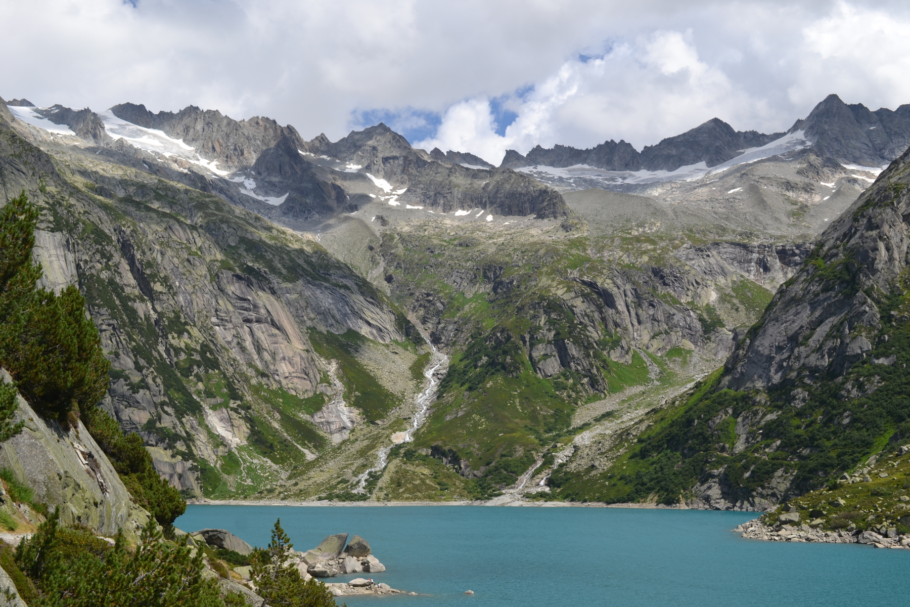
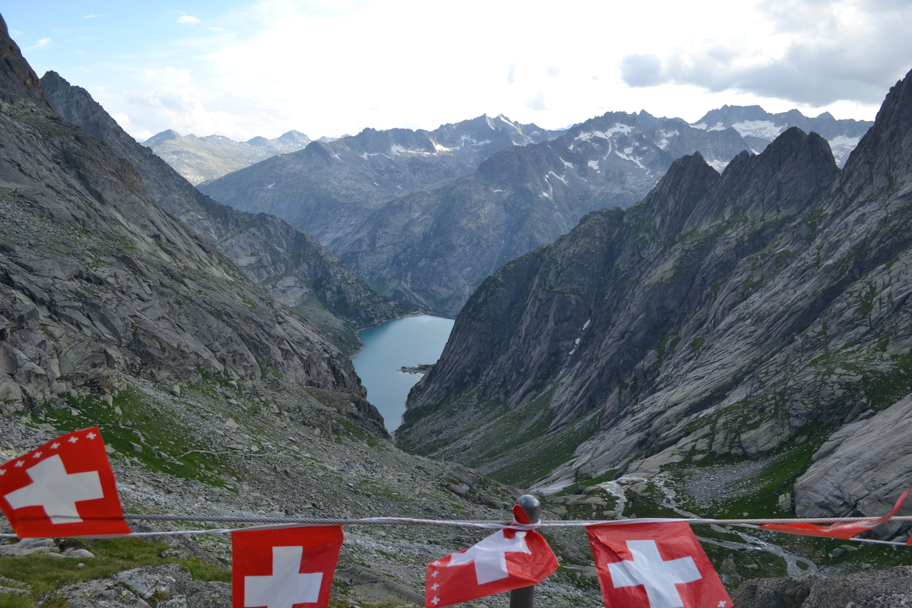
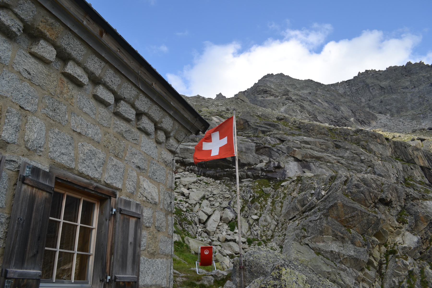
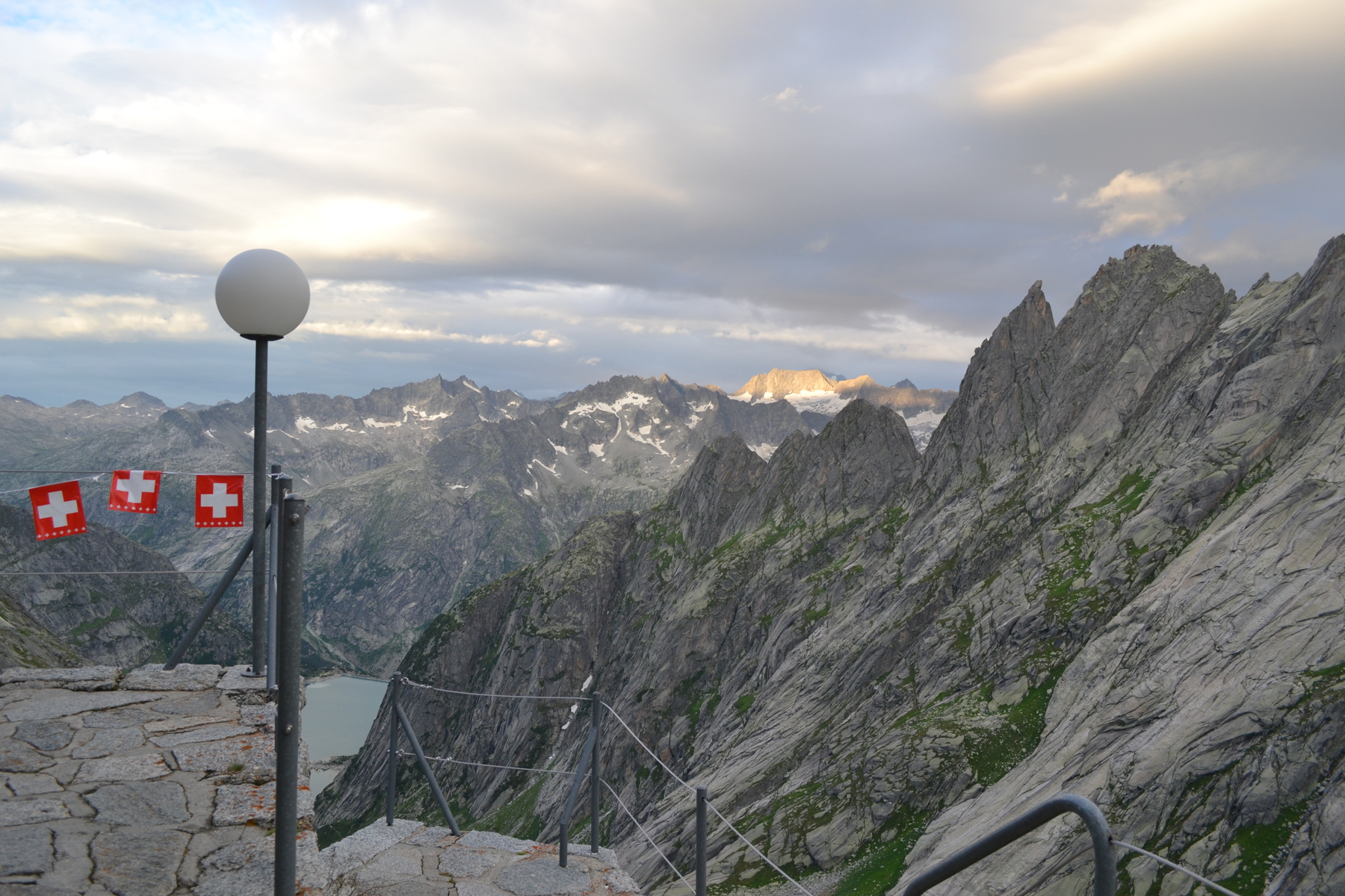
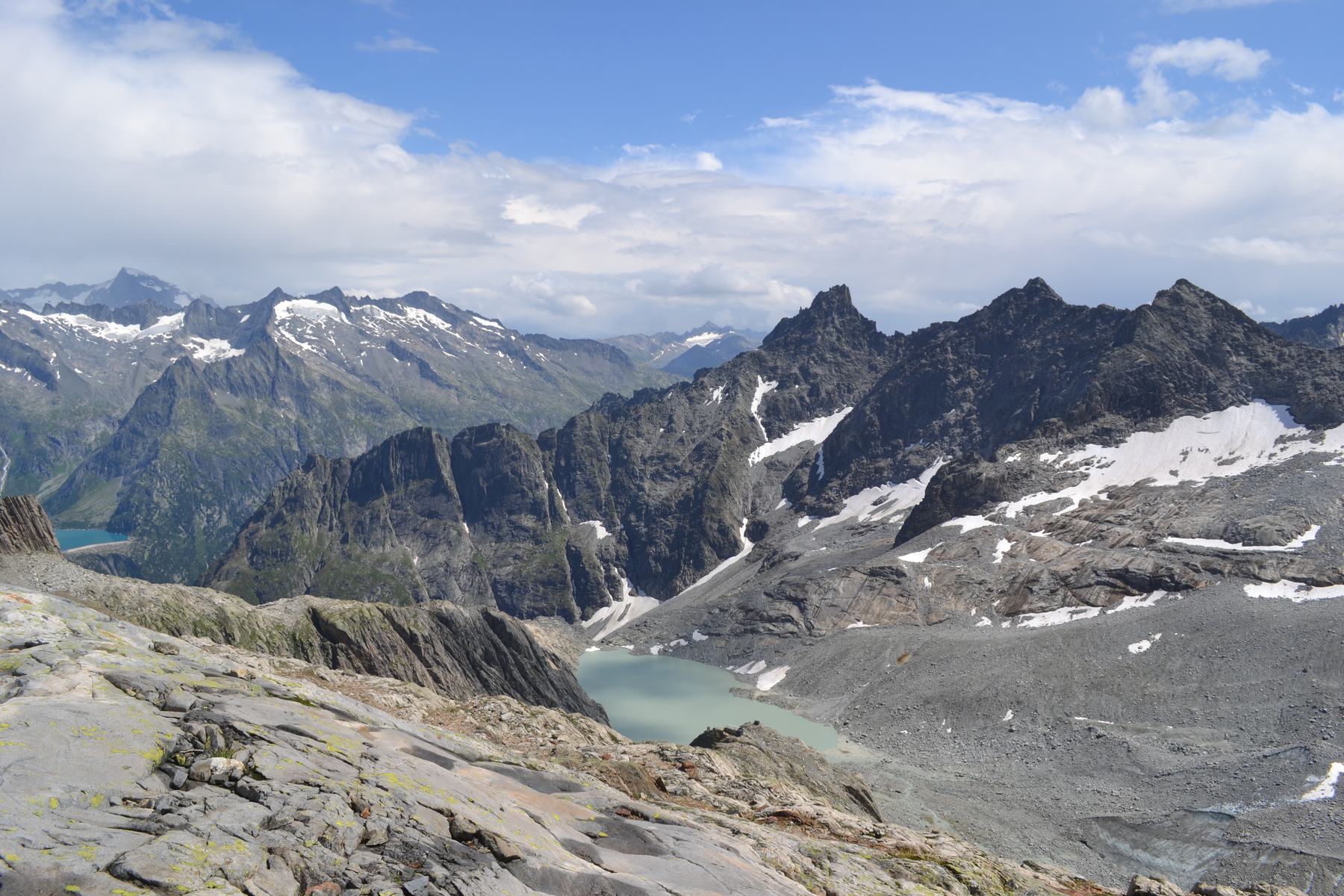
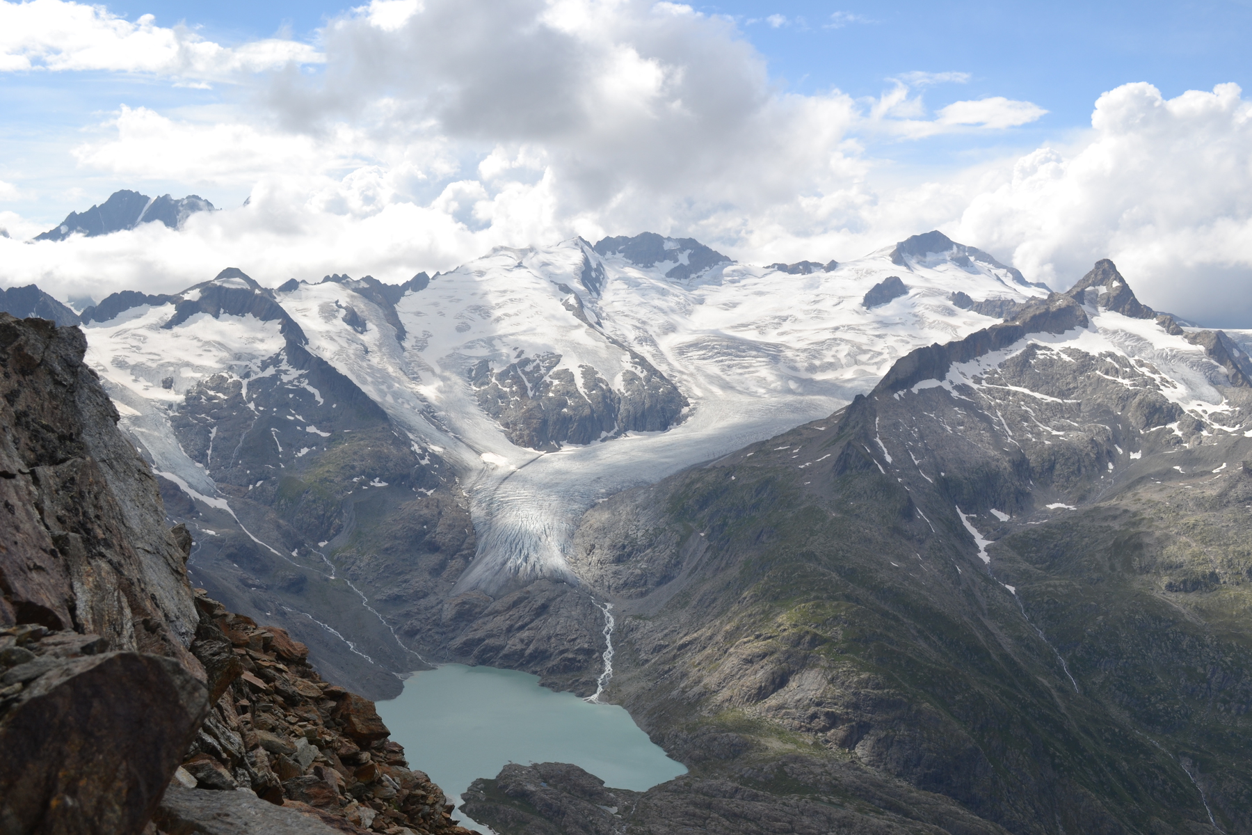
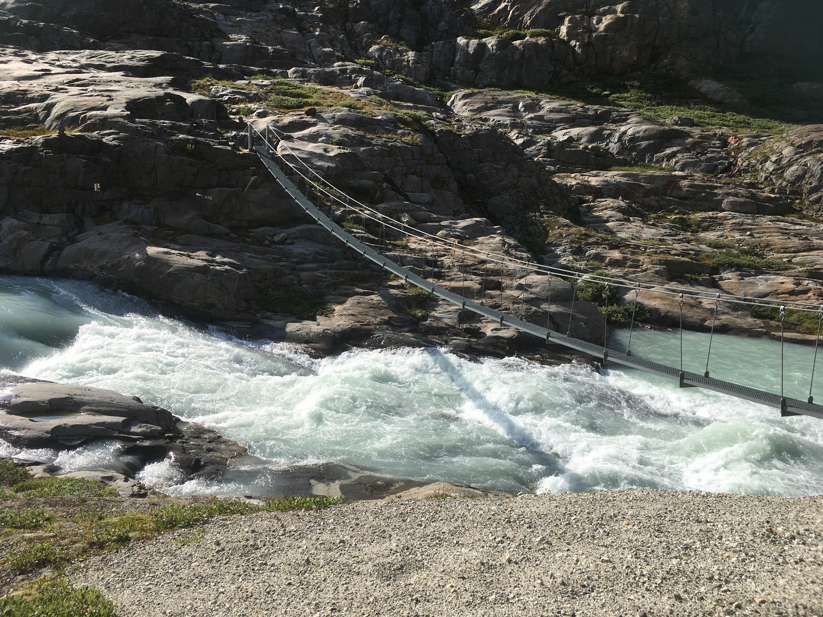
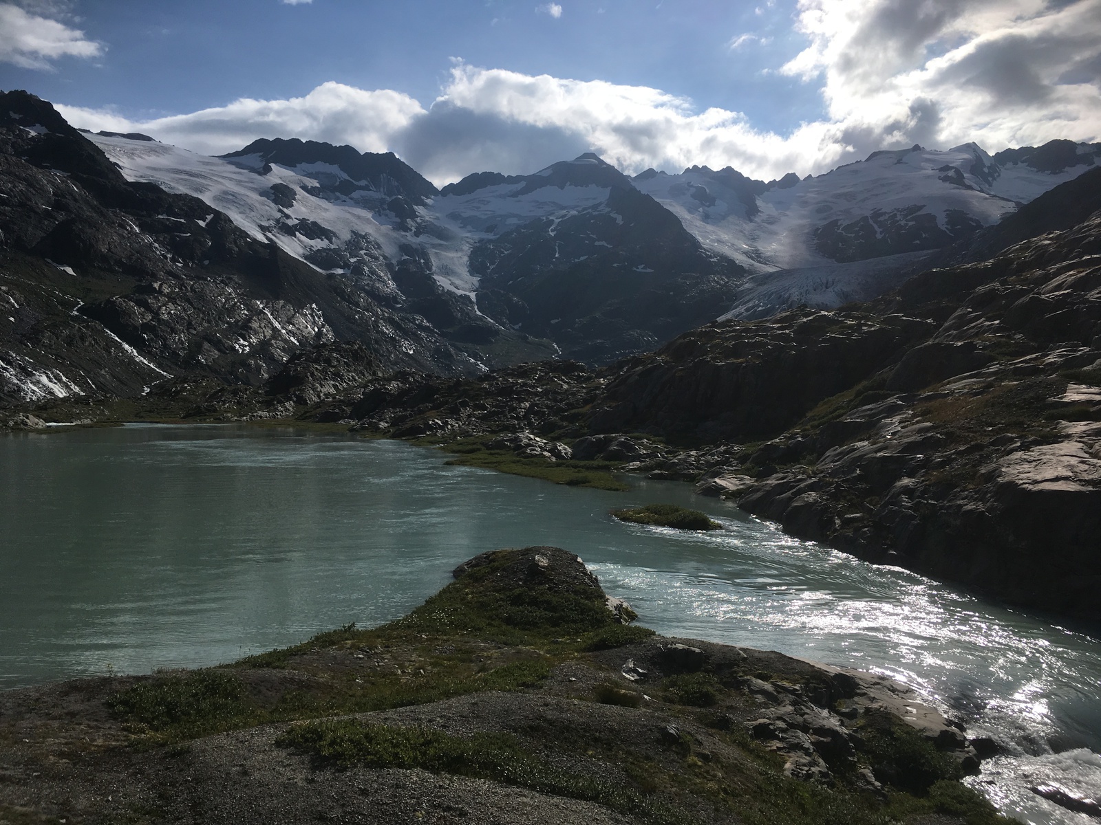
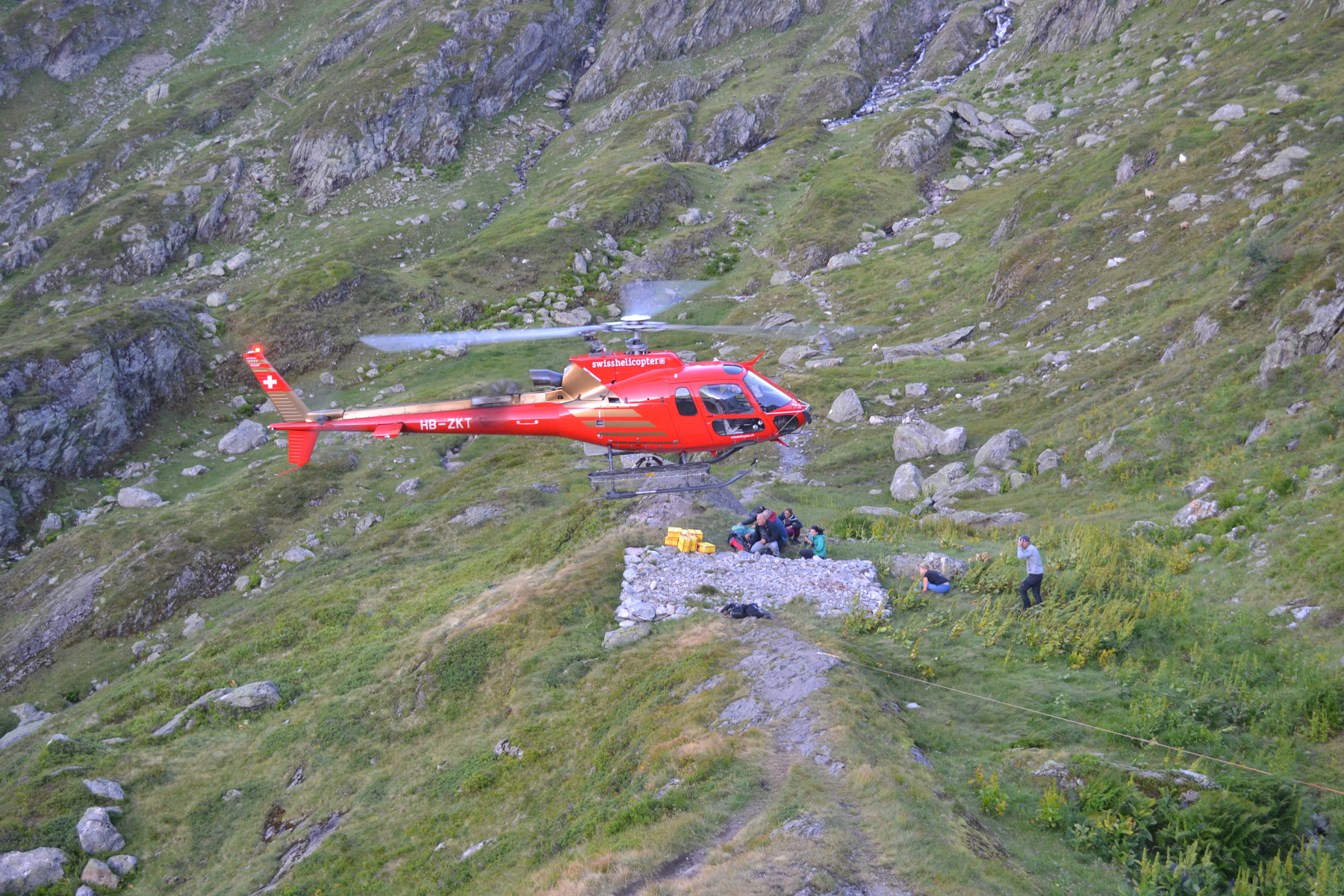
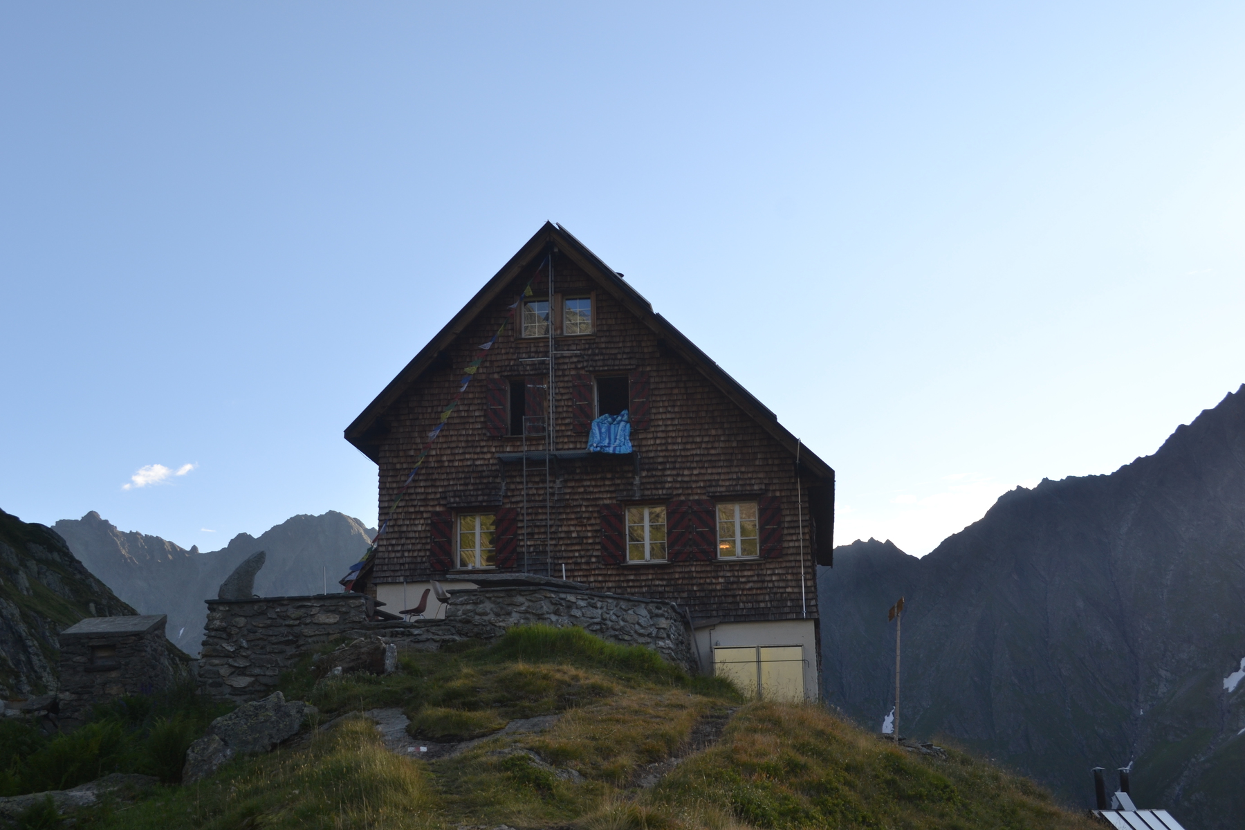
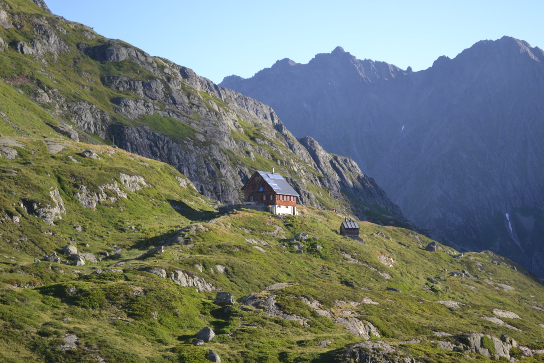
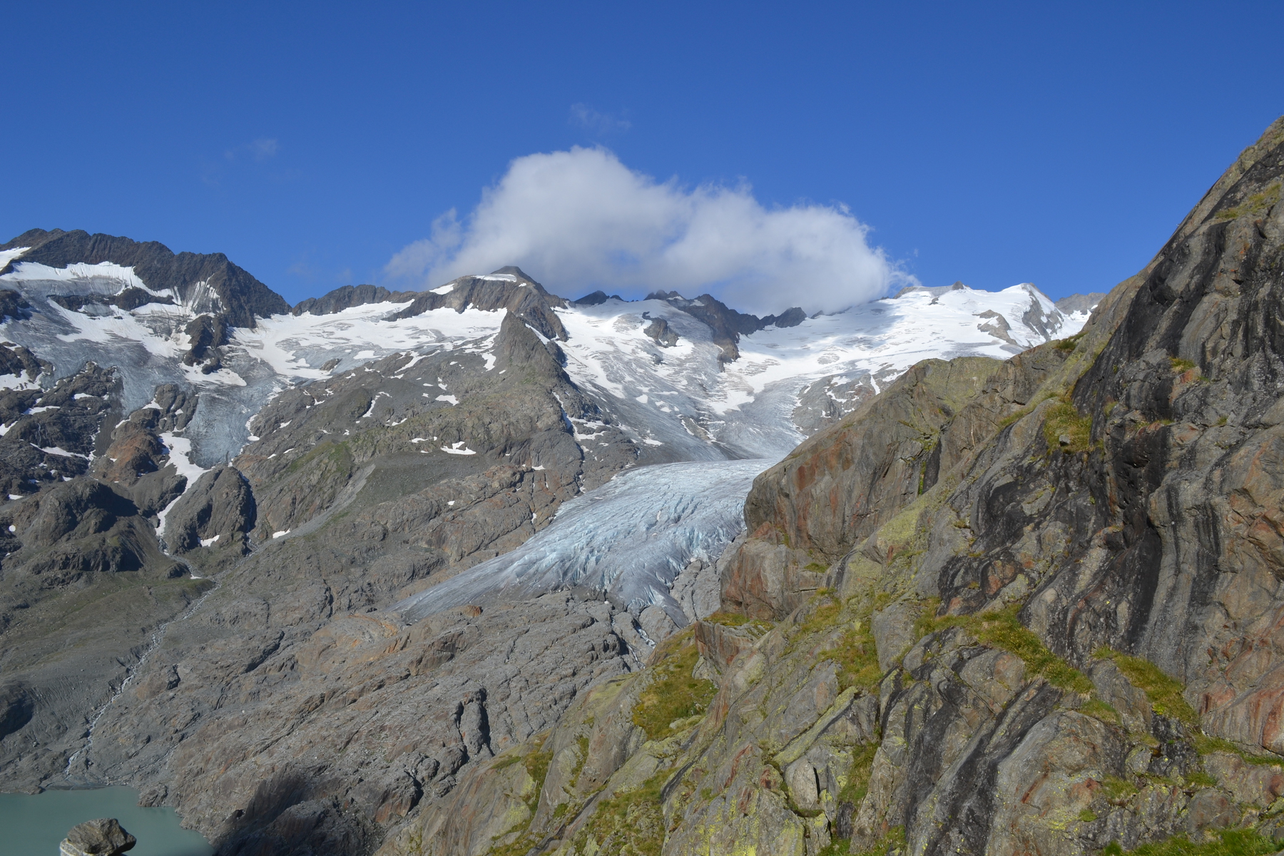
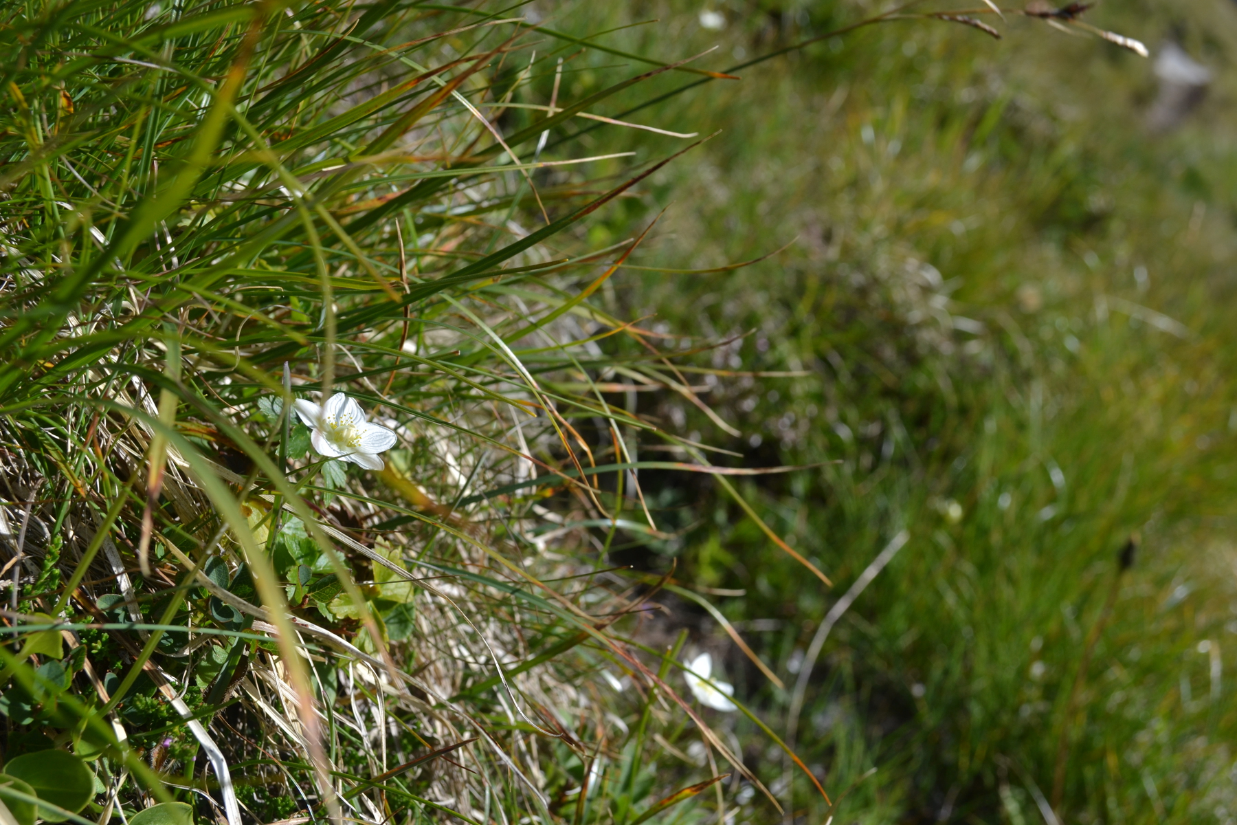
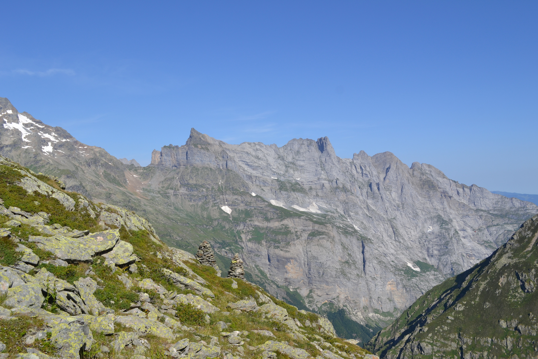
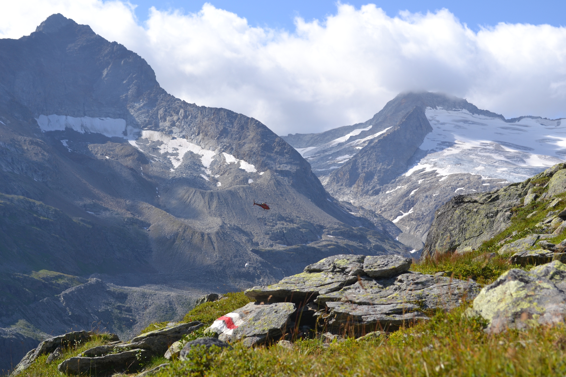
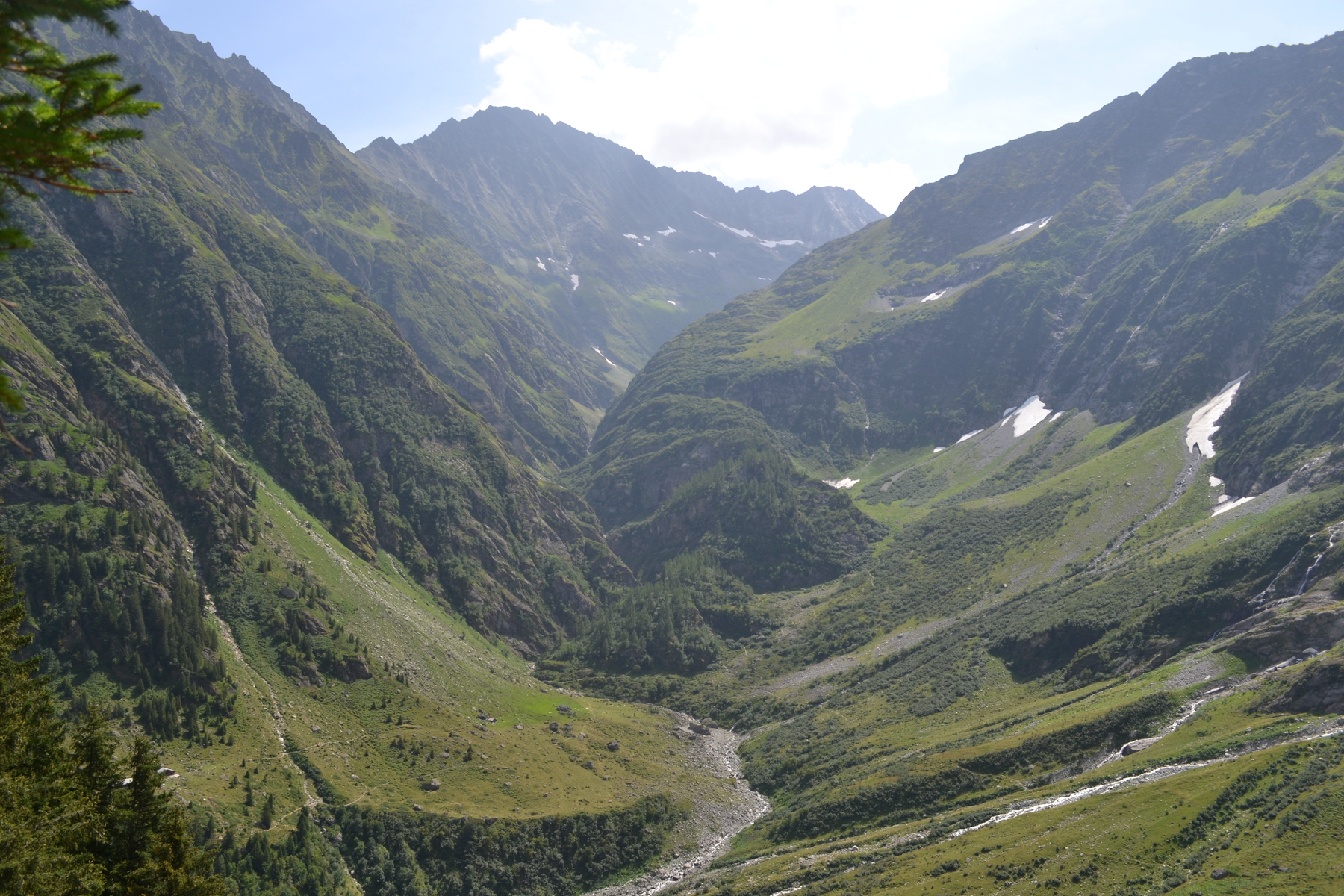
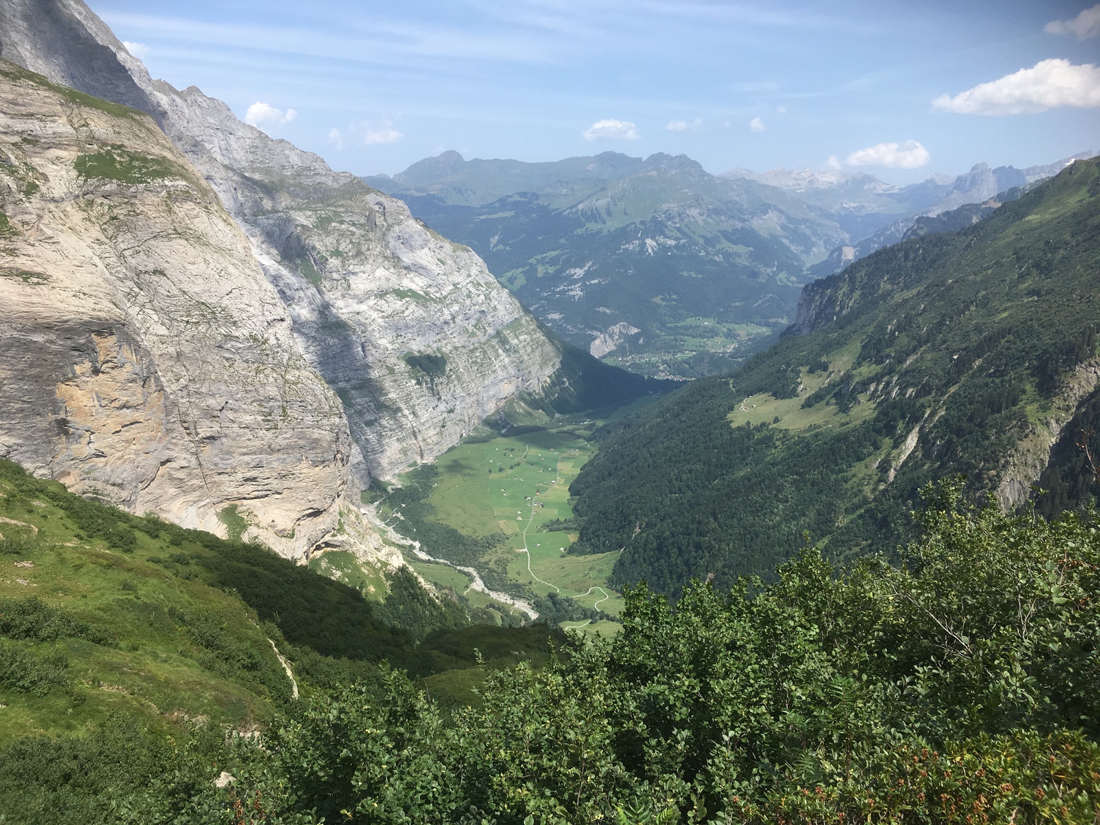
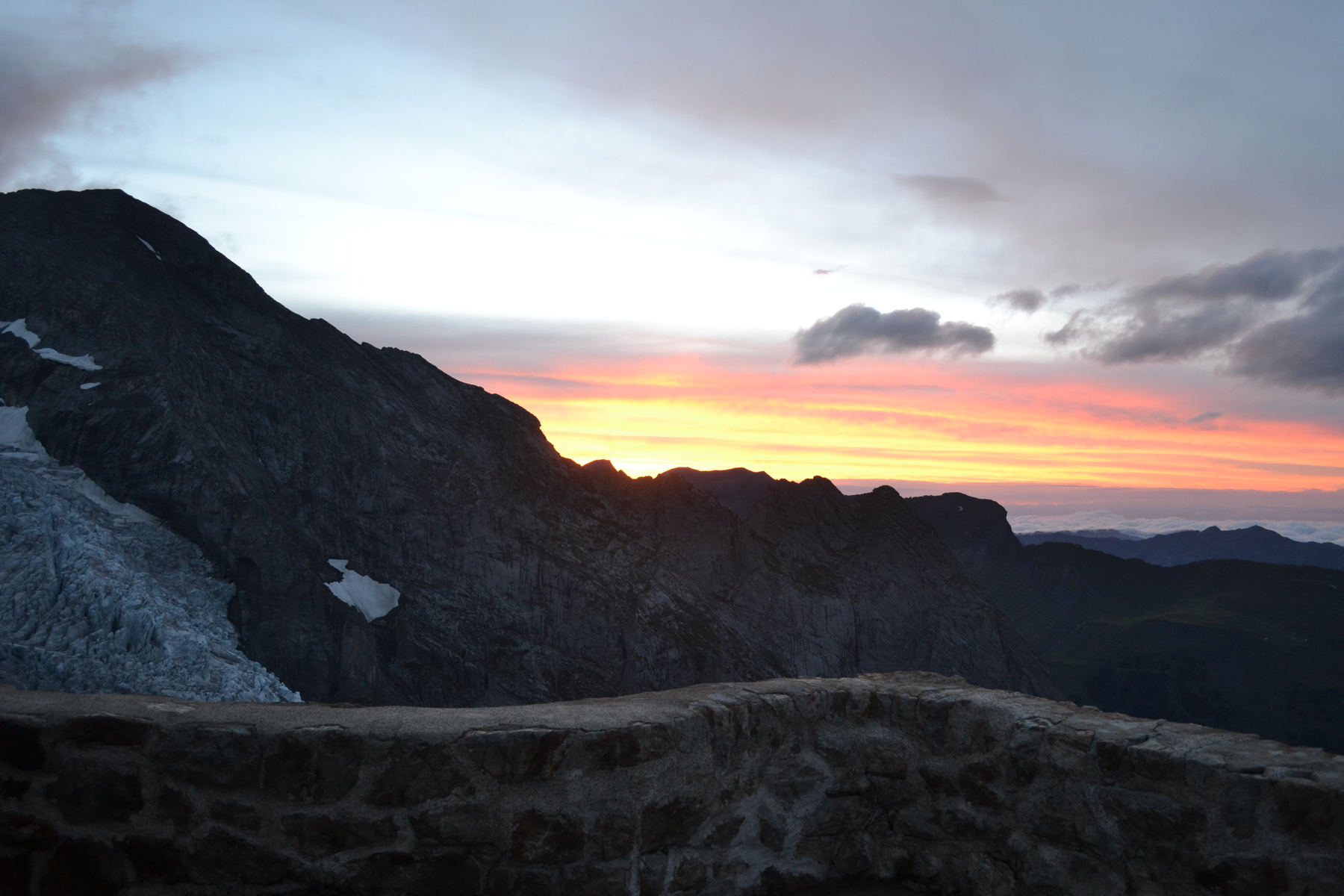
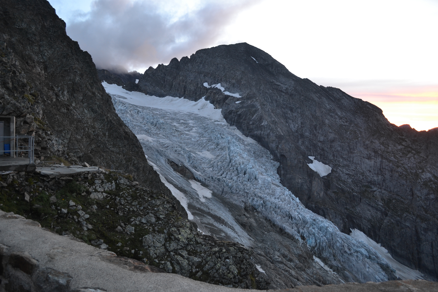
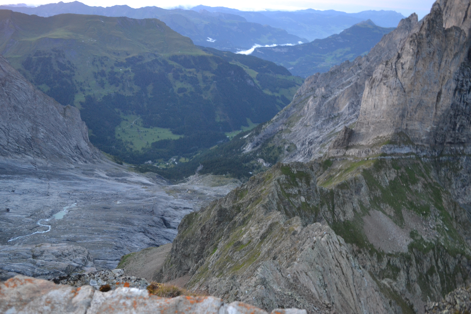
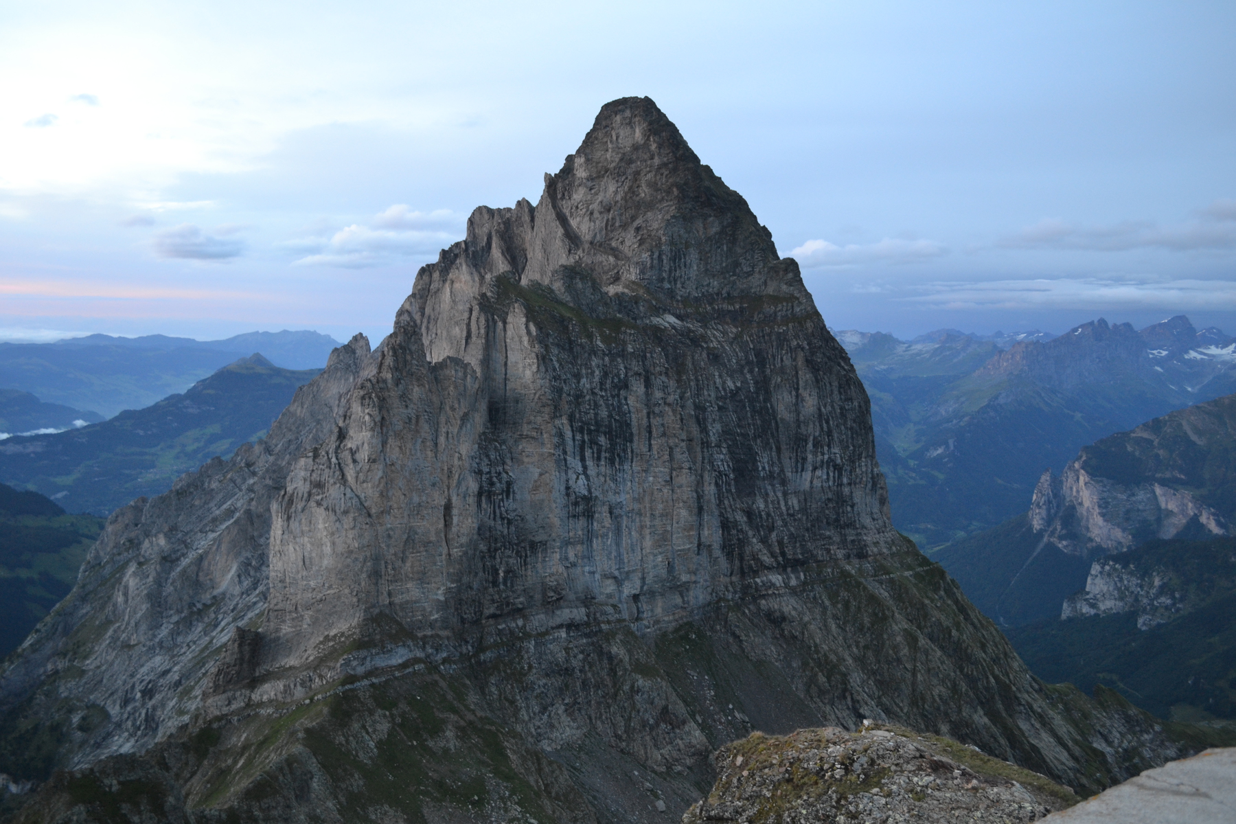
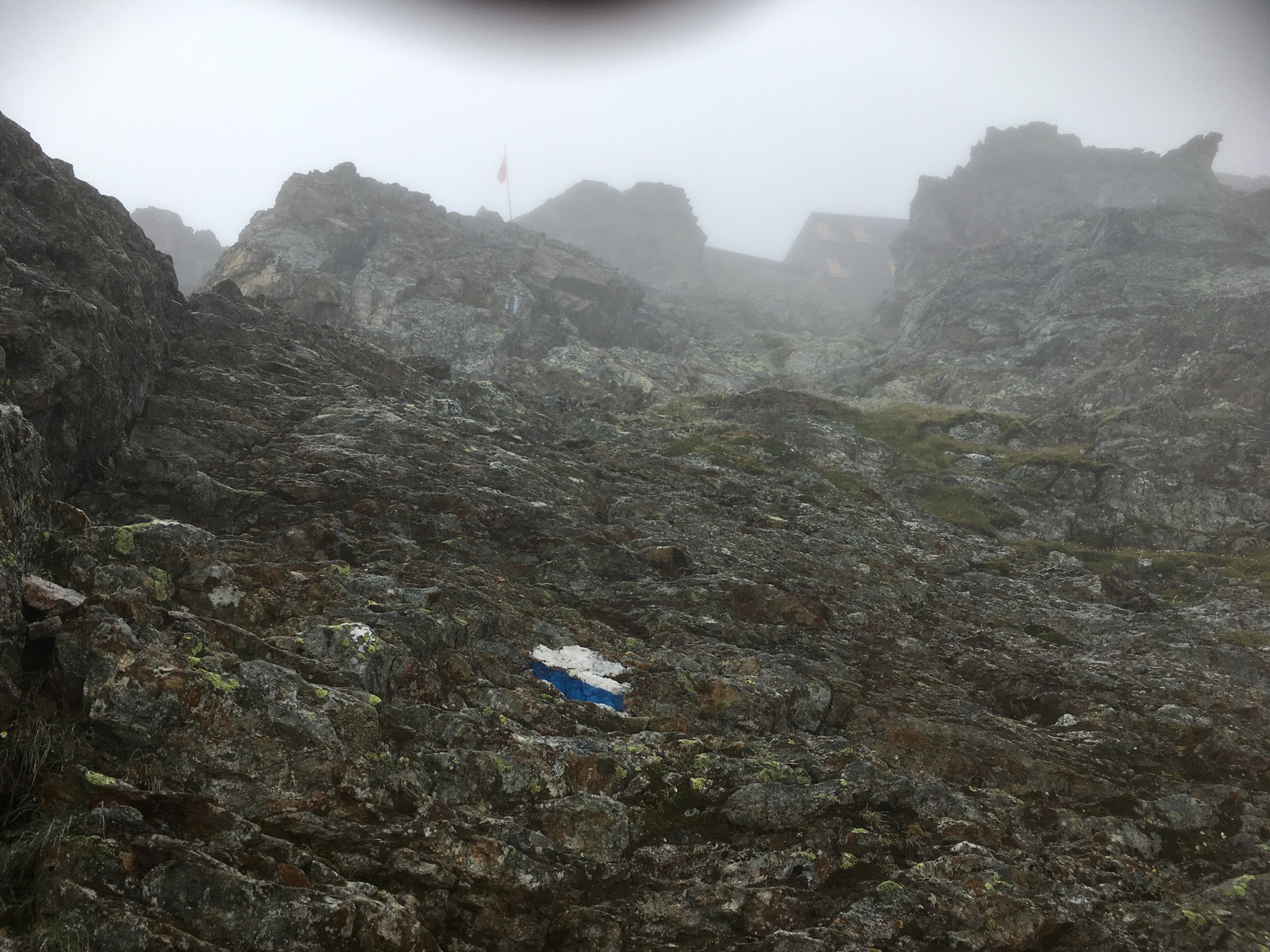
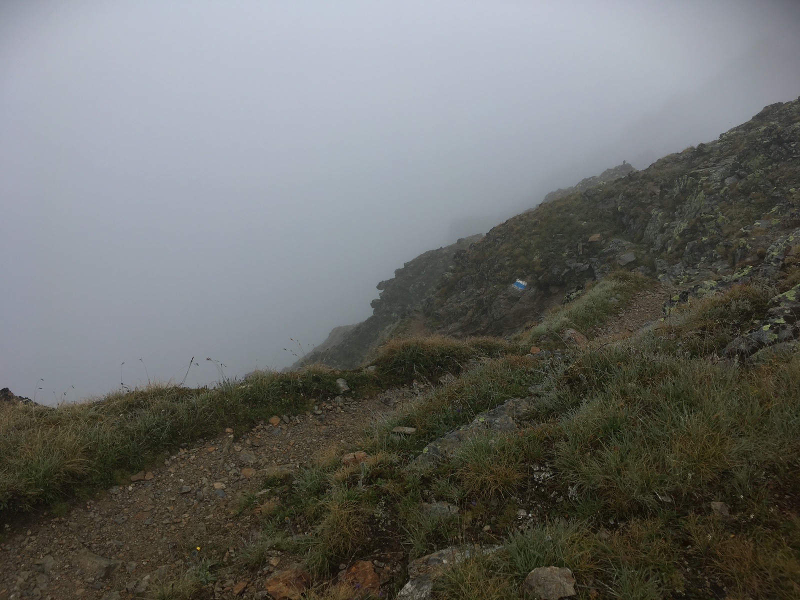
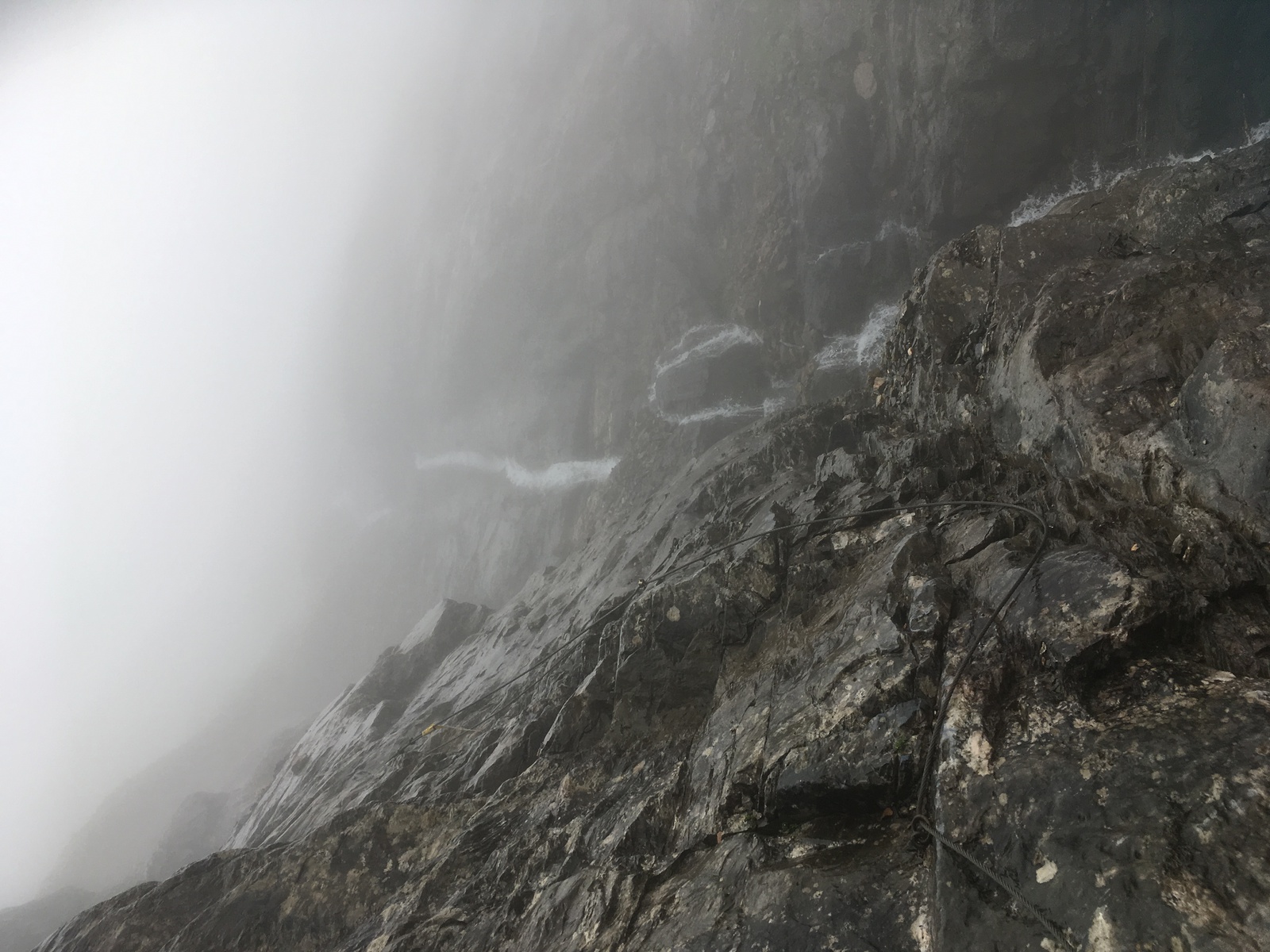
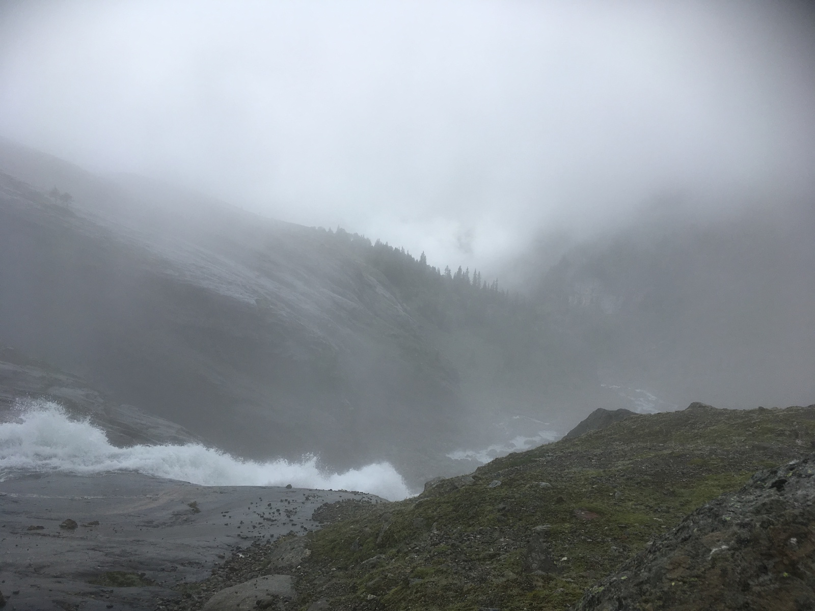
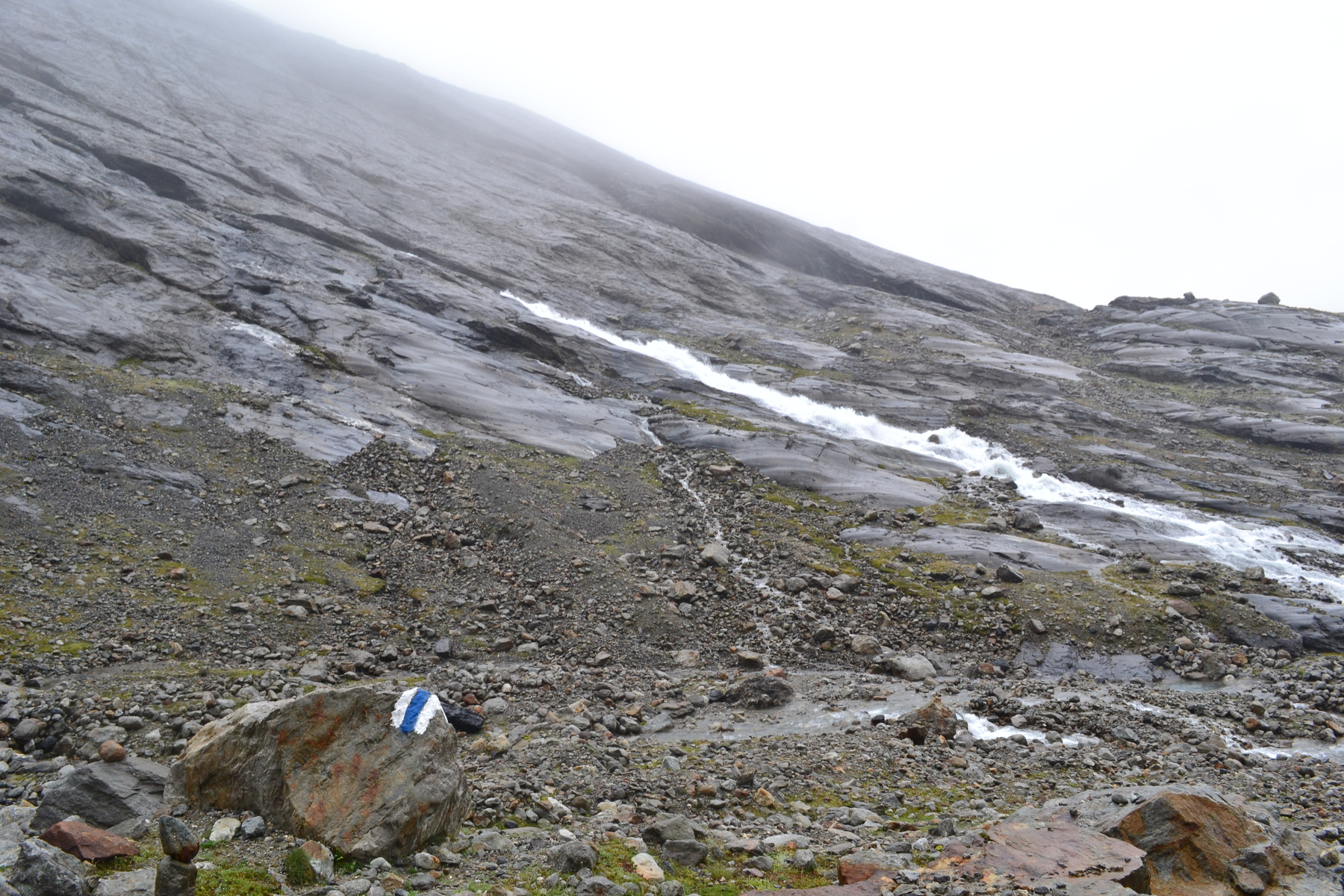
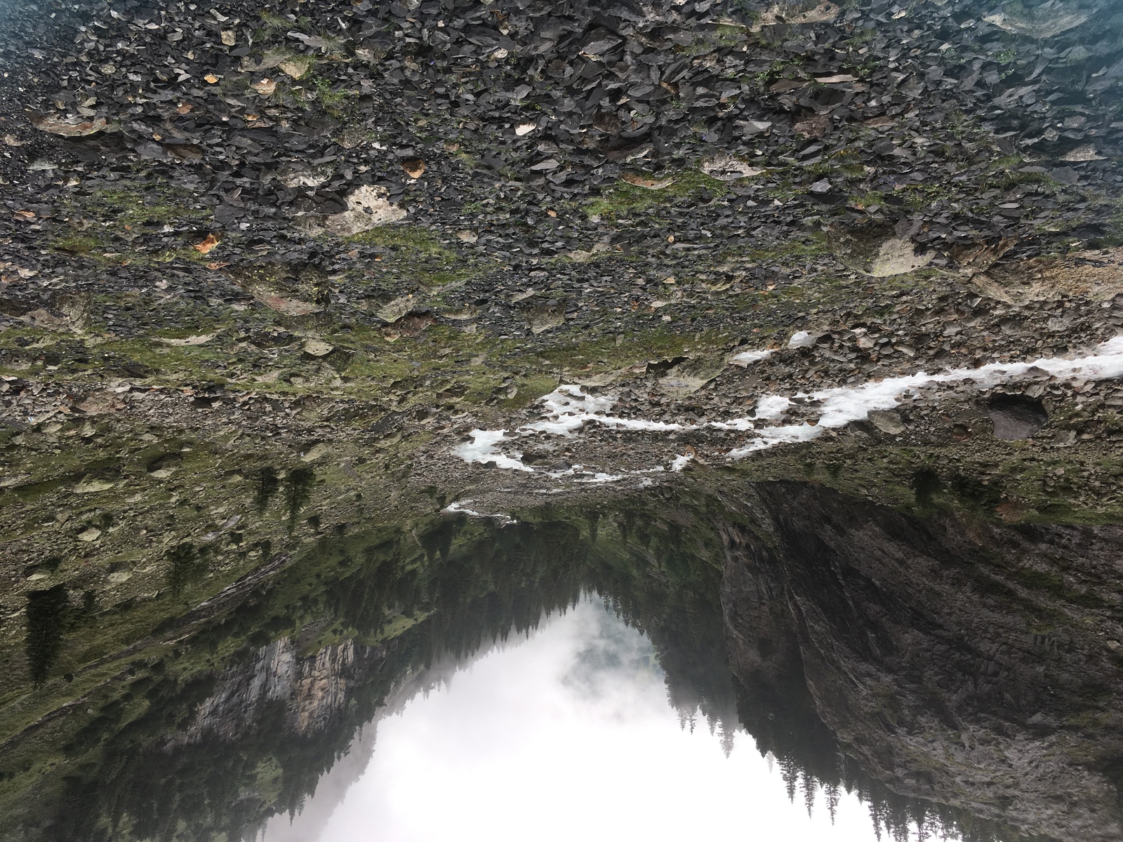
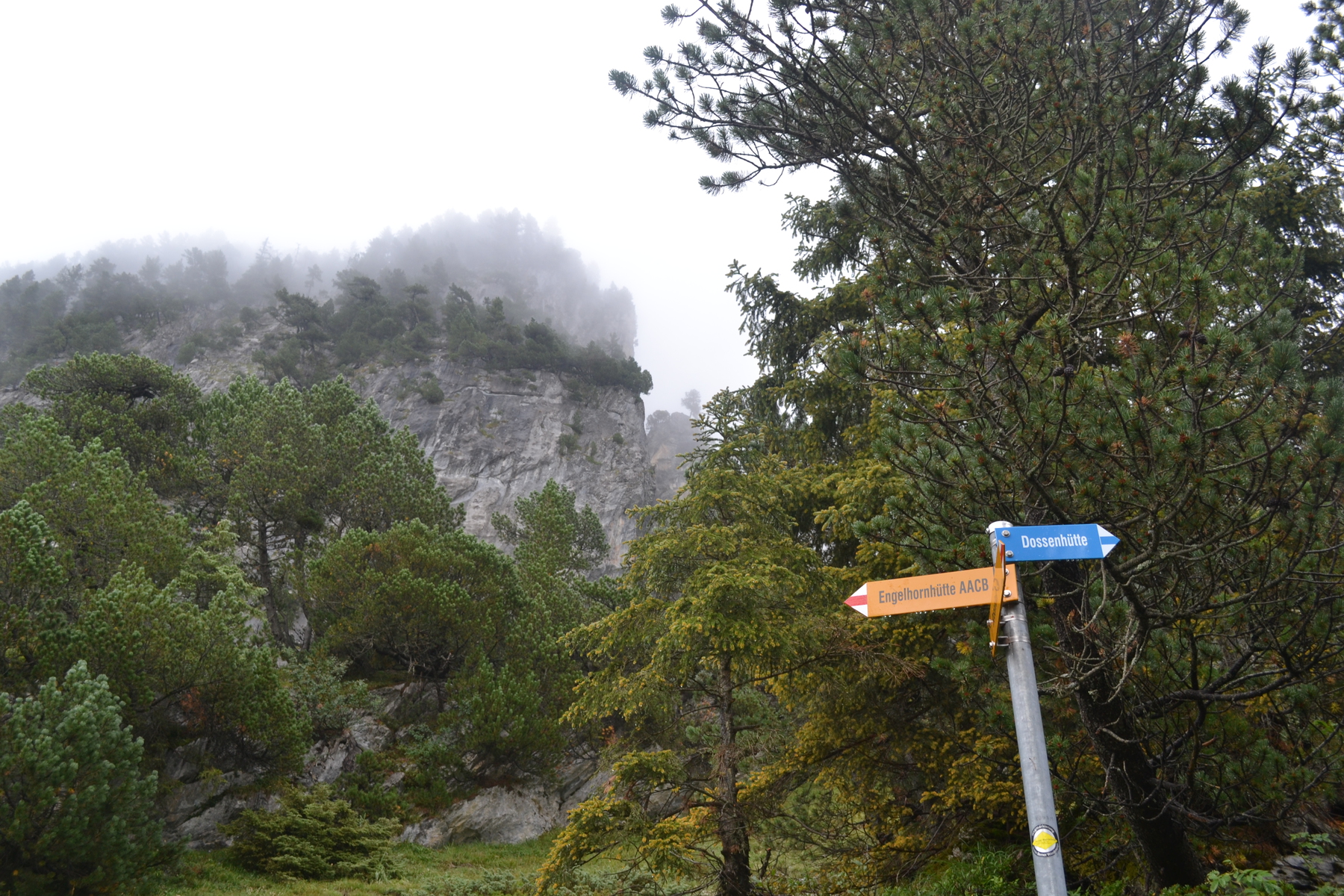
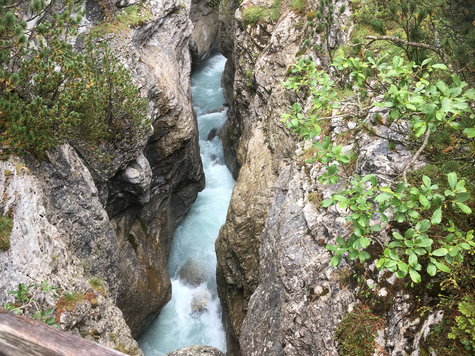
The numbers had confused me for awhile until I looked at a Swiss topo sheet and realized that those numbers were elevations as marked on that map. So I had carried a copy of that map on my iPhone. As it turned out, despite all my fears of impassable cliff faces and unmarked trails, what really happened is that at Gruebenhütte the trail when from white/red/white to white/blue/white. Later I learned that this meant it was no longer a "hiking trail", but rather an "Alpine trail" or a "Mountaineering trail". The rain abated and the sun came out, then at 2963m I saw a "Chamois" (German: Gämse) . It looked to me like a prong horned antelope, but the alpine chamois is more closely related to the mountain goat. In any case it scampered away across highly pitched talus slopes as easily as I would hope to be able to run on the prairie. So I guess I am not really the only living creature in this vast cwm. I crossed a snowfield and finally approach the last 40 meters of the climb. The path to the ridgeline is up a ravine filled with an unstable talus slope. Every step I take seems to release a small landslide and I am not clear that I am making any progress. So I work my way over to the edge of the ravine and start to rock climb. However I soon find myself climbing a fairly difficult corner and wondering how I got myself into this situation. If I was on belay and prepared it would have been fun, but I am instead backpacking. So I worked my way down to the talus slope, and with patients and perseverance slowly climb up the talus to the ridge. When I pulled myself over the knife edge and find shelter from the wind, I am exhausted but also excited. I've successfully crossed that great unknown on my venture! Just because I am "over the top" and it is mainly downhill doesn't mean I am home. The drop into the Gauli basin is a series of snow fields, talus slopes and cliff faces. Cairns and painted blazes don't survive long on shifting slopes and snow fields. So for much of my descent I am following my compass toward a point on my map where a bridge crosses the Ürbachwasser, the river which drains the Gaulisee. The day is also winding down and I expect I'll be late for dinner! So where I encounter a long snow field it is a delight to seat myself in the white stuff with my pack on my front and quickly slide for 300-400 meters! But I have my feet in front of me to brake and keep me under control; although I must look a bit like a snowplow. Great fountains of snow fly up from my feet as I plow my way downhill. At the bottom of the snowfield I startle another chamois! And then their are cliff faces to get around. Almost always after a five minute search I would find a ravine with a blue and white blaze and I was on my way again. The Ürbachwasser is a raging mountain river, green with glacial milk. Fortunately there is a suspension bridge spanning it and I was soon on the other side. It is 6:00, dinner is at 6:30 and only a kilometer away! But the trail winds around the hills to the southwest, when I want to go north, but that is the way it is. At a cross roads two trail signs point to Gaulihütte, I plunge down the white/red/white one but then fifteen minutes later have my doubts. I can see the hütte well above me with cliffs intervening. Also this trail isn't on my map. It seems to be headed towards Mattenalpsee, another lake, from which there is a trail back to the hütte, but that would be a long route. So I retrace my steps to the cross roads. Later I find that if I had continued another 100m I would have seen a new, direct, trail to the hütte and been on time for dinner. Back at the cross roads I follow the white/blue/white trail along a cliff face above the Gaulisee. A steel cable fixed to the rock offers a handhold and assurance. Then an ascent, a scramble with a fixed cable, up a crack and I am on a flat platform with a magnificent vista! I am in the middle of a vast cirque with mountains, tarn and glaciers -- but I am also late for dinner; so I rush on. I arrive at Gaulihütte at 7:25 when most of the guest are finishing dinner. The hütte warden, the same Fränzi who had emailed me advice about my hike, was very kind and scraped together a late dinner. My table companions tell me about their walk in the Gailgletscher and I tells them that I walked over from Gelmerhütte. They look at me with astonishment and suggest that I mean Gruebenhütte. The idea of a 20km march was as much beyond their experience as their romp among sérac and crevasses. I am exhausted and delighted to find that my spot on the sleeping platform tonight is next to the window and the hütte is only half full, so I have a bit of room to spread out. The stars outside the window are amazing! August 9th, 2018 I have a short day planned today, the trail to Dossenhütte is only about 7km (4+ miles), but as part of that I need to drop a kilometer and climb up nearly a mile. My companions from dinner last night had suggested that I join them and climb Hangendgletscherhorn and then continue to Dossenhütte. By that route it was only 6km, with a 800m climb and 300m drop, a far easier route. Alas, I don't have crampons and an ice axe with me, and wouldn't attempt the icy spire of Renfenhorn without them. Still, it is going to be a short day so I allow myself to lay-in, breakfast at 7:00. In fact a leisurely breakfast; coffee, muesli, bread, jam and cheese. As I was packing, a helicopter arrived with supplies for the hütte. I was reminded of the start of the old television show MASH; all the staff were crouched around the landing pad, keeping their heads low and well away from the helicopter's blades. When it landed they dashed in and unloaded supplies, reloaded what was going out, and the helicopter took off. At 8:00 I headed out going south. Because we are surrounded by high peaks, only now is sunlight reaching the hütte. So despite my late start I am still leaving at sunrise. I am heading south, which is not the way to Dossenhütte. However yesterday I was so impressed with the area around Gaulisee that I wanted to return and spend a little leisure time there. So I walked a bit over a kilometer to that flat platform at the top of the fixed cables with the magnificent view. The hills are alive -- with the sound of water! I am standing in the middle of a great cirque which is 7-8 kilometers (5-6 miles) across, surrounded by a dozen peaks starting with Hiendertellihorn to the south east and ending with Bärglistock, at 3630m) to the west. In-between each of these peaks is a glacier. Hühnertalgletscher, Grünbergligletscher and then the king of all glaciers, streaming down from Bärglistock; Gauligletscher. And all around this massive bowl, from every snow field and glacier, from ravines and cliff faces and talus slopes, water is racing toward Gaulisee, cascading, tumbling downward. All around me I hear the roar of a hundred waterfalls! Beyond the water though, it is a sterile valley. A few birds, a bit of grass and moss, but by far it is water, ice and rocks. After sitting for awhile it is time to head north, back past Gaulihütte. The sun is out and the day is going to be bright. The next section reminds me of my time in Wales, for the path is cut into a grassy slope which is pasture lands to sheep. The main difference is that all these sheep are belled so you can hear them long before you see them. When I startle a group of sheep they inevitably choose to waddle a long ways along the path in front of me instead of moving perpendicular to the side of the trail. There is a long cliff face above me, but my trail snakes its way through a gap, and all of a sudden the lower Ürbachtal valley opens a few kilometers north of me and a thousand meters below my feet. The valley floor is flat farmland, yet the valley walls rise nearly straight up, in some places as much as 2km vertically! My trail drops down to the head of the valley, 1000m down, and then rises 1400m up to Dossenhütte. In fact I can see the hütte from here, it is less then 5km away, but I have hours of work. Down and down I go and I feel like I am returning to summer as the air gets warmer and thicker with each switchback. Down past the sheep into thicker and thicker vegetation. Down from 2250 to 1450 meters; down through all the Alpine layers of life and back to the trees. When I reach bottom I see across the stream cows whose bells dwarf those worn by the sheep. The tinny deep clanks seem to come from some old Swiss storybook. But no sooner have I reached bottom when it is time to climb again. I have 1200m to climb, and am averaging about 400m per hour. The first vertical 200m was though the woods were the air was thick and hot. It is curious how I think in terms of vertical distance instead of horizontal. Out of the woods and into pasture lands and a cooling breeze! In the second hour I transition from meadows and grasslands into a land of broken rocks and a web of streams. The mountains above must continuously be shedding rocks and water. Higher up, in the third hour (at 2,000m) , it is all rocks and streams. But at 2,500 meters the trail hits bedrock again. There is a tricky traverse across a cliff face, with cables mounted to the rocks, and then on up again into one more cirque. I know I have only 200-300 meters to go, but the hütte is still hidden by the rim of the cirque. But high across the cirque (or cwm) is stretched a cable with a hose bound to it. It starts up in a snowfield on Dossen, and I am quite certain that it carries water to the hütte. So it can't be too far away. Finally, when I top the rim of that last cirque I find myself with an easy 50m stroll to the hütte. Dossenhütte's website describes it as an "Eagle's Nest", an apt description. The hütte is surrounded by a stone terrace. Beyond the terraces' parapet the drop is a bit disturbing. I am told that I am the first to arrive (about 3:15) and that they will only be four guest tonight. There are a lot of cancellations due to tomorrow's forecast. Since I can choose any place on the sleeping platform, I pick the one nearest the window. Outside my window is an inspiring view of Gstellihorn, the last and highest peak of the Engelhörner ridge. Engel means "Angel", so maybe it fits with the Monk and Jungfaur just to the west. The peak of Gstellihorn, a spike or fin of rock, is only 800m, half a mile away, yet the rampart which faces me looks impregnable. That is to say when I can see it. The weather changes hourly and the peaks are often lost to the mist and rain. By evening the weather has cleared and all the guest, including another couple which joined us, sat out on the terrace watching the sun set over the Rosenlauigletscher (Rosenlaui Glacier) and over the clouds which filled the Rosenlaui Valley. One of the guest told me he had skied down that glacier last winter. Now the ice is a tumble of crevasses and sérac, as the glacier cracks as it cascades over a cliff face. He tells me that the snow is incredibly thick in the winter, but looking at that face, he shudders and can't imagine how he skied it. So there are six of us for dinner. The new couple are in their fifties, she teaches kindergarten. The triplet is a father in his late sixties and his twenty-something son and daughter. Dossenhütte has a chef! This was undoubtedly the best meal on trail, and perhaps the best I had in Switzerland. It started with an appetizer of cucumber and cream cheese on pumpernickel. For the soup course we had a thick carrot puree with a touch of ginger, followed by a crisp salad. The main course was pasta and cheese, which sounds simple enough and has all the carbohydrates an Alpinist would want. But the cheese sauce was extraordinary, made of three or four cheeses, with a touch of tomato. And then cake and tea. Over dinner the couple told us that they had attempted Dossen, but had a hard time navigating in the clouds and so didn't summit. They had originally intended to return to Dossenhütte and then push on to Engelhornhütte, down the mountain, this afternoon. But they decided against the descent because of the poor visibility. When they called the other hütte the warden there said that it was all right to cancel. There was no one else there, so she would find her daughter and walk into town. The triplet had been out on the Rosenlauigletscher today, with ropes, ice-axes and crampons. I think the son and daughter were doing their best to try and keep Dad out of trouble. They told me that at one point today the ice had collapse under their father and they had to haul him out of a deep crevasse. I got the impression that the children thought the father a little careless. The father shrugged, as if this is what happens every day. For him, maybe it was. He told us that he had been out on 30 back-country ski trips last winter. "Warum tue ich das? Denn wenn ich das tue, weiß ich, dass ich lebe", he told us, they translated for me, "Why do I do this? Because when I do this, I know I am alive." August 10th, 2018 I have been toying with the idea of cutting my hike short. I dropped a plank on my foot just before starting and my foot continues to throb. Also todays hike doesn't seem that far, but this descent will take hours of careful work. Still, I didn't think I had decided until yesterday evening when the hütte warden suggest breakfast at 8:00 and I had agreed instead of requesting an earlier time and an earlier start. Breakfast was good, but also very standard; birchermusli (musli, fruit and yogurt), bread, cheese, butter, jam and coffee. While eating the hütte warden sat and talked with me about the trail down. He told me that I should have no problems, but also warned me to keep a close eye on the blue and white trail markers. The first hour is a long series of switch backs and at many of the turn a goat trail continues. With inattention you could easily get yourself out on a cliff face where you did not want to be. He told me that from any trail marker I should be able to see the next - even in this thick and blinding mist. Three stone steps from the terrace and I could feel that it was going to be a tricky descent. The rocks and stones, cold and wet and slippery. Between Dossen and the Engelhorn range is Ürbachsattel (Ürbach saddle). My vision of a saddle is a semi-stable area with gentle curves up to peaks in two directions, and down to the valleys in the other directions. There were no gentle curves here. Ürbachsattel is a knifes edge which connects Dossen to the Engelhorn fin. Later I read that this is a T4 (in one guide book a T5!) trail and that, "a climber trying this trail should not be given to giddiness at great height and extreme exposure". The trail seemed to take a perverse delight in balancing itself on that knife edge. True, there is no wind, but the stone underfoot is wet and slippery. The fog is so thick I can not see how far are the drops, but certainly they are far enough. I crept slowly. As a side note; when my brother taught me to rock climb he insisted that we always have three points of contact with the rock, two feet and a hand, or two hands and a foot. I now often used four points, two hands, a foot and my bottom as I gingerly lowered myself. Finally I left the knife edge, so at least one side of the trail was granite, even if the other side was only mist. In a number of places there are fixed cables bolted to the cliff face. I was surprised to see that where the cables would lash against the rock in wind, it had been wrapped in plastic tape to stop the chaffing. Occasionally there is a level stretch and I amble along with a 200m drop to my left, as easily as if I was walking on a sidewalk next to Main Street. One does get use to these things. Out on an arrêt, back along a cliff face, down a few iron rungs mounted to the rock, I zig-zagged down the mountain. At one point I realized I was 200m below Dossenhütte, but only 50m separated us horizontally. At last I was off the cliff face. Across a talus slope and into a chasm with a waterfalls a few meters off to the side. Here the descent would have been impossible without the cables, iron rungs and sometime ladders. The water next to me fell and disappeared into the mist below my feet. In a few hours that same water will cascade over Reichenback Falls, the site of Holmes and Moriarty's famous struggle. This descent may sound like I was lost in a cloud, but in fact I was never out of site of the white/blue/white blazes of this Mountaineer's Trail. Eventually I came out of that waterfalls filled chasm, and the bottom of the cloud, and trekked across a broad stone valley. Water from the Rosenlaui Glacier is spouting from a hole in the cliff in front of me. The valley thunders with water. And now the tree line. With every passing minute the world becomes more tame. I meet a few hikers (not Alpinist) headed to a lower hütte. Now I meet families with small kids and pass by a picnic area. The path is a broad woodland trail when I emerge at Rosenlaui. I have just missed the bus and will have to wait an hour. But there is a cafe at the trail head, which is a good place for this walk to finish.
|