|
[Click on any photo to get a higher resolution.
Ask Tim to email you the highest resolution.]
|
I haven't taken a bike trip in a few decades, but they use to be the central point of my summer. So this year I am back to the bike and pushing those peddles.
I think I made a mistake the first day and got the food-to-miles ratio wrong. The whole point of these trips is to spend a lot of time in diners/cafes/bakery shops, talking to locals and consumming thousands of calories.
So the important numbers:
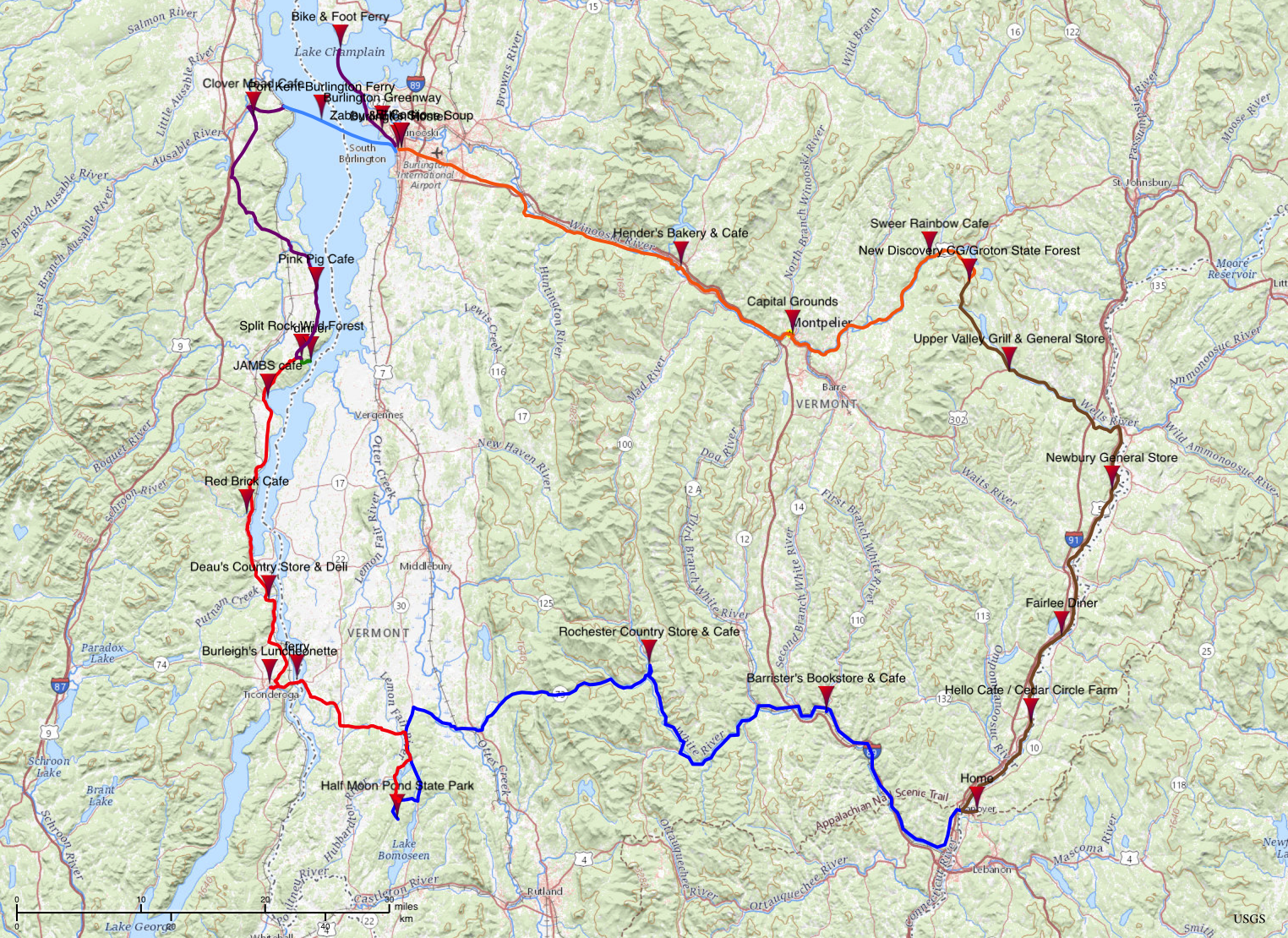
5 days, 306 miles, 17 diners/cafes/bakery shop
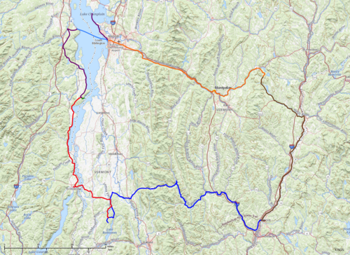
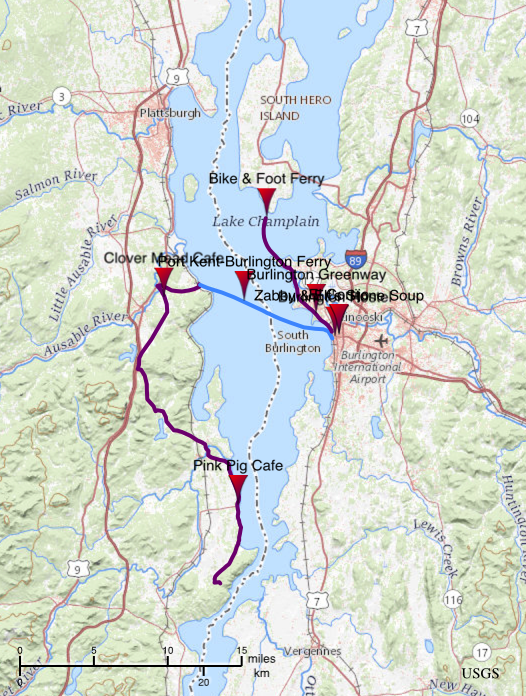
Day1: blue. Day 2: red. Day 3: purple & light blue. Day 4: orange. Day 5: brown.
|
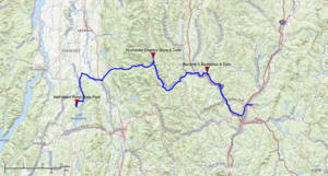
Map of Day 1 |
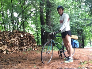
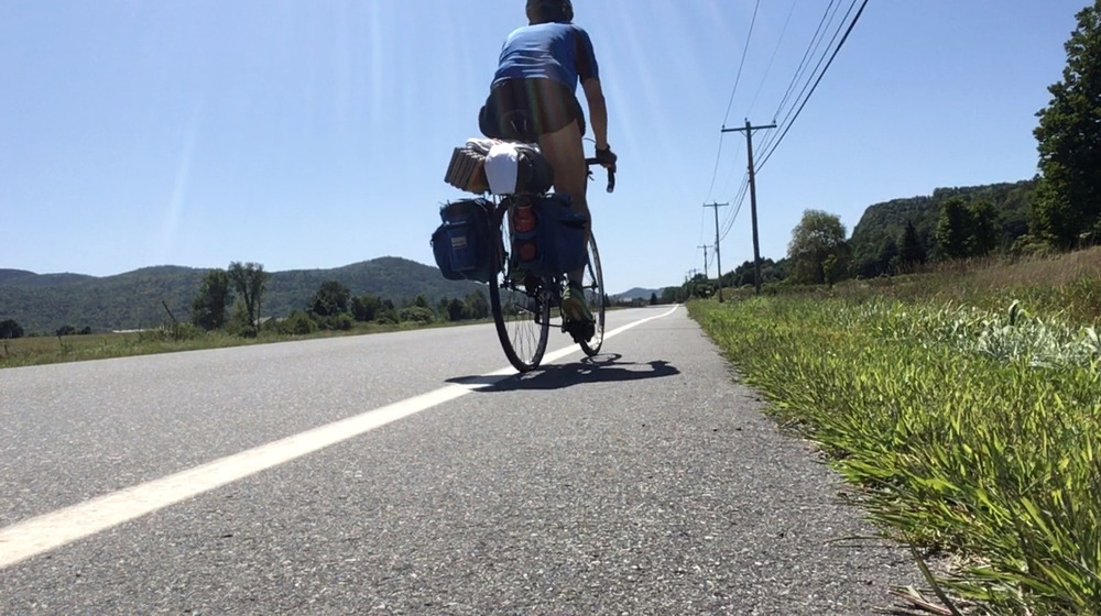
At the Start |
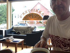
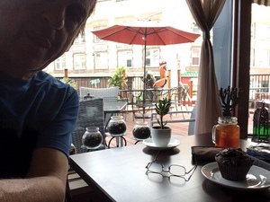
First coffee of the trip |
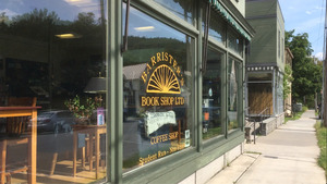
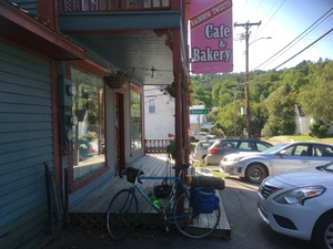
Barrister's Book & Cafe |
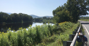
The White River in Bethel |
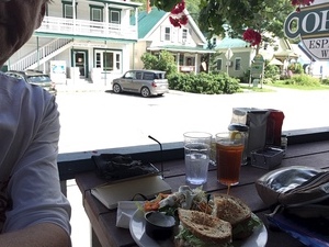
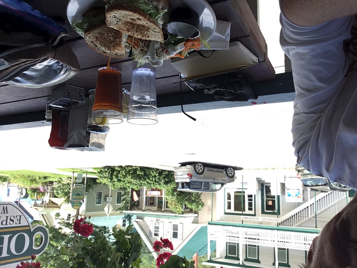
"Tim's Specialty",
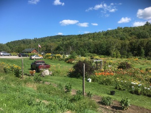
Rochester General Store & Cafe |
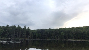
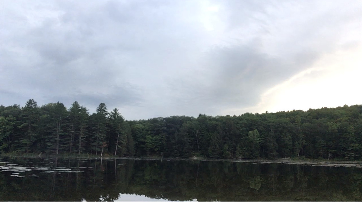
Half Moon Pond |
Thursday, August 22nd, 2019
Hanover, NH - Half Moon Pond State Park, VT
83 miles
It is always a bit of a comedown when you realize that the start of a long and exotic trip starts with the mundane, short and local problem of just getting out of the house and out of town. In fact some of the worst traffic I encountered on this ride was in the first two miles, as I traversed the commuter traffic of Hanover. Hundreds of cars headed to the hospital, and downtown full of students who have arrived for orientation and are a bit aimless on their wanderings.
Across the river and as far as Hartford the world was full of people trying to get to work, while I was trying to get away from it all. Finally, once I was winding up the White River, on VT-14, things became a bit calmer.
I stopped in West Hartford for a few minutes to talk with two hikers. This is where the Appalachian Trail crosses the river. The hikers were resting on the steps of the general store. Yesterday had been damp, actually a deluge, which had caused me to postpone my departure, and so I asked them how they had survived the rain. One of them held up her damp shirt and told me she was starting to dry out. But they both agreed that it might be a day or two before their shoes and socks were happy.
This morning's ride follows the White River upstream. It is quiet in the late summer, shrunk from the raging torrent it can be in the Spring. But now you can see all the ledges which make the rapids (and thus the "White") of this river. They also remind me that I am going up, but the climb is genteel.
I stopped in South Royalton for my first of many coffee shops. South Royalton is the home of Vermont Law School and the coffee and book shop "Barrister's". The shop is run by students of the law school and when I was there a new recruit was being oriented. The veteran Barista suggested to the novice that they start out by constructing the novice's favorite beverage. But this proved to be difficult, since the novice didn't actually enjoy anything in the greater coffee family.
On up the river past Royalton, where another cyclist called out to me, "Keep on Rock'n Baby", and through Bethel. The roadside eateries are busy as it is now noon, but I have visions of reaching Rochester before I stop again.
There is plenty of road work going on and I am stopped every few miles by a flag-person as the highway becomes one lane for a quarter mile around a crew patching potholes. I realize that I am slower then cars and therefore the last one through the one-lane sections. So I am the one holding up traffic. Therefore at one of these stops I am determined to sprint.
When the flagger's sign pivots from Stop to Slow I stomp on my peddles as I am shifting down, and managed to pop my chain off and jam it between the gears and the frame. It takes a few minutes, and traffic cycles to dislodge and restore it and eventually I am on my way, but every few seconds my chain bumps and skips!
Eventually I pull off the road and realize that I have slightly bent the chain. When one link goes through the rear derailer it gets caught and kinks the whole system momentarily. Mechanically, this was the worst (and only) problem of the whole trip. I knew I couldn't really ride hundreds of miles with this slip-catch-kick going on. I had visions of an early demise to this whole venture.
I then remembered that on our first "Long Trek" (scout hike in 2005) we had rented mountain bikes in Rochester - so perhaps there was a bike shop there, about half a dozen miles from now. But how to get across those miles?
Down in the bottom of my panniers I have a vice grip and a pair of long nosed pliers, and with these I was able to twist that one bent link back to an acceptable amount of straightness. So in twenty minutes I was back on the saddle and heading towards Rochester.
Rochester is a nice little village in the heart of the Green Mountains. It has a book store, hardware store, laundromat, bakery, bike shop and general store. The general store also has a cafe, which is where I ended up, on the porch, for lunch. Ice tea and "Tim's Specialty Turkey Sandwich", Tim is the sandwich maestro in the back room.
The next hour (and a bit) is the one I have been dreading since I envisioned this route. It is the climb up to Brandon Gap. "Low gears and patients", is what I later told a flag-person was the key to these long climbs. Sometimes I drop to a jogging pace, sometimes even to a walking pace. But patients will bring that gap to me if all I do is keep turning these peddles and wait.
At the top of the gap the world was misty and there wasn't really a view. In fact beyond crossing the Long Trail it was without note, and so I started down.
Brandon Gap to the town of Brandon is about seven miles and I think I only peddles two of those. It is a delight to slalom down a winding mountain road through the forest!
In Brandon I called Half Moon Pond State Park to make sure they had camp sites available. They told me there were plenty, but they closed at 6:00. It was a dozen miles in a straight line and I had almost two hours, so I didn't see a problem.
Nothing is straight! I was over twenty miles, which still should have been fine until I got to a few very steep hills and realized that my legs had seen a lot of miles and were trashed! I crept up as best I could. Still, with three miles and ten minutes before they closed I called again. The ranger assured me that I could just camp, and then register in the morning, so I did.
Once at the campsite I sat with my feet in the pond for awhile, ate bagels, cheese, nuts and chocolate, had a shower and tumbled into my sleeping bag.
I'll note here that this was my first night with my new summer sleeping bag. Kristina wanted to get me something for this trip for my birthday (two days ago). I suggested a light, compact, summer bag. I seemed to have acquired several winter bags, but the last time I bought a summer bag was in 1975 for a trip to Philmont Scout Ranch in New Mexico. This new bag is filled with goose down, weight about two pounds and compacts down to about 1.5 liters! It is rated to 40-degs (we get some cool nights) and it is a delight to sleep in!
|

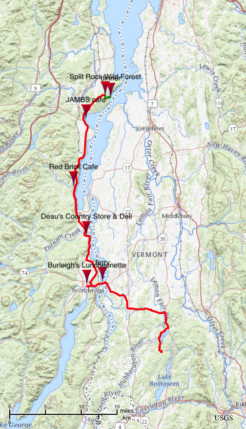
Map of Day 2 |

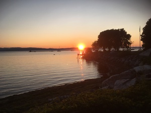
Sunrise on Vermont Pond |
Vermont Morning |

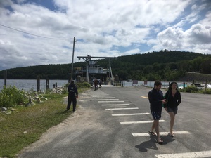
Down to Lake Champlain |
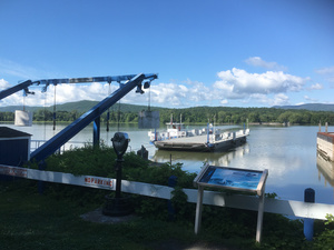
Ticondaroga Ferry |

Rolling by the lake |
Red Brick Cafe |

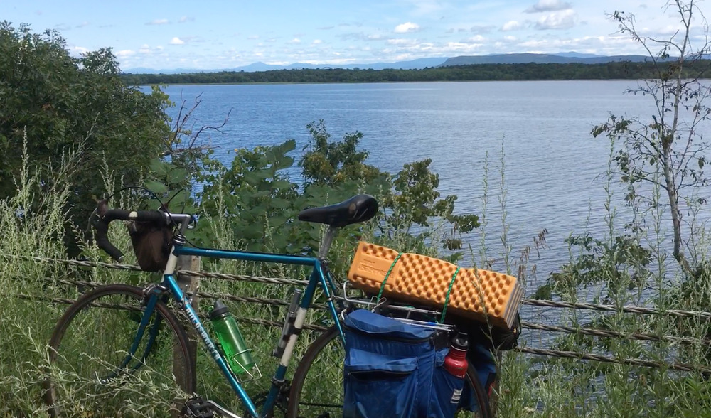
Bike & Lake Champlain |

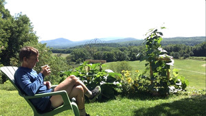
Dinner overlooking Snake Den Harbor,
Split Rock Wild Forest |
Friday, August 23rd, 2019
Half Moon Pond State Park, VT - Split Rock Wild Forest, NY
52.4 miles
Last night, to make the ground a bit softer, I had gone off into the woods next to my site and gathered a dozen armloads of leaves and duff. I think the ground would have felt like cement without them. As it was, it was still hard enough that I wasn't going to sleep late. I was up at 7:00 and left the site at 8:00. There was still no one at the gate, so I left a note and cash.
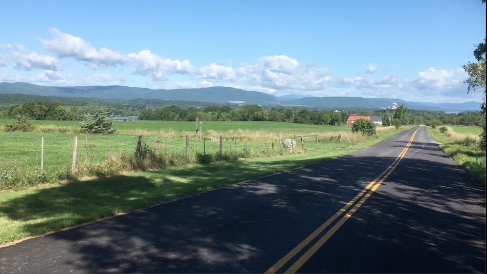
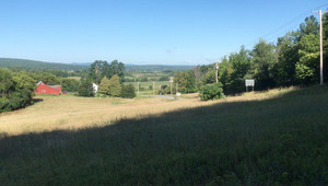
It might only be 12 to 15 miles straight to the ferry to New York, but nothing is straight in the direction that you want. So I wound around ponds with veils of early morning mist, and eventually broke out into farmlands and rolling hay fields. I rode by a lot of old barns which were drooping and starting to meet the earth. But occasionally I would ride by one of the very modern dairy farms, large open sided pole barns with hundreds of cows. They are often very neat and the grounds around them are trim and maintained. But one of the things I like most about them is that these barns are still generally red!
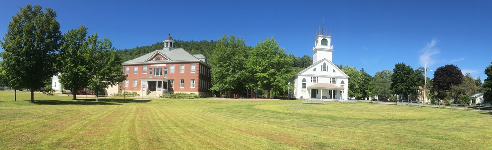
I rolled through the village of Orwell whose green is lined with stately civic buildings, which speak of pride from a hundred years ago. And then down a long glide to Larrabee Point and the Ticonderoga Ferry. 2$ and ten minutes and I was in New York State.
The village of Ticonderoga is about a mile behind the ferry landing and fort, and I was delighted to find Burleigh's Luncheonette serving up breakfast. Burleigh's styles itself as a '50s diner, but somebody has put a lot of work in recent decades into making it feel that way. Although I was impressed that the prices seemed almost to date from the last century, and since I was famished I ordered a lot of eggs, pancakes and ham for breakfast.
The counter had lots of angles in it to maximize the number of stools, and so I sat facing a group of five teenagers. It was curious and entertaining to watch these guys, constantly fidgeting, poking each other, subtly elbowing each other. I am sure that some people view them as obnoxious, but I expect that they think they are comic and just having fun. Even if it meant drinking half a friends milkshake when they had gone off to the washroom.
Refueled, I walked over to the visitor's center and crossed paths with "Cycle ADK". This was a week long bike tour of the Adirondacks, complete with support trailers, food and even portable showers. There seemed to be hundreds of riders, with more showing up as time passed. Ticonderoga was their last stop.
The day is becoming sunny and hot as I cycled north. At Crown Point I stop for a soda at a "Mom 'n Pop" store, and could not resist the fresh made donuts glazed with maple sugar.
Lake Champlain is flanked with all sorts of little villages with the appellation "Port". Apparently they all date to a relatively small sliver of time where boat traffic dominated commerce, before the railroads took over. In recent decades all these ports have been reborn as summer destinations. On a sunny day Champlain is festooned with sails and powerboats, and the marinas of these ports are busy.
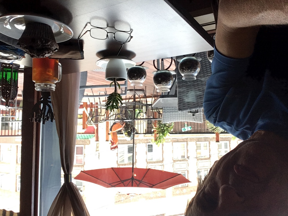
My next stop was the Red Brick Cafe, in Port Henry. A nicely restored old building with a good Americano and chocolate muffins. When I texted a photo of this to Kristina she suggested that I am actually in the same cafe, just occasionally switching tables.
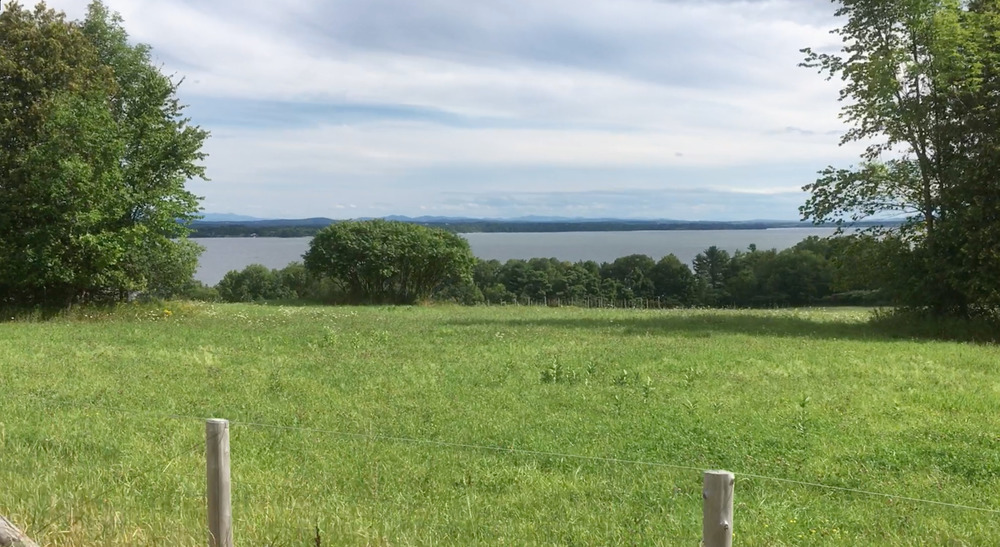
In Westport I had a bagel and acquired a turkey sub which I would have for dinner that evening. A few miles later I finally reached "Split Rock Wild Forest", my destination for today.
Split Rock is a designated "primitive camping" area, which means you can just pitch your tent where ever you want, if it is beyond 150 feet from trails, or roads, or a quarter mile from designated camping areas. I had originally envisioned carrying my gear to the lake shore, but that is a long bumpy trail. So instead I rolled my bike in about ten minutes and set up camp.
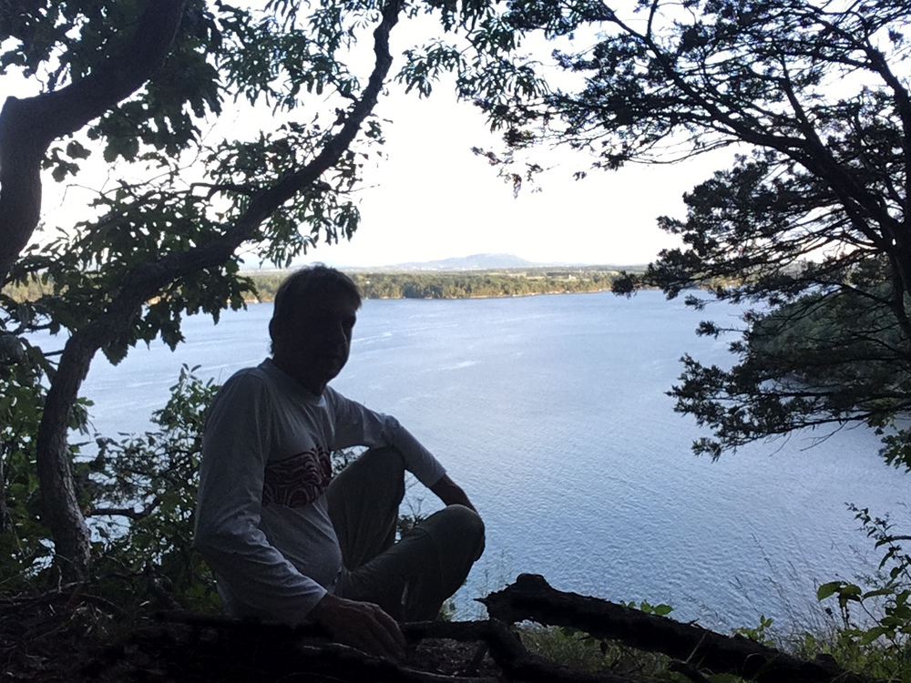
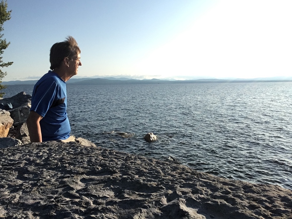
Then, with my dinner in my pocket, I walked to "Snake Den Harbor Overlook" (about a mile) and sat at the top of the cliff watching the sun light fade from the lake. Half a mile away, on the Vermont side, the shore is gentle and cottage lined. But the New York side is jagged cliffs and deep wilderness.
Then back to my tent in twilight and to bed.
|
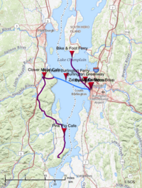
Map of Day 3 |
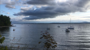
Early morning - Lake Champlain |
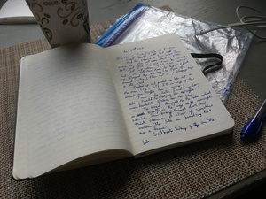
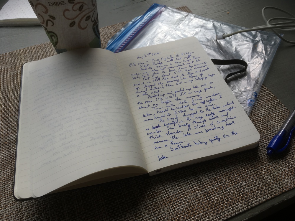
Writing in my Journal at Breakfast |
Ferry at Port Kent, NY |
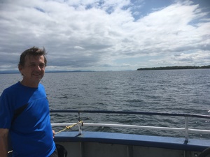
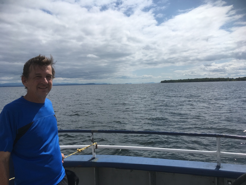
On the ferry |
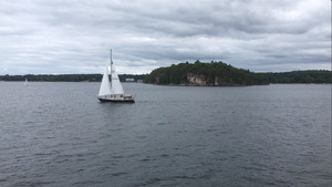
Sailboat from ferry |

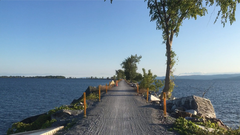
Bikepath on Causway |

End of the bikepath |
Burlington Greenway |
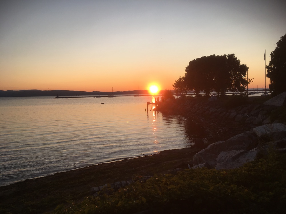
Sunset over Lake Champlain |
Friday, August 24th, 2019
Split Rock Wild Forest, NY - Burlington Hostel, VT
47.6 miles
At the first suggestion of light I went out and retrieved my bear bag, it was still too dim to consider packing. So I sat in my sleeping bag (cocoon) and ate dried apricots.
Eventually I packed up and pushed my bike out to the road and headed north. There is almost no traffic this morning.
Two miles later I met a cyclist heading south. He was on his way to Westport for coffee and breakfast. I was on my way to Essex for the same.
The road dropped to the lake shore which is beautiful in a way that only early mornings can be. The sun breaking through thick, dark clouds, lighting up a sliver of water. Most of the lake was a dark and brooding frame around this dancing silver path.
Sailboats bobbed quietly on the lake. There are lots of cottages here, some quite fancy.
In the village of Essex I found the "Pink Pig Cafe". On the porch a young man was explaining to nearly everyone who walked by, "Yes indeed, we found a replacement band!" To a small girl who didn't want to be hugged he said, "Show me some love. I am getting married today!"
Later, as I devoured my breakfast sandwich of croissant, eggs, tomato and avocado, I could hear the head of the replacement band introducing himself to the best man. The musician was about fifty years old and explained that he had made his nest egg in the "the city" in real estate. But life in the city was crazy, so he had cashed out and was living the good life in Westport, occasionally playing for weddings.
You would think that the shore of a lake would be as level as water can make it, but the roads don't stick to the shore and instead seem to prefer rolling up and down every hillside that they can find. Past Willsboro I am back into the rolls, the foothills (toe-hills?) of the Adirondacks.
The early morning cyclist I met had suggested I take Mace Chasm Rd, circumscribing Keeseville. He also mumbled something about coffee.
Mace Chasm Rd is some sort of bike magnet. I saw more bikers riding on this road than on any stretch of macadam so far. (The Cycle ADK group were eating). Beautiful, rolling farm land which brought me to the Clover Mead Farm & Cafe.
The cafe staff told me that two waves of bikers had wiped out their bakery stock. More things are in the oven, but not ready for awhile. So they gave me a grilled cheese and tomato sandwich and I sat outside at a picnic table talking with other bikers.
These bikers described themselves as "weekend warriors". One long hard ride on Saturday and they were done for the week. They envied my tour, but also preferred their once-a-week dash.
The ferry from Port Kent to Burlington goes every 2-3 hours and I arrived an hour before the 1:30 departure. It is a pleasant day to hang out on the lake shore. Earlier the sky had been overcast and threatening. But now the clouds are evolving into something a bit puffier and white and there are patches of blue between them.
The ferry ride is about ten miles which gave me time to talk with two fellow travelers; a father and son biking pair. The two of them had been exploring the Burlington waterfront and Greenway bike trail when the son (age 4?) suggested the ferry. So they had crossed the lake and were now returning.
I checked in a the Burlington Hostel, a few blocks from the ferry landing. Hostels can be an odd mixture of people. The staff are young and enthusiastic, exactly what you would hope for. But the guest can be varied. For instance there was a couple just before me at check-in who were astonished to discover that at $40 a night you shared rooms. I think they thought it was just a cheap hotel. And there was the guy who slept with his boots on all day in the bunk below me, and then sat in the dark in the late evening muttering to himself.
But I think my major disappointment was that when I sat in the common room in the evening everyone else (six of us) had their ear buds in and eyes glued to their screens. It is not clear to me why they traveled to Burlington at all.
In the early afternoon I had "fika" at "Zabby & Elf's Stone Soup", a place Kristina and I have stopped at before. But what do you do when you are on a bike tour and you have a free afternoon? I wanted to go back to the waterfront and explore Burlington's Greenway. And it seemed like the best way to see the Greenway was mounted on a bike.
The Greenway is a converted rail-trail, which means it is flat, something I have not experienced on this ride. It goes north along the lakefront, mainly through parkland. At one point you are on neighborhood streets for half a mile. Then you are passed onto the Island Line Trail, which crosses a three mile long causeway to South Hero Island in the north end of Lake Champlain. The causeway actually has a break in it, a 60 meter gap which allows boats to pass. But a local bike group maintains a ferry for bikes and pedestrians across the gap.
I actually got to the gap about half an hour after the ferry had stopped operating, which was probably a good thing. The peddling is so easy; I'm not carrying gear and there are no hills. So I may have sped on mile after mile into the twilight. As it was I turned and headed back to the city.
When hunting for dinner I came to the realization that Church Street in Burlington is not the place I wanted to be. Church Street is the main street of Burlington and for many blocks it is a pedestrian way. It is very busy and there are dozens of good restaurants, most with outdoor seating on a pleasant August evening. But it is packed with tourist (yes, I too am on a tour) and it was very noisy.
A block away I found "El Cortijo Taqueria Y Cantina", ("The Farmhouse Restaurant/Cantina"). It was really good, Vermont/Mexican food. The place is stretched out like a railroad car diner and I sat at the counter. Chip soon sat next to me and we talked all through dinner. He had just come off the Long Trail. He had planned a five day hike but it got cut short at three days. He also had been an assistant scoutmaster and a cross-country and track coach. So we had a few things to discuss.
And then to bed, in the upper bunk, with a mattress.
|
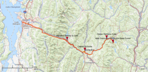
Map of Day 4 |
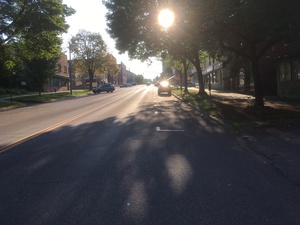
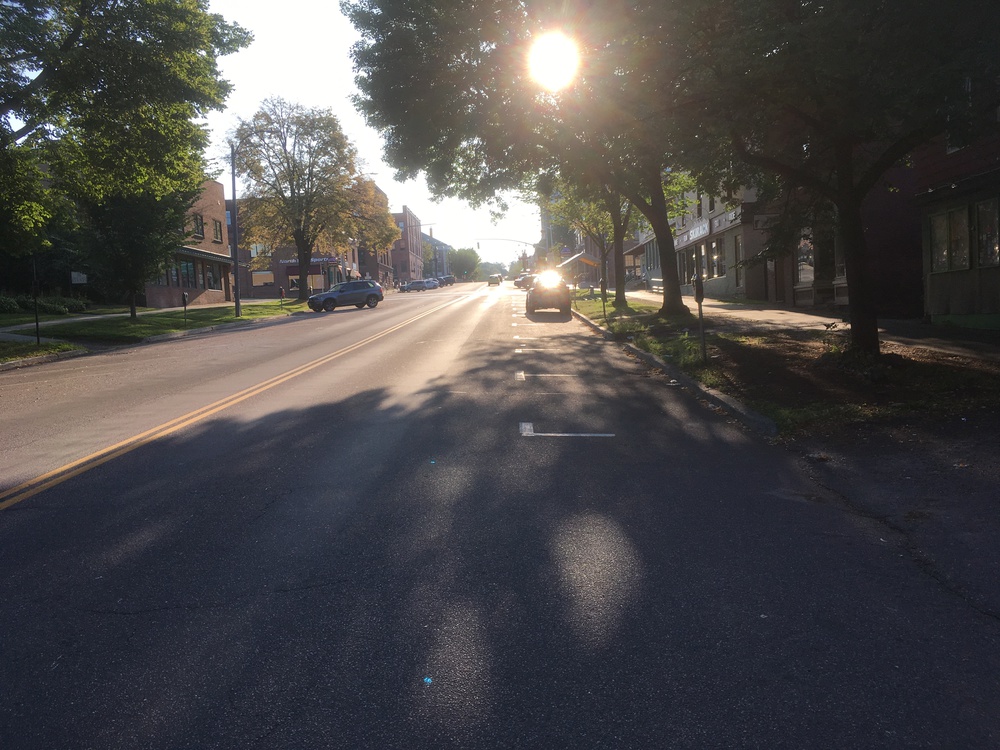
Burlington, early morning |
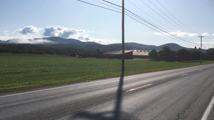
Headed towards the Green Mountains |
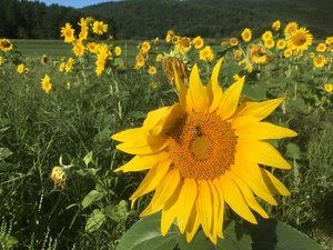
Roadside Sunflowers |
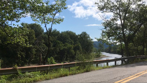
Riding by the Winooski River |
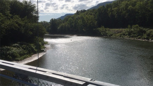
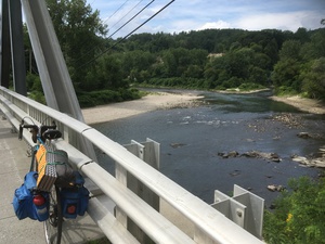
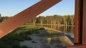
The Winooski from the Long Trail bridge |
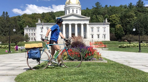
The Vermont State House in Mountpelier |
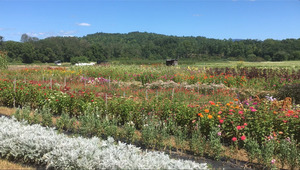
The Vermont Flower Farm |

Inside Sweet Rainbow |
Outside Sweet Rainbow |
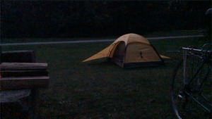
Camp at New Discovery |
Sunday, August 25th, 2019
Burlington Hostel, VT - New Discovery Campground, Groton State Forest, VT
63.1 miles
Mornings at the hostel are quiet. I awoke about 6:45, showered, made a waffle, had coffee, repacked, and rolled out by 7:30.
Sunday mornings in Burlington are even quieter. I was soon out of the older part of town, past the University of Vermont, and across I-89 into the land of the strip malls.
Tonight's destination, Groton State Forest, is on the divide between the drainage basin for the Connecticut River and the Winooski River, which flows into Lake Champlain. This means that today is essentially all uphill as I chase after the head waters of the Winooski.
A young woman zipped by me on her bike at a pace which impressed me. But five miles later I noticed that I was closing in on her. When I finally caught up with her at the top of a hill she told me that she just got off shift at the hospital and that she knew she raced the first few miles home, but now she was slowing.
After an hour on US-2 I noticed a sign for the Cross Vermont Bike Trail. I had read about this and hoped it would help me avoid some traffic, so I turned off the highway to follow it. First it was a dirt and gravel road, then a small dirt road, and finally a single track mountain bike trail. I encountered little car traffic here as I wound my way through swamps, pastures and hay fields.
After a mile I was back on pavement.
The Winooski River cuts a unique valley across this part of Vermont. It is perpendicular to the spine of the Green Mountains, and thus offers a unique transportation corridor. Within a few hundred meters is; The River (Winooski), I-89 (Vietnam Veterans Memorial Highway), US-2 (Theodore Roosevelt Highway), the Railroad (New England Central), Powerlines, and what every river needs, "River Road". That is where I peddled.
Most of River Road is nicely paved and winds along the river bank and seems to be very popular with bikers. I met runners and other cyclist every few minutes for a ten mile stretch and thought that was just a normal Sunday morning. But than I came to the end of the pavement and lost all my fellow cyclist. Did they know something I didn't? I also crossed the Long Trail on this stretch. It crosses the Winooski on a suspension bridge, so I stopped, walked across the bridge, and viewed the valley from the other side.
Finally I made it to Hender's Bake Shop and Cafe in Waterbury. Time for a second breakfast and a chat with a couple who were on a two day mountain bike tour. They told me that unfortunately they would have to get on pavement for the last few miles home.
From Waterbury to Montpelier was an uneventful few miles on US-2, but once in the capital city I stopped for a few minutes in front of the state house. Here I met an elderly woman (in her 90's) who told me that she was from New Jersey. But she absolutely "loved Vermont, the people are so friendly!" When I told her I was from New Hampshire she amended her statement, "Well, all of New England. It is so clean! And the people are so nice!"
Once in downtown I asked some hipsters about a coffee shop and they directed me to "Capital Grounds". Here I sat in the window and let people on the sidewalk entertain me. Maybe I really didn't need to stop, with Waterbury only an hour ago. But I know that the next twenty miles are going to be a real hill grind.
East Montpelier, Plainfield and Marshfield, ever eastward and upward.
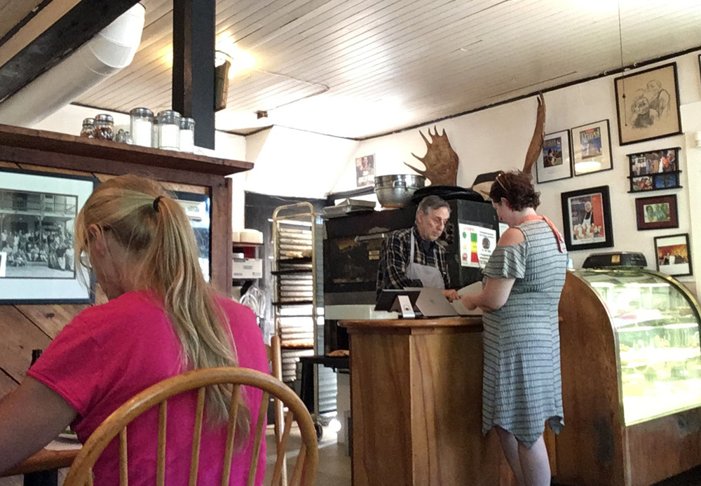
In Marshfield I stopped at Sweet Rainbow Cafe. The proprietor of this establishment is a wizardry character in his late sixties who tells every one who walks in that this is the finest bakery in Northern New England. There is also a framed magazine cover on the wall which seems to back up his statement. The pastries were exceptionally good, but it was the elf who made the place a destination. Anytime anybody asked for a glass of water he replied, "One desert cocktail!"
There was one last, long grinding hill out of Marshfield which nearly broke the spirits of this peddle-pusher. But once that hill was behind me, the people, pond and campsite at New Discovery, Groton State Forest, made it worth while.
The ranger at the gate told me, "The Smithsonian has been after us to get our printer", and old dot matrix machine which chattered as it printed receipts. "We have an employ name `Dot', or `Miss Matrix'". He also told me where he thought the softest grass might be; "We clip it on Wednesday, with a ruler, so by now it might be a bit shaggy." He also told me about remote campsites and the Cross Vermont Bike Trail. He offered me a kayak and left firewood at my site when I was down at the pond.
When I entered the campground I was welcomed by Mike & Linda. Mike has recently lost his foot to diabetes and is just getting use to his prosthetic. "Wonderful people at the VA." Mike recently retired at age 63, but Linda will wait until next year. They have a dog named "Bear" who is about a foot long, half a foot tall and if you shaved it, it would lose half its volume. Tomorrow will be their second anniversary. (far too much info?)
Linda runs the office for the "Snow Travelers Association of Vermont", and umbrella over the snowmachine (snowmobiles to you non-New Englanders) clubs of the state.
I liked how they told me that their families where "all over", and then listed a dozen towns -- all in Northern Vermont.
Down by Osmore Pond I met four guys, college friends, trying to skip round rocks. "Hey a duck!" one of them called out. But by the time we all looked up there were only ripples left on the pond. When no duck reappeared the other started ribbing the first guy, questioning his eyesight, but I kept my eye on that part of the pond. Eventually the loon reappeared and I pointed it out and mentioned that it was famous for its long dives. The first guy felt vindicated, but two of the guys didn't know what a loon was. So the rest of us tried to imitate the maniacal calls you might hear in the middle of the night.
I had dinner by my fire, a sub I had brought from Montpelier (or "Mount Peculiar" as the ranger had told me). I also had a bagel and cheese, pieces of which I skewered on a stick and roasted over the fire. Why is toasted cheese so good?
Set up the bear bag, took a shower, watched one million stars, and went to bed.
|
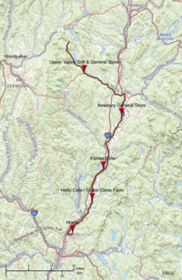
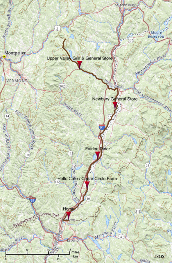
Map of Day 5 |

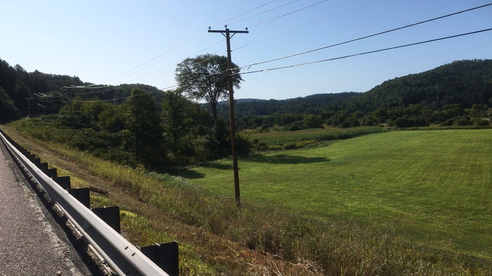
Wells River Valley |
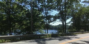
Conneticutt River, between
Wells River & Newbury |
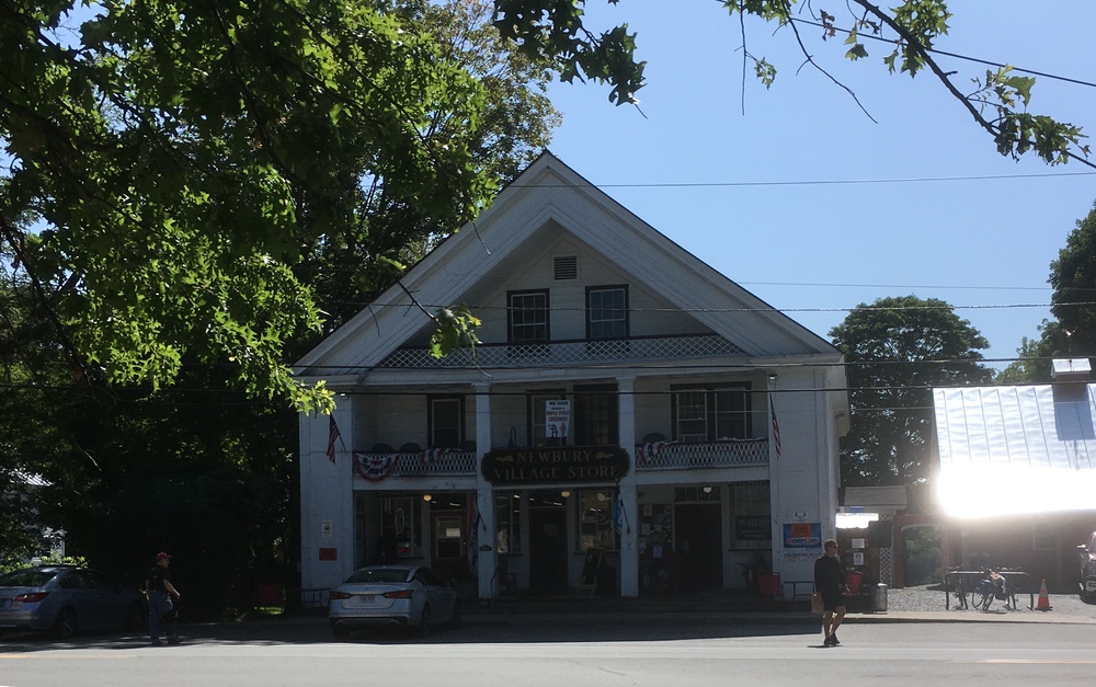
Coffee behind Newbury General Store |

Newbury Green |
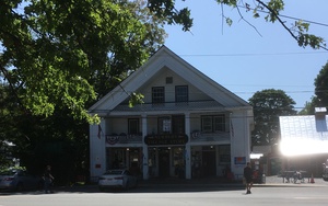
Newbury General Store |
Monday, August 26th, 2019
New Discovery Campground, Groton State Forest, VT- Hanover, NH
60.0 miles
It was cold in the morning and I was very glad for my new down sleeping bag. But still, as soon as it started to get light I was ready to roll out. I was up at 6:20 and on the road by 7:00.
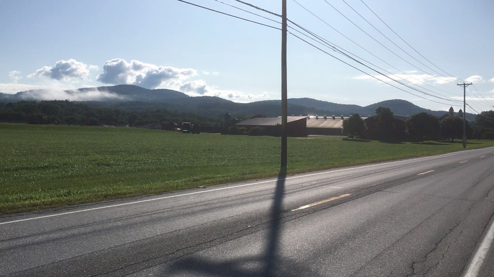
The road through Groton State Forest is generally downhill, into the Wells River / Connecticut River basin. But coasting downhill on a cool and misty morning is not a really good way of warming up. After about an hour of watching the sunlight get stronger through the mist and leaves I left the forest and emerged onto US-302, the "Scott Highway". Across the road was the "Upper Valley Grill & General Store". A quarter of the store as laid out at a diner, so I found myself a stool at the counter and ordered a full breakfast.
I think I was the only stranger in the store. The staff seemed to know the names of everyone else who walked in. At one point the phone rang and the waitress brought the phone to the guy next to me who was enjoying coffee and reading the paper. "It's for you", she said as she handed the phone over. "How do they know I'm here?", he asked, to which the waitress just laughed lightly.
One woman who came after me asked if I had just come down the "Forest Road". I said yes, and she told me she had heard me, and really liked the "swish" sound of a bicycle.
There was also a long discussion of secret fishing holes. If only I had kept better notes!
Scott Highway follows the Wells River to the town of "Wells River" on the Connecticut. And I followed the highway, generally down. An easy ride.
In Wells River I turned south on US-5. This is now familiar territory. In 2010 the scouts had a voyage on this river, and in 2017 I took a kayak trip here. You can read my accounts of those treks elsewhere.
I stopped at the Newbury General Store for coffee and a roll, and spent some time behind the store, looking across the valley, and thinking `we really do live in a beautiful place'.
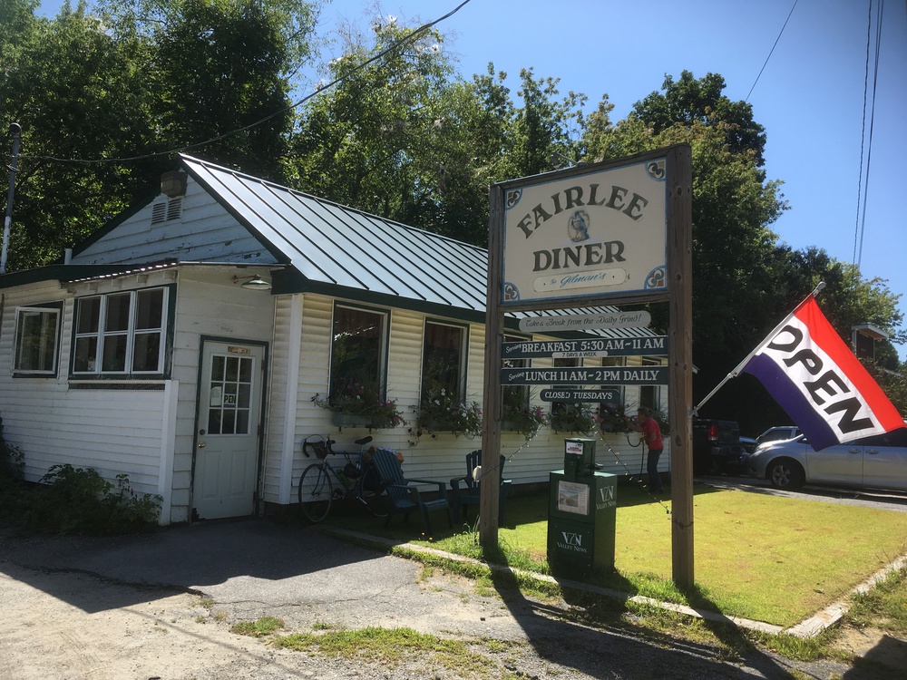
I rolled through Bradford without stopping, I can only drink so much coffee. But then stopped at the Fairlee Diner for lunch. When the cook brought me my BLT (I was sitting at the counter) and saw me writing in my journal he asked me if I had spelt his name correctly. I mumbled something about checking later, but a moment later I realized I should have replied, "But of course I know how to spell Chef Guillaume".
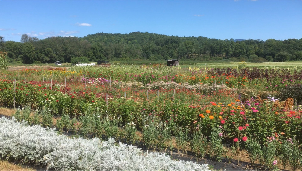
Ten miles from home is the "Hello Cafe" at Cedar Circle Farm. I didn't really need to stop for ice tea, but I think I was trying to prolong the bike trip as long as I could. It really has turned into a lovely day.
And then it is back across the Ledyard Bridge, through Hanover, past the college, and home.
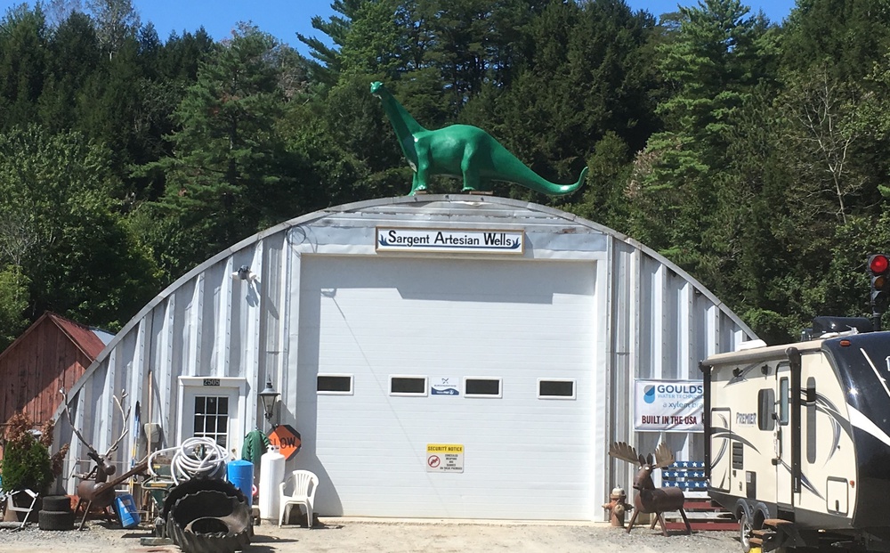
Between Bradfor & Fairlee |

A Roadside Attraction? |

Fairlee Diner |
Flowers at Hello Cafe / Cedar Circle |
River Road, Norwich, VT |
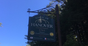
Welcome to Hanover
Welcome Home |
|
|