|
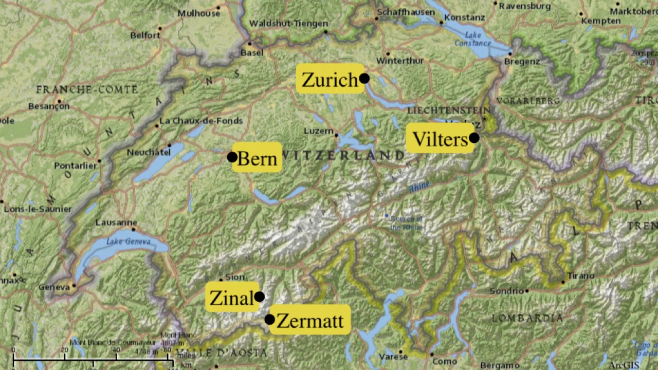
Zinal to Col de Tracuit Switzerland |
||||||||||||||||||||||||||||||||||||||||||
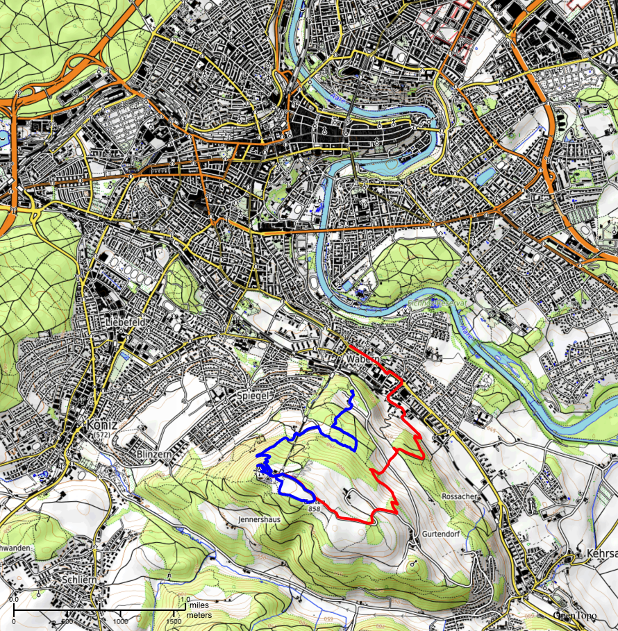
Click on any photo to get a higher resolution. Most of this journal posting is about a one day hike, Zinal to Col de Tracuit. There is also a brief write-up of the rest of our trip. Time is Zermatt, Vilers and Bern, as well as the first day in Zinal. That posting is locate after the Zinal ramble.
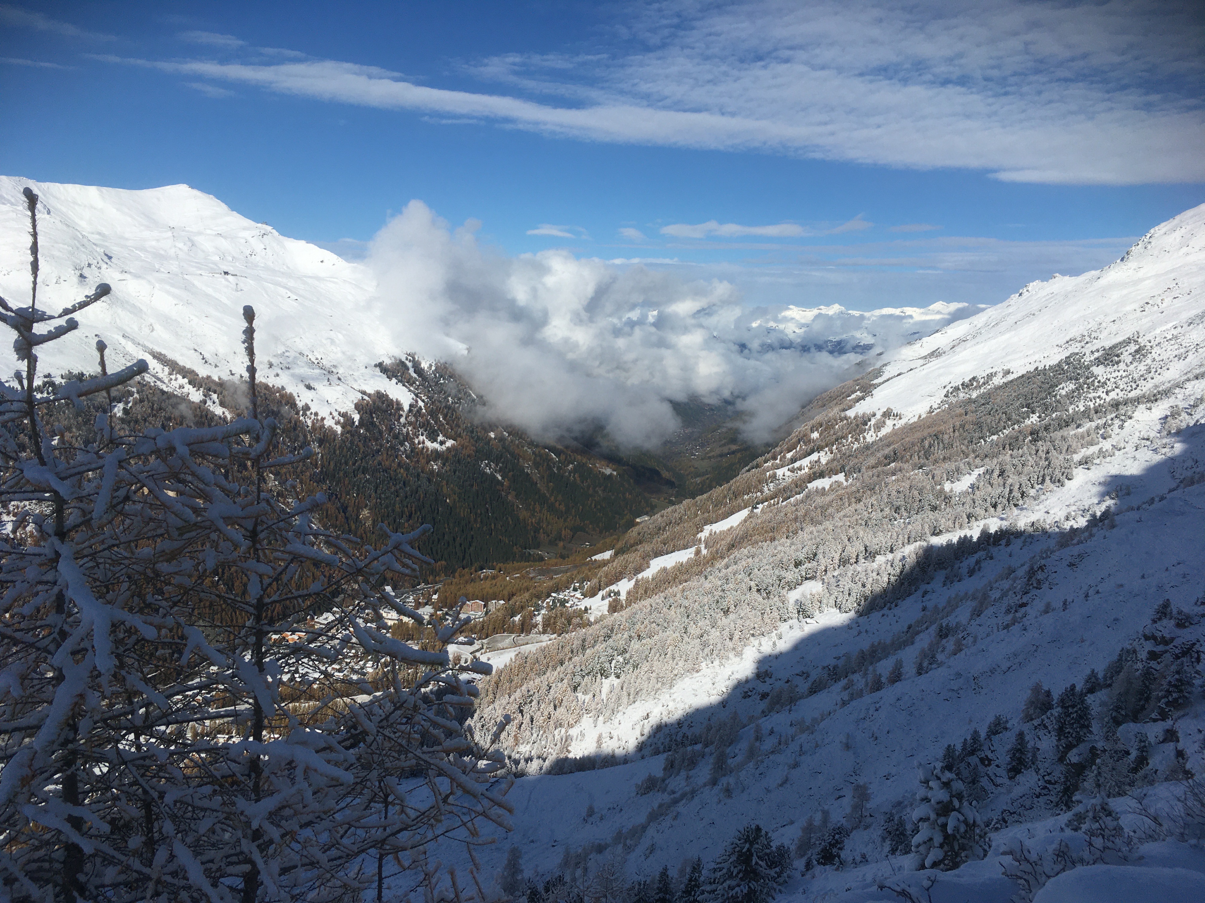
Tuesday, Nov 5, 2019 My last vision before eyelids got too heavy last night was seeing a few flacks of fluff falling through the darkness into Zinal (Zi-nel). In the morning there is a new coat of snow on everything. Yesterday the high country had snow. Today winter has reached into the bottom lands of this valley. I am up at 7:15 and breakfasting at 8:00, where I finally meet my landlord. Zinal is a ski and hiking town. But early November is neither ski nor hiking season and so the town and this hotel are essentially closed. Yesterday when I arrived, just inside the front door of the hotel was a note with my room key: Attention M. Timothy Smith . . . chambre 17 le restaurant l'Europe est ouvert à quelle heure voulez-vous le petit-déjeuner? As far as I could tell, I was the only one in the hotel, and almost the only one in the village. But that matters little, since I like to ramble on my own.
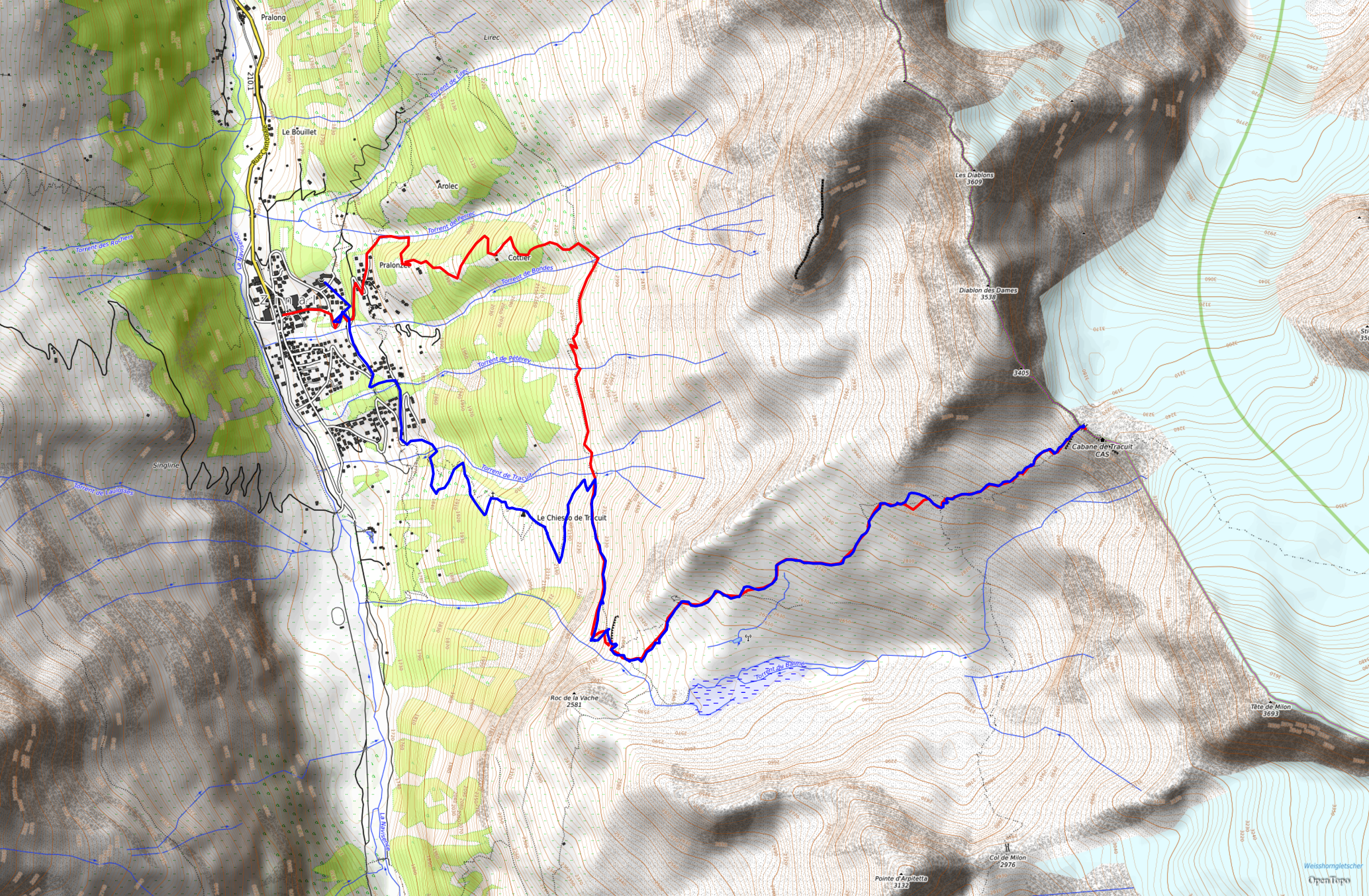
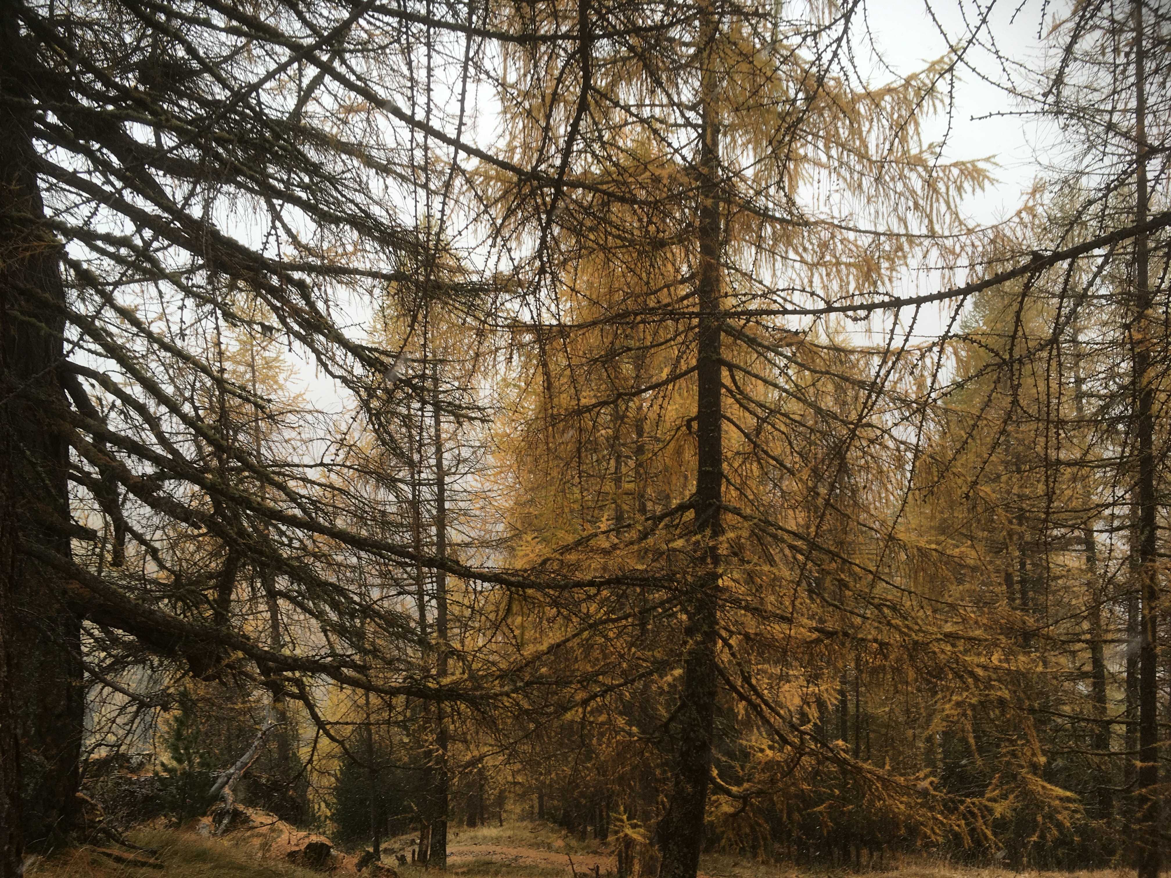
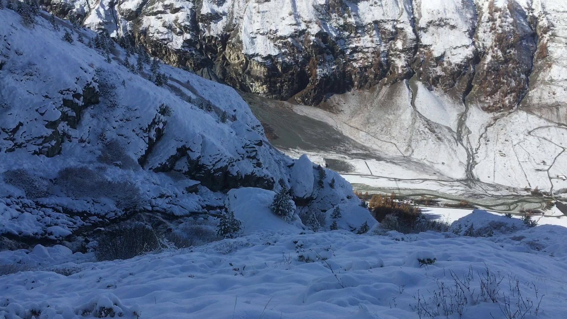
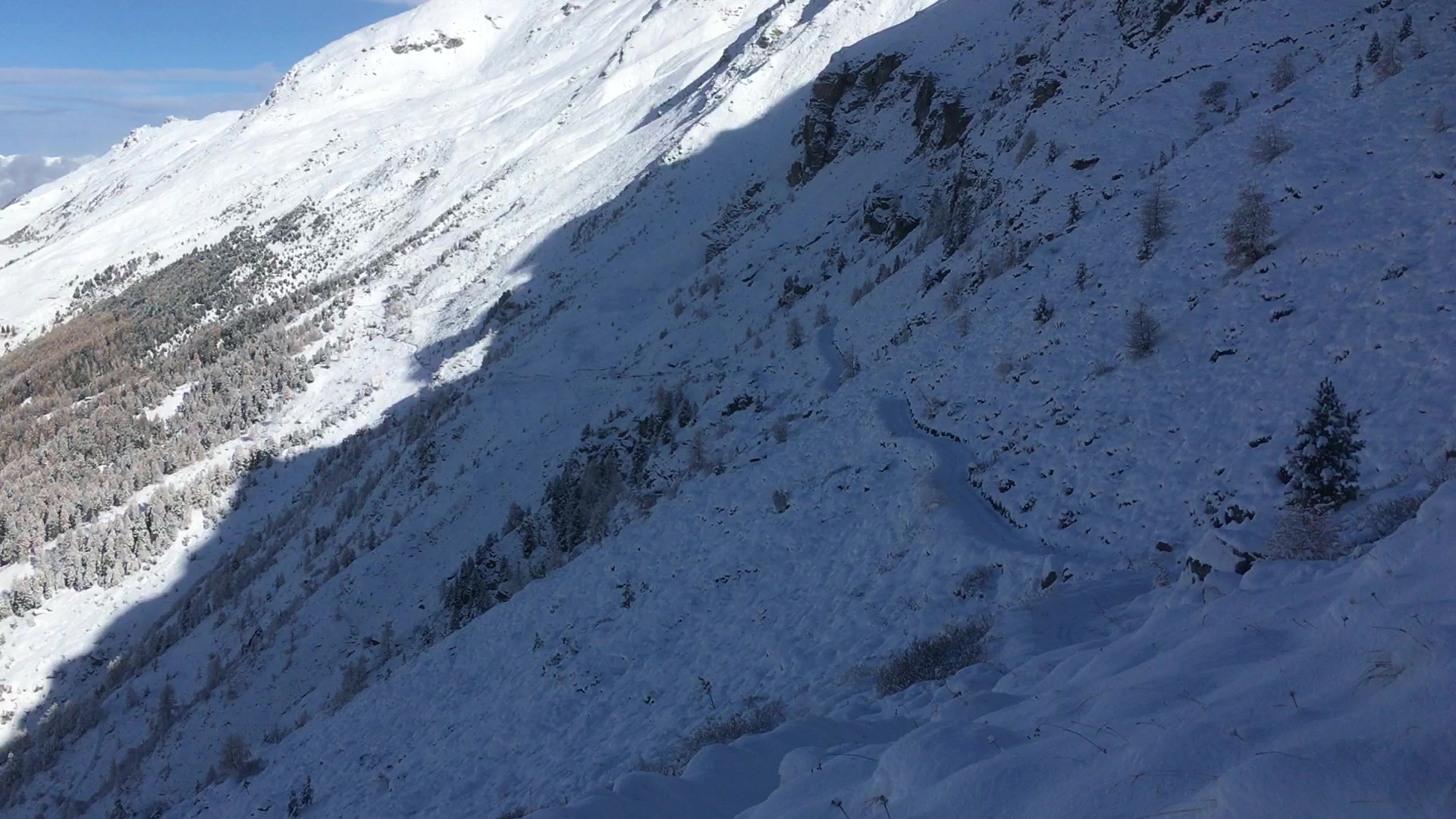
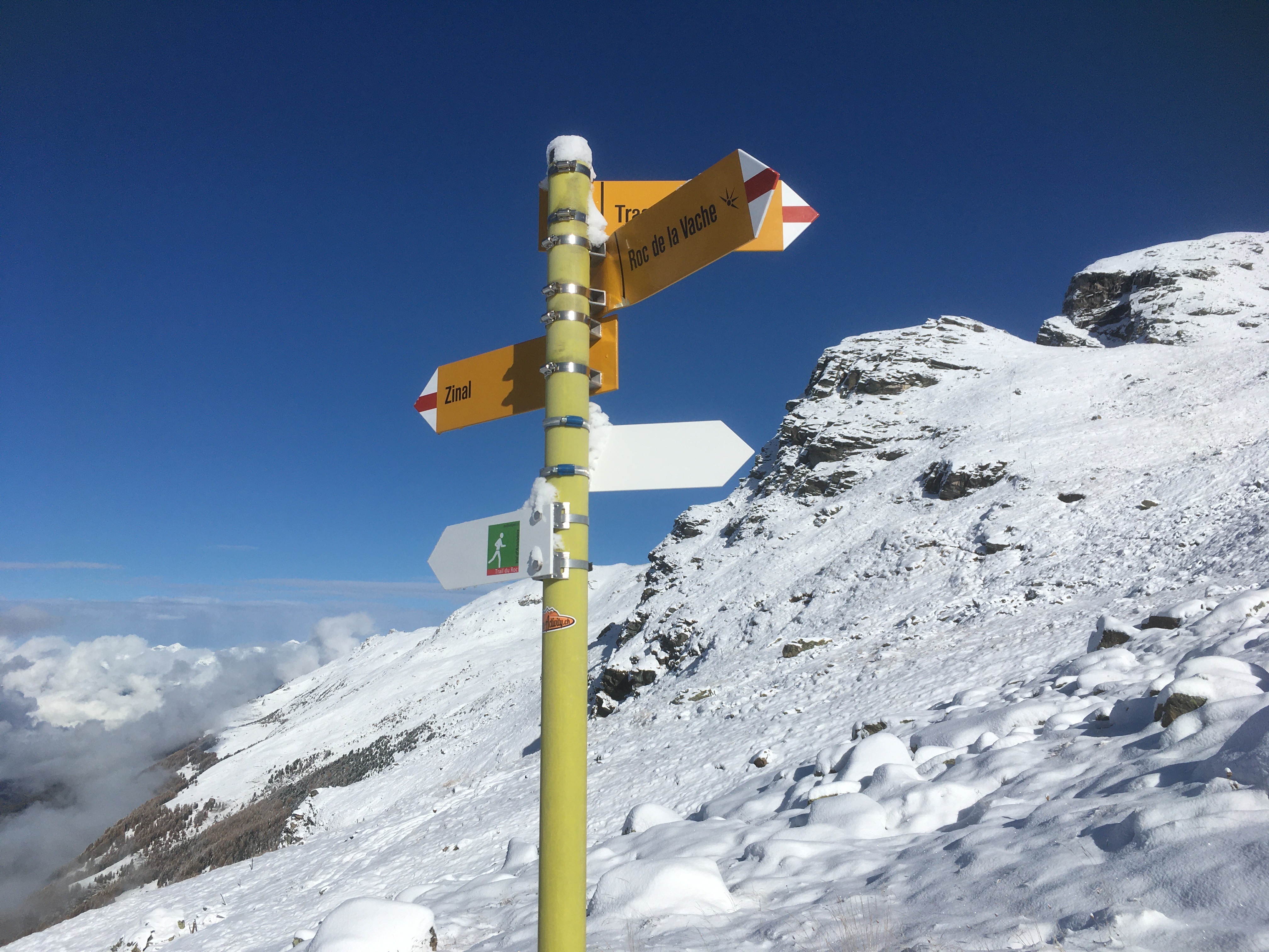
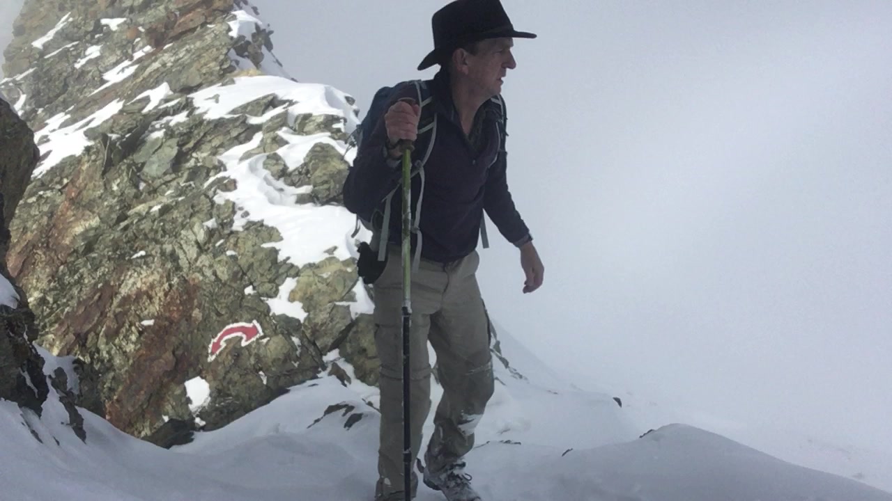
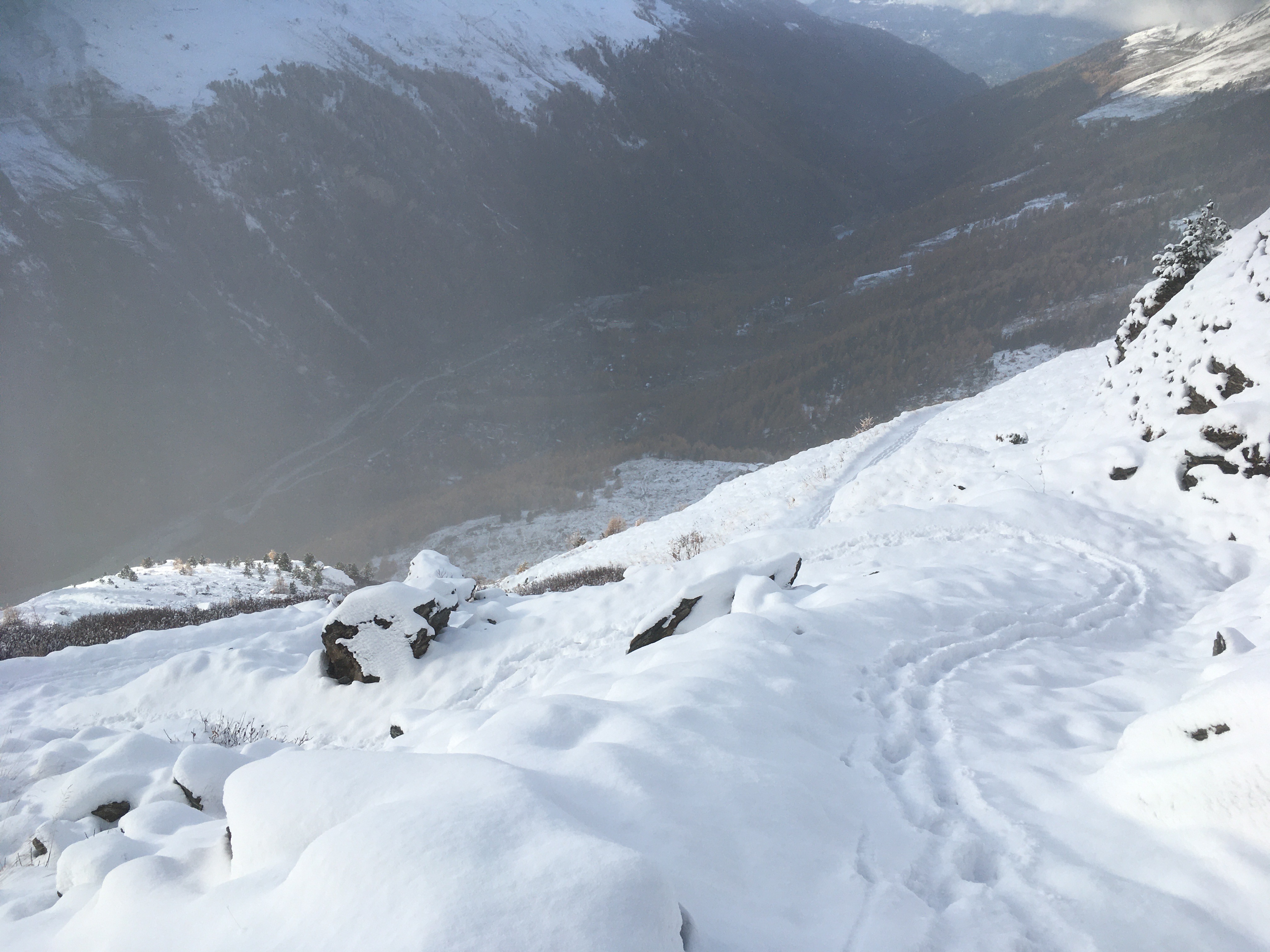
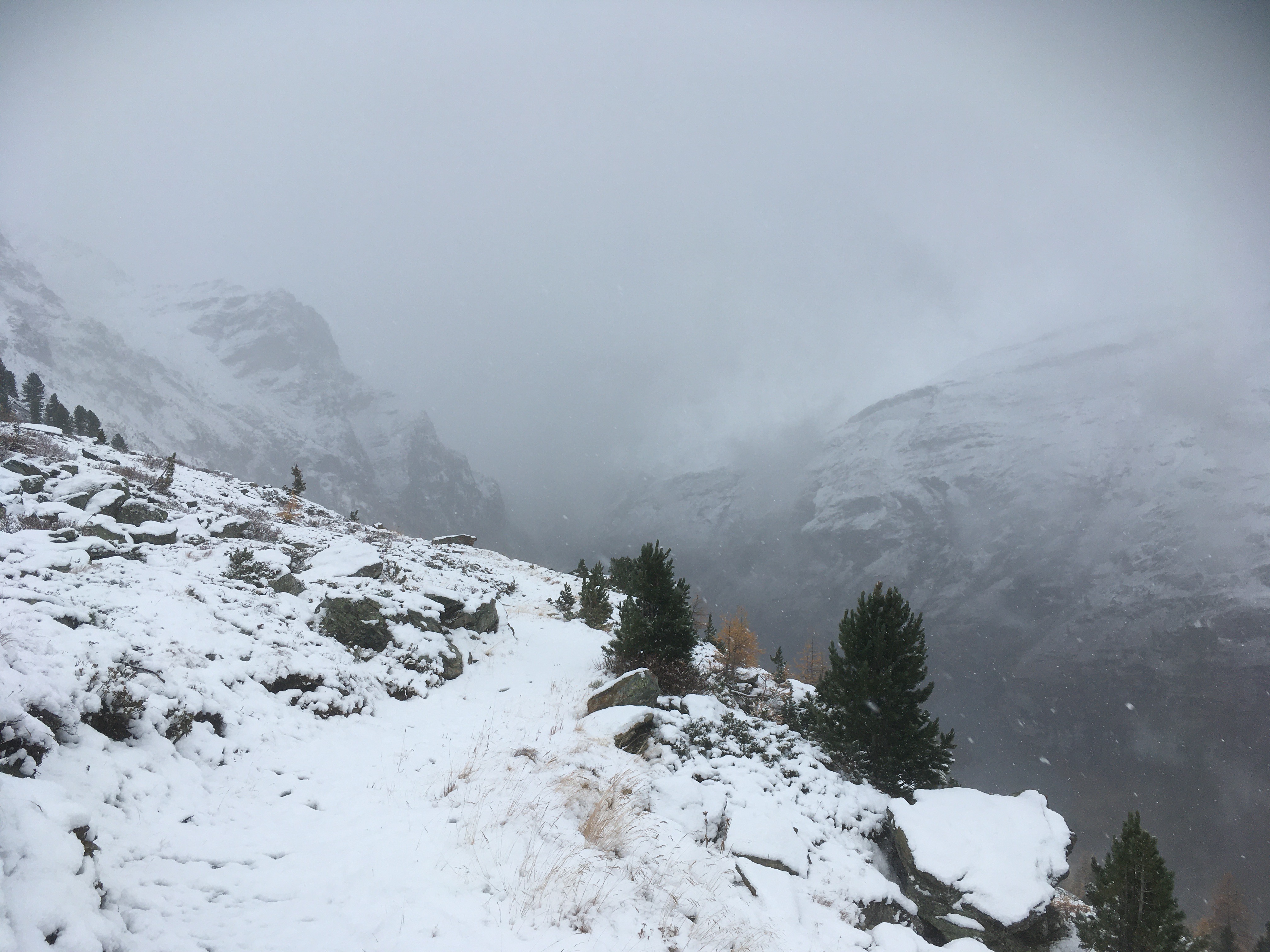
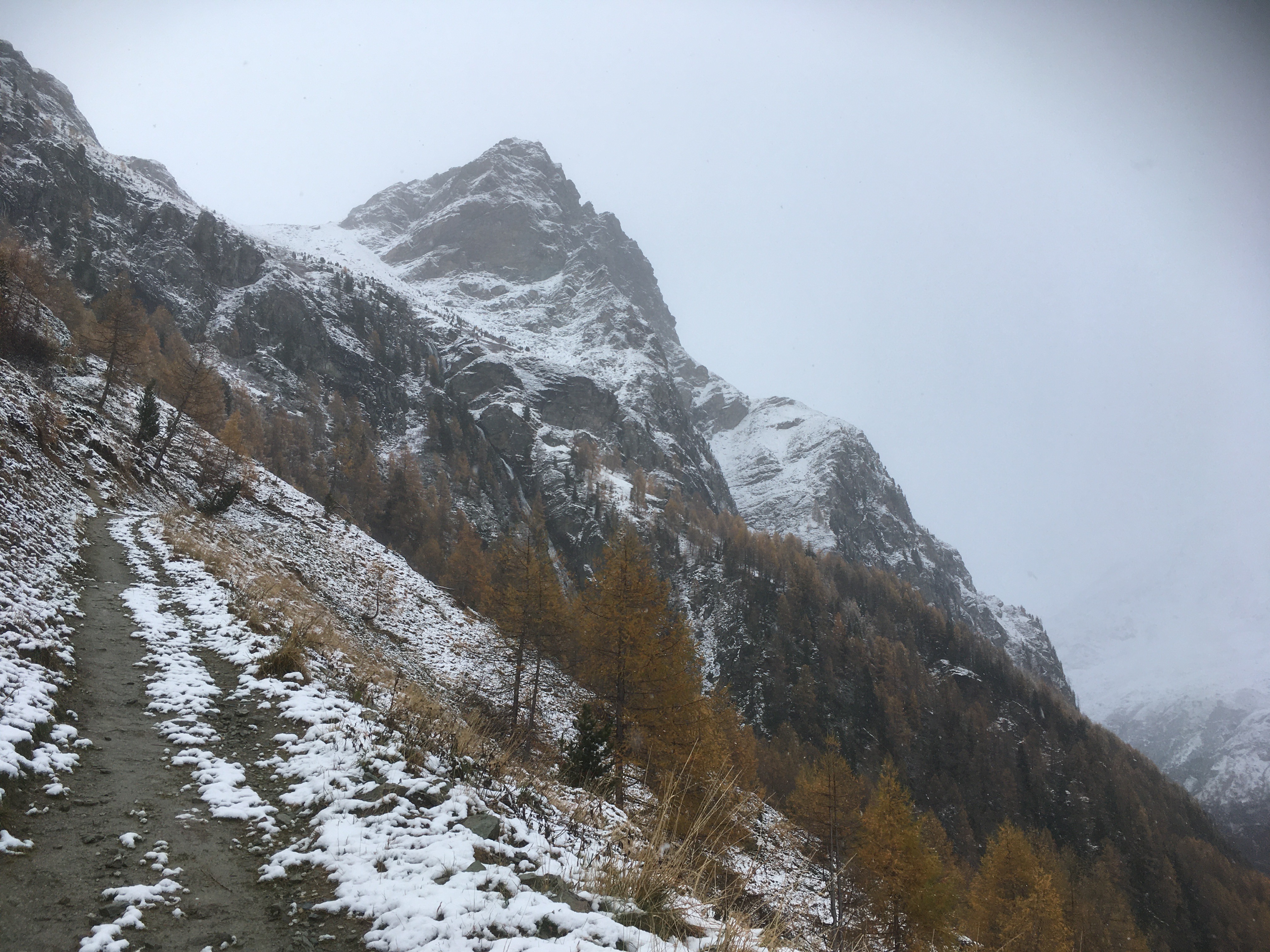
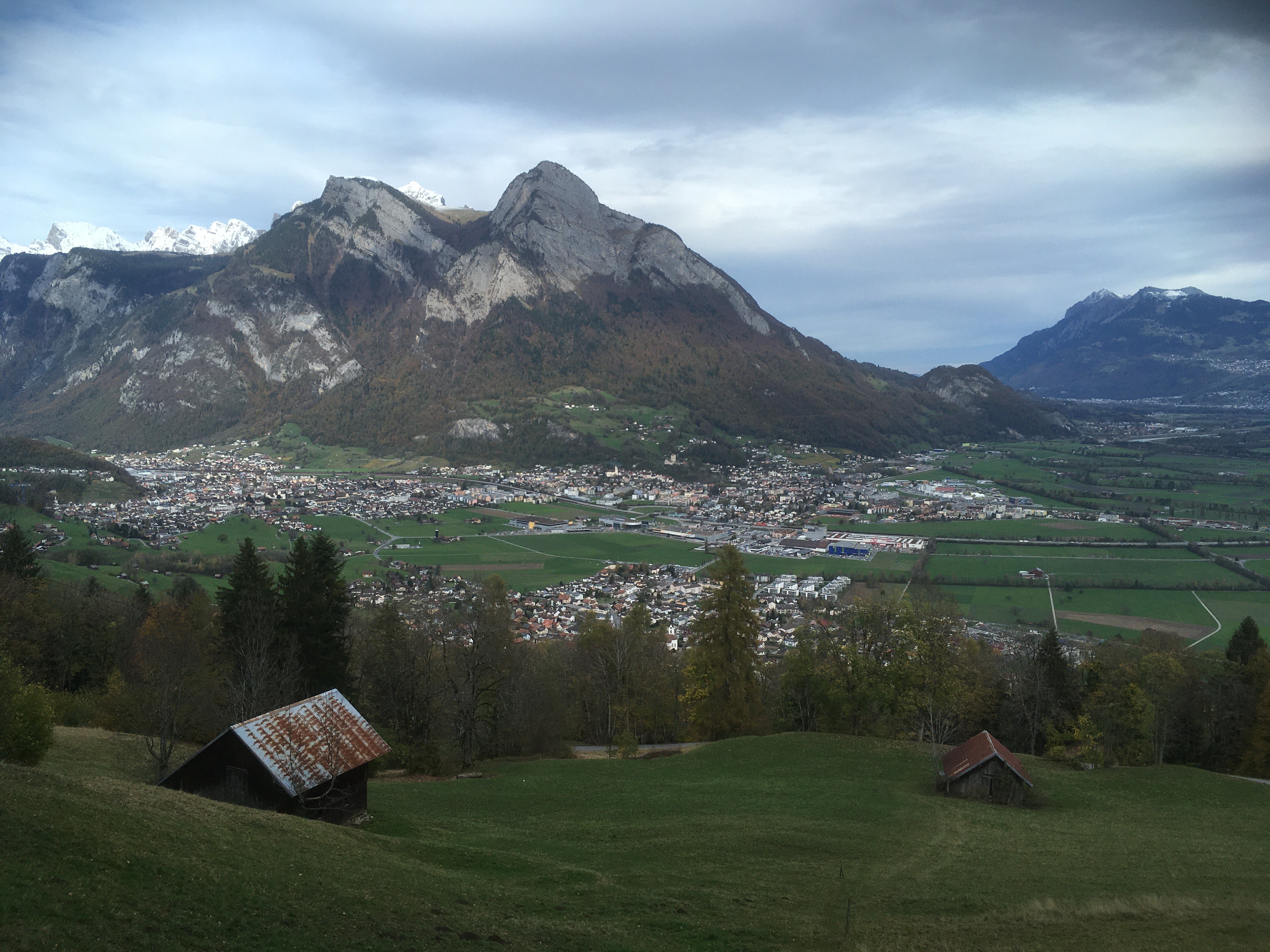
A bit before 9:00 I step out on my walk, which may seem a bit late, but I have very low expectations for today. Two weeks ago I twisted my knee while running and I have been hobbling ever since then. True, it has gotten better. But yesterday's five mile jaunt was as far as I had managed since the twist. My original plan, weeks ago, was to sprint up to "Col de Tracuit". But that is a 20 km/12 miles round trip, and so I need a plan-B. An alternative is to walk to the top of "Roc de la Vache", still an ambitions 6-7 miles (10-12km) with a lot of climbing. In either case, the path to "Tracuit" and "La Vache" lie in the same direction. My first mile; flat, in-town and along the valley floor, speeds by in 21 minutes, which bodes well. This is my fastest mile since the knee twist, and almost a normal pace. But then I start my climb up past Le Chiesso de Tracuit, a farm stead on the edge of town. The woods are fantastically beautiful! On the valley floor they are dominated by larch, related to the tamarack of home. Larch (and tamarack) are unusual in that they are one of the few deciduous conifers; they are trees with needles that lose them every autumn. And before they drop their needles, they turn a russet orange, a medieval red-gold, someplace between the red maple and the sugar maple. Later I told Will that it was like a Max Parish painting, something with a little too much gold to be real. And with the dusting of snow, the classic alpine farm buildings, I am walking through a story book. I am climbing 100 meters vertical every ten minutes so I am passing quickly to new strata of the environment. Above the forest are pasture lands and with a few more switchbacks I reach the "Promenade des Arolles". I have also seen this listed as "Le Sentier des Arolles". It is only 10miles/16km in a straight line from Zermatt to Zinal, but it is also one valley and one language away. Zermatt, and most of Switzerland where I have traveled, is German speaking. In Zinal am trying to piece together my Swiss-French. "Sentier" translates as footpath or trail, whereas "Promenade" can also mean a trail but it conjures images of a broad and level place for an evening stroll. How many cities have "promenades" or "esplanades" parklands along their rivers or coastline? "Promenade des Arolles" is indeed genteel, a level easy walk chiseled into the upper slopes of the Val de Zinal. I see on one map this is marked as a "1 meter" trail. It looks like a small bulldozer with a one meter blade sliced this from the hillside. The higher I climb, the deeper the snow. I am now pushing my boots through 10 cm/4 inches of new, wet white stuff. A few scrubby pines flank the path. Finally we (the Sentier, my feet and myself) reach "Torrent du Barmé". "Barmé" is the name of the hamlet at the bottom of this cliff face. It is the term "Torrent" which I find so interesting. Yesterday, on my shake-down walk, I crossed Torrent de Lirec, Torrent de Perrac, Torrent de Bondes, Torrent de Pétérey and Torrent de Tracuit. These are streams which plunge down the side of the valley at something greater then a 45-deg grade. Although they don't drain a large watershed, when they do gush I expect that crossing them is more than difficult. Torrent de Perrac in particular caught my attention since it is a smooth trough cut into the bed rock. It is easy to imagine tons of rocks, boulders and gravel polishing and sanding the stream bed smooth. The torrents which enter the village of Zinal also have a pretty aggressive debris basin and dikes, build to protect the chalets from landslides. But right now the Torrent du Barmé is but a happy little stream which meandered through the upper Tracuit valley and now has carelessly stepped over the end of the upper valley and is plunging into Val de Zinal. It is laughing and singing as it cascades. Beyond the cascade is "Roc de la Vache", the "Rock of the Cow". Don't ask me how this monolith got that name. From the valley floor it rises 1,000 meters and is the most imposing cliff face of the valley, in the same way Half Dome dominates Yosemite. But now I am up to over three-quarters of its height and I can see the peaks beyond it. Roc de la Veche is but the first and lowest shoulder of Pointe d'Arpitetta. My trail takes a number of zigzags here and threads its way up the last cliff face to the upper valley. The Tracuit valley is a classic "hanging valley". Ages ago it was cut by a small glacier, but that glacier didn't have the weight to cut a valley nearly as deep as the one cut by the Glacier de Zinal. So the floor of the Tracuit valley "hangs" 800 meters (half a mile) above the floor of the Zinal valley, which in turn is about 1,000 meters above the valley of Le Rhône. An now I am finally at that decision point. If I continue on Le Sentier des Arolles I reach Roc de la Vache in half an hour. Or I could turn and climb to Col de Tracuit. My knee is feeling rather grand, the sun is shining and I have made excellent time. If I went on to the The Cow (La Vache) I would get back to the inn by mid afternoon, and then what? The point of this trip is to walk, and so I turn to the left and head towards Col de Tracuit. In the summer, I expect, the next mile or so of my walk would be across high country pastures. But today, with 15cm/6inch of snow, the trail is nearly erased. Actually my feet can generally tell me when I get off trail. Off trail there is snow on grass. On trail the snow on dirt and stones feels different. You can also see a gentle depression in the snow, a suggestion as to where the trail is. Or occasionally I'll see a stream which is flowing diagonally across the face of a slope, a more natural path for a walker then for water. In a few minutes, much to my surprise, I came into a little hollow which held an upland hut and a series of stone walls and pens. Do shepherd still follow their sheep to high country pastures, and then live in these huts? Are there still shepherds? There was a sign next to it which said Du respect... Pas de déchets! Proches de vous. Les Paysans Suisses my translation Show respect . . . do not litter! Your neighborhood Swiss farmer
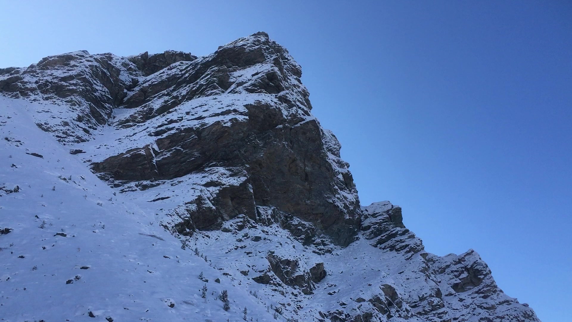
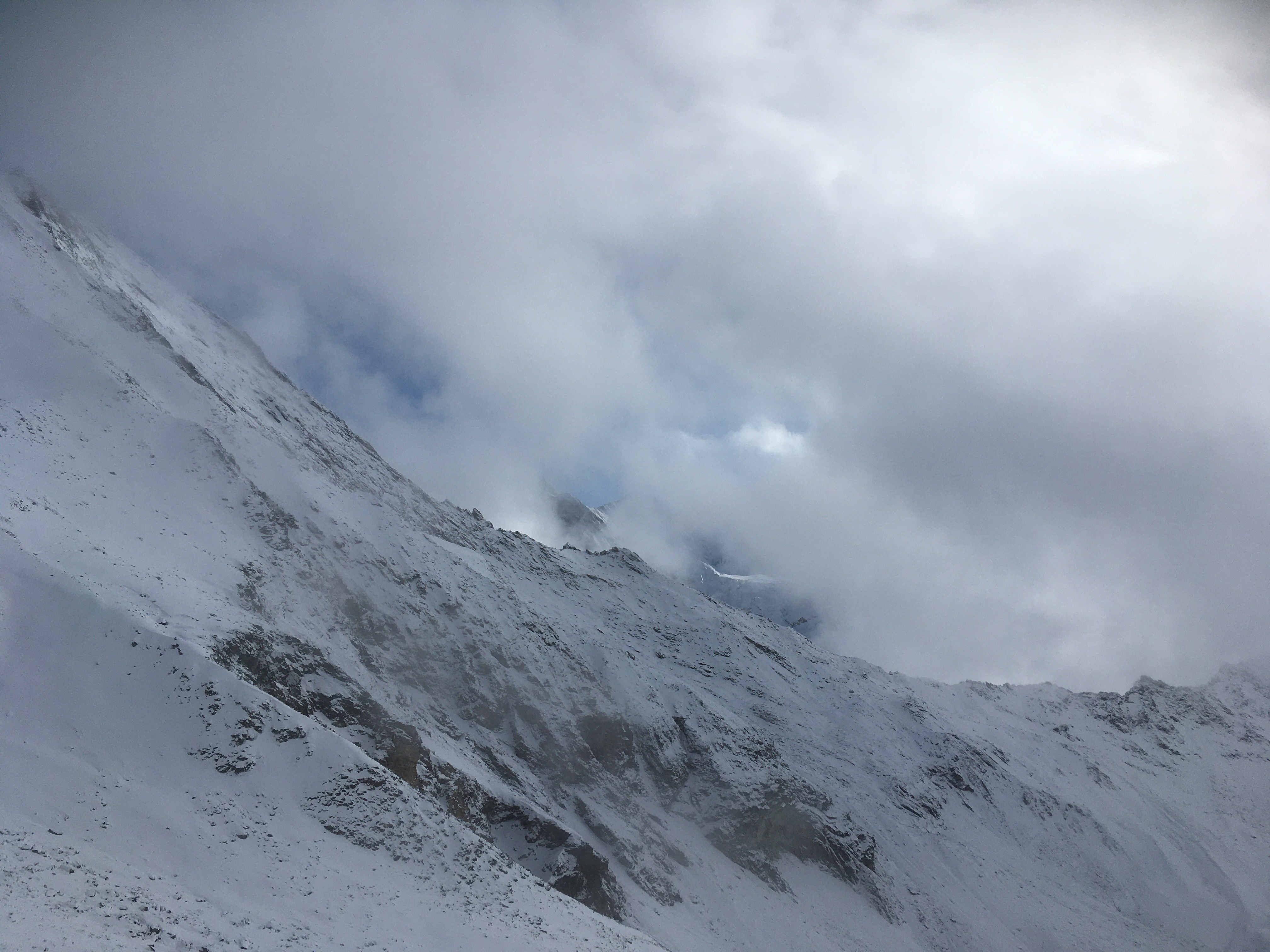
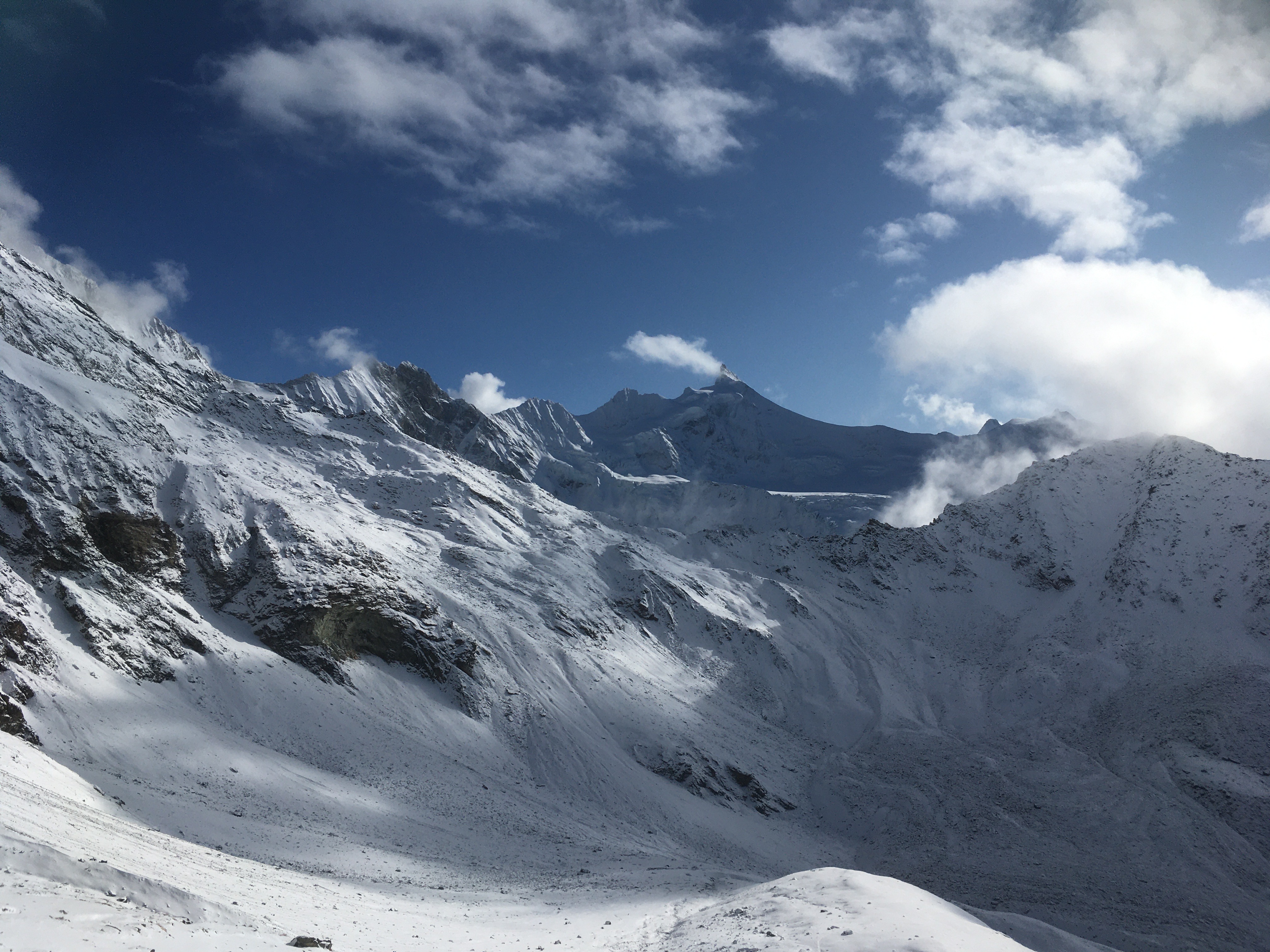
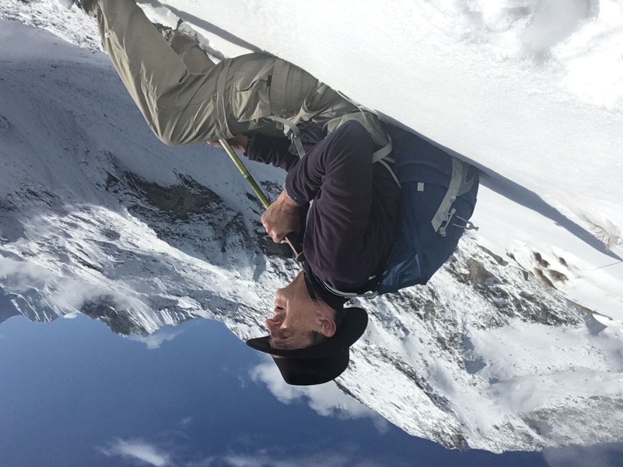
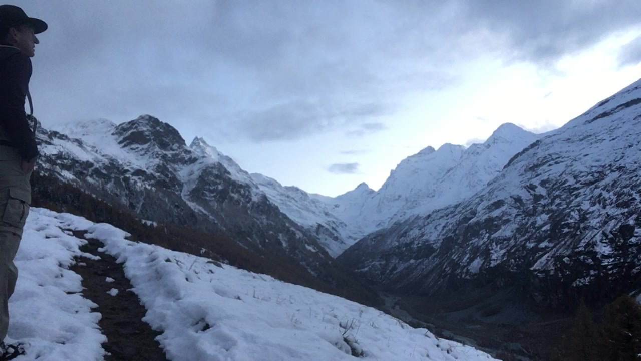
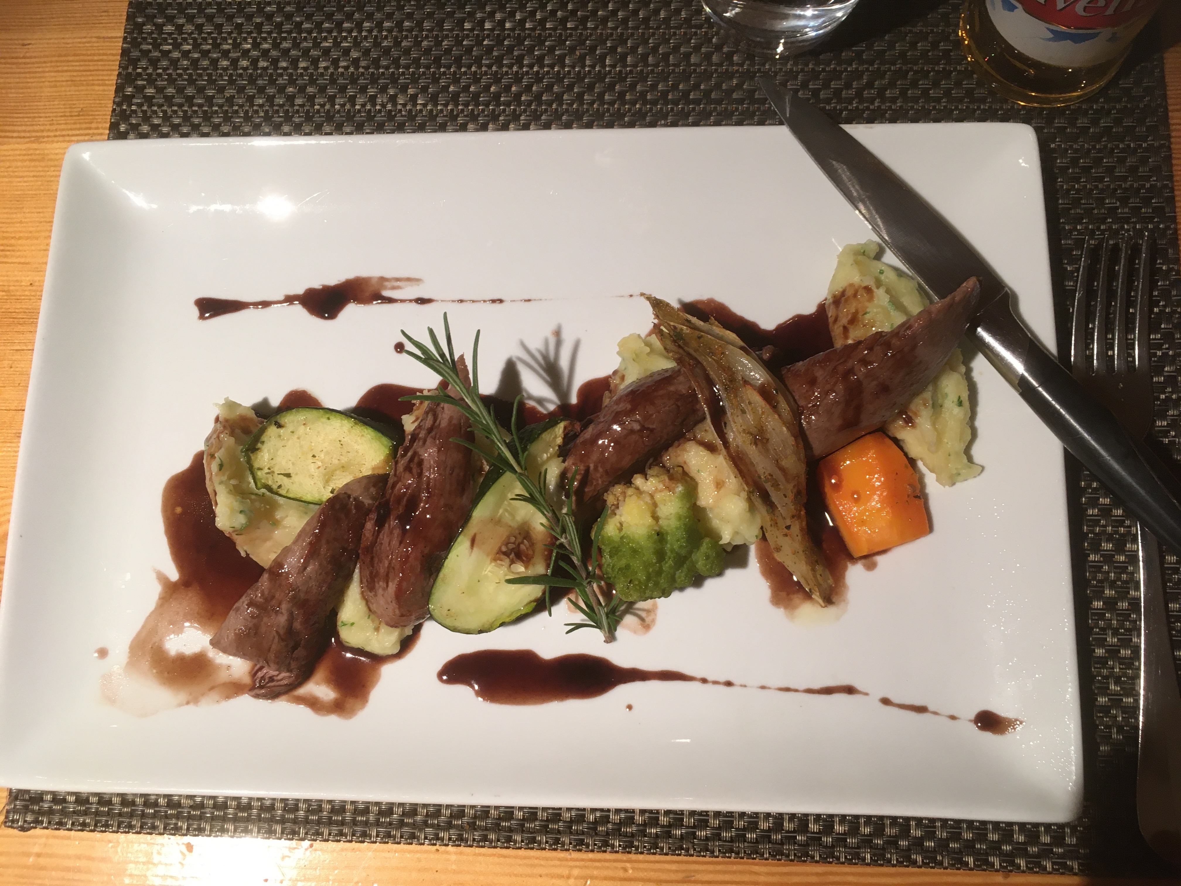
I can imagine this as a delightful picnic destination in the summer, a few hours of leisurely walking from Zinal, and then back down in time for afternoon tea. The next hour was a steady climb. I can usually see the SAC hütt on the col, although it is still 1-2 miles away. SAC is the Swiss Alpine Club. You see I have fallen into the habit of calling these building a "hütt", the German name, because of my first encounter with them a year ago in the Bernese Oberland. Here they are called "Cabane". So what is the difference, in English, German or French, between a cabin and a hut? By the way, "Cabane de Tracuit" only has historical connections to a small shelter. It has been rebuild and expanded multiple times in the last ninety years and is now essentially a remote hotel which can sleep over a hundred guest in the summer. But it is locked up this time of year. I have read that there is an emergency enterence for desperate winter travelers, a resource I do not plan on using. Most of the walk, like most hikes is just putting one foot in front of the other. But the last 1500 meters (1 mile) to the col was a real series of challenges. But before starting the last approach I turned and realized that now I tower over Roc de la Vache and I wonder why I ever saw that as a challenge. First there was a boulder field to cross. I lost the trail here and found myself picking my way step by step over the boulders. In the summer it would slow me some, but at least I would know how far up or down I would go in each step. Powder has filled all the spaces between the boulders and I never know if the next step is a centimeter down or a half meter plunge. So I end up testing most steps with my trekking pole as I creep over this field. When ever I am looking most inept there is a witness. 200 meters up the slopes, and 50 meters higher than me are two alpine ibex. I've seen their hoof prints traversing these slopes, making it all look easy. The higher I climb, the more snow, and the more severe the drifting. When the trail passes to the lee of a big boulder I find myself waist deep in the white stuff. The last 300 meters is up a broad arete. Or arête, it is curious how many French words for mountainous features have slipped into English. I expect many of them did that language hop in this region of the world. Words like "cirque", "col" and even "glacier" have been captured by English. Back to that ridge between two cwm (welsh)/cirque. Ten meters to the right is the top of a cliff face. Ten meters to my left a slope which would lead to tumbling and bruising. But here the trail is pretty clear; I am following the footprints of a snowshoe hare. I've never noticed their claws before, but the snow has an icy crust and claws are nature's own crampons. I am kick-stepping into this wind-packed snow. It looks like the last 20 meters will be up a cleft in a cliff face. But before that, they is one last moat of snow to cross. I can sense that this drift will be deep as I gingerly step into the snow, and promptly sink to over my waist. What can I do? It is four or five meters to the other shore, to firm footing again on granite, so I effectively swim. The snow is fluid enough, and after half a minute of breast stroke I am hauling myself up on a ledge. That cleft is simplicity itself, although steep, it has a chain bolted to the rock face for assistance. And then I am there! Col de Tracuit is the low point on a knife edge, or "Crête" ("crest") between Diablon des Dames to the north and Tête de Milon to the south. But the sight I really wanted to see lies to the east. In the valley below me is Turtmanngletschär, the Turtmann Glacier. The astute reader will note that I am truly on a border line; in front of me is the land of the umlaut, behind me circumflex, accent and cedilla. I sit at the furthers east extreme of the Swiss-French language. Actually I am more conscious of being on a 2-meter wide knife edge. To the northeast it quickly drops a few hundred meters to snow and then the ice of the glacier, which continues to flow down its valley at a similar pitch. To the southwest the drop is twice as far and twice as steep, and very rocky. But the southwest also has a half meter thick parapet, as if nature had designed a battlement to protect the glacial valley. The glacier is breathtaking. There is a mist over the glacier which add to its mystery and attraction. I don't spend much time on top. It is a bit cold and windy here. Also this crête, or knife-edge is really high up and exposed. Heights don't generally make be "giddy", but I am not too comfortable, and soon I am ready to go down. Down is super easy. Where I swam through snow drifts before, the trail is now broken. By the snowshoe hare's prints I can easily kick in my heels. Where I doubted my way up, I need not pause or hesitate. When seen from above, I can chart a better way through the boulder field. Down into the high pastures, past the shepherds cabin to the "Le Sentier", which is now clearly a "Promenade". Progress is in fact so simple that I add a mile of two to my return by circling north of Zinal and dropping down through the larch forest of Cottier. Once back in the village, in twilight, I stop at my inn to get a pair of dry socks, then scurry across the street to the only open cafe. There is still time for a little "Fika" (Swedish) / "Le Goûter" (French) / "High Tea" before the day really ends.
The following is just a brief synopsis of the rest of the trip. Friday, Nov 1, Hanover - Boston -- Flew out of Boston.
Saturday, Nov 2, Zurich - Zermatt Arrived in Zurich and took the train to Zermatt. Zermatt is unique in that private cars are not allowed in the town. So there is a big parking garage one train stop before it. Zermatt is the town that all ski resorts are trying to imitate! The classic Alpine architecture. The valley is golden with larch! It looks unreal. From our hotel room we can see the base of the Matterhorn, but its peak is vailed in clouds. I need to get a hiking map, so I asked at a sporting good store. They suggested going down the street to "ya-ma-seat". It took me a few minutes to realize that he was referring to a climbing store called, "Yosemite". It makes me wonder about my pronunciation of all none English words. Dinner at "du Pont Cafe". Finally, real Swiss Fondu! I ate far too much, and enjoyed all of it.
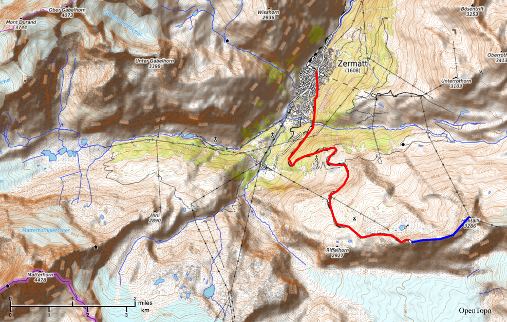
Sunday Nov 3, Zermatt, Gornergrat This is our one full day to play in Zermatt. The Gornergrat cog railway climbs up out of the Mattertal (Matter Valley - Matte means "meadow") to Gornergrat, a climb from 1,500 to 3,100 meters, and from October to January. On top there is a Victorian hotel with a terrace where a score of tourist enjoy the mountain vista. To the north are ski slopes. To the south there is a 600-700 meter drop to the Gorner Glacier. Beyond that there is a ridge line which runs west to the Matterhorn, still lost in clouds. After awhile Kristina headed down to Zermatt, and I went for a walk along the ridge line. Ten minutes into the walk a sign explains that beyond this point the trail is marked with blue & white blazes, meaning it is for "Alpinist" and "Mountaineers". Or does that refer to the side trail down the cliff face? The way which runs next to the mountain biking trail? I wonder how many guest of the hotel have needed rescuing. Beyond here the trail occasionally vanishes in the snow, but it is clear how to get to Hohtälli. Some scrambling, a fixed cable in a rock face, a lot of snow and I am soon there. The top of this peak is home to a ski gondola landing bay. I tag and turn back. The return tromp is made a wee bit difficult by a blinding snow squall. By the time I get to Gornergrat the viewing terraces have been abandoned. On the train back down I talked with a crew who had just spent two days in ice caves inside the glacier. That evening we found a small restaurant near our hotel called "Brasserie Uno". It was fantastic! We had a series of small plates which included moose meatballs and lingonberries. We finished with wood sorrel ice cream!
Monday, Nov 4, Zermatt - Zinal Kristina caught the first train to Bern. I had breakfast at the hotel and finally saw the Matterhorn! But then I headed to Zinal. It is only 16km/10miles in a straight line, but because of the mountains I traveled 50 miles via two trains and two busses to get there. Zinal is essentially closed, which is just fine with me since I am here to walk. Tomorrow I am planning on my major walk of the trip. So today is just a bit of a shake-down. A chance to test my knee and get myself oriented. I follow my nose northeast out of the village and am soon over the edge of my map. But I have seen the trail online, this is the famous "Haute Route", High Route trail from Chamonix to Zermatt. The key is to turn onto the "Le Sentier des Arolles", and not to continue to the "Weisshorn Hotel" in the next valley. So I climbed up through a golden forest of larch. Just as I was emerging into a pasture it started to snow - which added a bit of magic to the whole day. "Le Sentier des Arolles" clings to the valley wall 600 meters above Zinal and I head south, walking in and out of a number of snow squalls. I am entranced by the whole valley and the ring of mountains around it, and I don't want to go back down into the village! However dinner and bed are on the valley floor and so I descend and land back at Le Trift, my inn in Zinal.
Tuesday, Nov 5, Zinal - Col de Tracuit
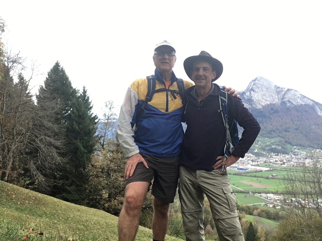
This is the day described at the top of this journal. Wednesday, Nov 6, Zinal - Zurich - Vilters Recently (last week) I made contact with my roommate from 1982-3. Eric Lutz had beaten me at the New York State DIII Collegiate championships in the Steeplechase. That summer I met him at a meet and told him I was looking for an apartment in Rochester, since I had just started a job there. Eric was at the University of Rochester, and looking for a roommate. So I moved in and trained with him for the next year. I had heard via my old coach that Eric was in Switzerland and with a bit of googling found him, and he invited me to visit. Eric had a meeting today in Zurich, so I am to meet him near there. I took a series of busses and trains, and got to Zurich with some time to spare and so walked around the old city for awhile. Then headed out to Thalwil, a suburb, and rendezvoused with Eric. Eric then drove us to his home in Vilters where I met his wife and son. Long, long talks, late into the night! I had forgotten how much fun Eric is!
Thursday, Nov 7, Vilters - Bern In the morning Eric takes me for a walk upper the lower slopes of his local mountain, Pizol. The way up was through farm land and then a forested ravine. We then cut over to the ski slopes and zig-zagged our way back down. I had promised Eric Fika in the afternoon. He talked of taking me to Lichtenstein, about 10km away, but were short of time, so he took me to a place on top of a cliff face were we looked down on the Rhine valley, and across it to Lichtenstein. Then it was time for the train. Back to Zurich and on to Bern to catch up with Kristina.
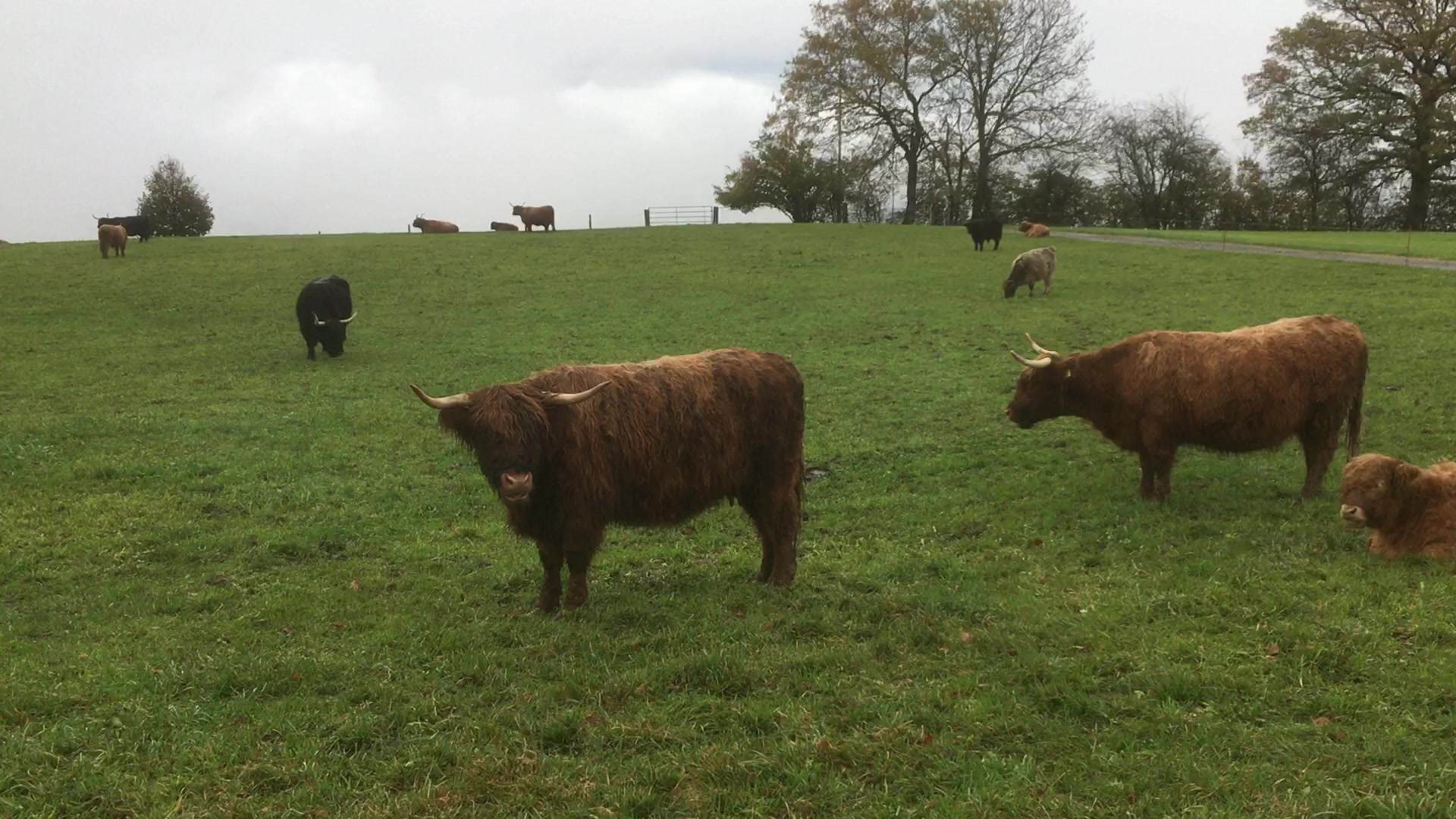
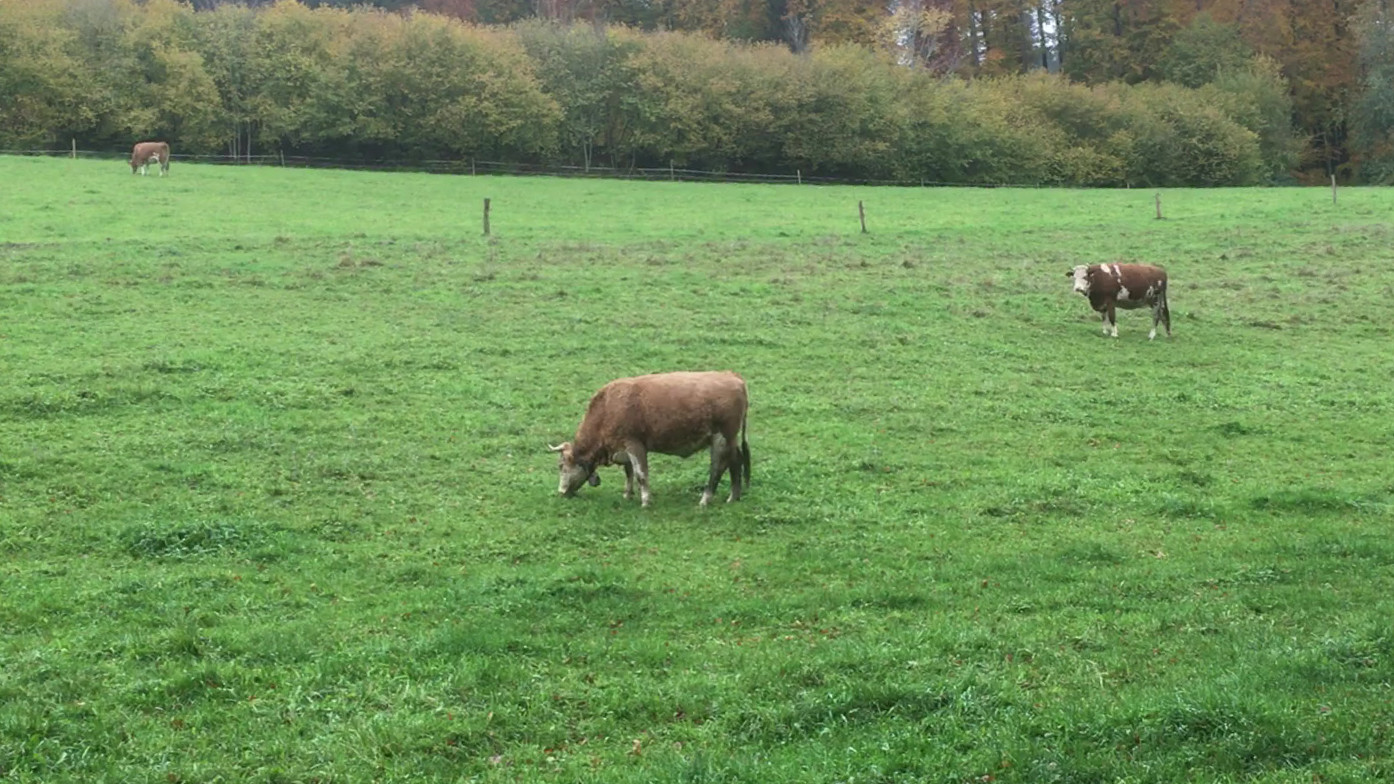
Friday, Nov 8, Bern - Gurten Kristina was off to ISSI, the International Space Science Institute, after breakfast and I needed a walk. On the map I spied a place called Gurten and the hotel receptionist said that it is nice, and many people enjoy the funicular railroad. So I catch a street trolly from downtown to the base of this hill. It is only 2-3 kilometers, but I do like trams. Once I got to the base station of the funicular I decided that I would rather walk. It is hard to believe that I can be so close to the center of Bern, and yet be in such a bucolic setting. I walk through woods and pastures, decorated with cows wearing traditional massive alpine bells. On top of the hill is a hotel and restaurant. I arrived moments behind a funicular full of elderly women who know all about lunch and make a beeline to the cafeteria. It has been a light drizzle all morning, so I doddle over my soup and coffee for as long as I can. Then make my way leisurely back down the hill to the tram. Back in town I stop at the Cathedral, find Kristina, and we go out to dinner.
Saturday, Nov 9, Bern - Zurich - Boston - Hanover Our flight is at the end of the afternoon, so we wander around Bern, and have a leisurely lunch before training it to Zurich and the airport. An eventless flight. We (miraculously!) make it through customs in record time and caught the bus with minutes to spare. Then on to Hanover and a midnight walk home. |