|
Connecticut River Canoe Voyage September 10th-13th, 2020 |
|||||||||||||||||||||||||||
[Click on any photo to get a higher resolution.
When I am reading these notes years from now I may be wondering about some of the choices, so let me remind the future reader that 2020 was the year of the COVID pandemic. This meant that I was trying to actively minimize my contact with other people, starting out with choosing to paddle this stretch of the Connecticut River. From Hanover to Putney Vermont is 100 kilometers. The river is pleasant, but it is neither exciting or wilderness. I would like to paddle this segment again another year, when I could enjoy landing at all the little villages: Windsor, Bellow's Falls, Walpole, and exploring them. I enjoy talking to locals, eating in the diners and just walking around. But this year's voyage is a hermit's retreat into a world bound by the canoe's gunwales. So if not adventure, let this be a Voyage of Luxury. I am carrying extra books to read, a seat which roles up and a camping lantern. Once I had chosen to avoid people I pushed my trip into September, which meant dealing with shorter days and longer evenings. And once I had a lantern, I also stowed a small solar panel for recharging. Finally, I knew that I was facing a few portages, one of which is about a mile and a half long. The idea of carrying the canoe that distance seemed bone crushing. And then walking back one or two trips for the rest of the gear was dispiriting. So I toyed with the idea of using portaging wheels. With a set of portaging wheels you can transform your canoe into a wagon, which then carries your gear. Thus the extra 20 pounds of luxury would become a non-issue, and so I continued to fill my ship, at least mentally, with extra chocolates and cameras, a tripod, and so forth. But then when I went to buy a set of portaging wheels I found I was too late in the season. All of our local canoe shops were sold out. Summer is essentially over, they reminded me. At this point my cargo hold, or at least my dry bags, are filled to busting. So I built my own set of wheels. There had been a set of abandon bicycle training wheels in the basement since our boys took to two wheelers twenty years ago. With those, a 2x4, a few scraps of wood, bungee cords and some very large screws, I built my wheels. For a test trial I took my canoe for a walk up and down the street. And now I think I am ready to launch! Thursday, September 10th, 2020
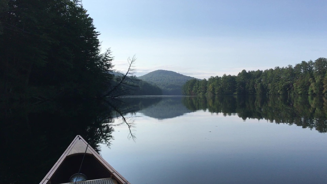
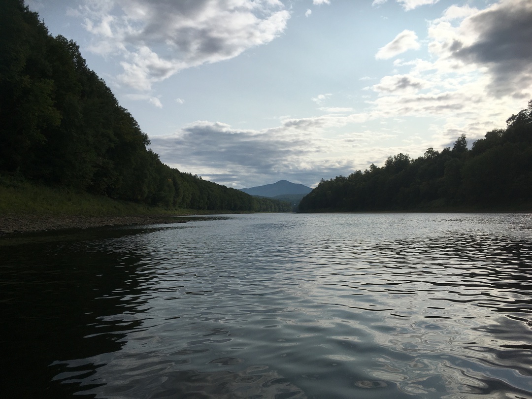
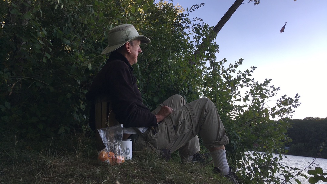
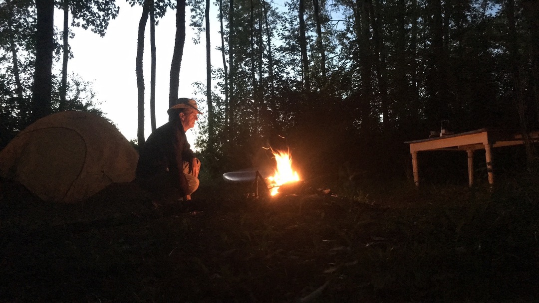
There is always a few last things to do in the morning before you head out. So it was about 8:00 by the time Kristina dropped me off at the boat launch. The dock at Ledyard Canoe club has not been put in this year, so I started from the new Norwich launch, just across the river. The Ledyard bridge is busy as hundreds of Vermonters head to work at DHMC. But I get to float under the arches and drift off to a more Golden Day. The waters past Gilman Island are glass. The first hour, to the Wilder Dam, is simple early morning sweetness. Wilder Dam is my first portage. It starts with a set of stairs climbing up out of the river. Above them is a flat section of grass. So I strapped my canoe onto the portage wheels, filled the canoe with gear, and started to tow my stuff across the grass. Occasionally a wheel was stuck behind a rock, or in a hole, but a sharp yank would get us rolling again. But then, at about the half way point, I realize that one of the wheels was twisted and out of alignment - which was quite alarming! I unpacked the canoe and carried gear to the launch end of the trail, and realized that I would have to carry the canoe the last fifty meters anyhow: it had steps and boulders I had to cross. So back and forth a few times and I was through the portage. 300 meters in 45 minutes. Below the dam the river is in a deep trough. It is an unfriendly place, down so deep that it is often in shadows. You can also see how the river sometime scourers the valley in the spring, or perhaps at a dam release. It is all rocks and sand for ten feet above the river waters. Today the river is low, but there is more current than above the dam and I am soon down to the confluence of the Connecticut and White Rivers. With the White River coming in from the right I can see two railroad bridges and three road bridges, for I am between the villages of West Lebanon and White River Junction, but I can hardly see anything of the towns. In fact this is something which will continually surprise me on this trip is how much these towns have turned their backs to the river. I can hear traffic, but only see trees and geese. When a tributary joins the Connecticut it dumps gravel and cobbles into the river. At the confluence itself the river is only inches deep with a few ripples. But apparently this forces fish up to the surface and so these ripples are a magnet to Canadian Geese and a number of other ducks. There should be a park on the point of land where the Mascoma River joins us from the east. It is a green grove of willow and sand banks. I am now paddling behind the big box stores of West Lebenon, the primary retail strip of the Upper Valley, but you can see none of that. The stores are just beyond the bluffs, completely hidden from the river that I share with only waterfowls. The river winds past Blood's Brook and some small rapids. In truth all these "rapids" are merely ripples with the water so low, but they are still fun to shoot. I pull out for lunch, on to a sand bar on the New Hampshire side of the river. Across the waters the Ottauquechee River joined us, and down stream, above some ledge, I could see Edgewater Farm. It was my standard trail lunch, cheese, a bagel (a very durable bread) and dried apricots. Up to this point I have been debating about how far to push today. I could push a long day to Wilgus State Park (25 miles total) or to Burnham Meadows (16 miles). After I decided on Burnham, the pressure was off to speed on and I could poke around and explore. So I headed up the Ottauquechee. I can't go very far up this tributary. Under the railroad bridge and up to a waterfalls is all of 200 meters. The railroad bridge supports a rope-swing, but with the river being inches deep, it is hard to imagine anyone enjoying that long swing. The waterfalls has two covered bridges across the top, and a small hydropower station perched on one side. But I have miles to go and so turn my bow downstream, sliding over shallow cobbles. A few miles later I come to Sumner Falls, my last portage of the day. At high waters this would be a fun place for a sports kayak. But now, instead, the river has cut a few narrow channels through the bedrock before a plunge of only a few feet. To portage I first had to shuttle my stuff up a steep bank to a dirt access road. Then, while strapping on my portage wheels and stowing gear, a pick up truck with the original Vermonter stopped to talk. I have rarely seen a guy with such a full set of whiskers. I could barely find his mouth among the bush. He told me that this was a great place for all sorts of things, especially fishing. But it was also haunted. The stone just up the road marked the gravesite of an Indian, and a number of campers had reported to him sightings of ghost. I thanked him and said I would bear this in mind when pitching my tent. It was still 3-4 miles to my site at Burnham Meadows, but this is a easy stretch. I caught up with a party, in both senses of the word, floating down the river. They were in massive inner tubes which looked more like Lazy-boy recliners then car tires. Most of them also had "Cooler-barges" in tow. They told me that an outfitter had dropped them off, and was going to pick them up at some unknown place downstream. The next group I caught up with were kayakers, about a dozen. They too were landing someplace downstream, where their outfitter would flag them down with a large orange paddle. It was an employee appreciation day from Simon Pierce. I realized that the Simon Pierce glass blowing shop was near my campsite, so asked them if that was their destination. The first woman I asked told me it was her first day on the job, and she had no idea where they were going. The others confirmed that that was where they were heading. Burnham Meadows campsite is about 50 meters beyond where the kayakers and inner tubers took out. It is only 5:00, so I made some coffee and sat by the river for a little while. But not too long, the sun sets at about 7:00 these days. Two Bald Eagles glided down the river. Camp routines. First I used my filter pump to extract drinking water from the river. While pumping a local, out for an evening stroll on the river bank, stopped and told me about all sorts of great local places - and I had thought this trip would be a type of solitary hermitage. Dinner of pasta and tuna. Then a dip in the river with only the company of the stars. It is early in bed because of the dark, so I sit and read for a while. I am glad for the little folding seat and the lantern. Friday, September 11th, 2020
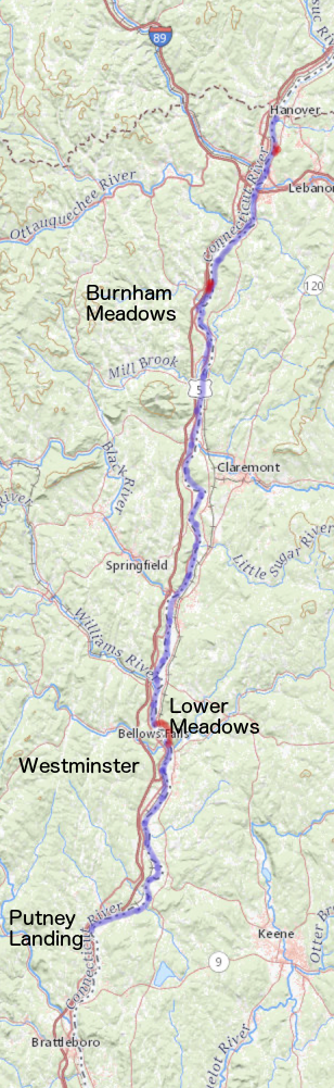
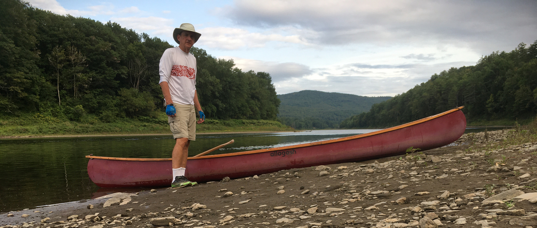
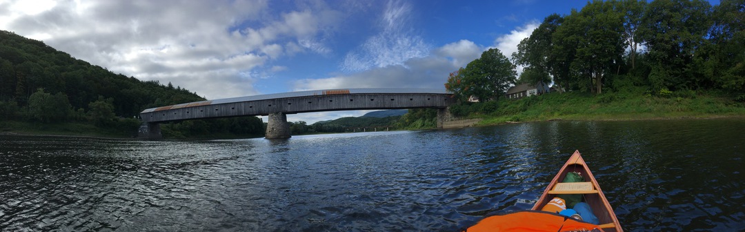
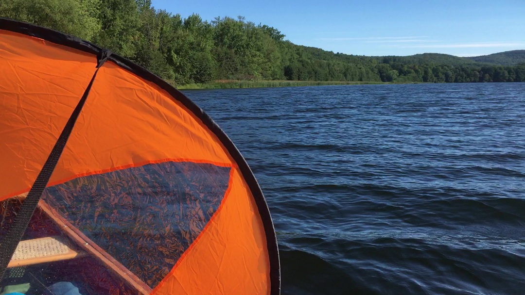
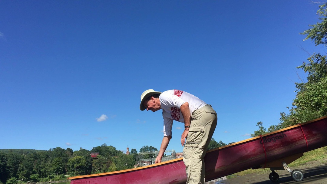
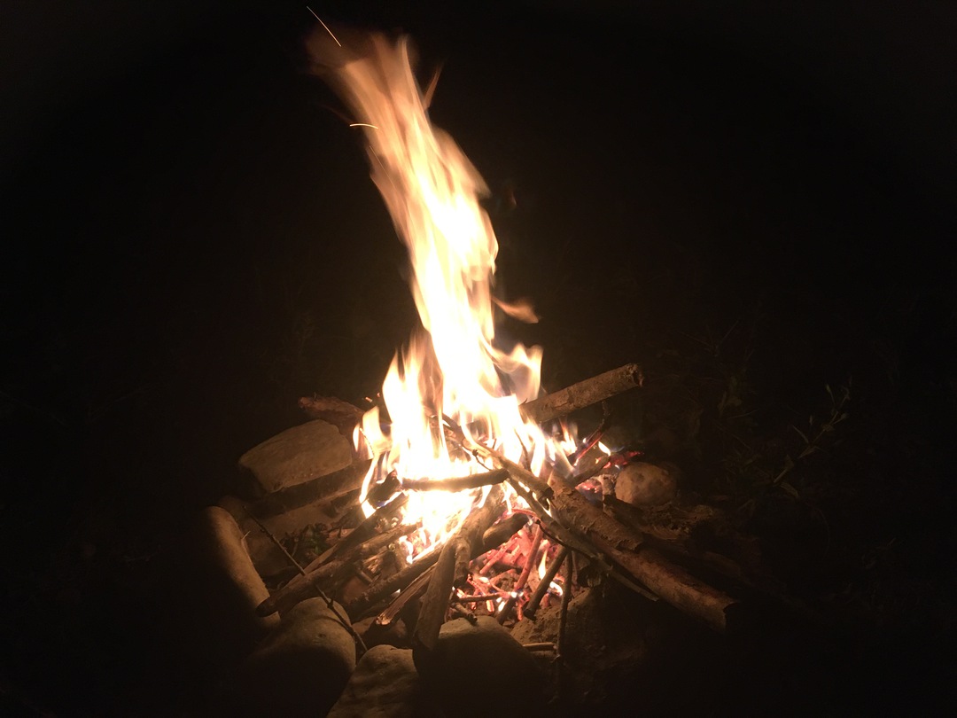
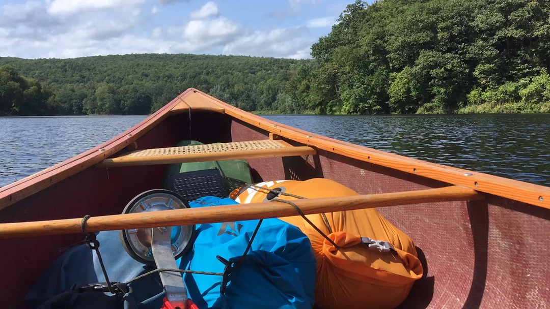
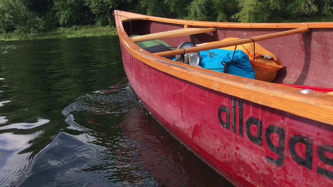
I was seated by the river at about 6:20, just before dawn, with oatmeal and coffee in hand. The sky is dark and brooding, but that is often how clear days start in the Upper Valley. I must have enjoyed that coffee and contemplation too much, because it was about 8:00 by the time I had broken camp and launched myself back out on the waters. A mile downstream, where the river is very broad, I can see a gravel bar stretched all the way from the Vermont to the New Hampshire shore. I can't find a channel, an so end up bumping through a few meters of cobbles. It continues to amaze me how low the river is right now. I have slid over a number of cobbles on this trip and am glad that I am in my fiberglass canoe and not my frame and fabric kayak. The wind is at my back and so I experiment with the canoe sail that my son Will gave me. It consists of a big hoop, about 4 feet across, with an orange nylon sail in the middle. In the center of the sail is a clear plastic window, so you can see where you are going. The hoop has a variety of clips and straps which I try in various configurations. The rigging which worked best was to clip the bottom edge of the hoop to a thwart, the canoe's cross-bar, and then tie one of the straps to the seat, by my hip. If the wind is steady, the hoop stands up nicely. I had an idea that I could mount the paddle in a loop at the side of the canoe, and then steer with one hand. This works, but there really are few things you can do with the other hand. Yes, I could eat gorp, or sip from my water bottle. But I needed two hands to dig the gorp out of my dry bag. In the morning I had a strong and steady wind and on a few occasions exceeded 4 mph just sailing! However, most of the time the best thing to do was to be "wind assisted". My normal paddle rate is about 2 mph, but with the sail up I could easily maintain 3 mph. That doesn't sound like much, but it made an 18 mile day into a 27 mile day, which will change the character of tomorrow's paddle. The River, my canoe, and I, passed under the Cornish Covered Bridge. At one time it was billed as the "Longest Covered Bridge in the World", which is not quite true. There is a bridge in New Brunswick which is longer, but has been periodically closed for maintenance. It was during one of these closers that Cornish claimed its title and put up their sign. Every reach of the river has its own characteristics. Some are long and so gather a good tail wind. Some are short and I am soon around the next bend. In general the river is "entrenched", so rarely can I see what is a hundred meters away. Sometimes the shore is a steep bluff. Sometimes a narrow strip of trees clue me in to the fields beyond. Most of the time I can see the more distant hills and mountains, which means that in the morning I watch Mt. Ascutney slowly pass off the starboard side. Beyond Windsor/Cornish the river becomes deeper, I expect backed up from the dam at Bellow's Falls. Occasionally cattails and marsh lands hide the mouths of side streams. And now and again I see summer cottages with a dock and motor boat. I passed Hubbard Island campsite and finally stopped for lunch at the SCA (Student Conservation Association) campsite. It was good to walk around and stretch the legs after five hours of paddling. I had thought about stopping here for the night. The next campsite is 11 miles downstream. But it is only 1:00 in the afternoon. Also tomorrow I will face the major portage of this trip, a mile and a half around Bellow's Falls, and I would like to get beyond that as early as I can. At this site there are wooden stairs down to the river, where I sit and eat my bagel, cheese and dried apricots, and weigh my options. Once I decided to push on, I quickly pack my food bag, shove off into the river and head downstream. This is a long day when I count miles, and there are no portages to break it up, so it seems like a good time to tell you about my canoe. Kristina gave me this canoe in 1990 as an early graduation gift. The gunwales have rotted and been replaced. The seats and the portage yoke/middle thwart are also new. But the wine red fiberglass is original. Although it has a few battle scars. A decade ago, on a scout trip, it was badly smashed up on a rock in the Androscogain River, in the Errol Rapids, just below Lake Umbagog. One side was stowed in, with a rip a meter or more long. Somehow we patched it with duct tape, lashed some drift wood to the gunwales and paddle are last few miles, bailing as we went. I was convinced that was the end of the canoe, and I wouldn't even look at it for a month. However, a closer, more sober examination showed me that a lot of the fibers still bridged that gash. So I carefully popped it out and patched it on the inside. I epoxied it on the outside, and replaced the gunwales. And on I paddle. On this trip I am paddling it backwards. Normally the bow seat is closer to the mid point of the canoe than the stern seat. This is because you need space for your legs, and so that dictates which end of the canoe is the bow. But when you are solo paddling I like to be closer to the middle of the canoe, it helps with tracking and wind. So I sit on the front seat, but face backwards. Still, I load most of the gear as far forward as I can to hold the bow down. I am caring five "dry bags" of gear; 1) is my sleeping bag, 2) my tent and sleeping pad, 3) food & cook gear 4) clothing, books, etc and 5) is my "day bag". My day bag is hooked to my seat and contains things I might want at short notice, like maps and camera, binoculars, gorp and water bottle. I also have my homemade set of portage wheels. Back on the river I passed Charlestown and the mouth of the Williams River, and then a few more broad reaches and I was able to pull out for the night at the Lower Meadows Campsite. The ground is a bit marshy and damp, but there are two tent platforms upon which I can camp. With a cup of coffee and a granola bar I sit on the river's edge and watch the day wind down. While cooking supper my stove starts to sputter and finally stopes, yet my rice is still a bit crunchy. I would like to take the stove apart and clean it, but it is too hot to handle. Instead I start a fire. It is going to be a cold evening so I had gathered firewood while it was still light. In half an hour I have a bed of coals and my rice pot is on the boil. While huddled by the fire I clean soot out of the stove, fired it up and while water was heating I rigged a bear bad. Finally, with tea in hand I sit, write in my journal and read until I have burned all my firewood. And then to bed. Saturday, September 12th, 2020
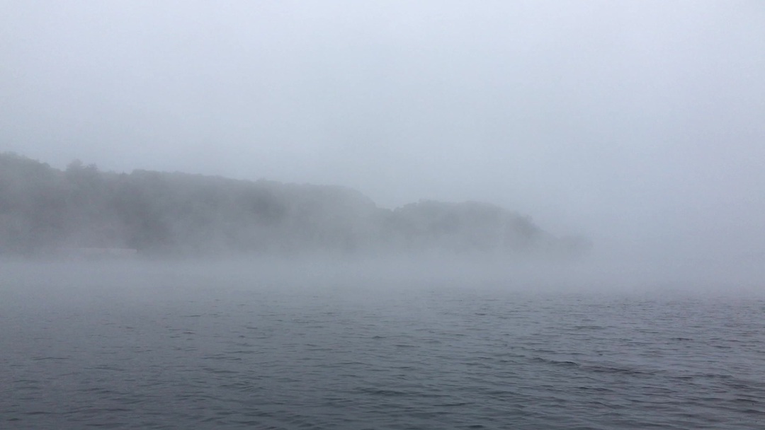
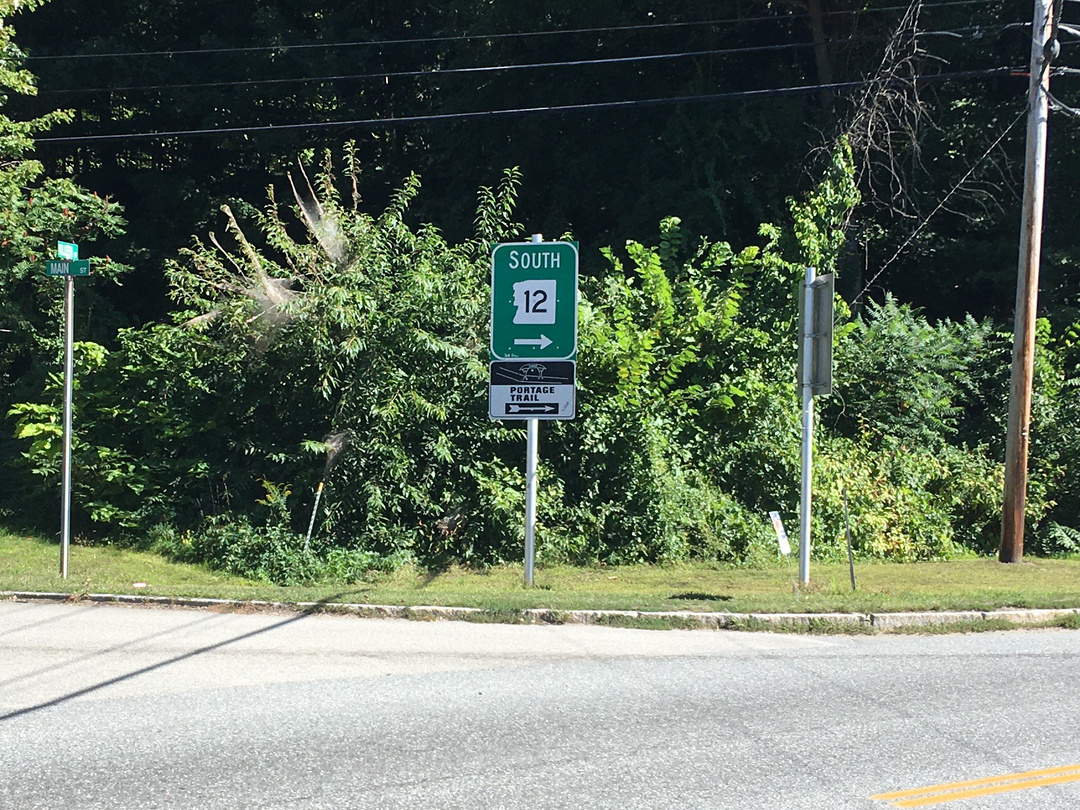
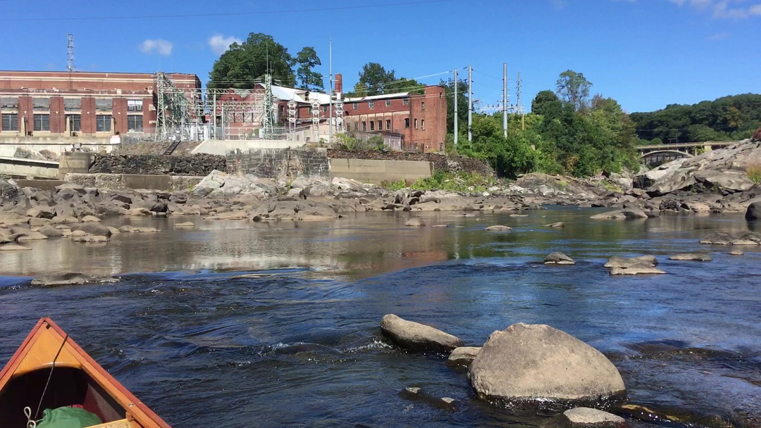
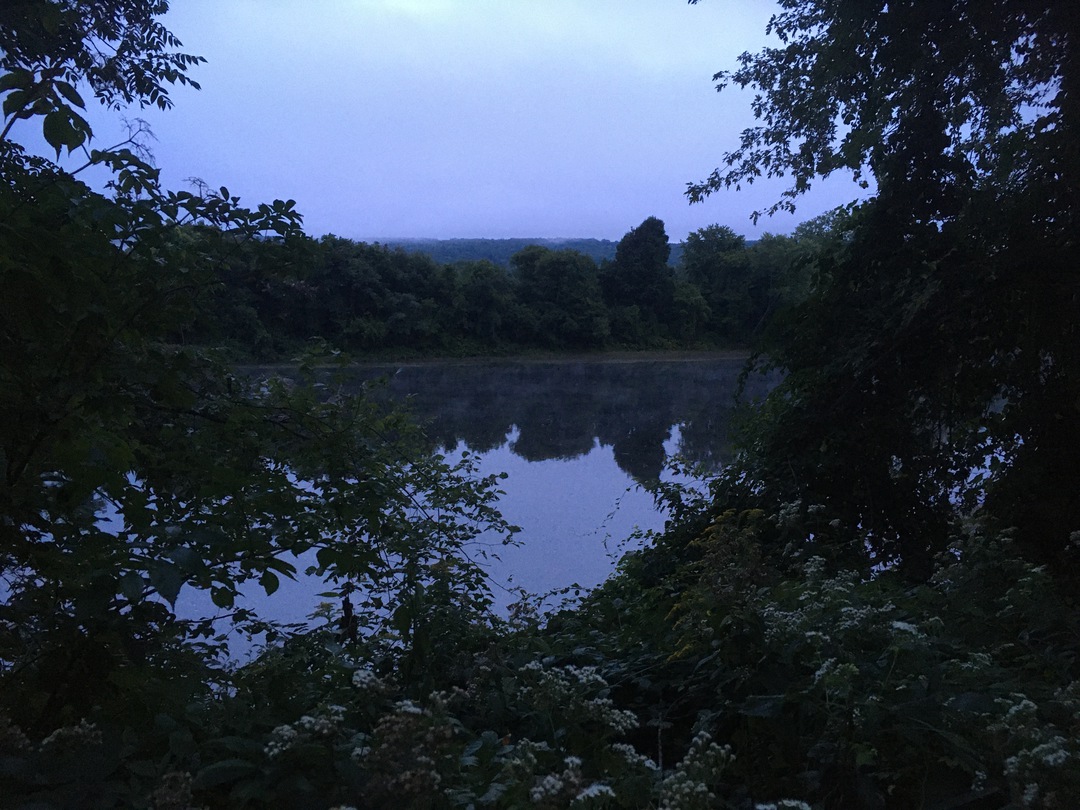
Was that to sound of a dog being strangled, or perhaps a coyote? There are few odd noises in the middle of the night. It was very cold by morning and I was glad I had packed my winter sleeping bag. I rolled out at about 6:30, made coffee and then took my seat, coffee and sleeping bag to the river bank. I am also glad I had brought my running gloves and headband, for it really is cold - at least for September. I sit in my sleeping bag which had a hood, with my thermo cup of coffee. I am in a cocoon and life is good! The river is thick with mist, I expect that the summer waters are much warmer than the cooler autumn-like air. Columns of mist are rising and twisting, dancing and blowing downstream. Occasionally I hear the honk of geese, but can't see them through the mist. Eventually I make my oatmeal and a second cup of coffee, then back into the cocoon. I am in no rush this morning. Across the river I can first hear, and then see, a railroad switchyard where a train is being assembled. The mist is slowly thinning and after awhile I can see a hilltop a mile away, which is sun lit. And all of a sudden I know more about the way the weather will evolve today. This grayness is only over the river and will soon burn off. In fact by the time I am packed and pushing away from the shore the sky is blue and the day is golden. Two miles later I land in North Walpole, the New Hampshire counterpart to Bellow's Falls. This is the start of the long dreaded portage. After the wheels of my portage contraption bent 50 meters into the Wilder experiment, I have had visions of the whole thing just collapsing, leaving me to carry everything the old fashion way. In the worst case scenario I have to carry the canoe on my shoulders the whole mile and a half. I then have to go back for my gear, in fact I expect twice. Which means a total of five trips or seven and a half miles. I also can't carry the canoe the whole way in one go, and don't like abandoning my gear for too long. So I expect that I would be doing a lot of quarter mile shuffles back and forth. That is not something I was looking forward to. Plan-B is that I try to wheel the canoe, maybe with a few light things in it, and only have to go back once. Plan-C is that I fill the canoe like originally planned, but keep a close eye on it and try to avoid forcing it, avoiding rocks and potholes. I start with plan-C. I feel like I have a 16-foot long red wagon which I am towing down the sidewalk. North Walpole is an old mill town. It is filled with old working class houses and a sidewalk which is only a few inches wider than the wheels under my canoe. I creep along slowly, carefully watching the wheels and pulling with a light hand. Fortunately all the curbs are cut at the street corners. At the first major intersection I stood there waiting for the light and planning how best to cross, for there was a lot of turning traffic. But when I finally had the light and started crossing a driver saw me, smiled and waved, and blocked traffic until I had my sixteen foot wagon safely on the other side. Crossing railroad tracks was a bit of a trick as my wheels wanted to stay in the slots next to the rails. I would gingerly coax them out and on our way. One of my favorite sites in town was a highway sign, the top panel pointed out NH Hwy 12 South, to the right. And just below it was a panel for the "Portage Trail", also to the right. The portage trail icon has two happy people carrying a canoe overhead, holding it up with straight arms. Seeing the signage, I half expected to see a line of us portagers, but in fact saw no-one until I got to the end of the portage. A slow mile and a half, in about an hour, but without incident. And unworthy of all of my concerns. At the launch I met six guys who applauded me. They explained that they had seen me on the road in the middle of town and were glad to see that I had arrived. These guys told me that their were part of a group of 17 who were boating and fishing there way down the river. They would camp someplace down there, then take out near Brattleboro tomorrow. There also told me that whereas they were pleasant, I should be forewarned that the rest were all "Pirates!". I asked where they were camping. They said they didn't know, the organizer was already downstream, but it was a few hours away. And then they took off in their motorized skiffs and canoe, one of which sported a beach umbrella. All of them piled with beer coolers and held together, in part, with duct tape. They seemed like a fun and happy group, but I wanted a solo experience, especially this year of COVID, so I decided to not join them. There are two campsites between here and Brattleboro and I wished I knew which one they were headed to. The paddle trail maintains an online registry of campsites. It reminds people that there is no such thing as "reserving", but it ask large groups to indicate where they will be, so others can plan around them. Four miles from here is the Westminster Campsite, and no one was listed there. But seven miles beyond that is the Windyhurst site, where a group called "Float You Boat Boys Trip" was spending the night. Would Pirates call themselves "Float Your Boat", it seemed likely to me. So I will plan on Westminster, unless it is full of pirates. So a leisurely day. Once launched I poked around the bottom of Bellow's Falls. As I've told you before, the river is very low, with hardly a trickle going through the turbines. I let myself drift downstream, watching cobbles on the riverbed below me, and the flocks of Canadian Geese following the river overhead. I landed at Westminster and made lunch, and then planned a leisurely afternoon. But first I have time to make my bedding better. Last night I realized that my airpad has a slow leak. So before setting up my tent I gathered a few armloads of grass, essentially hay, and piled them below my tent. I have time to gather firewood, clean the stove, and go for a swim, all the way to New Hampshire and back. In the evening I enjoyed a fire on the riverbank, and then a comfy bed. Sunday, September 13th, 2020 Westminster Campsite, VT (mile 172) - Putney Landing, VT (mile 159) 13 miles
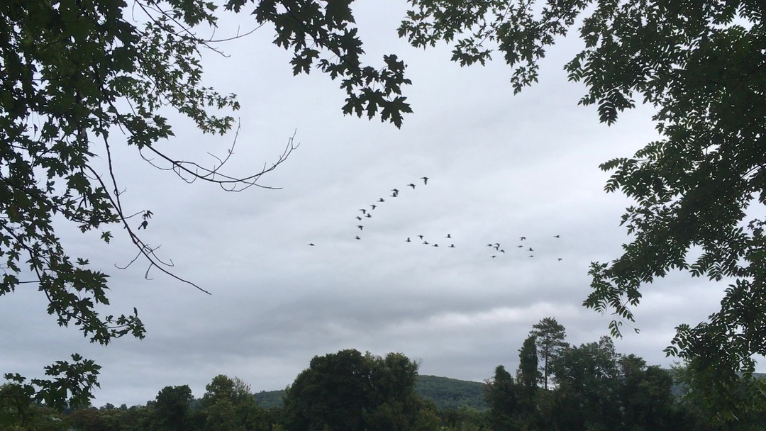
It was warmer then the previous night, and with my mattress of hay I slept well. I got up at 6:20 with the idea of having an early cup of coffee as the mist lifted off the river. But my stove wouldn't cooperate. So after half an hour I gave up on the stove and lit a fire. I still had wood from last night, and was soon cooking my breakfast by the river. While I am working on the fire I hear, and sometimes see, flights of geese. And twice I heard the report of a shot-gun - a little too close! By 8:30 I am back out on the waters. With the sounds of geese and hunting, and a few leaves falling, it really does feel like autumn is upon us. My thermo-cup of coffee is between my feet, which adds comfort to this misty morning. Will has agreed to meet me at Putney landing at 3:00 to take me home. For most of the morning I think to myself: what am I going to do with my extra time? But then about noon a head wind comes roaring up from the south. Every reach of the river now must be played with tack. On one stretch the Vermont shore will off a bit of shelter, on the next stretch I think just below the bluffs on the New Hampshire side looks more doable. There are a few stretches where I am making almost no progress against the wind and think perhaps I should just land for a while and hope the wind shifts. But it doesn't abate and I don't stop, just clawing my way down the river. I passed the Windyhurst campsite, the pirates have already gone and floated their boats. At one point I needed to cross the river and was blown upstream, despite my frantic paddling! But, in general, I steadily crawled south. Will texted me to say he had been bicycling in the morning and was going to be a bit late. I texted back to tell him that I still had a few miles of headwind to go. I finally landed at Putney at 3:40, and am a bit dazed when standing on "terra firma" after battling the wind for three hours. Will arrived a few minutes later. No great conclusions, except that if you continue to dip your paddle into a river, you will somehow end up further downstream. |