|
A Walk in Vermont June 22nd-23rd, 2021 |
||||||||||||||||
[Click on any photo to get a higher resolution. 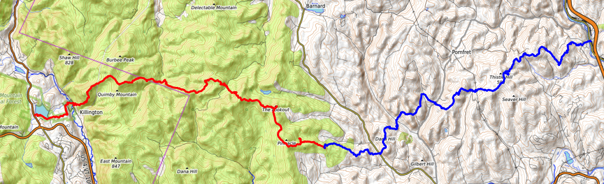 Tuesday, June 22, 2021 This is my "shake-down hike", before a bigger one next month. I am planning on three days, forty-five miles from Killington, Vt to Hanover, NH.
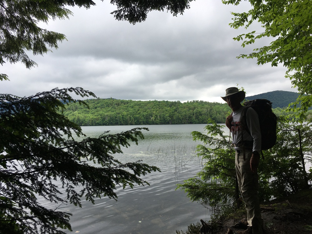
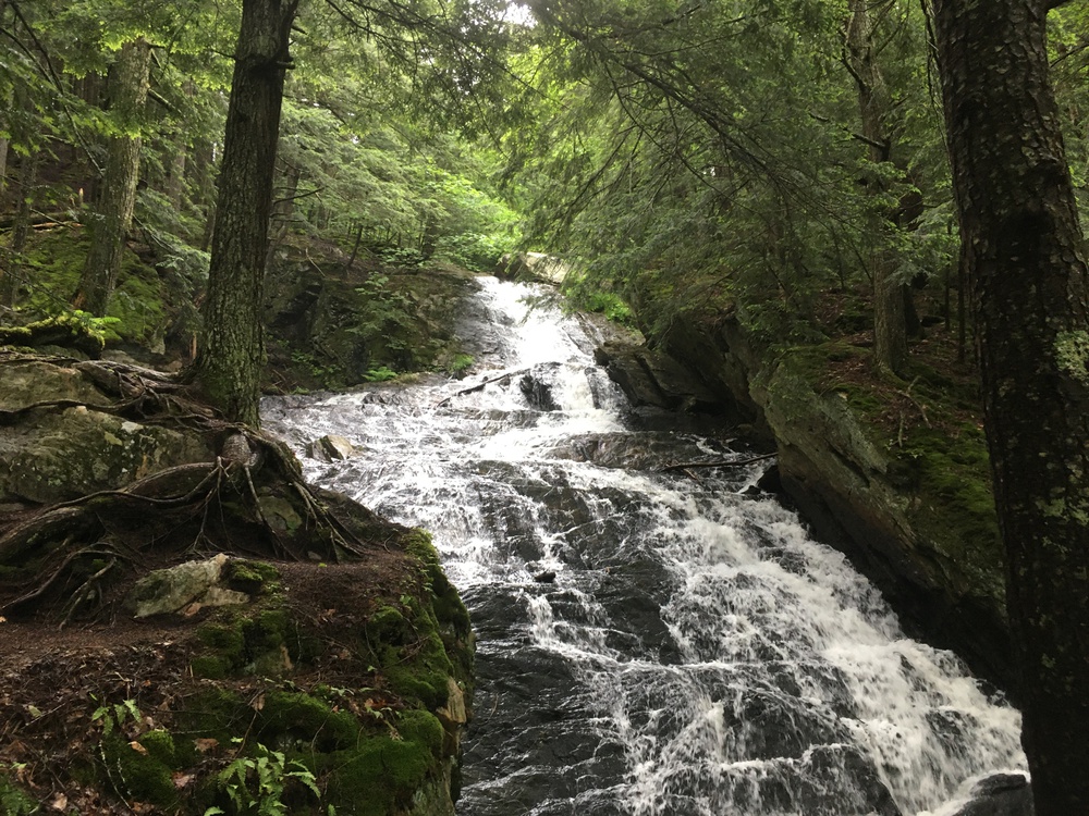
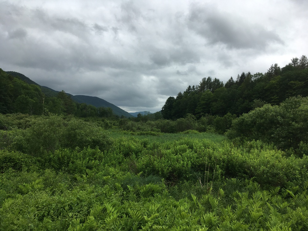
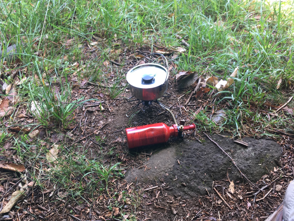
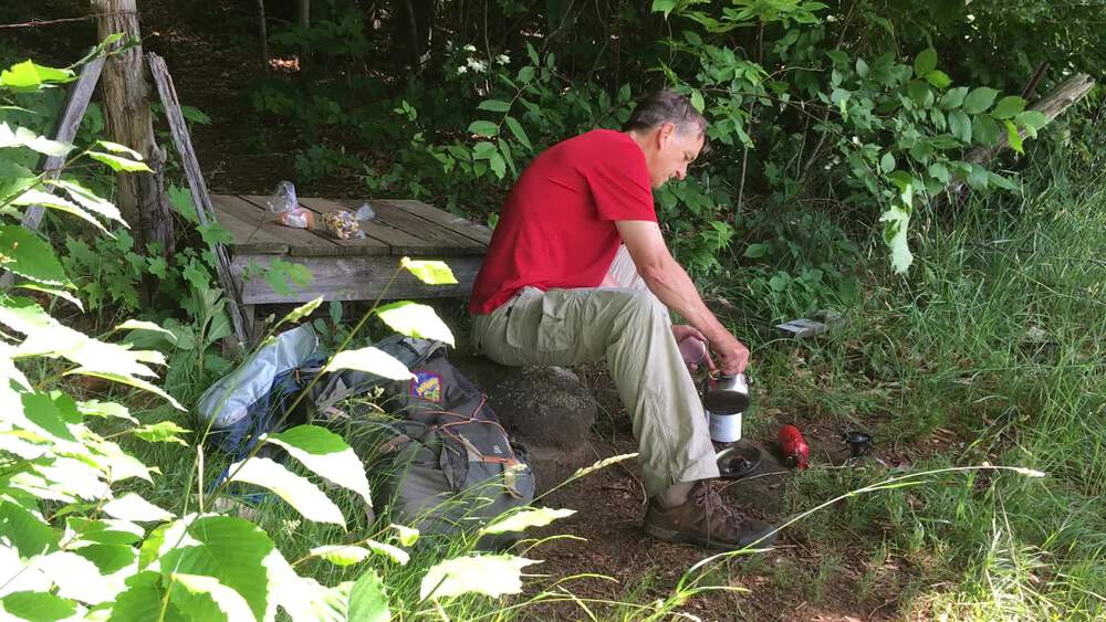
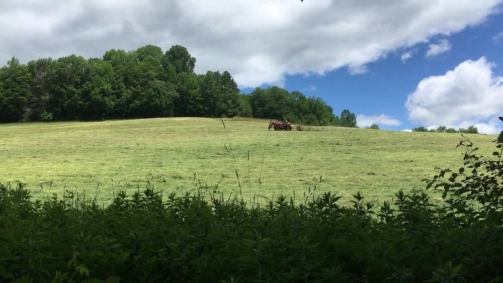
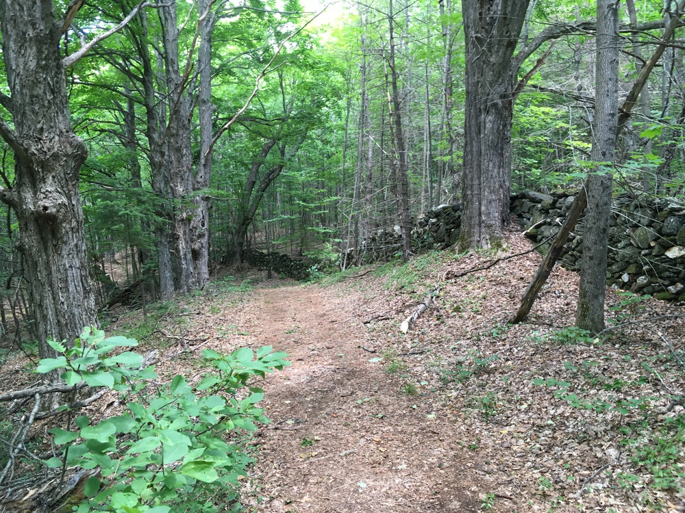
We were up early, and Kristina dropped me off at Kent Pond at 9:00, which was a much earlier start then I had expected. I took a wrong turn right out of the parking lot, but did not come to any serious grief. The map makes it look like the trail runs next to the pond, so I walked down to the pond to find the trailhead. Actually the trail makes a 30 meter jog to avoid a swampy bit, but I soon found my footing and was heading east. A mile later I stopped at Thunder Falls and talked with an elderly couple. They were from Arkansas and are ten days into their month of traveling to see the country. Thunder Falls is nice, but how did it rate on this couples list of things to see? They can not be poking into every corner of the landscape if they have come all the where from Arkansas to here in ten days. But if they are not making a microscopic inspection, they would never have found Thunder Falls. The climb up Quimby Mountain is a long series of switchbacks, and just when I thought I was going to start to break into a sweat, a gentle rain started falling, to cool my overheated brow. It was here where I was passed by my first "Thur-Hiker", he was moving a lot faster then me (as would be most thru-hikers). While I amble along the Quimby ridge line, this might be a good time to explain my shake-down. This spring I decided that it has been a number of years since my last true backpacking trip. I've had canoe, kayak and bike trips and I have hiked from hostel to hostel, or hutt to hutt, but it has been over ten years since I've carried the full load (camping equipment, food, tent, etc.) for more then an over night. But I do this with some trepidation. A full backpack is heavy. I think my pack on scouting trips a decade ago would tip the scale at 30-35 pounds. One thing which I have found mysterious is that when I was a teenager my pack typically weight in at about 20 pounds. However, thirty or forty years later I've lost the spring of my youthful step, and gained 15 pounds on my back. How did that happen? I was 17 when I first acquired a stove - which also means carrying fuel. I also think I used chlorine tablets (or maybe drank straight from streams?) instead of a filter pump. My old tent was 4 pounds instead of 7 (but leaked like a sieve). And I now can't sleep without an air pad. So this spring I started to re-equip myself. To start with, my new summer sleeping bag is filled with down, weighs a pound and compresses to the size of a small cantaloupe. My new air pad is half the weight, a quarter the volume and twice as warm as my old one, yet it inflates to twice the thickness. I have also gone from a water-filter which was adequate for a troop of scouts and weighed a pound, to purification tablets at less then an ounce. Finally I swapped my two person, winter proof, 7 pound tent for a 18 oz bivy sack. More about that later. Total weight - 27 pounds. A few miles later I stopped at the "Stony Brook" Shelter for lunch. The Appalachian Trail has shelters, most of them 3-sided lean-tos, about every six to eight miles along its 2,100 mile length. While eating lunch "Almost There" stopped for a few minutes. "Thru-Hikers", people who hike the length of the AT, and "Section-Hikers", people who do major sections at a time, have their own unique culture. Part of that culture is the "trail-name", a nickname or a handle. It is a name someone else gives you, but then you chose to identify yourself as. "Almost There", was the first of a dozen I would meet. Shortly after shouldering my pack I met "Dirt Fox", as she filtered water from a stream. She told me that the hot topic on the through hiker grape-vine was "The Lookout", a few miles up the trail. This is a private cabin just outside the AT corridor which was open to hikers for use. Is it raining? Or are the trees just dripping? Is this a low cloud on the ridge, or is all of Vermont engulfed in fog? When I got to the Lookout's turn off I decided to take a gander, it is only a few hundred meters out of the way. The cabin is on a bit of a knoll, but to enhance the view, a platform has been build on the roof. The place is also a magnet for thru-hikers, about half a dozen are here already, and four of them called me up to the platform. It is a nice view - but I am itching to do some more miles. The day is winding down when I arrive at Winturri Shelter, which was also the destination of most of the hikers I have encountered today. There are eight guys and three women here tonight. I cooked and ate my dinner of tea and noodles and talked with everyone. "Whoa! that's a classic!", somebody commented on my "Whisper-Lite" stove. I guess it is now about 15 years old, but I told him I thought it was positively modern compared to my other stove. I bought my Svea in 1977, but its design dates to 1955. Whereas I enjoy talking with these young people, I'm guessing 90% are between 20 and 30 years old, I would like a quiet evening. So I shoulder my pack and head on down the trail. The rules which govern the AT corridor say that you can either camp at a designated site near a shelter. Or almost anywhere else, if you are at least 200 feet from the trail and more than a quarter of a mile from a shelter. At first that second clause (1/4 from shelter) sounds odd. But what was happening is that shelters are magnets; they usually are near water, have latrines and are a social hub. And so people were creating little "personal" camping sites near them. So the clubs which manage the AT decided it was better to create "designated" sites near shelters, than a sprawling mess of cleared spaces. But I am choosing the "dispersed" camping option. A mile beyond the shelter, and 300 ft to the south I find a nice spot in the woods and make camp. I rig my "bear-bag" as it is getting dark, and set up my "bivy sack". This is my first night with a "Bivy Sack", or "Bivy Bag". This is the smallest of tents, just slightly bigger than my sleeping bag and airpad. But I have had a long walk today (19 miles), and have barely the energy to update my journal before I fall asleep.  Wednesday, June 23rd, 2020
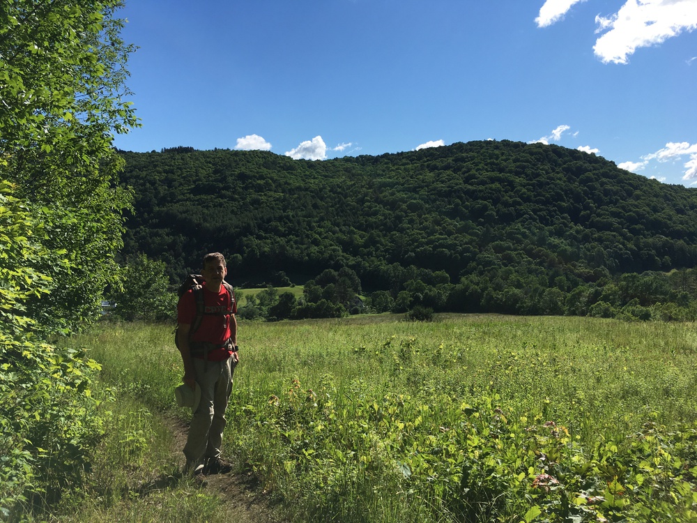
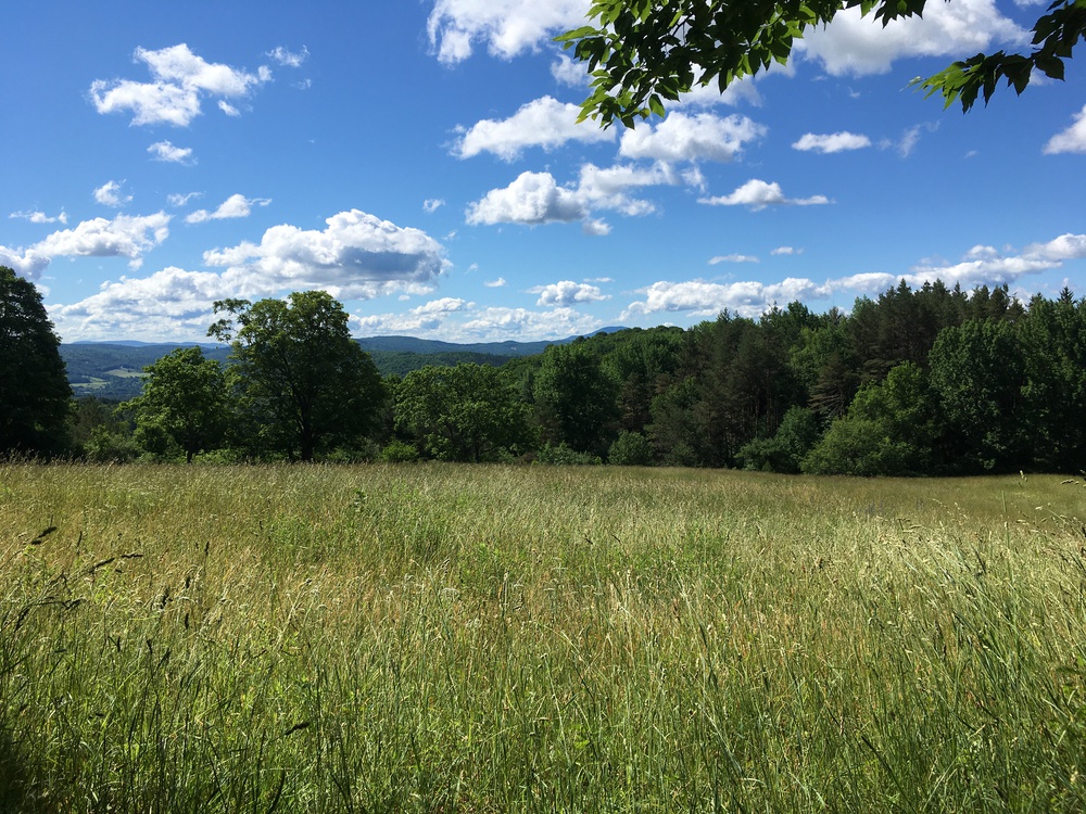
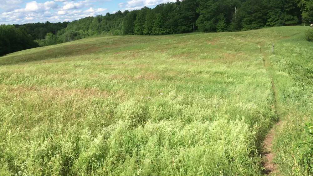
It was windy last night, but dry. I wanted to see how the bivy sack would work in the rain, but tonight was not the test. One of the challenges of the bivy sack is that there is no space inside of it for your gear. So I rigged a small tarp just outside the doorway for my boots and backpack. I woke at 4:30, with just a suggestion of light - but still too early. Then I slept until 6:30. Retrieved the bear bag. Coffee & oatmeal for breakfast. Packed and was on the trail by 7:30. I am a bit stiff this morning and it takes about two miles before I am in stride. One of the delightful features of today's hike is the number of times I come out on hill top meadows -- with vistas! So much of the AT is the "Great Green Tunnel" - but not today. On top of Dana Hill I stop for a second breakfast; coffee, gorp and apricots. I sat on a stile, which use to cross a fence - but the fence has crumbled away. Apparently it is not hard to keep the forest behind me from invading the meadow in front of me. The day is sunny and bright and the trail is full of hikers; Almost There, Dirt Fox, Coop, Lone Wolf, Critter and more. I am guessing that a dozen thru-hikers pass this spot each day at this time of year. A few observations about thru-hikers
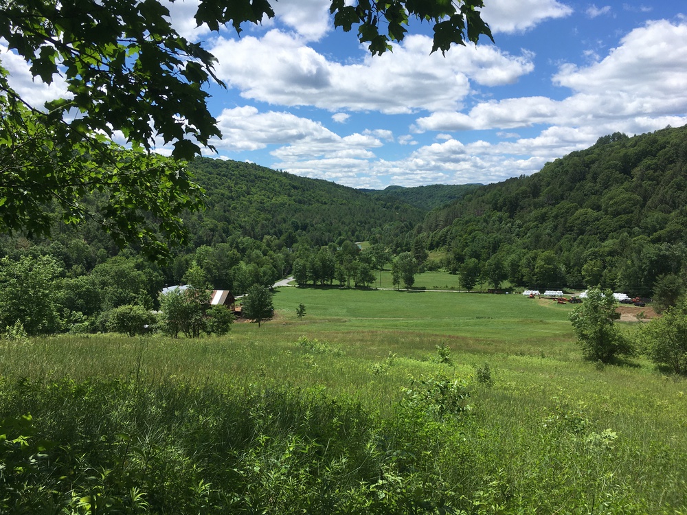
Apparently I just missed seeing a bear! Between Pomfert Rd and Cloudland Rd is a bit of really nice Class IV road (an unmaintained "ancient" road) curving through the forest between solid stone walls. There I met a woman walking three dogs. While we exchanged pleasantries I heard something in the bushes to the west and down in a ravine. The dogs went wild and the woman, with much effort, was barely able to control them. Later, as I lunched, a hiker passed me and told me of the bear in that woods. Just before Cloudland Road the trail zig-zags down through a meadow and I found a rock to sit on for my lunch. Bagel & cheese. Gorp & apricots. It was a really pleasant spot within sight of Cloudland Farm. Cloudland Farm is a beef farm which also host a restaurant which specializes in farm-to-table. Kristina and I have eaten there a few times and especially enjoy the hilltop view. Next time we come, I think I should take Kristina on a short walk up this zig-zag trail. An hour later I stopped at Thistle Hill shelter. There were two hikers at the shelter and they told me most of the thru-hikers which I had met at Winturri had pushed on to West Hartford in search of a fabled "Blue Barn". But the reports, received via text messages, were that their search had failed. Rumor has it that the "Blue Barn" has a very nice trail angel host, but it wasn't clear where this barn is located. These two hikers were feeling very superior because they had not engaged in this wild goose chase. Instead, they were at this well known shelter. I tried making myself coffee, but my stove failed! I could see that the fuel orifice was clogged. Usually I carry a safety pin for just such events - but for some reason had forgot it on this walk! I am still planning a few more miles - and there are a few more hours of day light; so why not? But as I continue I increasingly find stream beds dry where I had hoped to fill my bottles. I am near the top of a ridge line, and could always follow the stream beds down until I find water, but I just want to tick off the miles towards home. Also my feet are starting to get a bit sore and so I don't want to wander. About a mile from West Hartford I am making a steep descent into a lovely green and mossy ravine. I can hear the water rushing and splashing. I can almost taste it. Still, it was the end of a long day and I should have listened to my feet! Blisters broke and I was hobbled! I was able to text Kristina, it is only 7 miles in a straight line home. (It is ten miles by trail, and a dozen miles by road.) She volunteered to come and get me. I told her that I would walk the last half mile into West Hartford and meet her there. But ever so slowly. To get over the White River the Appalachian Trail joins the Quechee-Hardford Rd for a quarter of a mile. And at the north end of the bridge is a blue house, with a blue barn, with "AT" in ten foot tall stylized letters just under the peak of the barn. On the porch of that house were half a dozen hikerss I knew, including; Almost There, Dirt Fox and Critter. They offered me pizza, but just as I was reaching for a slice, Kristina pulled up, and my ramble across Vermont was over. |