|
Rambling in the South San Juan Wilderness June 20th - 22nd, 2022 |
||||||||||||||||||||||||||
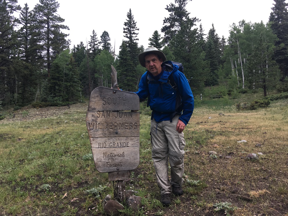
[Click on any photo to get a higher resolution. 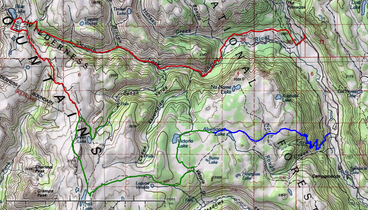 Monday, June 20th, 2022 When you start in a city, it takes a long time to get to even the edge of a Wilderness. It was 2:26 by the time I shouldered my pack and stepped on to the trail. Last night I flew into Albuquerque. And even with an early start, it is a lot of miles to the South San Juan Wilderness in Colorado.
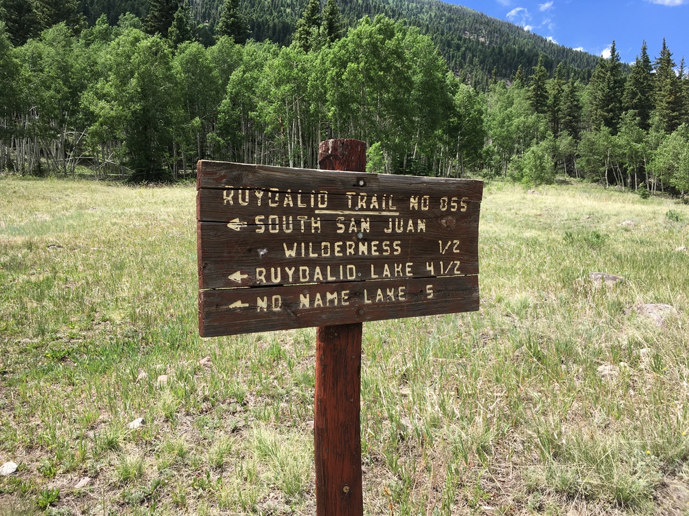
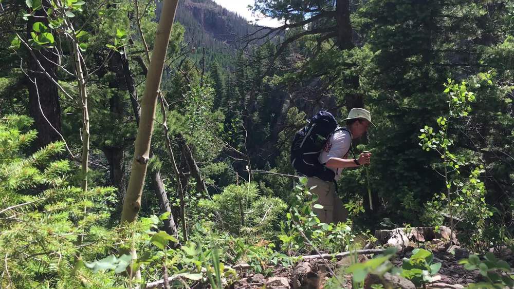
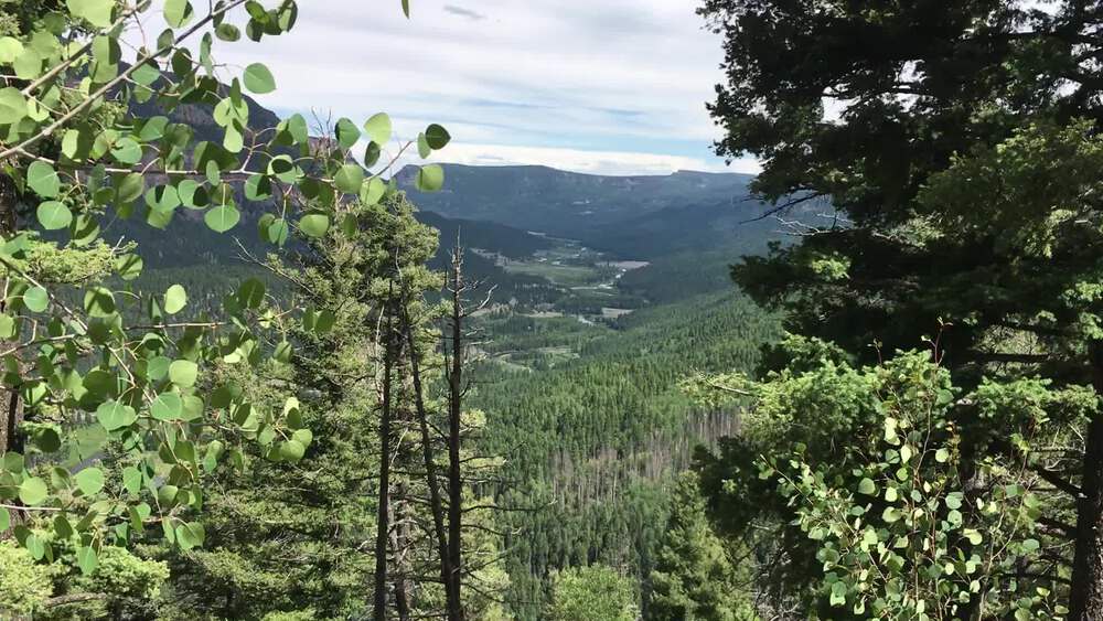
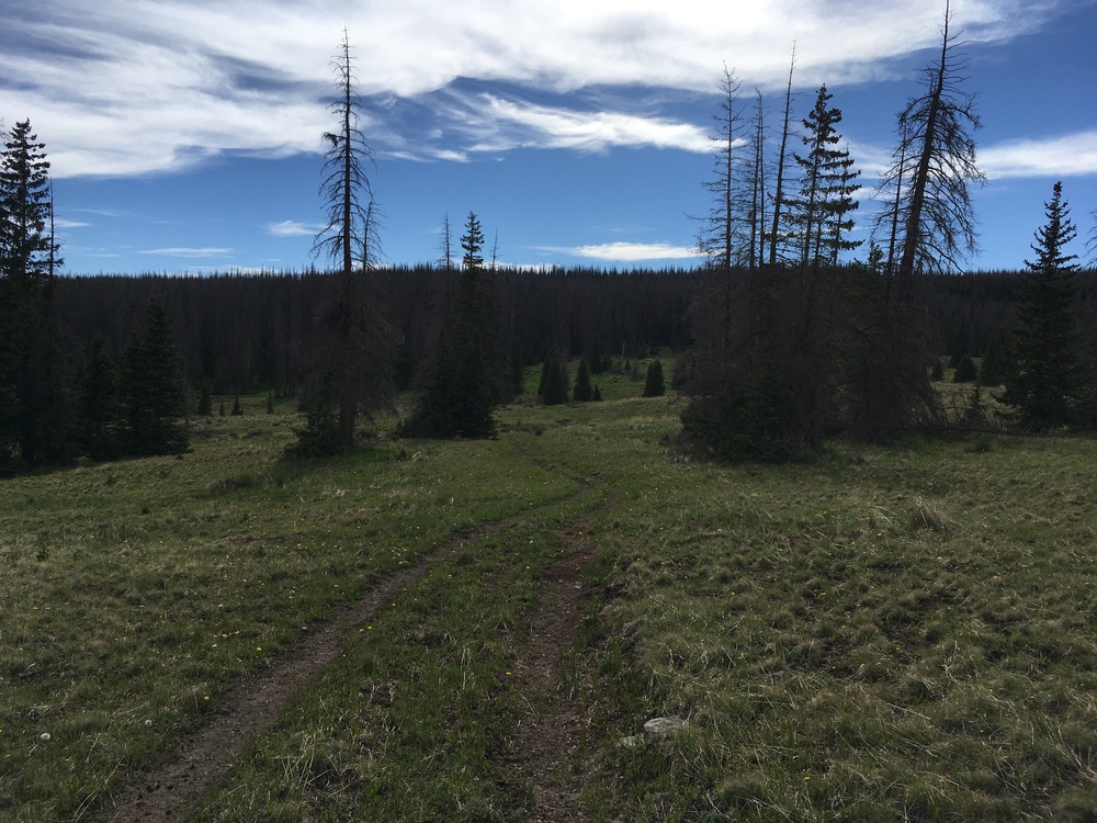
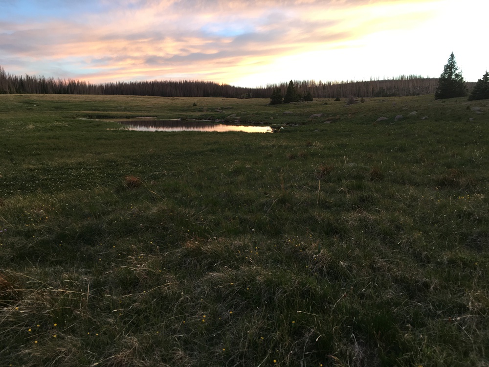
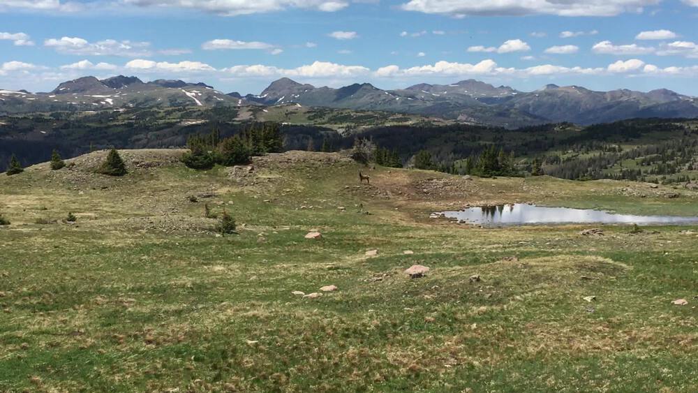
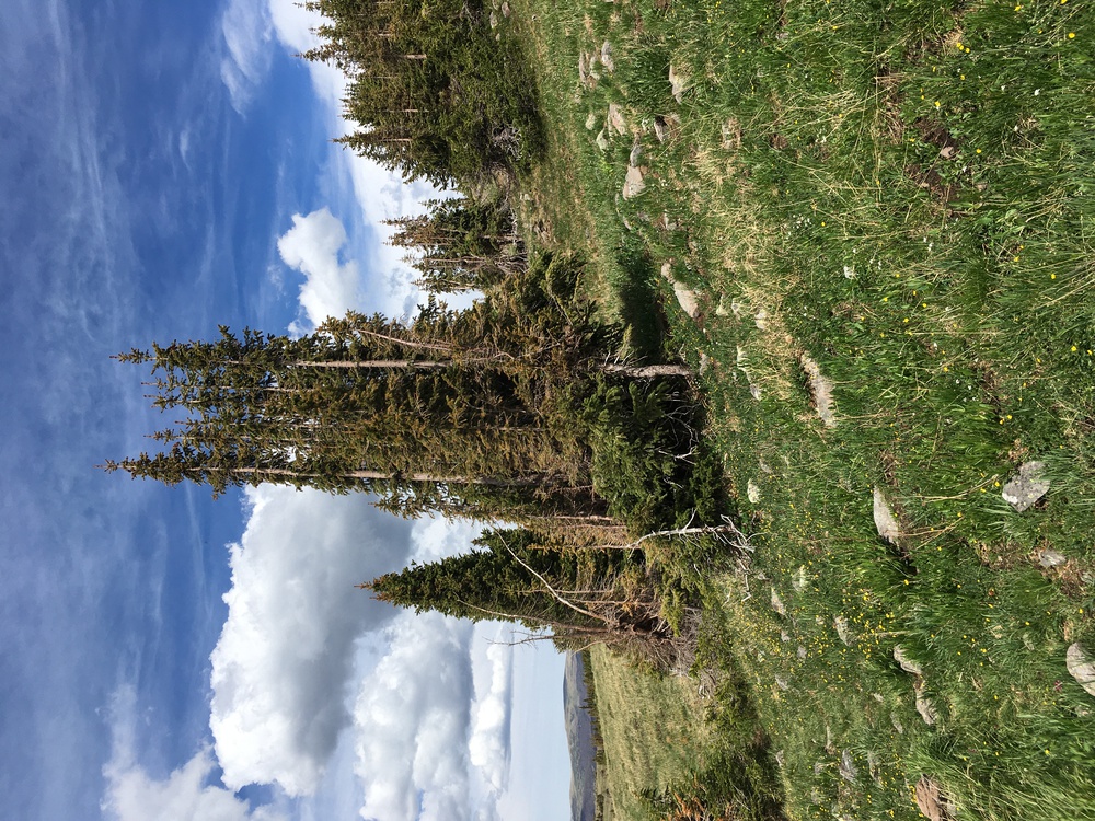
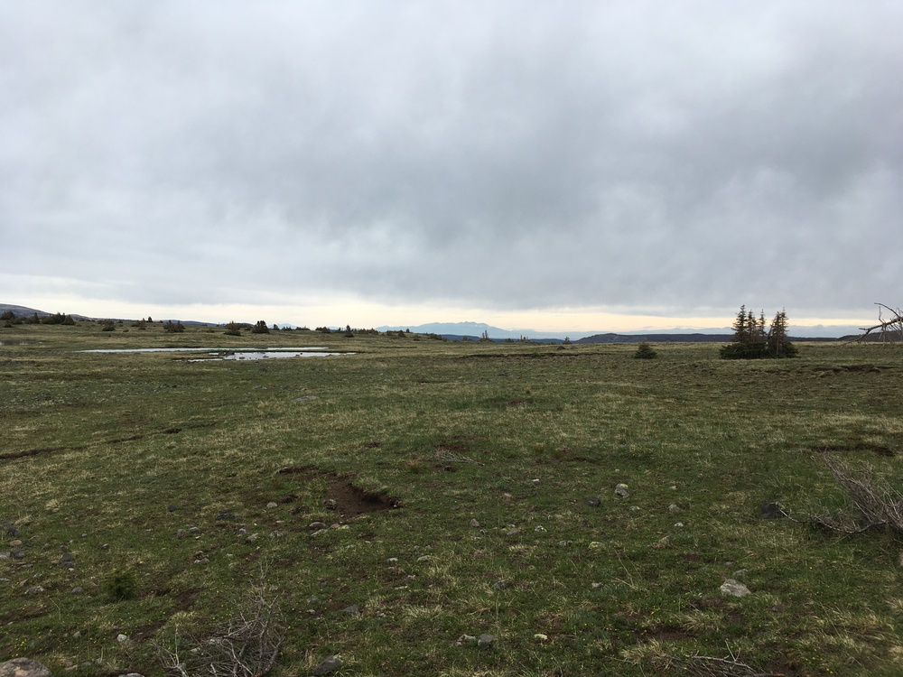
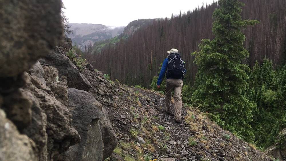
The hike is very "front loaded", which means that most of the work of the next few days is packed into the beginning of the trek. In fact most of the elevation gain is packed into the first 2-3 miles. My trailhead is at 8,800 feet, and three miles from now I'll be at 11,400. That means that this assent is a lot like climbing the Franconia Ridge in the White Mountains of New Hampshire. Except the air is a bit rarefied. Quaking Aspens and Engelmann Spruce as I zig-zag up a number of switchbacks. The air may be thinner than in the east, but the trails are much easier to walk. In the Whites and the Adirondack I always felt like some burly mountain man took a compass bearing on a peak and then plunged into the forest - and we, 150 years later are to timid to challenge the wisdom of that rocky, rutted, rooted and muddy, straight up the mountain trail. In the west they have something called a "switchback". In theory we have them in the east too, but eastern trail designers are miserly with them; presumable saving switchbacks for some future alpine challenge. The trail is simple but I still stop every half hour for water and to enjoy the forest. The Aspen are a playful tree; I can see a breath of wind approaching because the aspen leaves dance, lifting their skirts and showing the color of their undersides. It only took two hours to climb to over 11,000 feet, and then life became easy and the trail relatively flat. My trail goes in and out of the forest; a mile in the fir trees, and the I break out into a broad grass land which follows a stream. I want to call these "parks", as in "Estes Park", but a park in that sense is a high valley, with the parkland being hedged in by mountains on all sides. These are meadow on top of high plateaus. Just beyond where the trail to Ruybald Lake headed north, but before I got the the turn off for No Name Lake, I caught up with a young family of backpackers. Mom, Dad, older brother (age 10?) and younger sister (age 7?). There were headed in my direction, to Averjones Lake for a few days of camping and fishing. The girl looked crushed. I expect her backpack only held her sleeping bag and maybe a stuffed companion. Her dad was slinging her backpack on his front and was trying to figurer out how to coax her on. I turned to the girl and said, "You came up all that climb? I'm impressed! You are amazing! Where are you headed?" She promptly replied, "Averjones Lake, for some fishing", and bounced to her feet. Her dad, who was behind her gave me a conspirator wink, and I was off on my way, with this family at a more sensible pace. I few miles lake I broke out of the forest onto Averjones Lake and startled something which ran for cover. With a hint of red, at first I thought a fox. But it was much too large, so perhaps a coyote. Do they have wolves around here? And then I noticed something much larger and black making for cover a quarter of a mile away. I'm guessing a young bear - but then it disappeared. My plan was to camp near this lake. But it is windy and still early. So I continue west, but with an eye out for a good camping spot. The woods are full of bugs, and the grasslands are windy. Eventually I find a compromise, a bit of grassland tucked into an eddy of the forest wall. Which meant somewhat out of the wind and somewhat into some bugs. But I have my head net, so bug are not such a problems, except when eating. I find some bear scat near my site. It is very old, but I still rig my bear bag carefully But when the sun heads toward the ridge line, the temperature plummets, the bug vanish and I head to bed. Tuesday, June 21st, 2022
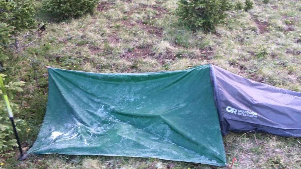
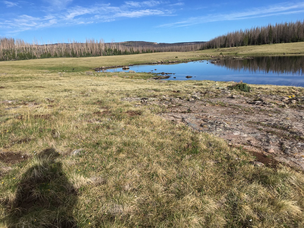
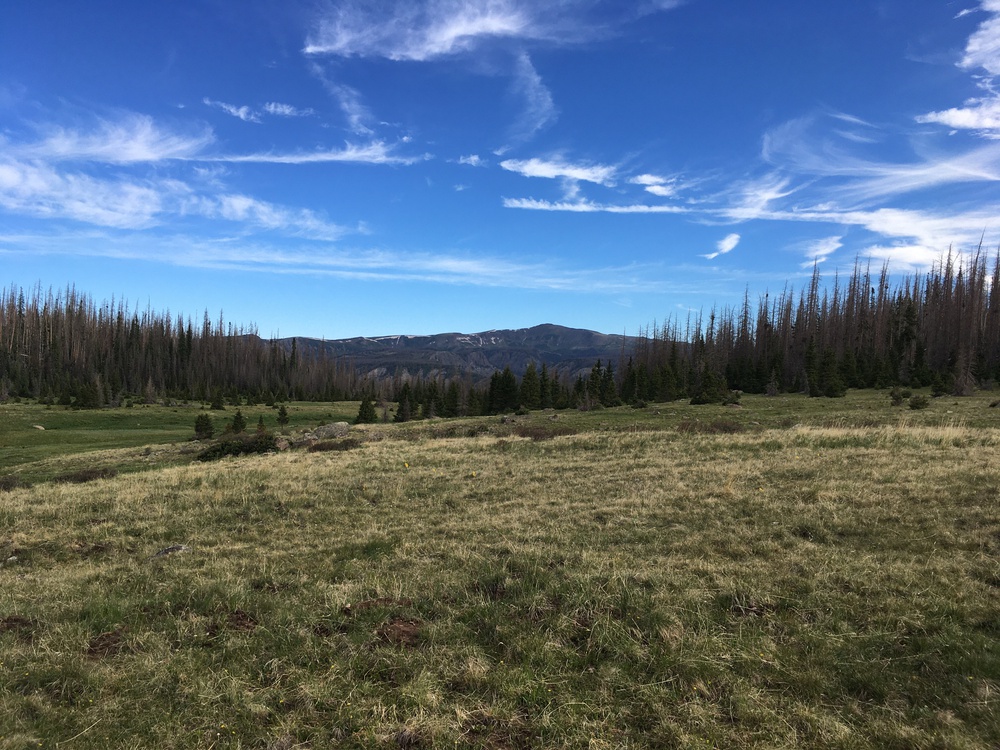
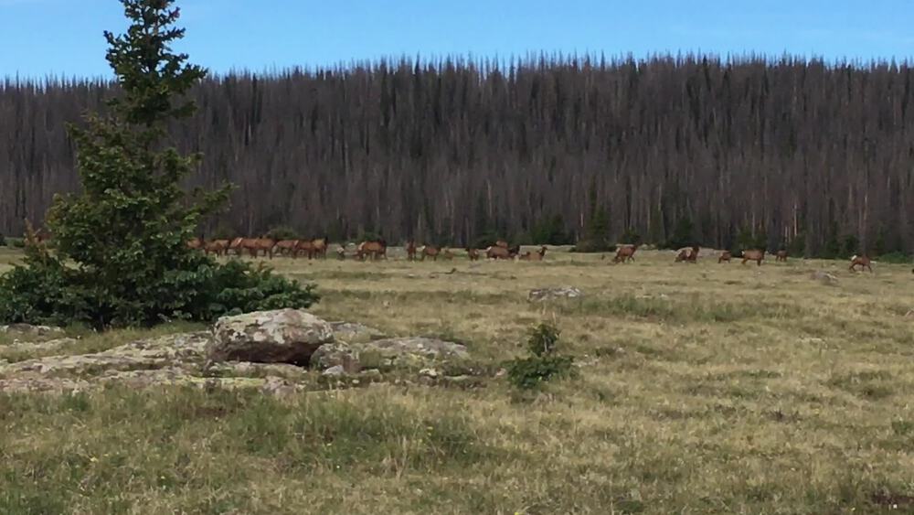
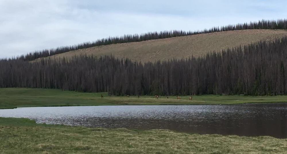
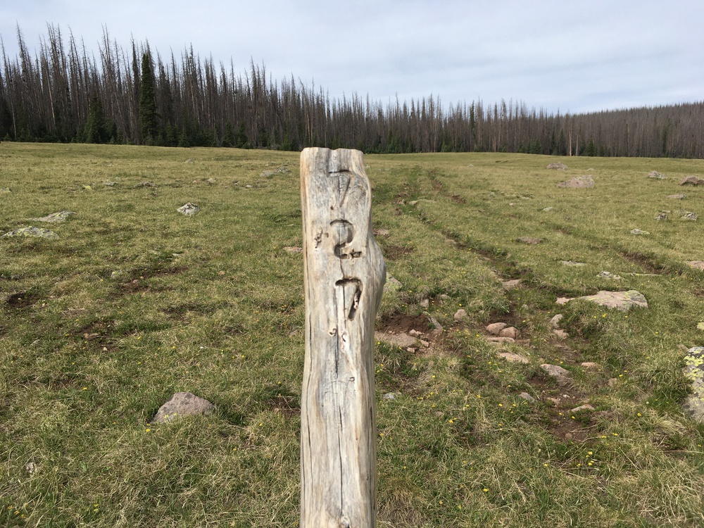
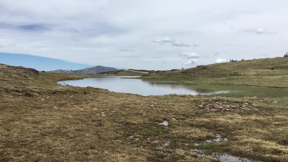
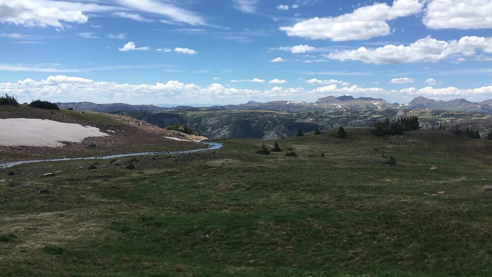
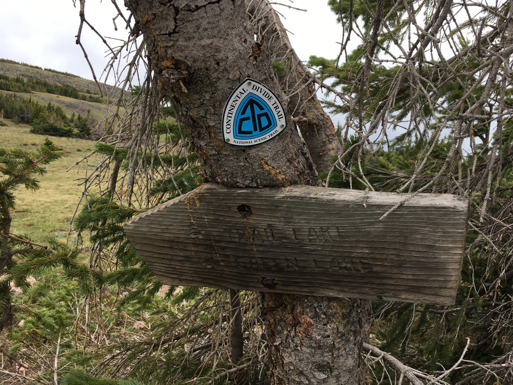
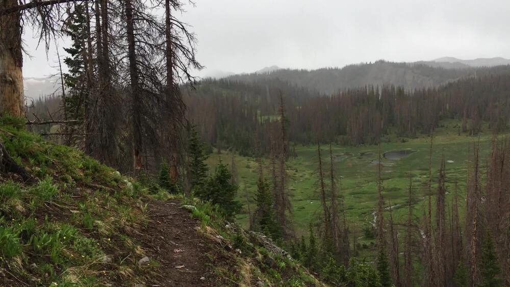
It was cold last night! I started the night in long johns, wool socks, a thermal shirt and my fleece, all inside a down sleeping bag which is rated to 32-degs. I soon added my hiking pants and a second set of socks. But my knees are still could, there are pressed against the sides of the sleeping bag, so I put on my knee braces - which really did help. But my toes remained cold - even in double socks. But then I remembered a trick from Greg Hogg. I was able to reach outside of my bivy sack, light my stove and heat water. I then poured the hot water into my water bottle and kick it down to the bottom of my sleeping bag. Still, it was a very uncomfortable night with a fitful sleep. Although when I woke in the middle of the night, I was rewarded with a sky full of the Milky Way! I was up at 5:30. The first day of summer, and my bivy sack and tarp are encrusted with a thick frost! While still laying in my sleeping bag and bivy sack, I can reach out, light the stove and make that first cup of tea. There is a film of ice on the pool next to my campsite, and four elk are have their breakfast on the far side of the meadow, while I am enjoying my coffee and oatmeal. The sun has melted the frost on my bivy sack and tarp, but they are still damp when I am packing. As I hike, trail keeps vanishing and then reappearing, especially where the grass is growing well. Is it that the spring growth is pushing up grass, yet the summer boots have yet to trod it down? Actually on this section of the trail I am not worried about losing my way. The map tells me that the trail follows a long grassy swale, a boggy meadow which will take me to Victoria Lake. The swale is edged by a forest of spruce so my directions are pretty clear. At one point a branch of the swale falls to the north, dropping into East Cañon Escondido. And this gives me my first view of Conejos Peak, and now I really know I am in the Rockies. It is a rounded peak, with cliff facing me. But at 13,172 ft., it dominates the local mountains. And then I came upon a herd of elk! Thirty to forty of these magnificent animals! Even though Elk Creeks lays only a few miles south of me, I had wondered if I knew the difference between a mule deer and an elk. These were very big and had black fur on their necks and face. So I was convinced there were elk - but where were their famous antlers? Later I learned that elk shed their racks late, in April or even May, and so are horn-less in June. Most of the elk are bigger than I am, but I still startled them and then ran off about 200 meters - of course the herd was still straddling my trail. So for the next mile as I hiked the herd rolled ahead of me. Finally, at Victoria Lake, most of them choose a much marshier route then I wanted to trod. I'm guessing that their hoofs are a bit more waterproof then my boots. Beyond the lake the grassy swale becomes really wet and boggy, and I find myself picking my way from grassy tussock to tussock - trying to keep my feet dry. This confuses me because it looks like there is a adequate grade for drainage to the center of the swale. But my feet tell me otherwise, and who knows what is just below the surface of the marshy meadow. A mile later I find a post with "727" carved in it. This is a trail intersection, and a bit of navigational reassurance. In this Wilderness area there are no blazes or trail markers. The intersections have these post, and 727 is the Valle Victoria Trail and my way to the Continental Divide. Here the tread way is pretty clear, but for much of the last mile I was inventing my own way. Now into the forest. This area has been hit with a spruce beetle blight which has killed nearly a third of the spruce. When thousands of tree, which would normally fall and decay over a century instead fall in just a few years, that leads to a tangled forrest. I don't think I can walk 100 meters without encountering a blow-down. So the going is slow. Not only do I have to either pick my way over the blowdown, or forge my way around it, but the trail disappears. And when each hiker devises a unique solution to every obstacle, the tread way on the other side don't always converge. But after years of hunting down trails I have a good nose for where a trail had ought to be. So I forge on through the woods. Still, it always feels reassuring to find a bit of recognizable tread way. I'll admit that about a kilometer into these woods I emerged into a glade with my trail clear ahead. But somehow it felt wrong. After consulting my map and GPS I convinced myself this must only be a game trail and so plunged back into the thicket, circling (as I was taught as a young scout) to the northwest, until I picked up the trail again. I was curious as to how I had lost the trail, and so back tracked towards the glade. It was curious to see the trail abruptly stop, and then to realize that there had been a landslide here. No wonder that trail had vanished. Another half mile of climbing and I broke out of the trees. The land is now open all the way to the Continental Divide trail. In the forrest and grassy swales there were no blazes or trail markers. But here, across the Alpine tundra, there are cairns every 200 meters or so. I wonder why? I guess that in the forrest there has ought to be a tread way to mark the trail, but here so much of the ground is stone and there is no tread way at all. Also, I expect, this wide open high lands may also find itself lost in a cloud. But not today. It is about two miles across this open tundra, and in the last section I am also crossing a few snow fields. At noon I cross the 12,000 foot contour line, and a few minutes later I'm on the Continental Divide Trail. This actually looks like a used trail, unlike what I've been rambling on this morning. I almost expect to see other hikers. But right now, I only need to share the ridgeline with a pair of elk just to the north. It is lunch time, so I find a spot behind a boulder and out of the wind, but with a thousand square mile of forrest and mountains spread out before me. Bagels, cheese and apricots - my usual trail lunch. I am tired and enjoy this break. It has only been about seven miles this morning, but all of that was in thin air, over 11,000 feet, caring a load, dealing with a tangled forrest, skipping from tussock to tussock as well as losing and finding trails. So I am happy to just sit in the sun for a few minutes. And the high country is exactly where I want to be! Today I am only on the Continental Divide Trail (CTD) for a few miles, but it is a heady experience, so high and so open. The ground itself is a sea of broken stone embedded in hearty grasses. I am sure in a few weeks this will be a carpet of alpine flowers, but this is still very early season. I cross a few snow fields, and then, early in the afternoon I stop for nearly an hours to lay in the sun and soak up the air. Across a small tarn I see a lone elk, who looks at me, and then snorts. I didn't know elk could snort! This is about a far as I will be from a trailhead, and so if there is any question about will I be able to make this hike, the question is now moot. I peel off my boots and let my feet dry - mountain tops are amazingly boggy. All those old John Denver tunes about life in the mountains play in my head. This is Good! This is why I made this trek! Eventually, however, it is time to tie on the footgear, shoulder the pack and head down the trail. In the back of my head I am thinking that last night, at 11,600 feet I was cold. I'm now at 12,200 and it will be even colder and more exposed here. My plan is to loose some elevation and find a sheltered spot in the forrest tonight. I leave the CDT on the Canyon Verde Trail, heading towards Green Lake. As I descend all of a sudden I can peer into a bowl in the forest, a meadow maybe a half a kilometer across and teaming with perhaps 60 elk! Even though I am a quarter of a mile away and barred by a cliff face, when they became aware of me, they all drifted off into the forrest. Green Lake is splendid! Its waters are a sage green and look very cold. If the days were warm I would be tempted to camp near here ("no camping within 300 feet"), but I really would like to drop some elevation. Five o'clock is early for stopping. But I now have time a miles to spare. Spanish Rice and tea for dinner. As I was crawling into my bivy sack and under my tarp, a few rain drops fell. But at 9:00, as I am writing in my journal, they have not developed into anything. Good Night! Wednesday, June 22nd, 2022
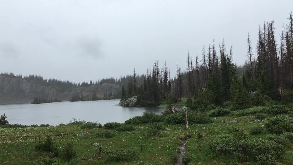
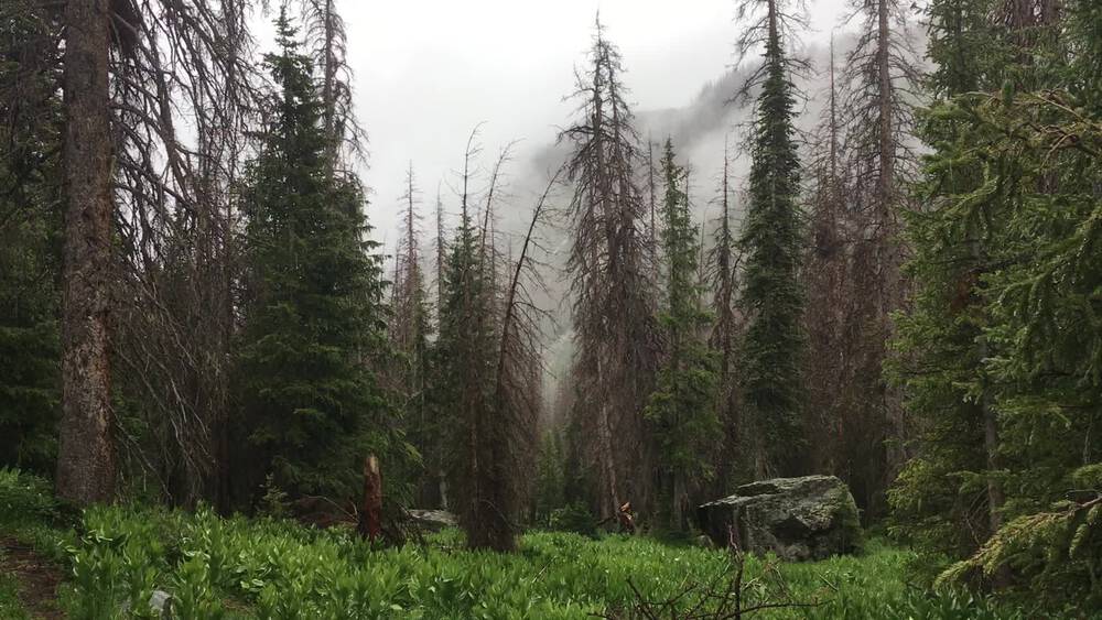
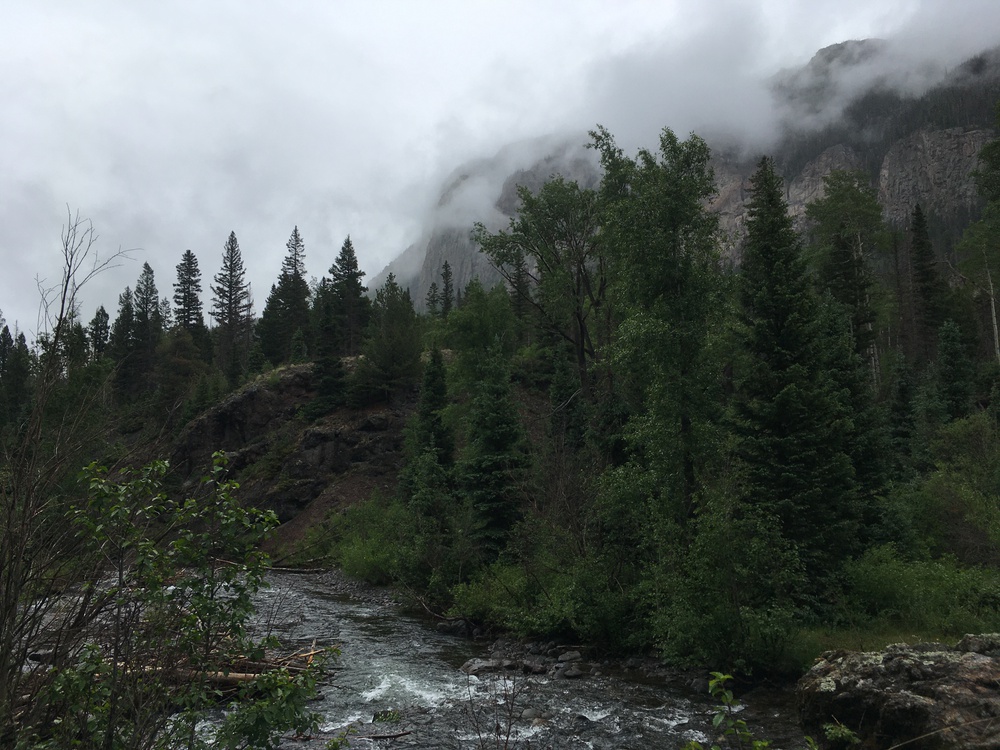
It was cold again last night, again my tarp and bivy were frosted in the morning. But it didn't feel as bitter cold as the pervious night - which makes me wonder how cold it was then. I woke at first light, but lingered in the sack for a little while. Eventually I rolled out, retrieved my bear bag and cooked breakfast - and laid out the plans for the day. My original plan had me following the Cañon Verde trail downstream to the South Fork Conejos trail and out, about eight or nine miles between today and tomorrow. Plan B was to go down to the South Fork Conejos trail, but then go upstream and climb Conejos itself. But that would mean camping tonight a thousand feet higher in elevation than I am now, and I just didn't want to face that. So a new plan, Plan C. I would go back pass Green Lake to the Continental Divide Trail, north to Blue Lake, and then down the South Fork Conejos trail, but from its head waters. That would mean a little over twenty miles over the next two days, I would get to be up in the high country today, but camp even lower tonight. So this looked like a good plan. Also I am feeling really good this morning. Yesterday, at the end of the hike, my back was getting achy, even sitting over dinner last night was hard. But this morning I feel great! So I head back to Green Lake. In an hour I have walked two miles, climbed a thousand feet and am back on the Continental Divide Trail. It is beautiful up here! But in a way very different than yesterday. Whereas yesterday was sunshine and smiles, this morning is overcast dark and brooding. The mountains are more magnificat, but less inviting. Whereas the background are these big, jagged rocky peaks, the foreground, the alpine tundra is tuffs of grass, rocks, pools, ponds and bog. Why is it that these highlands are so boggy? This past spring, in the upper valley, we had a very hard "mud season". This is because dirt road are froze solid a few inches below the surface, so surface water can not seep down into it. Is this what is happening in these chilled highlands? Or is it just that bedrock is only a few inches down? Back on the CDT, a pair of elk ambled across the the grasslands and sauntered upland over the ridgeline. I don't think the elevation has had much effect upon me until I see how easy they make it all look. Cairns mark my way across this open country, dot to dot I follow the line. The clouds are thickening and the wind is coming up. I think I'll make Blue Lake at about noon and the idea of pulling out my stove and making hot tea is inviting. And now it has started to rain; the lightest of rains, a mere mist! But that rain became heavier and heavier! As I approach Blue Lake the trail winds down below the tree line and I also find myself crossing a few snowfield. By the time I actually reach the lake it is pouring and sitting by its shore has little appeal. I decide to not stop, and so keep walking. I'll confess that I got off on the wrong trail here for about ten minutes. I later realized that this side trail was not on my map because it soon dead-ended in a meadow/hollow which was probably a delightful camp site on a sunny day at the end of July. This mislead was well worn because it connected this campsite with the lake shore. A few hundred meter on the right trail I came upon a set of footprints which explained everything to me. First there were horse shoe prints, but mixed with them was a set of petite house prints, half size, which I then realized were mule prints. They are headed north on the Rito Azul trail, which leads to the nearest trail head at Three Forks. Before I started my hike I had passes a number of outfitters with corals. Of course if you wanted to spend a few day fishing at Blue Lake, and you wanted a bit of luxury, you could hirer an outfitter to get you here, with mules to carry the load for "glamping". But I am not going north. My trail leads east, down the South Fork Conejos Trail. At this point I found a thick tangle of fir trees, so tightly meshed that the bed of needles underneath is still dry, despite the last few hours of rain. I crawled into the haven, pulled out my stove, and brewed the long promised cup of tea. Bagel and cheese for lunch, and although it is not too wet, I don't feel like lingering too long. The next two and a half miles are some of the hardest I've passes in a long time. There are so many dead trees and so many blow-downs that I can hardly go thirty meters with out meeting another obstacle. And every blow-down means climbing over a tangle, or going around it to the right, or around it to the left. And then try to find the trail again. Often I don't find the trail. But I know that the river had ought to be a fifty to a hundred meters to my right and so I look through the forest and reason where one should put a trail and head off in that direction. And then all of sudden I know I am on the trail again and I am happy for a minute until the next tangle bars me. The policy in these wilderness areas is to do the minimal amount of trail maintenance and improvement. But this leads to a lot of alternative trails around blow-downs and bogs, what the ADK trail crew chief called "Alluvial Trails". Which of course leaves me with this question about the environmental impact of less engineered trails vs. alluvial networks. All this bushwhacking in the rain also means I am soaked. And the idea of another cold night of camping in the high country - unless the sun comes out - is less and less appealing. Occasionally the trail winds close to the river, which has grown substantial from where I crossed it a few miles back on two stepping stones. Now it is a torrent of white water that would be very difficult to cross. Just before I get the the Cañon Rincon trail junction I meet two women, the first people I've seen in two days. They have big packs, rain suits, rain covers and fishing gear, and I have no doubt they are heading to Blue Lake and will survive the weather. They ask about the river crosses and I assured that it would not be a problem. But I could see the ragging steam below us and understood they question. I warn them about the blow-down, and they assure me that they have already dealt with that problem. But knowing what I know while writing this, they have only seen 10% of the mess they will have to deal with. Shortly after that I meet a group of five young men. They have just graduated from High School in Austin, Texas and this backpacking trip is they last fling before going off in various directions. When I mentioned the frost of the last two nights some of them looked a bit startled. But with five teenage bodies in a tent I am sure they will be warm. The canyon is increasingly flanked with cliffs, but of a crumbing of rocks. In one place a shale and in another place a conglomerate of sand, mud and cobbles. But the trail itself is becoming much easier with every mile as I seem to have left the worst of the blow-downs behind me. The treadway is clear and the grade is genteelly downhill. There is a meadow where the Cañon Verde trail joins us and I had thought of camping here. If I had just gone downstream from last night's camp it would have been three miles instead of nearly a dozen miles, but I do wonder what the river crossing would have been like? It is raining again, and so I decide to continue for a few more miles. With every mile the canyon is getting broader and the trail easier and faster. Finally, I realize that I am only three miles from the trail head and so I decide I am going to walk out now and sleep in my car tonight. I reach the trailhead just as the sun is disappearing behind the mountains - and finally it stops raining. My car is a little over four miles south of here at another trailhead. But walking a dirt road in the twilight is easy. So I sit down for awhile to cook my dinner and savor the miles. And then one more walk under a sky of diamonds and bed. Down here at 8,000 ft the temperature drops only in the low 40's. |