|
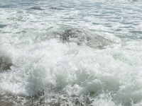
Pitch, Roll and Yaw Crossing |
I should have realized what was coming when I looked out across the
sheltered harbor and saw 20 meter tall spouts as Atlantic rollers crashed
on the breakwater. Once the ferry cleared the harbor and headed into
open waters we were in the midst of swells the length of our boat and
2-3 meters high. The ferry pitched and rolled and the crew searched for
the car owner who had not set his parking brake.
Within a few minutes the mainland had vanished and the ferry's
great engine ground on, pushing us further out to sea, further out
into that pea-soup fog. Why pea-soup? It maybe thick but it is not
green. Why not an old grey chowder?
My wife and I sat on the open deck in front of the bridged
and watched the horizon pitch back and forth, and back and forth.
I expected to be seasick, but wasn't. The world, the ocean, was
too captivating, too dynamic to leave time to think about my stomach.
However a great many of the passengers were not so possessed by
this excitement. The ferry pitched back as we rose up the
waves, then forward as we skidded down the other side. We are crossing
waves on a diagonal so we not only pitch, but roll, and at the
moment when we sit on the crest of the wave I can feel the whole ship
yaw, twisting around the smoke stack.
Nearly an hour later, Sandy Point, the northern most cape of
Block Island appeared off our starboard. Then the bluffs and Ball's
Point, Clay Head and finally the breakwaters of the Old Harbor. Terra Firma.
The Old Harbor
After an hour on an aqueous roller coaster, we disembarked at the
old harbor into a downpour and the village which surrounds this haven.
We couldn't hear the call of the beaches through the drizzle, and so
wandered about the village for awhile, locating coffee shops,
lunch cafes and restaurants for later reference.
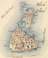
Map of Block Island - 1899
|
This village has many of the places you expect in a New England
seaside town; toffees and tee-shirts shops, ice cream emporiums and art
galleries, but the thing which strikes you as unique are the old Victorian
grand hotels. These grand old ladies, with rows of windows on their
clapboard face above the wide verandas and below the mansard roofs,
are from another age. Block Island is resplendent with them.
The Spring House, The Atlantic, The National and a half dozen more.
It is not very hard to imagine President Ulysses S. Grant strolling
along their promenades. The cigars may have vanished but the wicker
and rocking chairs are still there. Inside are parlors with views
of the ocean, grand dining rooms and dark wood paneled bars.
Our first restaurant, however, is a small place tucked away on a
side street behind the National Hotel. Eli's is very busy
on this chilly and rainy night, so after leaving our name on
their waiting list we tour the grand hotels, sampling various
appetizers. Finally, back at Eli's, we are tempted by the
Cioppino, a fishermen's stew which is zesty and reminded us not
at all of the fog in our crossing. But the swordfish and the
lamb sausage are also hard to ignore, and one must save room for
dessert. Because of our pre-dinner grazing around town we end up
packing precious leftovers home with us.
The rain is falling in curtains as we walk home that evening. Curious
the words we might use to describe the rain, "sheets" or "curtains"
are provocative of the waves of water we see. But here the "waves" are
stretched, drawn up into a the dark brooding sky.
Sandy Point, North Light and Bicyles
The morning dawned grey, but not raining. Still, it felt like at any
moment the clouds might change their minds. We walked into town
to find a latte and newspaper.
Off of the beach was a large rock covered with a dozen cormorants,
huddled in the spray and mist. I remembered that some type of
birds have special names for their flocks. For
instance a gathering of eagles is called a "convocation". We also
speak of "a murder of crows" and "a parliament of owls". My
suggestions for a gathering of cormorant is "a commiseration".
They looked like old men in long black coats, huddled together
in the rain in some type of communal misery, participating in a
communal "commiseration".
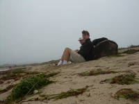
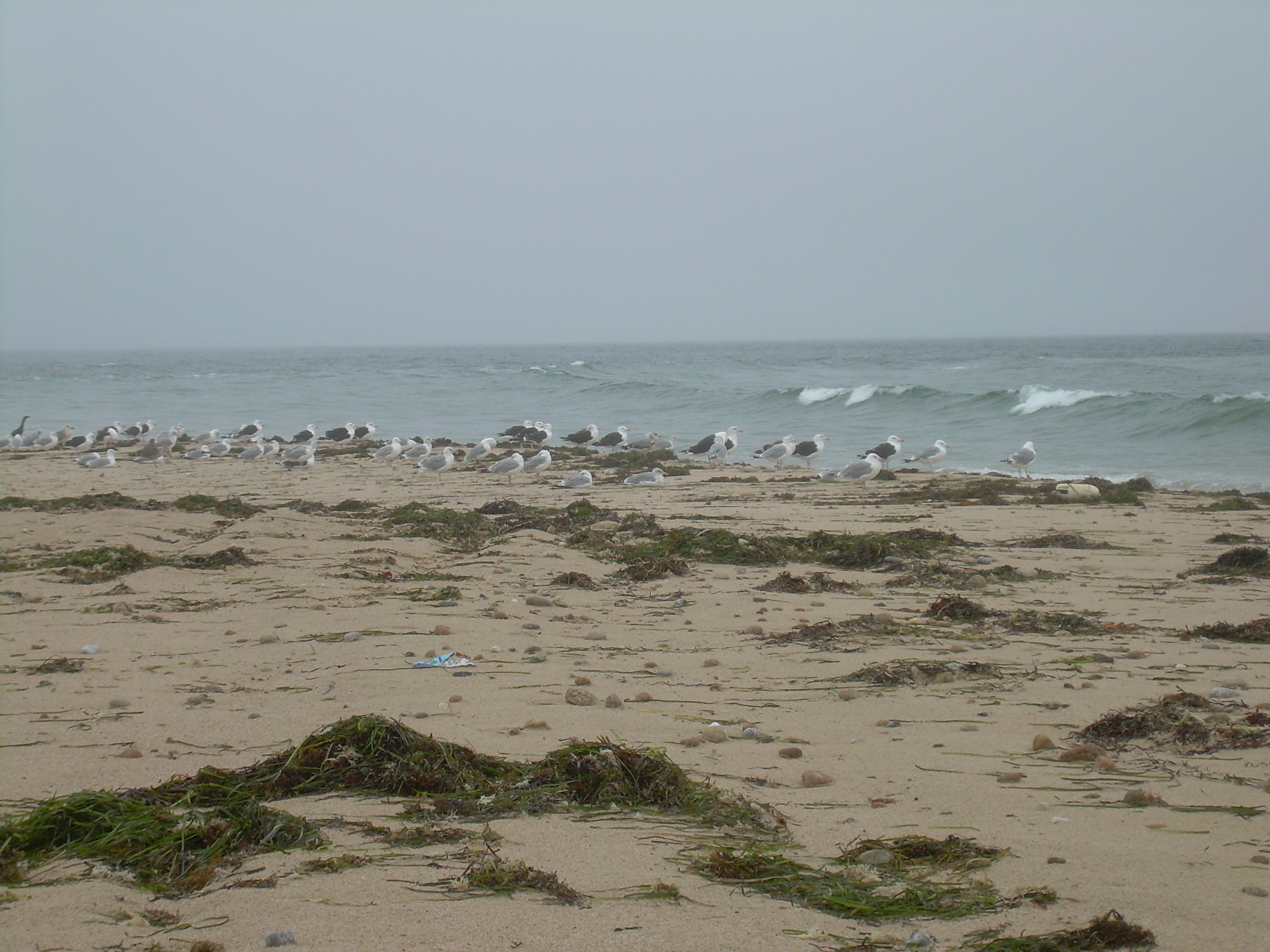
Lunch on Sandy Point
|
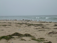
Gulls on Sandy Point
|
After finishing our eye-openers we packed our bikes with rain
coats and leftovers from last night and headed north.
One of the delights of Block Island is that it is well suited
to bicycles. Leave your car and worries on the mainland and step
onto the ferry without that baggage. In fact booking a crossing
for a car requires a great deal of planning ahead, but there is
always room for a few more bikes. You can even rent bikes
and mopeds just as you disembark at the old harbor.
The island is three miles wide at the
southern shore and stretches six miles north to Sandy Point.
In the middle of the island is the Great Salt Pond, nearly a mile
across. Since we are staying near the Salt Pond, everywhere
is within a twenty-minute bike ride.
The road north, Corn Neck, is twisting and flanked with stone
walls. But most drivers understand that they are out numbered
by cyclist and so drive accordingly. The road runs up the spine
of the north end of the island, with a number of dirt lanes,
tributaries, branch off to houses, ponds and bluffs. There is
a slight grade up Lot Hill and then we coast downhill past
Chaqum Pond and Settlers' Rock to the end of the road.
The sky is still grey and foreboding as we walk out Sandy Point.
But a grey day is a day when you can own the whole beach and
have it to yourself.
We tuck ourselves up against a bit of log which has drifted ashore
and have our lunch. The log has clearly come from the mainland,
it is much thicker then any tree on this island. For lunch
we have bread with garlic paste, salad, swordfish and lemon cheesecake.
The advantages of having not finished dinner last night.
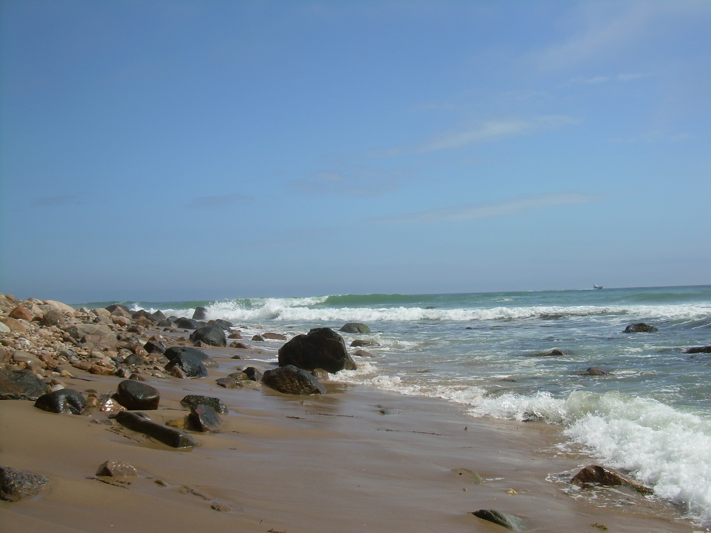
The surf is still rough and I enjoy listening to the pebbles
tumbling over the cobbles on the beach. They remind me of popcorn,
when dozens of kernels all pop at once, but a bit muffled by the water.
Or perhaps like fireworks, not the initial boom, but when the long
dandelion arms reach out and pop in a spray of magnesium white.
Fireworks at a distance.
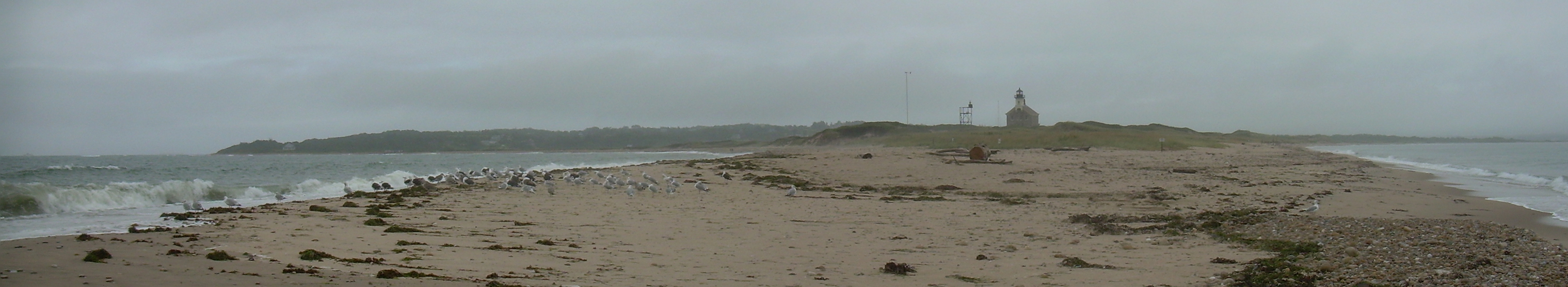
There is a classic stone lighthouse on this cape which dates from
1867, and beyond that the Block Island Sound on the west and the Atlantic
Ocean on the east merge over Block Island Reef. The last sandy spit is
covered with gulls. The Great Black Backs are a bit up wind, the Herring
Gulls downwind, and the Cormorants, in their commiseration, shunned
and relegated to the last few wet meters of sand. If the Gulls
are the "jets", the cormorants are the "sharks". If the cormorants
gather in commiseration, what do the gulls gather in? They are not
gangs or mobs because they really are without malice. Maybe they
gather in parties? But they are so clueless, sheep-like. Perhaps
flock is the right term for them.
Sandy Point and the North Lighthouse
Clay Head and Conservation Land
Our time on Block Island fell into a pattern. Everyday exploring
a bit, and returning to beaches, restaurants and walking paths
which we enjoyed. And as the days continued the weather cleared
and our circle of exploration grew.

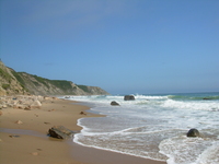
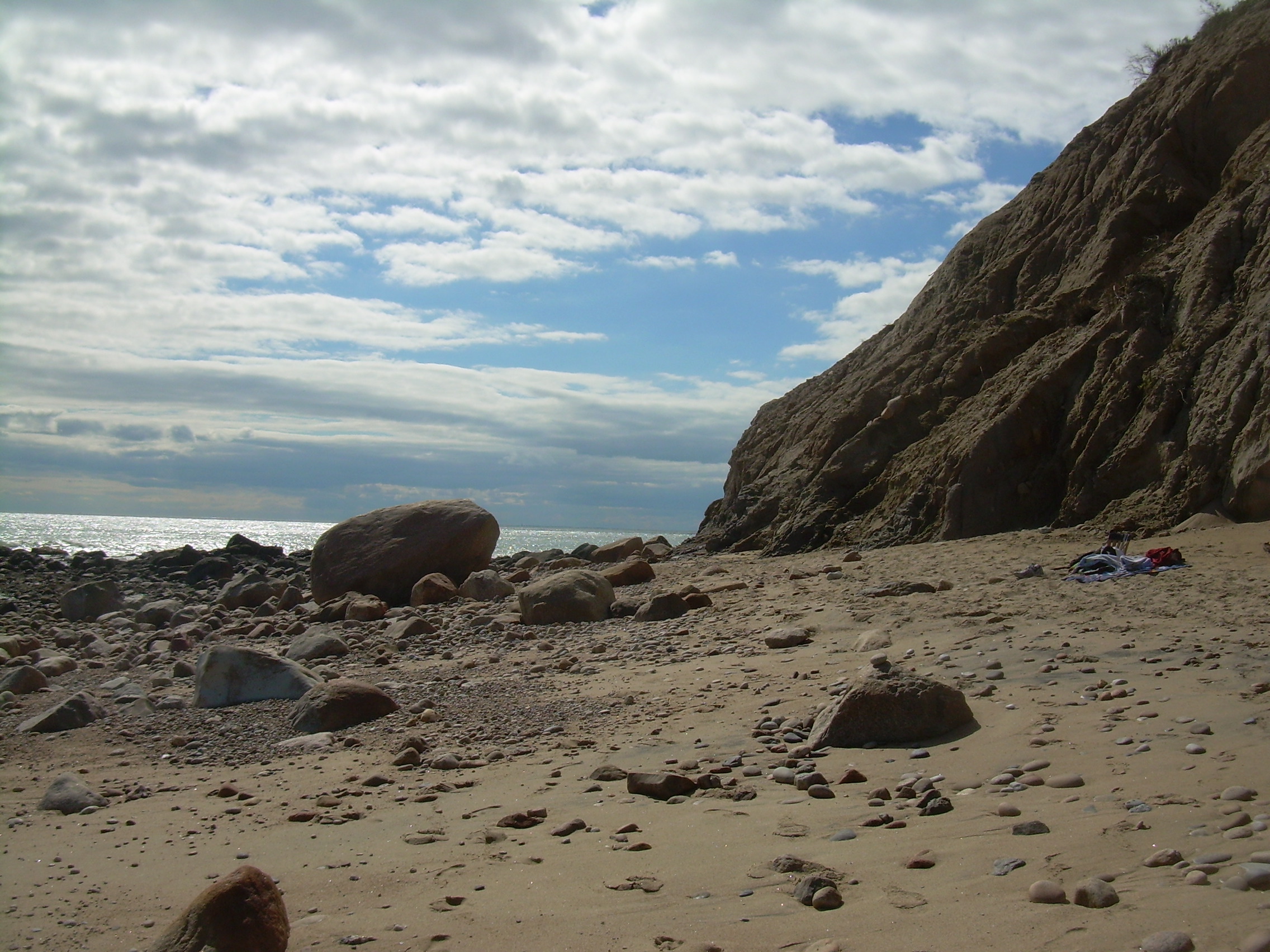
Beach below the bluffs
|

Clay Head & Ball's Point
|
Just south of Sandy Point is Clay Head. This land is owned by the
Nature Conservancy. Over forty percent of this island is protected
land. Some of that through the Nature Conservancy, some through the
Block Island Land Trust, conservation easements, and a few parcels
through a local organization, the Block Island Conservancy. This
means the island is a patchwork of undeveloped land and every lane seems
to end in a parking lot and trail head, most of these equipped with bike
racks.
At Clay Head we left our bikes and walked on a trail which started arched
over and thick with trees , but then broke out of the foliage at
Clay Head Swamp. This wetland is on the Eastern Flyway, and so it
is a birder's paradise during the migration seasons. Beyond that the
trails break out of the woods on top of the bluffs. You can stand
here and see northeast into Naragansett Bay and the bridges by
Newport. To the southwest, there is nothing between you and Africa
except the wide sea with fishing, lobster and crab boats working
their nets and pots. The trail trips along the top of the bluffs to the
north, past "The Maze" and over a mile later back to Settler's Rock and
Sandy Point.
A side trail drops into a ravine and a jungle of reeds and then spews
you out onto a remote cobble and sand beach.
At the other end of the island is Rodman's Hollow, protected by the
Block Island Conservancy. On another outing we collected
sandwiches from the "Sister's Cafe" and headed south. Bikes
are allowed on the old "Black Rock Road",
but loose sand can make the pedaling tricky. Down past the hollows
and open meadows with lively bird life, bayberrys and shadbush.
Past Plover Hill, eventually the old lane brings you out onto a bluff
and beach by Black Rock Point.
We sat in the sun, surrounded by our lunch, beach towels and our pile
of books. A pleasant afternoon caught between mesmerizing waves and
leisurely words.
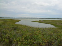
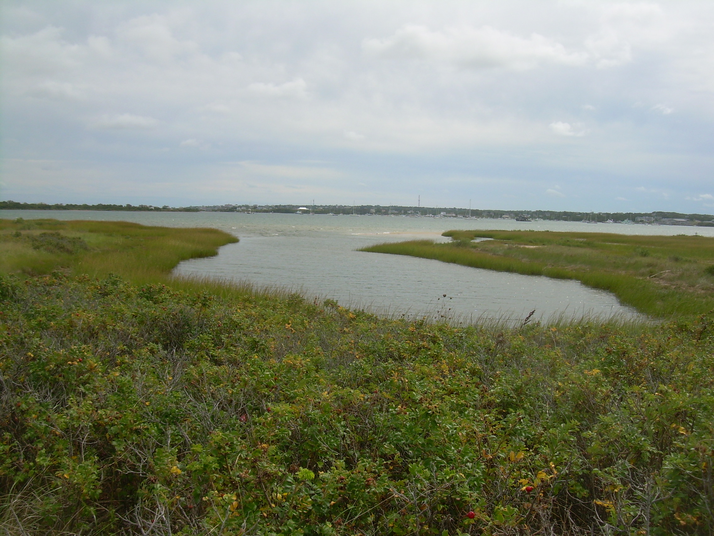
West Beach
One clear morning I cycled out West Beach Road to explore the sandy
spit of land between the Great Salt Pond and the open waters of
Block Island Sound. The road ends at West Beach which is well off
the beaten path and barely used. There is a side lane which parallels
the beach for eighty meters. A few trucks and an SUV are
parked here, and just below on the sand a few guys are fishing in the
surf. I stashed my bike in the tangled undergrowth and walked out the
lane past the trucks. This lane use to run the length of this spit of
sand but the beach has been eroded over time and the lane abruptly ends with
a two meter drop from the dunes to the beach.
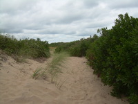
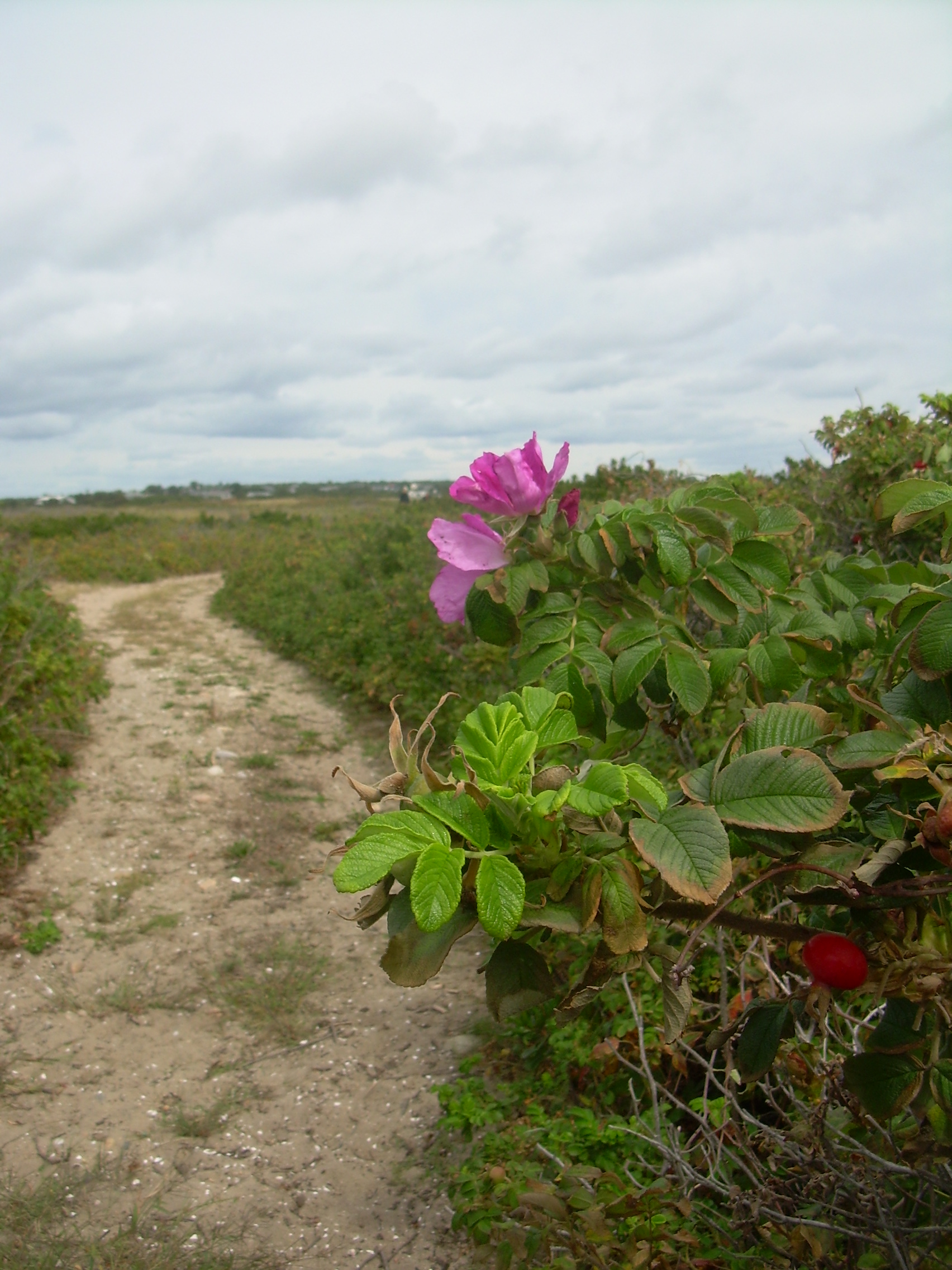
Sandy cart track
|
The 1889 Channel
| 
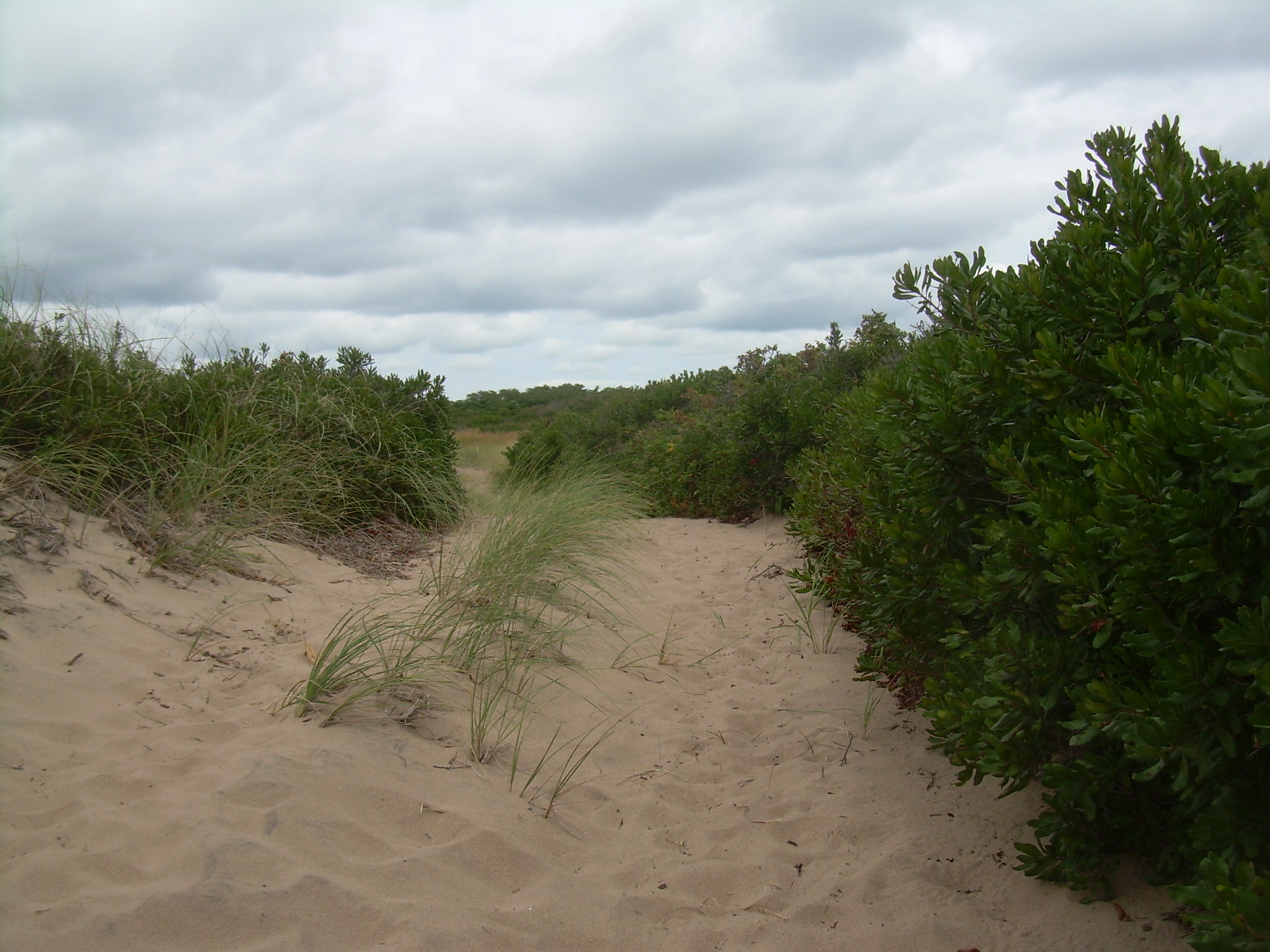
Beach Plumes (Prunus maritima)
| 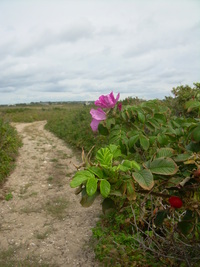
Beach Plumes and Sandy Lane
|
Fifty meters later the lane reappears and runs inland a few dozen meters.
Where I climb off of the beach to follow the lane you can see that the
spit is build of cobble stone mortared together with sand. This part
of the lane sees only occasional foot traffic.
Walking here I step back a century
into the world of an old Joseph Lincoln novel, wandering down the duel ruts of
a cart track on a remote sandy coast. The path is lined with cape grass
and beach plums. Occasionally there is some poison ivy intertwined among
the roots of the beach plums.
It is a slow walk in the loose sand, like wading through a foot of new
powdered snow or the way one runs in a dream when speed is important.
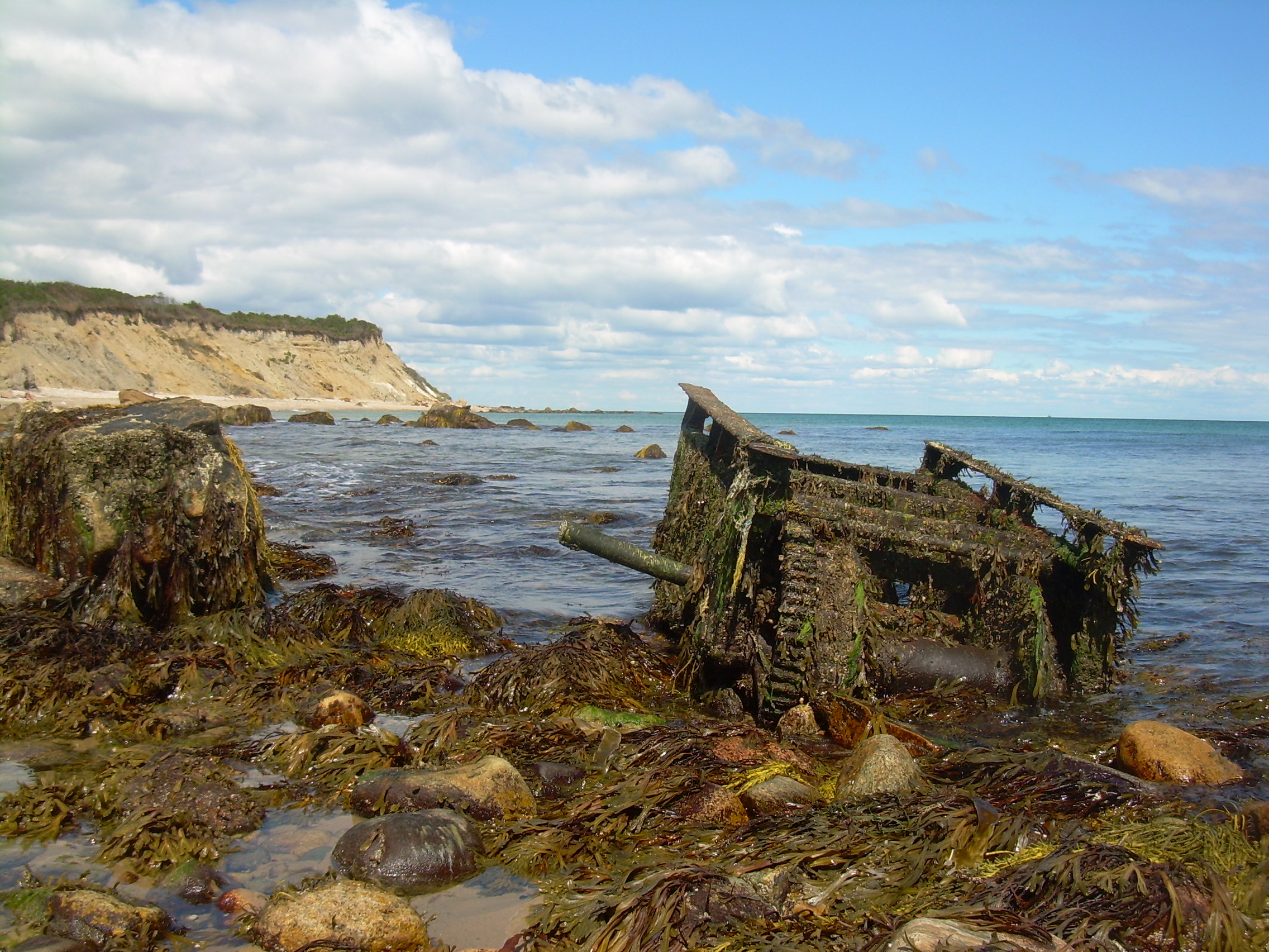
There is a trimaran washed up into the marshland on the pond side of
the spit. What sort of event would cause the owner to not seek after a
boat which lost its mooring in a storm, but didn't drift for more then
half a mile? By the state of the boats paint I think it must have sat
here grounded for a half dozen years.
The marsh is populated with snowy egrets, tall thin birds wading
in the brine and fishing.
In the middle of the spit is the remains of the 1889 channel which was
dug across the neck. Before that the Salt
Pond was cut off from the sea. The cut is distinct on the pond side,
but there is almost no signs of it on the ocean side, the cobbled beach is
seamless and shows no scab or scare, except for three post marching
into the waves. Yet I find it hard to imagine that those post have stood
there for 130 years, but they do line up perfectly with the cut on the
pond side.
At the end of the spit the land rises up a meter and there are a few
acres of trees. This copse is gated and marked with a sign telling us that
it is a National Wildlife Refuge - No Trespassing. I like to think
that I know how to not disturbed wildlife, but recognizing that if I
was to step across that gate other would be embolden to do the same.
So I turn aside and walk down to the beach instead.
I sit on the beach for awhile with my thermos of tea and watch boats
going in and out of the new channel (cut in 1895), and then start to
wandering back down the sandy lane.
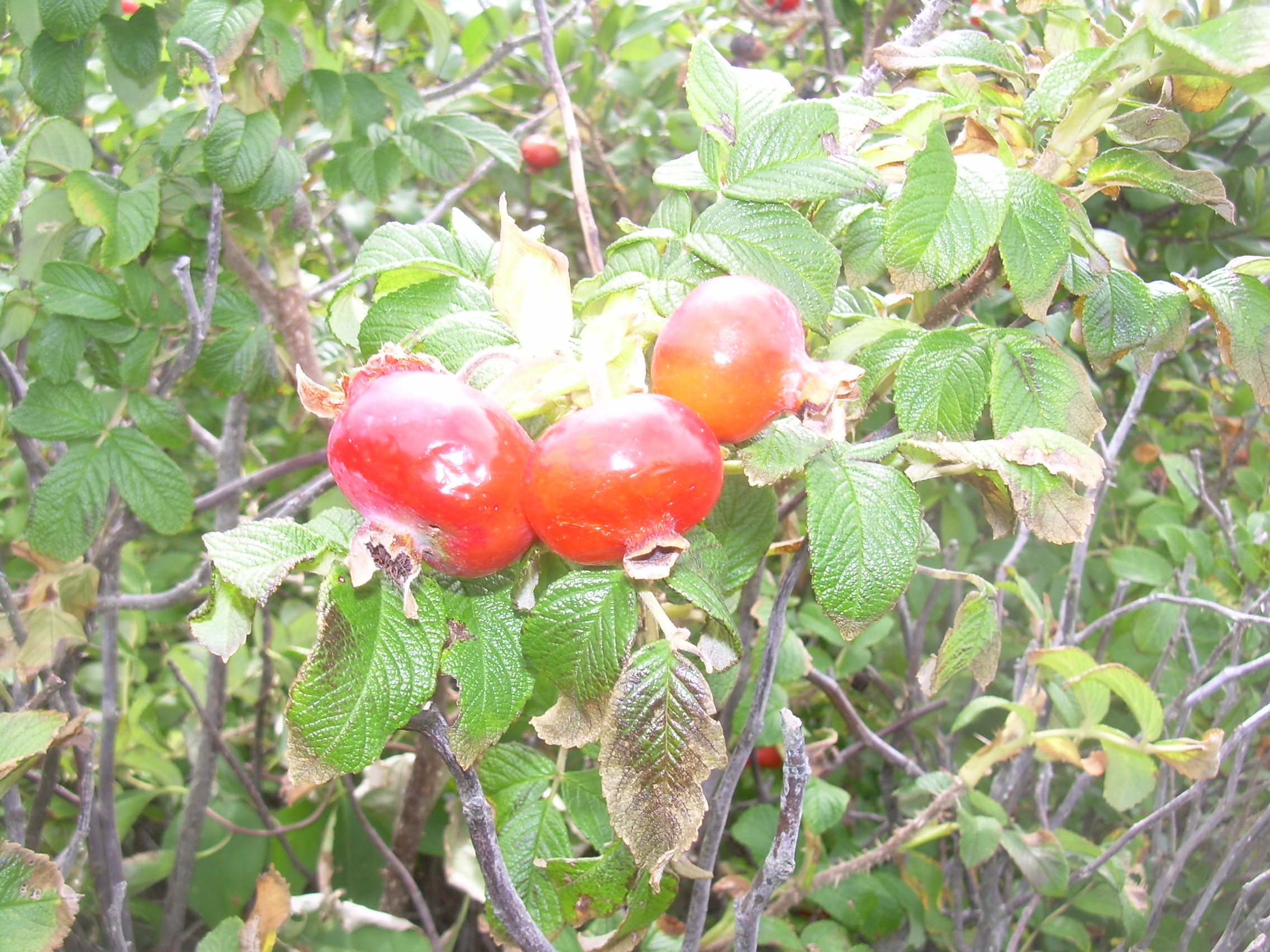
The lane is crowded with Beach Plumes (Prunus maritima)
and if you crouch down so you
are out of the sea-breeze the air is thick with their sweet smell. Why
is it that I have never eaten a Beach Plum? I am certain that they are
not poisonous since Beach Plum jams and jellies are a staple of these
summer towns. So I venture a tentative nibble and am immediately enlightened.
Despite the similarity of taste, it is not the eating fruit that one
expects from a plum. It doesn't have a center stone pit. Instead it
is filled with dozens of small seeds, the size of grape seeds. The flavor
is strong, and one bite later I understand why it is usually cooked
and pressed into a preserve. I suck the juices out and spit out the
seeds, satisfied with my experiment.
The walk back is slow, in part due to the deep loose sand, and in
part because I am in no rush to rejoin the twenty-first century.
East Coast Beaches
Much as you might enjoy the biking, the food and the walks, the reasons
to come to Block Island are the beaches. In September these are
quiet beaches, crisp and clean sand. They may be waiting for the winter,
but there are still days were they dazzle with sunlight. We take our
backrest chairs strapped onto the bike rack, lunch, piles of books
and a thermos of tea and head off to the east coast of the island.
On the map there appears to be a number of beaches here, Crescent Beach,
Scotch Beach, Mansion Beach, but in truth it is one long beach stretching
from the Old Harbor to Clay Head. If there is a division it is only in
recognition of the access points. In truth Crescent Beach is the whole
arching sand and not just the south half which is accessible through
the town's beach pavilion.
A beach which stretches over two miles from end to end has space for
all taste. The town beach is for everyone. It is the
place with a pavilion, shower house and life guards. By mid September
it is not as busy as high season, but there are still a number of families
camped out here, with kids crashing into the surf, and the ocean returning
the compliment.
Scotch Beach is a transition. Easily accessible from a parking lot on the
main road. This is the beach of the daily dog walkers.
And then there is Mansion Beach. It was a long bumpy dirt road on our
bikes to get here. We left our bikes near the ruins of the old mansion
and walked out onto the sand. We naturally gravitated to the north end of
the beach, where we are sheltered from the wind by the start of the bluffs.
Today the sun is dancing on the waves and I am tempted in to
swim. This close to the bluff there are a lot of cobbles on the sea floor
below the waves, so I work my way south to
sandier stretches. The water is still
warm and it is a pleasure bobbing up and down on the waves for awhile.
Back on shore we lunch on rolls and cheese and smoked blue fish.
We sip our tea and read novels and stare out into the open waters and
watch fishing boats, as well as lobster-men and crabbers pulling pots.
After awhile I grab my binoculars and wander north along the base of the
bluffs. I met a man covered with tattoos. His wife had a few designs on her
arms too, but most interesting to me was their dog,
a collie, which was buried in
sand. They told me that the flies were bothering it, and it was perfectly
happy to lie in the sand buried except its face.
I met the three of them that evening walking by the Salt Pond and they
were excited to show me how their dog's fur shined, "polished by the sand."
Past Jerry's Point and Roile's Harbor to Ball's Point. I think somebody
has put a name on every bump, hollow, point and cove, no matter how
shallow, on this island. And then back to our picnic place.
The day is starting to wane, and the shadows from the bluff are marching
across the sands and when they reach us we pack up and head home.
Mohegan Bluff
One day we decided to explore the south coast of the island.
We cycled out to where Old Town Rd. meets Center Rd. This cross roads
use to be the business and culture center of the town. The
building of the "Old Harbor" breakwaters in 1870 and the "New Harbor"
in the 1890's - and the establishment of the Grand Hotels shifted
the town's center. The Spring House (1853) predates the old harbor
break water, but is next to the Old Harbor Landing. The Atlantic (1879)
and The National (1888) surround the old harbor. Over on the new
harbor is the Narragansett Inn (1909). And back at the
Center and Old Town cross roads - almost nothing. A few nice old
houses - but hardly a trace of a town center.
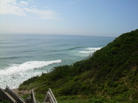
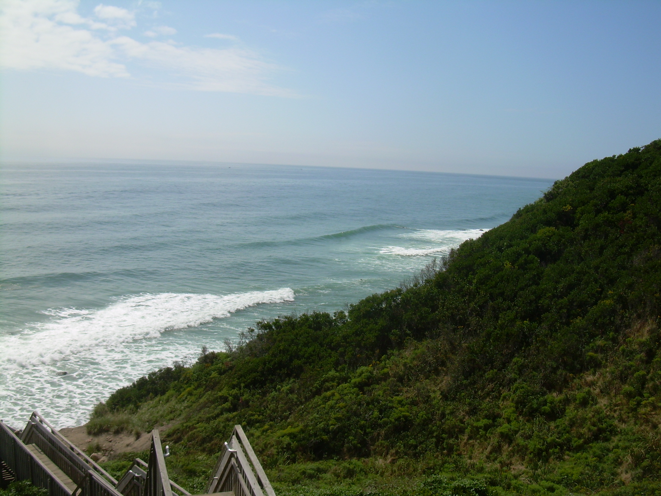
Stairs to the Beach
|
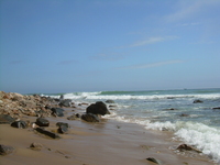
Beach below Mohegan Bluff
| 
Shower of aqueous
gems and light
| 
Mohegan Bluff
|
We continued south on Central past the airport and the old Indian
Cemetery, Fresh Pond and Seneca Swamp and finally up onto the Mohegan
Trail. The Mohegan Trail is a road that runs along the top of the
Mohegan Bluff. In 1590 a band of about 40 Mohegan Indians set out from
Montauk, about 15-20 miles west-southwest of here, to attack Block Island,
or "Manisses", the "island of the little god". The natives at that
time were the "Manises", which are a branch of the Narragansett tribe.
The Manises repelled the Mohegan, throwing some of them from
the top of this bluff. It is about 160 feet down, most of that is a
soft crumbling sandstone. We parked our bikes (the island is well equipped with
bike racks), and climbed down the steps to the beach.
A woman on the steps told us that it was the most perfect beach. I will
grant her that it is very nice and pristine. But "perfect" is a tough
standard. Two dozen people were clustered near the foot of the
stairs, so we walked a hundred meters west, down to
Sheffield's cove, where we were all alone. My wife sat with her toes in the
sand and surf while I walked on another half mile down to Fishing Rocks and
watched a few surfers riding the waves - much much diminished since
we first arrived on the island.
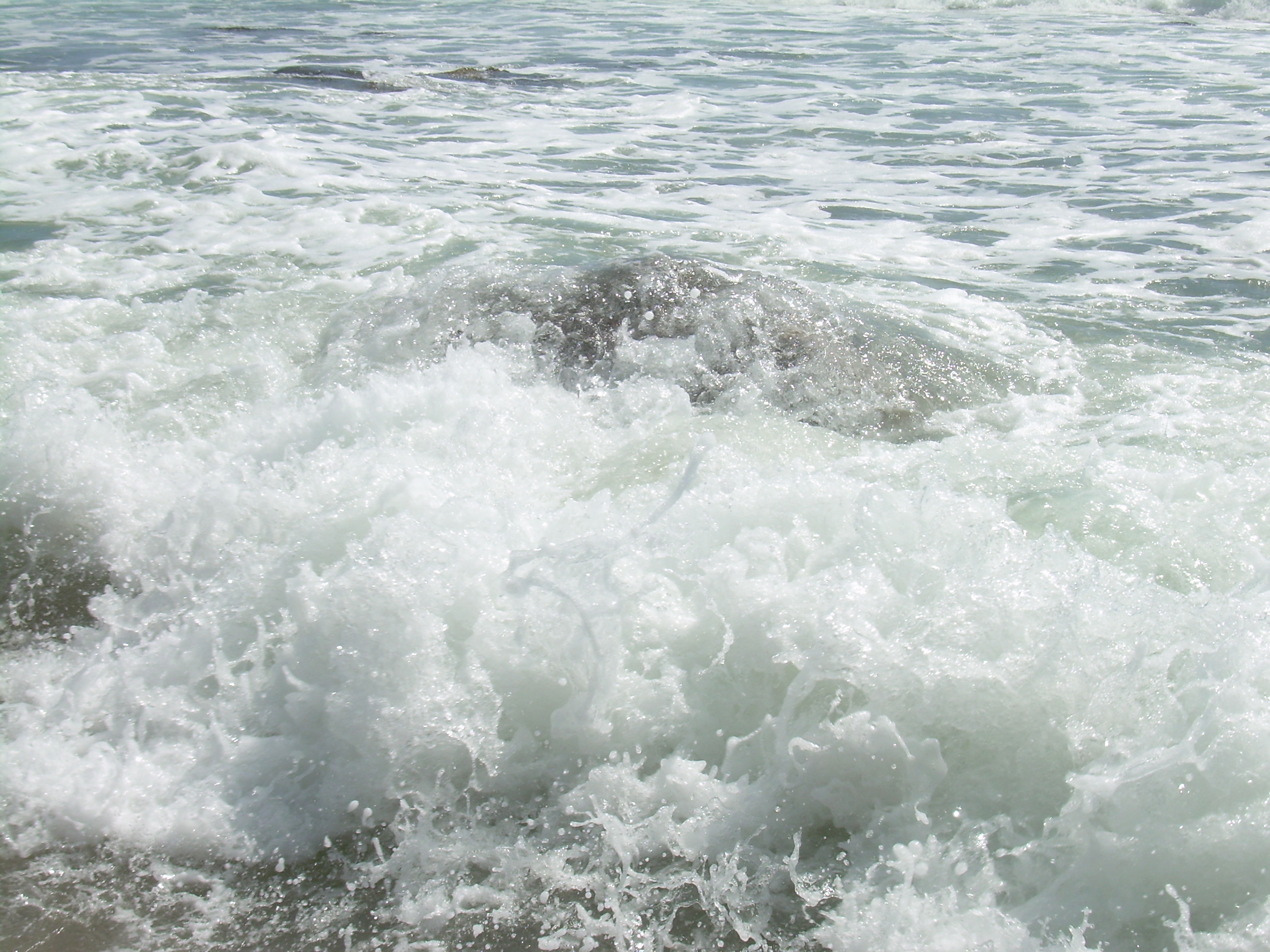
On this day the sun was bright and radiant. When the waves crashed on
the rocks and were shattered the shards of waters looked like an arm
full of diamonds broadcast into the sea! And then again and again,
a brilliant shower of aqueous gems and light.
After soaking up some sunshine we climbed the stairs past a tangle
of beach plums, cycled to the old Southeast
Lighthouse and then back into town.
This is a beach we returned to several
times, and each time it presented a different face.
One gray day we had the whole beach to ourselves. We sat in our rain
coats, wrapped in our beach towels. A warm mist, and then a light rain
drifted off the sea. Still we enjoyed reading, carrot cake and tea. I
commented to my wife, "Tea, cake and stylish hats. We are quite the
sophisticated couple!"
On another evening we couldn't get down the steps at first because they
were filled with a wedding party and we had no desire to try and slip
by the best man as he toasted the young couple. We sat on the top steps
and listed to the toast from the bridesmaid too and then watched the champagne
propagate up the steps. The party offered us a glass. We only
smiled and laughed and wished them the brightest of futures.
The top of the steps is a wonderful spot to watch the evening colors gather.
Sunset at New Harbor
Part of each day we explore, walk and bike. Part of the day we sit on
the beach. In the evening we have long, slow dinners. But before dinner, we
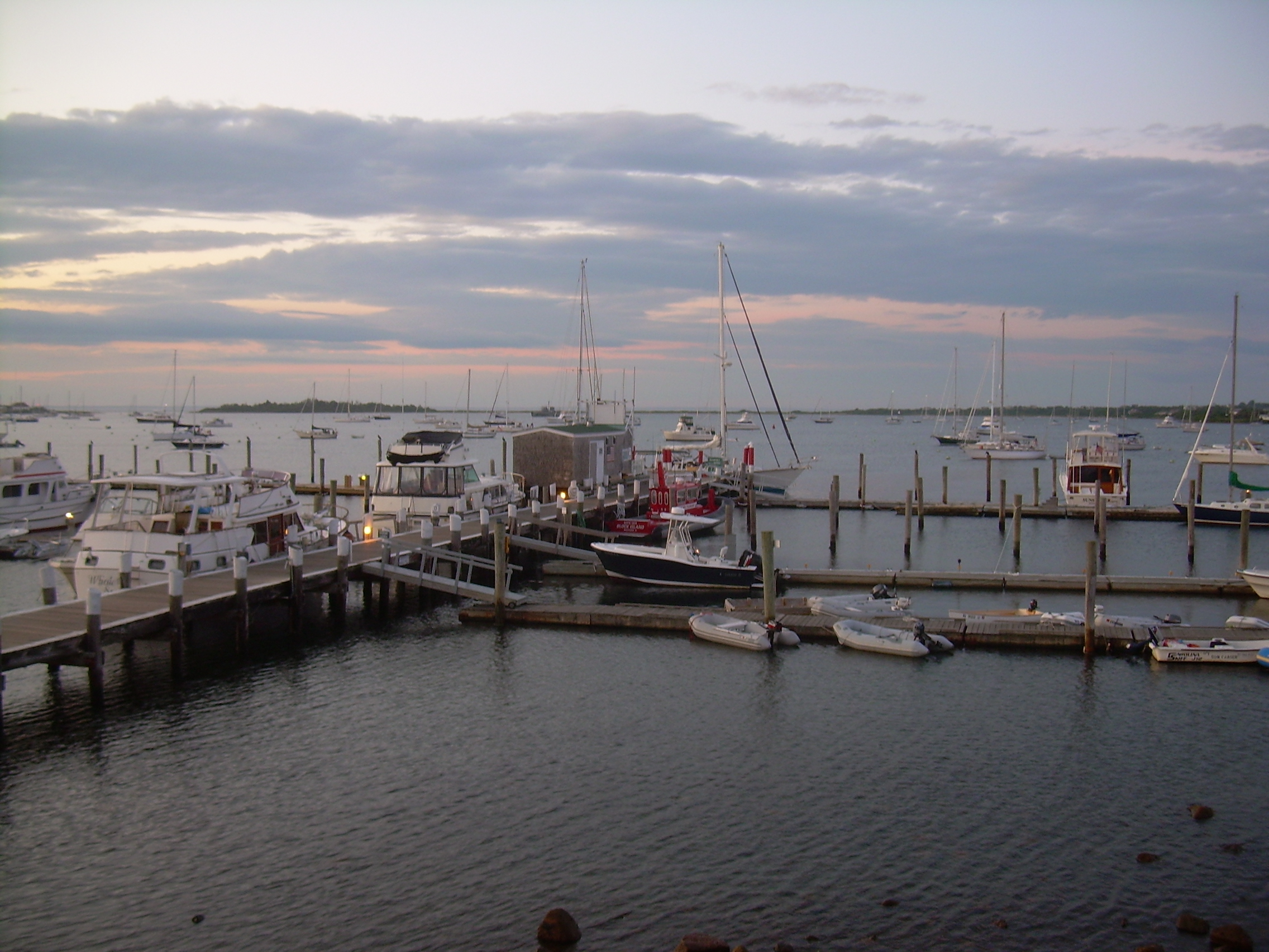
have developed the habit of gravitating to the New Harbor, in the Great
Salt Pond, and have hors d'oeuvres at the Oar House.
The Oar House has a deck covered with an awning and a view of
dozens of boats in the harbor.
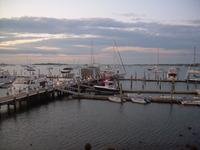
New Harbor from
the Oar House
|
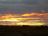
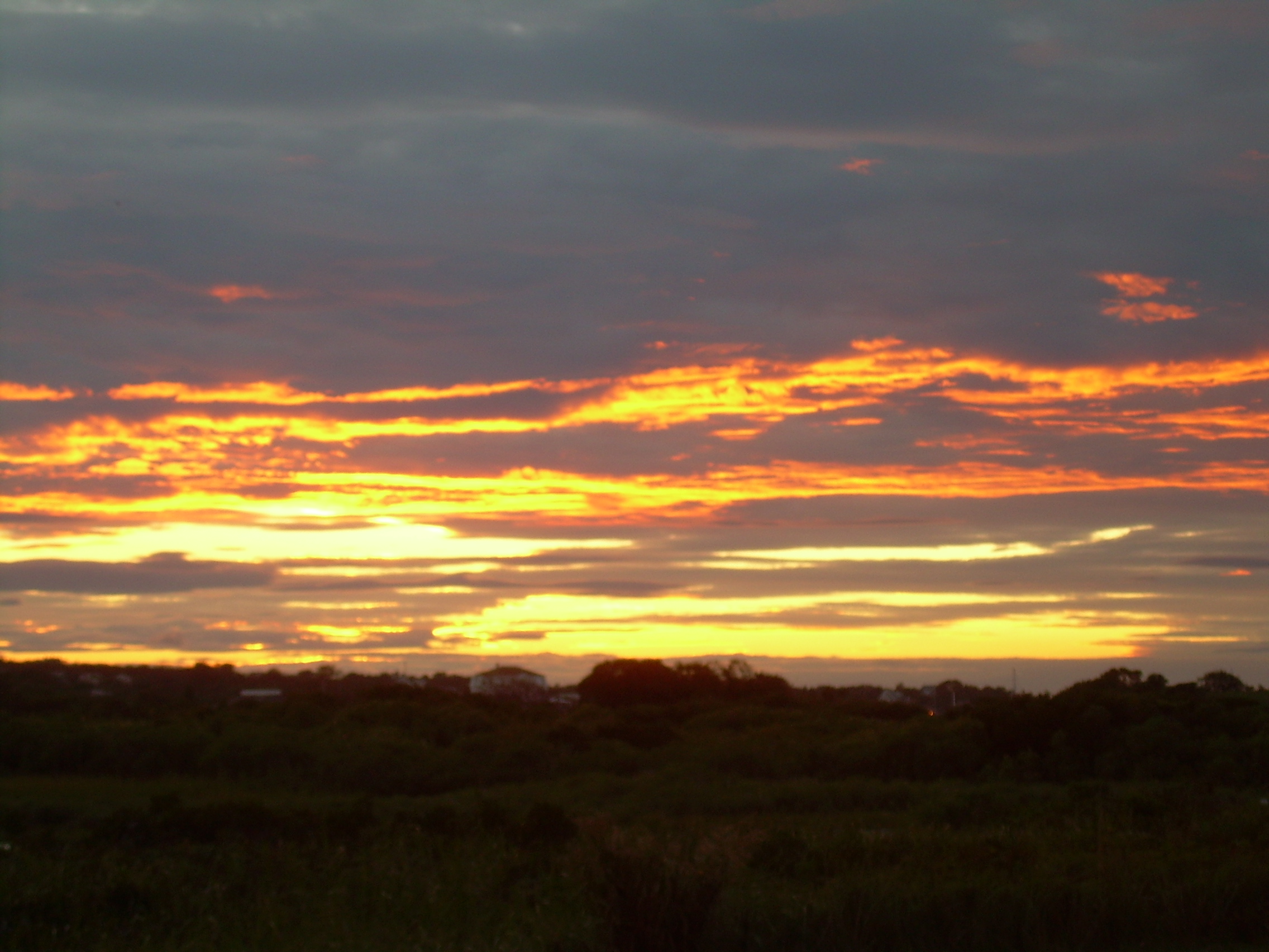
All the colors of Sunset
|
The daylight is starting to do interesting things on the water, across
the sky and on the landscape. Colors you can not find in the big box of
crayons. Another whole spectrum of brilliant hues crammed between
yellow and orange, and then a whole separate pallet between navy
blue and indigo.
The bar is full of characters. "Why do I live on a boat?" a grizzly
yatchmen next to me asked. "It's cold and wet -- but I couldn't imagine
not living there too", he answered himself. The season is winding down
and there is a lot of discussion about pulling boats out of the water
for the winter. For us our time on the island is also winding down.
Lights start to appear across the water before the sun has kissed the
horizon. Today it is clear and we can see the sun touch down just
on Cormorant Point and the sea beyond it. The sky is filled with splashes
of light, golds and oranges, violets and beach plum reds. And then
these great splashes are gathered together like curtains or the hem of
a flouncy dress, and are pulled down over the horizon. All that fire
quenched in the sea.
The stars, countless as the sands on crescent beach and as brilliant as
the diamond spray on the rock on Mohegan Bluff. The silver river of
the Milky Way stretch across the deep black sky and inspire us as we sit
on our island, out in the midst of the vast sea.
|


