|
The Wild River Wilderness September 28th - 30th, 2021 |
|||||||||||||||||||||
[Click on any photo to get a higher resolution.
Tuesday, Sep 28, 2021 It was pouring in Hanover when I woke up, which is not something that make you want to sprint out the door and head to the Wilderness. However, I knew it was suppose to stop, and so, with a bit of hesitation I headed out. Driving pass Moosilauke and on the Kancamagus might be the most direct route, but it is not the fastest way to the trailhead. Still, it gave the day a chance to get some of this perception out of its system. It was 11:30 by the time I shouldered my pack and headed up the trail to Carter Notch.
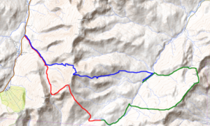
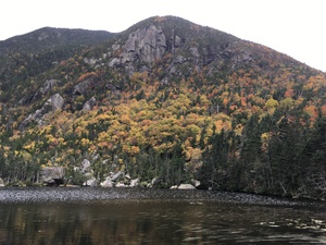
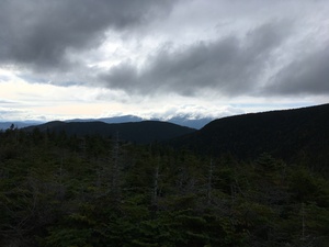
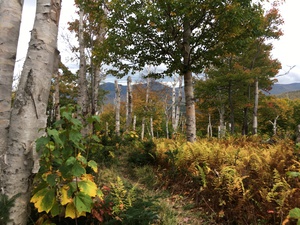
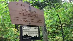
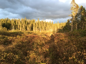
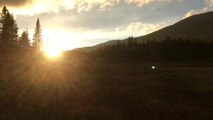
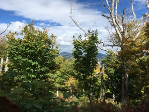
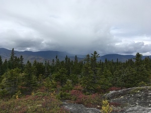
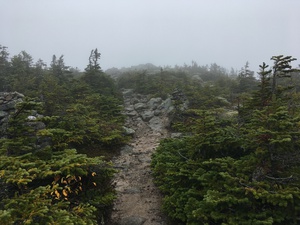
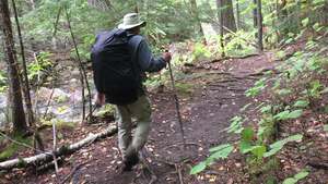
I felt like I was trying to sprint, to make up for such a slow start. But I can only hike so fast. It is almost 4 miles to the lake in the notch, where I finally pause for lunch. I found myself perched on a flat rock which juts out into the lake. It is a pleasant place, but you know that Autumn is upon us. The air is cool, maybe even cold, and I am quick to unpack my fleece. I've worked up a bit of a sweat climbing 1,800 feet to the notch and that sweat is growing clammy between my shoulder blades and down my spine. Across the lake the maples, birches, ash and other deciduous are in full color. Yet because the day is gray and overcast, what should be a blaze is instead the dull orange of an aged pumpkin. These are not the long and lazy days of summer, the Autumn Equinox has passed us and it is time to move on. The climb from Carter Notch to the top of Carter Dome is, in my opinion, among the three steepest ascent in the White Mountain. A note to people who have never hiked in the Whites; the trail architect in this area were completely unfamiliar with the concept of the switchback. I climb about 1500 ft (450 meters) in a mile. Admittedly there are a few beautiful view (which justify stopping) on cliff faces on this stretch, among the gnarled spruce. The top of Carter Dome is not very remarkable. A granite slab with bolt mark where a fire tower once stood. This use to be a bare top, but now, tightly growing spruce and balsam hem me in. A short side trails leads to a view of Mt. Washington, but I have miles to go, and so don't spend too much time here. The Rainbow Trail drops steeply to the southeast and I follow it back into a forrest of birch and fir. A little less than a mile later, the ridge line the trail is balancing on raise up and all of a sudden I am back in krummholtz and soon my head towers over the trees and I have a view down into the Wild River Wilderness. "Krummholtz" is German for twisted- or crooked-wood. It is something I expect on Carter Dome, at 4800 feet, but was surprised to see here at 4200 feet. Krummholtz tells you that you are in the land of extreme winter winds. Not only do they twist the trees, but they can be so severe that anything more then 3-4 feet tall will be stripped away. Below that height the snow encases the trees and protects them. Knowing this I try to imagine how the winter gales might file off the top of a forrest. Bit of ice blasting across the the snow could chew off any tree tops which might be exposed. Does it happen every year? Or is the height of the krummholtz set by the snow depth on the day of that once-a-decade severest of blast? For another hundred meters the ridge rises and the tree tops drop; from shoulder height to waist height to knee level. And among the krummholtz are great, bare slabs of granite. I image camping here and watching the star filled sky - miles for city or even village lights. I know camping in this alpine zone breaks all sorts of conservation ethics, but I am only doing it in my imagination. So I also imagine I find a hollow with a few less rocks and a few inches of duff to stretch out on. A mile later the Rainbow Trails brings me another unexpected curiosity. The trail comes out of the deeps woods into a clearing or glade. I am caught by surprise and stand there for a few minutes. An area the size of baseball field or soccer pitch, filled with birch and stripped maple saplings, all about waist high. But scattered across this glade, at 20-30 meter intervals, stand the trunks of paper birch. Just the trunks. No branches, no leaves, and all of them snapped off 10 meters above the ground. Random pillars of wood wrapped in their white windings. A forester friend of mine has suggested that there may have been a "micro-bust" here a decade ago. Microbust are a type of mini-tornado and recognizable because the broken trees radiate from a central point. I didn't know that at the time and so didn't think to look. And most of the downed tree were buried in ferns. All the time I have been on the Rainbow trail, the Wild River Wilderness has been about 50 feet, a stones throw, to my left, but at Perkins Notch I join the Wild River Trail and pass into the Wilderness Area proper. Less than half an hour later I arrived at "No Ketchum Pond" and campsite. Actually the pond is not apparent from the site, and since the day is winding down I quickly set about making camp. At this point I realize that I have forgotten part of my stove! When I switched to the smaller fuel bottle, I left the pump and valve attacked to the larger bottle. No matter. When I first camped with Troop 86, as a boy, we always cooked directly on the fire. But while there was still a bit of daylight I bushwhacked down to the pond itself. It's only 40 meters from the campsite, but whereas the site is high and dry, the pond is in a a bog. In fact the pond is well to being silting up, to becoming a marsh or bog. I ventured out away from the trees, hoping from hummock to hummock drawn on by the last golden rays of the day! Autumn is upon us. Once I have a fire going I am joined by another backpacker, Wyatt. He told me he repaired giant wind turbines. This involved parking the turbine in "Rabbit formation" - two blades up, one down - and then repelling down the face of the lower blade. In fact he had started out learning how to repair fiberglass boats, but when the opportunity arose to work on the turbines off of Block Island he switched careers. I enjoy campfires far too much. Wednesday, Sept 29, 2021 It was cold last night! Wyatt agreed and wondered how much colder it will be up on the Carter-Moriah ridge line tonight. He plans on camping at Imp tonight. Making a wood fire, and then letting it burn down to coals so I can cook my breakfast is a slow process. And I am never quit patient enough to let it burn down properly. Still, coffee (hot enough) and oatmeal sets me on the right foot- although slowly. I was up at ~6:30, but it was 8:20 before I actually was on trail.
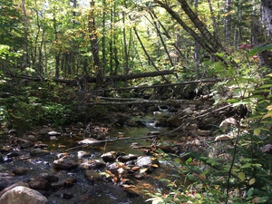
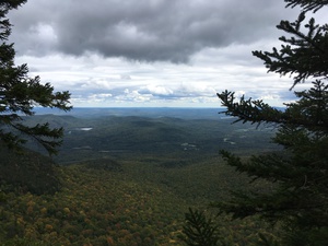
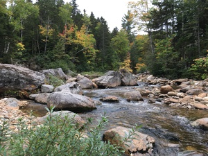
About a mile down the Wild River Trail I slipped off a log, which is the walkway. I sunk deep into the primeval ooze, the morose, of the bog. I was stuck and my foot was not coming free! I was a minute or maybe three before I managed to get my foot out of the mud, which somehow seems inexplicable! (in-extracatable!) By the time my foot pops free I am a bit sore from pulling - but mainly I am embarrassed as to how complicated this became. I changed socks with the idea that I need dry feet to avoid blisters. "Dry feet" is an idea that vanished someplace along the "Eagle Link (Bog Hopper) Trail". The Eagle Link trail branches off of the Wild River Trail - heading east towards Maine. All along it I find I need to focus my attention on not slipping off of old, decayed, flat topped cedar logs - which is how this trail crosses a lot of boggy ground. By the time I have reached Eagles Crag, my legs are beat and I am starting to have doubts about this trip. I've hiked about 14 miles since the trailhead, so clearly I can not walk out today. And the weather is deteriorating. The land drops abruptly in front of me as the White Mountain come to an end. A mile east, and a thousand feet down, it is farm land. Behind me is the basin of the Wild River Wilderness. It is a real pocket, hemmed in by the Carter-Moriah ridge to the west, the Baldface-Royce range to the east, and the highlands of the Perkins Notch and No Ketchum Pond to the south. To the north is the only simple access, and this is where the lumbermen came in. Right now I can see that it is raining hard across the far ridge line, ten kilometers to the west, and I can feel a bit of spit in the air as I huddle under a dwarf tree to eat my lunch of cheese and a bagel. North on the Meader and Basin Ridge Trail is a pleasant walk with some nice views east into Maine. Then I turned west on the Black Angle Trail. The first mile was much like most trails through a forest - mainly up. But then the trail became amazing; even, easy and simple. It is a highway, or at least an engineered path through the wilderness. Four strides wide, most of the way it retains the same profile as when the Hasting Lumber Company build this railroad bed 120 years. This section of the Black Angle Trail is really, really easy to walk, and my pace drops by ten minutes per mile. But it is also in-your-face that this is not forest primeval. This area was all logged off at the turn of the pervious century, and then burned over a few years later. Being a Wilderness now is only through the conscious and consorted effort of modern society. When I again reach, and need to cross, the Wild River it has grown up a great deal from when I last saw it. Their use to be a bridge here, but part of being a wilderness is the removal of human made structures, including foot bridges. This morning the Wild River was a stream, and one stone in the middle was all I needed to hope over it. It is now a river in the true sense, and I can see from the way the banks are gouged out that it often deserved the handle "Wild". Right now it is dancing mountain river 8 meters/25 feet wide. I lay down my pack, strip off my boots and wade into the river, looking for a good place to ford. The boulders are all slippery, rounded cobbles. Then I returned for my pack, and nearly made it across, when I slipped sidewards and partially tumbled in. One leg wet to the hip, and one arm to the shoulder. I think the pack was only splashed. On the other bank, while lacing up my boots, I meet the only other person I'll see in the Wilderness. Carrying an axes, he tells me he is a volunteer trail crew, just in for the day. He carries a second pair of shoes for the water crossing and vanish the way I just came from. It is starting to rain, and after my splash in the river I'm feeling chilled. Here the Wild River Trail is also on an old rail bed and the mile to Spruce Brook Tentsite rushes by. It is 5:30 by the time I arrive and since we are past the equinox that means there is not a lot of light left. So I gather firewood until it is too dark to see. Once I get the fire lite things settle down to a cheery evening. Dinner cooks on the coals at the edge of the fire and I pull out my journal and start to write. In fact the rain has increased in intensity, so I need to lean over my journal to keep it dry. I am wearing a curious combination of hat, headlamp and glasses - all so I can write down that fact that I am really very happy right now. Thursday, Sept 30, 2021 It rained a lot of the night, and although it was not coming down when I crawled out of my bivy sack, it felt like it could start again at any time. So I decided to instead of fussing with a fire to cook breakfast, I would just break camp right away, then walk for a mile to warm up, them stop to eat. Still, it takes time to pack and filter water. Inside the bivy sack, and under my pack cover, all is dry. But the out sides of every thing is wet. Packing is a clammy operation and I am happy to soon put one foot in front of the other and start hiking.
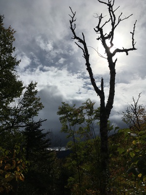
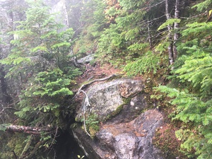
Back north to the river crossing, this time I turned west on the Black Angle Trail heading towards the Carter-Moriah ridge. It is all uphill for five miles to the ridgeline, but at least it starts out gradually. A short stop for a cold breakfast and I ready for some miles. A few miles later I missed where the trail cut left over a steam, and instead I continued into an unofficial campsite. I think of these are "renegade" campsites. In a Wilderness Area there are a few official site - like where I was last night. Otherwise you are encouraged to bivouac in a "primitive sites", which means anywhere more than 200 feet from a trail, and not to be used repeatedly. "Renegade" sites are often in very pretty locations and you immediately understand why somebody camped here, and probably why they came back again and again. The stone fire ring is heaped with the ashes of a hundred campfire demonstrates their popularity. Back on trail. With each mile the trail is getting steeper, and my pace is slowing. But the labor of the fourth mile was dwarfed by the truly aggressive nature of the last half mile of trail. The last section was a brutally physical challenge. Up boulders and down crevices. Across slabs which gave me pause; wet granite at 45-degrees and if you slip the slab ends with a five meter plunge into a tangle of balsam. I'm also in the clouds and even if it is not actually raining, it is dripping as the mist collects on the spruce and then rains on me as I scramble through. At last I breach the parapet - the last wall of the ridgeline's defenses - and come out on the Carter Moriah/Appalachian Trail. The Appalachian trail is sooo much more traveled than the Black Angle Trail, and crossing out of the Wilderness Area felt like stepping into a well peopled country. A half mile south is Carter Dome and the start of the Rainbow Trail, but I've already been there. So I turn north. A hundred meters later I come to a trail junction. To the right is Mt Hight, to the left a peak by-pass. At this point a meet a happy family, mother, father and 10 year old son, all decked out in Gortex and looking very determined despite the cold spit and rain. They tell me that Carter Dome is the last mountain on their list of 4,000 footers and they are excited to bag that peak. Their son explained to me that they had skipped Mt. Hight because, "Who needs it?" Hight is 4675 feet high. But since there is only a 125 foot drop between it and Carter Dome, a measurement known "prominence", peak baggers consider it a minor or sub-peak of Carter, and so it doesn't make the recognized list of 4,000 footers. Who needs it? Well I do. It will be my highest peak today, and I choose the right hand path. I think on many days Mt. Hight would be a pleasant peak. It is has that feeling of height and distinction, and since it can be by-passed by peak baggers, I expect you can often have it to yourself. I'll admit that today I didn't spend much time on the top. Something about the cold howling wind, the horizontal sleet, the snow and the 50 or less meters of visibility made lingering less attractive. The descent is a steep and my feet are starting to feel the miles and also feel as if they have been wet forever. It might be all down hill from here, but I think it will be a slow downhill as I pick my way down the giant's staircase. Down at Zeta Pass I meet a family coming up, ready for a late summer jaunt to a friendly peak. Mom, dad and three boys ages 6-9 with a pair of dog. They're dressed in hoodies and shorts. I don't want to tell them what to do. So I smile and tell them that it is a bit adventurous on top and mention that it was the first snow I had seen this season. The descent becomes easier and faster with every mile and I am soon back at the trail head. While I am changing into dry cloths and footwear the family from Zeta pass caught up with me. The father confided to me, out of ear shot of the boys, that he was become skeptical of the weather before I meet them and he was glad I told the boys of the sleet and snow because they had then suggested they turn back. A few minutes after they left the other family, dressed for a squall in the Arctic also arrived at the trail head. They told me that they couldn't see a thing on top, but life was great and peak #48 was in the bag! I was just happy that I remembered to leave dry cloths in the car and was soon on my way home. It was a golden evening, the autumn colors were brilliant as the sun peeked under the clouds before setting over Vermont. I thought to myself, "I really do live is a beautiful part of the world." |
