|
The Gila Wilderness June 11-14, 2024 |
||||||||||||||||||||||
[Click on any photo to get a higher resolution.
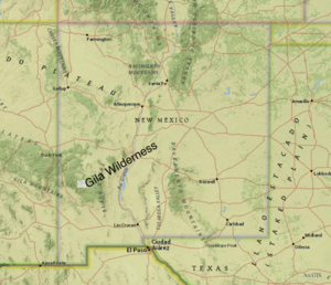
Day 1 - Tuesday, June 11, 2024 It is a long ways from Santa Fe to the Gila Wilderness, and that is a good thing. If Wilderness was easy to get to, it is hard to imagine that it would remain as wild as I would like. Map apps tell me it is 320 miles and 5 hours, 45 minutes. The first two thirds of that is I-25 and that 210 miles takes about 3 hours, which is a long enough time for me to explain why I want to go to Gila. In June, 1924, a century ago, the US Forest service designated a chunk of land, 40 miles by 30 miles, as "Wilderness". Aldo Leopold and others in the forest service had been pushing the idea that in the "lands of many uses" (the forest service motto) one of the uses should be wilderness. Originally cast in terms of recreational hunting, it was just one of the many uses of the forest. But even at that stage it was recognized that "Wilderness" meant, "without roads". One curiosity is that in the heart of that wilderness was "Gila Cliff Dwellings National Monument" (Roosevelt 1907). Which meant that at some point in the next forty years, when this wilderness was still at the whim of the forest service, a road was built into it and a corridor was carved out of this preserve. In 1964 with the "Wilderness Act", congress created the National Wilderness Preservation System. The Gila Wilderness is a charter member of that system. People will argue that Gila was the first, or among the first area to have a legal designation as Wilderness. And since the concept of Wilderness intrigues me, I felt I needed to visit it, much like my father needing to go to the Galapagos. But it is only a visit, because as it says in the preamble of the Wilderness Act A wilderness, in contrast with those areas where man and his own works dominate the landscape, is hereby recognized as an area where the earth and its community of life are untrammeled by man, where man himself is a visitor who does not remain. A second reason to hike here is that I have wanted to hike in an arid canyon land, in fact I have not backpacked in New Mexico since 1975 -- it seems like it was time to return to those dusty trails. In 1975 I had been so impressed with not needing to constantly prepare for the next rainfall. But that is enough of an intro, and I have got us 220 miles down the interstate to Truth-Or-Consequences, where I stopped for gas and groceries. The next 30 miles to Hillsboro is prairie flat. And the map apps still says 70 miles and 2 hours. But this is where I entered the mountains. A winding roads up to Emory Pass made the Highway to Hana look straight. Continuous hairpin turns for miles and miles. In the end it was a beautiful meander through hills and mountains. Ponderosa pines, mountain lakes, and then down into grassy valleys. And finally, after two hours of roller coaster, I reached the Gila Visitor Center.
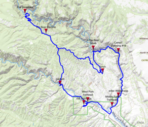
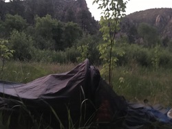
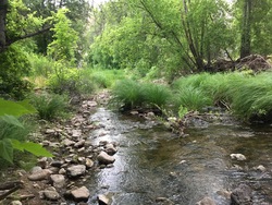
Most visitors are headed toward the cliff dwellings and the campgrounds near the road, but the volunteer who manned the front desk was full of information about the backcountry as well. Two years ago I had planned to backpack here, but because of all the wildfires, camping was restricted. So I had opted for Colorado instead. This year, he told me, the rains were normal, the rivers were running well, and there had been few fires. I asked about the "tanks". Tanks are basins which collect and retain water. Some are natural, some man made, and a few are great steel vats. My map showed open basin type tanks near where I was hiking, and I wanted to know abut alternate water sources. The volunteer told me that most were in good shape, except one to the southwest which was particularly dense with sulfur. And that I should still remember to filter the water. I topped up my water bottles (it is in the 90's), shouldered my pack, and headed north following the middle fork of the Gila River. A quarter of a mile later I hit my first stream crossing. Or I guess I should say river crossing - the Gila is a river. It is about 15-20 feet wide and 6-10 inches deep. Most hikers I meet just splash through this, but I know I am susceptible to blisters if I hike in wet footgear. So it was off with the shoes and socks, and then wade over the cobbled stream bed. I then dried my feet with a handkerchief, reassembled my footwear, re-shouldered my pack and I was off again. For another quarter mile to the next river crossing. The river meanders back and forth across the canyon, rubbing up against the base of the canyon walls every quarter mile or so; first the west side, then the east side. Since the trail doesn't climb the cliffs, it has to cross the river a lot. And every time I would stop, take off my shoes, wade across, dry my feet, and put my shoes back on. I only hiked four miles this afternoon, but waded across the river seventeen times. Between the second and the third crossing I pass "Lightfeather Hotsprings". There are two families there; four adults and a swarm of kids, under the age of eight, splashing and having a great time. The water right out of the springs is too hot to enjoy, but people have build pools in the river which mix spring and river water to a very comfortable compromise. But I've only started my walk and am not ready to stop. Just beyond the springs I cross the boundary into the Wilderness. On the eleventh crossing I thought I could do stepping stones. But the cobbles are just a bit to round and I slipped in, banging up my arm, and getting one side of me, plus both feet soaked! Every time I step into the river I startle these huge tadpoles. Are these future bullfrogs? Progress is slow. I walk a mile in twenty to thirty minutes, but then add four to five minutes every quarter mile for donning and doffing shoes and drying of feet. At about 7:30, when facing the eighteenth crossing, I decide enough is enough. And I had just seen a good site 30 meters back. I set up camp while the last sunlight climbs the canyon wall just opposite of me. Actually setting up camp is simplicity. Shake out the bivy sack, blow up the air pad (50 breaths), blow up my pillow (7 breaths), then slide air pad, sleeping bag and pillow inside the bivy sack, and I am done. Another backpacker stoped at my site for a few moments. He is on a quick overnight jaunt and hopes to get to Jordan Hot Springs this evening - another two to three miles. He and I speculated about a dead coyote on the trail a quarter mile back. It was not obvious to either of us what had killed it. With its cloud of flys, I had no desire to get close to it. While cooking dinner (Spanish Rice - bring to a boil for seven minutes) I hang a line for my bear bag forty meters from my site, and filter more drinking water. It is twilight by the time I finish dinner, finish washing up, and hanging the bear bag. I read for awhile, but it has been a long day and I am ready to crawl into the sack. There are no bugs tonight, so I leave the mosquito netting open and sleep under the stars. The moon is setting over the canyon's rim and the stars are bright! It is a beautiful night until my eyelids fall down. Wednesday, June 12, 2024
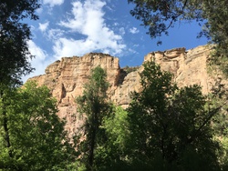
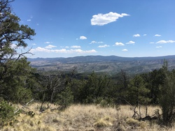
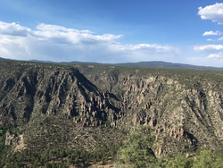
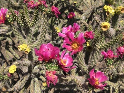
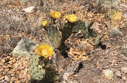
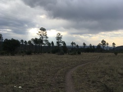
It is clear to me that I can not continue to march up this canyon. My feet are raw and on the verge of blistering. My original plan was to continue up to the trail junction where Little Bear canyon comes in from the south, and then continue nine more miles to a place called "The Meadows". But instead I'll go to Little Bear Canyon, climb up out of the Middle Fork Canyon, and hike in the high - but dry country. Big Bear Canyon looks like a likely destination for tonight. A mile after leaving camp I met the same hiker I saw last night. He has to be in San Antonio tomorrow, so is headed out. He tells me that there was a large church group occupying Jordan Hot Springs, so he had camp a half mile before it. Sometimes there is a strange telegraph along trails so you know about other groups that you may never actually see. It is two miles and ten stream crossings to the trail junction at Little Bear Canyon. It is clear that this is a very popular camping area, there are a half dozen stone fire rings and the forest floor has been swept clear of twigs and other kindling. It is also very pleasant in the shade of this grove of Ponderosa, and so I decide it is a good place for a long break. I let my shoes dry, I make coffee and I write in my journal. Last night I had gone to bed with the day only partially recorded. I also top up my water bottles. I'm carrying about two liters, and I am not certain how far it is to the next water. I now turned south into Little Bear Canyon, which starts out as almost a grotto. There is a trickle of water coming through a narrow clef, just wide enough to also host the trail. For about half a mile I walked in this cool, deep, canyon with just a seepage underfoot. And then the water ended. You can still see the sandy wash from a wetter season, but it is now dry. The canyon has broaden out into a wide valley and the trail criss-crosses the sand wash. I'm tempted to walk up the stream bed, but it is loose sand whereas the trail is pack and easier walking. For the last mile of this section the trail leaves the stream bed and starts to climb the valley wall. This also means leaving the shade of the ponderosa and moving into a country of sparse grass, occasional pinon pines and cactus. At the top of the valley is a trail junction. If I was to continue south I would drop into Adobe Canyon and leave the Wilderness at TJ Corral, on the West Fork of the Gila River. It is clear from hoof marks and droppings that a number of horses and mules have come up from the corral. My path, however, is to the west, on the Lilley Park Trail, along the ridge line between the Middle Fork and the West Fork. But right now it is time for lunch. I have taken to carrying a small ground cloth with me, two feet on a side. I spread this out under a pinon pine, in what shade I can find, and have lunch. Bagel, cheese, dried cranberries, and water - of course. Since the stream in Little Bear canyon dried up not too far from the river, I am starting to prepare myself to find a similar situation in Big Bear Canyon. And so I think about how to use my two litters wisely. The next four miles is along a ridge line, which means up and down, a roller coaster. It is sunny and hot. Actually it is more than sunny, it is glaring! I almost never wear sunglasses, but I have a pair with me and wore them in this section. I don't like them, it makes me feel one degree separated from the world around me. Like I am watching the world through a window or the face shield of a helmet. But given the intensity of the sun today, maybe that is not a bad idea. There are some grand views; hills, ridges, mountains, off into this vast wilderness. Off to the right my map shows Little Bear Tank and Deep Tank. But my water is good, so I stay on the trail. Eventually I reached a trail junction, with the Big Bear Trail coming up from the south and joining the Lilley Park trail for a third of a mile. I took a break and sat in the shade of a pinon pine for a while. Vultures circled overhead, but I am not there to feed them. The Walking Stick (or Cane) Cholla cactus grows in great clumps, sprawling like a rhododendron bush. In this season they are decorated with yellow new growth and brilliant purple flowers. They are buzzing with bees which avoid all the needle sharp spines and find themself past the purple/fuchsia pedals and onto the golden stamen to wallow in pollen. There are various yucca and prickly-pear as well, but the cholla is in full bloom and holds the eye. A third of a mile later the Big Bear and the Lilley Park Trail fork and I follow the Big Bear north, down into Big Bear Canyon. Big Bear Canyon might be more of a cliff lined canyon where it joins the river. But here it is a broad valley of grass and ponderosa pines. And down the center flows a sandy stream bed, without the stream. There are a number of nice camping sites, but with the stream dry I don't find it tempting. I wonder if in the fall, in the hunting season, there would be water. I see a lot of hoof prints and I can imagine that if your hunting party was brought up here on horses, with a wrangler and pack mules, and if there was water, it could be quite a nice place. My map shows a trickle tank a half mile south, but instead I decide to head back to the Middle Fork of the Gila River where I am confident there is water, about three miles from here. Two miles later I leave the Big Bear Trail and turn onto the Meadows connector. And then there is a real canyon at my feet! It is nearly a quarter of a mile down, and one and a quarter miles by switch back trail, from here on the rim to the river below. But it is a spectacular moment and one worth postponing the end of the day for ten minutes to enjoy. I want to say it is a miniature Grand Canyon, or a quarter size scale Grand Canyon, but it is full of trees, tall Ponderosa, which give it the look of life. Down there it looks cool and shady. It seems a bit miraculous that the trail builders where able to find a cleft in the cliff face, a chick in the armor, which separates the high plateau from "The Meadows" by the river. But somehow the trail runs back into a ravine and then out onto a shoulder in the cliff face, and then down some long switchbacks. I tried to gauge how far I had to go by imagining how many ponderosas would have to be stacked on top of each other to reach my present switchback. Finally the Meadows and the river. At the river's edge I met a group, ten teen age boys and two adults. They told me they were a church group from Texas, and that the younger members were back at Jordan Hot Springs. I was surprised how unfriendly they were, but will attribute that to a long hot day. At first I had thought they might be a scout group. But the group dynamics and outdoor ethics (washing dishes and dumping food into the river) were all wrong. So I hunted around for a private site away from that group. Below their site was a great tangle of tree trunks and boulders which looked like some flash flood had trashed that section of the canyon maybe ten or twenty years ago. So I bushwhacked a hundred meters upstream, found a level patch of grass, and set up camp. I bathed in the river and made dinner. It has been a long day and as soon as it got dark I was ready to crawl into my sleeping bag. Again there are no bugs, so I slept with my head outside the bivy sack. I watch the moon until it disappeared beyond the rim of the canyon. Thursday, June 13, 2024
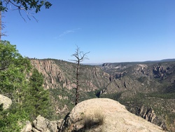
It was a restless night for me, despite the near perfect weather. I had leg cramps, which are no fun especially if you are in a mummy sack. It was a good thing the sky was beautiful! The stars started fading at 5:00, but I forced myself to stay in bed until about 6:00. I think part of last night's cramps was lack of water. I also think I didn't eat enough yesterday. So this morning I gorge myself. I start the day with coffee and three packages of oatmeal, then more water while I sit by the river. In fact I could not finish all that oatmeal. I shouldered my backpack at 7:30, expecting that the climb out of the canyon will be hot work. Work I want to do in the cool of the morning. When I pass the campsite of the church group - no one has yet stirred. I am climbing those same switchbacks I came down yesterday afternoon, and am surprised how easy it is going. I climb the mile and a half in about 40-45 minutes! With the hardest part of the day behind me, I stop for second breakfast. Or at least coffee and dried cranberries. Today is not a long hike and so I forced myself to sit and enjoy the morning. I'm about 20 meters from the rim of the canyon with a clear view a few miles upstream and downstream. I sip my coffee, write in my journal (I fell asleep last night before I finished writing) and just watch the world for forty-five minutes. But I have a hard time with too much leisure. The next few miles are a repeat of yesterday's walk; down through Big Bear Canyon, past the sandy stream bed and up to the Lilley Park/Big Bear trail junction. I am carrying 1.8 liters of water, and every mile I force myself to stop briefly to drink. If anything, it might be hotter than yesterday. It may surprise readers to know that I am in long pants and a long sleeve shirt. As hot as it may be, it is the intensity of the sun which I primarily feel. Now I turn south towards the West Fork of the Gila River. What if it too is dry? I think this is highly unlikely; I had been reassured that they "rivers were flowing", which I took to mean both Middle Fork and West Fork. And the West Fork looks to be a major river on my map. Still, the way to avoid problems is to have a backup plan if need be. I'll have about half a liter when I get to the West Fork, and if the river is dry, I could just walk out today. It will only be about half a dozen miles to the car. And then I see the canyon. It is classic in shape, very much like the Middle Fork, cliffs which drop into verdant oasis where willow lined the river. A lot of switchbacks bring me to the canyon floor. The footing is steep and someplace loose, but not dangerous. So I creep down slowly. I can hear water. At the end of the switchbacks I joined the West Fork Trail. I decided to head up stream for a ways, but within five minutes spot a beautiful, secluded, potential campsite. It is about fifty meters from the trail, right by the water, and in a shaded arbor beneath cottonwood and willow. It is only about 2:00 and so I have a long afternoon in front of me. I filter water and drink a liter with my lunch of bagel, cheese and cranberries. Then I look for a spot to swim. Most of the river is a dozen feet wide and six inches deep. But ten meters downstream of my site is a pool a meter deep! I have been so hot that it takes me a few minutes to creep into the cool waters. But there I sit while I feel my skin temperature drop a degree or two. I spread out my bivy sack as a ground cloth, and then blow up my air pad and pillow, and lay there in the shade drying out. I am sure I fell asleep for an hour or so. Somehow I manage to while away the rest of the afternoon in in-activity. I toyed with the idea of finishing my hike today, but just being here in the canyon is where I want to be, and what I want to do. So I play in the river and do a little exploring. I catch up in my journal and do a bit of reading. In the evening, when I go to cook dinner, I discovered that my fuel tank is empty. I've taken a number of three day trips with this stove and a small canister of fuel has always been sufficient, but this is one day more. So I go down next to the river to build a cooking fire. Back at the ranger station there were no fire restrictions posted, but they did note that conditions were hot and dry. I set up my fire on a flat stone surrounded by cobbles, essentially in the stream bed. I build up my fire, then let it burn down to coals and then start to cook. However my fire of twigs didn't produce the bed of coals I needed. So I paused my cooking and rebuilt the fire to produce a thicker bed of coals. It also takes twice as long at 6,000 feet to cook my pasta. Which also made me wonder if I went through more fuel in the last few days than usual? But I have plenty of time. After supper I douse the fire. It has been a hot day and it is still warm this evening. So sitting around a campfire - even if cheery - has little attraction. Clouds have rolled in and I may have heard a rumble in the distants, so I set up my bivy sack with a small tarp over the head opening. It is so hot that to zip the bivy up to be watertight would also be stifling. But nothing comes of the clouds, so I roll back the tarp and sleep with my air pad on top of the bivy sack, and myself on top of my sleeping bag for half the night. All those clouds means it doesn't cool off much over night. But no bugs, so laying on top of everything was very comfortable. Friday, June 14, 2024
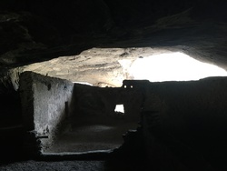
No stove - and I didn't feel up to creating a cooking fire - so just bagels and cheese for breakfast. It is amazing how durable bagels and cheese are even in these 90+ degree days. I woke at 6:15 and was on trail by 7:00, and almost immediately there was a stream crossing. Off with shoes and socks, across the cobbled stream bed (where is the sand when I am barefoot?) and on again. In about a mile the canyon broadens out into a wide, shallow valley, and I have only four stream crossings in four miles. Which brings me to the West Fork TrailHead. This trailhead is also the entrance to the Gile Cliff Dwellings National Monument, and my arrival coincides with the arrival of the park staff, fifteen minutes before opening. The walk through the Cliff dwellings is about a mile and I have lots of time, so I wait for the opening and then amble through the dwellings. These caves are smaller but deeper than what I have seen in Mesa Verde or Bandelier. Which means when you are in the dwellings you look out through the mouth of the cave. Inside the cave is dark and cool, while beyond the arch the world is hot and brilliant. I asked one of the rangers if he knew how hot it got yesterday. He told me he didn't think it broke 99 degrees. However the woman who sold me a book about New Mexico fauna told me she thinks she saw 103. Should I take the average? I started at the Middle Fork trailhead and now I am at the West Fork trailhead, which means I still have two miles to go. And the day is only getting warmer. Asphalt roads are easy to walk on but not very interesting. But they quickly got me back to my starting point. The Gila, the canyons, the high dry plateau of cactus, the Wilderness. It is what I had hoped it would be. And I am happy. |
